
Is Tourstart an alternative to MRA Routeplanner and MRA Navigation next?
I took the 14 day trial of Tourstart for evaluation purposes. It comprises an online route planner and a navigation app for navigating planned routes.
I’ll start with the route planner.
When you open the website as a user you are presented with this screen.
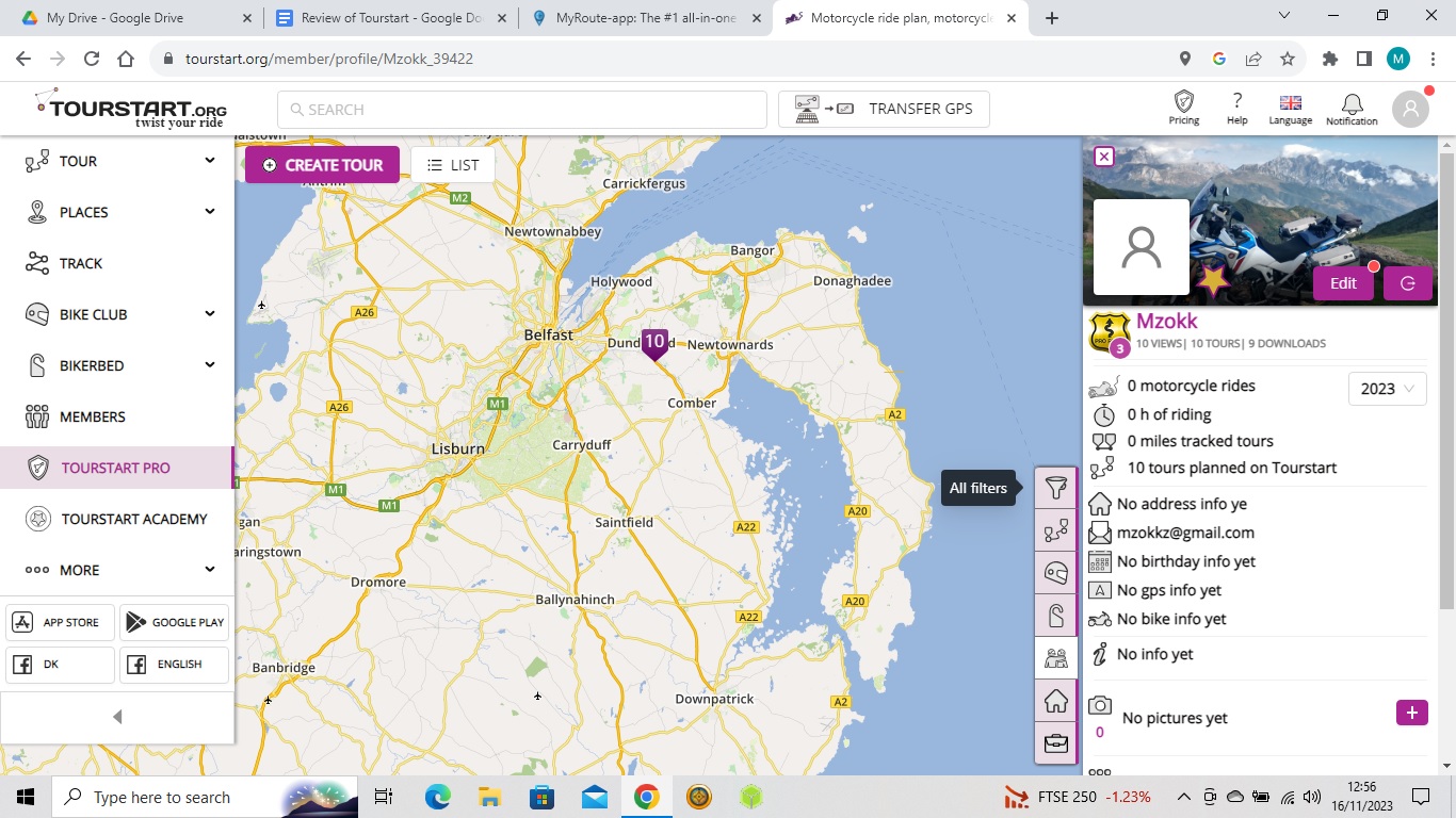
Which has the menu items(with drop downs) down the left hand side and a context display on the right. The main items of use from a route planning point of view are Tour and Places, the track menu displays saved tracks from the navigation app, and the Tourstart academy is a series of short videos explaining how to use the application and is very useful. Bike Club, Bikerbed and members are more sort of social media type tools for bike clubs, lodgings (presumably biker friendly) and members allows contact with like minded bikermates.
The route planner can be used stand alone and has .gpx download profiles for the following devices. Garmin,Garmin track,TomTom,Navigon,GPX,KML,BoomBox GTS 6.5,BoomBox 4.3 and BMW Motorrad Connected ride.
Unlike MRA Routeplanner (which has access to Open Street Maps,Here, TomTom, Michelin and Google maps) , the Tourstart offering is all based on Open Street Maps. The download profiles listed above use OSM for the routing but add shaping points based on the navigation unit selected. So having created a “Tour” which is the creation of a route GPX file, if you select the garmin profile and import the GPX file to Basecamp or MRA routeplanner you can see that several shaping points have been added to ensure that the here maps route in Basecamp/MRA matches the route created on Open street maps. This seems to work
well.
Like MRA Routeplanner you can automatically create routes by using the Ridetwister menu using the menu options on the right side of the screen. The screen below indicates a round trip the arrow gives direction and the wavy line strip with the green marker increases distance left to right. It works fine and you can edit the routes created but, it's not the way I usually create routes.
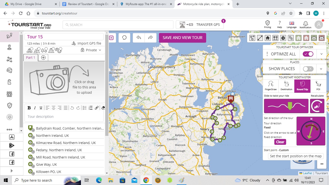
One thing worthy of note is the route optimization tool which corrects errors in the placement of route points (for example putting a point to the side of a road or up a side road) the optimization tool corrects these automatically and accurately.
For me my main type of route creation is point to point on the roads that I want to be on. Like MRA routeplanner and basecamp the application works well in this regard
.
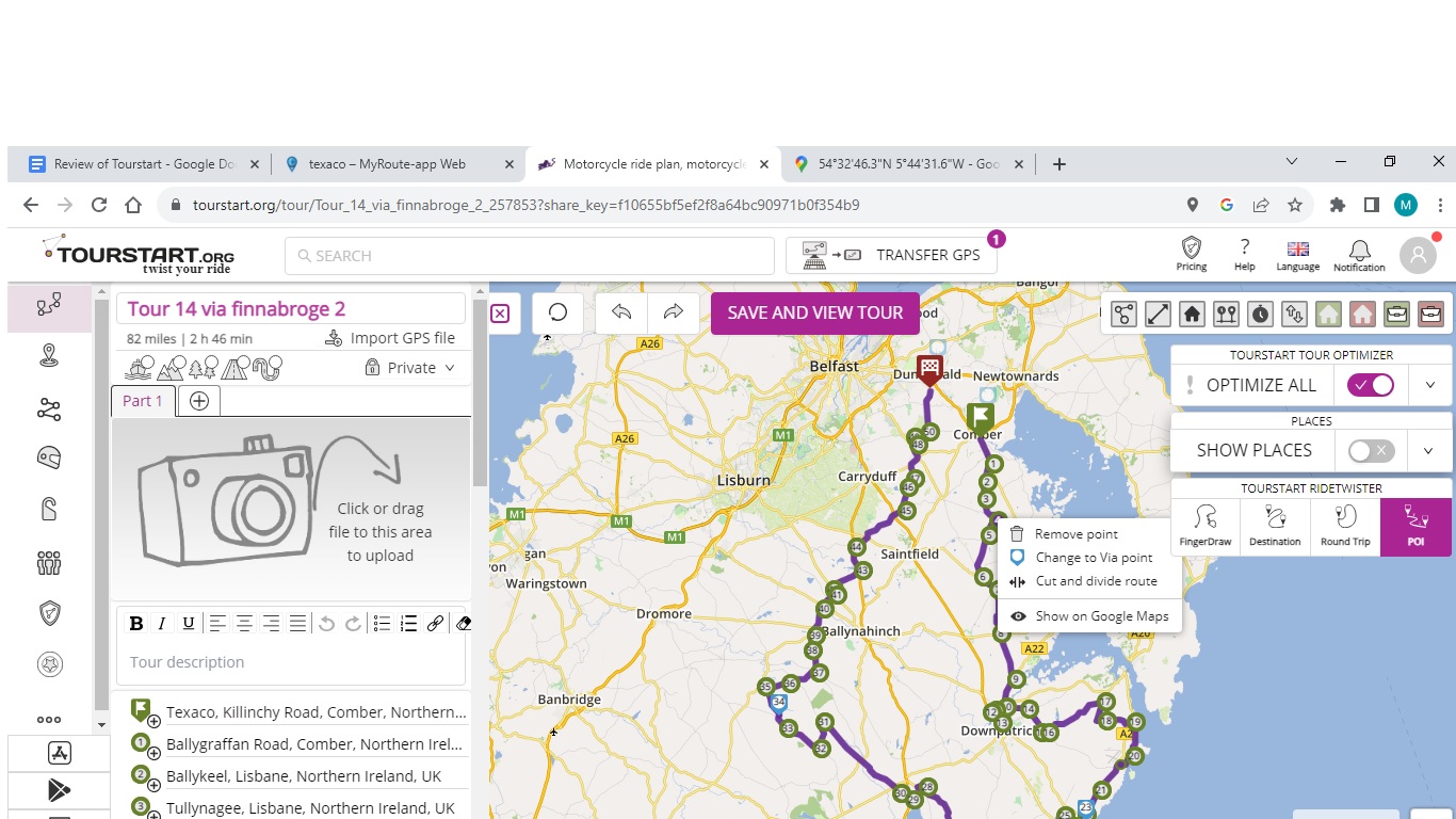
You can also organise your “tours”/routes into folders to keep everything organised.
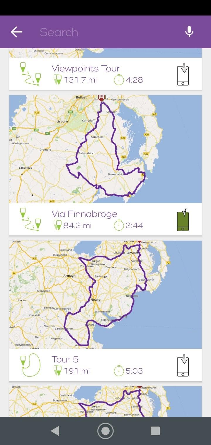
Overall the routing tool is great intuitive and I copied several of the routes to my Zumo XT using the Garmin version of the files and a standard GPX to be used by OSMand and the Tourstart app. They worked fine on Garman and OSMand with no difference in the routing. This is only a brief overview of the product that has many more features including a user created GPX route library and filters to select routes. I would recommend that anyone looking for a routing tool has a look at this and MRA routeplanner and decide which suits their needs.
The app
The app allows you to create routes and save them to the Tourstart cloud if you have wifi-4g connection. If not you can route using the route that you have created immediately on down loadable OSM maps. The only method I found useful for my fat fingers was POI. It took about 5 mins to create an 80 mile route with plenty of turns and junctions. Impressively the automatic route creation tools are available to you in the app and you can route immediately using the created route offline. You need to be online to save the route.
To access your online “tours”/routes you need Wifi or 4g but you can save the route you want to navigate to your phone and use it to navigate offline indicated by the little phone icon turning green after you download it. If the route is not at your location the app will navigate you to the start of the route.
When it comes to Routing the app works well the screen is clear and missed “drag points” or shaping points in Garmin parlance can be missed and it will route to the next via point. The drag points can be binned up until the first via point using the little arrow below the speed indicator.
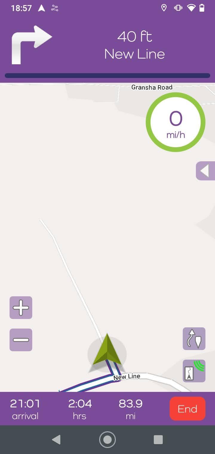
The navigation app also records your track as you progress so that you can see how far off piste you have gone
Overall I liked the route planner but for me it offers nothing that MRA routeplanner does not and is probably not as slick. Still easy and intuative to use and links seemlessly with the navigation app.
The app was also good for navigation and running on Open Street Maps does not seem to cause the phone overheating issues that the Here maps api seems to be causing for the MRA app at the moment. One clincher for me is that the app is not yet Android Auto compatable. In addition, I had a couple of instances of the app crashing while I was messing around with it (not during navigation). This could be because I was using it on an old smartphone (Motorola 7G power) rather than a buggy app. The demo is 14 days with full access to the systems. A yearly subscription is $29 or about £24 for the routing system and the navigation app. I was impressed with the caveats mentioned above. Might be worth a try for someone.
I took the 14 day trial of Tourstart for evaluation purposes. It comprises an online route planner and a navigation app for navigating planned routes.
I’ll start with the route planner.
When you open the website as a user you are presented with this screen.
Which has the menu items(with drop downs) down the left hand side and a context display on the right. The main items of use from a route planning point of view are Tour and Places, the track menu displays saved tracks from the navigation app, and the Tourstart academy is a series of short videos explaining how to use the application and is very useful. Bike Club, Bikerbed and members are more sort of social media type tools for bike clubs, lodgings (presumably biker friendly) and members allows contact with like minded bikermates.
The route planner can be used stand alone and has .gpx download profiles for the following devices. Garmin,Garmin track,TomTom,Navigon,GPX,KML,BoomBox GTS 6.5,BoomBox 4.3 and BMW Motorrad Connected ride.
Unlike MRA Routeplanner (which has access to Open Street Maps,Here, TomTom, Michelin and Google maps) , the Tourstart offering is all based on Open Street Maps. The download profiles listed above use OSM for the routing but add shaping points based on the navigation unit selected. So having created a “Tour” which is the creation of a route GPX file, if you select the garmin profile and import the GPX file to Basecamp or MRA routeplanner you can see that several shaping points have been added to ensure that the here maps route in Basecamp/MRA matches the route created on Open street maps. This seems to work
well.
Like MRA Routeplanner you can automatically create routes by using the Ridetwister menu using the menu options on the right side of the screen. The screen below indicates a round trip the arrow gives direction and the wavy line strip with the green marker increases distance left to right. It works fine and you can edit the routes created but, it's not the way I usually create routes.
One thing worthy of note is the route optimization tool which corrects errors in the placement of route points (for example putting a point to the side of a road or up a side road) the optimization tool corrects these automatically and accurately.
For me my main type of route creation is point to point on the roads that I want to be on. Like MRA routeplanner and basecamp the application works well in this regard
.
You can also organise your “tours”/routes into folders to keep everything organised.
Overall the routing tool is great intuitive and I copied several of the routes to my Zumo XT using the Garmin version of the files and a standard GPX to be used by OSMand and the Tourstart app. They worked fine on Garman and OSMand with no difference in the routing. This is only a brief overview of the product that has many more features including a user created GPX route library and filters to select routes. I would recommend that anyone looking for a routing tool has a look at this and MRA routeplanner and decide which suits their needs.
The app
The app allows you to create routes and save them to the Tourstart cloud if you have wifi-4g connection. If not you can route using the route that you have created immediately on down loadable OSM maps. The only method I found useful for my fat fingers was POI. It took about 5 mins to create an 80 mile route with plenty of turns and junctions. Impressively the automatic route creation tools are available to you in the app and you can route immediately using the created route offline. You need to be online to save the route.
To access your online “tours”/routes you need Wifi or 4g but you can save the route you want to navigate to your phone and use it to navigate offline indicated by the little phone icon turning green after you download it. If the route is not at your location the app will navigate you to the start of the route.
When it comes to Routing the app works well the screen is clear and missed “drag points” or shaping points in Garmin parlance can be missed and it will route to the next via point. The drag points can be binned up until the first via point using the little arrow below the speed indicator.
The navigation app also records your track as you progress so that you can see how far off piste you have gone
Overall I liked the route planner but for me it offers nothing that MRA routeplanner does not and is probably not as slick. Still easy and intuative to use and links seemlessly with the navigation app.
The app was also good for navigation and running on Open Street Maps does not seem to cause the phone overheating issues that the Here maps api seems to be causing for the MRA app at the moment. One clincher for me is that the app is not yet Android Auto compatable. In addition, I had a couple of instances of the app crashing while I was messing around with it (not during navigation). This could be because I was using it on an old smartphone (Motorola 7G power) rather than a buggy app. The demo is 14 days with full access to the systems. A yearly subscription is $29 or about £24 for the routing system and the navigation app. I was impressed with the caveats mentioned above. Might be worth a try for someone.


