Quest1 - how does it display directions to off-road waypoints?

Scotbot

Guest
Hi,

A quick question about the Quest 1 (just ordered one).

If I program in a waypoint that's away from a road, eg in the middle of Salisbury Plain, how will it direct me there?

I'm assuming it will take me to the nearest road and then just say 'head east' or give an arrow or something. Or are off-road waypoints non-routable?

I ask because I plan to program a load of routes over the weekend but don't have the unit yet to test it out.

Cheers, Scott.

Thats about it, east west etc,

Ask Whatton as he is the resident Quest expert:augie
 
As said...it takes you to the closest point on a known road, then drops a straight line on the map display to the off-road point and says 'head east 1 mile' or whatever :)

PS It can help to turn off the 'snap to road' function when messing around with off-road points :)
 
What Richie said. If you make an intermediate waypoint at the end of the actual road that leads to the off road area then it will take you from your start position there then direct you as the crow flys to the off road waypoint :thumb2
 
Great, thanks. I've managed to find the PDF manual online which I'm about to read. I've been using GPS for years but have never used a road-based system so I wasn't sure how it would cope with this type of waypoint.

Thanks again.
 
I've got some way point files that Clive created of the byways around Reading. If you want them I'll send you a copy.
 
Adding OSGB waypoints

Another question if a kind person has the time to answer...

I have set Mapsource and my Quest to use OSGB as the map datum. Is there a website similar to Google Maps, Stretmap etc that will show an Ordnance survey map and tell me the grid ref of a point, either by showing the location of the mourse cursor or where I click on the map or similar?

It needs to be on a landranger map really.

This would really help me to program in all my off-road waypoints...

I can't use Google Earth because the image resolution is far too poor in a lot of areas.

Cheers!

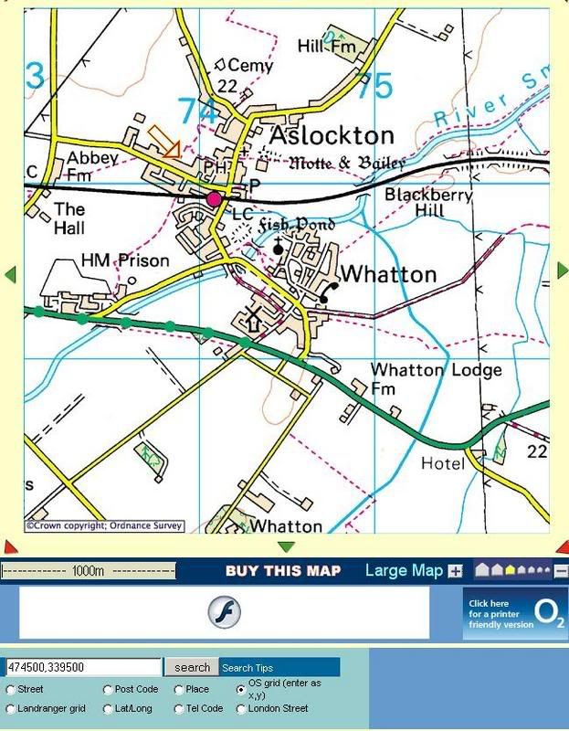
This site will use OSGB
:thumb2

Look at the bottom of the screen shot and you can select Landranger grid ................


ScreenShot018-1.jpg
 
Aha, I stupidly hadn't spotted that and was trying to decode it from the url...

Cheers!


Back
Top Bottom