GPS routes in Google Maps

REM

Registered user
Joined
May 17, 2006
Messages
94
Reaction score
0
Location
Devizes, England
For anyone interested in the posting of the "weekend of trailriding 9th 10th June" route on Google Maps:

http://maps.google.com/maps?f=q&hl=...1.930718,-1.728973&spn=0.012437,0.028925&z=15

There is an explanation of the rather convoluted way of getting a route in Google Maps on that thread.

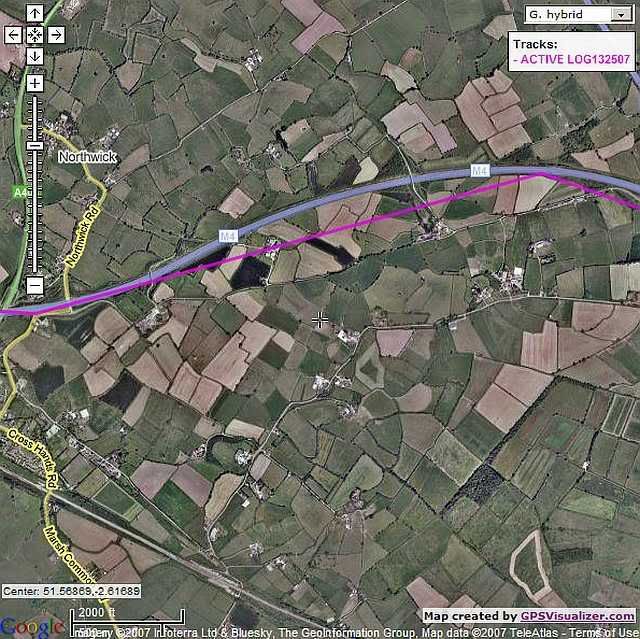
However there is an easier way of converting your GPS waypoints and routes to Google Maps :

http://www.gpsvisualizer.com/

This is a pretty comprehensive site for converting GPS data form one format to another including Google formats.

You can also get instantaneous results to view a route in Google Maps but it is hosted only temporarily on the gpsvisualizer site.

If you want a persistent record to share with other people you still need to go down the route of:

create kml file (gpsvisualizer does this)
upload kml file onto some web space (if you have an email account you probably have some web space)
in Google Maps point to the URL of the kml file.

Its easy but if anyone wants step by step instruction .... happy to oblige.
 
Thanks again for your previous pm's Richard. Thought I'd ask some questions within the forum in case others were trying to get some results aswell.

I've tried loading a couple of Garmin routes and also some tracks into the site you've mentioned and get a result of sorts. It seems to show only a rough approximation of the route, it certainly doesn't appear to follow the road too closely.

The map is only being hosted on the GPSvisualisation site at the moment so I can't show you an actual example.

What do you think I might be doing wrong - because the result you achieved is way more accurate.
 
I would imagine that the problem is the translation of co-ordinates between the different systems, i.e. Your GPS receiver, MapSource, GPSVisualizer and Google Maps (including the actual aerial photos). You have to allow for a margin of error, particularly with google maps, which are essentially satellite photos that have been stitched together in a 'as good as we can get it' manner.

If your track/route doesn't follow the route exactly, then the best thing you can do is zoom out a level.. Or is the error level greater than this? If you send me the html file, I can host it on a server for you (using my google api key).

The website owner/author Adam Schneider is very helpful, and has in fact posted here before (tracing the server hits back to this forum), so you could also drop him a mail, or he may even drop by, if enough people follow REM's link to his site and he gets curious!
 
Also, I would imagine that actual tracklogs are a lot more accurate, as they would have a lot more reference points than routes or 'drawn' tracks (which only contain a few co-ordinates).

Even REM's visualization contains some anomalies if you get close up and personal.

Or else he's driving a tank..
 

Attachments

  • Cuts_Through_Houses.JPG
    Cuts_Through_Houses.JPG
    46.9 KB · Views: 150
If your track/route doesn't follow the route exactly, then the best thing you can do is zoom out a level.. Or is the error level greater than this?

The error level is greater than that. Here's a sample of what I mean.

GPSVisualiser.jpg


This is from an actual tracklog off an eTrex set at the "most often" interval for recording tracks.
 
Could you see if there were any co-ordinates in the tracklog at that location (i.e. by looking at it in MapSource)?

You can scroll the tracklog by going to [Track properties], [Center map on selected item(s)], clicking in the list of track items, and then using the up and down cursor keys to scroll through the track.
 
The error level is greater than that. Here's a sample of what I mean.
.jpg[/IMG]

This is from an actual tracklog off an eTrex set at the "most often" interval for recording tracks.

This is not an error as such. DodgyGeeSer is on the right lines... assuming that you were travelling along the M4?

The GPS records a position usually once every 2 seconds (it may vary with instruments). The software looks at the list of positions and joins the dots to make the route alignment. Obviously travelling along a motorway you cover quite a distance in two seconds and if you go round a corner/curve in the interval the route will appear to cut the corner - hence the farm building reference in DodgyGeeSer's post. Again if the GPS looses signal then there will be even bigger anomalies.

You cannot get around this unless your GPS can have the time interval changed when it produces a trace.... or drive at a snails pace!

Google Maps is actully pretty accurate spatially. When zoomed right in you will be viewing aerial photography not satellite imagery. The aerial photography will be accurate to +- 2m generally. There are some errors in the track from Nin's Garmin which is probably due to a poor fix on the satellites giving a high error in the recorded GPS position.


Back
Top Bottom