
Crossing the border into Armenia took some time as I had to run back and forth with papers in Armenian, the whole process costing around 42 euros for the two bikes. When we were finally in, we set out to look for a place to camp as the Sun had dropped quite low and a thunder storm seemed to be approaching from Georgia.
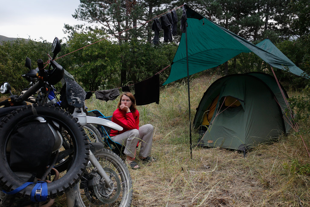
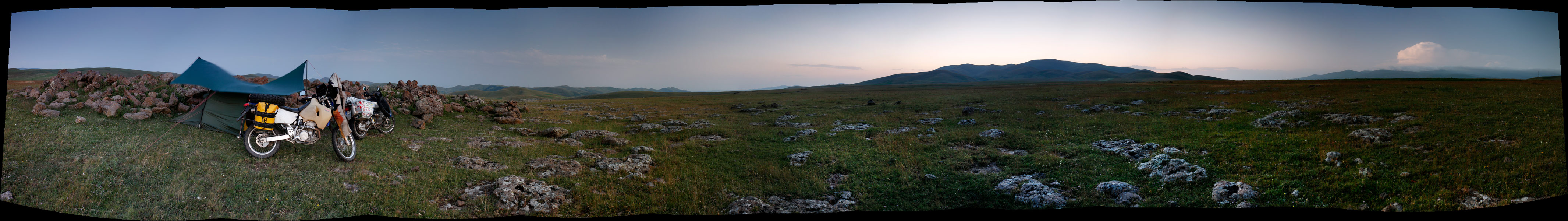
The light breeze and a bit of altitude meant that the temperature was quite pleasant as we rode across the relatively plain landscape. There were some low-lying piles of rock scattered around that we thought might be our only shelter, so we took a small track that led towards one and settled behind it. We were a few hundred meters from the highway and it was getting dark, so we ignored the fact that we were only half-hidden behind it.
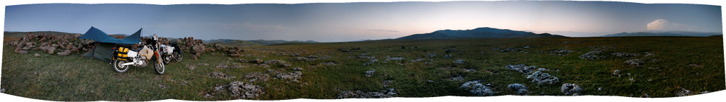
The wind grew stronger, making pitching of the tent somewhat tricky. When we were finally set up, it was already dark, with the exception of the northerly direction where we could see lightning lighting up the mountains. It seemed that the storm was limited to the high hills, as the skies cleared up above us and we could see big, round Moon rising above the horizon in the east.
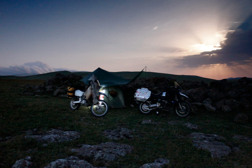
Moonlight camp in the windy plains of Northern-Armenia.
At night, Kariina woke up to the dreams of curvy roads and feeling sick. After trying to fight the “motion sickness” off she had to admit that it wasn’t the dreams but perhaps some nasty microbe which forced her out of the tent and into plain moonlight to vomit. In the morning she was still feeling sick and had a slight fever, so we decided to ride to the nearest town and have some rest.
The town of Gyumri isn’t really on tourist maps as there isn’t a lot to see (the town was heavily damaged by the 1988 earthquake, and is slowly being rebuilt). After a few hours of resting in a guesthouse we headed into town to find something light to eat (Kariina didn’t have a lot of appetite and neither did I as it was blazing hot outside), after which we decided to wander through the local market.
It seemed to be closing down, but as we wandered into some back alley, we got taken down by some butchers (one of local delicacies is cows’ heads). After some regular chatting as to where we’d come from and so on, we were invited to the local “bar” just a few stall away, where vodka was poured (it might have been a few hours past noon) to toast the friendship of our nations. Kariina was offered some super sweet soda which quickly reminded her of the curvy roads that she’d ridden all night long, but she managed to keep the stuff inside not to insult the enthusiastic locals. It seemed that it hadn’t been the first time for the men to go to the bar that day, but everybody was really friendly.
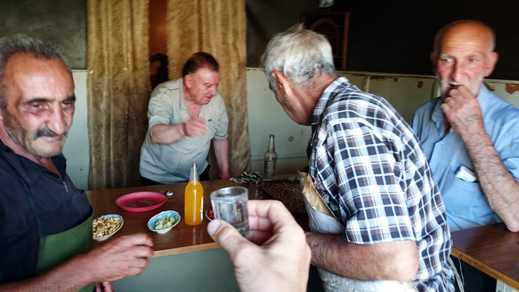
Drinking "lemonade" (Armenian vodka) in a shady bar with butchers and a history professor.
...::: Click to listen to live Armenian music on the street :::...
We skipped the Armenian capital city Yerevan as it sits in between some hills and it gets really hot there in summer, meaning over 45 degrees Celsius, which is too much for us. Even riding through the suburbs (all major roads pass through the city with no way around) we felt like being in an oven. As we got out of the city we headed east towards one of the more famous monasteries in Armenia. By the way, many people we met in the country proudly mentioned that Armenia was the first Christian country in the world, and we even saw huge banners aside the main highway greeting the pope who had visited Armenia just recently. Therefore there are loads of sights in Armenia that are of great religious significance and we surely needed to see at least a few of them.
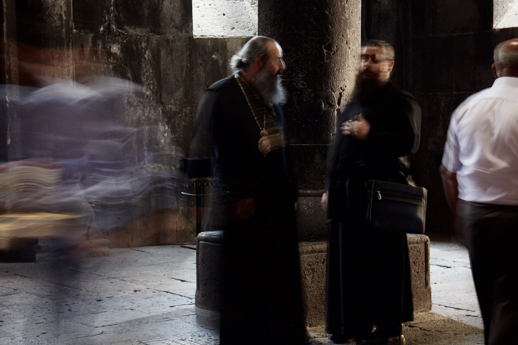
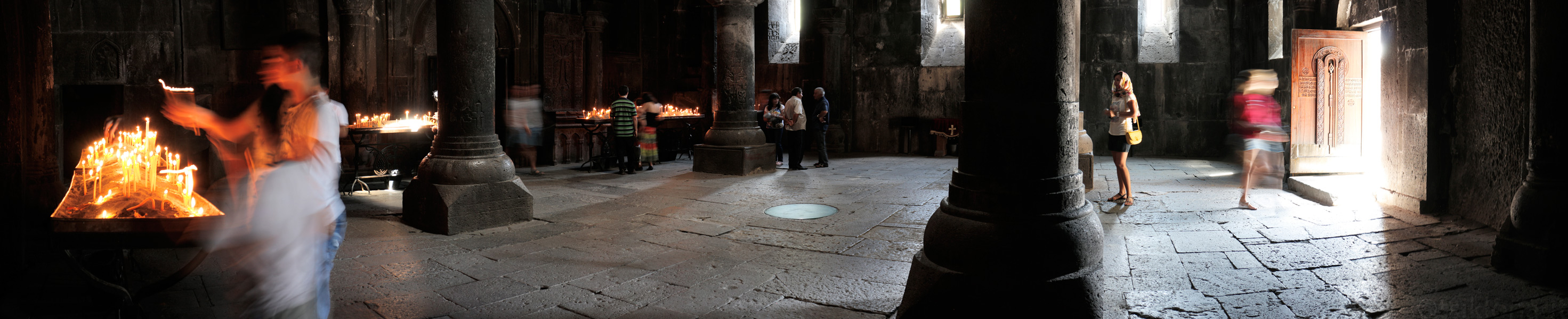
Geghard (sounds German, but it actually means a spear in local language) monastery was carved into stone in the 4th century, and is still functioning. Many newlyweds pay a visit to the monastery’s church, and since we visited on a Friday we too met a few wedding processions.
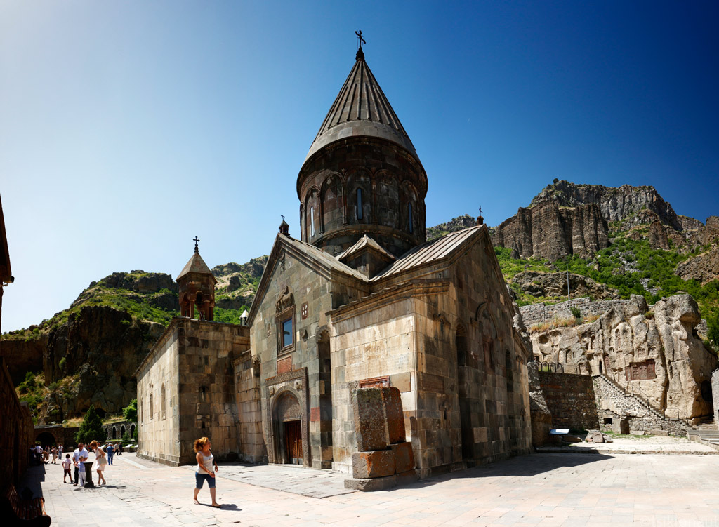
Geghard monastery, Armenia.
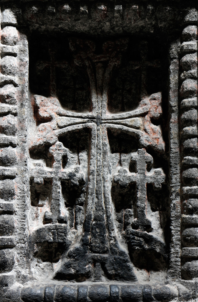
Ancient cross in the wall - Armenia was the first official Christian state on Earth.
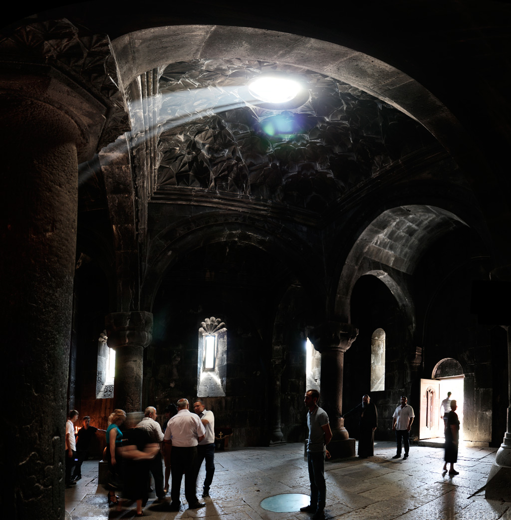
The light inside is magical.

Panorama from the columns supporting the heavy dome.
...::: Click to listen a religious chant in Geghard monastery :::...
Between Armenia and Azerbaijan lies an area that our foreign office advises against all travel to, and entering which is, according to Azerbaijani law, illegal. This area is Nagorno-Karabakh, a self-proclaimed republic under control of Armenia. Historically and culturally, it is part of Armenia, which was in 1920 assigned to Azerbaijan by Stalin, most probably to keep the countries in perpetual conflict and thus to better control them from above. In 1980ies, independence movement in the area started growing, exploding into a war that lasted from 1988 to 1994. On one side, there was Azerbaijan and Turkish elite officers, and on the other side, Karabakh independence fighters assisted by the Armenian army. In total, 30 000 people were killed (considering that today’s Karabakh population is only 150 000 people, probably there is no one who hasn’t been touched by war personally). Nature prefers the brave, it seems that the smaller and weaker ones - Karabakhs, alongside Armenians, won this war, regaining their territory, but the situation is far from settled. The crude-oil-driven, richer and more powerful Azerbaijan still considers Nagorno-Karabakh its own, and if you look on international maps, you will see that it is part of it. There are no border points with (or roads crossing into) Azerbaijan, and the area can only be accessed from Armenia (who also issues permits for the area).
We asked our “visas” not to be stuck in our passports, because later on we were intending to visit Azerbaijan, and with any evidence of having visited Nagorno-Karabakh, one is black-listed and refused entry into the country (or possibly put to jail in Azerbaijan).
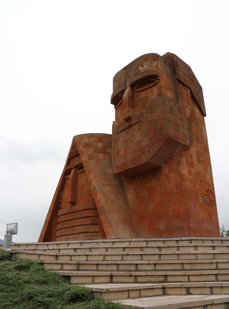
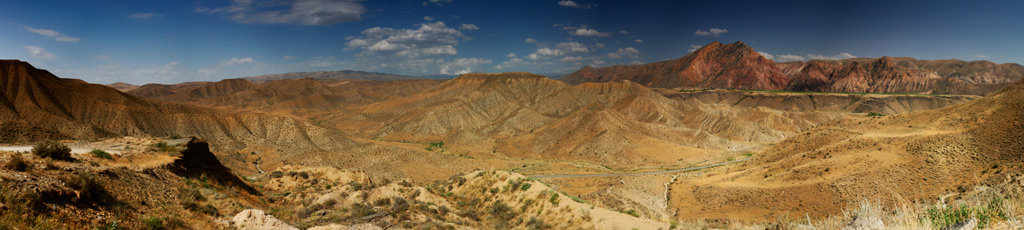
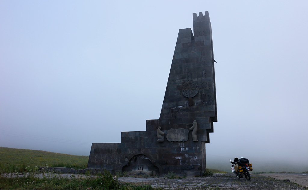
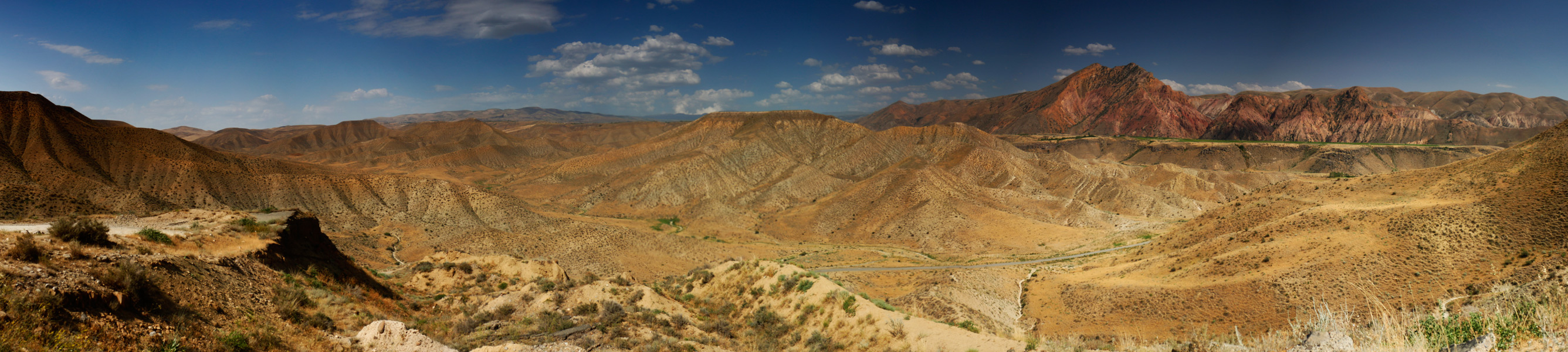
Visiting the area is actually quite depressing. Or perhaps it was the somewhat grim weather that greeted us when we got our first glimpse of Nagorno-Karabakh from atop a mountain ridge with an interesting monument.
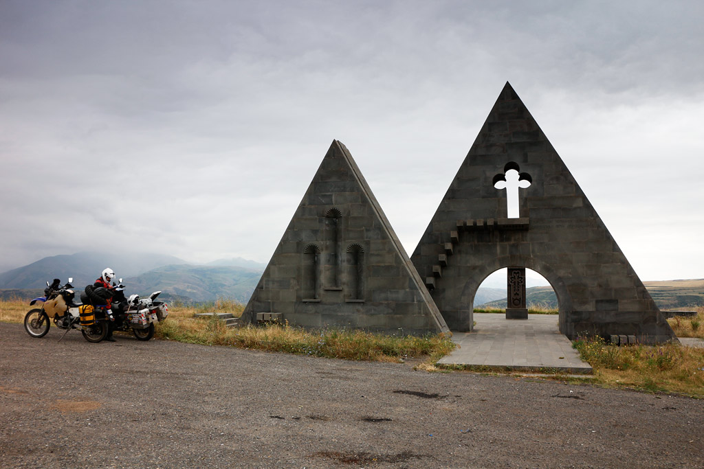
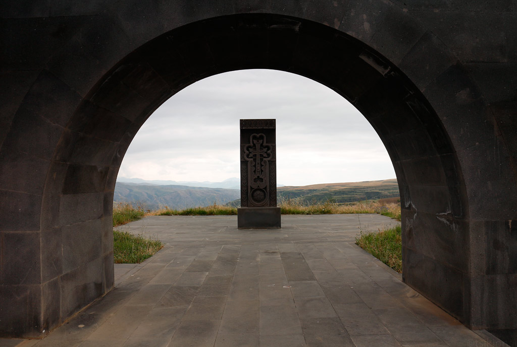
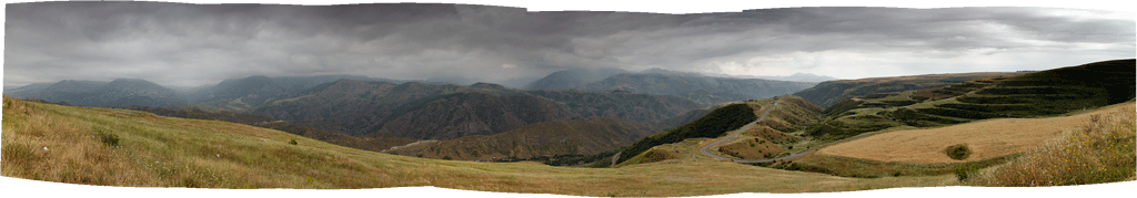
Nagorno-Karabakh landscape (click to enlarge)
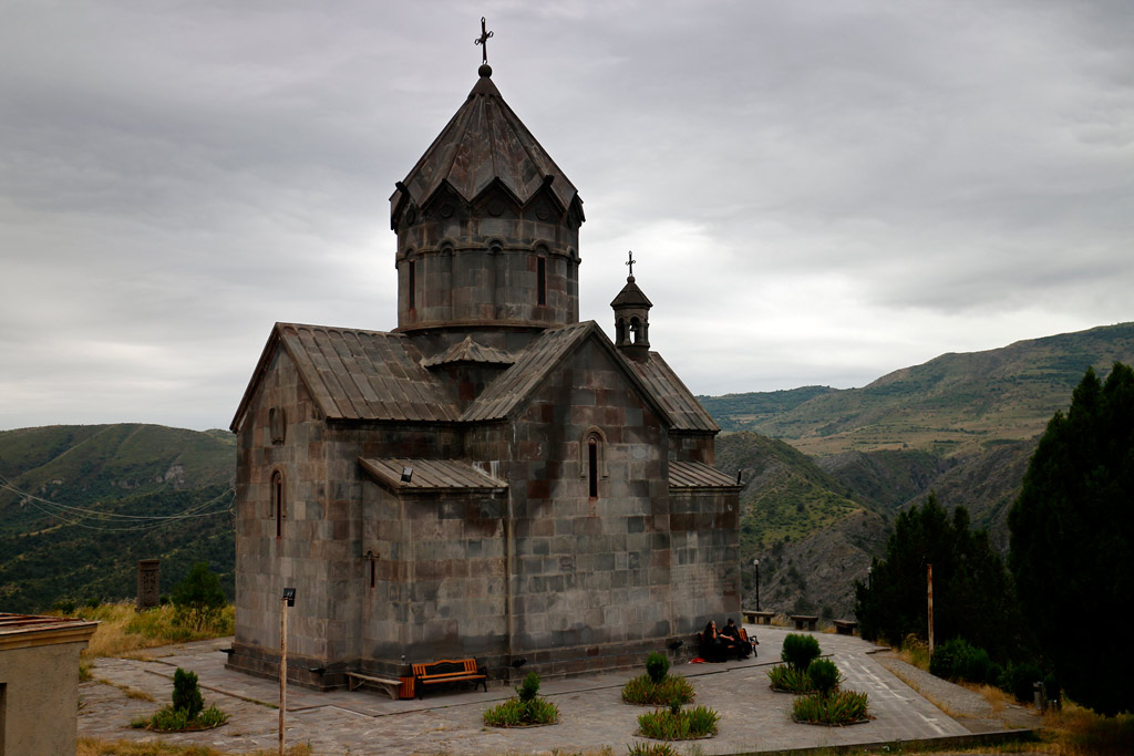
Karabakh churches have their own style.
Stepanakert, the capital, looks to be in a better condition than most towns in Armenia, with many new looking apartment houses with children’ playgrounds and so on. Yet, they stand side-by-side with some war-torn buildings.
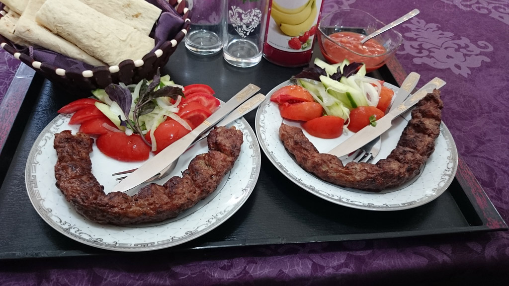
In a local restaurant we got to try out some great local food - a mutton and vegetable stew wrapped into very thin and deliciously crispy lavash bread. Accompanied with local draft beer, of course:
Iconic statue of peace and independence in Stepanakert, the capital of Nagorno-Karabakh.
Karabakh sense of art indeed is awkwardly good in a way. You see their vision everywhere.
We also went to a museum dedicated to lost soldiers. In fact, it is just one room with mostly pictures of soldiers who were never found after the war, but the exhibition was explained to us by a lady who’d lost her only son (who had just gotten married before the war began), which made the tour really emotional. If we talk about a war in numbers, it is just plain statistics, but if we try to embrace the human tragedy, it simply is overwhelming.
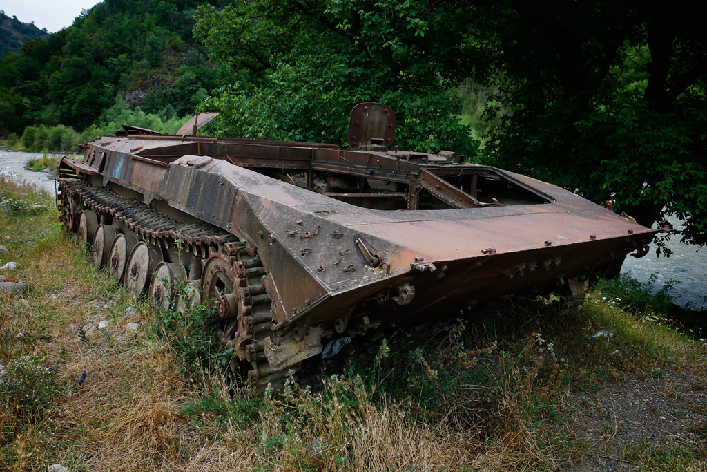
We only spent one night in Stepanakert, and moved on. We found a road back to Armenia through the northern part of Nagorno Karabakh. Here are some pictures:
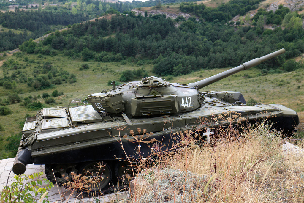
Karabakh tank.
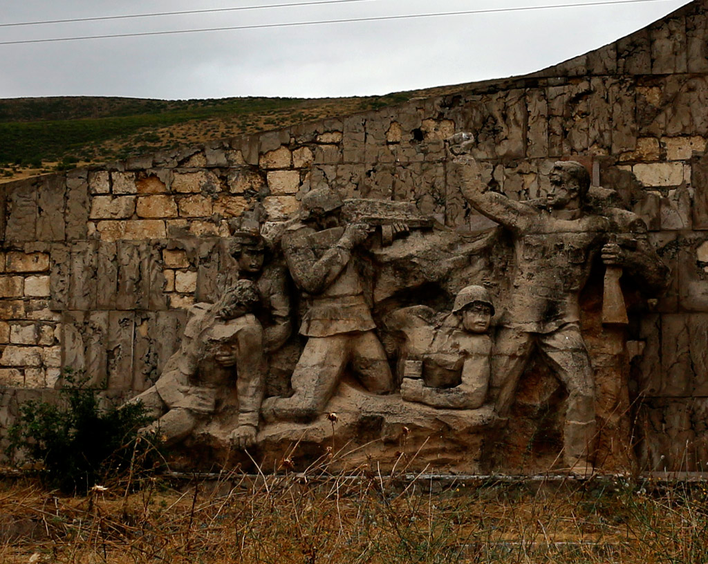
An old war memorial.
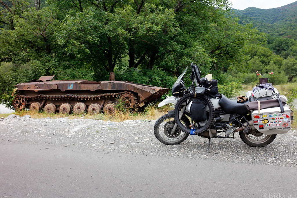
Destroyed tank.
Trail through northern Karabakh mountains, you can't walk off it - it's among the most heavily mined areas in the world.
Three men fought to the death with this tank.
We did not expect Armenia to be so varied in terms of landscape. While the North-West of the country could best be described as undulating plateau, the further we travelled from Yerevan, the capital, the more topography there was. The rather low, sunburnt hills reminded us of the areas of Iran that lie close to the Caspian Sea.
Moving in the southeasterly direction, we passed some rather dramatic canyons, before the road climbed upwards to the misty Vorotan Pass at around 2300 meters above sea level, and passed the Spendaryen Reservoir. Up high, we could almost swear that we’d been teleported to cold, damp Faroe Islands in the Atlantic.
Vorotan pass, Armenia.
Spendaryen Reservoir.
After crossing the pass, we rolled into the town of Goris and treated ourselves to some fine kebab - after all, in Armenia is known as shashlik country.
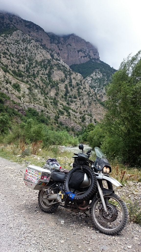
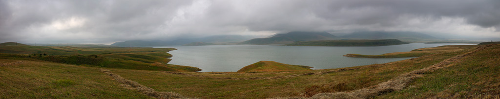
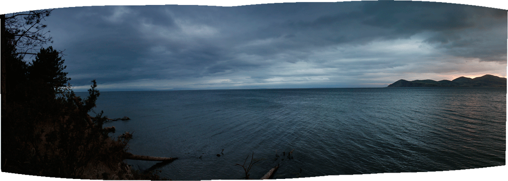
Heading back north, we decided to get off the beaten path and try the road that skirts Lake Sevan’s eastern shore, rather than the “usual” road that runs on the western side of the lake and where the local resorts are scattered. It turned out that the eastern shore is completely undeveloped, which is no wonder, because it lies so close to the border with the hated Azerbaijan (and hence, the Foreign Office quite clearly discourages visiting the area). It seems that the only thing that brings life to the very few villages along the road, is the cargo train that runs to and from the gold mines located on the border with Nagorno-Karabakh. The road itself is in various states of disrepair - quite decent in some places, but mostly in appalling condition. Yet there seems so much potential to develop the area tourism-wise, because the lake is magnificent.
Since the lake is situated in the mountains (the lake itself lies at the altitude of 1900 meters above sea level), its shore is somewhat steep and thus we had some difficulty finding and getting to a suitable spot for setting up camp, but we managed to pitch our tent between some nice smelling pine trees just aside the shore. After a dip in the coldish water, and doing some laundry, we could enjoy a magical sunset.
Laudry done, now rest.
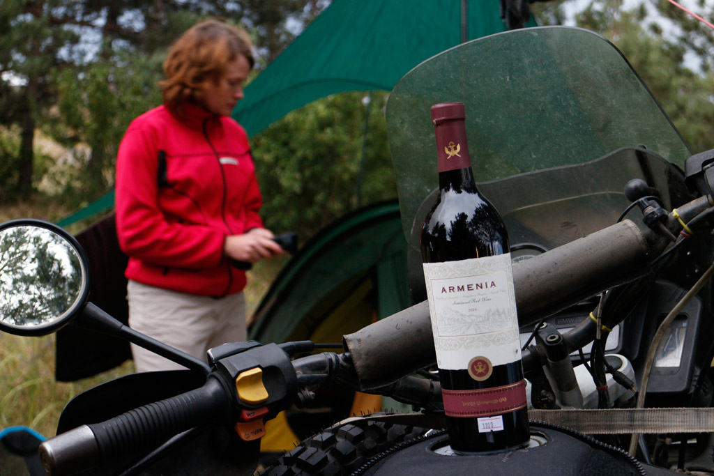
Rest done, now Armenian wine.
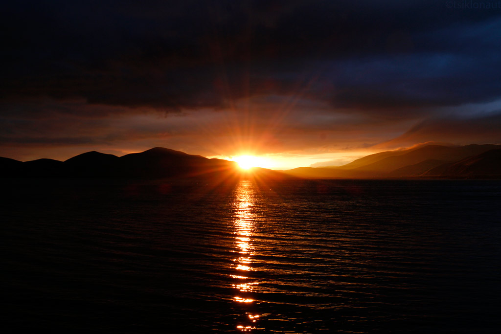
Along with lake Sevan sunset.
Sevan at dusk.
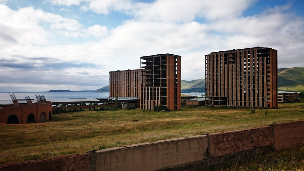
When we rolled on, we could notice a huge, derelict resort site on the northern shore of Lake Sevan.
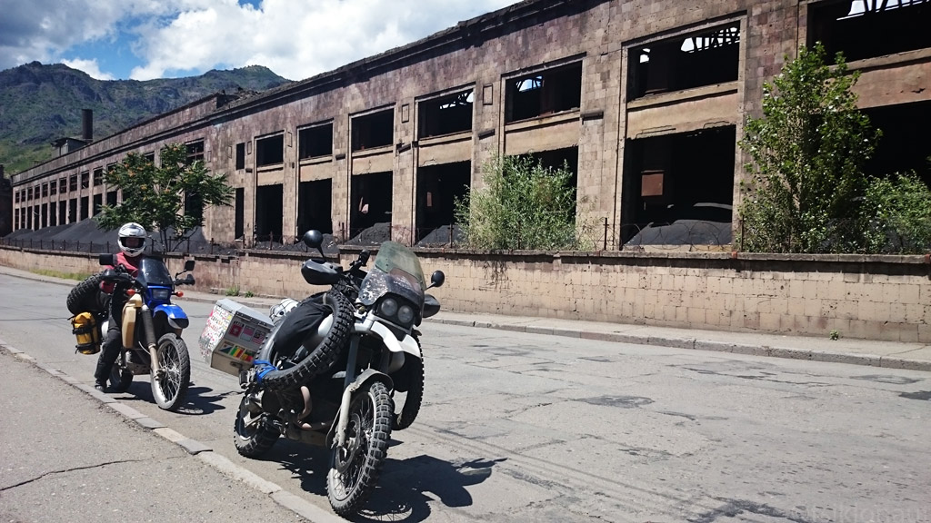
From there on we headed further north through the mountains where we saw both ancient monasteries and abandoned mining towns.
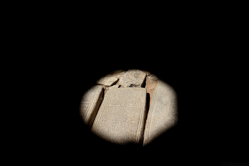
Light spot on a tombstone in Sanahin monestary.
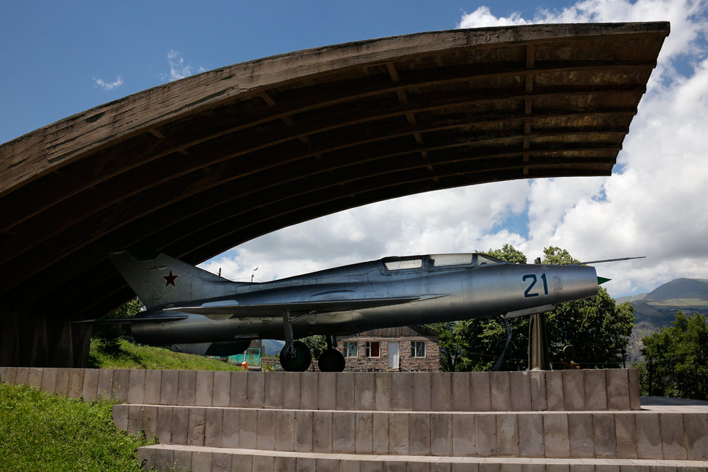
Also visited the Mikoyan house museum, he was the main designer of MiG fighter planes.
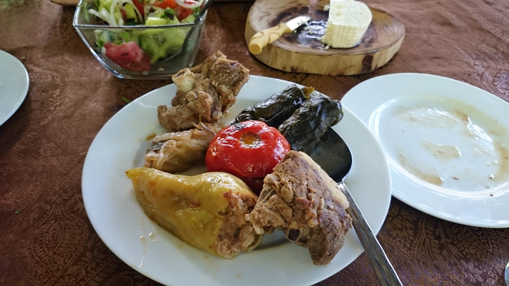
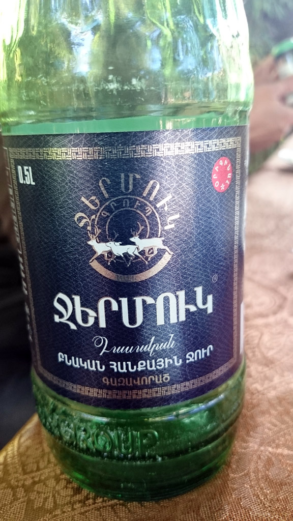
Before crossing the border back to Georgia, we stopped by a roadside eatery where we had some magnificent mutton and dolmas (vegetables stuffed with mince and rice), and flushed it all down with Armenian mineral water Jermuk (note the script - by the way, we’ve heard that Georgians mock Armenians because of their alphabet, saying that it looks like dropped spaghettis - whereas theirs looks almost the same…).
Margus
The light breeze and a bit of altitude meant that the temperature was quite pleasant as we rode across the relatively plain landscape. There were some low-lying piles of rock scattered around that we thought might be our only shelter, so we took a small track that led towards one and settled behind it. We were a few hundred meters from the highway and it was getting dark, so we ignored the fact that we were only half-hidden behind it.
The wind grew stronger, making pitching of the tent somewhat tricky. When we were finally set up, it was already dark, with the exception of the northerly direction where we could see lightning lighting up the mountains. It seemed that the storm was limited to the high hills, as the skies cleared up above us and we could see big, round Moon rising above the horizon in the east.
Moonlight camp in the windy plains of Northern-Armenia.
At night, Kariina woke up to the dreams of curvy roads and feeling sick. After trying to fight the “motion sickness” off she had to admit that it wasn’t the dreams but perhaps some nasty microbe which forced her out of the tent and into plain moonlight to vomit. In the morning she was still feeling sick and had a slight fever, so we decided to ride to the nearest town and have some rest.
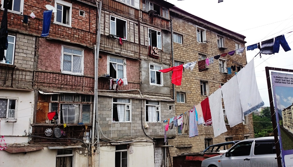
The town of Gyumri isn’t really on tourist maps as there isn’t a lot to see (the town was heavily damaged by the 1988 earthquake, and is slowly being rebuilt). After a few hours of resting in a guesthouse we headed into town to find something light to eat (Kariina didn’t have a lot of appetite and neither did I as it was blazing hot outside), after which we decided to wander through the local market.
It seemed to be closing down, but as we wandered into some back alley, we got taken down by some butchers (one of local delicacies is cows’ heads). After some regular chatting as to where we’d come from and so on, we were invited to the local “bar” just a few stall away, where vodka was poured (it might have been a few hours past noon) to toast the friendship of our nations. Kariina was offered some super sweet soda which quickly reminded her of the curvy roads that she’d ridden all night long, but she managed to keep the stuff inside not to insult the enthusiastic locals. It seemed that it hadn’t been the first time for the men to go to the bar that day, but everybody was really friendly.
Drinking "lemonade" (Armenian vodka) in a shady bar with butchers and a history professor.
...::: Click to listen to live Armenian music on the street :::...
We skipped the Armenian capital city Yerevan as it sits in between some hills and it gets really hot there in summer, meaning over 45 degrees Celsius, which is too much for us. Even riding through the suburbs (all major roads pass through the city with no way around) we felt like being in an oven. As we got out of the city we headed east towards one of the more famous monasteries in Armenia. By the way, many people we met in the country proudly mentioned that Armenia was the first Christian country in the world, and we even saw huge banners aside the main highway greeting the pope who had visited Armenia just recently. Therefore there are loads of sights in Armenia that are of great religious significance and we surely needed to see at least a few of them.
Geghard (sounds German, but it actually means a spear in local language) monastery was carved into stone in the 4th century, and is still functioning. Many newlyweds pay a visit to the monastery’s church, and since we visited on a Friday we too met a few wedding processions.
Geghard monastery, Armenia.
Ancient cross in the wall - Armenia was the first official Christian state on Earth.
The light inside is magical.
Panorama from the columns supporting the heavy dome.
...::: Click to listen a religious chant in Geghard monastery :::...
Between Armenia and Azerbaijan lies an area that our foreign office advises against all travel to, and entering which is, according to Azerbaijani law, illegal. This area is Nagorno-Karabakh, a self-proclaimed republic under control of Armenia. Historically and culturally, it is part of Armenia, which was in 1920 assigned to Azerbaijan by Stalin, most probably to keep the countries in perpetual conflict and thus to better control them from above. In 1980ies, independence movement in the area started growing, exploding into a war that lasted from 1988 to 1994. On one side, there was Azerbaijan and Turkish elite officers, and on the other side, Karabakh independence fighters assisted by the Armenian army. In total, 30 000 people were killed (considering that today’s Karabakh population is only 150 000 people, probably there is no one who hasn’t been touched by war personally). Nature prefers the brave, it seems that the smaller and weaker ones - Karabakhs, alongside Armenians, won this war, regaining their territory, but the situation is far from settled. The crude-oil-driven, richer and more powerful Azerbaijan still considers Nagorno-Karabakh its own, and if you look on international maps, you will see that it is part of it. There are no border points with (or roads crossing into) Azerbaijan, and the area can only be accessed from Armenia (who also issues permits for the area).
We asked our “visas” not to be stuck in our passports, because later on we were intending to visit Azerbaijan, and with any evidence of having visited Nagorno-Karabakh, one is black-listed and refused entry into the country (or possibly put to jail in Azerbaijan).
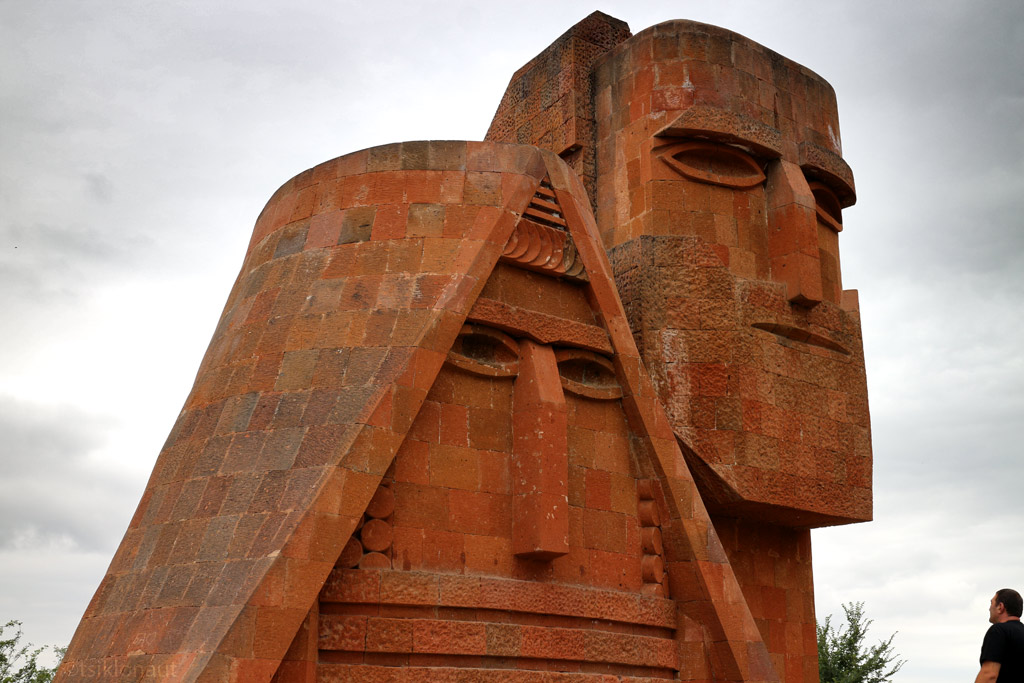
Visiting the area is actually quite depressing. Or perhaps it was the somewhat grim weather that greeted us when we got our first glimpse of Nagorno-Karabakh from atop a mountain ridge with an interesting monument.

Nagorno-Karabakh landscape (click to enlarge)
Karabakh churches have their own style.
Stepanakert, the capital, looks to be in a better condition than most towns in Armenia, with many new looking apartment houses with children’ playgrounds and so on. Yet, they stand side-by-side with some war-torn buildings.
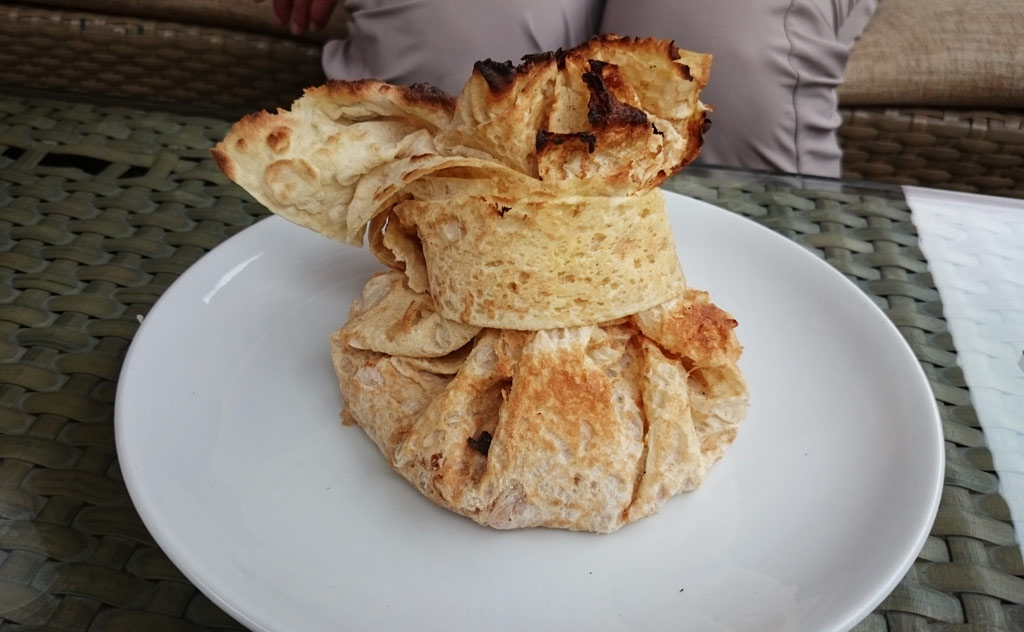
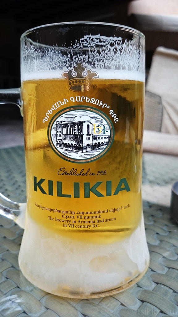
In a local restaurant we got to try out some great local food - a mutton and vegetable stew wrapped into very thin and deliciously crispy lavash bread. Accompanied with local draft beer, of course:
Iconic statue of peace and independence in Stepanakert, the capital of Nagorno-Karabakh.
Karabakh sense of art indeed is awkwardly good in a way. You see their vision everywhere.
We also went to a museum dedicated to lost soldiers. In fact, it is just one room with mostly pictures of soldiers who were never found after the war, but the exhibition was explained to us by a lady who’d lost her only son (who had just gotten married before the war began), which made the tour really emotional. If we talk about a war in numbers, it is just plain statistics, but if we try to embrace the human tragedy, it simply is overwhelming.
We only spent one night in Stepanakert, and moved on. We found a road back to Armenia through the northern part of Nagorno Karabakh. Here are some pictures:
Karabakh tank.
An old war memorial.
Destroyed tank.
Trail through northern Karabakh mountains, you can't walk off it - it's among the most heavily mined areas in the world.
Three men fought to the death with this tank.
We did not expect Armenia to be so varied in terms of landscape. While the North-West of the country could best be described as undulating plateau, the further we travelled from Yerevan, the capital, the more topography there was. The rather low, sunburnt hills reminded us of the areas of Iran that lie close to the Caspian Sea.
Moving in the southeasterly direction, we passed some rather dramatic canyons, before the road climbed upwards to the misty Vorotan Pass at around 2300 meters above sea level, and passed the Spendaryen Reservoir. Up high, we could almost swear that we’d been teleported to cold, damp Faroe Islands in the Atlantic.
Vorotan pass, Armenia.

Spendaryen Reservoir.
After crossing the pass, we rolled into the town of Goris and treated ourselves to some fine kebab - after all, in Armenia is known as shashlik country.
Heading back north, we decided to get off the beaten path and try the road that skirts Lake Sevan’s eastern shore, rather than the “usual” road that runs on the western side of the lake and where the local resorts are scattered. It turned out that the eastern shore is completely undeveloped, which is no wonder, because it lies so close to the border with the hated Azerbaijan (and hence, the Foreign Office quite clearly discourages visiting the area). It seems that the only thing that brings life to the very few villages along the road, is the cargo train that runs to and from the gold mines located on the border with Nagorno-Karabakh. The road itself is in various states of disrepair - quite decent in some places, but mostly in appalling condition. Yet there seems so much potential to develop the area tourism-wise, because the lake is magnificent.
Since the lake is situated in the mountains (the lake itself lies at the altitude of 1900 meters above sea level), its shore is somewhat steep and thus we had some difficulty finding and getting to a suitable spot for setting up camp, but we managed to pitch our tent between some nice smelling pine trees just aside the shore. After a dip in the coldish water, and doing some laundry, we could enjoy a magical sunset.
Laudry done, now rest.
Rest done, now Armenian wine.
Along with lake Sevan sunset.

Sevan at dusk.
When we rolled on, we could notice a huge, derelict resort site on the northern shore of Lake Sevan.
From there on we headed further north through the mountains where we saw both ancient monasteries and abandoned mining towns.
Light spot on a tombstone in Sanahin monestary.
Also visited the Mikoyan house museum, he was the main designer of MiG fighter planes.
Before crossing the border back to Georgia, we stopped by a roadside eatery where we had some magnificent mutton and dolmas (vegetables stuffed with mince and rice), and flushed it all down with Armenian mineral water Jermuk (note the script - by the way, we’ve heard that Georgians mock Armenians because of their alphabet, saying that it looks like dropped spaghettis - whereas theirs looks almost the same…).
Margus
")


