
A rather longish post this time mates, so put it in the loading mode and go grab a beer or three and hopefully it's loaded by the time you get back.
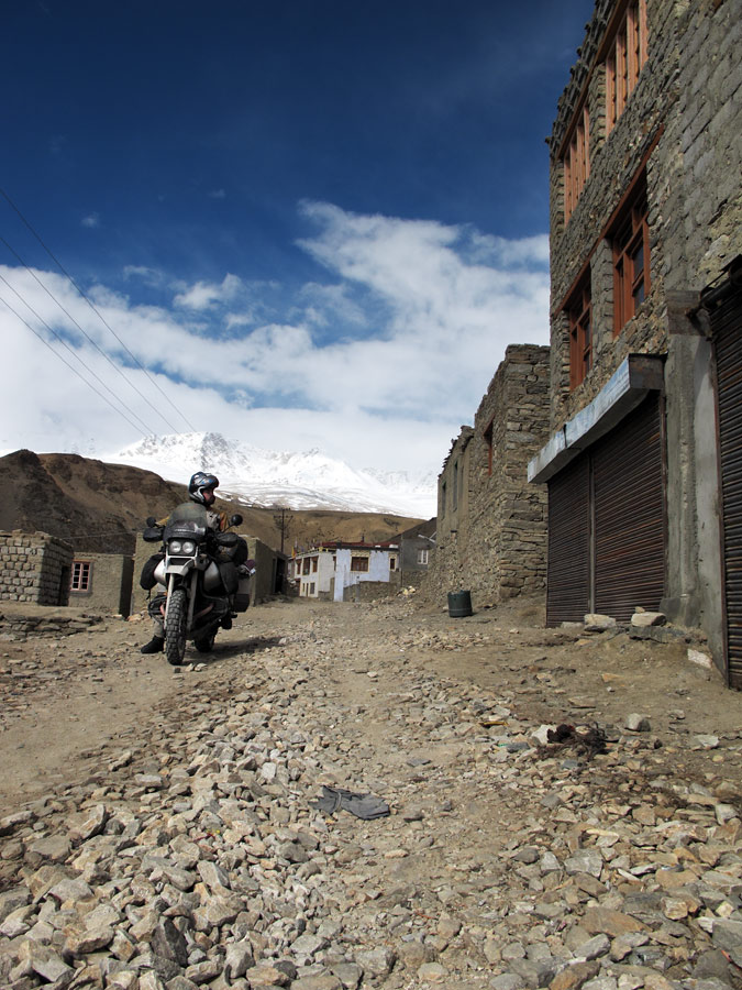
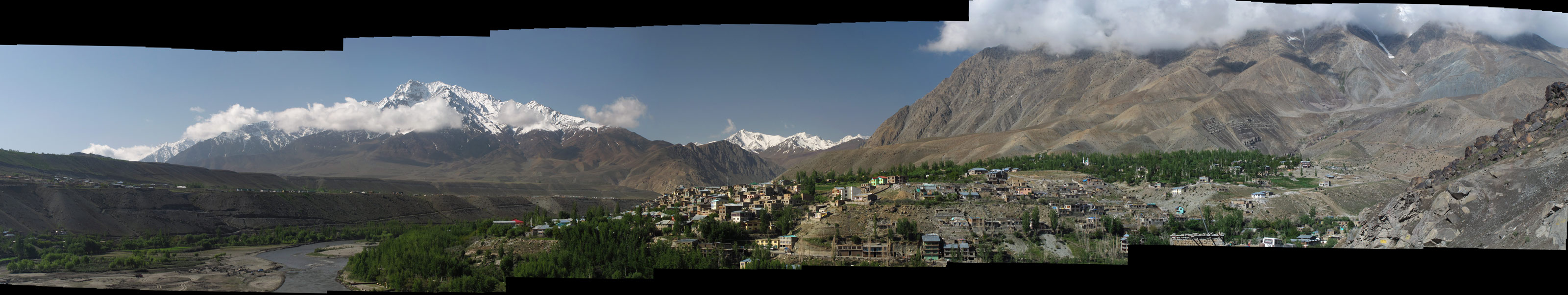
Travelling from Srinagar to Leh, the town of Kargil is the last outpost of Islam. Sure enough it has all the traits of a muslim settlement, including the 4 AM recital of Quran.
After that, moving further East, as one crosses the high passes and descends into fertile valleys, the spirituality changes completely - it is the Buddhist country. Although today India is predominantly Hindu, it was not always so - already in the 3rd century BC Buddhism became the dominant religion in all of today's India. However, due to different reasons Hinduism grew more powerful, and later the Mughal period patronized Islam, so today the religious image is pretty confused.
So far we've only experienced Tibetan buddhism (interestingly, its roots are in India, from where it was Imported to Tibet by the traders in the 4th century) in India, which seems to be predominant in parts of Himachal Pradesh and especially Ladakh. It seems to be concentrated in MacLeodGanj, home to the government in exile of Tibet, but there are viable Tibetan communities elsewhere in the northern part of India.
One of the more interesting villages is Mulbekh with its 8-metre high relief of Maitreya-Buddha:
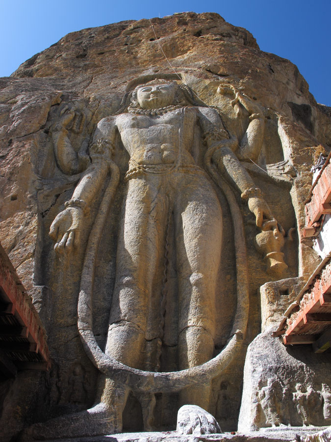
Maitreya.
Maitreya and the monastery below it.
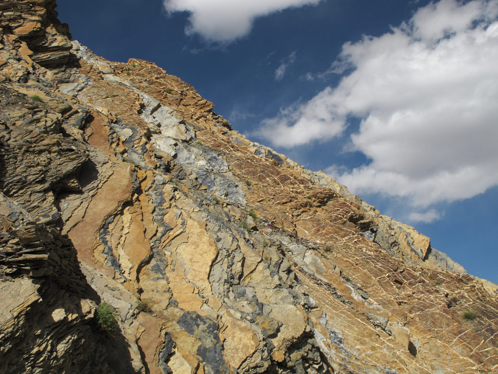
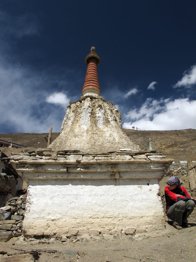
Our road and a chörten, a Tibetan Buddhist stupa.
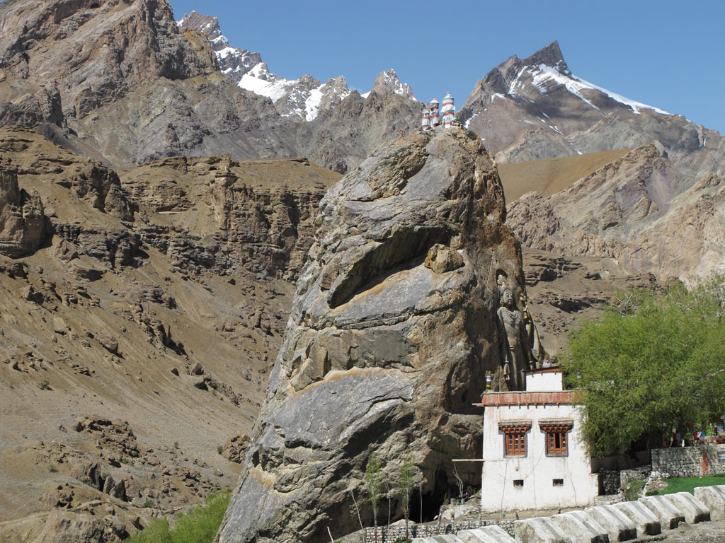
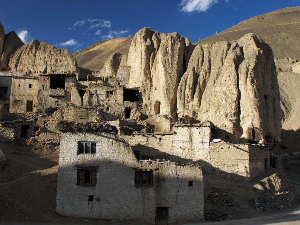
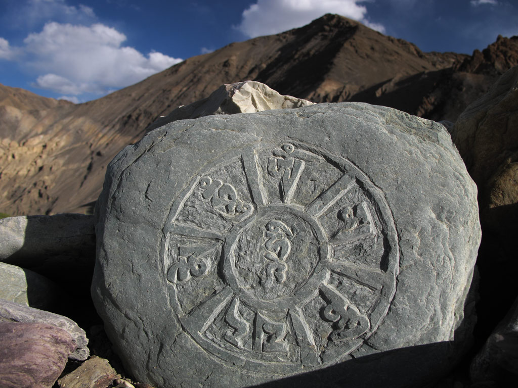
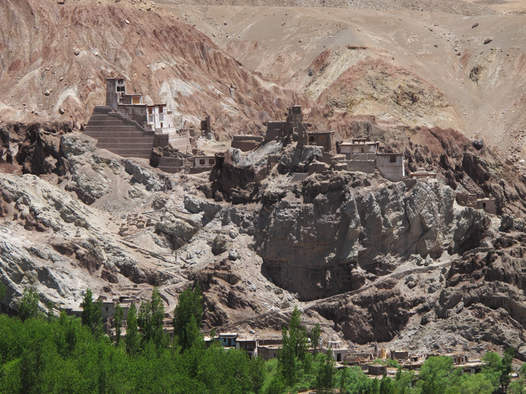
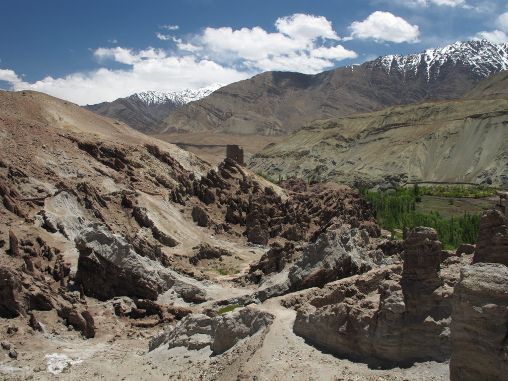
But there is also the remarkable village of Lamayuru which is home to a buddhist monastery dating back to the 11th century. The monastery is great, and so are the ancient looking chörtens (Buddhist stupas) that are sprinkled everywhere on the rocky slopes of the village, and the mani-stones with Tibetan inscriptions, and the warmth of the people.
Lamayuru.
Different layers of ground representing different eras.
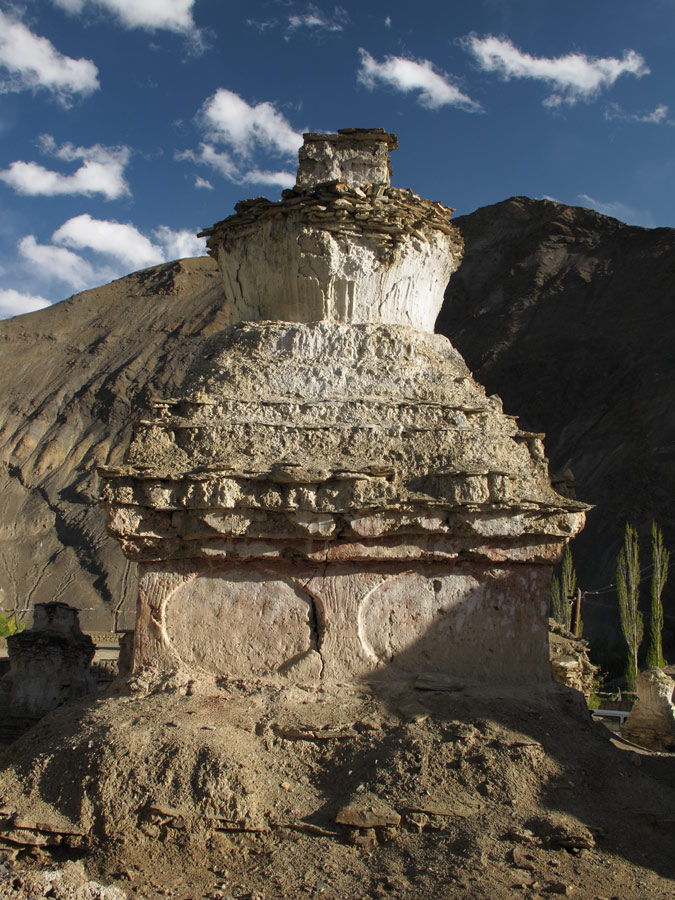
Ancient chörten in sunset.
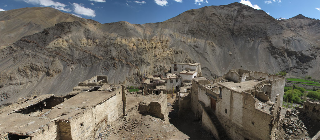
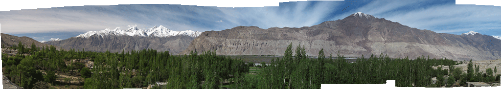
Lamayuru panorama.
Lamayuru architecture.
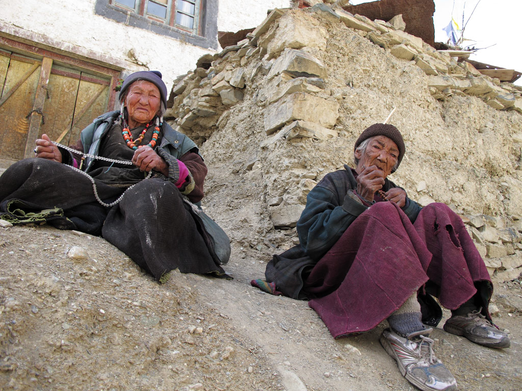
Two old women on the Lamayuru street.
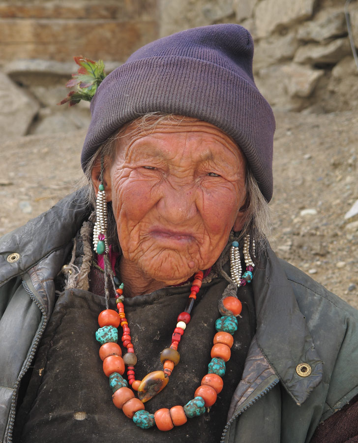
A Buddhist woman with her prayer wheel, she hosted us.
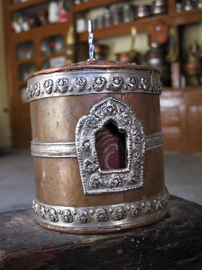
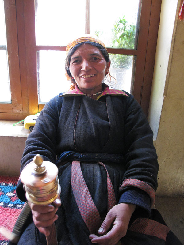
One of the internal-rotating prayer wheels on family's kitchen table.
Kariina under a chörten.
Lamayuru in sunset.
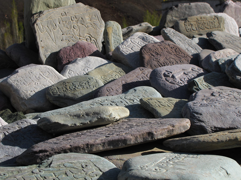
Mani stones with scripts.
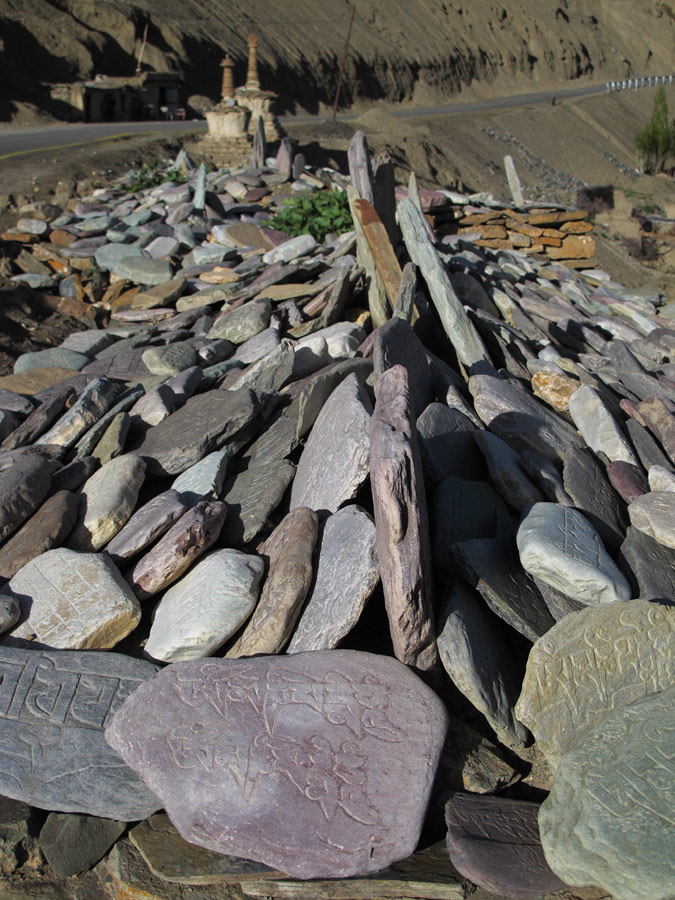
Loads of them.
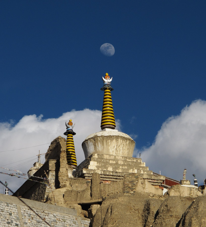
The moon above the holy land.
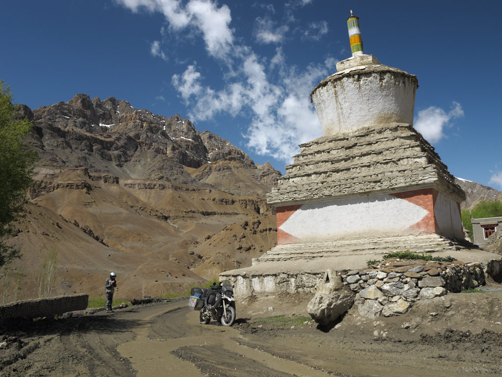
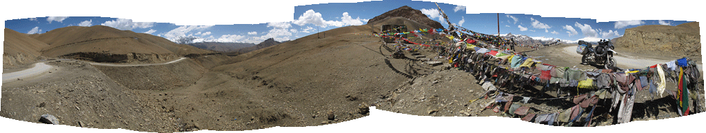
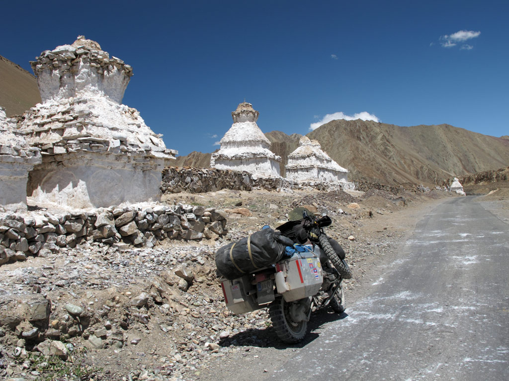
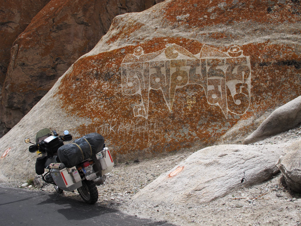
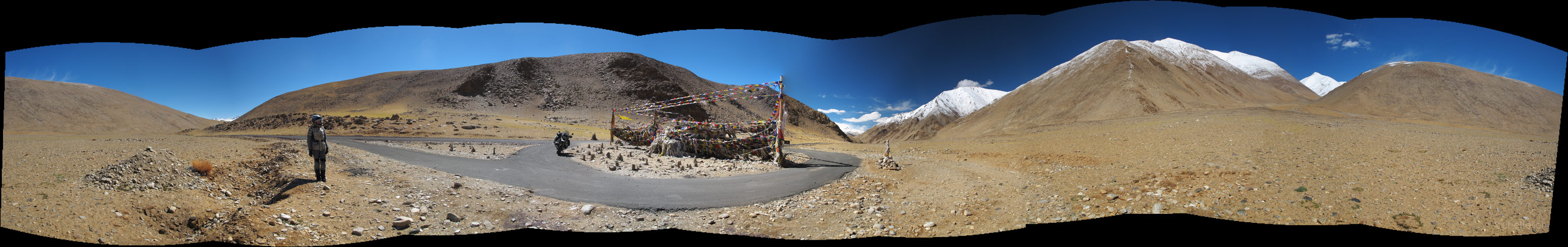
Between Mulbekh and Lamayuru, there is a high pass - Fotu La, where there are many prayer flags with mantras to be carried away by the wind.
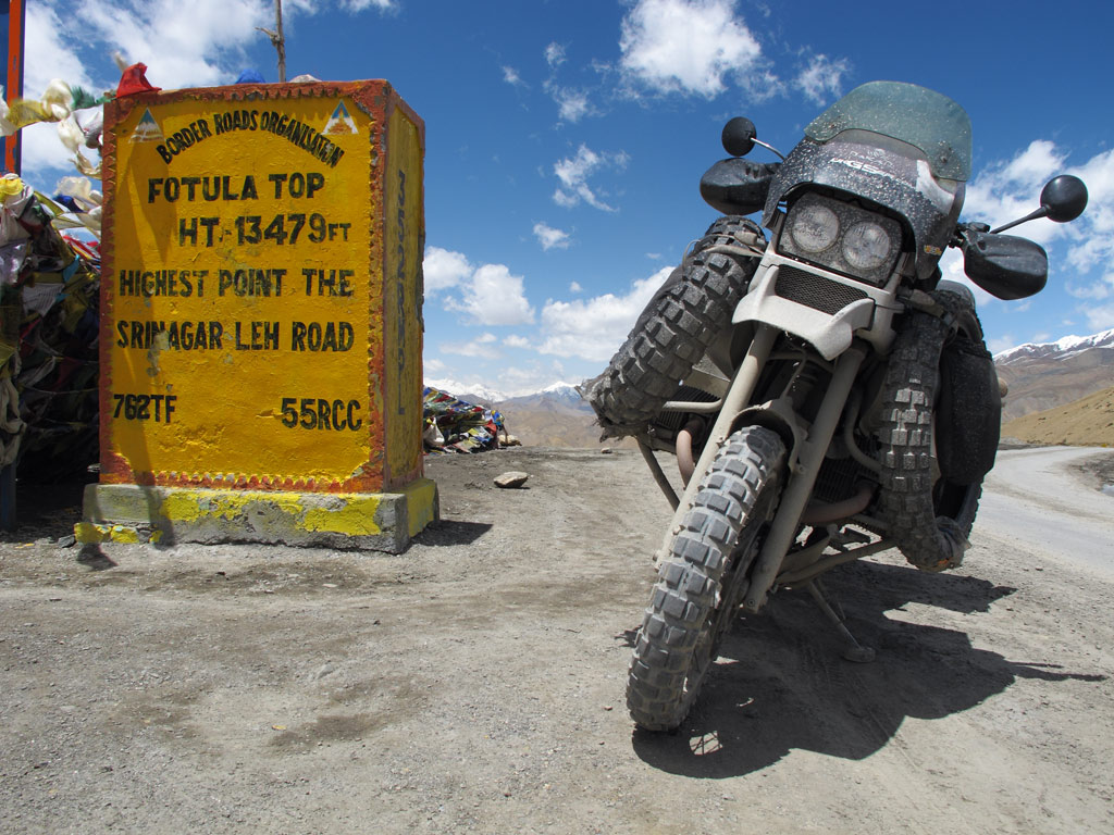
Fotu La, 13 000+ft.
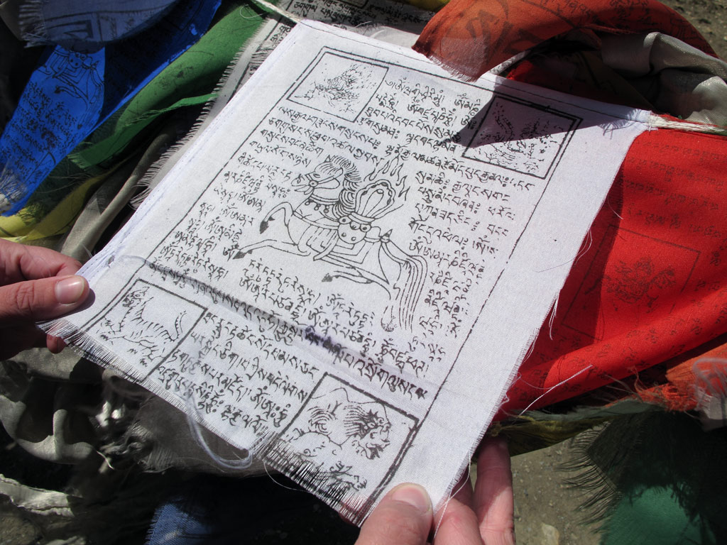
One of the prayer flags in detail. Loads of them on different mountain passes.
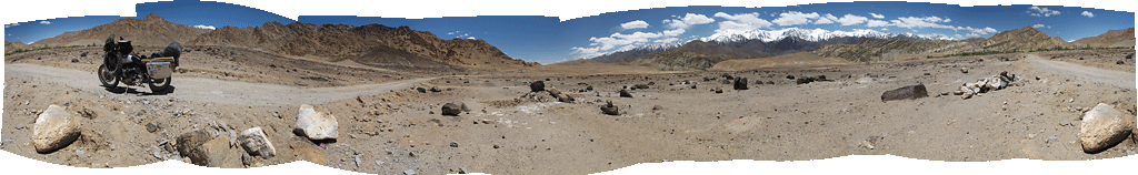
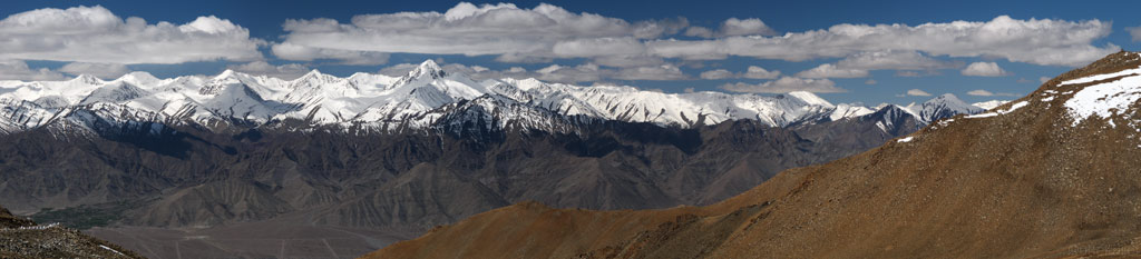
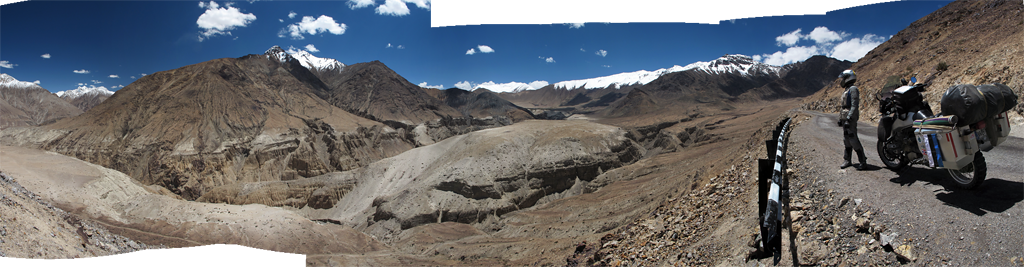
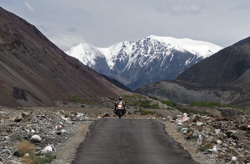
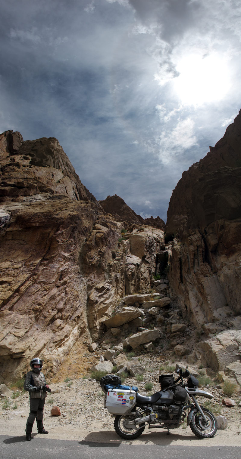
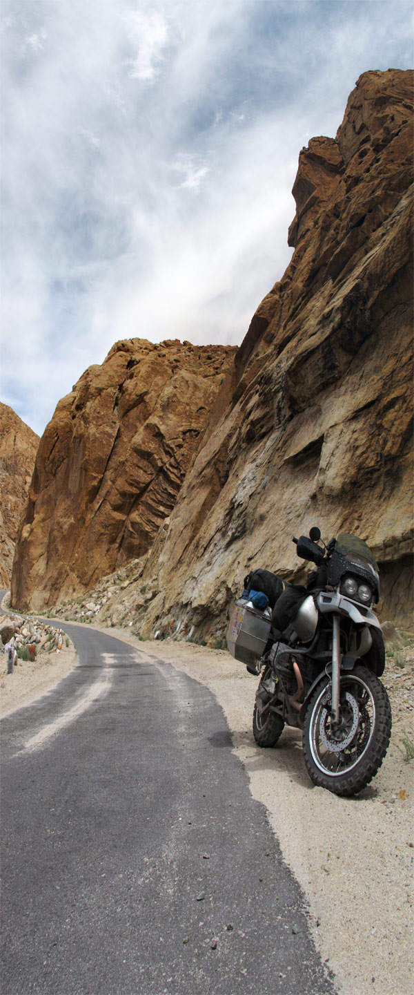
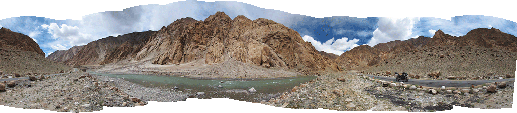
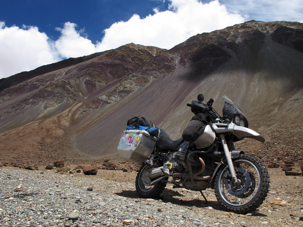
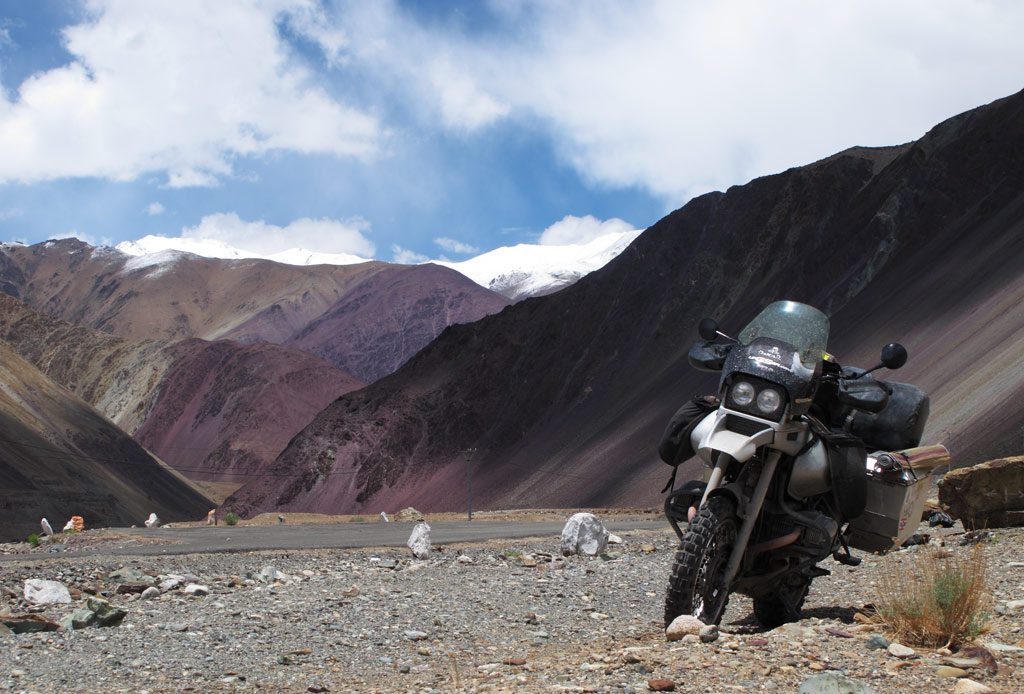
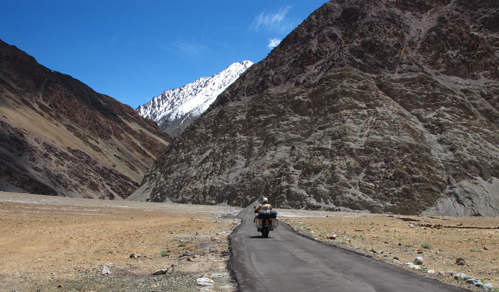
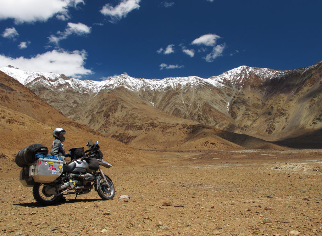
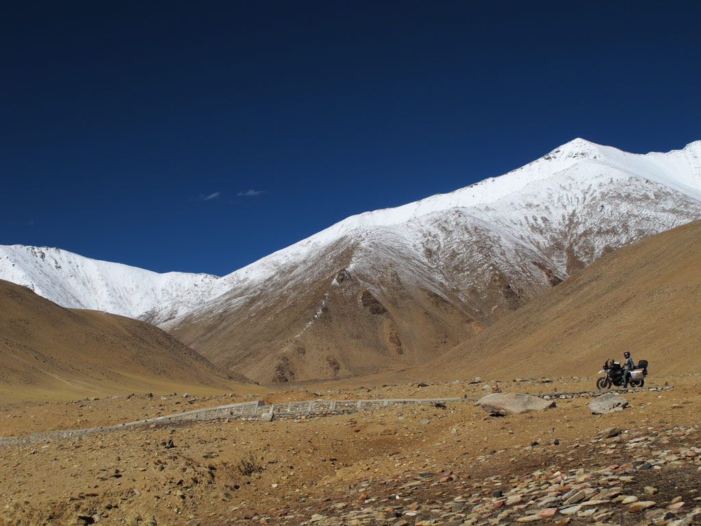
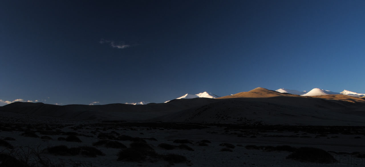
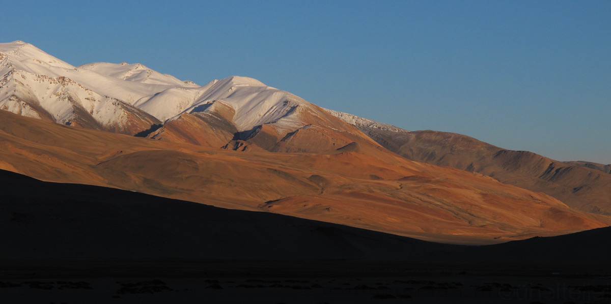
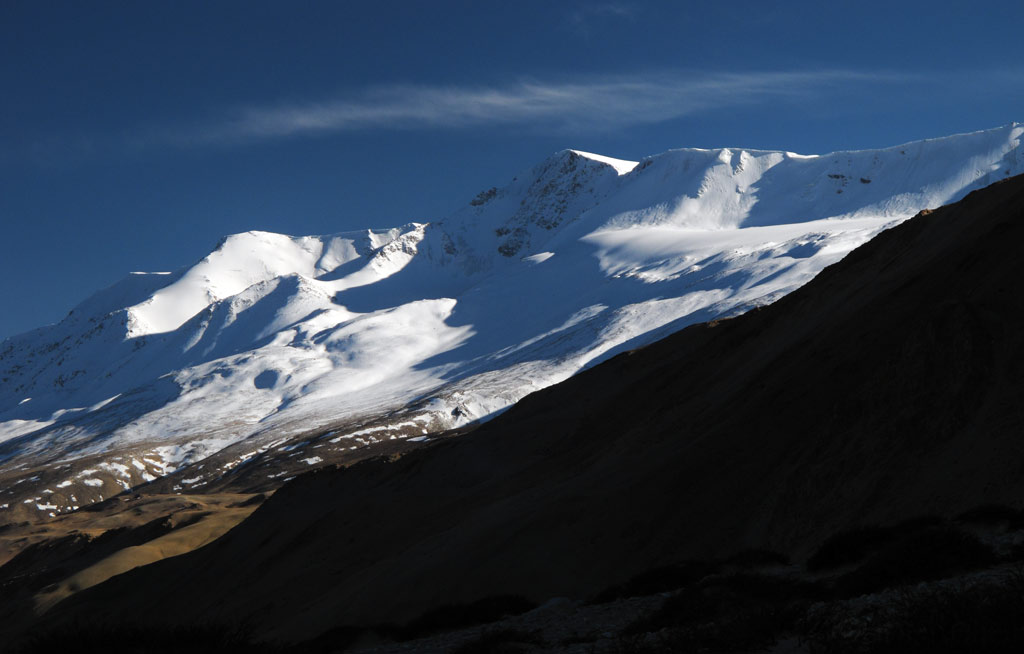
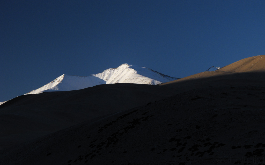
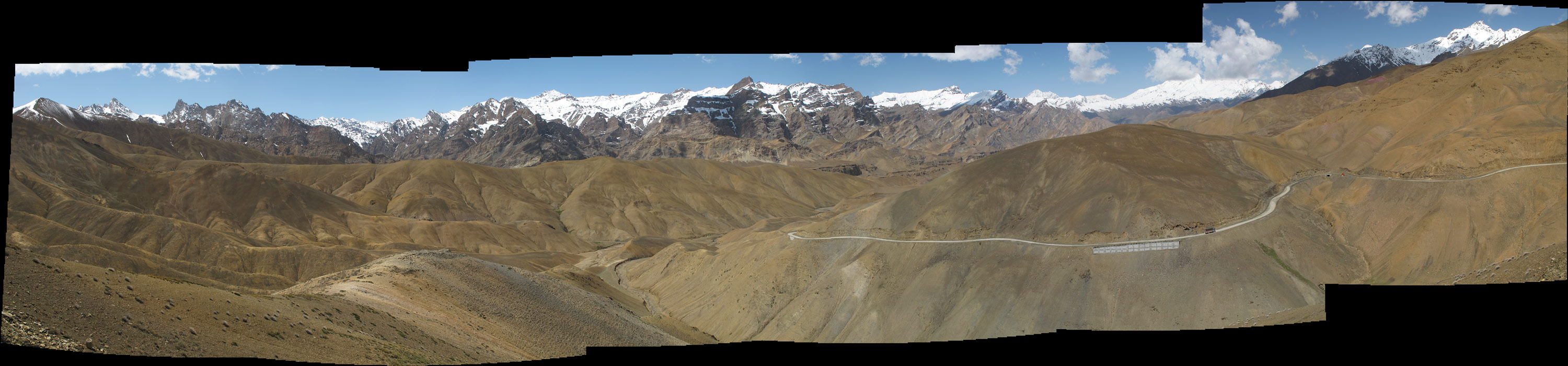
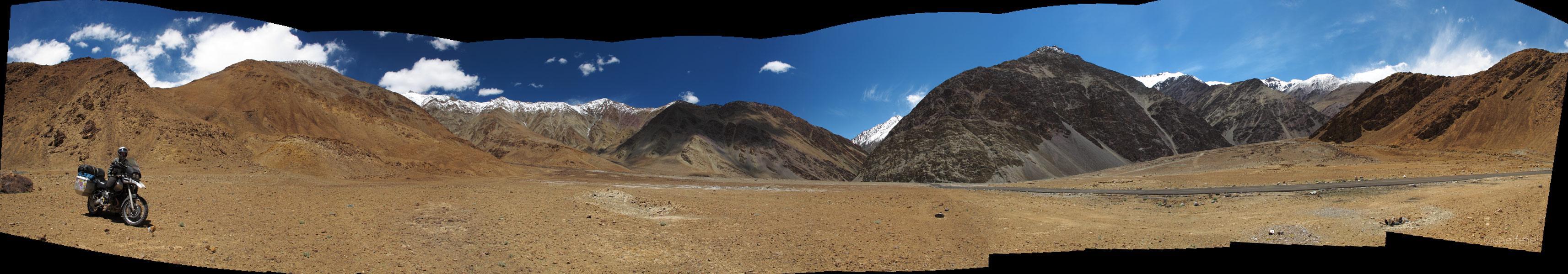
The road winds through some magnificent scenery of the "roof of the world".
GS under the Himalayan peaks.

Panoramas - click to enlarge each one.

GS and the prayer flags - crossing the Namika La.

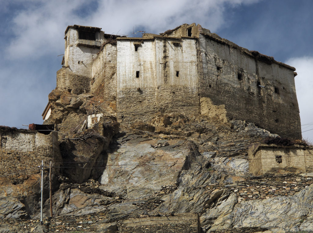
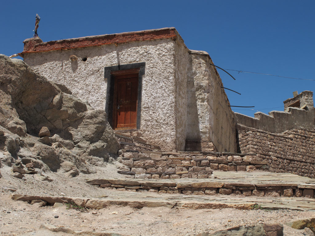
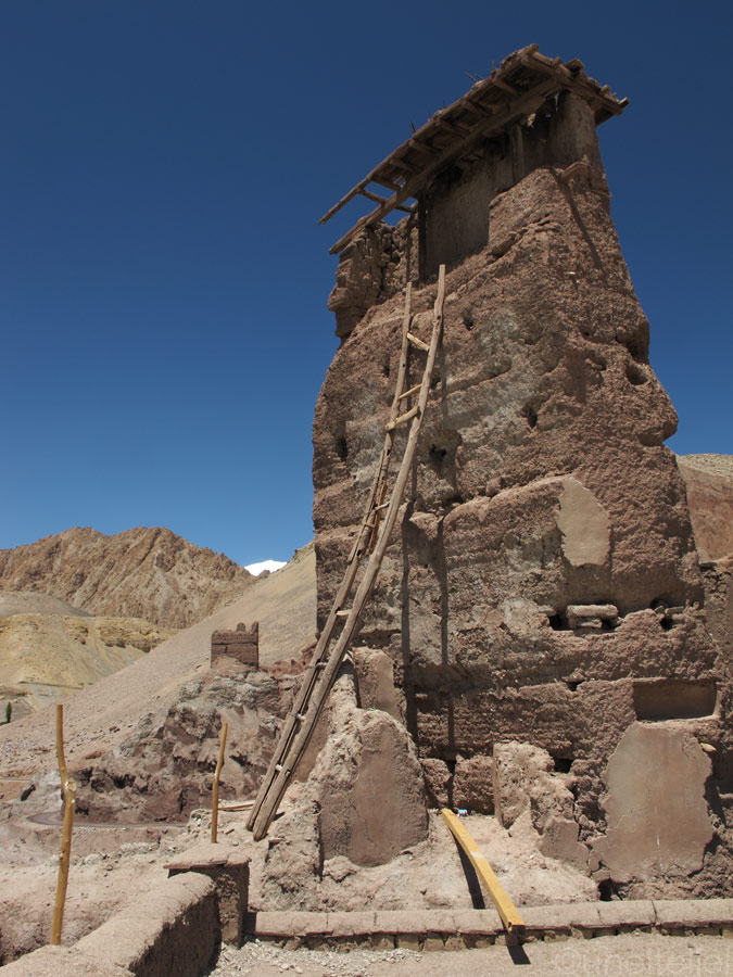
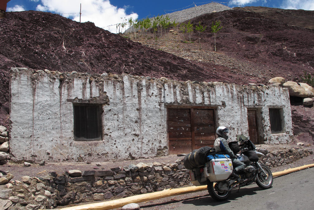
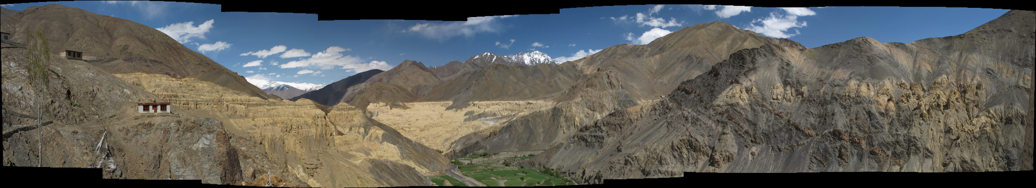
For five centuries Leh has been considered the capital of Ladakh, but it has not always been the case. Before, it was the little-known Basgo that ruled the region. In 1470 the emperor of Basgo, Lhanchen Bhagan, conquered the kingdom of Leh, and the era of the Namgyal (meaning "the victorious") dynasty began. As the power shifted to Leh, Basgo was left to its own, and tody it is no more than a sleepy village set amongst crumbling old chörtens and bright green barley fields. Only the ruins of the mighty hilltop fortress remind us of the glorius past.
Basgo fort.
Colourful chörtens.
A house.
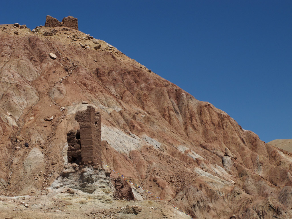
Fort's ruins against reddish mountain.
Tibetan monastery and a GS below.
Streets inside the forts.
Remains from far-far past.
Tibetan monastery from above.
Himalayan surroundings...
And some pics of the road from Basgo to Leh.
GS and chörtens.
Chörten on a mountainside.
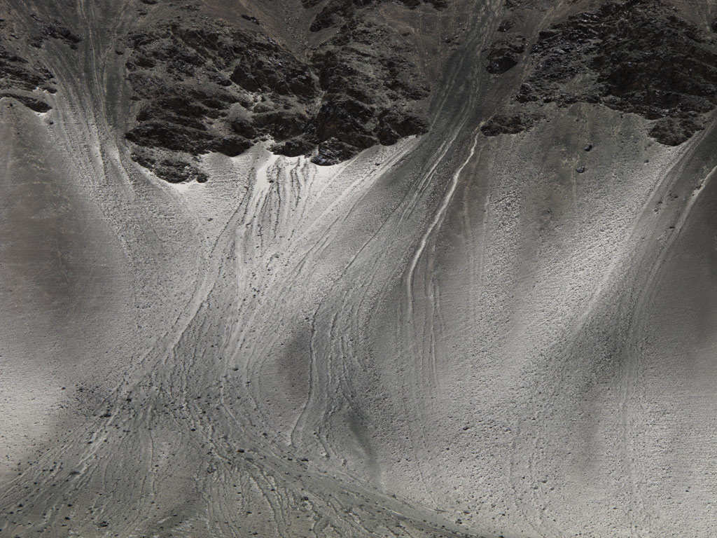
Alien-planet-like reddish mountains are a standard feature here.

Panoramas from the road - click to enlarge each one.


For centuries, Leh was a stopping place for caravans plying between Tibet and Kashmir, China and India. However, even today it boasts a strategically good position, namely for Ladakh bound tourism. Today, instead of kashmere wool, silk and brocade, it is the middle-class Indian tourist that is being transported along the valley of Indus.
Today's Leh is no longer an atmospheric village it used to be. Instead, it has grown to become a town of more than 27 000 inhabitants, but still it has something coarse to it, some remains of the feel of a mountain village. Low mudbrick houses line the narrow alleyways that wind in a manner of a three-dimensional maze, home to sleeping dogs and holy cows. Here and there you notice a chörten, or a colourfully painted prayer wheel, revving like a generator of positive thoughts.
Sounds of the gigantic prayer wheel that ringed the bell on each revolution:
.:: LISTEN ::.
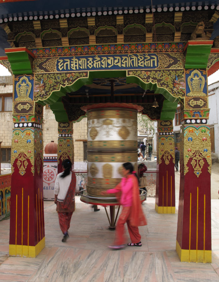
The "ringing" prayer wheel.
Sleepy stray dogs everywhere on the streets.
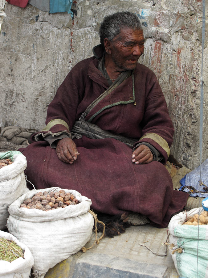
Tibetan street merchant.
Leh market.
Selling spices on the street.
Streets of Leh.
We happened to be here just in time to witness some Buddhist celebration that seemed to involve the whole town. People were walking in masses from one sanctuary to another, and one could hear dub-techno-like cacophony of sounds reflecting back from the mountain sides.
.:: LISTEN ::.
Buddhists walking down the mountain - uphill is one of the holy gompas.
Chörten against the Zanskar range.
Festival's main square.
Young ladies at the festival.
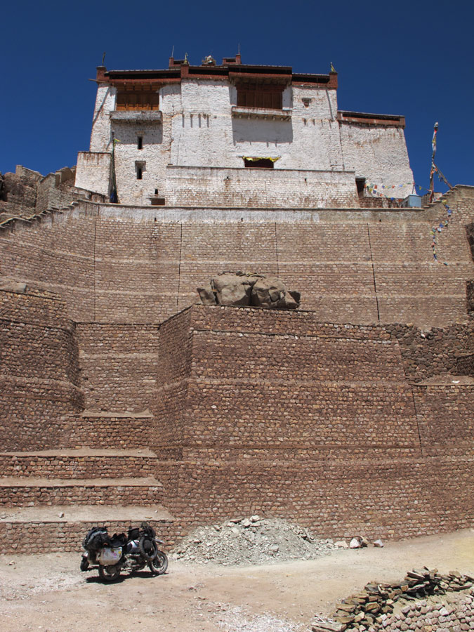
As you climb up the steep hill, you find yourself among some old gompas and the mighty 17th century palace. It was built by Sengge Namgyal, king of Ladakh, but although it is nine storeys high, its mudbrick design did not quite strike us. Rather it was the views from the palace onto the town of Leh, nestled in a green valley, the Indus valley behind it, and the towering peaks of the Zanskar range like a crown to the majestic view.
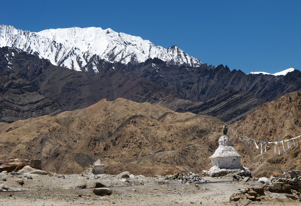
Bright white chörtens and a gompa.
Leh palace.
Inside the palace...
The same gompa that buddhists came down from in the beginning pics of the thread.
Mountain versus sky.

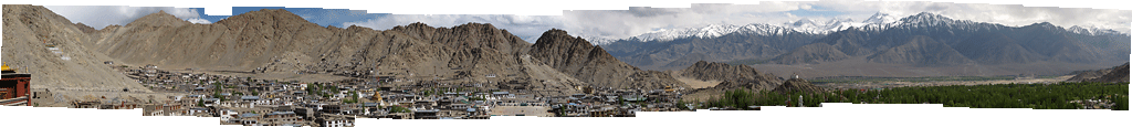
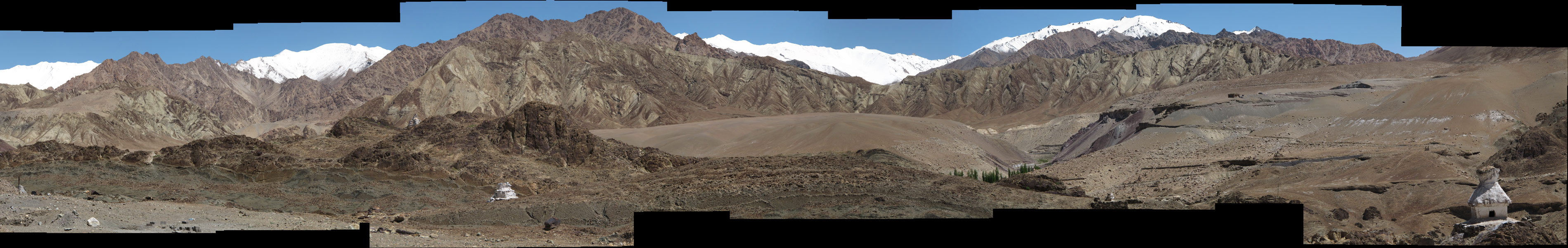
Looking down to Leh from the palace - click to enlarge the panoramas.

Leh panorama.
Panorama zoomed in more into Zanskar mountains that side Leh from the South.
However, the tourists are lured here also by something else.
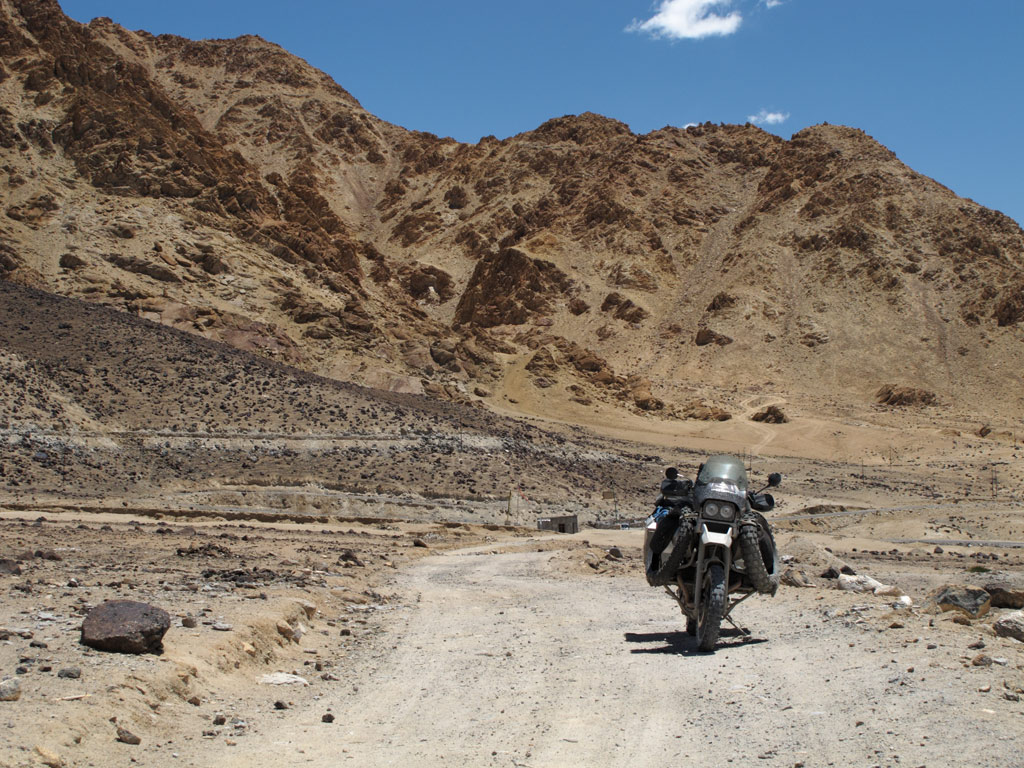
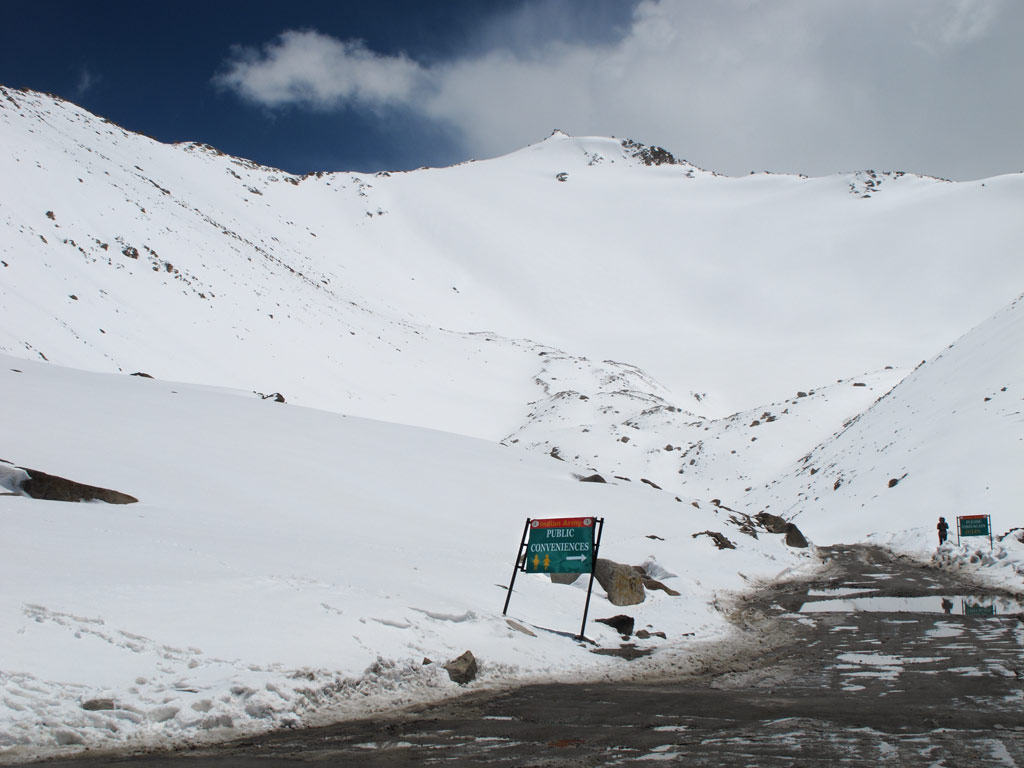
May came to an end, and June got started, but the legendary road from Leh to Manali still remains closed. Too much snow this year, they say. Well, we've got some mandatory things to do anyway before we go. Such as getting ourselves to the so-called highest motorable pass in the world, Khardung La, which is, in fact, just a one-and-a-half hour's ride away from Leh.
But before doing that we decided to pay a visit to Pangong Tso, allegedly the most beautiful lake in Ladakh. So we applied for the required permit (since the lake lies right on the disputed border between China and India, one has to have an Inner Line Permit to visit the area) and got going.
There were some more gompas and chörtens alongside the road, but although we had already developed the feeling that "once you have seen one of them, you've seen them all", some of these still impressed.
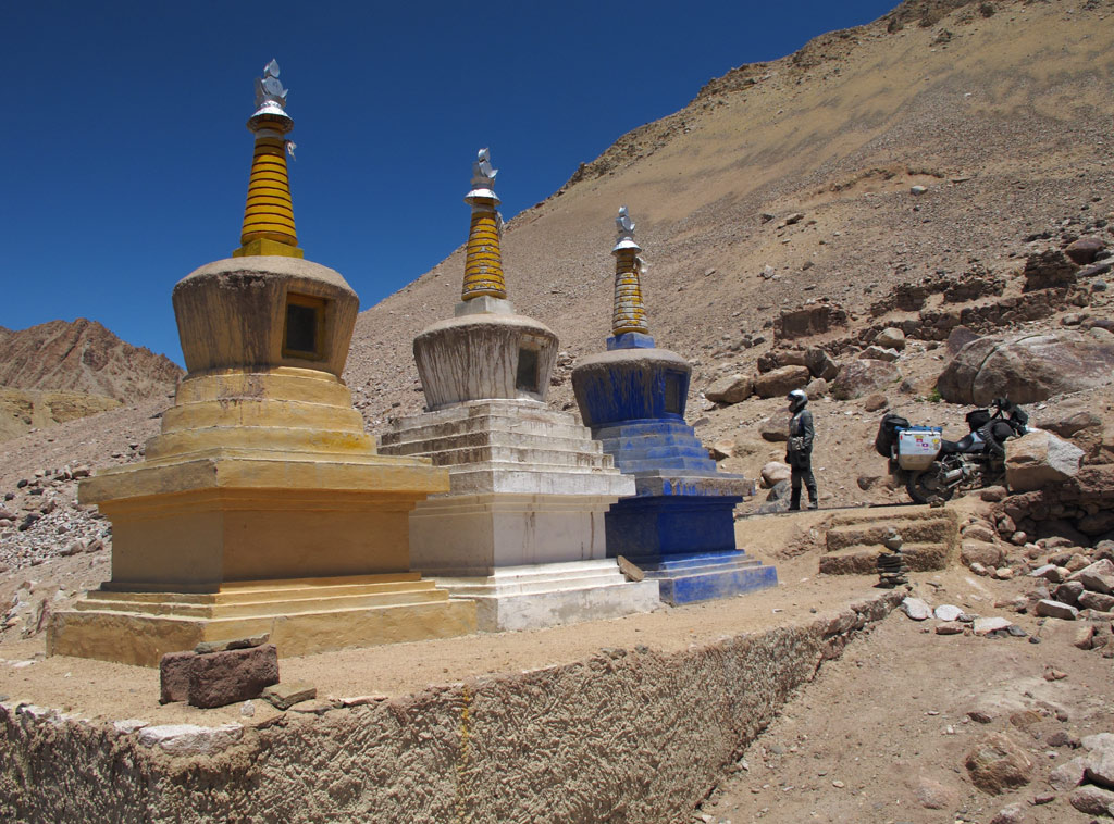
For example Maropa Photang - a collection of some hundred or so sugar white chörtens, some smaller, some bigger than others, dispersed in a piece of dry landscape. It definitely had some magic to it.
Sitting under one of the Maropa Photang chörtens.
Click to enlarge the panorama.
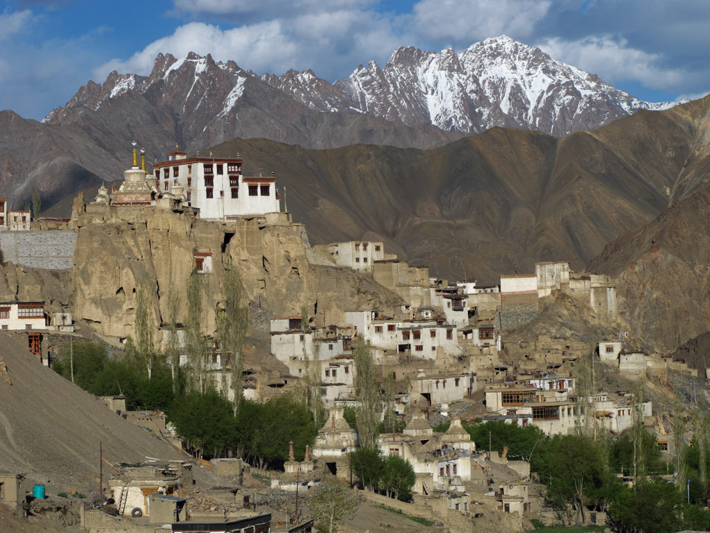
Or a pretty striking monastery in Thiksey, covering the entire rocky slope. It was huge indeed.
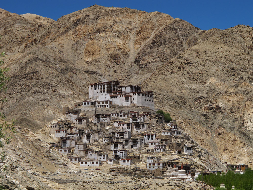
Or the monastery in Chemre, that blends so well with the surroundings.
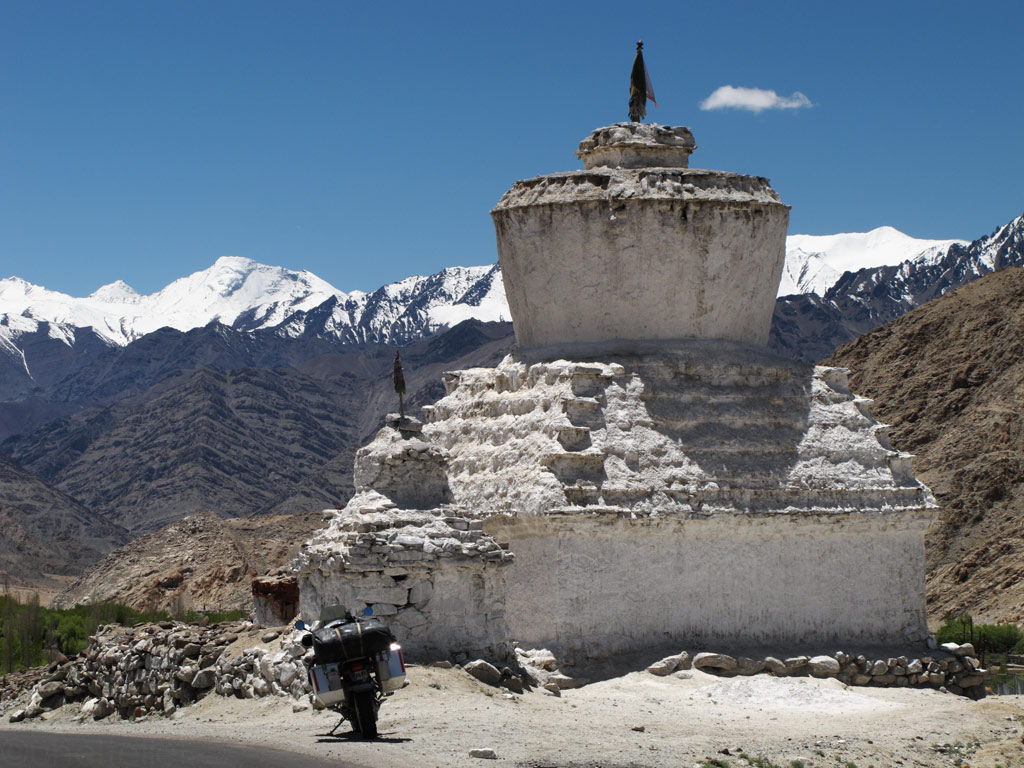
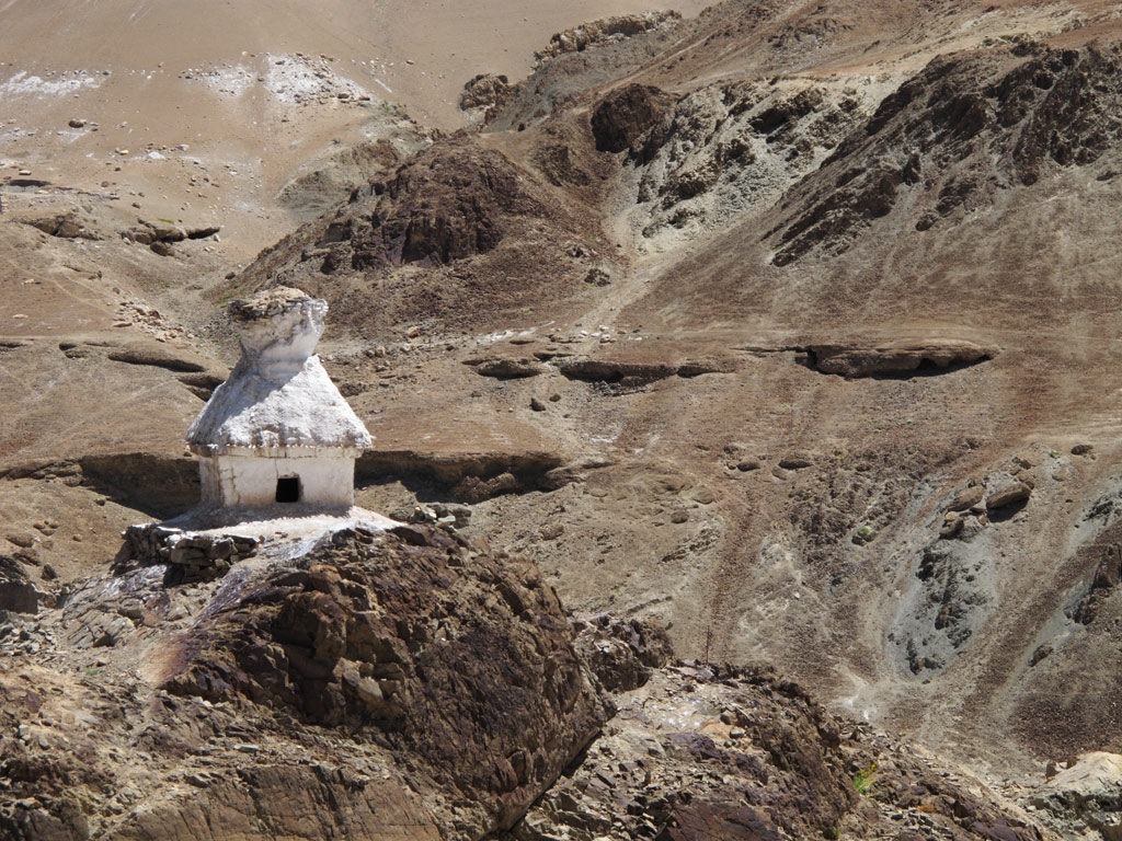
An oversized chörten by the road.
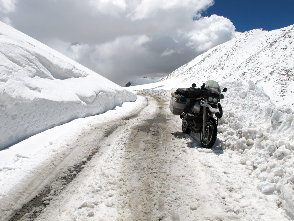
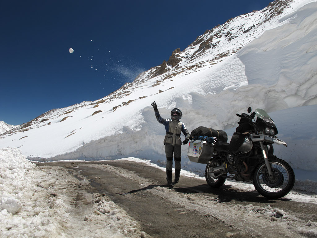
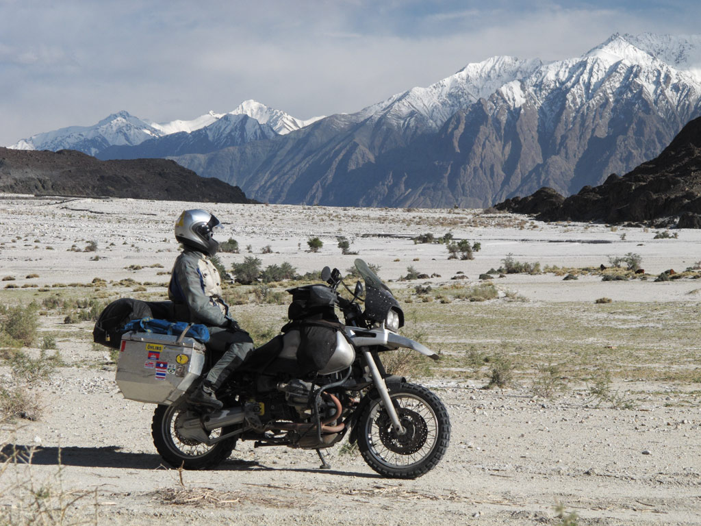
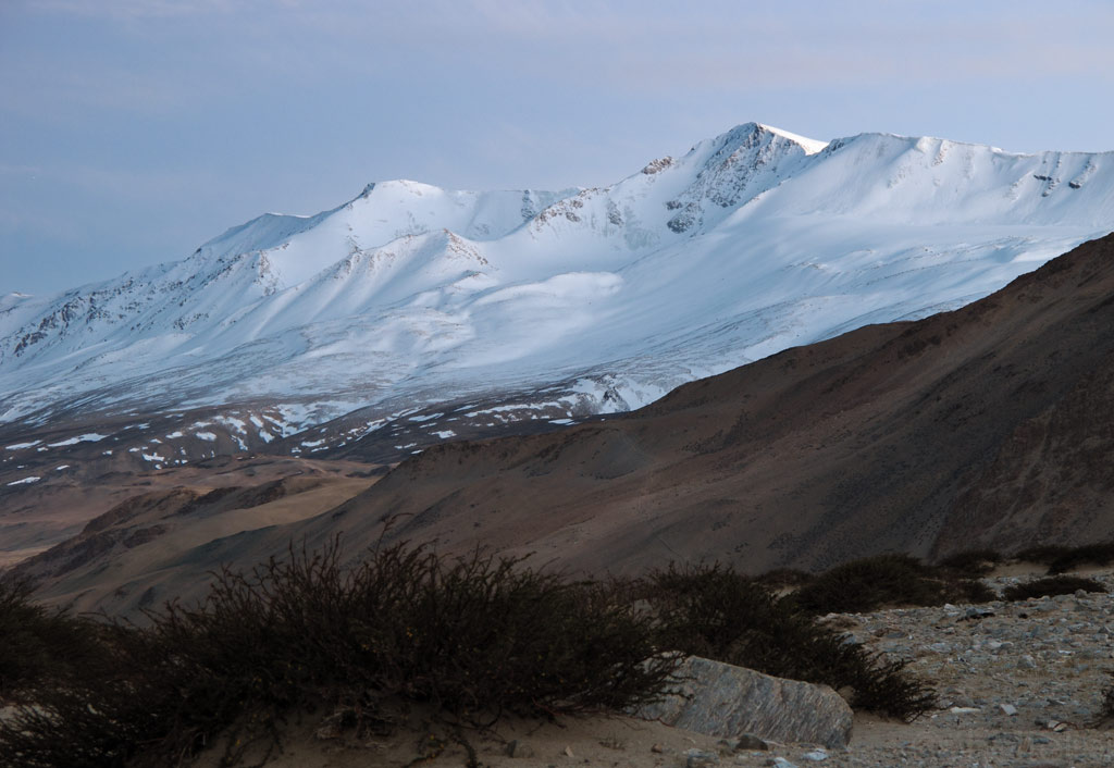
This far the ride has been a pleasant sunday ride, with pretty smooth tarmac making its way through green fields and Tibetan villages where people were smiling and waving to us. But then it started to climb uphill, and while the views became wider, the road deteriorated. We were approaching Chang La, a pass that is 5360 metres (17 586 ft) high.
A little before that we saw two abandoned Royal Enfield Bullets aside the road, wondering if it was the engines that had failed, or it the high altitude had struck the riders so that they had quit. In any case it did not smell good - even though the road may be officially open, the snow still makes riding it quite a challenge.
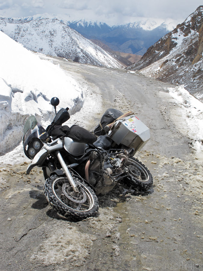
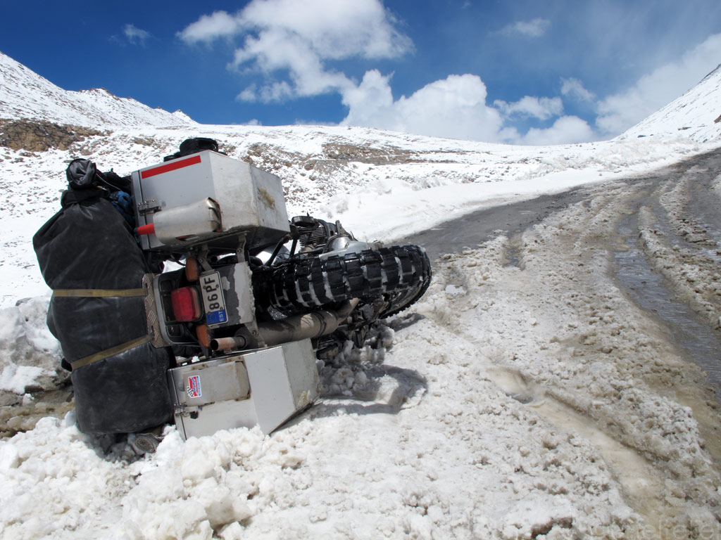
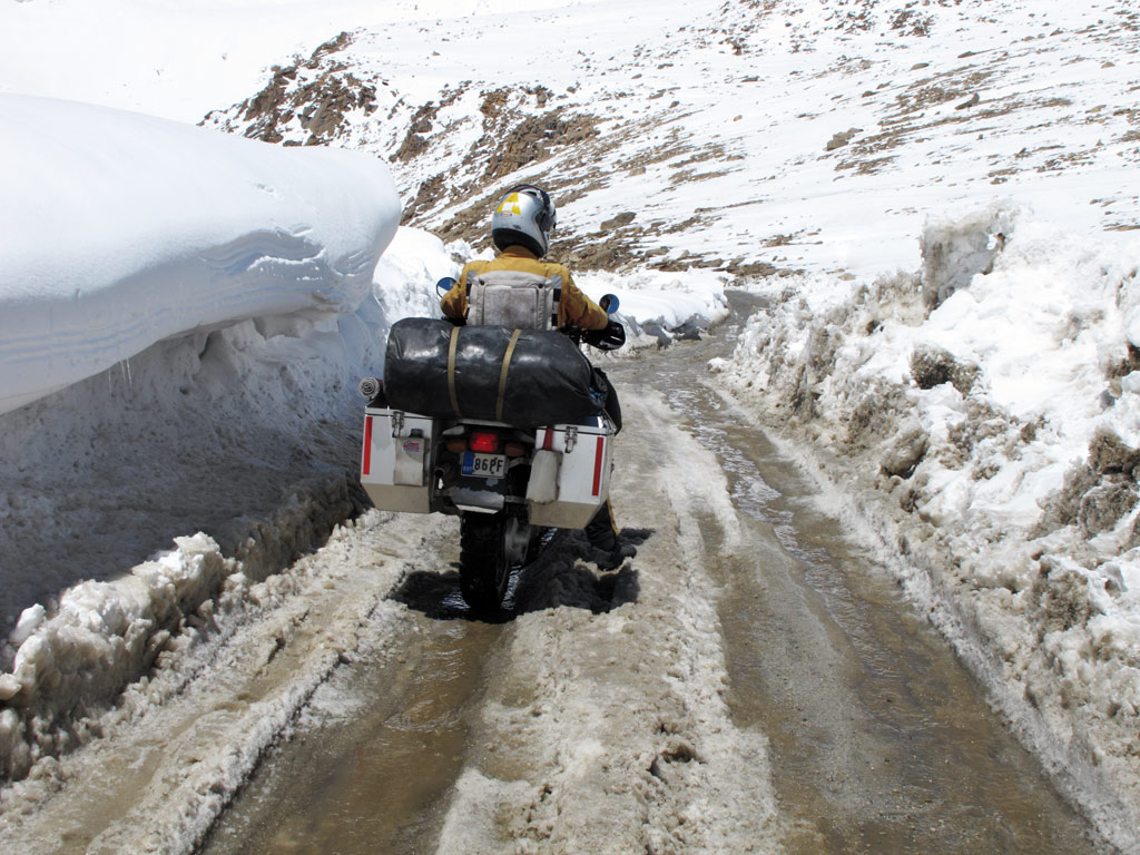
Soon we realised that it might have been the road conditions that had forced the "enfielders" to give up. The higher we got, the more half-melted snow and water appeared on the road, hiding invisible ice, which, of course, contributed to our falls' statistics.
And you thought you can take curve easily on the water covered ice? Thank God I didn't ride off the cliff fer fox sakes! I suddenly took it all easy from there…
Lifting it up at this altitude is sure no fun - at more than 5000 meters (16 400 ft), the oxygen is so sparse, that even holding the bike up while negotiating the tough conditions, is rather a feat, let alone lifting the fully loaded 300 kilogram bastard! Tough it was, but we succeeded.
Kariina decided to ship the adrenaline and walk the remaining couple of hundred meters to the top, while I tried to keep the rubber side down on an uneven icy road covered with sleet and water - great combination? NOT! I would have killed for proper ice-track riding stud-tyres in those conditions!
So there I was, on worn TKC80s with infinitely-close-to-zero grip, just throwing up an arc of water and sleet behind and not moving much uphill. But momentum was my friend - once I got the bike moving (with some serious additional bone-push-power, obviously) I could not stop. But then again, on a bumpy road that is filled with hidden ice covered with water, sooner or later you "kiss" the ice road again once the front wheel just slips away, like a cow's leg on an ice - yeah, on water covered ice, that usually happens faster than you can blink your eyes.
Taking it more easy doesn't help either. Exhausted Kariina's madly sucking oxygen poor air into her lungs and probably thinks: "Not again! Our dear trusty GS, why the hell are you suddenly so heavy to lift up?"
And there's additional problem - over half of the bike's power is lost on that altitude and it barely can idle, and in our case it had a tendency to stall while revving. Meaning you go uphill with great momentum and slipping rear wheel on an icy road and all of a sudden engine dies, rear wheel blocks and… of course, you go down. It was our dirty old air filter that needed replacement, fortunately we had been carrying a brand new spare filter with us. After replacement, the engine got more air and it didn't stall that easily, also some additional power boost was noticeable that helped.
Air filter change.
Anyways, by some miracle, after passing some stuck 4x4s, couple of additional falls combined with low oxygen environment (16 000+ft) GS-lifting training, I somehow, to my own amazment, made it up to the pass. Soldiers there looked at me as if I were some crazy guy trying to prove something, but looks like I was the only bike up there that day.
Kariina soon got up as well and took a breathing rest on the pass signpost - yes, even walking at over 17 000 ft without acclimatisation is like running full speed on the sea level - it takes you breathless very quickly!
5360 metres (17 586 ft) - this is our record so far!
Kariina taking a break.
Toilet at 17 500 ft? I didn't dare to go and try it...
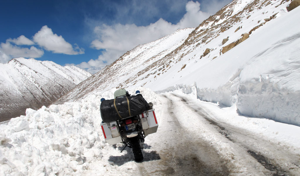
After the pass, the road obviously went downhill, but there was a lot more snow. One would think that riding downhill should be easier than uphill, but in fact, the risks are greater. The brakes become useless on ice and there is a real chance one might end up "scraping" the snow or rock walls, which is a better option, or go down into the abyss. Since neither of these did sound really appealing, I did my best to take advantage of any riding skills I had, and we descended safely.
Our road downhill.
Decent scenery. Time to make a snowman?
Views from the road…
GS vs a thick layer of snow…
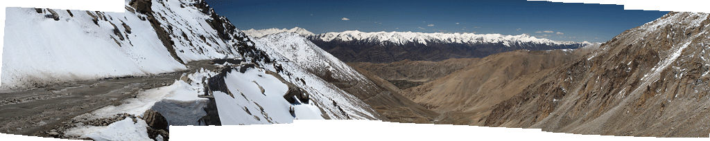
Panorama from the road - click to enlarge.
In Tangtse we were greeted by a friendly dog, and our permits were checked. At the check point, there was a totalled Yamaha that had gone "over the edge", reminding us that the road should be taken very seriously. We had seen trucks in the abyss before, but the bikes are so small that they barely look more than a dot seen from some thousand metres above.
All mighty Himalayas.
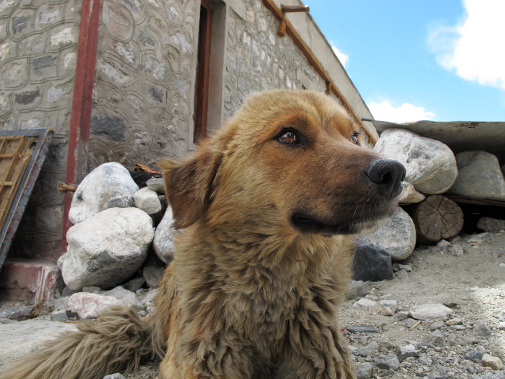
A friendly dog at military checkpoint.
A fallen off the cliff Yamaha two smoker.
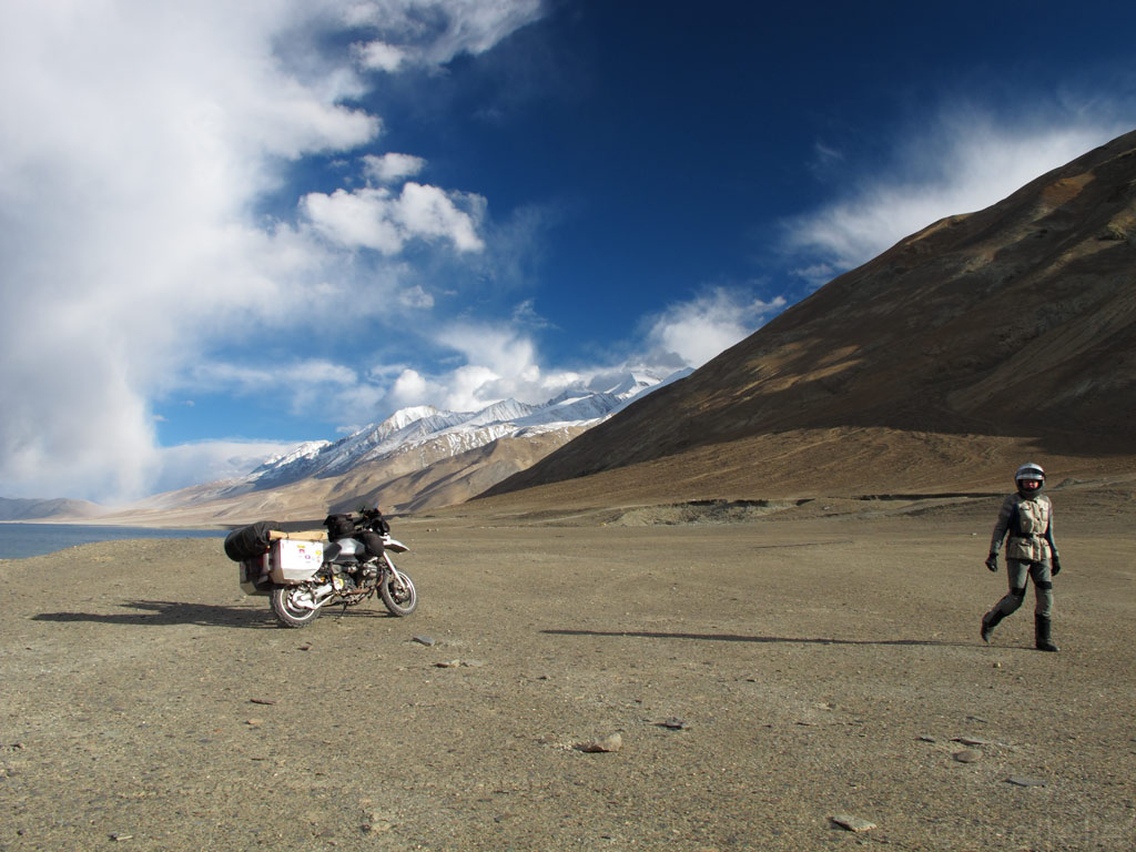
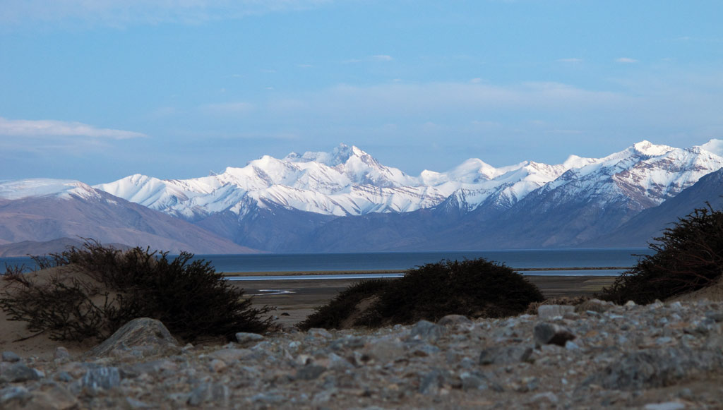
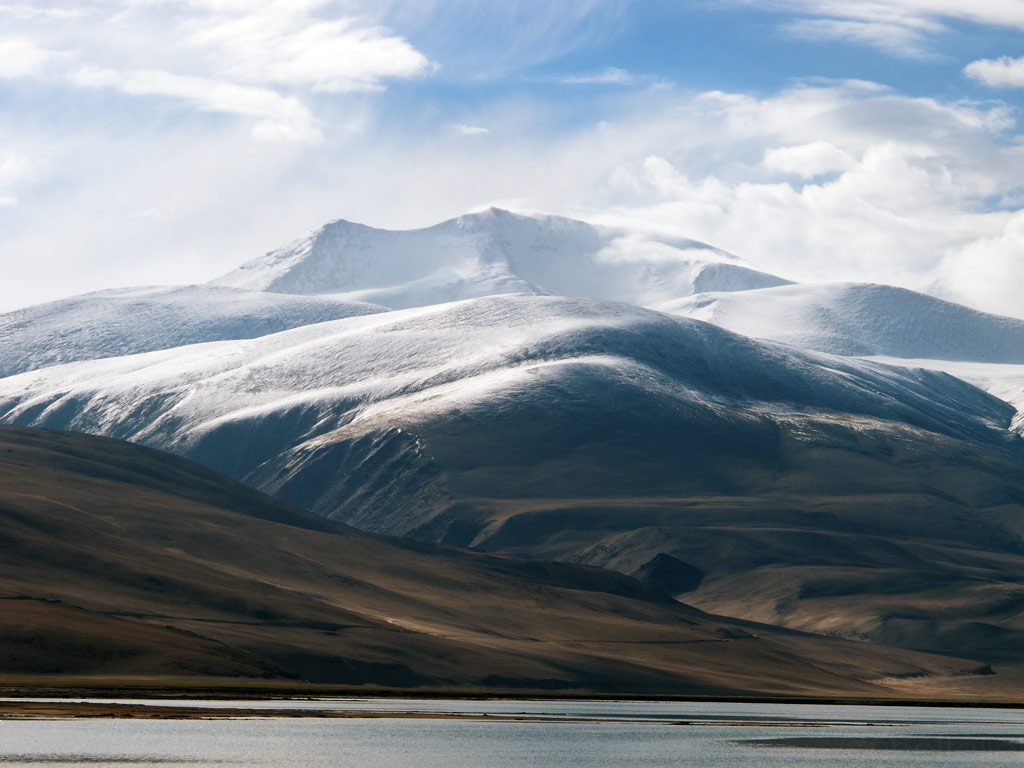
A little bit more, and we arrived at Pangong Tso. The turquoise waters, the mountains and the dramatic clouds above them created a truly indiscribable picture, so perfect and unreal that it might as well have been created by an illusionist. It reminded us of the high plateaus of Bolivia where the nature displays its beauty in a similar way. In any case, it definitely was the most beautiful thing we had seen in India.
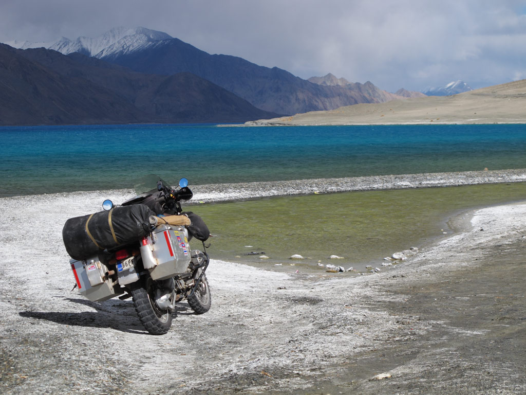
Pangong Tso in its colours.
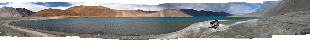
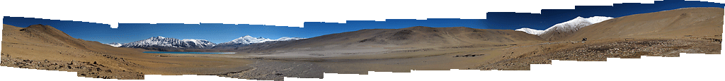
Panorama from the Pangong Tso - click to enlarge the panoramas.
Panorama from the road.
Plateu vs the mountains create stunning clouds and dramas, especially close to the sunset.
Our GS in it's favourite environment - decent scenery and a decent rocky dirt road.
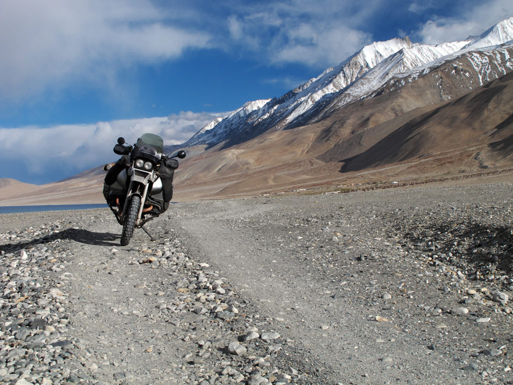
One of the best roads we've taken.

Panorama from our road and Pangong Tso - click to enlarge
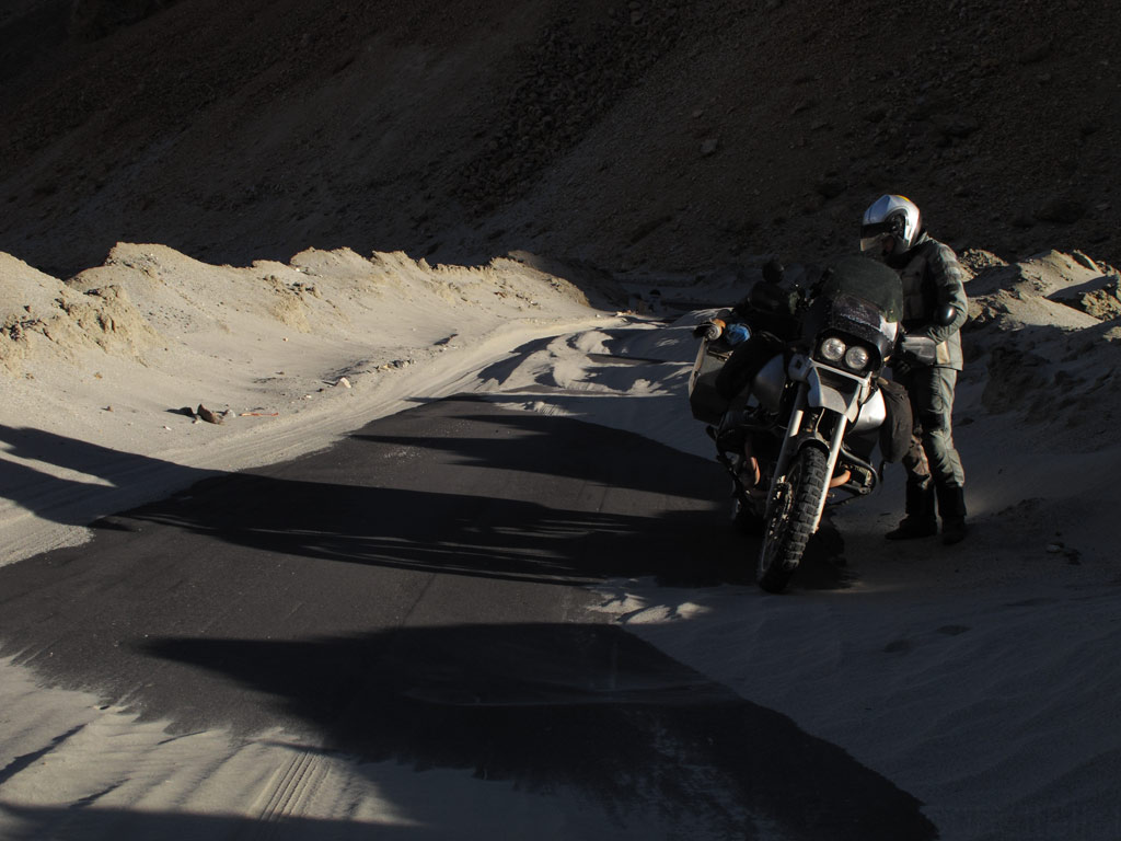
It had been a long and an interesting day, but as the sun was about to set it was time for us to find a place to pitch our tent. It was a long time since we last did it, namely on the coast in Malaysia, but this time the environment was completely different as we were surrounded by mountains.
The mountains have an advantage over the plains when it comes to wild camping - there is not so much population, hence the chance that someone spots you is very small. But at the same time, mountains also mean rocky slopes and sharp rubble covering the valley floors, making it rather difficult to find a level place to pitch the tent. It can become quite cold, too.
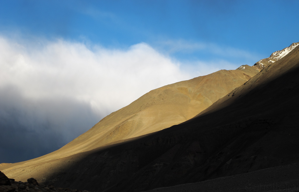
As the night was falling, we knew we had to find a place to settle fast, nevertheless we took time to absorb the beauty of the fading light.
Shadows and light...
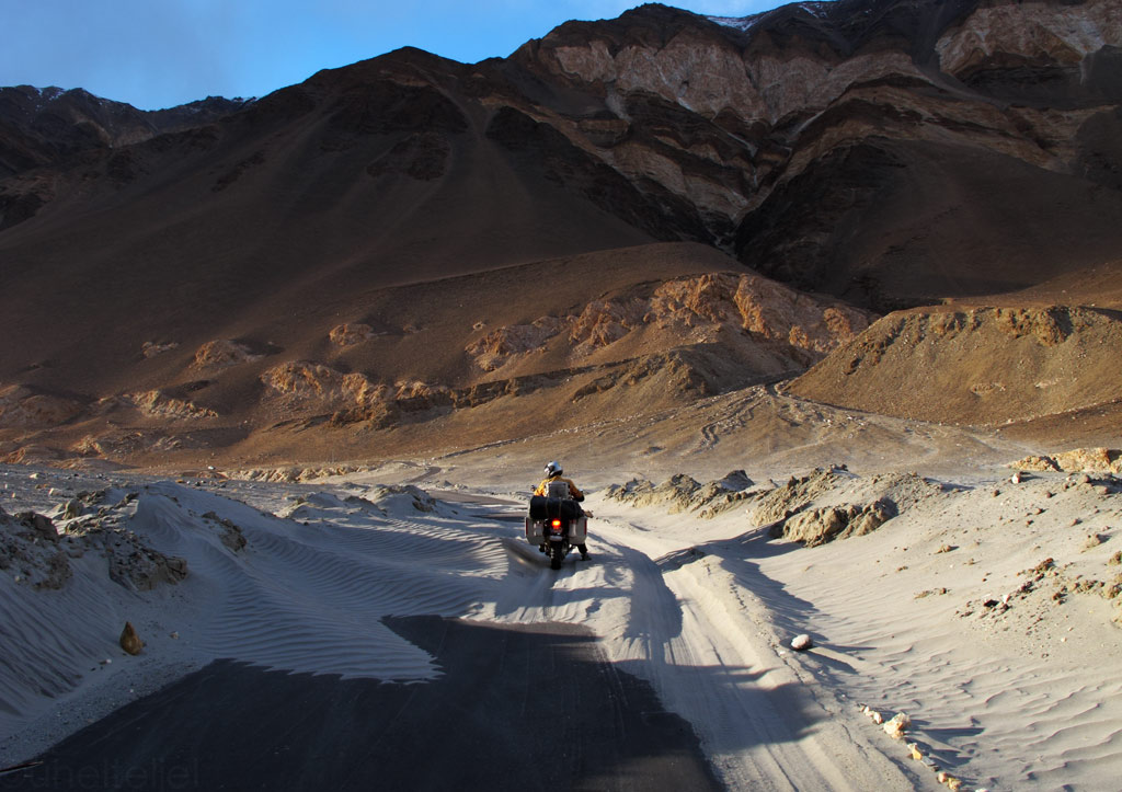
Nice sandy patches on the road to torque through with the GS.
Lightplay.
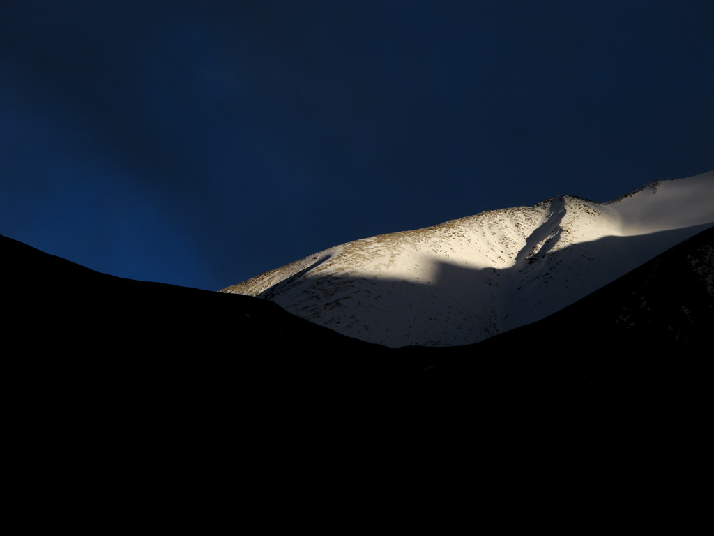
White peak agains blue velvet...
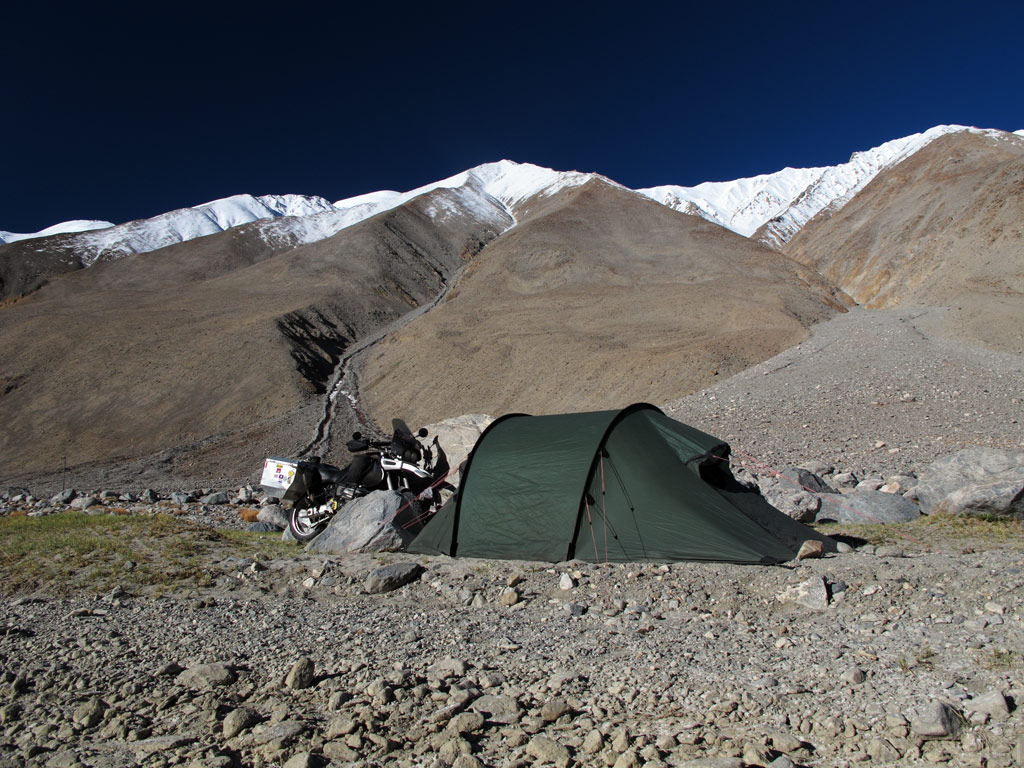
Before the sun slipped behind the snowcapped horizon we had managed to find a place in a dry riverbed, a big rock almost hiding us from the lights of the passing traffic. Luckily there wasn't so many.
In the morning, our thermometer only showed some +4C (+40F) in the tent, meaning that it must have been close to freezing at night. It had been chilly indeed, as our sleeping bags are good down to +8C (+46F). It helped a little to cover the feet with our riding jackets - if your toes are cold, it is difficult even to fall asleep.
The morning light was bright, with no trace of clouds in the sky.

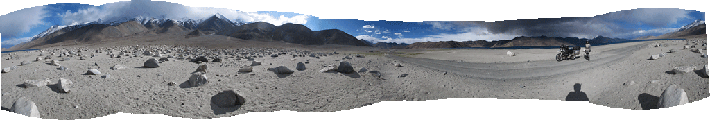
Panorama from the camping spot.
Good morning Ladakh!
We set off, back towards Chang La, in a good mood. The air was fresh and there was nobody around. Well, except for a rabbit and some marmots that we were lucky to spot. The glowing mountaintops created a stunning scenery.
Reflections.
Click to enlarge the panorama.
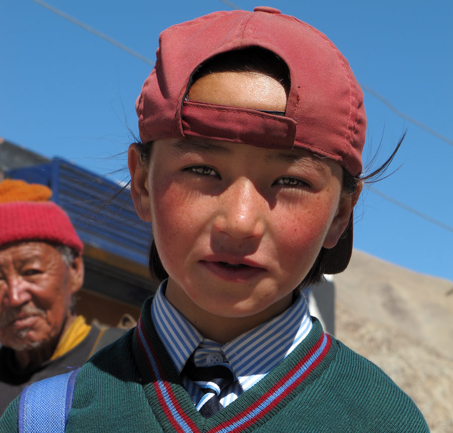
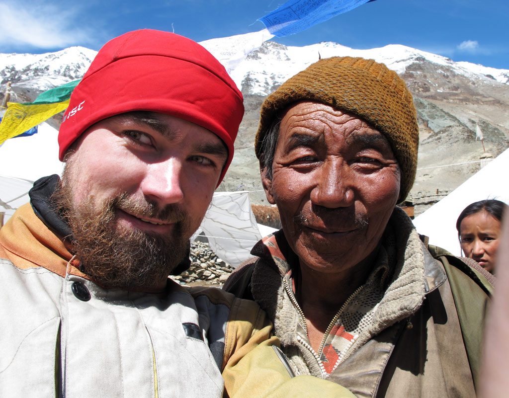
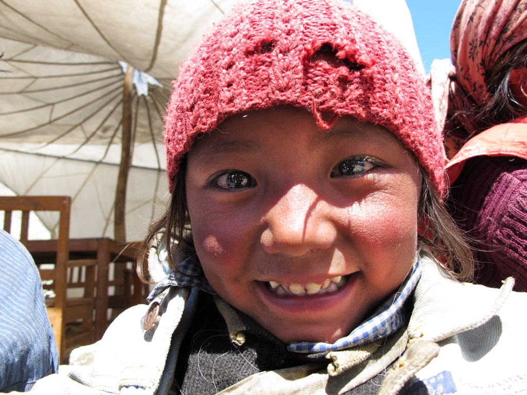
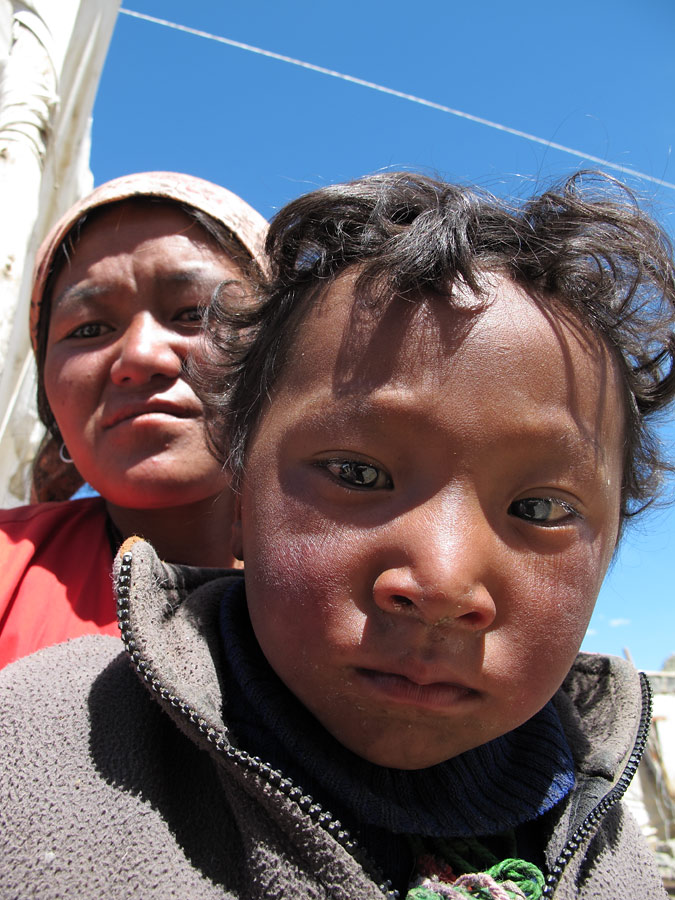
Once again we stopped in Tangtse to replenish our water supplies, as some local schoolchildren came to check us out. It is nice to see that even in such an isolated place (which is cut off from the rest of the world every now and then as the pass gets covered in snow) children do go to school.
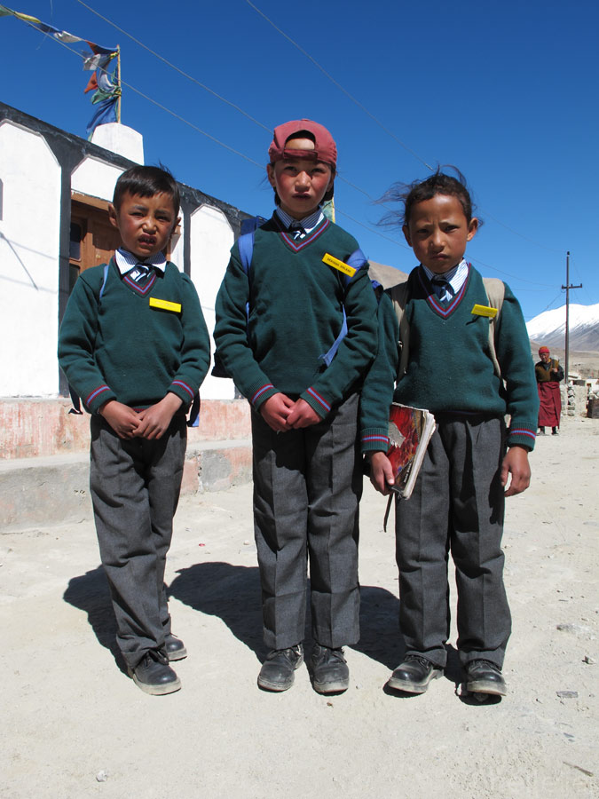
Ladakh children.
Deachan.
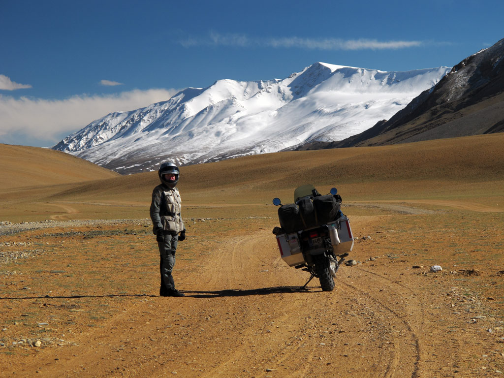
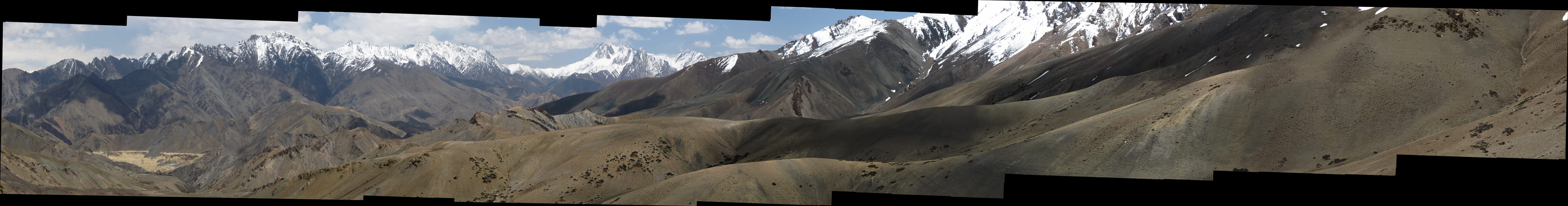
Then the road started climbing again, and as we were in no rush, we stopped many times to take photos and take in the scenery.
Himalayan magic.
Click to enlarge the panorama.
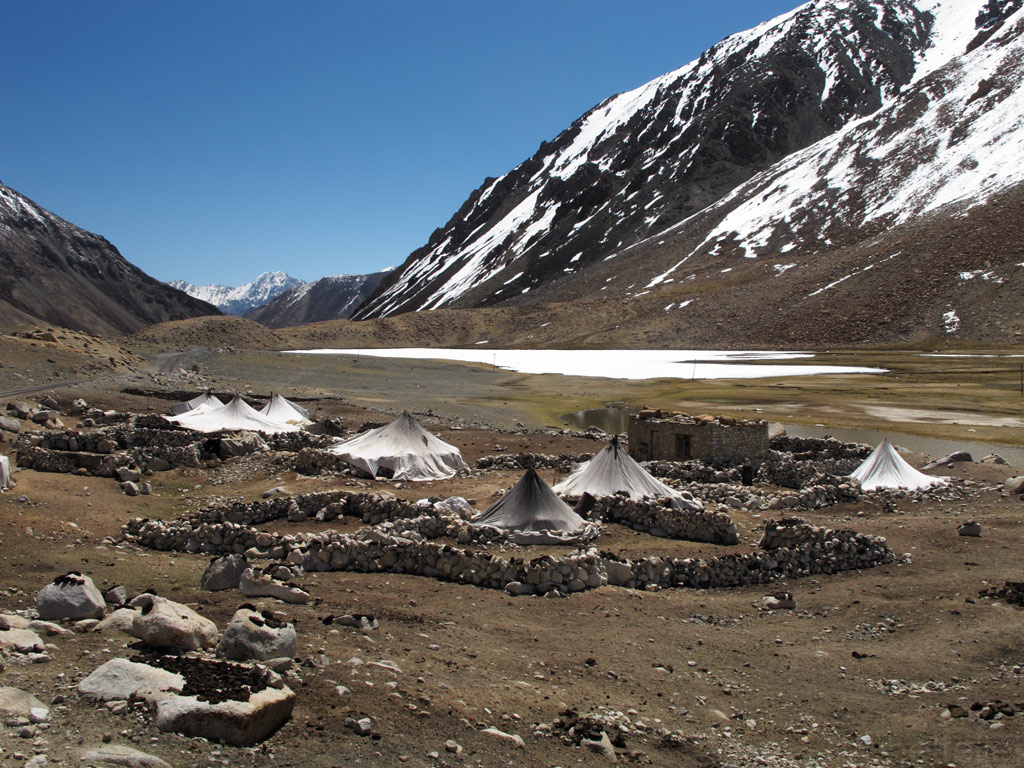
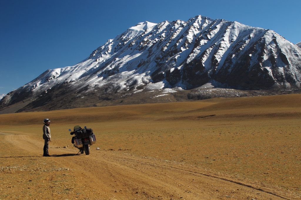
Homes of the nomadic herders - the only people we saw in the area.
GS in its native environment.
Chörten on the backdrop of the Himalayas.
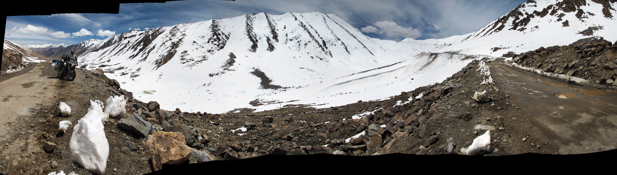
Approaching the Chang La this time, we took time ad took it easy. Had a snowball fight, posed with prayer flags and piles of snow, and sipped tea on top of the pass courtesy of Indian Army. Life's good!
Yes, you have to clear that thick snow to expose the road.
A snowball fight with Kariina.
Decent icy roads.
Click to enlarge the panorama.
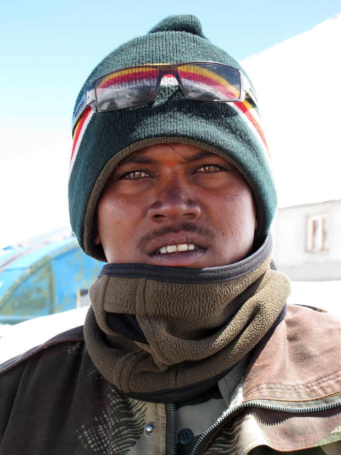
Military boys on the pass - this one's imported from the South and you can see he doesn't like the cold here")
Local soldiers seemed to be more suited to the environment being comfty with the surrounding cold.
Indian soldier checking us out.
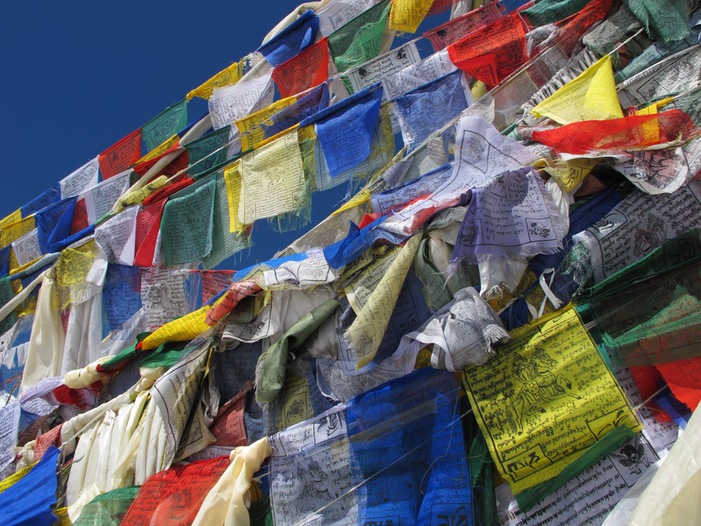
Prayer flags at 5 kilometers above sea level.
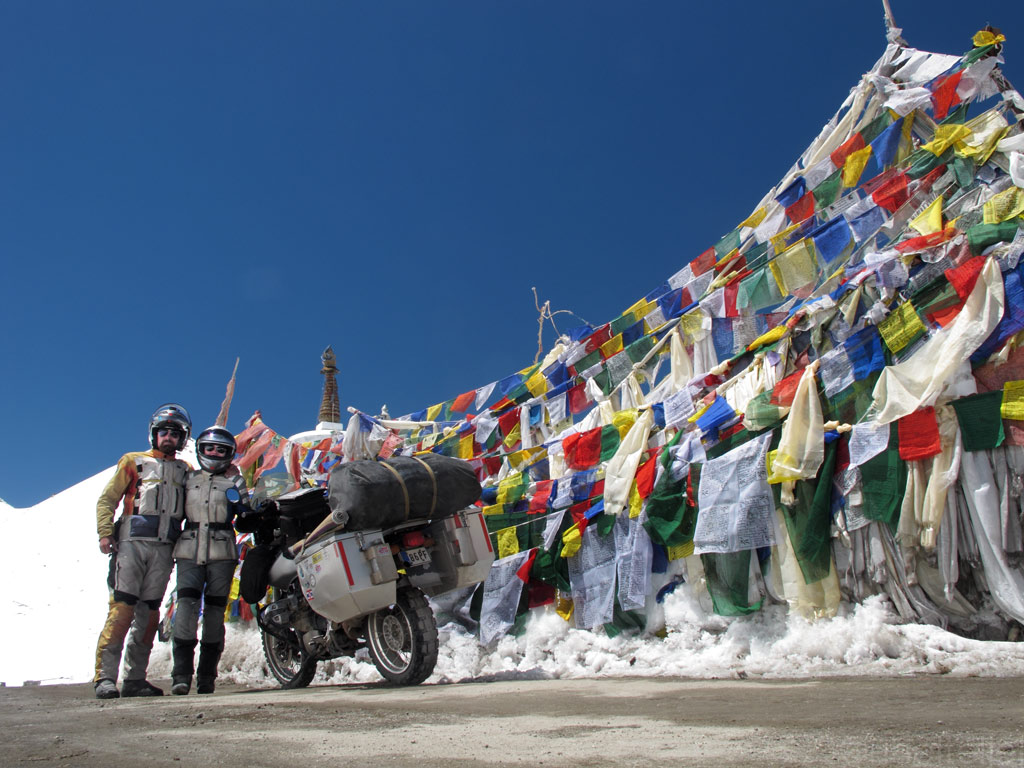
And a final "family picture" on the Chang La pass.
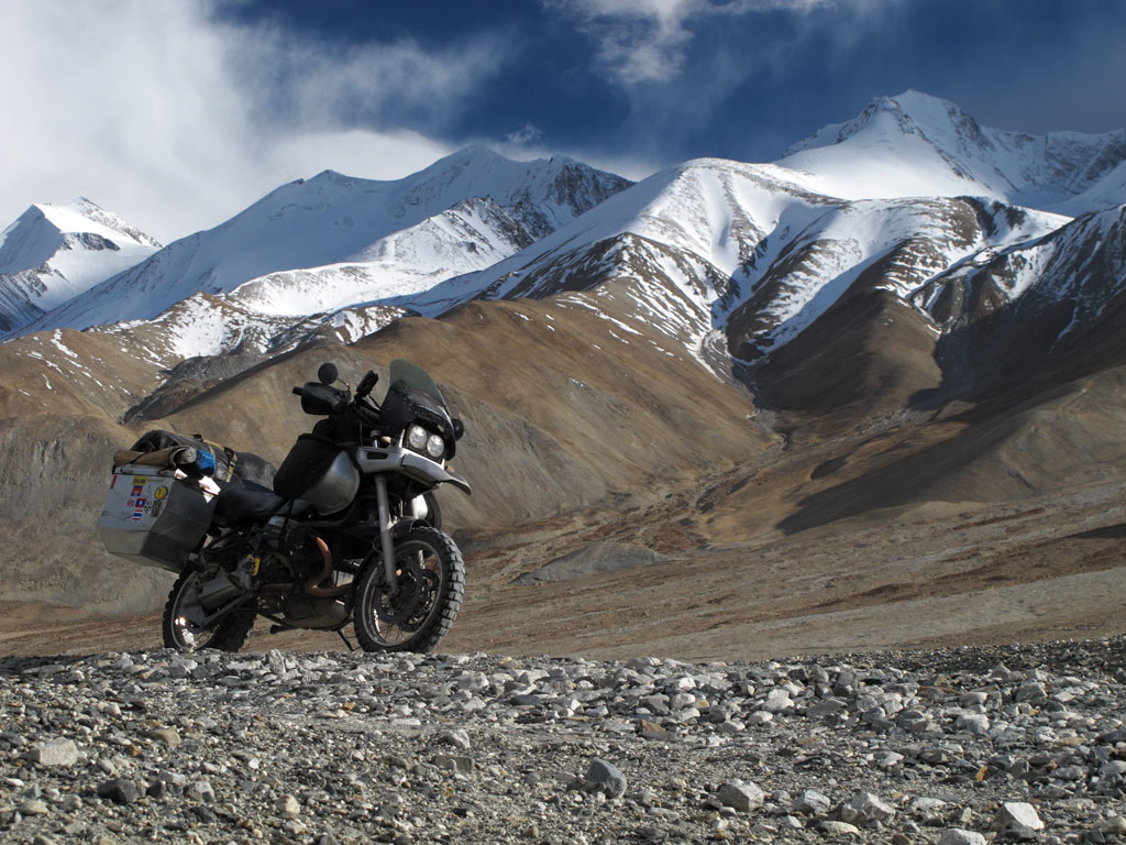
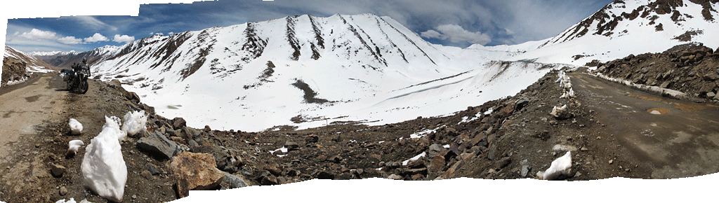
It was time to head for Khardung La, which is, according to Guinness, the highest motorable pass in the world. Our map showed it to be 5606 meters (18 393 ft) high, so we even looked up an Estonian flag and attached it to the pannier. After all, it is pretty likely that our GS is the first bike with Estonian licence plate to make it that high.
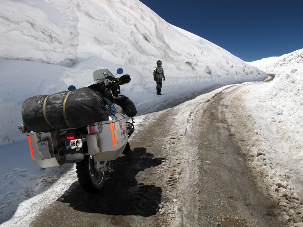
Khardung La, just a one-and-a-half hours drive north from Leh, is also pretty near the uncertain border with both China and Pakistan, so it is mainly used by military convoys. The road is smooth tarmac up to the military camp just south of the pass at some 4600 meters. From there on the eroded surface, huge pools of meltwater and invisible ice make it somewhat a challenge, which becomes bigger the higher you get. Luckily we were clever enough to take acetazolamide tablets that help to absorb more oxygen before the ascent, so it was not so painful this time.
Panorama on the way up - click to enlarge.
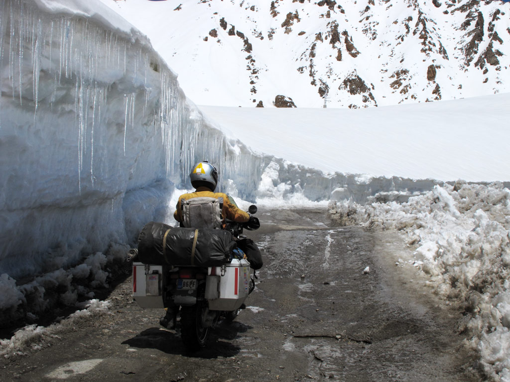
An alley of icicles.
Click to enlarge the panorama.
The engine was on its own though, and had some trouble breathing, but we kept going, keeping an eye on our GPS' altimeter. Still 900 meters to go, 800 meters to go, 700 meters to go, 600 meters to go, 500 meters to go, 400 meters to go, 300 meters… what the hell? We're already there??? Prayer flags everywhere, and signs saying "Welcome to Khardung La, 18 380 ft". Our GPS was only showing 5334 meters (17 500 ft)!
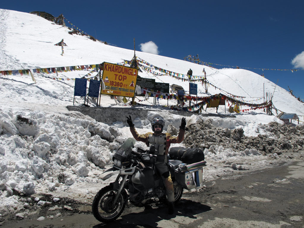
Looking at the faked sign I should have snown "ADV-greeting" with the middle fingers on both hands instead of V for victory :lol3
But the views were great and nobody around since we won the race up to Khardung La once the military post opened the road below.
And we took a chance to make another picture, again, should have been "ADV-greet" fingers on this one, but it's a Gompa sign, so we are polite.
Views from Khardung La.
That's THE real roof of the world.
Rumour has it that before the current road across the pass was built, there was an even higher mule track at the same location, and that later the sign stating the altitude had been brought down and installed next to today's pass. So the actual height of the pass is definitely not what our map and many other s say, and it is not the highest motorable pass in the world either. Interestingly, our GPS showed Chang La to be even higher!
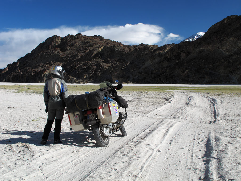
The weater was good, so we decided not to head back to Leh, but to descend to Nubra valley instead. This area is even closer to the disputed border, so obviously one cannot move around so freely (even with a permit).

Panoramas from the road - click to enlarge.
Click to enlarge.
Descending into the valley.
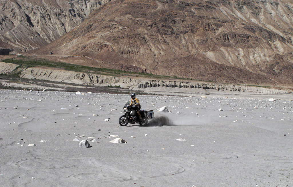
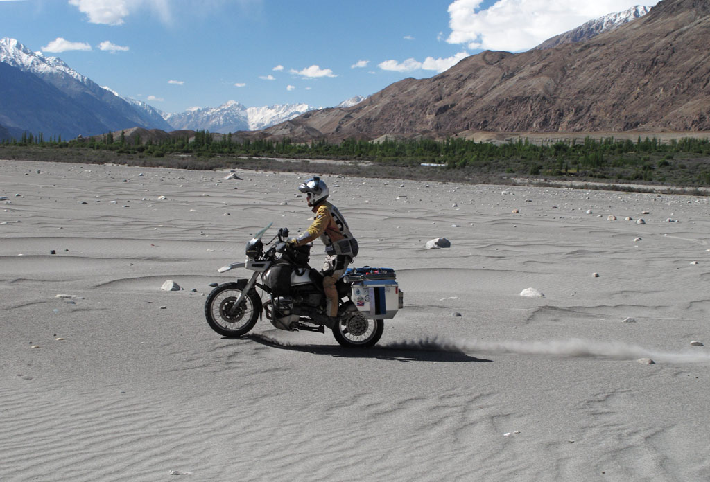
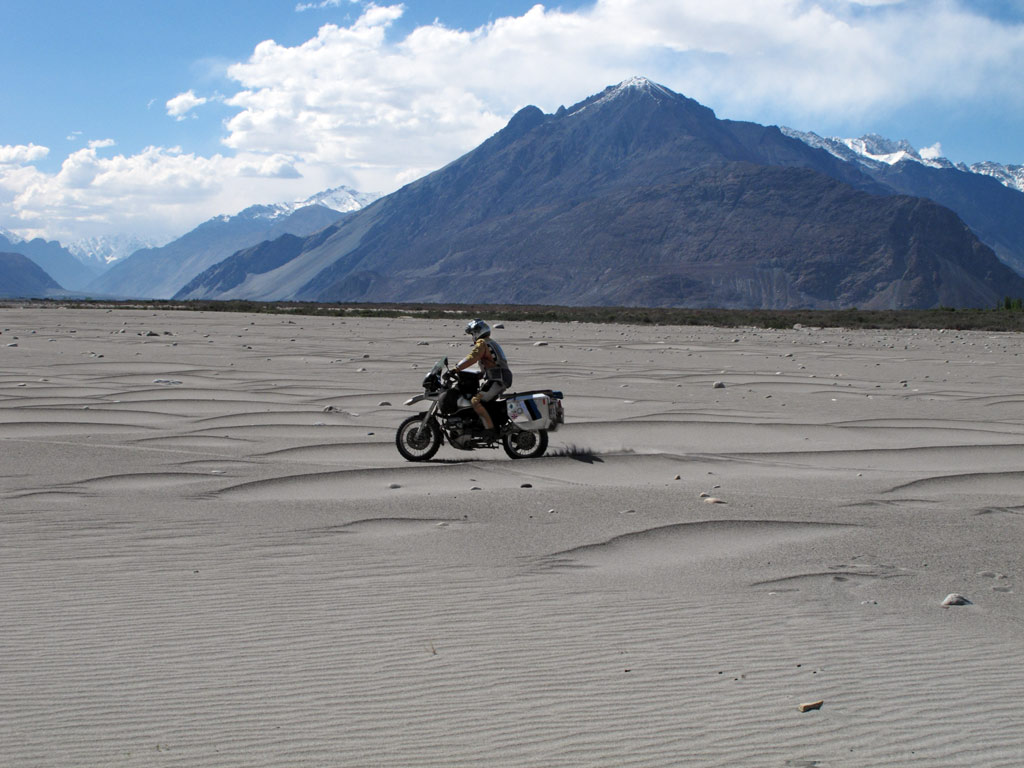
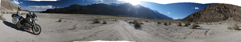
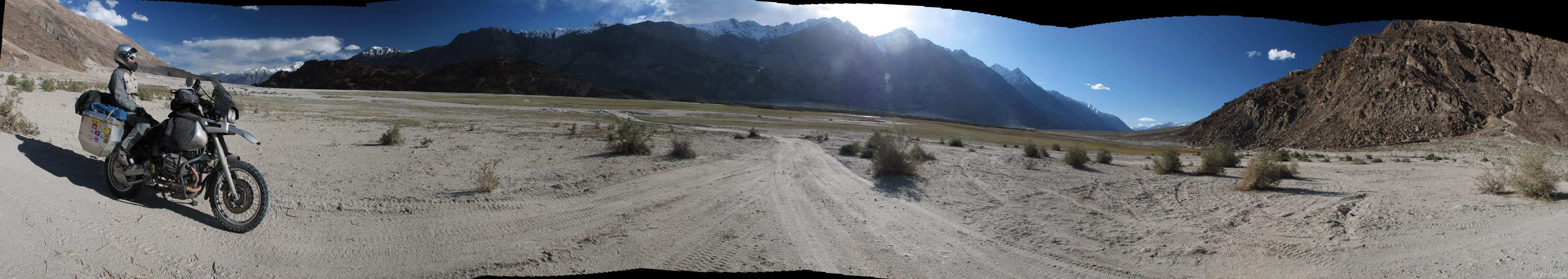
The valley floor was covered in low sand dunes, and it offered wide views both to the Ladakh and Karakoram ranges. I could not resist the urge to have some fun in the lifeless sand.
Waterfall.
Sure enough there were verdant Buddhist villages with monks and huge prayer wheels. Weird as it is, just some 100 kilometers further north lies the so-called highest battleground in the world, Siachen glacier. Pakistani and Indian troops fought there since 1984 till 2003 when a cease-fire was called, but even today it remains a sensitive subject. The extreme conditions actually killed more men than the battle itself - at some 6000 meters (19 700 ft) the wind can blow as fast as some 160 kph (100 mph) and temperatures can drop down to -50 C (-58 F). Add to that the avalanches and the altitude itself… Moneywise, it was not a cheap war either, with both sides spending over half a million USD a day!!! They even have a special High Altitude Warfare School here in India.
Of course, regular tourists without a very special permit and a military escort cannot go anywhere near the glacier.
Monks on a moutainside.
A big prayer wheel in Nubra valley.
Panorama from the green part of the valley - there's obviously population as well. Click to enlarge.
The natural beauty isn't as powerful here as in Pangong Tso, but it is still there.
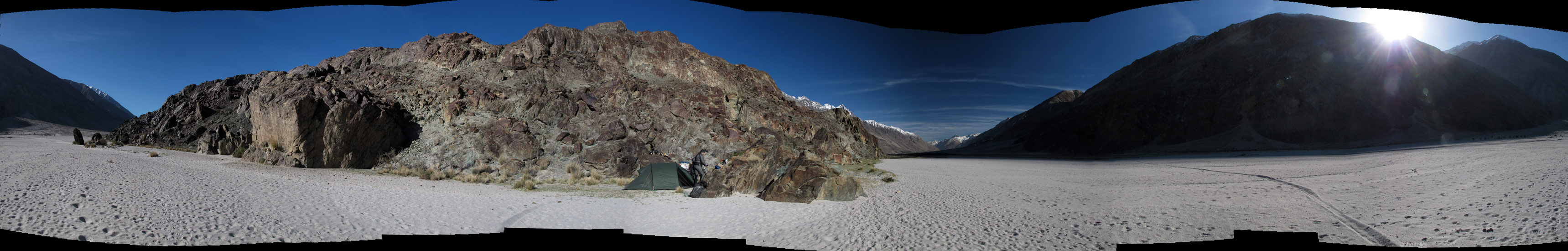
We set up our camp in the shadow of a huge rock in the middle of a whide sandy riverbed of Nubra. We were not exactly hidden looking from the road, but it was pretty far away, so we felt safe. A lone fox passed by as we were pitching the tent, but otherwise it was calm. Maybe it was the rock that emitted the peacefulness…
In search for a camping spot. We didn't know that cliff actually hided a lake in the middle of it.
Sunset panorama - click to enlarge.
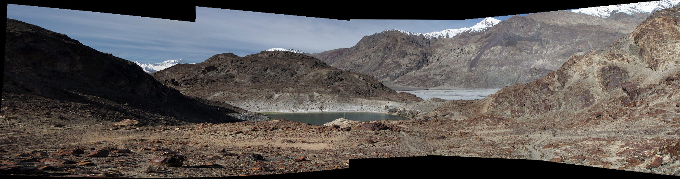
In the morning I got up the rock to get a better view of the surrounding area as I stumbled upon a small lake nestled right in the middle of it. The only way to see it is from above. Obviously it was a sacred place to someone, as there was a small sanctuary right on the edge of it. Interesting, how such natural formations become objects of worship - just like Uluru in Australia. In any case, it had an air of a microcosm, with white peaks of surrounding mountains surrounding this rock with a peaceful lake hidden in it. Probably an ideal place for meditation…
Good morning Nubra valley.
Panorama from our camping spot and a "GS territory markings" on the sandfield that leads here.
Inside the rock's own valley that hided a sacred lake and everywhere there were towers made out of smaller rocks. A holy place for Buddhists.

Panorama from the sacred hidden lake in the rock's valley that's inside Nubra valley. A wierd but fascinating combination! - click to enlarge.
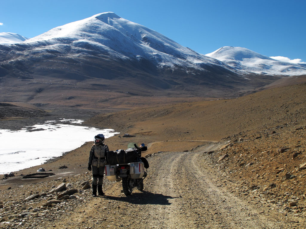
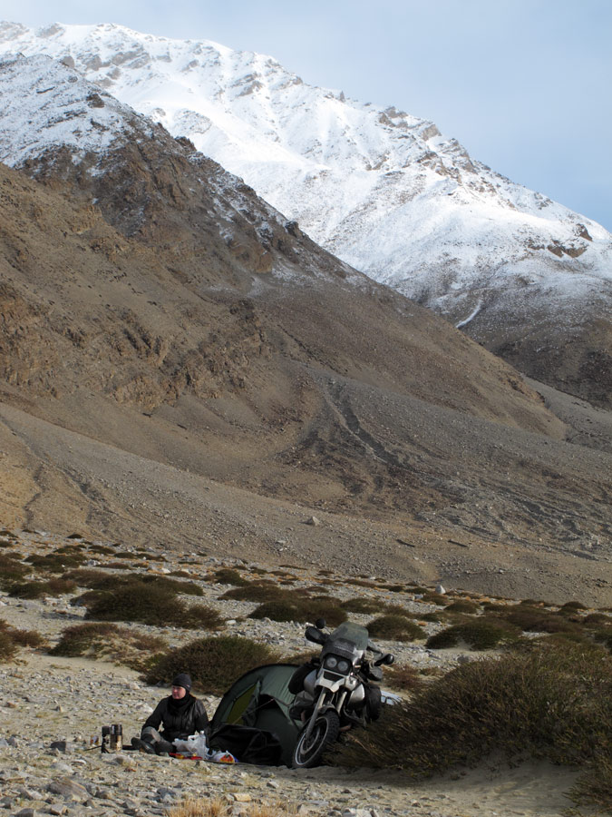
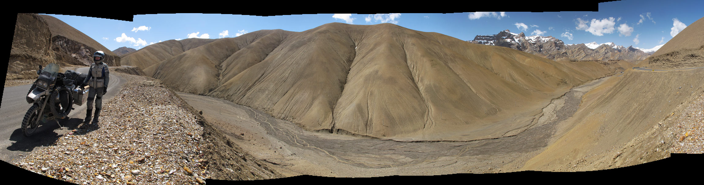
The road to Manali still closed, we decided to have another detour and to go to see one more high-altitude lake, Tso Moriri. Even before we arrived in India, we looked at the map and thought that it might be an interesting ride, part of the road leading to it marked as a rough track. Bearing that in ming, we changed the tyres as the old ones were too old to have much traction on loose surface, and replaced the leaking oil sight glass.
Oil sight glass replacement, with spontaneously collected Indian audience, as always.
Old vs new.
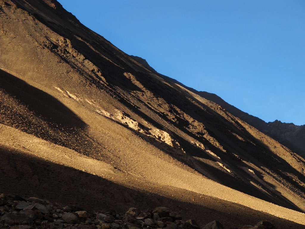
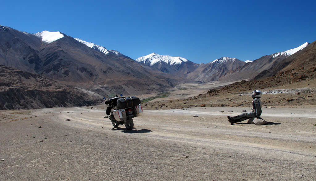
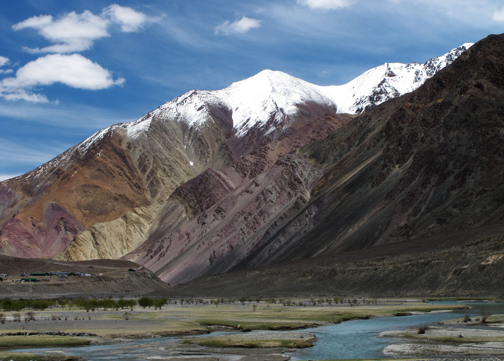
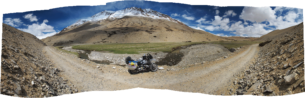
First our road snaked alongside the mighty Indus - although we were moving in one, and the river in the other direction, meaning we were going uphill. The rocky valley first appeared in yellow and brownish colours, which were soon replaced by grey and syrreal purple. Just as if the nature had decided to add some extravagance to its creation. In places, the sand that had accumulated on the hill sides shone like gold dust. In any case, that kind of use of colours and materials couldn't fail to impress.
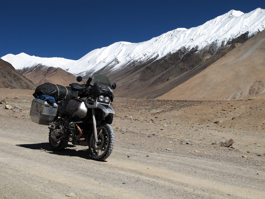
A Road, a GS and a peak.
Tibetan Buddhist mantras on the rock.
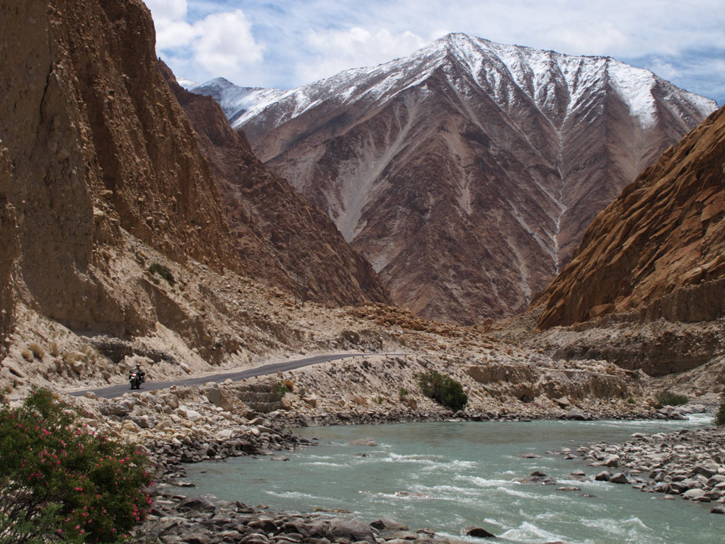
GS in the unique Indus river valley.
Rocky walls in the Indus valley topped by circled sun.
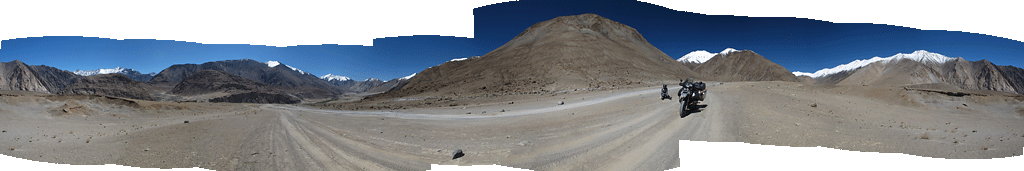
Panorama from the road, click to enlarge.
Purple mountains...
Funky colours indeed!
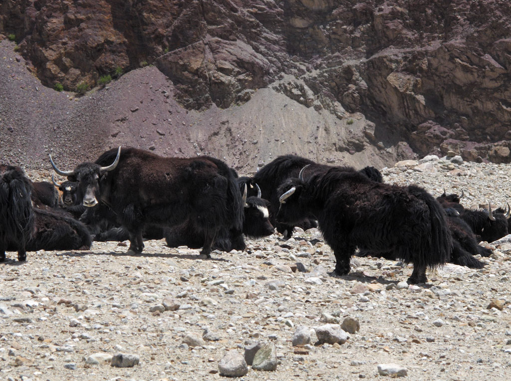
Yak heard. Yak cheese tastes fantastic, if you didn't know.

Panorama from the mountains, yak heard also on it. Click to enlarge.
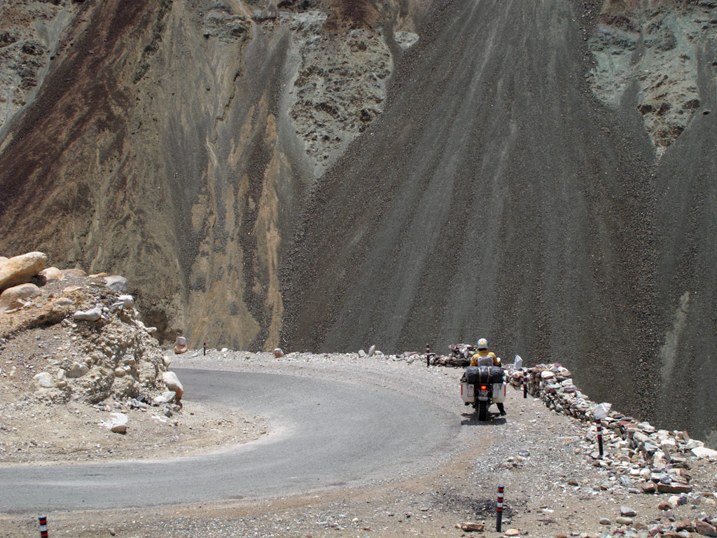
Curve vs abyss.
Gold rush?
Here and there the landscape was ruined by huge military bases, but interestingly, the small villages blended perfectly with the surroundings. Interestingly, although the Ladakhi people do not normally like their picture to be taken, here we could find some smiling faces that were happy to pose.
A house in the village.
With friendly locals.
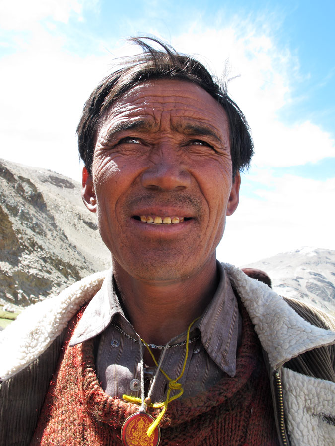
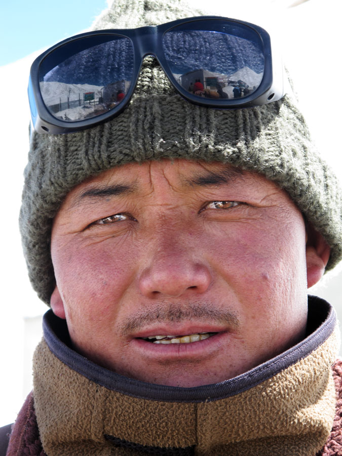
Ladakh man.
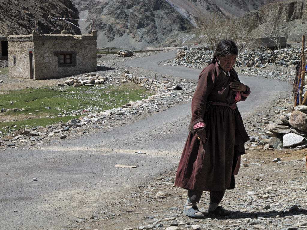
Old woman in the village.
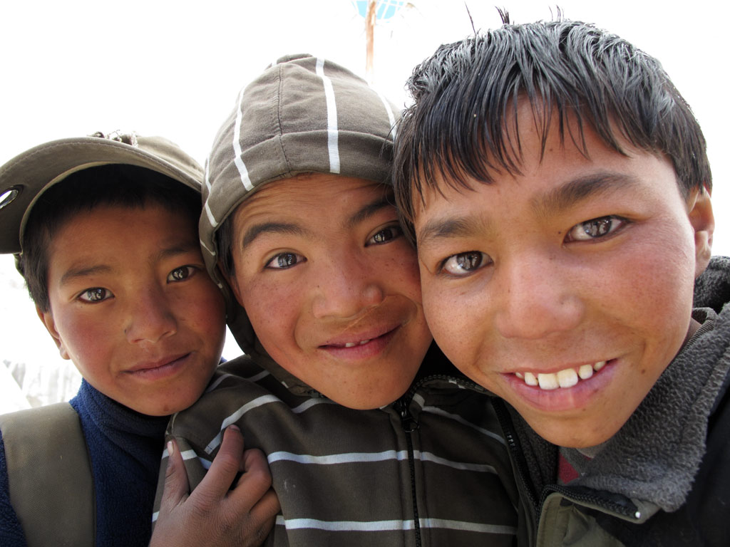
Boyz.
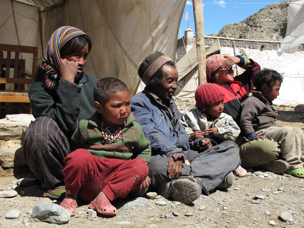
A family warming in the sun in front of their house on a chilly day.
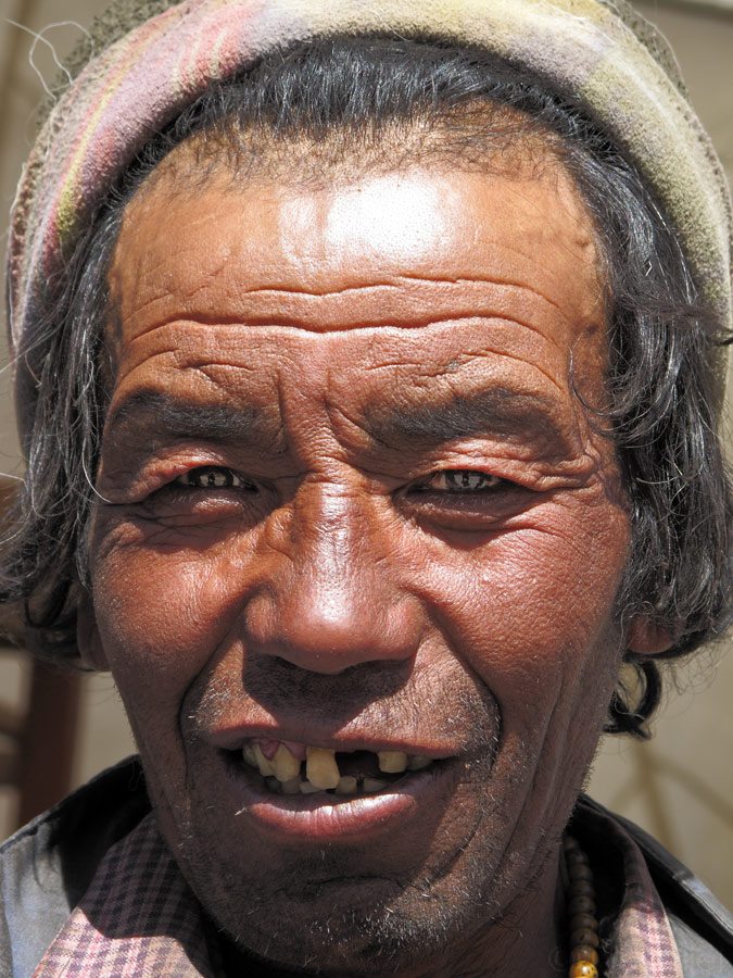
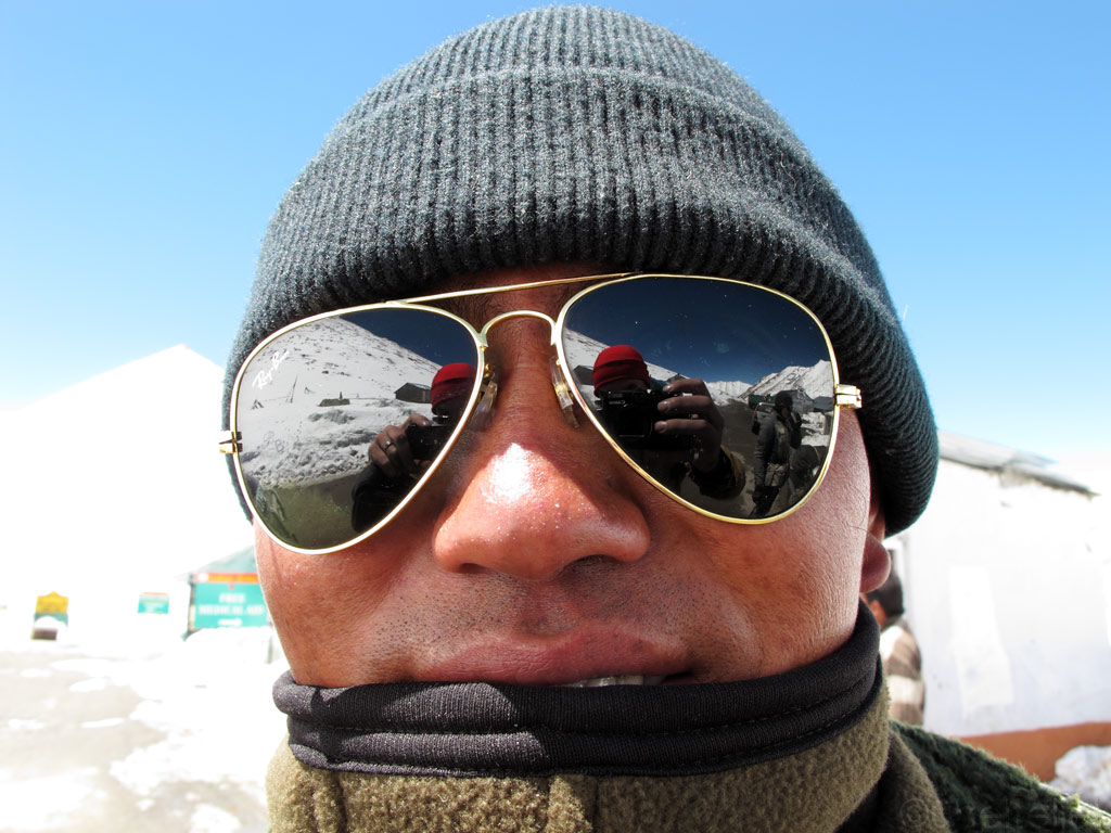
A funky Ladakh man.
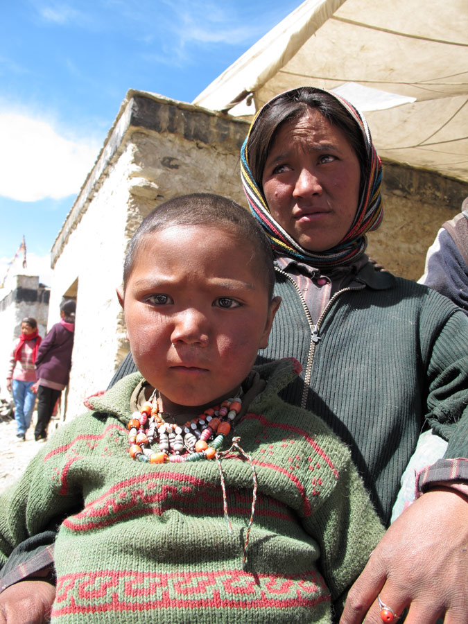
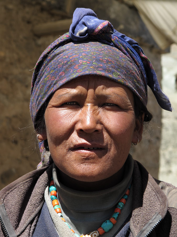
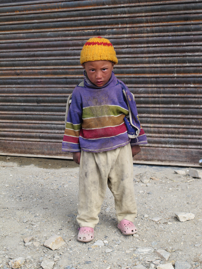
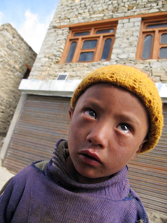
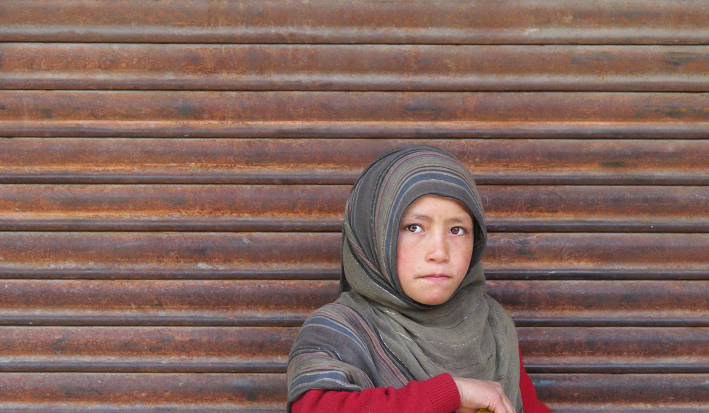
Woman with a child.
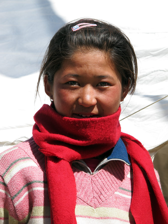
Ladakh girl.
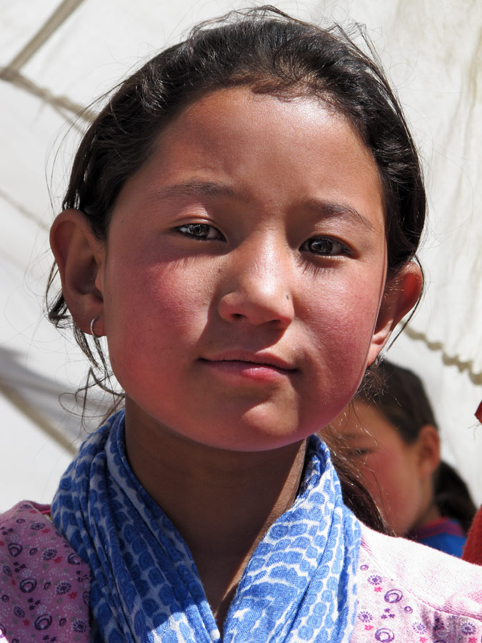
Curious faces...
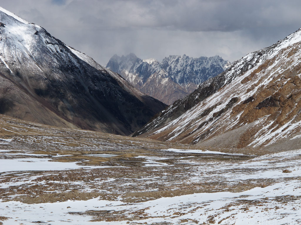
At one point we parted with Indus and turned onto a smaller road, leading us onto the high plateau. The landscapes had more air and space to them, with more and more snowcapped mountains appearing before our eyes.
What a view!

Click to enlarge the panorama.

We crossed a 4800 meters (15 700 ft) pass at Namshang La before continuing on the plateau. Click to enlarge.
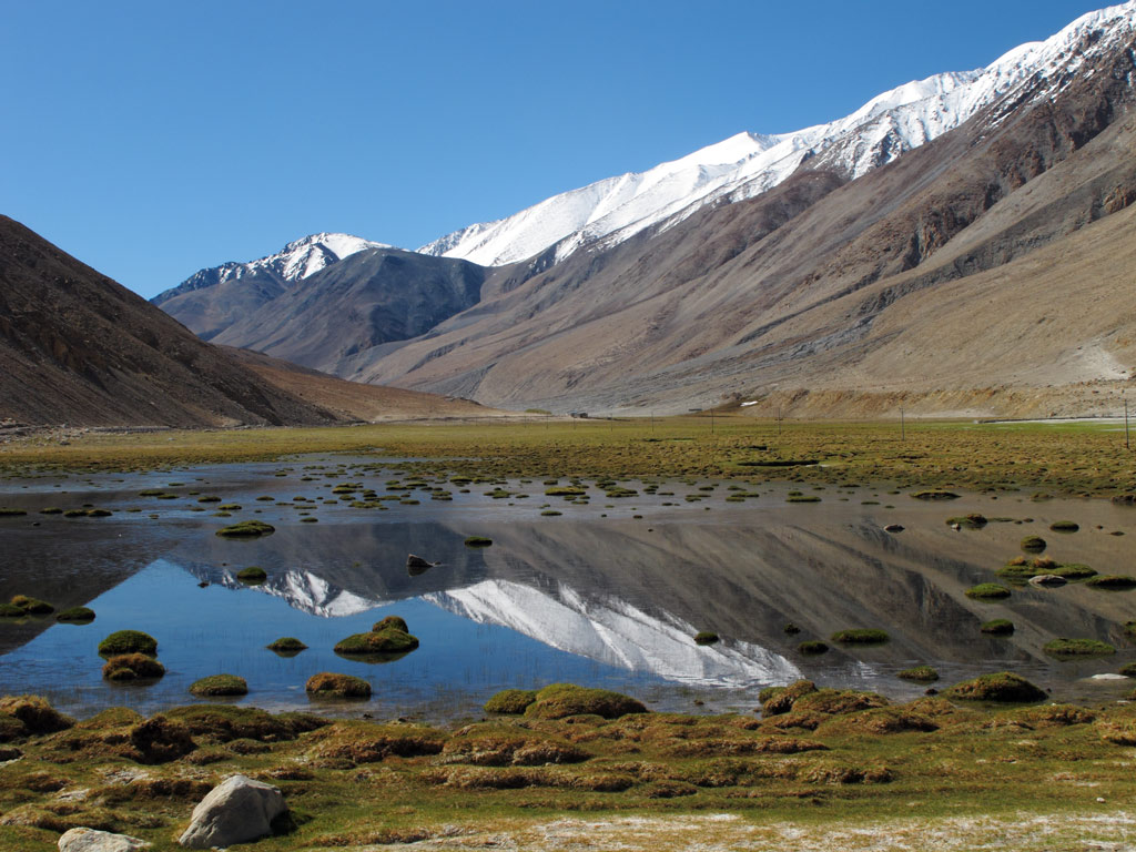
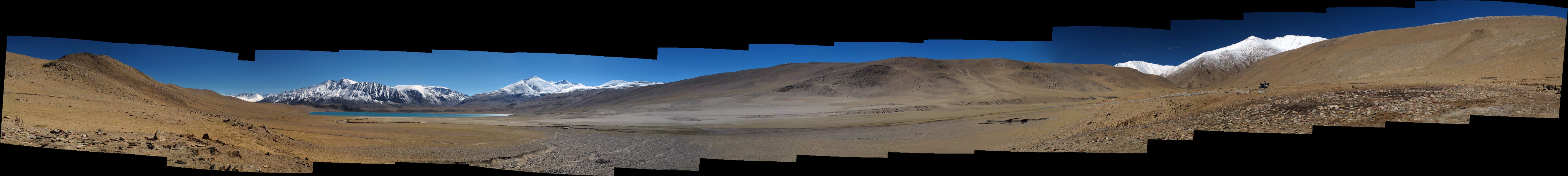
Soon we spotted a lake, but wasn't it too early? Our GPS was showing that it was still some 10 kilometers away… (click to enlarge the panorama)
The closer we got, the more powerful was the sight, with the lake just perfectly reflecting the blue of the clear sky, and mountains behind it covered in mysterious looking frost. As we found out later, it was not Tso Moriri, but a much smaller Kiagar Tso.
Kiagar Tso.
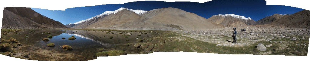
We had come for Tso Moriri, but had discovered another jewel. Kiagar Tso offered a million dollar view indeed, which must have been enhanced by the relatively monotonous and lifeless surroundings of the high plateau.

Kiagar Tso approaching. Click to enlarge the panorama.
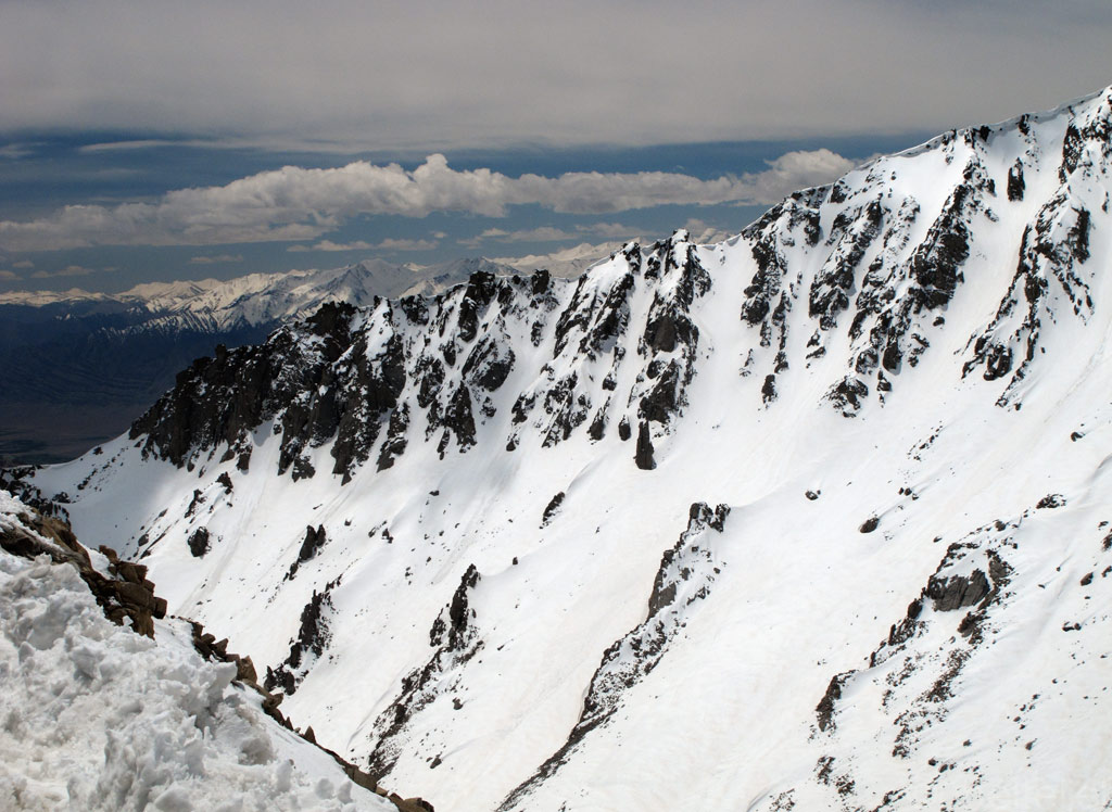
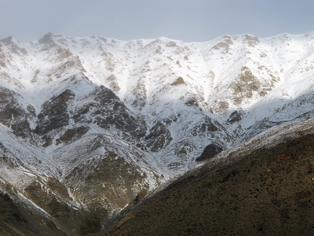
Then the pavement ended, and only a rocky track continued along the high plain. It was bumpy and shaky - pretty demanding, but the scenery was just outstanding, otherwordly. We had to stop for photos every couple of minutes or so.
On the mighty 13 000+ ft. plateau. Just about the snowline itself. And it was freezing!
Decent roads.

Click to enlarge the panorama from the plateau.
We were coming closer and closer to the lake, but it was clear that the sunset wasn't far away either. He had to choose whether to brave the worsening road conditions and try to reach the only settlement in the area, the village of Korzok right on the shore, or to find a place to camp away from the lake.
Somehow, the second option had more appeal. True, the landscape was desolate, dotted with some low lying bushes that would not offer us a lot of cover from the sight of bypassers, but then again there is something about spending the night under the open sky away from the civilization. It makes you think as if the twinkling of the stars, the whispers of the wind and the cold breath of the snow covered mountains all belonged to you, realising at the same time that you are nothing more than a note in a magnificent symphony, orchestrated by something bigger, something inconceivable. You feel a slight shiver of anxiety, but at the same time you feel secure.
We take a good look around.
Approacing Tso Moriri from the only rocky trail road leading there from the North.

Click to enlarge the loooong panorama (and who still doesn't know, click to enlarge it again in new window (in Internet Explorer I think the full button appears on one of the corners of the image if you go there with the cursor) to see it in 100% size, and then scroll horizontally to get the full experience of the panorama)
There were no perfect options, but we realised that as the sun was setting, the dimming light would soon wrap us in its disguise - so we pitched the tent quite close to the trail road, behind a bush that almost covered us, and hoped that there would not bee too much traffic on that small rocky trail.
Then all was left to do was to stare in awe at the million dollar view as it changed in the light of the setting sun. It was an enticing show, depicting the struggle between shadow and light which was happening in deafening silence.
Light plays with darkness.

Till darkness started to win...
Mountaintop in dusk.
We were at the altitude of some 4600 meters (15 000 ft), so at night the temperature fell below freezing. But the stars… I do not remember ever seeing so many of them in the night sky! It was a true poetry of vibrating light dots above us...
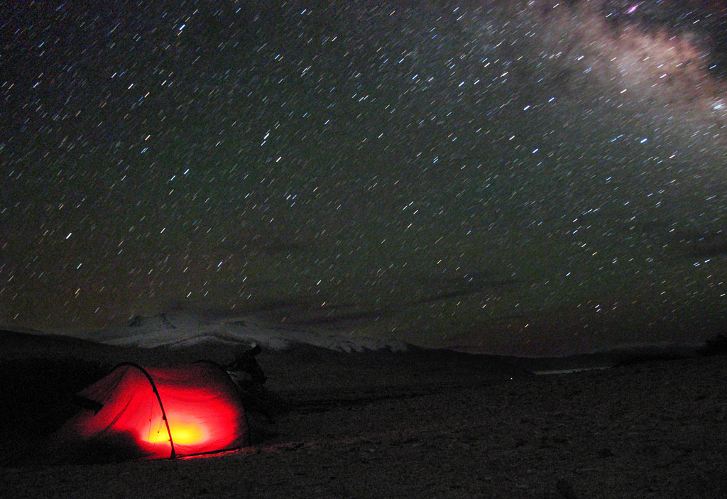
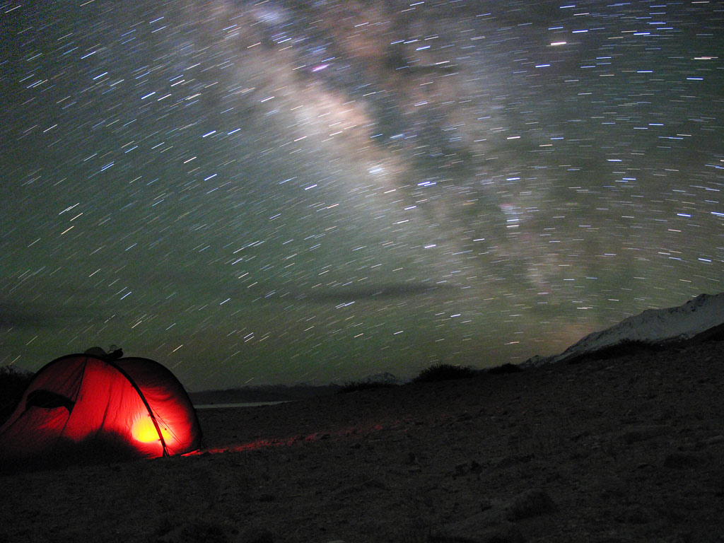
Under the Milkyway...
When we woke up in the morning, with temperatures still below freezing, clouds were blanketing the sky, but the show that the sun still managed to put up was remarkable. We had breakfast, packed our stuff, and headed towards Tso Moriri.
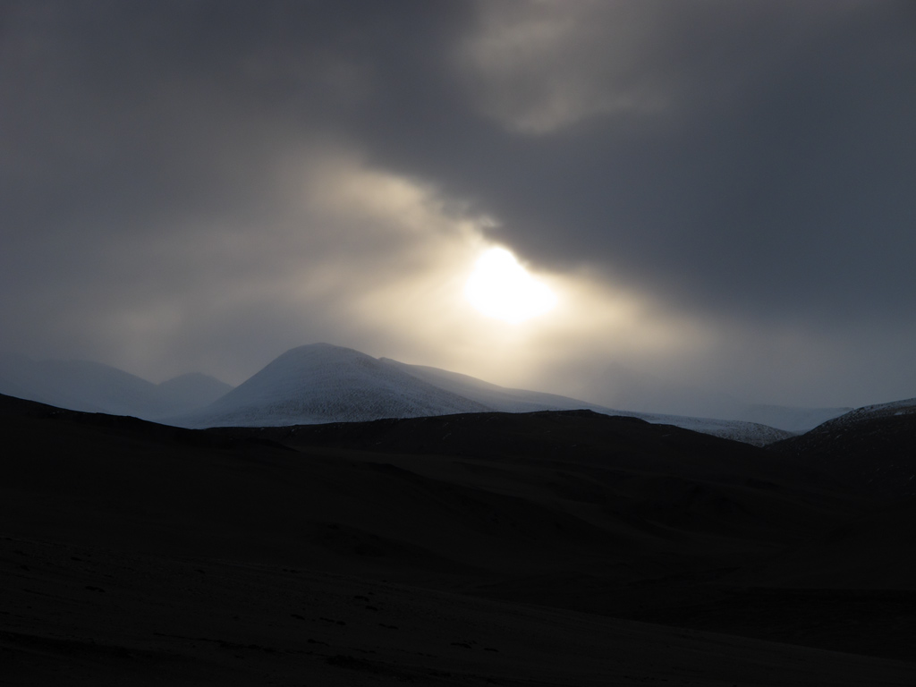
A morning fight between warm rising sun versus freezing snow clouds above a high peak.
Breakfast time, weather finally started to clear.
Our wild camping spot panorama (click to enlarge).
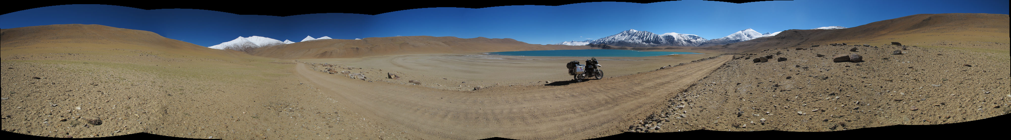
That is how this high altitude lake looks like (click to enlarge)

Panorama from close range (click to enlarge).
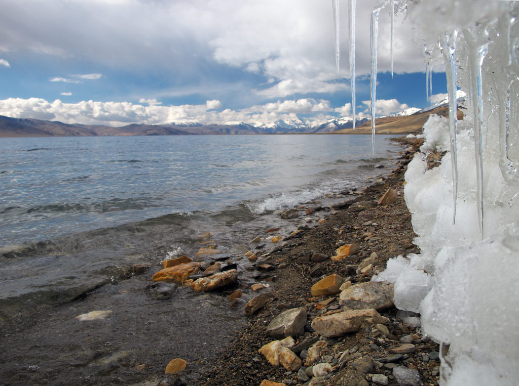
Ice still remains on the shores of Tso Moriri from the winter.
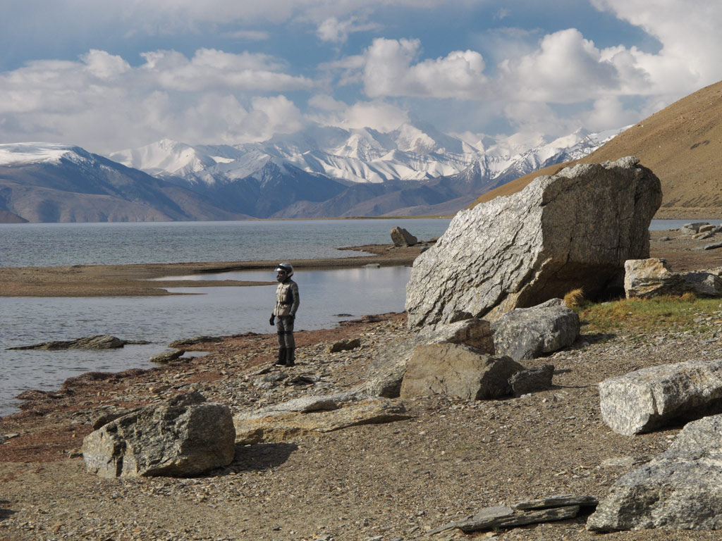
Tso Moriri.
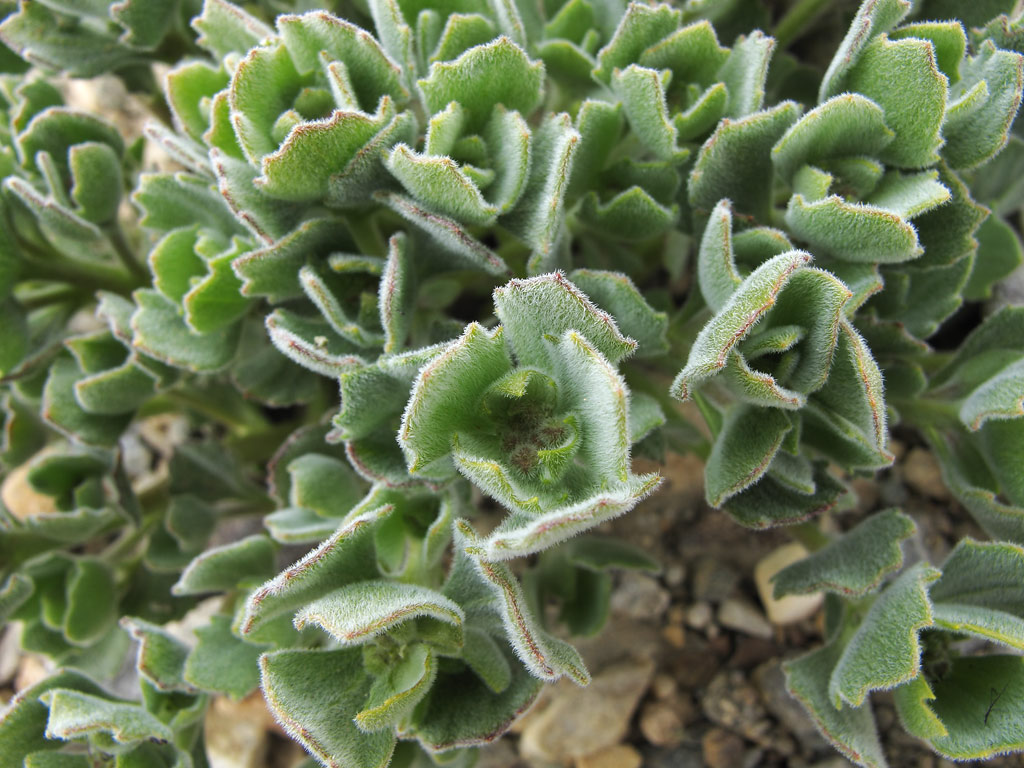
Despite the freezing temperatures, flora was flourishing.
Natural wonders over Tso Moriri.
We stopped at the village of Korzok, to replenish our water supply and to find out that it is a rather depressive place. Nevertheless it has an old monastery.
Main street of the Korzok village.
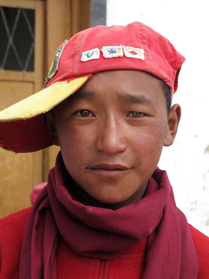
Young monk at the monastery.
Curious little fellow.
"Are you from another planet?"
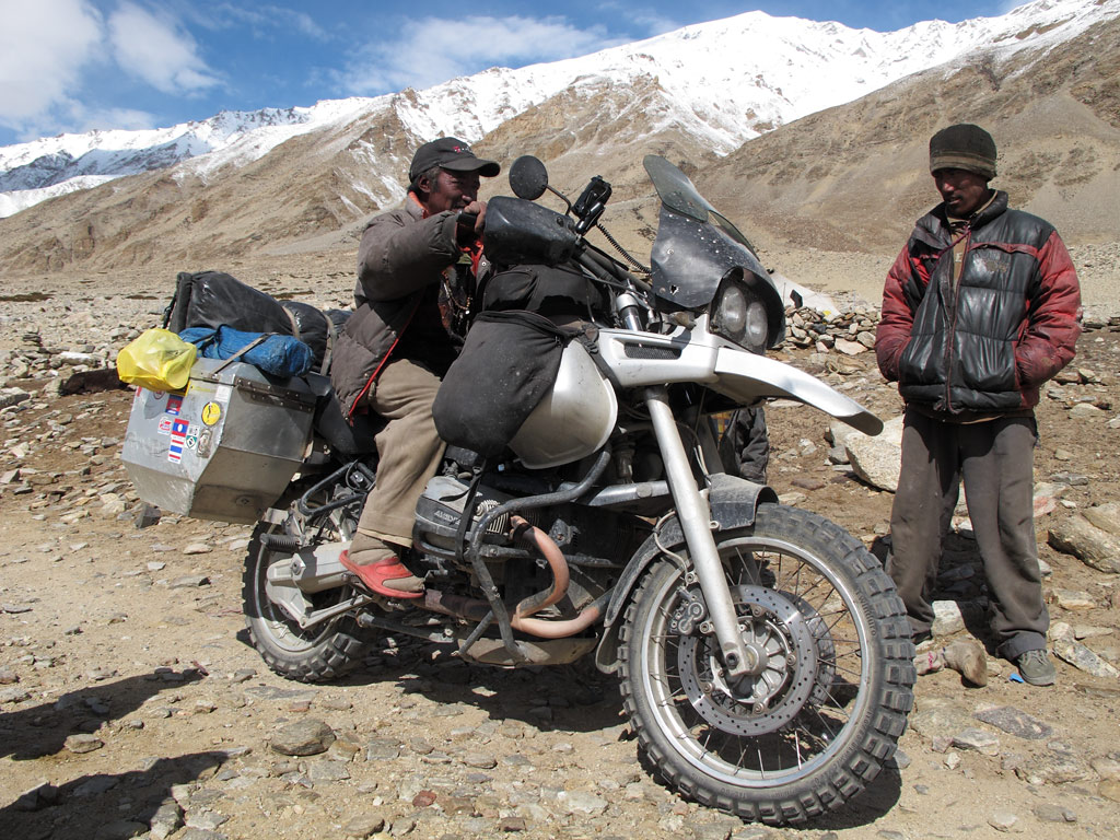
After that we started riding back, stopping by a makeshift village of nomadic herders. They came to check us out as we were surprised by the way they live, and by how little is actually needed. The kids' toys were made out of wire and empty tins, but they nevertheless looked cheerful - I do not think the kids who have ten Barbies or a state-of-the-art remote controlled model cars are happier. It made us think once again that it is not the things that matter, but something else - the warm welcome of a stranger, and the responsible attitude towards the environment, for example. The ecological footprint of those people is much smaller than ours, but we still crave those Prada shoes, speedliving cell phone, fancy car, ultra portable something…
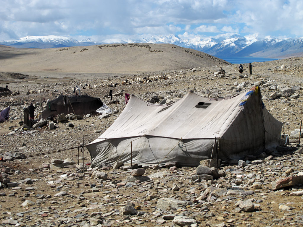
Nomadic herder's mobile "village" with a couple of tents.
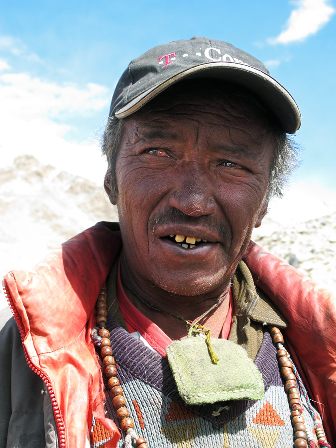
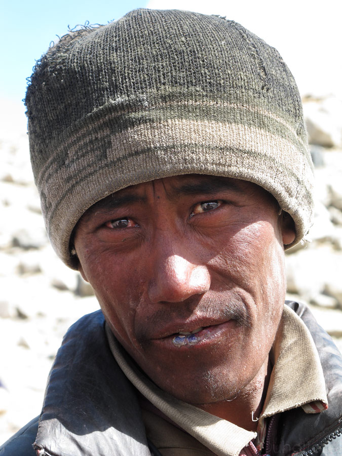
A nomad man with a lot of UV-exposure on those altitudes.
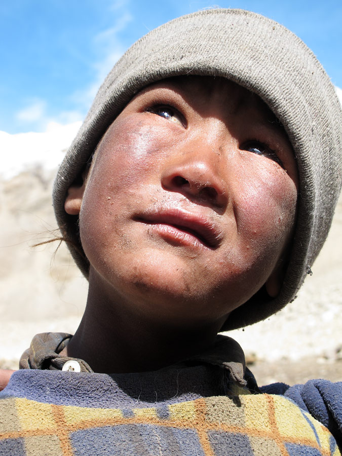
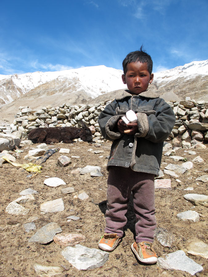
A nomad child.
They had to feel what's it like...
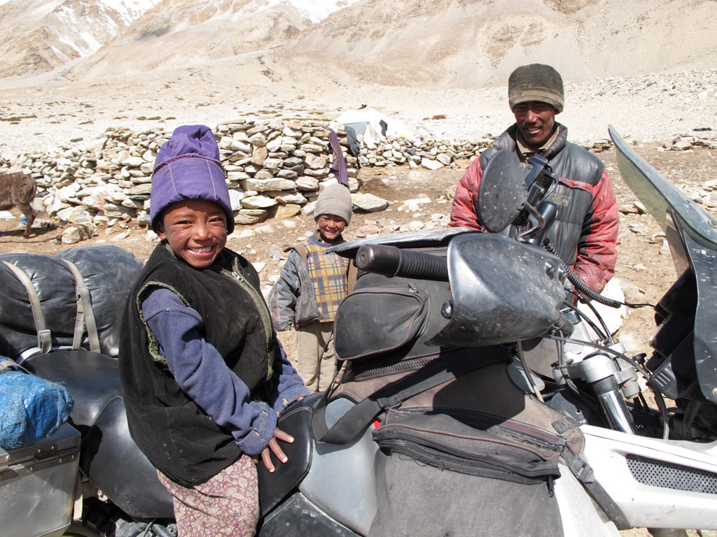
Nomadic men checking the GS out hands-on style.
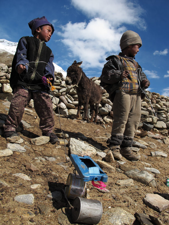
Children and their home-made toys.
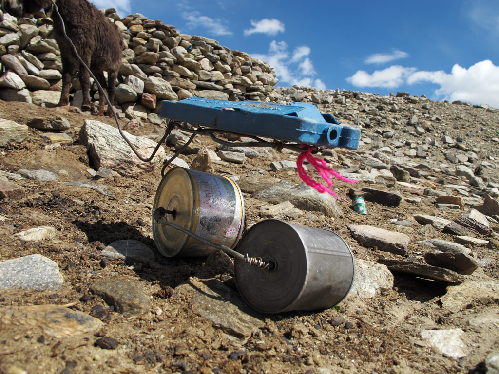
It even had steering with the wire!
Everything can be converted into ingenious toys for them - a leftover shampoo bottles or match boxes.
We rolled on, thinking of the things we had seen. It is not us who own it all, we are a part of it. And if we know how to value what we have been given, those million dollars could belong to everyone of us.
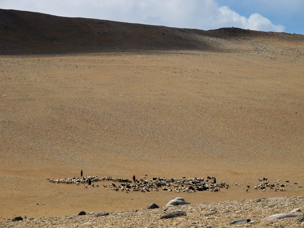
Nomadic herders on the hillside.
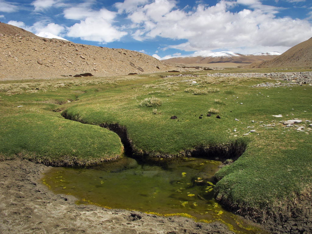
Found a green valley within a desert of dryness...
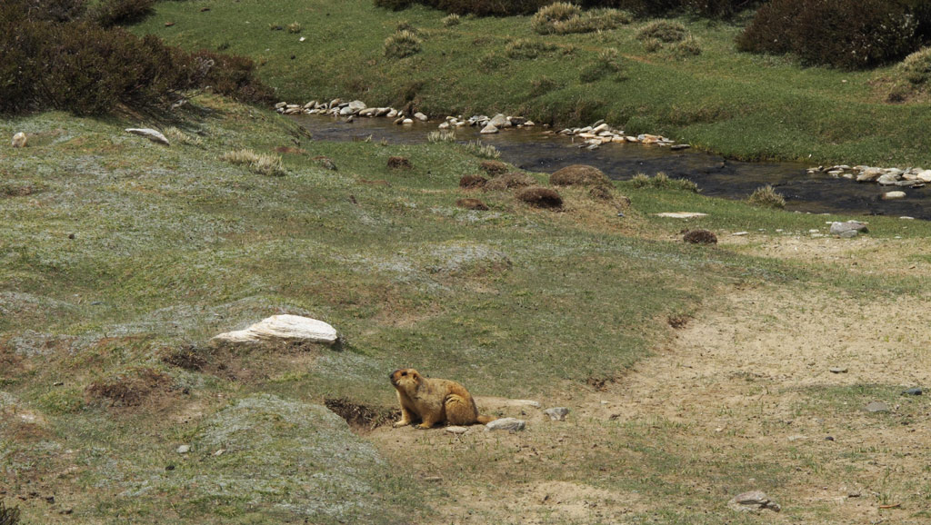
And if there's green to eat, water to drink, there was a lot of marmots.
Panorama from the green valley (click to enlarge)
Our only road back into civilization, still far away and shadowed by dramatic weather ahead...
Final part of India coming soon...
Travelling from Srinagar to Leh, the town of Kargil is the last outpost of Islam. Sure enough it has all the traits of a muslim settlement, including the 4 AM recital of Quran.
After that, moving further East, as one crosses the high passes and descends into fertile valleys, the spirituality changes completely - it is the Buddhist country. Although today India is predominantly Hindu, it was not always so - already in the 3rd century BC Buddhism became the dominant religion in all of today's India. However, due to different reasons Hinduism grew more powerful, and later the Mughal period patronized Islam, so today the religious image is pretty confused.
So far we've only experienced Tibetan buddhism (interestingly, its roots are in India, from where it was Imported to Tibet by the traders in the 4th century) in India, which seems to be predominant in parts of Himachal Pradesh and especially Ladakh. It seems to be concentrated in MacLeodGanj, home to the government in exile of Tibet, but there are viable Tibetan communities elsewhere in the northern part of India.
One of the more interesting villages is Mulbekh with its 8-metre high relief of Maitreya-Buddha:
Maitreya.
Maitreya and the monastery below it.
Our road and a chörten, a Tibetan Buddhist stupa.
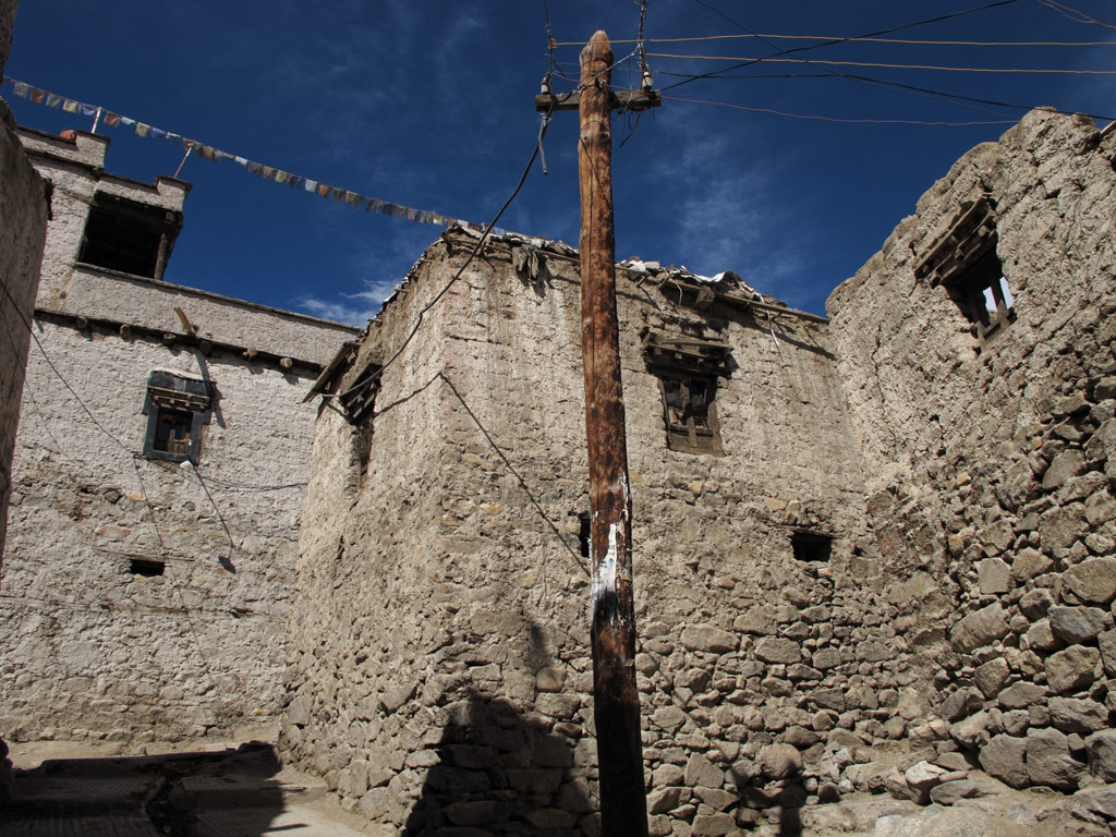
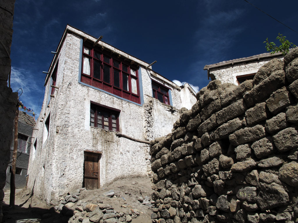
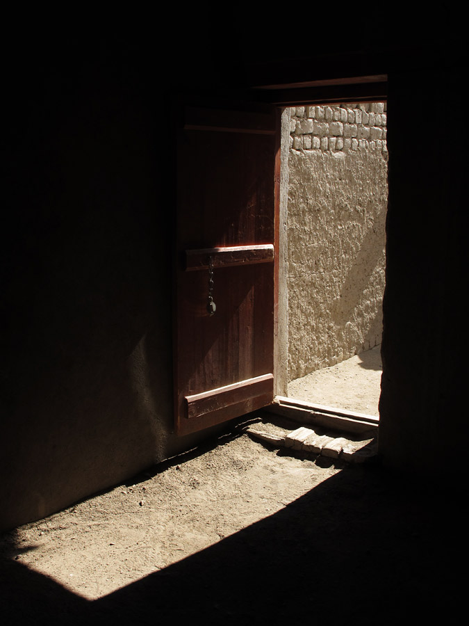
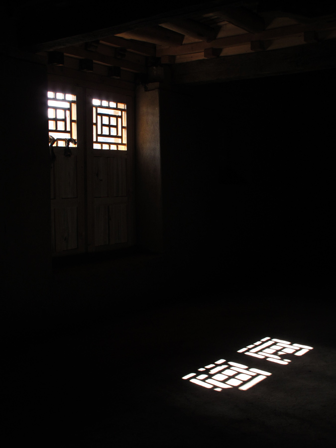
But there is also the remarkable village of Lamayuru which is home to a buddhist monastery dating back to the 11th century. The monastery is great, and so are the ancient looking chörtens (Buddhist stupas) that are sprinkled everywhere on the rocky slopes of the village, and the mani-stones with Tibetan inscriptions, and the warmth of the people.
Lamayuru.
Different layers of ground representing different eras.
Ancient chörten in sunset.

Lamayuru panorama.
Lamayuru architecture.
Two old women on the Lamayuru street.
A Buddhist woman with her prayer wheel, she hosted us.
One of the internal-rotating prayer wheels on family's kitchen table.
Kariina under a chörten.
Lamayuru in sunset.
Mani stones with scripts.
Loads of them.
The moon above the holy land.
Between Mulbekh and Lamayuru, there is a high pass - Fotu La, where there are many prayer flags with mantras to be carried away by the wind.
Fotu La, 13 000+ft.
One of the prayer flags in detail. Loads of them on different mountain passes.
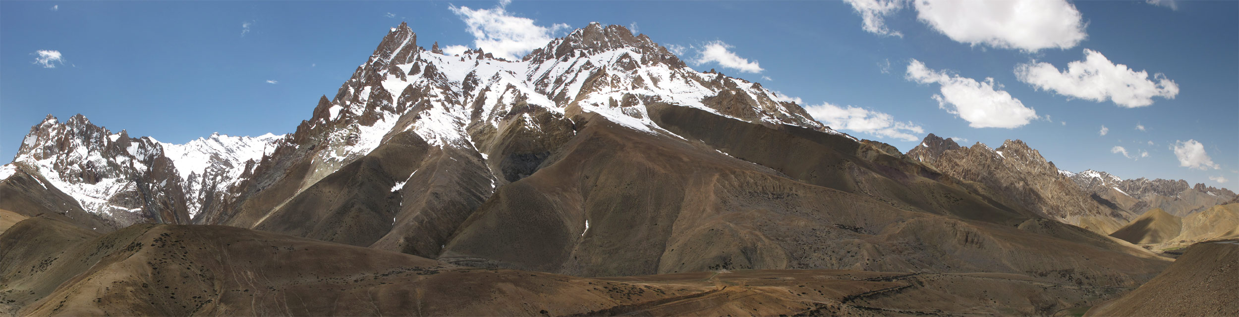
The road winds through some magnificent scenery of the "roof of the world".
GS under the Himalayan peaks.
Panoramas - click to enlarge each one.

GS and the prayer flags - crossing the Namika La.
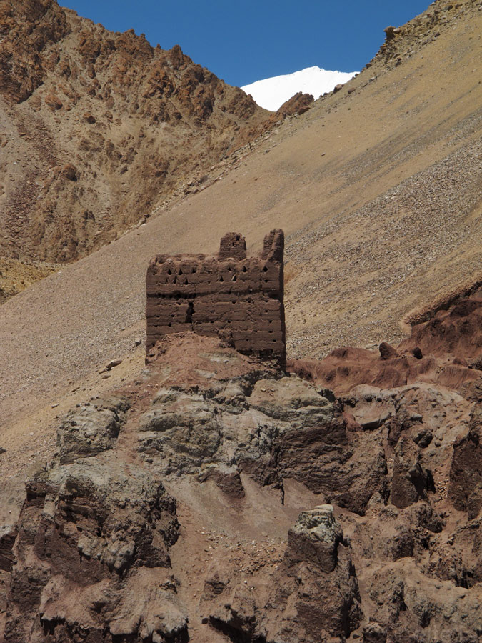
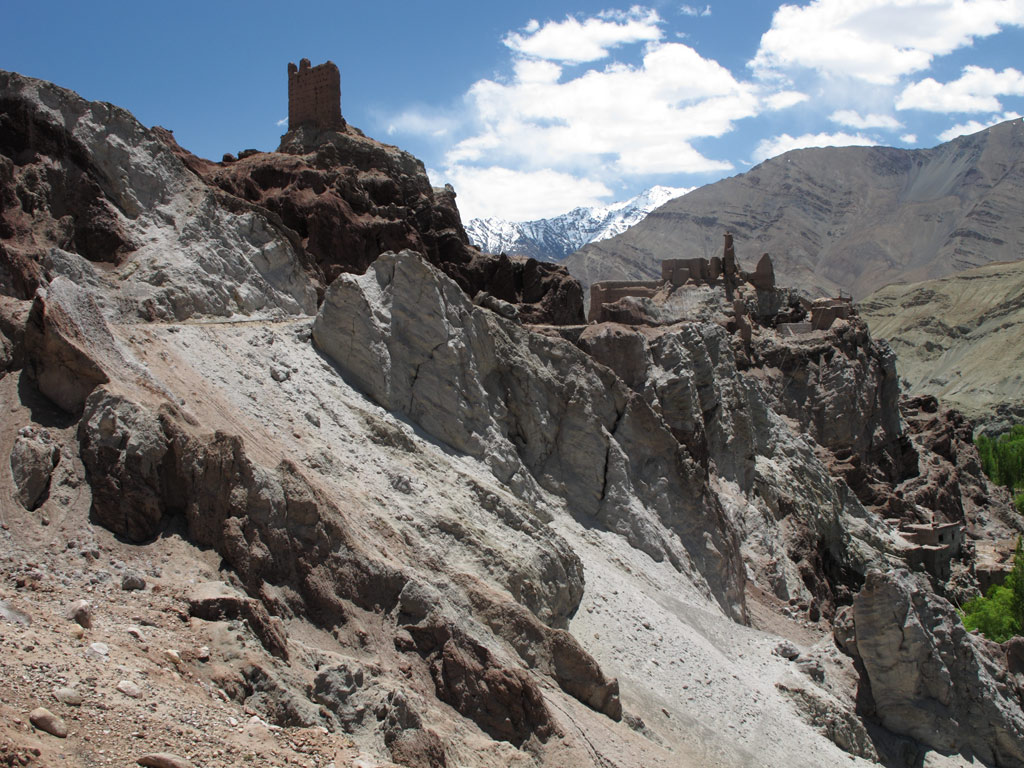
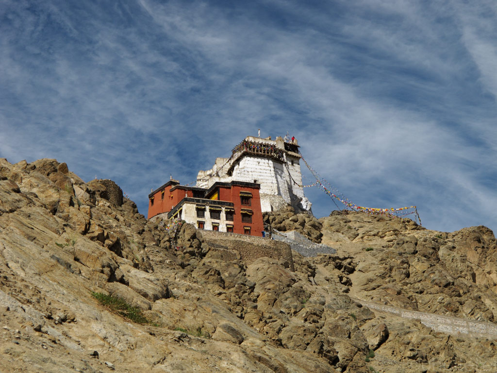
For five centuries Leh has been considered the capital of Ladakh, but it has not always been the case. Before, it was the little-known Basgo that ruled the region. In 1470 the emperor of Basgo, Lhanchen Bhagan, conquered the kingdom of Leh, and the era of the Namgyal (meaning "the victorious") dynasty began. As the power shifted to Leh, Basgo was left to its own, and tody it is no more than a sleepy village set amongst crumbling old chörtens and bright green barley fields. Only the ruins of the mighty hilltop fortress remind us of the glorius past.
Basgo fort.
Colourful chörtens.
A house.
Fort's ruins against reddish mountain.
Tibetan monastery and a GS below.
Streets inside the forts.
Remains from far-far past.
Tibetan monastery from above.
Himalayan surroundings...
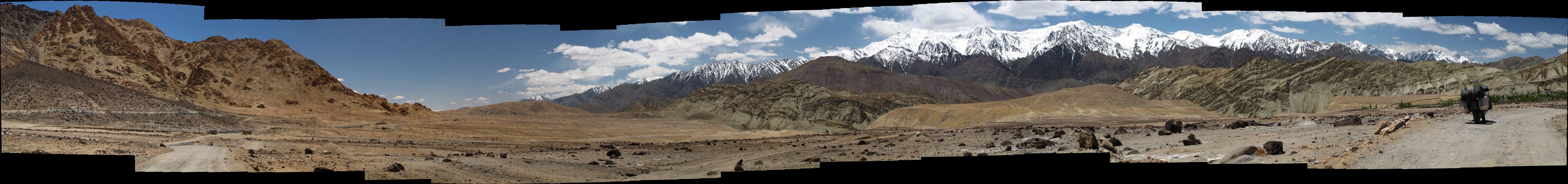
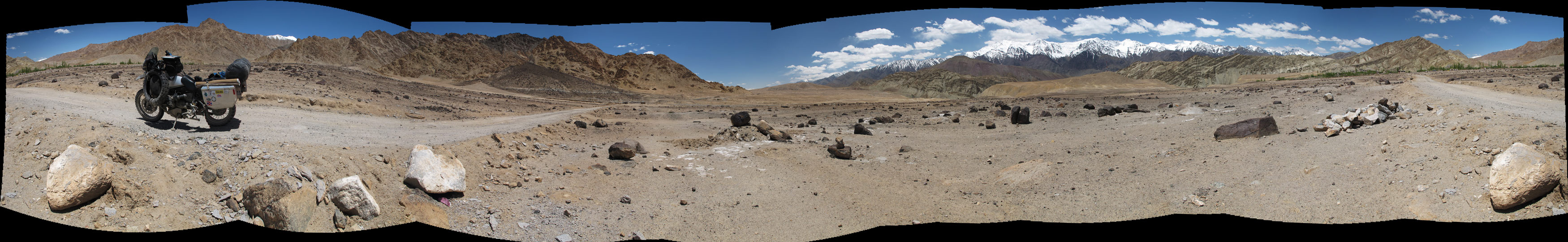
And some pics of the road from Basgo to Leh.
GS and chörtens.
Chörten on a mountainside.
Alien-planet-like reddish mountains are a standard feature here.
Panoramas from the road - click to enlarge each one.
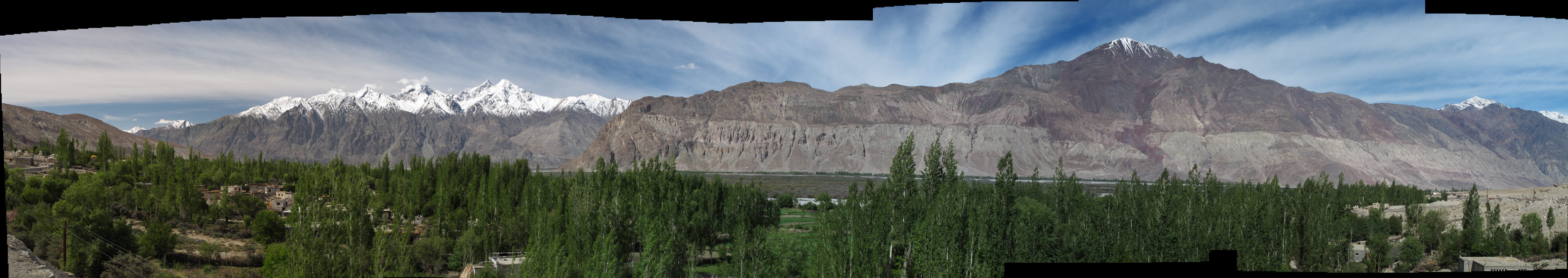
For centuries, Leh was a stopping place for caravans plying between Tibet and Kashmir, China and India. However, even today it boasts a strategically good position, namely for Ladakh bound tourism. Today, instead of kashmere wool, silk and brocade, it is the middle-class Indian tourist that is being transported along the valley of Indus.
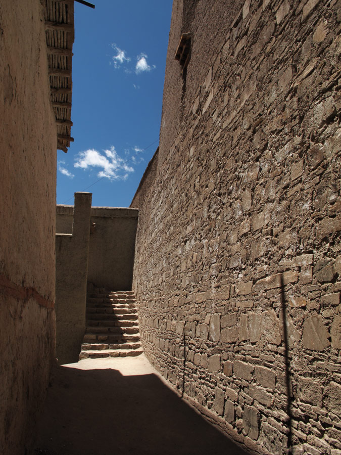
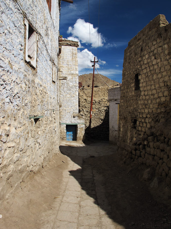
Today's Leh is no longer an atmospheric village it used to be. Instead, it has grown to become a town of more than 27 000 inhabitants, but still it has something coarse to it, some remains of the feel of a mountain village. Low mudbrick houses line the narrow alleyways that wind in a manner of a three-dimensional maze, home to sleeping dogs and holy cows. Here and there you notice a chörten, or a colourfully painted prayer wheel, revving like a generator of positive thoughts.
Sounds of the gigantic prayer wheel that ringed the bell on each revolution:
.:: LISTEN ::.
The "ringing" prayer wheel.
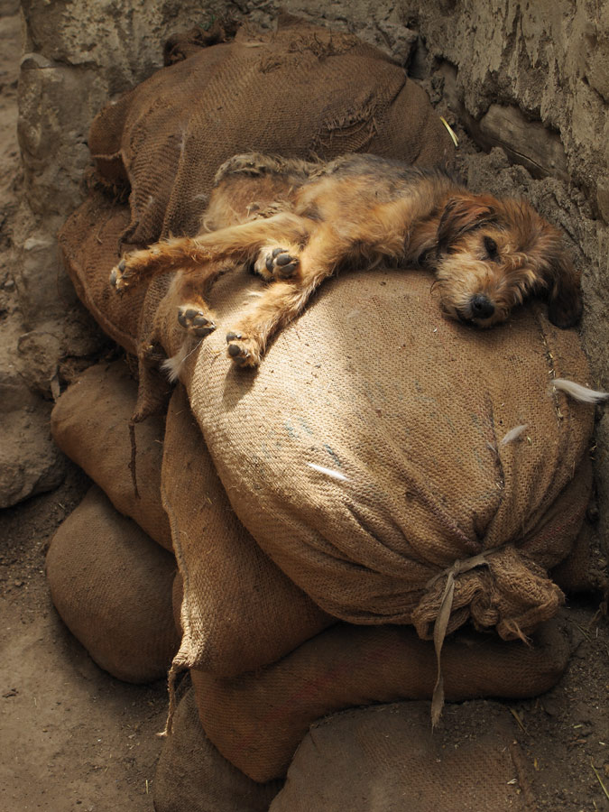
Sleepy stray dogs everywhere on the streets.
Tibetan street merchant.
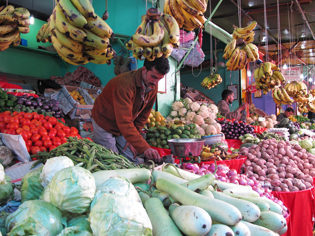
Leh market.
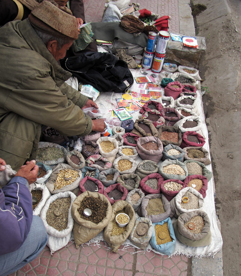
Selling spices on the street.
Streets of Leh.
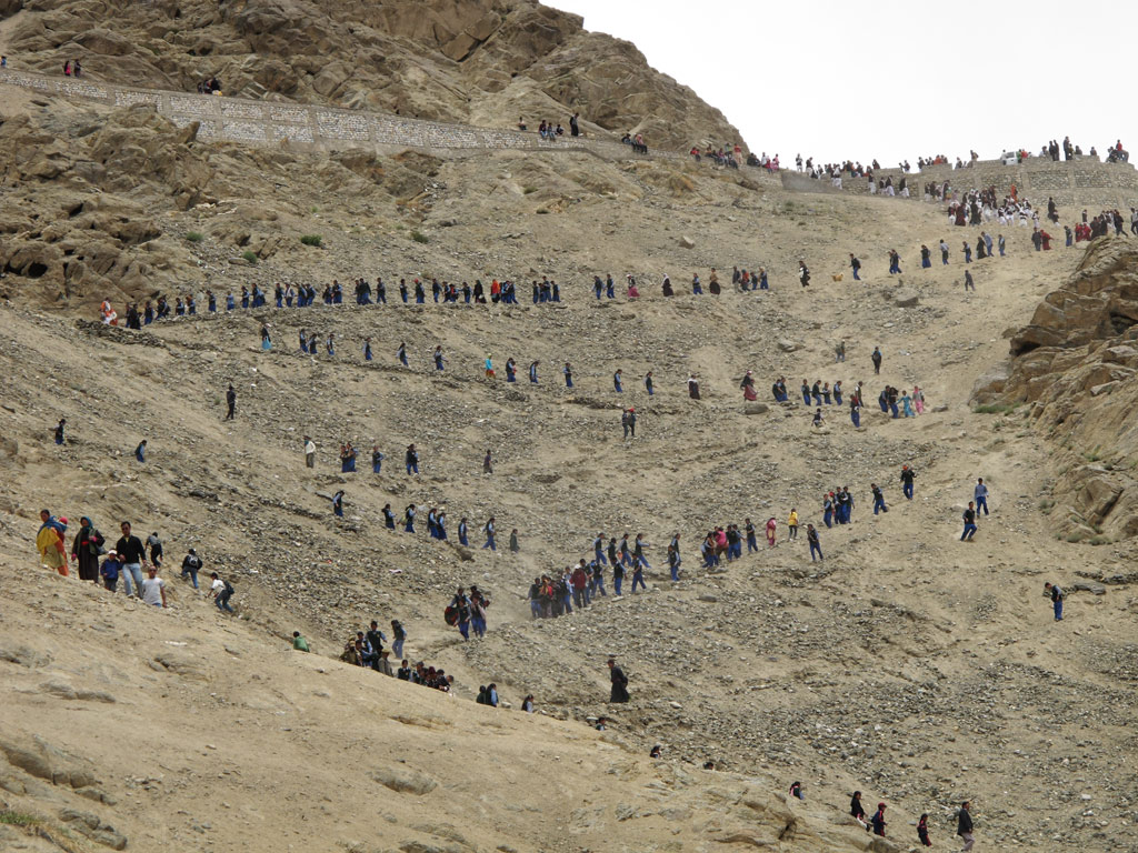
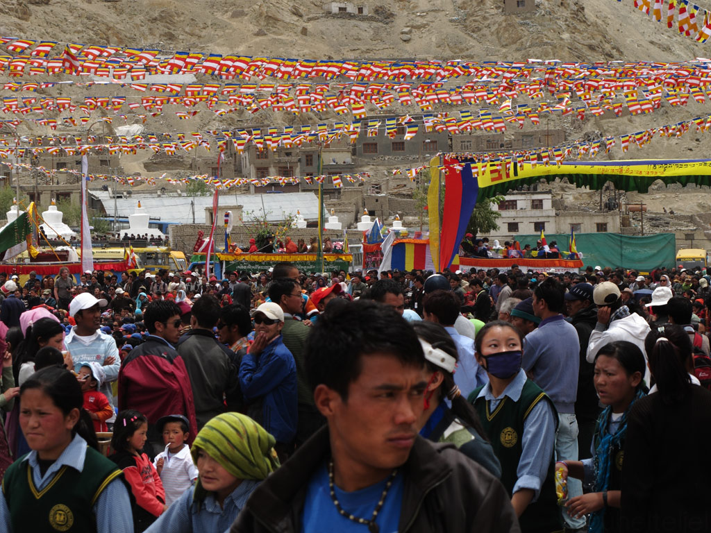
We happened to be here just in time to witness some Buddhist celebration that seemed to involve the whole town. People were walking in masses from one sanctuary to another, and one could hear dub-techno-like cacophony of sounds reflecting back from the mountain sides.
.:: LISTEN ::.
Buddhists walking down the mountain - uphill is one of the holy gompas.
Chörten against the Zanskar range.
Festival's main square.
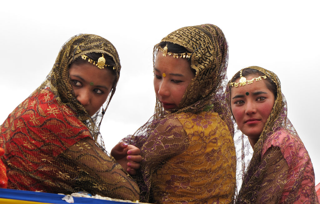
Young ladies at the festival.
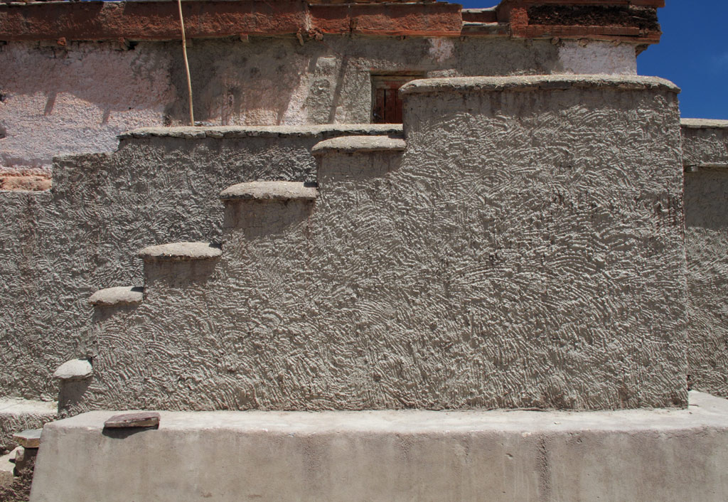
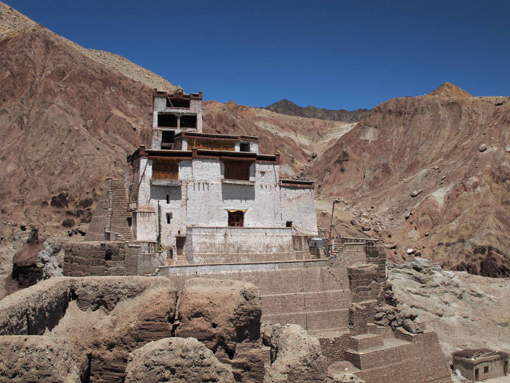
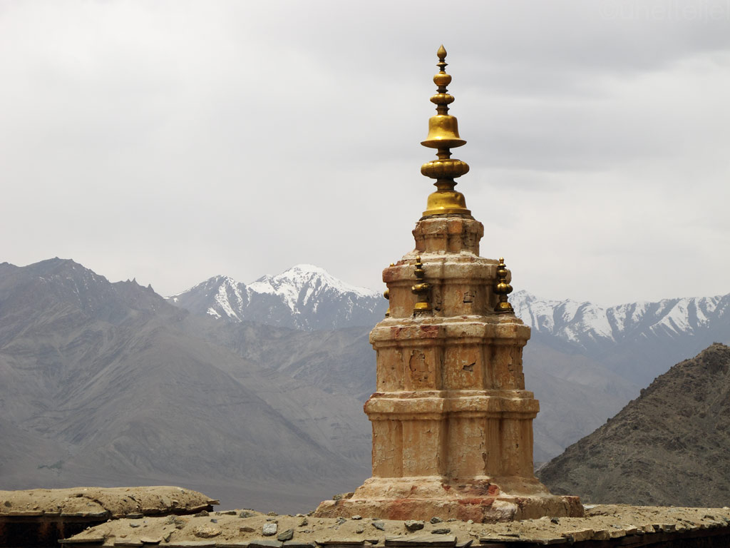
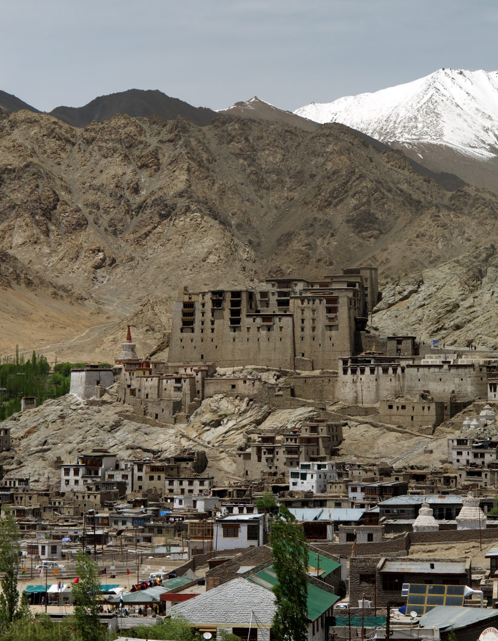
As you climb up the steep hill, you find yourself among some old gompas and the mighty 17th century palace. It was built by Sengge Namgyal, king of Ladakh, but although it is nine storeys high, its mudbrick design did not quite strike us. Rather it was the views from the palace onto the town of Leh, nestled in a green valley, the Indus valley behind it, and the towering peaks of the Zanskar range like a crown to the majestic view.
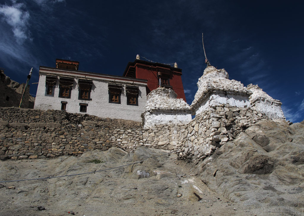
Bright white chörtens and a gompa.
Leh palace.
Inside the palace...
The same gompa that buddhists came down from in the beginning pics of the thread.
Mountain versus sky.
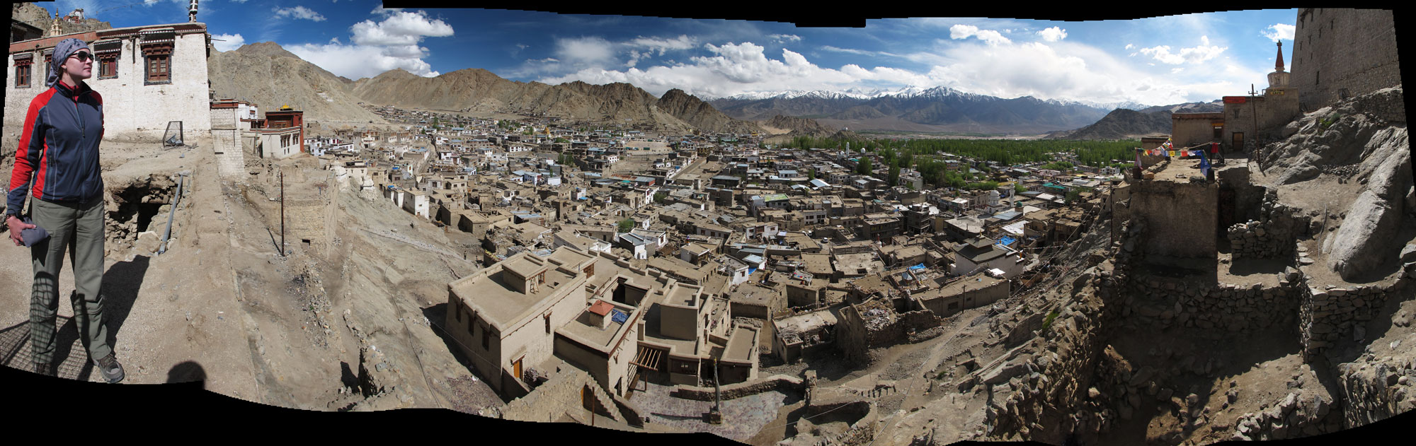
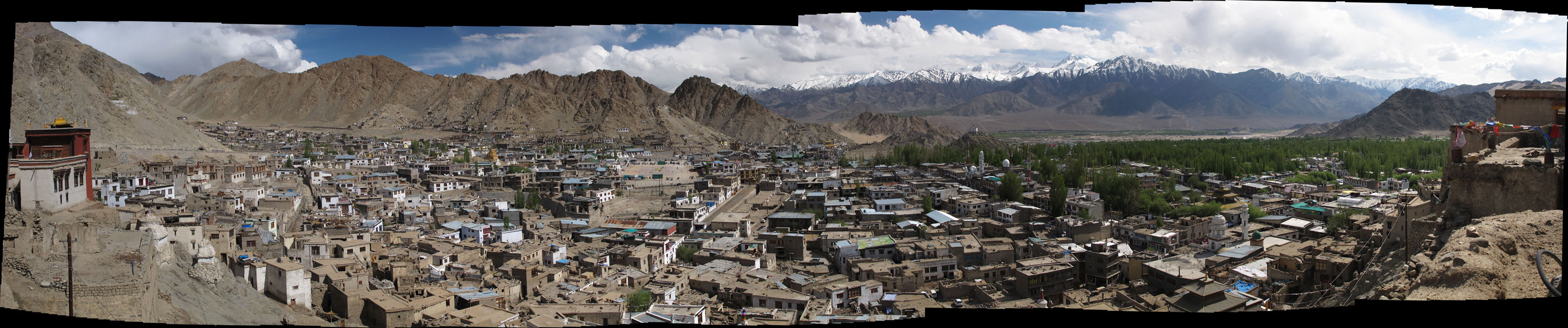
Looking down to Leh from the palace - click to enlarge the panoramas.
Leh panorama.
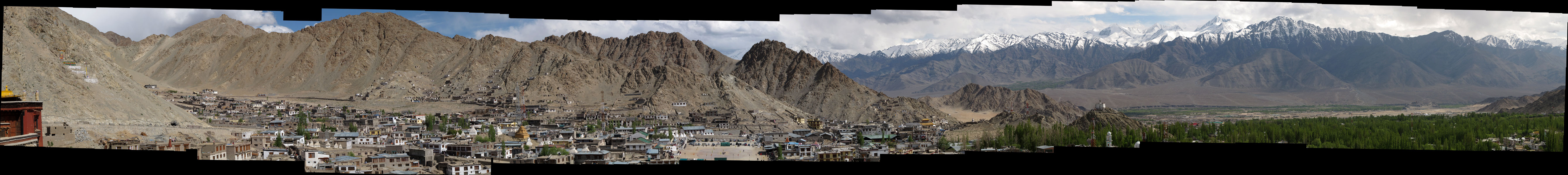
Panorama zoomed in more into Zanskar mountains that side Leh from the South.
However, the tourists are lured here also by something else.
May came to an end, and June got started, but the legendary road from Leh to Manali still remains closed. Too much snow this year, they say. Well, we've got some mandatory things to do anyway before we go. Such as getting ourselves to the so-called highest motorable pass in the world, Khardung La, which is, in fact, just a one-and-a-half hour's ride away from Leh.
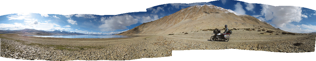
But before doing that we decided to pay a visit to Pangong Tso, allegedly the most beautiful lake in Ladakh. So we applied for the required permit (since the lake lies right on the disputed border between China and India, one has to have an Inner Line Permit to visit the area) and got going.
There were some more gompas and chörtens alongside the road, but although we had already developed the feeling that "once you have seen one of them, you've seen them all", some of these still impressed.
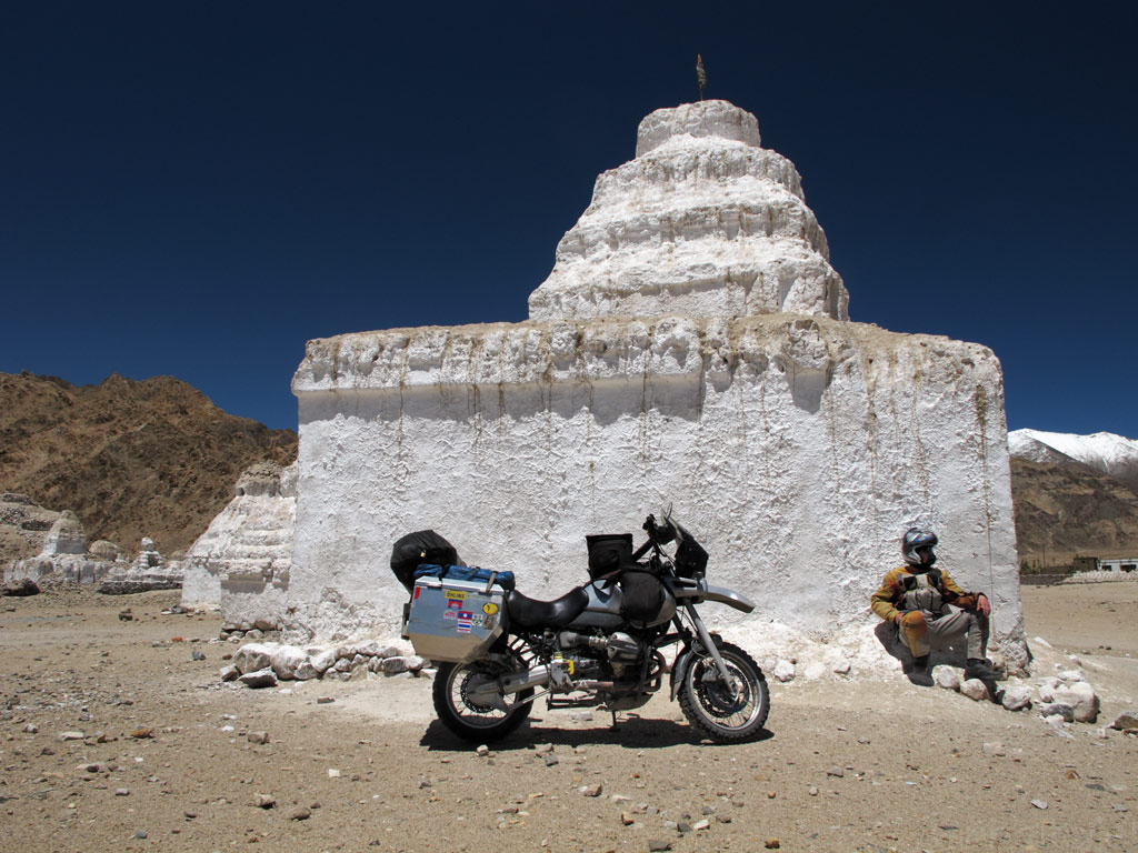
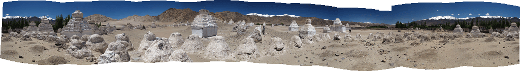
For example Maropa Photang - a collection of some hundred or so sugar white chörtens, some smaller, some bigger than others, dispersed in a piece of dry landscape. It definitely had some magic to it.
Sitting under one of the Maropa Photang chörtens.

Click to enlarge the panorama.

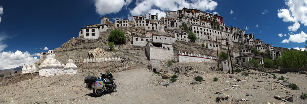
Or a pretty striking monastery in Thiksey, covering the entire rocky slope. It was huge indeed.
Or the monastery in Chemre, that blends so well with the surroundings.
An oversized chörten by the road.
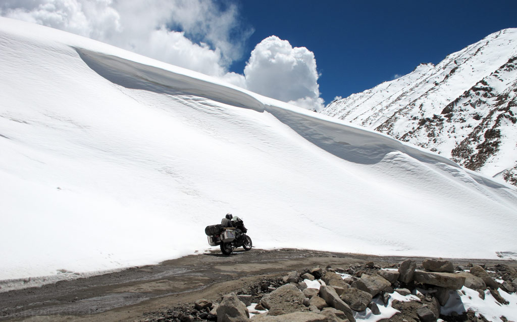
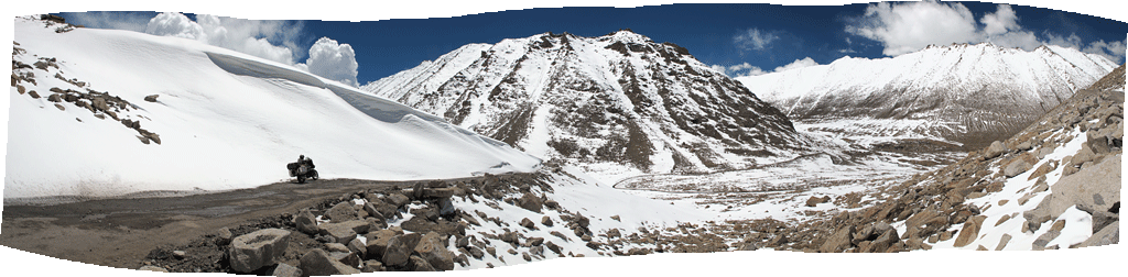
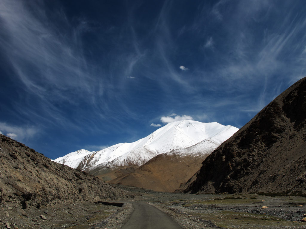
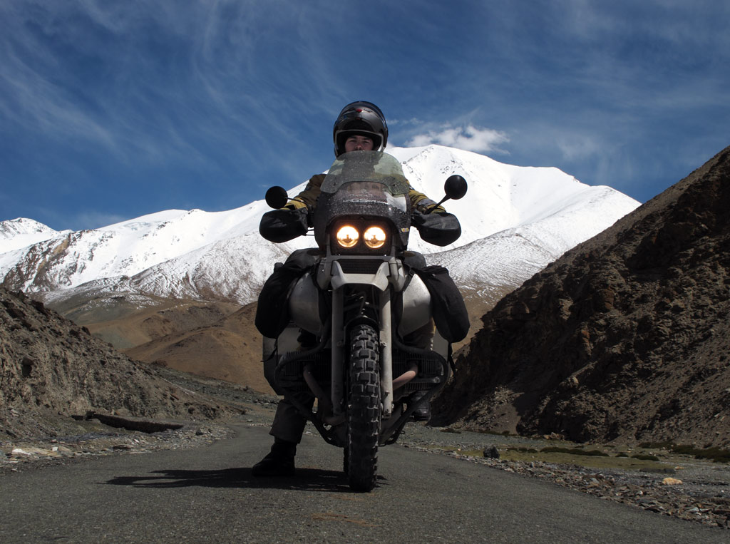
This far the ride has been a pleasant sunday ride, with pretty smooth tarmac making its way through green fields and Tibetan villages where people were smiling and waving to us. But then it started to climb uphill, and while the views became wider, the road deteriorated. We were approaching Chang La, a pass that is 5360 metres (17 586 ft) high.
A little before that we saw two abandoned Royal Enfield Bullets aside the road, wondering if it was the engines that had failed, or it the high altitude had struck the riders so that they had quit. In any case it did not smell good - even though the road may be officially open, the snow still makes riding it quite a challenge.
Soon we realised that it might have been the road conditions that had forced the "enfielders" to give up. The higher we got, the more half-melted snow and water appeared on the road, hiding invisible ice, which, of course, contributed to our falls' statistics.
And you thought you can take curve easily on the water covered ice? Thank God I didn't ride off the cliff fer fox sakes! I suddenly took it all easy from there…
Lifting it up at this altitude is sure no fun - at more than 5000 meters (16 400 ft), the oxygen is so sparse, that even holding the bike up while negotiating the tough conditions, is rather a feat, let alone lifting the fully loaded 300 kilogram bastard! Tough it was, but we succeeded.
Kariina decided to ship the adrenaline and walk the remaining couple of hundred meters to the top, while I tried to keep the rubber side down on an uneven icy road covered with sleet and water - great combination? NOT! I would have killed for proper ice-track riding stud-tyres in those conditions!
So there I was, on worn TKC80s with infinitely-close-to-zero grip, just throwing up an arc of water and sleet behind and not moving much uphill. But momentum was my friend - once I got the bike moving (with some serious additional bone-push-power, obviously) I could not stop. But then again, on a bumpy road that is filled with hidden ice covered with water, sooner or later you "kiss" the ice road again once the front wheel just slips away, like a cow's leg on an ice - yeah, on water covered ice, that usually happens faster than you can blink your eyes.
Taking it more easy doesn't help either. Exhausted Kariina's madly sucking oxygen poor air into her lungs and probably thinks: "Not again! Our dear trusty GS, why the hell are you suddenly so heavy to lift up?"
And there's additional problem - over half of the bike's power is lost on that altitude and it barely can idle, and in our case it had a tendency to stall while revving. Meaning you go uphill with great momentum and slipping rear wheel on an icy road and all of a sudden engine dies, rear wheel blocks and… of course, you go down. It was our dirty old air filter that needed replacement, fortunately we had been carrying a brand new spare filter with us. After replacement, the engine got more air and it didn't stall that easily, also some additional power boost was noticeable that helped.
Air filter change.
Anyways, by some miracle, after passing some stuck 4x4s, couple of additional falls combined with low oxygen environment (16 000+ft) GS-lifting training, I somehow, to my own amazment, made it up to the pass. Soldiers there looked at me as if I were some crazy guy trying to prove something, but looks like I was the only bike up there that day.
Kariina soon got up as well and took a breathing rest on the pass signpost - yes, even walking at over 17 000 ft without acclimatisation is like running full speed on the sea level - it takes you breathless very quickly!
5360 metres (17 586 ft) - this is our record so far!
Kariina taking a break.
Toilet at 17 500 ft? I didn't dare to go and try it...
After the pass, the road obviously went downhill, but there was a lot more snow. One would think that riding downhill should be easier than uphill, but in fact, the risks are greater. The brakes become useless on ice and there is a real chance one might end up "scraping" the snow or rock walls, which is a better option, or go down into the abyss. Since neither of these did sound really appealing, I did my best to take advantage of any riding skills I had, and we descended safely.
Our road downhill.
Decent scenery. Time to make a snowman?
Views from the road…
GS vs a thick layer of snow…

Panorama from the road - click to enlarge.
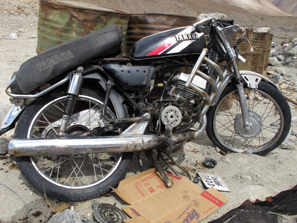
In Tangtse we were greeted by a friendly dog, and our permits were checked. At the check point, there was a totalled Yamaha that had gone "over the edge", reminding us that the road should be taken very seriously. We had seen trucks in the abyss before, but the bikes are so small that they barely look more than a dot seen from some thousand metres above.
All mighty Himalayas.
A friendly dog at military checkpoint.
A fallen off the cliff Yamaha two smoker.
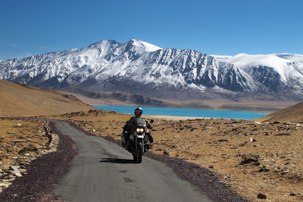
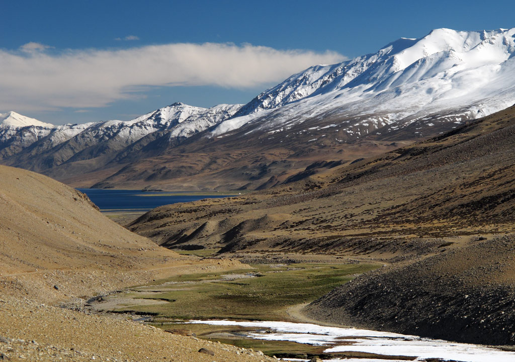
A little bit more, and we arrived at Pangong Tso. The turquoise waters, the mountains and the dramatic clouds above them created a truly indiscribable picture, so perfect and unreal that it might as well have been created by an illusionist. It reminded us of the high plateaus of Bolivia where the nature displays its beauty in a similar way. In any case, it definitely was the most beautiful thing we had seen in India.
Pangong Tso in its colours.
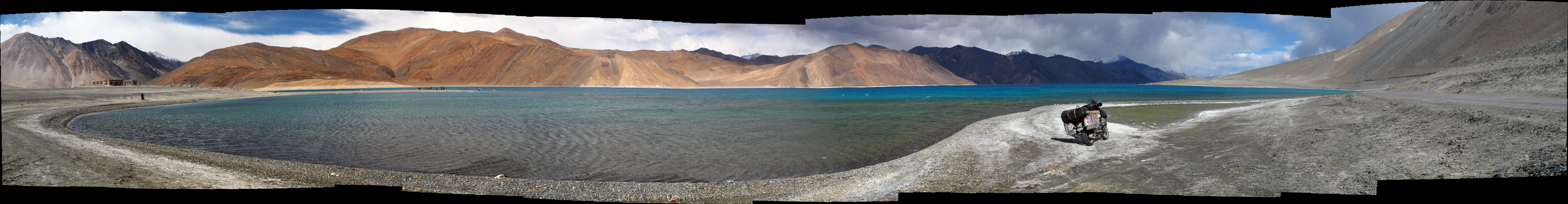
Panorama from the Pangong Tso - click to enlarge the panoramas.
Panorama from the road.
Plateu vs the mountains create stunning clouds and dramas, especially close to the sunset.
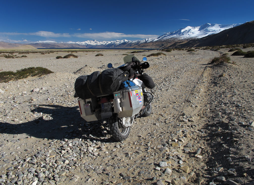
Our GS in it's favourite environment - decent scenery and a decent rocky dirt road.
One of the best roads we've taken.

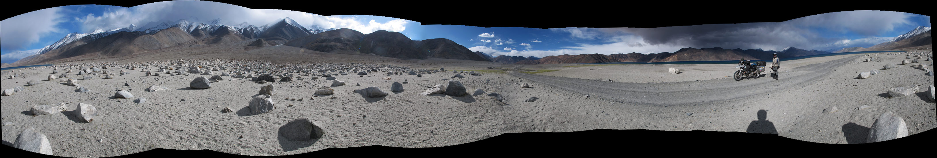
Panorama from our road and Pangong Tso - click to enlarge
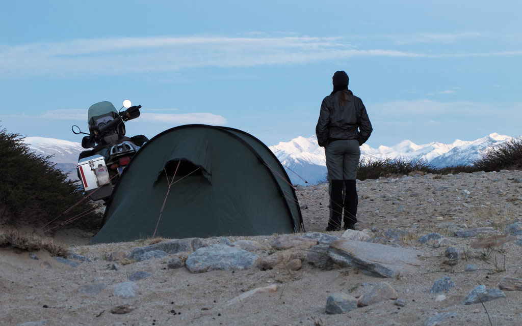
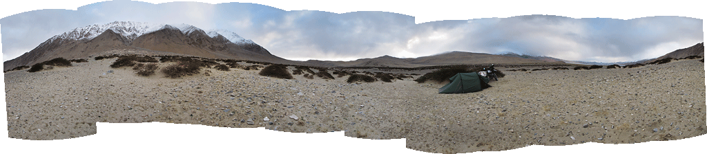
It had been a long and an interesting day, but as the sun was about to set it was time for us to find a place to pitch our tent. It was a long time since we last did it, namely on the coast in Malaysia, but this time the environment was completely different as we were surrounded by mountains.
The mountains have an advantage over the plains when it comes to wild camping - there is not so much population, hence the chance that someone spots you is very small. But at the same time, mountains also mean rocky slopes and sharp rubble covering the valley floors, making it rather difficult to find a level place to pitch the tent. It can become quite cold, too.
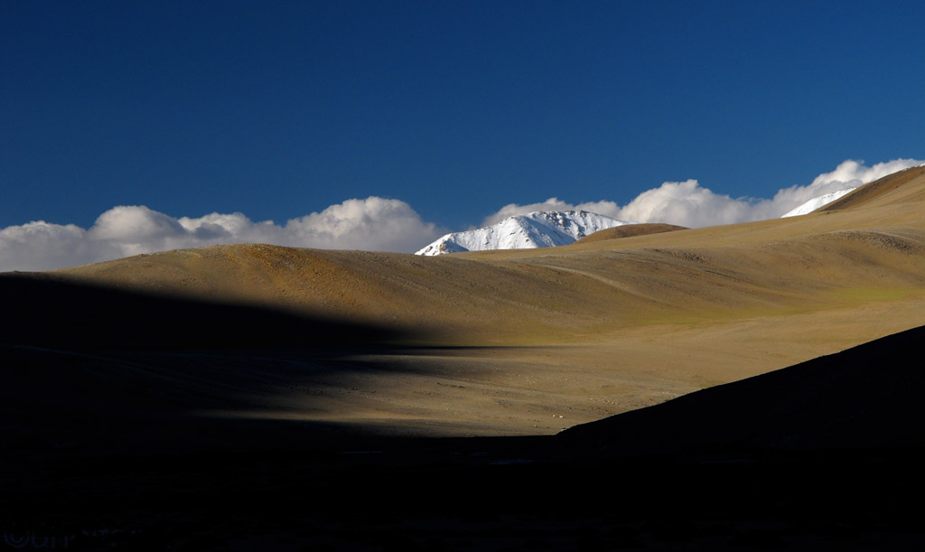
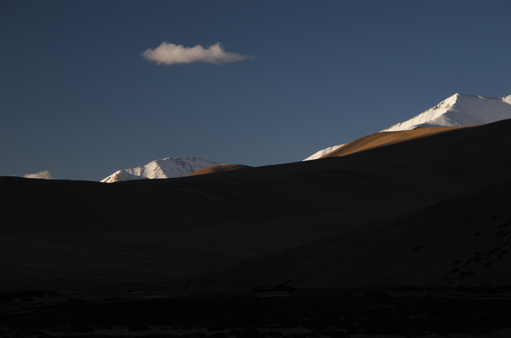
As the night was falling, we knew we had to find a place to settle fast, nevertheless we took time to absorb the beauty of the fading light.
Shadows and light...
Nice sandy patches on the road to torque through with the GS.
Lightplay.
White peak agains blue velvet...
Before the sun slipped behind the snowcapped horizon we had managed to find a place in a dry riverbed, a big rock almost hiding us from the lights of the passing traffic. Luckily there wasn't so many.
In the morning, our thermometer only showed some +4C (+40F) in the tent, meaning that it must have been close to freezing at night. It had been chilly indeed, as our sleeping bags are good down to +8C (+46F). It helped a little to cover the feet with our riding jackets - if your toes are cold, it is difficult even to fall asleep.
The morning light was bright, with no trace of clouds in the sky.
Panorama from the camping spot.
Good morning Ladakh!
We set off, back towards Chang La, in a good mood. The air was fresh and there was nobody around. Well, except for a rabbit and some marmots that we were lucky to spot. The glowing mountaintops created a stunning scenery.
Reflections.

Click to enlarge the panorama.
Once again we stopped in Tangtse to replenish our water supplies, as some local schoolchildren came to check us out. It is nice to see that even in such an isolated place (which is cut off from the rest of the world every now and then as the pass gets covered in snow) children do go to school.
Ladakh children.
Deachan.
Then the road started climbing again, and as we were in no rush, we stopped many times to take photos and take in the scenery.
Himalayan magic.

Click to enlarge the panorama.
Homes of the nomadic herders - the only people we saw in the area.
GS in its native environment.
Chörten on the backdrop of the Himalayas.
Approaching the Chang La this time, we took time ad took it easy. Had a snowball fight, posed with prayer flags and piles of snow, and sipped tea on top of the pass courtesy of Indian Army. Life's good!
Yes, you have to clear that thick snow to expose the road.
A snowball fight with Kariina.
Decent icy roads.

Click to enlarge the panorama.
Military boys on the pass - this one's imported from the South and you can see he doesn't like the cold here
Local soldiers seemed to be more suited to the environment being comfty with the surrounding cold.
Indian soldier checking us out.
Prayer flags at 5 kilometers above sea level.
And a final "family picture" on the Chang La pass.
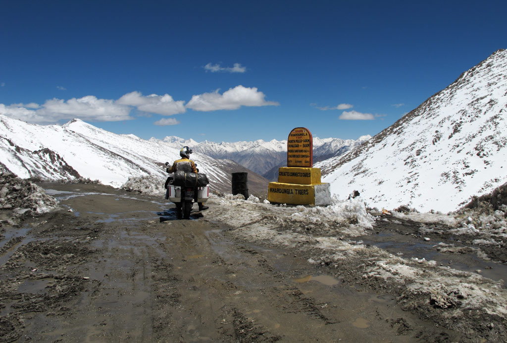
It was time to head for Khardung La, which is, according to Guinness, the highest motorable pass in the world. Our map showed it to be 5606 meters (18 393 ft) high, so we even looked up an Estonian flag and attached it to the pannier. After all, it is pretty likely that our GS is the first bike with Estonian licence plate to make it that high.
Khardung La, just a one-and-a-half hours drive north from Leh, is also pretty near the uncertain border with both China and Pakistan, so it is mainly used by military convoys. The road is smooth tarmac up to the military camp just south of the pass at some 4600 meters. From there on the eroded surface, huge pools of meltwater and invisible ice make it somewhat a challenge, which becomes bigger the higher you get. Luckily we were clever enough to take acetazolamide tablets that help to absorb more oxygen before the ascent, so it was not so painful this time.

Panorama on the way up - click to enlarge.
An alley of icicles.
Click to enlarge the panorama.
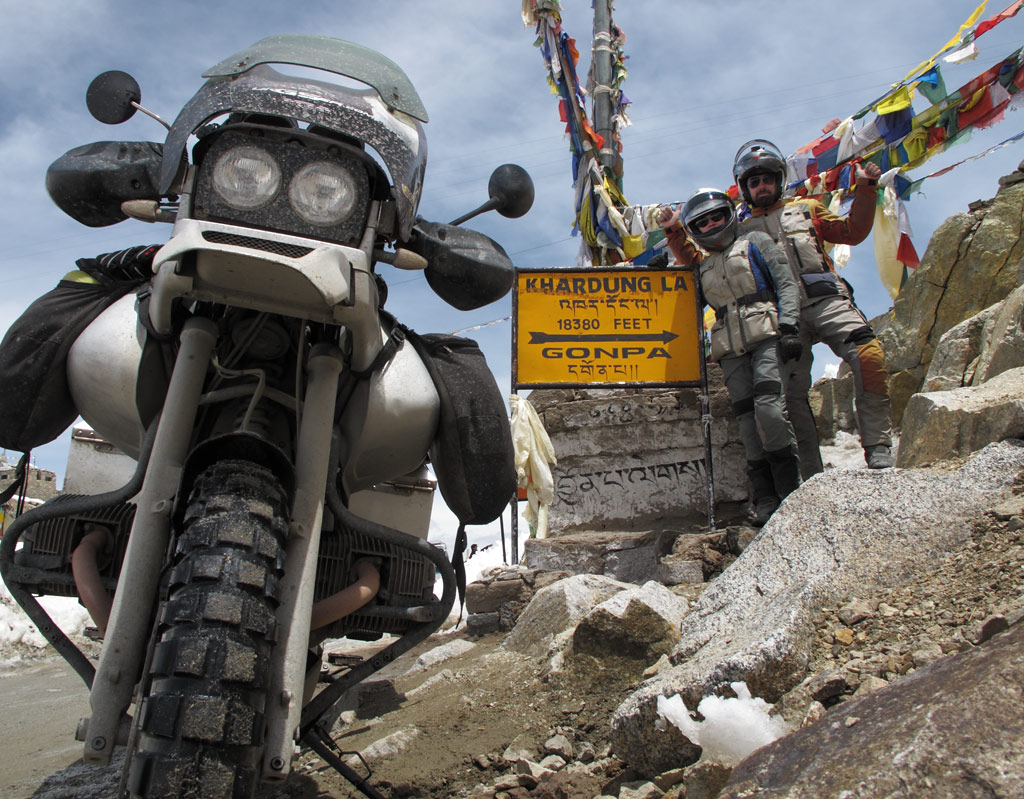
The engine was on its own though, and had some trouble breathing, but we kept going, keeping an eye on our GPS' altimeter. Still 900 meters to go, 800 meters to go, 700 meters to go, 600 meters to go, 500 meters to go, 400 meters to go, 300 meters… what the hell? We're already there??? Prayer flags everywhere, and signs saying "Welcome to Khardung La, 18 380 ft". Our GPS was only showing 5334 meters (17 500 ft)!
Looking at the faked sign I should have snown "ADV-greeting" with the middle fingers on both hands instead of V for victory :lol3
But the views were great and nobody around since we won the race up to Khardung La once the military post opened the road below.
And we took a chance to make another picture, again, should have been "ADV-greet" fingers on this one, but it's a Gompa sign, so we are polite.
Views from Khardung La.
That's THE real roof of the world.
Rumour has it that before the current road across the pass was built, there was an even higher mule track at the same location, and that later the sign stating the altitude had been brought down and installed next to today's pass. So the actual height of the pass is definitely not what our map and many other s say, and it is not the highest motorable pass in the world either. Interestingly, our GPS showed Chang La to be even higher!
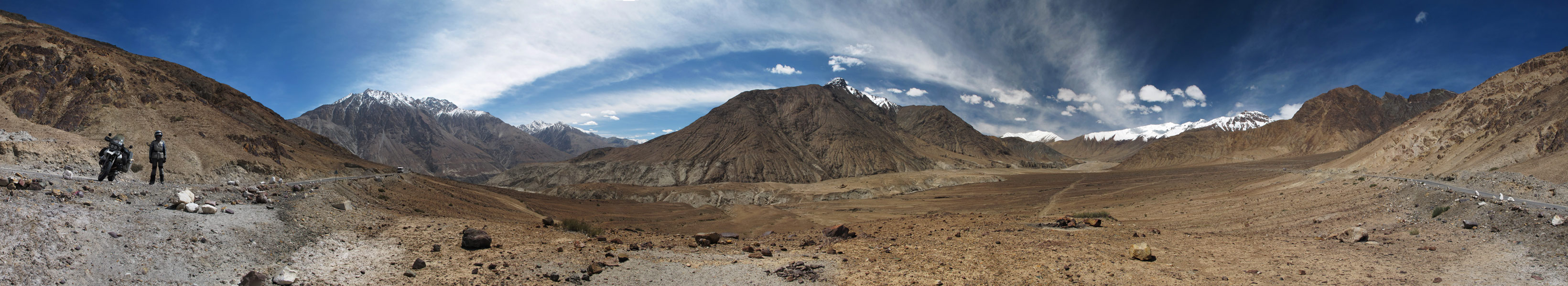
The weater was good, so we decided not to head back to Leh, but to descend to Nubra valley instead. This area is even closer to the disputed border, so obviously one cannot move around so freely (even with a permit).
Panoramas from the road - click to enlarge.
Click to enlarge.
Descending into the valley.
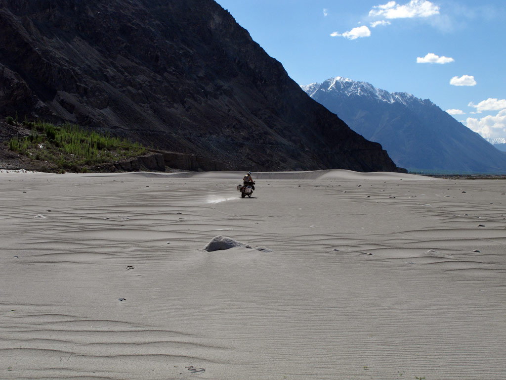
The valley floor was covered in low sand dunes, and it offered wide views both to the Ladakh and Karakoram ranges. I could not resist the urge to have some fun in the lifeless sand.
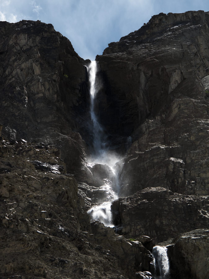
Waterfall.
Sure enough there were verdant Buddhist villages with monks and huge prayer wheels. Weird as it is, just some 100 kilometers further north lies the so-called highest battleground in the world, Siachen glacier. Pakistani and Indian troops fought there since 1984 till 2003 when a cease-fire was called, but even today it remains a sensitive subject. The extreme conditions actually killed more men than the battle itself - at some 6000 meters (19 700 ft) the wind can blow as fast as some 160 kph (100 mph) and temperatures can drop down to -50 C (-58 F). Add to that the avalanches and the altitude itself… Moneywise, it was not a cheap war either, with both sides spending over half a million USD a day!!! They even have a special High Altitude Warfare School here in India.
Of course, regular tourists without a very special permit and a military escort cannot go anywhere near the glacier.
Monks on a moutainside.
A big prayer wheel in Nubra valley.
Panorama from the green part of the valley - there's obviously population as well. Click to enlarge.
The natural beauty isn't as powerful here as in Pangong Tso, but it is still there.
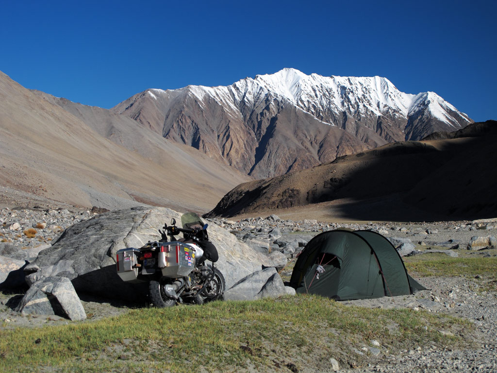
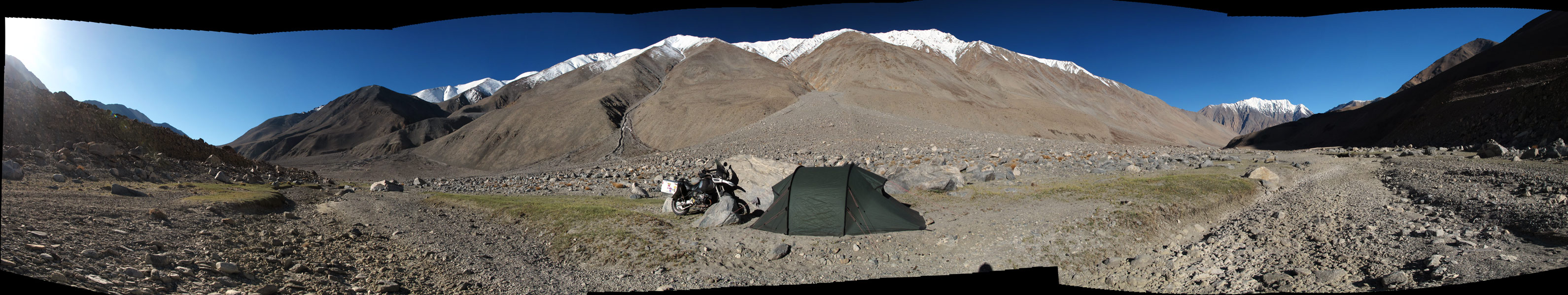
We set up our camp in the shadow of a huge rock in the middle of a whide sandy riverbed of Nubra. We were not exactly hidden looking from the road, but it was pretty far away, so we felt safe. A lone fox passed by as we were pitching the tent, but otherwise it was calm. Maybe it was the rock that emitted the peacefulness…
In search for a camping spot. We didn't know that cliff actually hided a lake in the middle of it.
Sunset panorama - click to enlarge.
In the morning I got up the rock to get a better view of the surrounding area as I stumbled upon a small lake nestled right in the middle of it. The only way to see it is from above. Obviously it was a sacred place to someone, as there was a small sanctuary right on the edge of it. Interesting, how such natural formations become objects of worship - just like Uluru in Australia. In any case, it had an air of a microcosm, with white peaks of surrounding mountains surrounding this rock with a peaceful lake hidden in it. Probably an ideal place for meditation…
Good morning Nubra valley.
Panorama from our camping spot and a "GS territory markings" on the sandfield that leads here.
Inside the rock's own valley that hided a sacred lake and everywhere there were towers made out of smaller rocks. A holy place for Buddhists.
Panorama from the sacred hidden lake in the rock's valley that's inside Nubra valley. A wierd but fascinating combination! - click to enlarge.
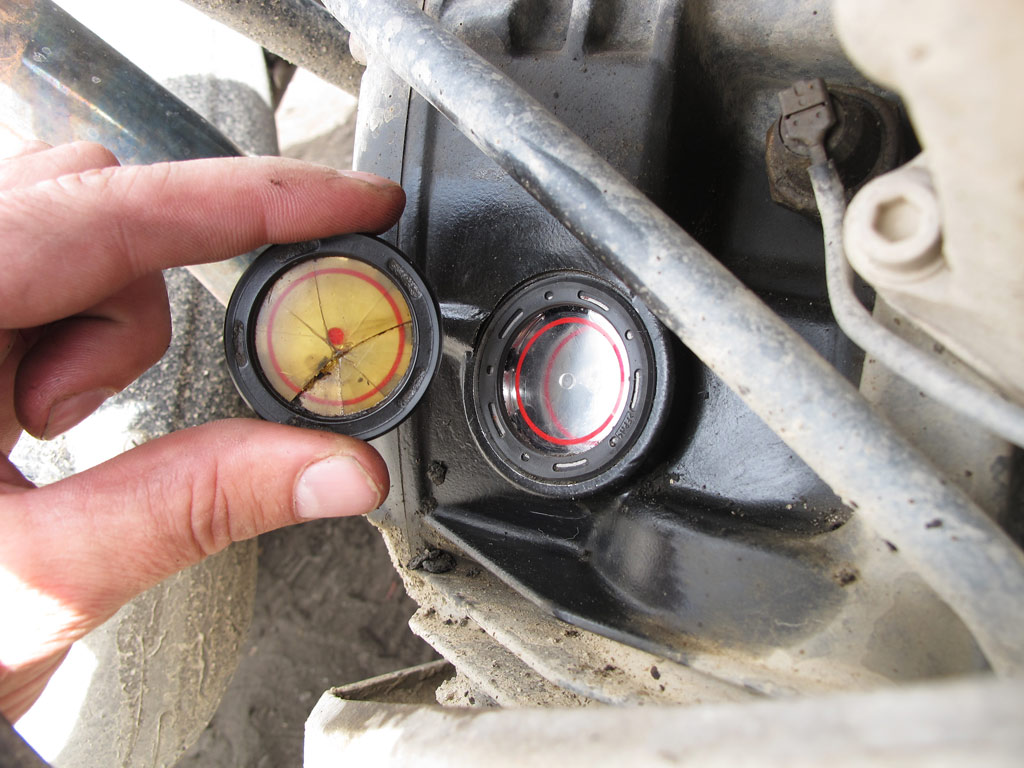
The road to Manali still closed, we decided to have another detour and to go to see one more high-altitude lake, Tso Moriri. Even before we arrived in India, we looked at the map and thought that it might be an interesting ride, part of the road leading to it marked as a rough track. Bearing that in ming, we changed the tyres as the old ones were too old to have much traction on loose surface, and replaced the leaking oil sight glass.
Oil sight glass replacement, with spontaneously collected Indian audience, as always.
Old vs new.
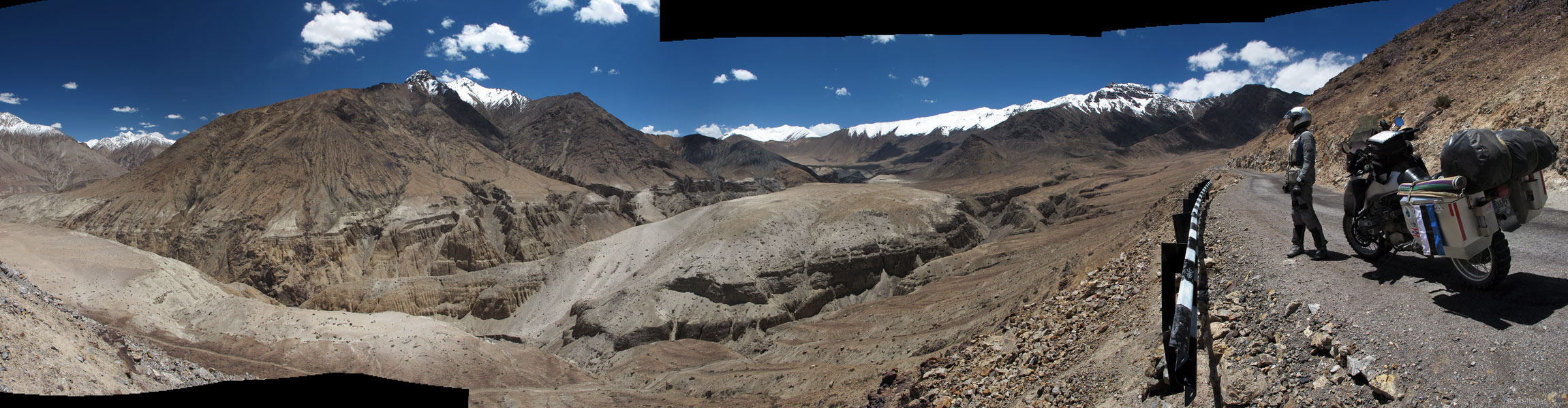
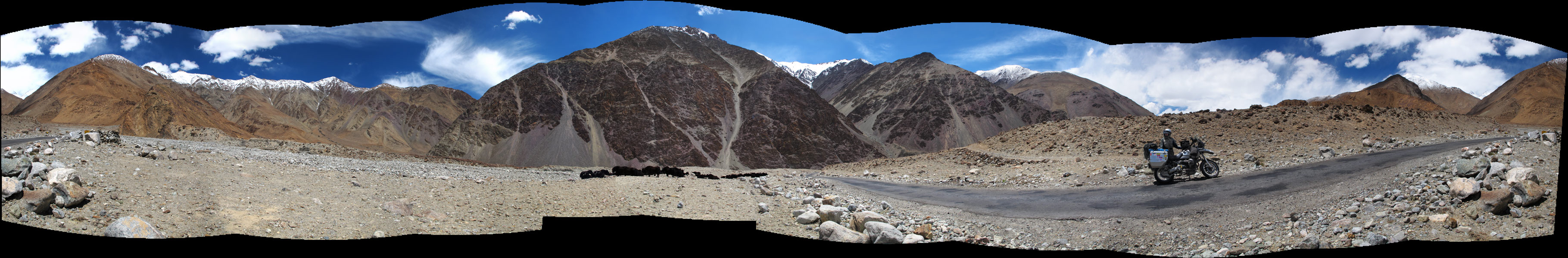
First our road snaked alongside the mighty Indus - although we were moving in one, and the river in the other direction, meaning we were going uphill. The rocky valley first appeared in yellow and brownish colours, which were soon replaced by grey and syrreal purple. Just as if the nature had decided to add some extravagance to its creation. In places, the sand that had accumulated on the hill sides shone like gold dust. In any case, that kind of use of colours and materials couldn't fail to impress.
A Road, a GS and a peak.
Tibetan Buddhist mantras on the rock.
GS in the unique Indus river valley.
Rocky walls in the Indus valley topped by circled sun.

Panorama from the road, click to enlarge.
Purple mountains...
Funky colours indeed!
Yak heard. Yak cheese tastes fantastic, if you didn't know.
Panorama from the mountains, yak heard also on it. Click to enlarge.
Curve vs abyss.
Gold rush?
Here and there the landscape was ruined by huge military bases, but interestingly, the small villages blended perfectly with the surroundings. Interestingly, although the Ladakhi people do not normally like their picture to be taken, here we could find some smiling faces that were happy to pose.
A house in the village.
With friendly locals.
Ladakh man.
Old woman in the village.
Boyz.
A family warming in the sun in front of their house on a chilly day.
A funky Ladakh man.
Woman with a child.
Ladakh girl.
Curious faces...
At one point we parted with Indus and turned onto a smaller road, leading us onto the high plateau. The landscapes had more air and space to them, with more and more snowcapped mountains appearing before our eyes.
What a view!
Click to enlarge the panorama.
We crossed a 4800 meters (15 700 ft) pass at Namshang La before continuing on the plateau. Click to enlarge.
Soon we spotted a lake, but wasn't it too early? Our GPS was showing that it was still some 10 kilometers away… (click to enlarge the panorama)
The closer we got, the more powerful was the sight, with the lake just perfectly reflecting the blue of the clear sky, and mountains behind it covered in mysterious looking frost. As we found out later, it was not Tso Moriri, but a much smaller Kiagar Tso.
Kiagar Tso.
We had come for Tso Moriri, but had discovered another jewel. Kiagar Tso offered a million dollar view indeed, which must have been enhanced by the relatively monotonous and lifeless surroundings of the high plateau.
Kiagar Tso approaching. Click to enlarge the panorama.
Then the pavement ended, and only a rocky track continued along the high plain. It was bumpy and shaky - pretty demanding, but the scenery was just outstanding, otherwordly. We had to stop for photos every couple of minutes or so.
On the mighty 13 000+ ft. plateau. Just about the snowline itself. And it was freezing!
Decent roads.
Click to enlarge the panorama from the plateau.
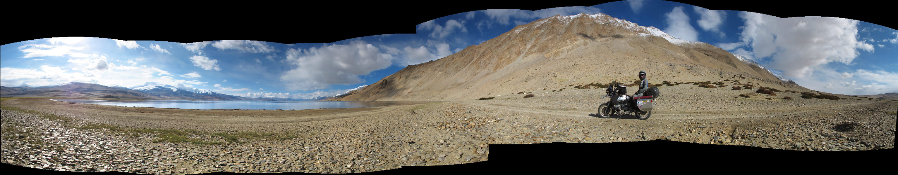
We were coming closer and closer to the lake, but it was clear that the sunset wasn't far away either. He had to choose whether to brave the worsening road conditions and try to reach the only settlement in the area, the village of Korzok right on the shore, or to find a place to camp away from the lake.
Somehow, the second option had more appeal. True, the landscape was desolate, dotted with some low lying bushes that would not offer us a lot of cover from the sight of bypassers, but then again there is something about spending the night under the open sky away from the civilization. It makes you think as if the twinkling of the stars, the whispers of the wind and the cold breath of the snow covered mountains all belonged to you, realising at the same time that you are nothing more than a note in a magnificent symphony, orchestrated by something bigger, something inconceivable. You feel a slight shiver of anxiety, but at the same time you feel secure.
We take a good look around.
Approacing Tso Moriri from the only rocky trail road leading there from the North.

Click to enlarge the loooong panorama (and who still doesn't know, click to enlarge it again in new window (in Internet Explorer I think the full button appears on one of the corners of the image if you go there with the cursor) to see it in 100% size, and then scroll horizontally to get the full experience of the panorama)
There were no perfect options, but we realised that as the sun was setting, the dimming light would soon wrap us in its disguise - so we pitched the tent quite close to the trail road, behind a bush that almost covered us, and hoped that there would not bee too much traffic on that small rocky trail.
Then all was left to do was to stare in awe at the million dollar view as it changed in the light of the setting sun. It was an enticing show, depicting the struggle between shadow and light which was happening in deafening silence.
Light plays with darkness.

Till darkness started to win...
Mountaintop in dusk.
We were at the altitude of some 4600 meters (15 000 ft), so at night the temperature fell below freezing. But the stars… I do not remember ever seeing so many of them in the night sky! It was a true poetry of vibrating light dots above us...
Under the Milkyway...
When we woke up in the morning, with temperatures still below freezing, clouds were blanketing the sky, but the show that the sun still managed to put up was remarkable. We had breakfast, packed our stuff, and headed towards Tso Moriri.
A morning fight between warm rising sun versus freezing snow clouds above a high peak.
Breakfast time, weather finally started to clear.

Our wild camping spot panorama (click to enlarge).
That is how this high altitude lake looks like (click to enlarge)
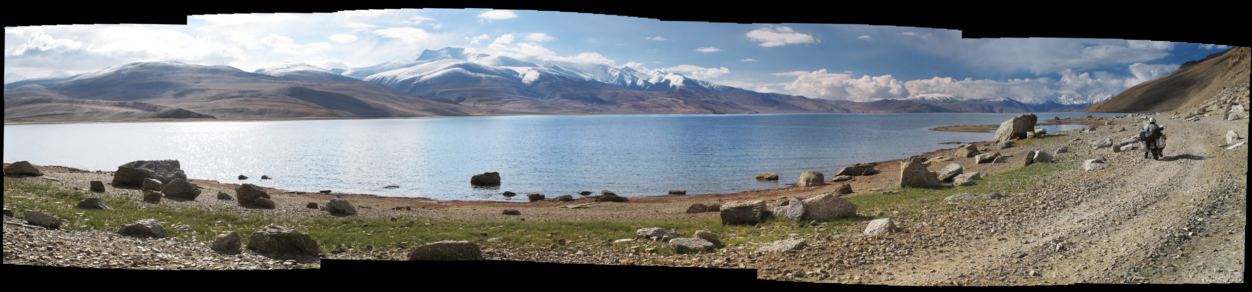
Panorama from close range (click to enlarge).
Ice still remains on the shores of Tso Moriri from the winter.
Tso Moriri.
Despite the freezing temperatures, flora was flourishing.
Natural wonders over Tso Moriri.
We stopped at the village of Korzok, to replenish our water supply and to find out that it is a rather depressive place. Nevertheless it has an old monastery.
Main street of the Korzok village.
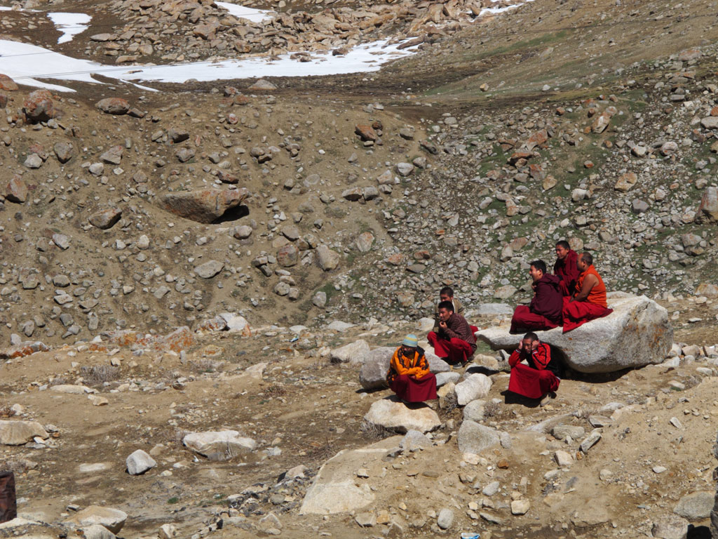
Young monk at the monastery.
Curious little fellow.
"Are you from another planet?"
After that we started riding back, stopping by a makeshift village of nomadic herders. They came to check us out as we were surprised by the way they live, and by how little is actually needed. The kids' toys were made out of wire and empty tins, but they nevertheless looked cheerful - I do not think the kids who have ten Barbies or a state-of-the-art remote controlled model cars are happier. It made us think once again that it is not the things that matter, but something else - the warm welcome of a stranger, and the responsible attitude towards the environment, for example. The ecological footprint of those people is much smaller than ours, but we still crave those Prada shoes, speedliving cell phone, fancy car, ultra portable something…
Nomadic herder's mobile "village" with a couple of tents.
A nomad man with a lot of UV-exposure on those altitudes.
A nomad child.
They had to feel what's it like...
Nomadic men checking the GS out hands-on style.
Children and their home-made toys.
It even had steering with the wire!
Everything can be converted into ingenious toys for them - a leftover shampoo bottles or match boxes.
We rolled on, thinking of the things we had seen. It is not us who own it all, we are a part of it. And if we know how to value what we have been given, those million dollars could belong to everyone of us.
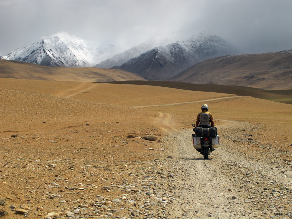
Nomadic herders on the hillside.
Found a green valley within a desert of dryness...
And if there's green to eat, water to drink, there was a lot of marmots.

Panorama from the green valley (click to enlarge)
Our only road back into civilization, still far away and shadowed by dramatic weather ahead...
Final part of India coming soon...


