
<- coming from Iceland (part III)
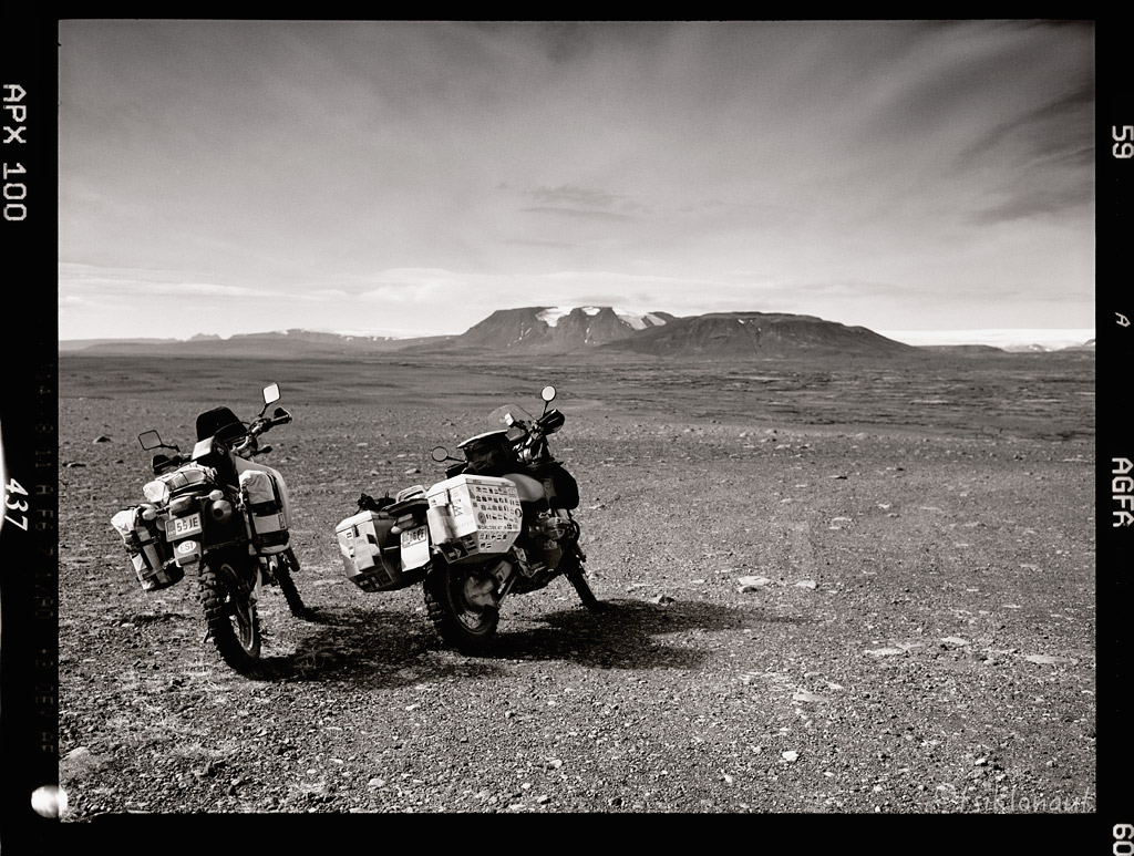
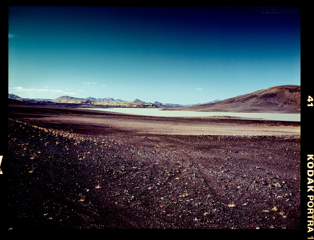
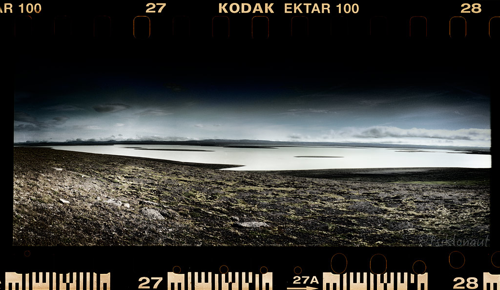
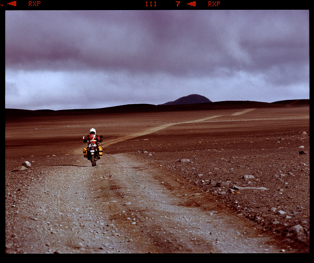
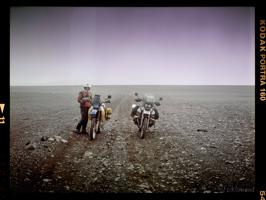
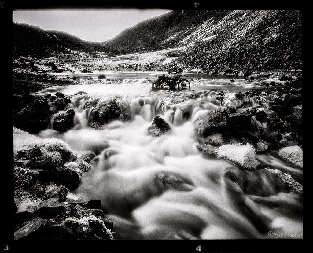
The F35 track continued over surreal Mars-like landscapes:
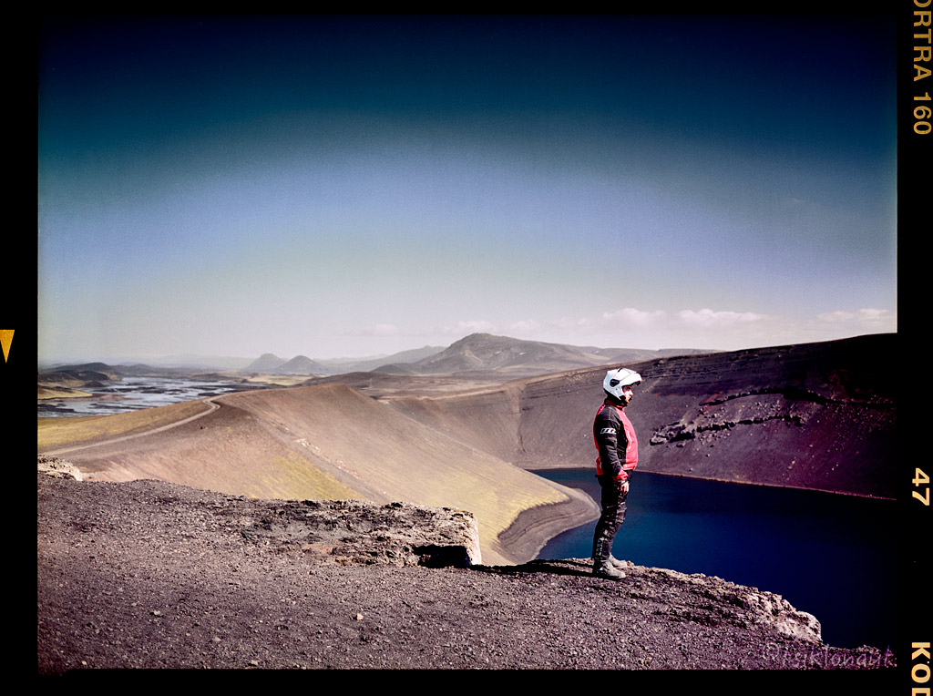
Then we came close to Landmannalaugar, which is a place in the Fjallabak Nature Reserve in the highlands of Iceland. It is at the edge of Laugahraun lava field, which was formed in an eruption around year 1477. It is known for its natural geothermal hot springs and surrounding landscape, and is extremely popular with hordes of tourists.
Ljótipollur.
Frostastaðavatn.
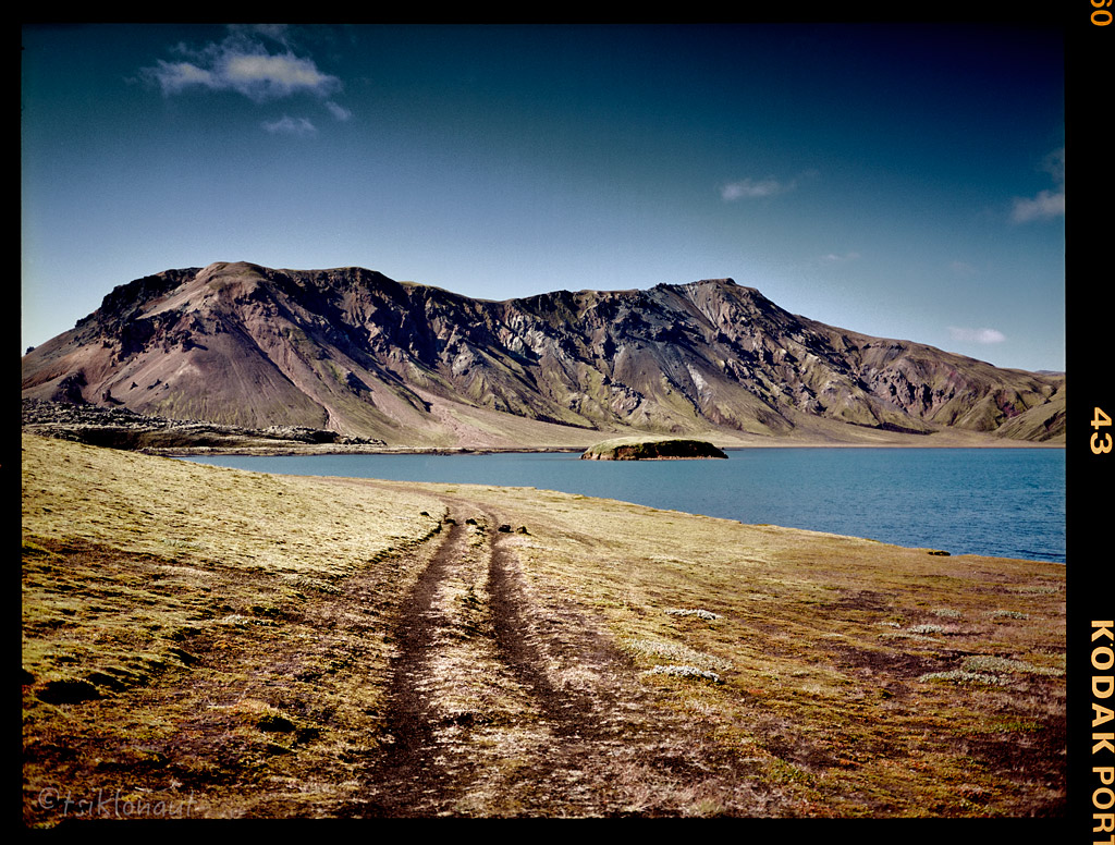
Landmannalaugar.
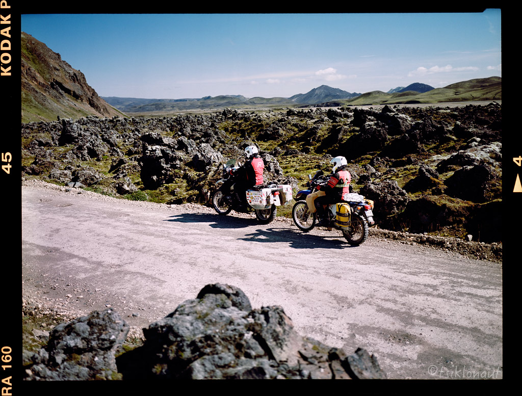
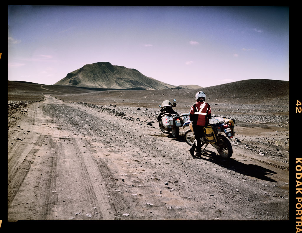
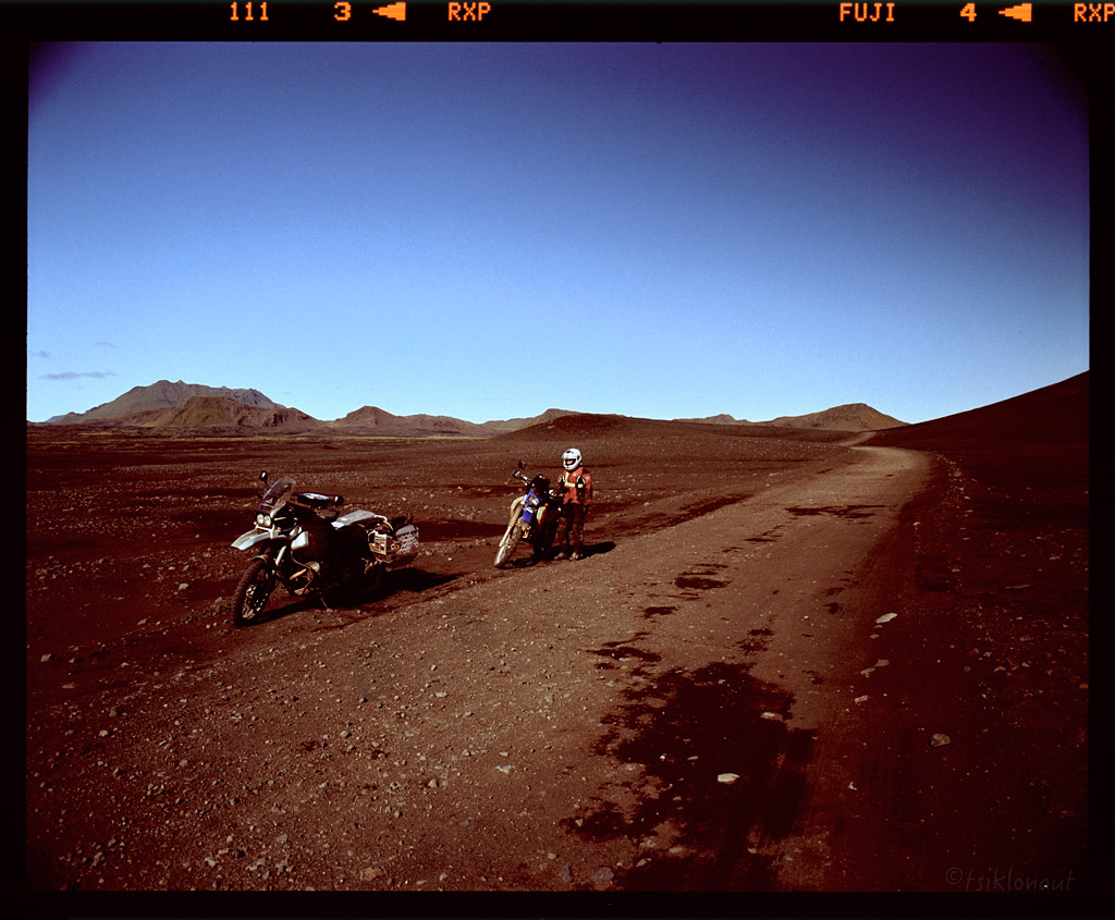
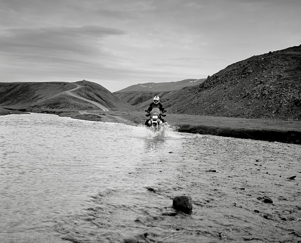
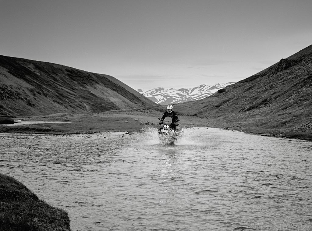
From there it was a good chance to try out the famous F26 piste. F26 or Sprengisandsleið piste is a highland gravel road in Iceland, running through the Sprengisandur area between the glaciers Hofsjökull and Vatnajökull. There were loads of river crossings.
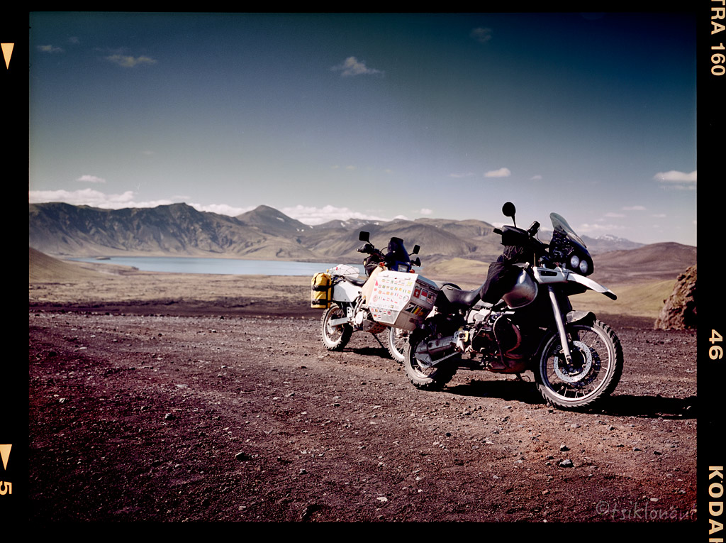
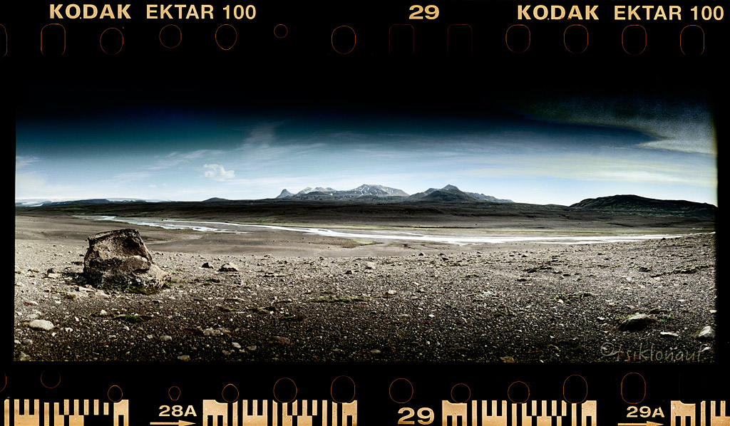
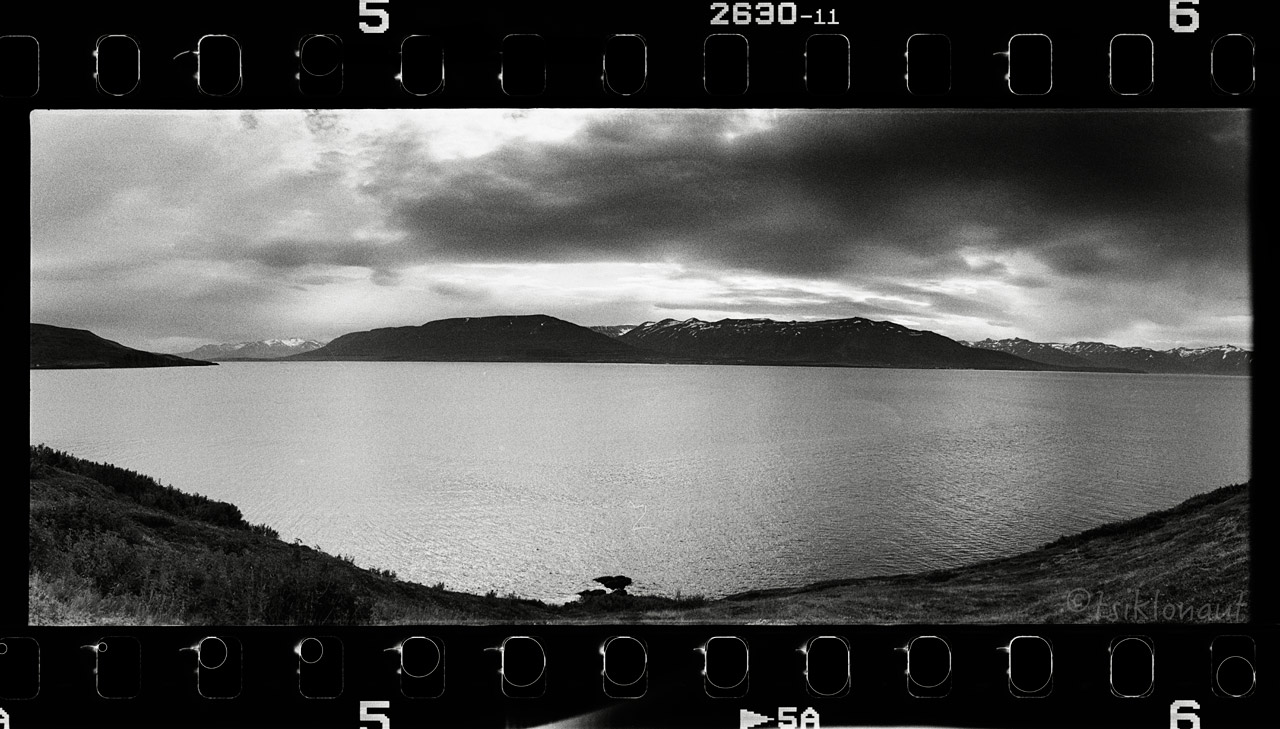
We first passed the 109 meters deep Þórisvatn lake, which is the largest lake in Iceland:
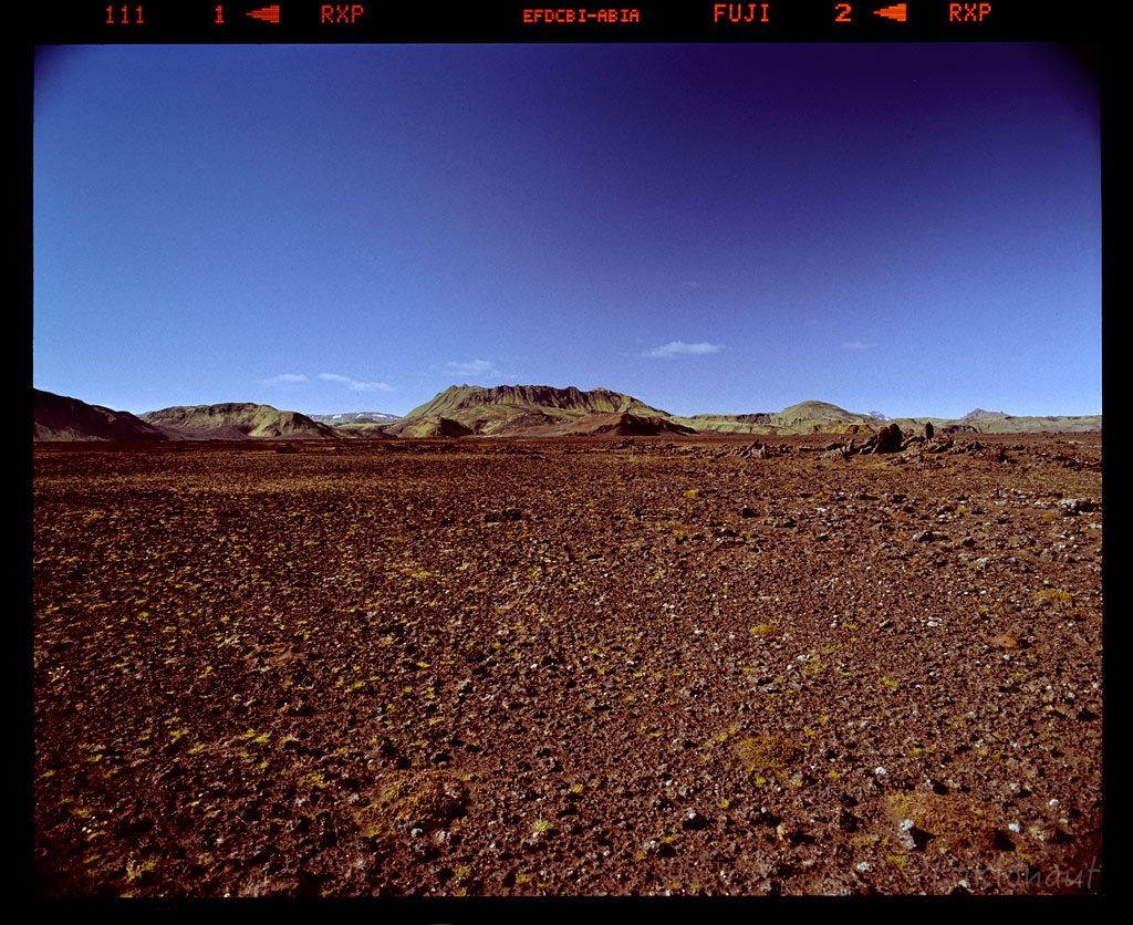
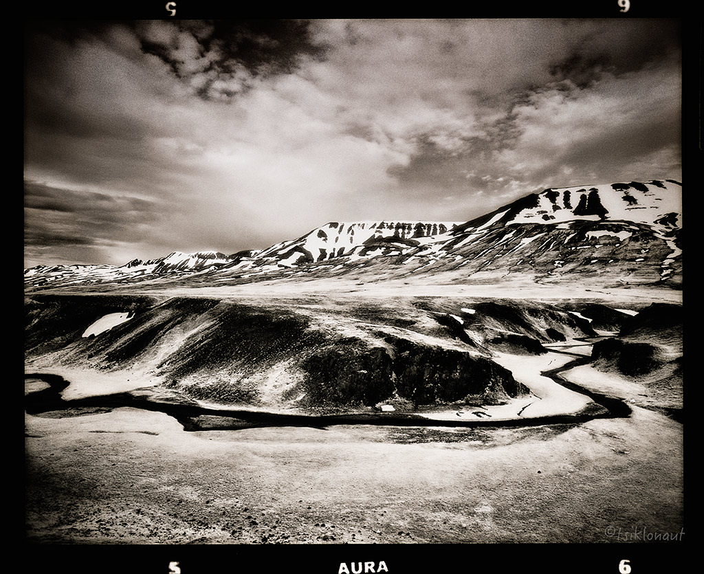
An unusual Moon-like landscape of the central highlands:
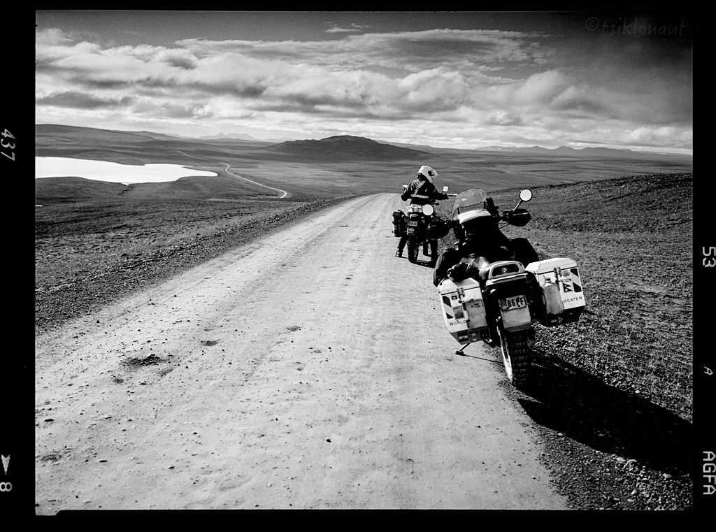
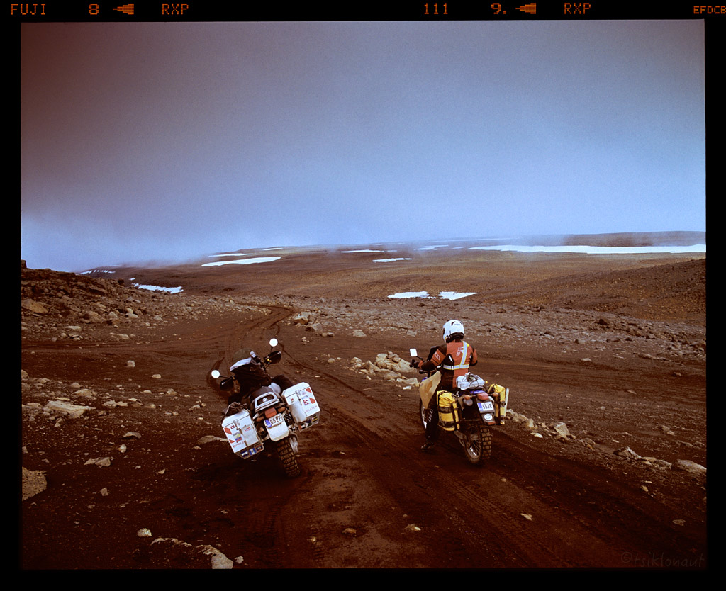
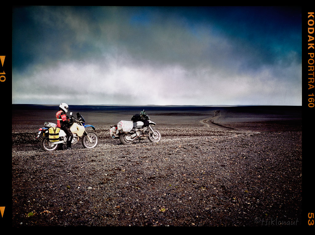
The road conditions were truly appalling – large loose rocks, and of course the wind that kept pushing us from one edge of the road to another. In a way we wondered what the hype was all about – in general, there isn’t really much to see except for the barren ground. But I guess it is the glorious sense of solitude and being one-on-one with the force of nature that makes up for the hardships.
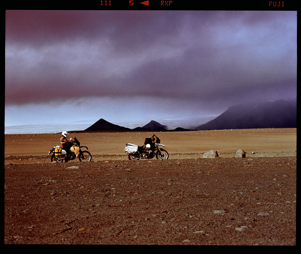
Just before the sun set, and after having crossed three rivers that day, we arrived in Nyidalur camp just half way through the piste at the altitude of 800 meters. The wind showed no sign of subsiding, and the temperatures were nearing zero. Boy, the night was freezing!

The morning wasn’t easy. First we had hard time getting out of our sleeping bags, but we had to get moving fast – before the first rays of light would start melting the glaciers again, making the water levels rise. We had the biggest river crossing on F26 yet ahead, and we wanted to be there as early as possible.
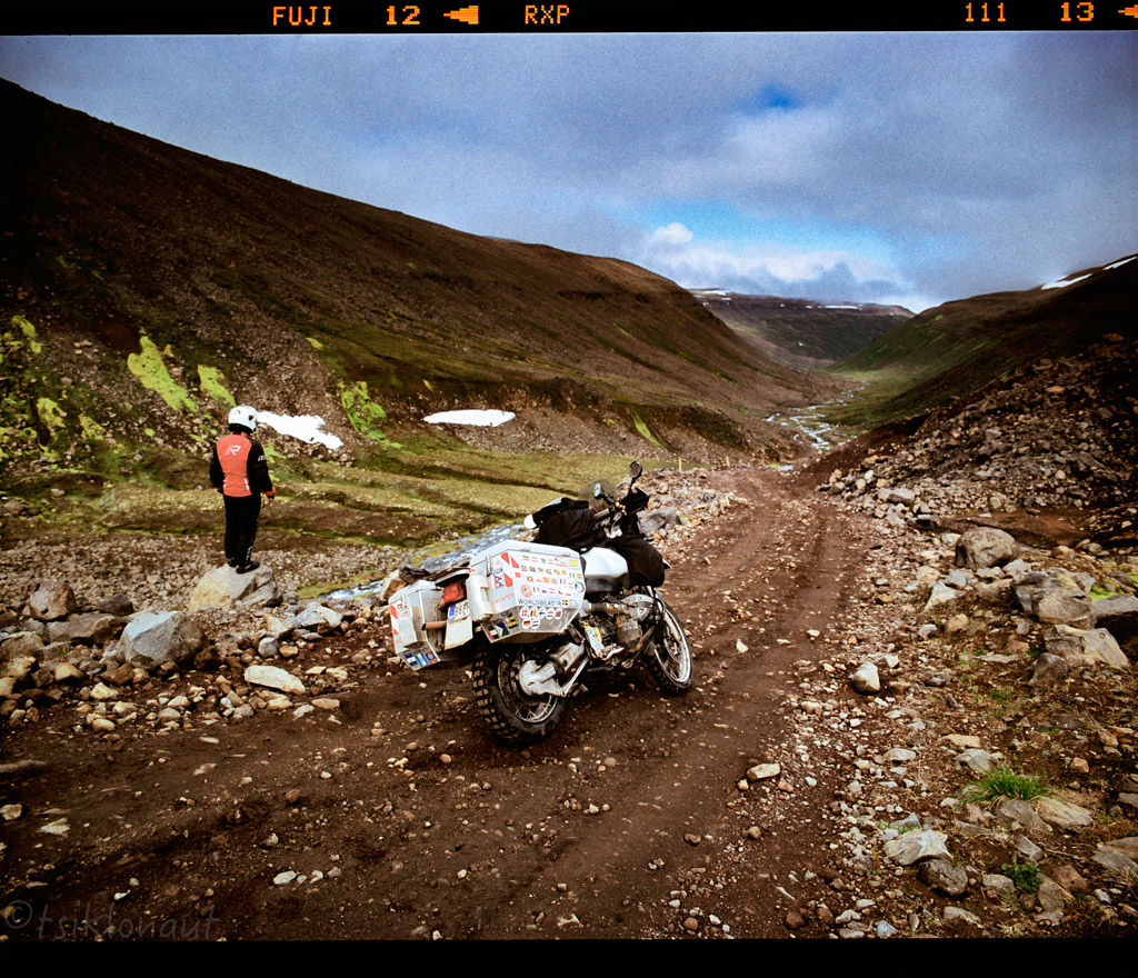
After we’d crossed the river, the road ascended to a vast, rocky plateau. It was raining slightly, but as the sun shyly peeked through the clouds, the mist turned into silver haze.
We rode on, then turned to the rocky F821 Eyjafjarðardeild piste:
But as the piste started descending and we left the cloud that we’d been riding in behind, we were ultimately delighted to see the magnificent Eyjafjörður valley opening in front of our eyes:
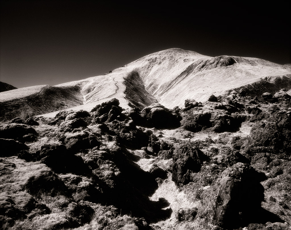
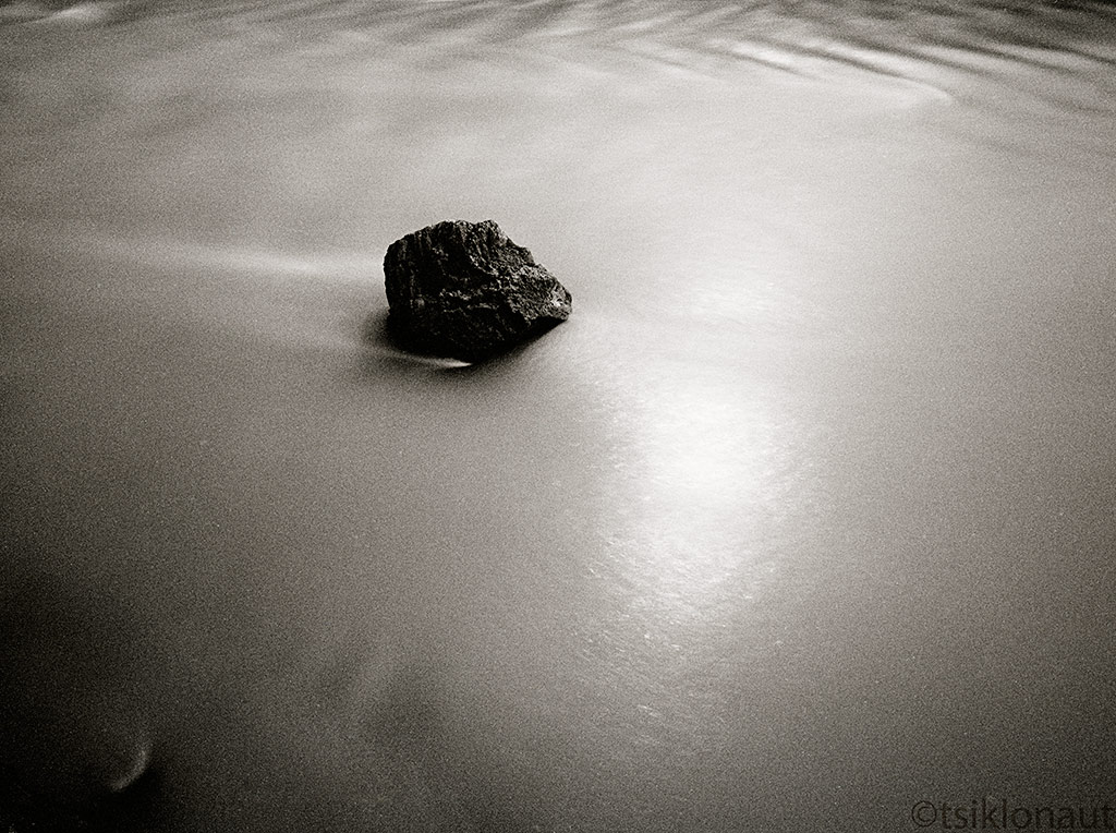
Further down the valley I stopped in one of the river crossings. It was a good chance to wash off the volcanic dirt from my trusty iron horse by crossing Iceland from one side to another through the center and meld this moment with the magical setting of the surroundings. Captured this on an infrared b&w film.
Symbiosis by tsiklonaut
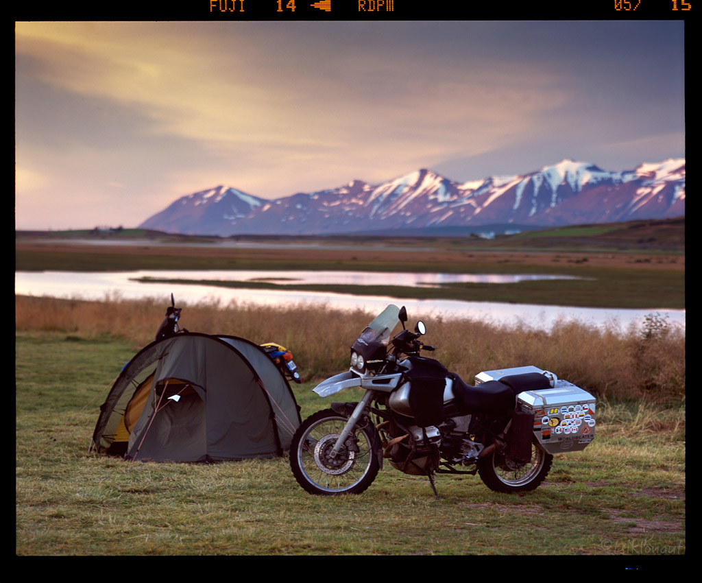
Kariina's front tyre was so worn that we needed to get a new one. We had to settle with what Iceland’s second largest town Akureyri had to offer. Good thing it was supposed to be the nicest weather town in whole Iceland - a good prospect as we had grown quite tired of that miserable rain and cold in the central highlands.
The bike shop that we came across could only find Michelin Anakee 2, which was a pity, but with no choice it had to do. Kariina was then limited to hard offroad pistes. We still had to wait till the tyre was delivered from Reykjavik the next day, so we headed out of Akureyri and towards Siglufjörður peninsula, where we camped out near Dalvik:
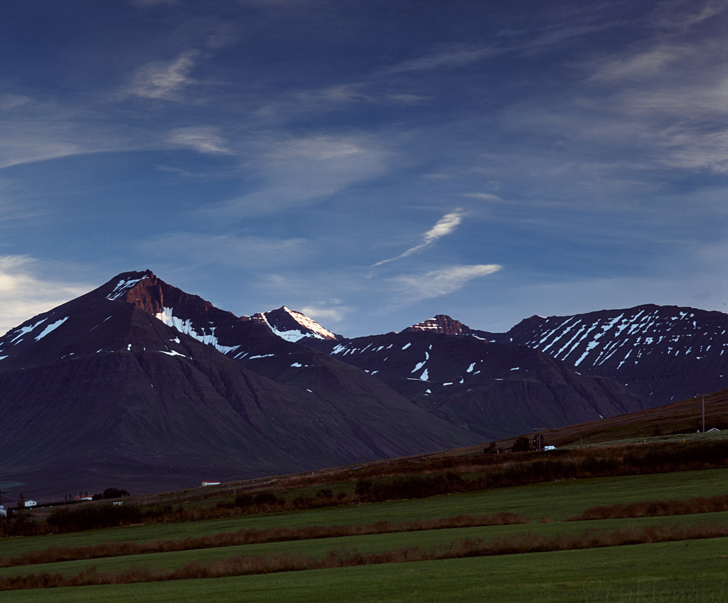
Siglufjörður fjord itself was nice:
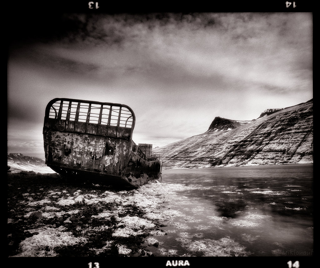
Wrecked by tsiklonaut
Once we got back to Akureyri and mounted the new tyre, we decided to check out the Flateyjarskagi peninsula. It was an excellent challenge blessed with an equally worthy scenery.
Flateyjardalur is a deserted valley in northern Iceland, on the Flateyjarskagi peninsula. The valley stretches north from the Fnjóskadalur valley all the way north to Skjálfandi bay. Flateyjardalur is named after the island of Flatey, which lies just off the shore. Finnboga saga ramma, one of the Icelandic sagas, takes place in the valley. The last inhabitants left the valley in 1953. The same year a road was built from Fnjóskadalur to Flateyjardalur, connecting the valley to other parts of the region. There are three concrete houses in the valley, built in the late 1920s, which today are only inhabited seasonally, during summer.
Flateyjardalur by tsiklonaut
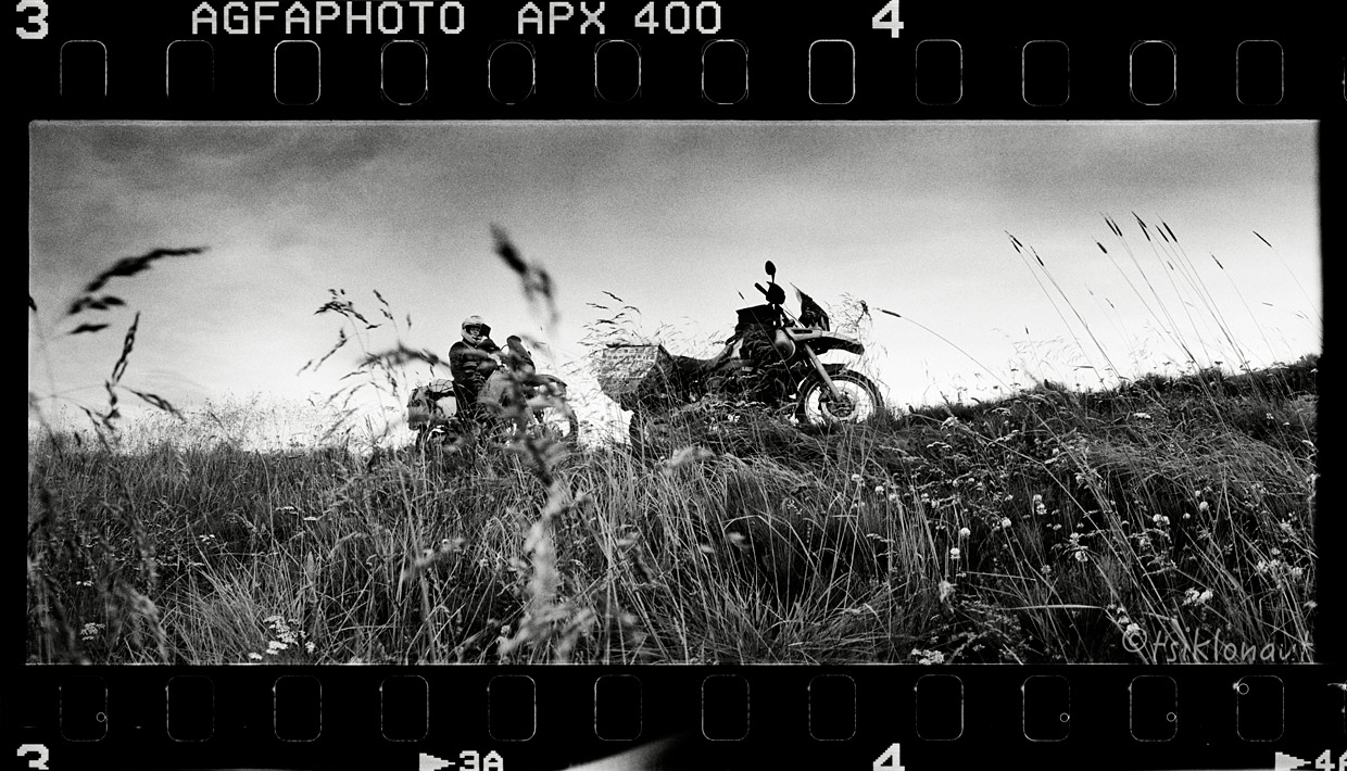
Most river crossing were decent and easy:
But then we were suddenly stopped by a large river. With the water depth over the balls almost to the tits there was no other way but to turn back.
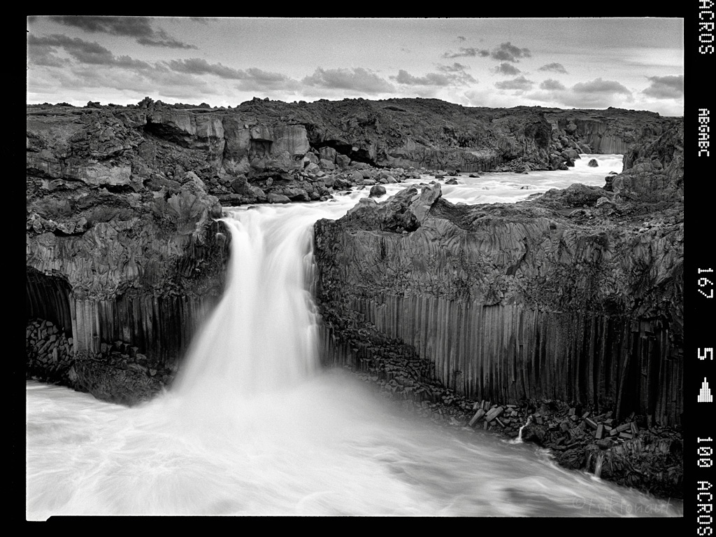
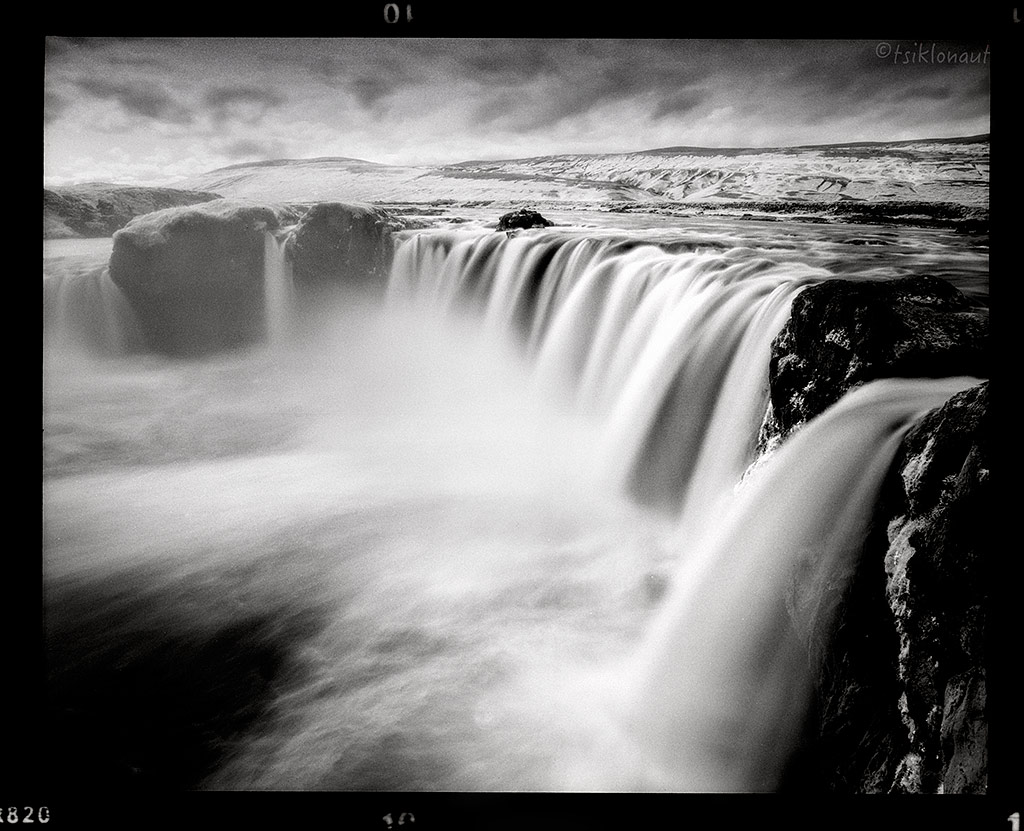
Back on the main road, we took the F26 to Aldeyjarfoss, The waterfall is situated in the northern part of the Sprengisandur Highland Road. One of the most interesting features of the waterfall is the contrast between the black basalt columns and the white waters of the fall. The river Skjálfandafljót drops here from a height of 20 m. The basalt belongs to a lava field called Frambruni or Suðurárhraun, hraun being the Icelandic designation for lava.
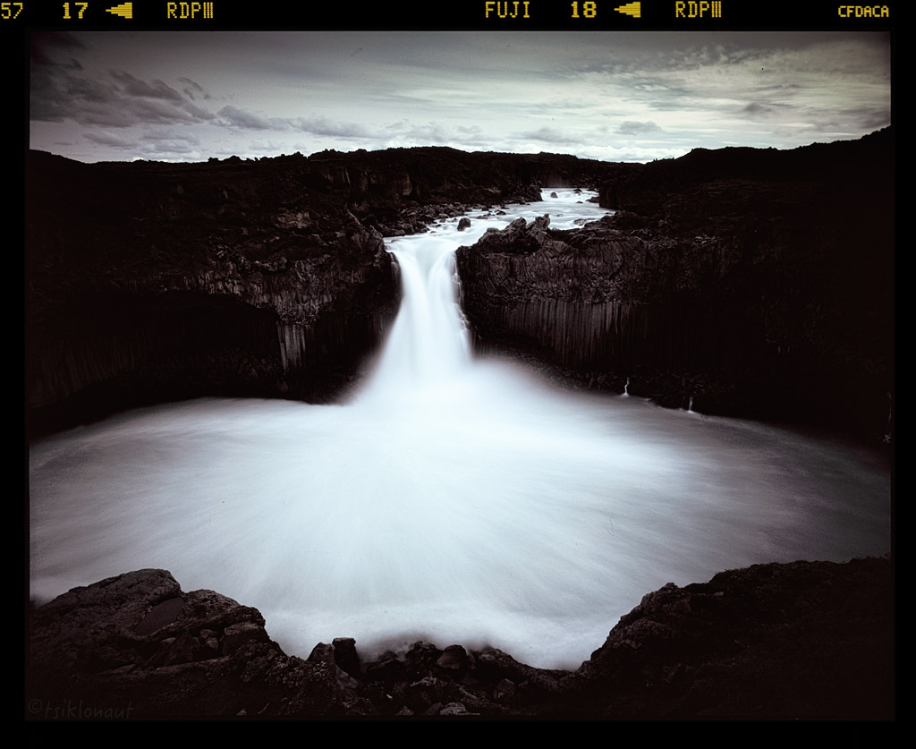
Oval by tsiklonaut
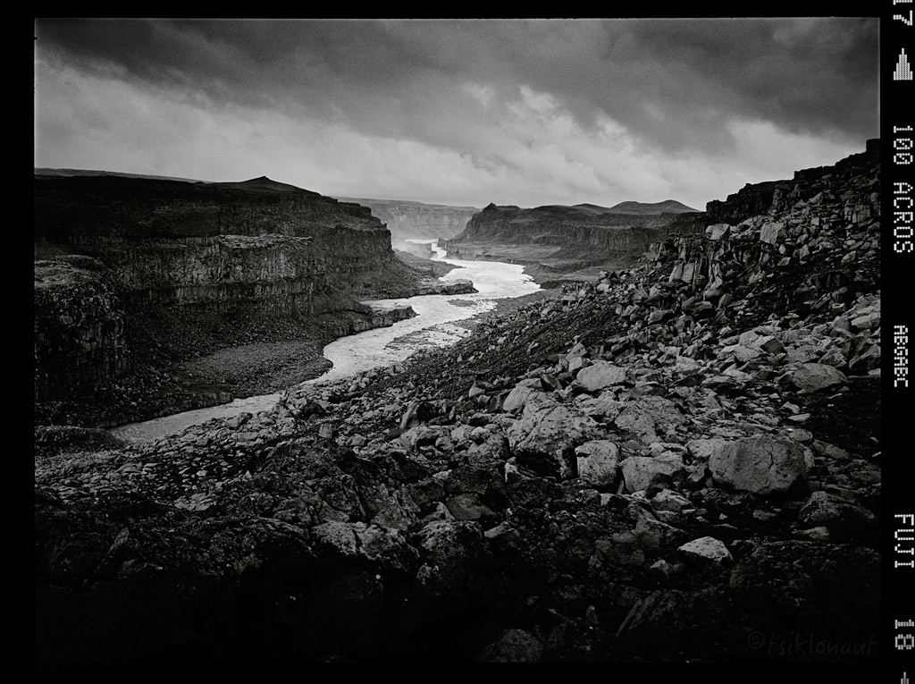
Skjálfandafljót valley itself is an eroded marvel:
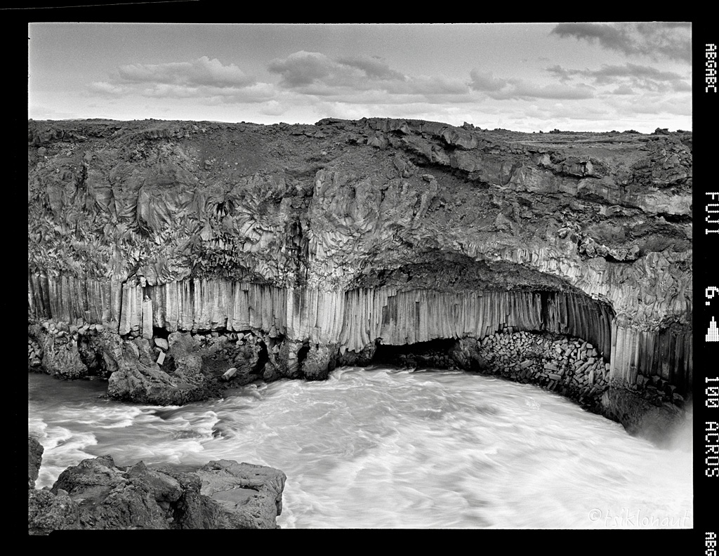
Very interesting is the volcanic pillar layer, this forms only under very special conditions:
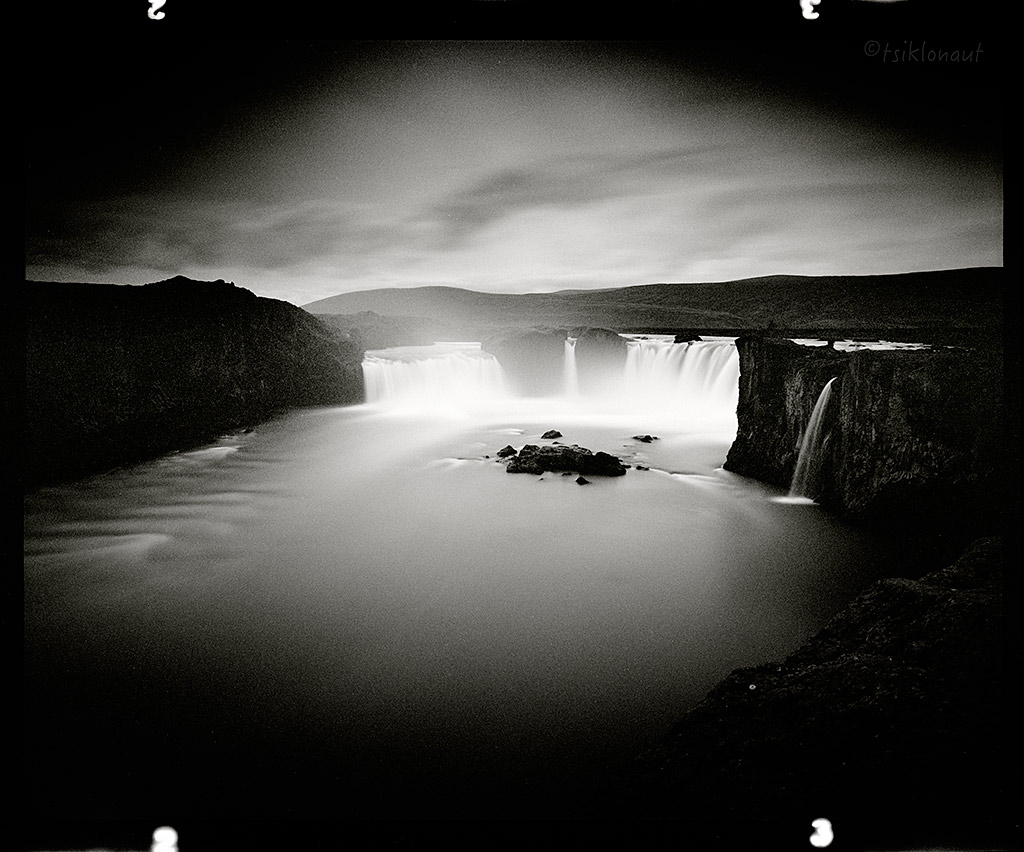
Nearby, we paid a visit to Goðafoss (Icelandic: waterfall of the gods or waterfall of the goði), one of the most spectacular waterfalls in Iceland. The water of the river Skjálfandafljót falls from a height of 12 meters over a width of 30 meters. Spot the people up there to scale things up.
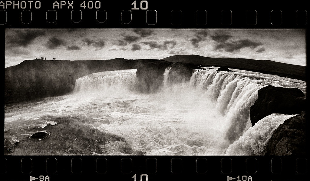
The Fall by tsiklonaut
Goð by tsiklonaut
Nods to the Gods by tsiklonaut
-> go to Iceland (part V)
The F35 track continued over surreal Mars-like landscapes:
Then we came close to Landmannalaugar, which is a place in the Fjallabak Nature Reserve in the highlands of Iceland. It is at the edge of Laugahraun lava field, which was formed in an eruption around year 1477. It is known for its natural geothermal hot springs and surrounding landscape, and is extremely popular with hordes of tourists.
Ljótipollur.
Frostastaðavatn.
Landmannalaugar.
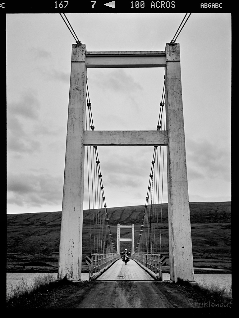
From there it was a good chance to try out the famous F26 piste. F26 or Sprengisandsleið piste is a highland gravel road in Iceland, running through the Sprengisandur area between the glaciers Hofsjökull and Vatnajökull. There were loads of river crossings.
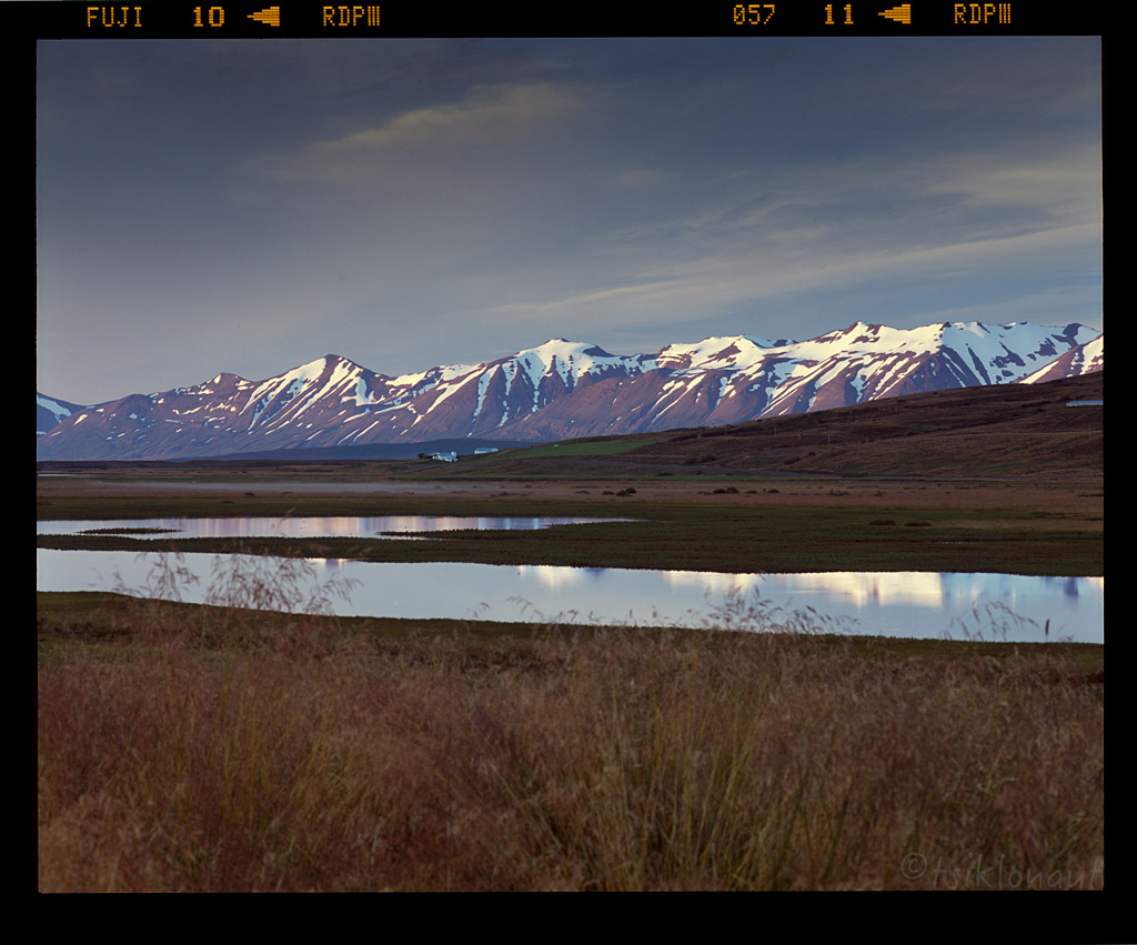
We first passed the 109 meters deep Þórisvatn lake, which is the largest lake in Iceland:
An unusual Moon-like landscape of the central highlands:
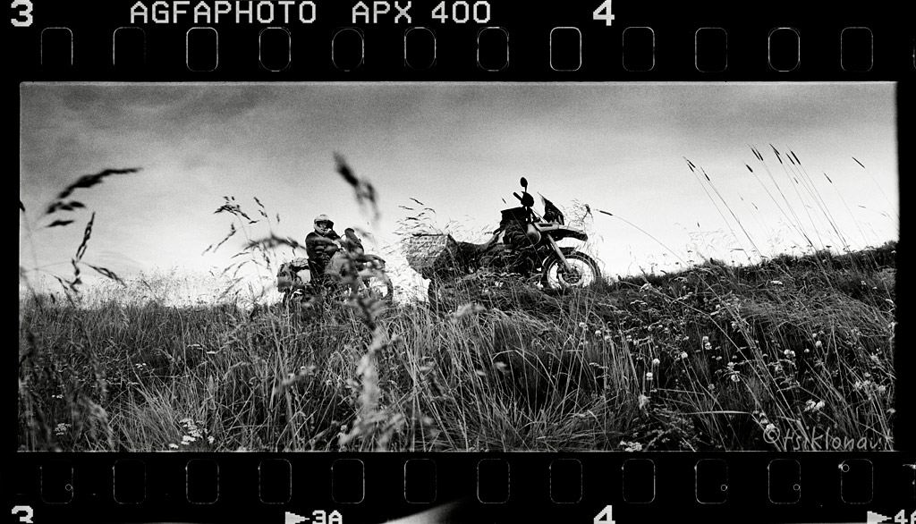
The road conditions were truly appalling – large loose rocks, and of course the wind that kept pushing us from one edge of the road to another. In a way we wondered what the hype was all about – in general, there isn’t really much to see except for the barren ground. But I guess it is the glorious sense of solitude and being one-on-one with the force of nature that makes up for the hardships.
Just before the sun set, and after having crossed three rivers that day, we arrived in Nyidalur camp just half way through the piste at the altitude of 800 meters. The wind showed no sign of subsiding, and the temperatures were nearing zero. Boy, the night was freezing!
The morning wasn’t easy. First we had hard time getting out of our sleeping bags, but we had to get moving fast – before the first rays of light would start melting the glaciers again, making the water levels rise. We had the biggest river crossing on F26 yet ahead, and we wanted to be there as early as possible.
After we’d crossed the river, the road ascended to a vast, rocky plateau. It was raining slightly, but as the sun shyly peeked through the clouds, the mist turned into silver haze.
We rode on, then turned to the rocky F821 Eyjafjarðardeild piste:
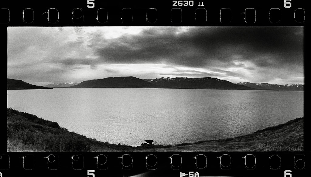
But as the piste started descending and we left the cloud that we’d been riding in behind, we were ultimately delighted to see the magnificent Eyjafjörður valley opening in front of our eyes:
Further down the valley I stopped in one of the river crossings. It was a good chance to wash off the volcanic dirt from my trusty iron horse by crossing Iceland from one side to another through the center and meld this moment with the magical setting of the surroundings. Captured this on an infrared b&w film.
Symbiosis by tsiklonaut
Kariina's front tyre was so worn that we needed to get a new one. We had to settle with what Iceland’s second largest town Akureyri had to offer. Good thing it was supposed to be the nicest weather town in whole Iceland - a good prospect as we had grown quite tired of that miserable rain and cold in the central highlands.
The bike shop that we came across could only find Michelin Anakee 2, which was a pity, but with no choice it had to do. Kariina was then limited to hard offroad pistes. We still had to wait till the tyre was delivered from Reykjavik the next day, so we headed out of Akureyri and towards Siglufjörður peninsula, where we camped out near Dalvik:
Siglufjörður fjord itself was nice:
Wrecked by tsiklonaut
Once we got back to Akureyri and mounted the new tyre, we decided to check out the Flateyjarskagi peninsula. It was an excellent challenge blessed with an equally worthy scenery.
Flateyjardalur is a deserted valley in northern Iceland, on the Flateyjarskagi peninsula. The valley stretches north from the Fnjóskadalur valley all the way north to Skjálfandi bay. Flateyjardalur is named after the island of Flatey, which lies just off the shore. Finnboga saga ramma, one of the Icelandic sagas, takes place in the valley. The last inhabitants left the valley in 1953. The same year a road was built from Fnjóskadalur to Flateyjardalur, connecting the valley to other parts of the region. There are three concrete houses in the valley, built in the late 1920s, which today are only inhabited seasonally, during summer.
Flateyjardalur by tsiklonaut
Most river crossing were decent and easy:
But then we were suddenly stopped by a large river. With the water depth over the balls almost to the tits there was no other way but to turn back.
Back on the main road, we took the F26 to Aldeyjarfoss, The waterfall is situated in the northern part of the Sprengisandur Highland Road. One of the most interesting features of the waterfall is the contrast between the black basalt columns and the white waters of the fall. The river Skjálfandafljót drops here from a height of 20 m. The basalt belongs to a lava field called Frambruni or Suðurárhraun, hraun being the Icelandic designation for lava.
Oval by tsiklonaut
Skjálfandafljót valley itself is an eroded marvel:
Very interesting is the volcanic pillar layer, this forms only under very special conditions:
Nearby, we paid a visit to Goðafoss (Icelandic: waterfall of the gods or waterfall of the goði), one of the most spectacular waterfalls in Iceland. The water of the river Skjálfandafljót falls from a height of 12 meters over a width of 30 meters. Spot the people up there to scale things up.
The Fall by tsiklonaut
Goð by tsiklonaut
Nods to the Gods by tsiklonaut
-> go to Iceland (part V)
")


