
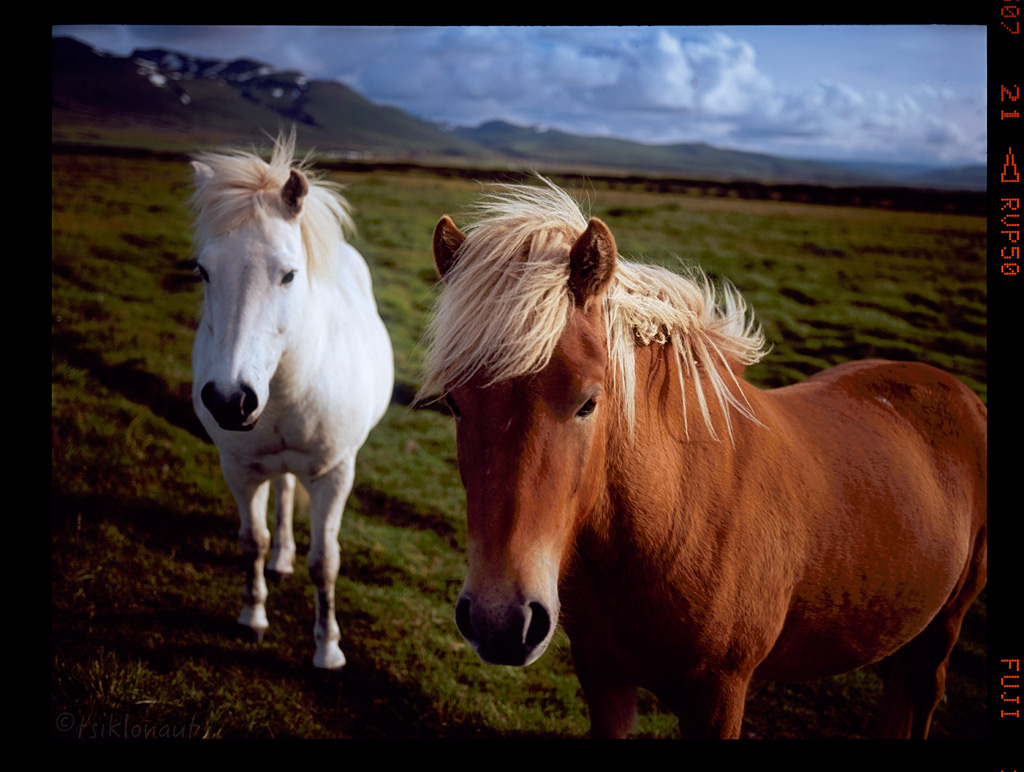
<- coming from Iceland (part IV)
Who said there are no mosquitos on Iceland? There's loads of 'em around lake Myvatn. We had to GTFO as fast as we could there and head to Námaskarð for the rotten egg smelling sulphur smoke shelter and succumb into those outwordly volcanic landscapes:
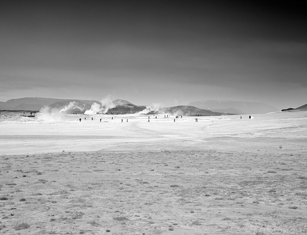
Shades of Námaskarð by tsiklonaut
All the landscape and atmosphere does make it seem like a scene from post-apocalyptic event...
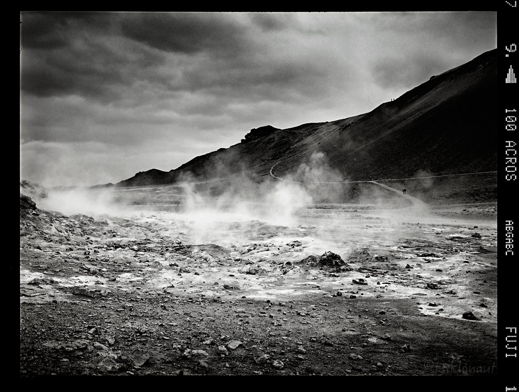
Transition Ground by tsiklonaut
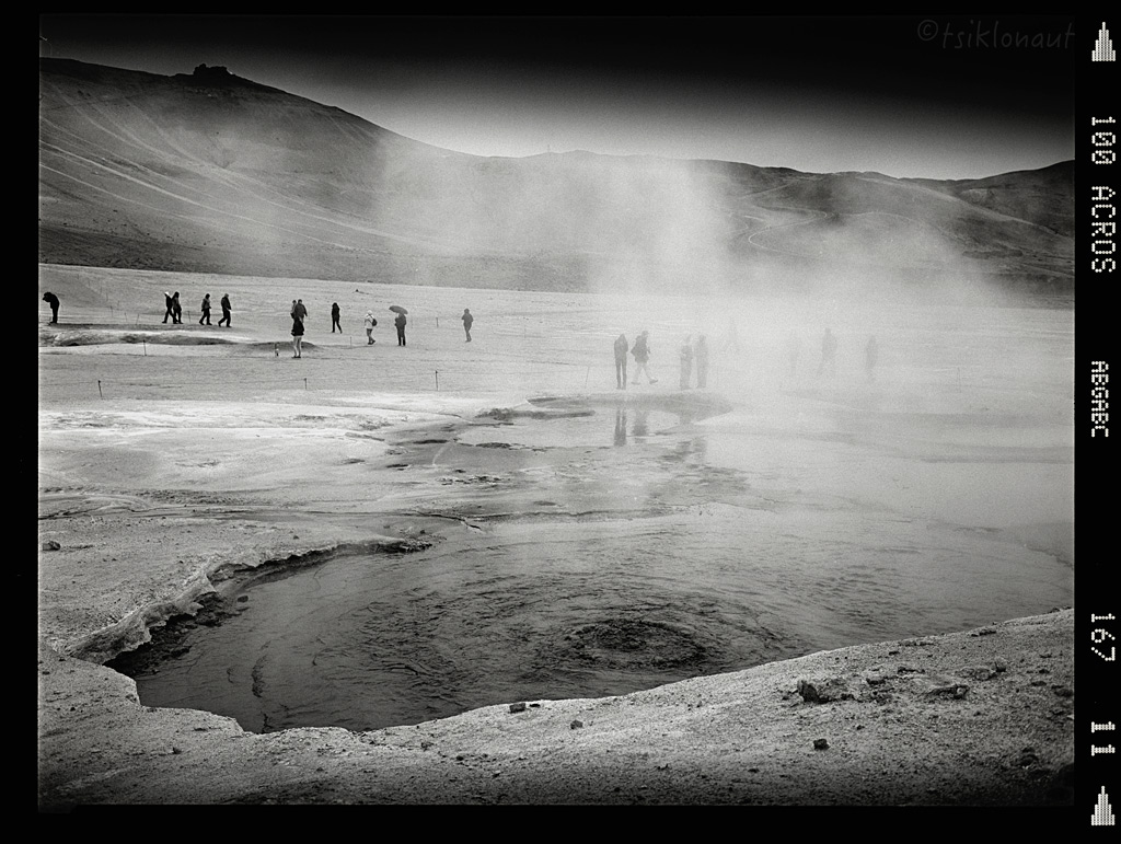
Boiling grounds.
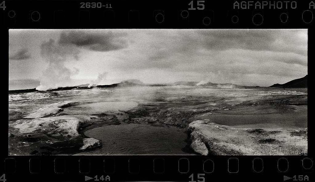
Sulphuric Atmosphere by tsiklonaut
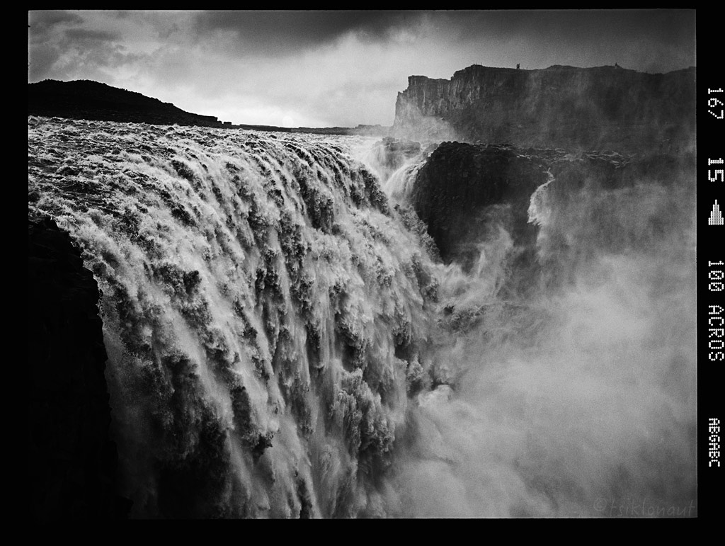
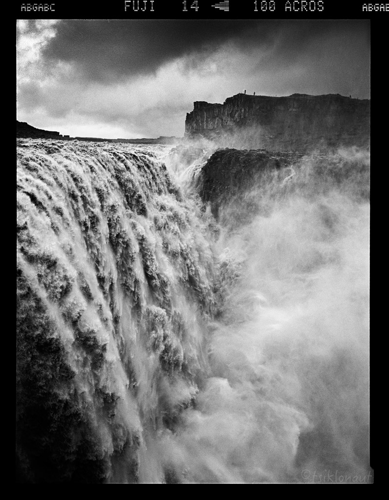
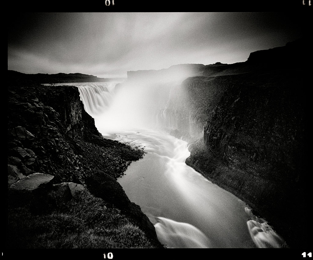
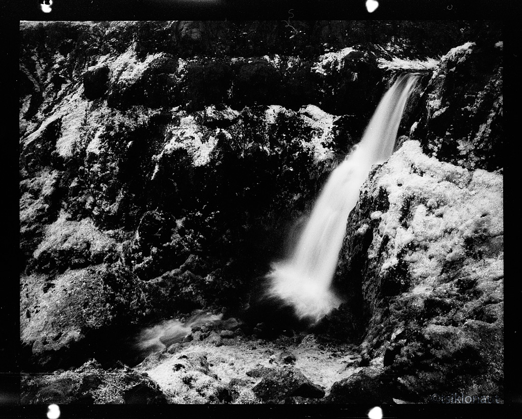
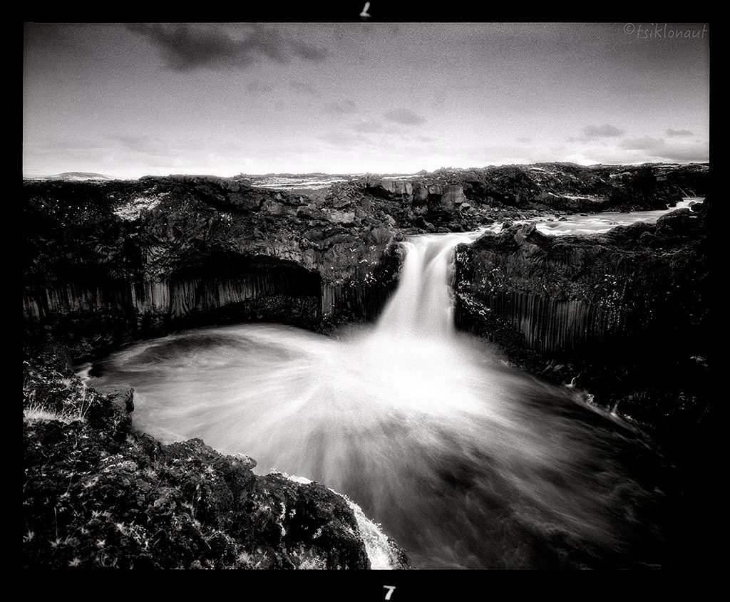
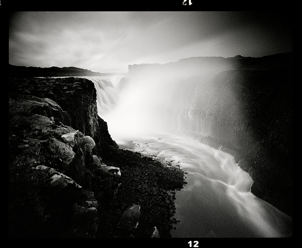
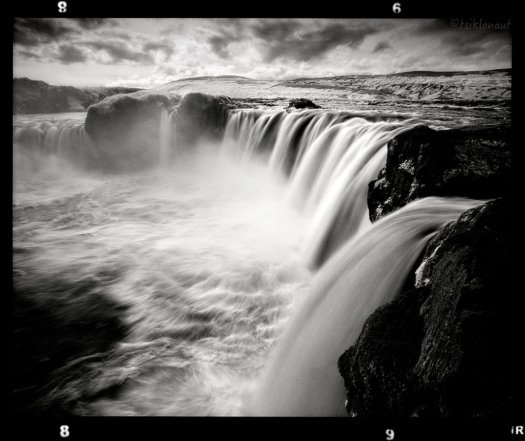
It was then too close to the most powerful waterfall in Europe, the Dettifoss. The falls are 100 metres (330 ft) wide and have a drop of 45 metres (150 ft) down to the Jökulsárgljúfur canyon.
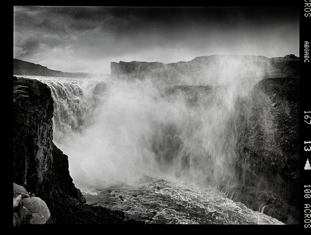
Fall to Rise by tsiklonaut
Gravity-assisted art.
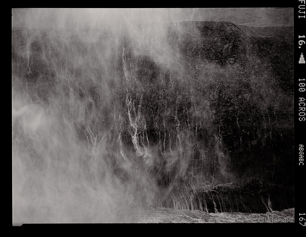
It is the largest waterfall in Iceland in terms of volume discharge, having an average water flow of 193 m3/s. It was an unreal experience, just staggering power you feel through your body standing aside it.
Turn by tsiklonaut
Sheer power...
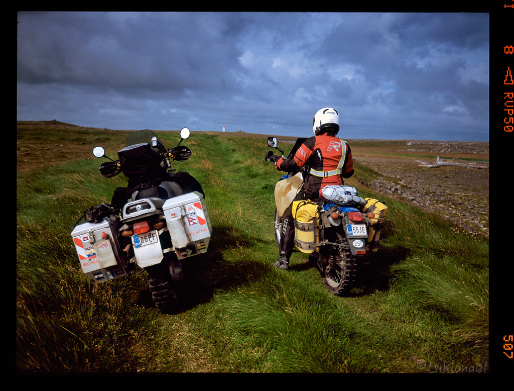
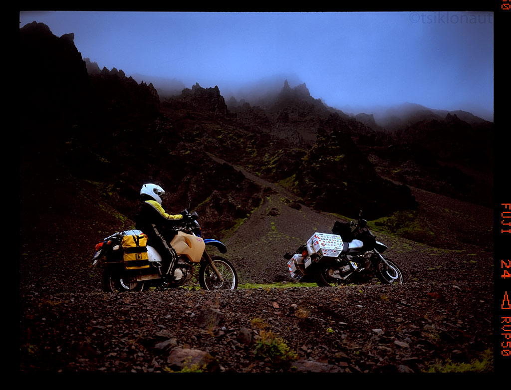
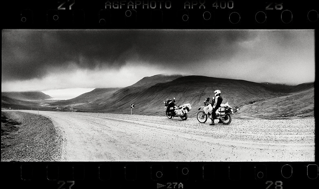
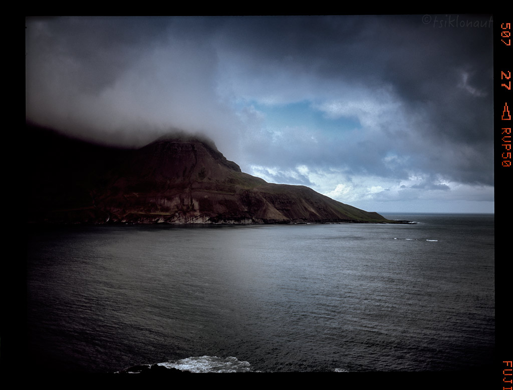
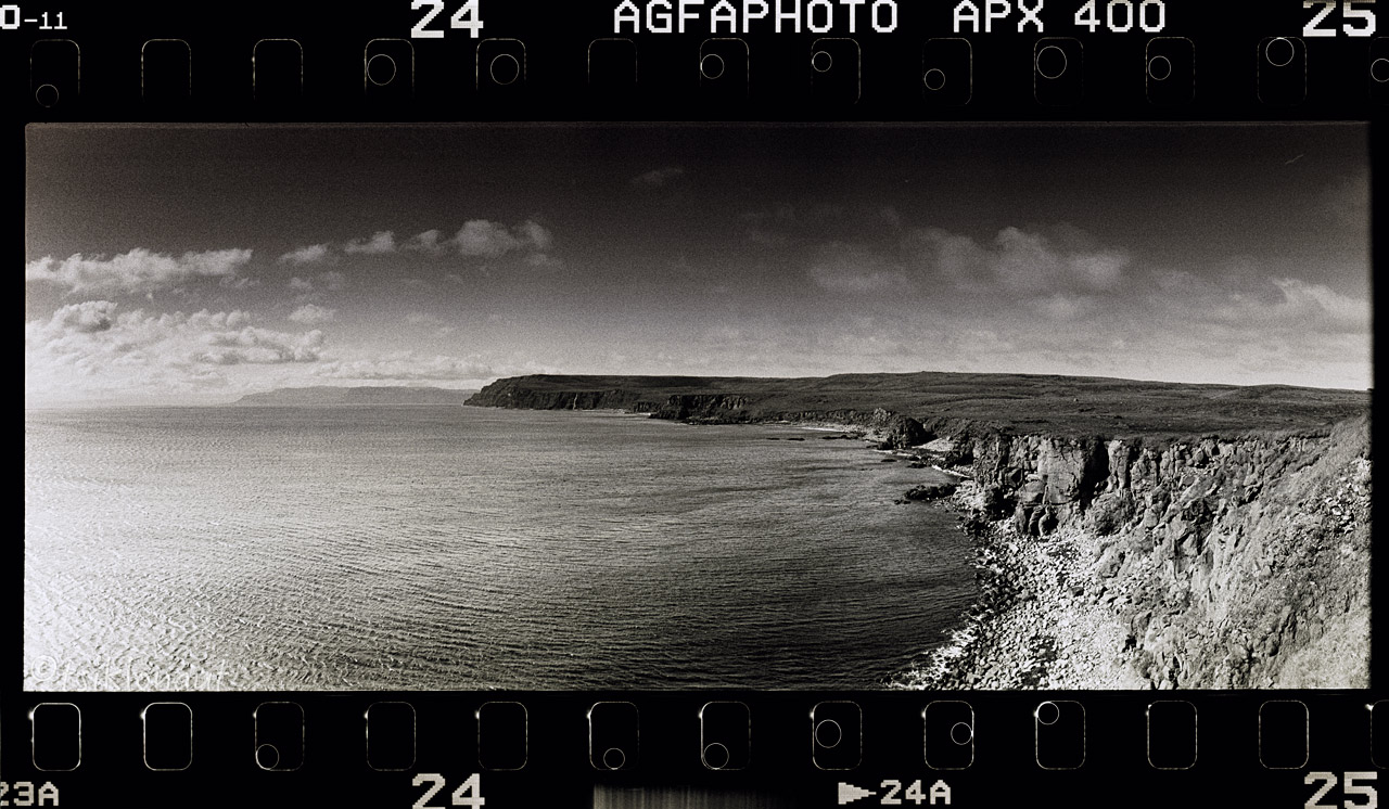
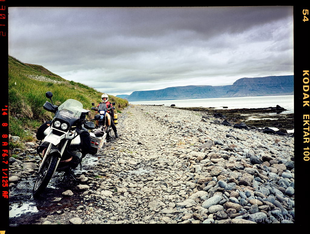
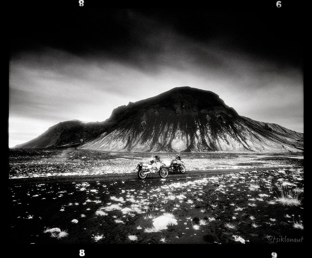
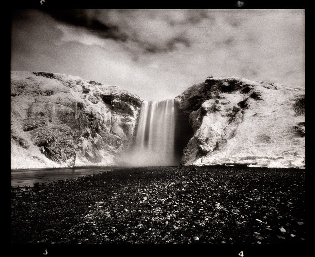
A little flashback to Westfjords, we tried to reach the highest fjord on the way to Skalavik, our luck ran out with the weather.
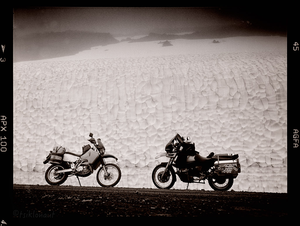
Below a massive glacier.
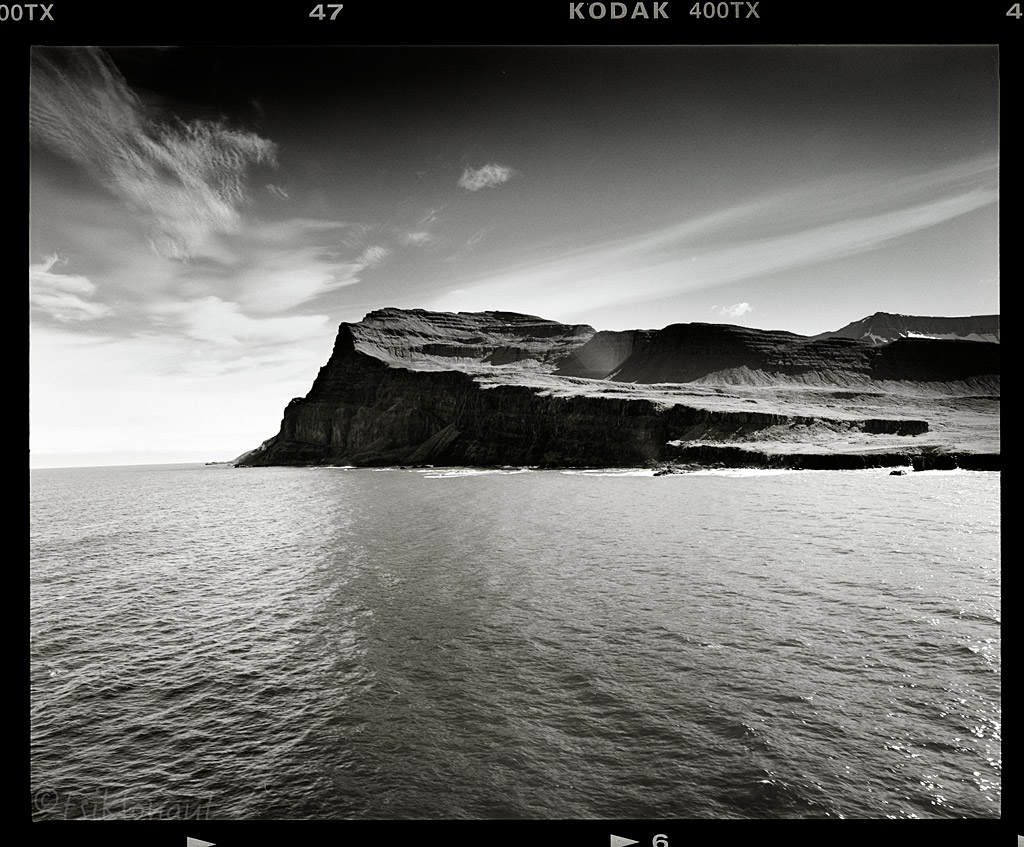
Trail up to Bolafjall was nothing but inside a cloud, visibility less than 10 meters, giving a bizarre feeling like you're floating on the 600 meter drop of the edge:
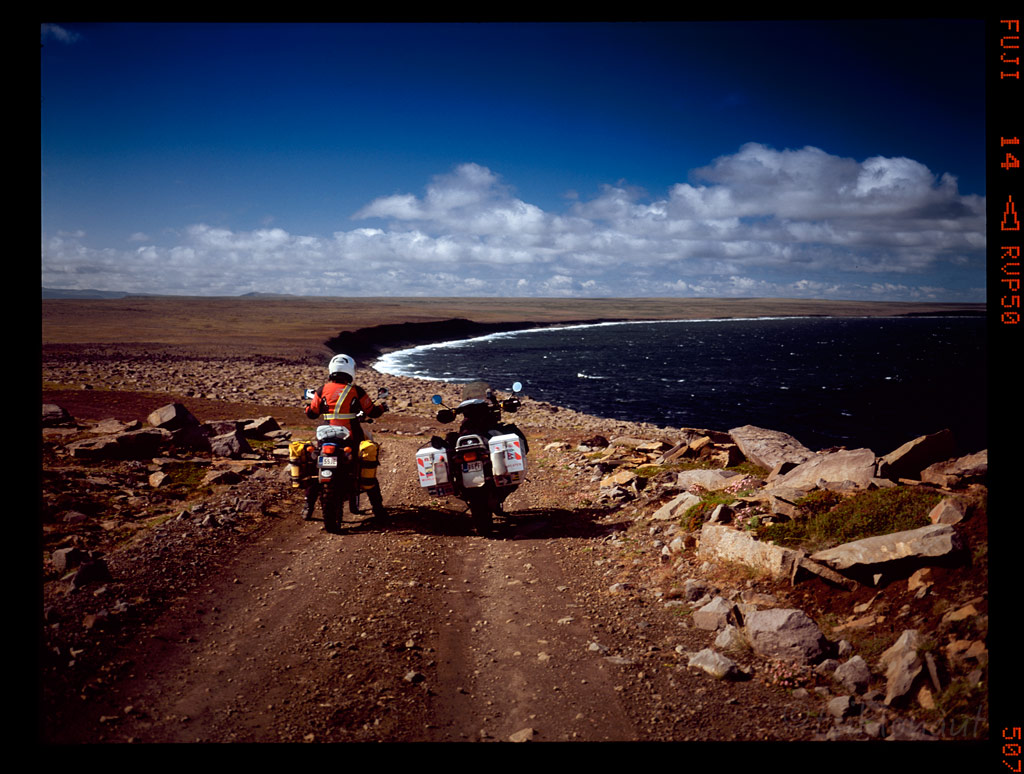
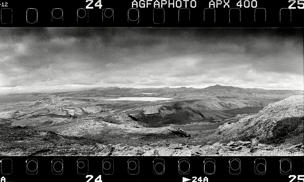
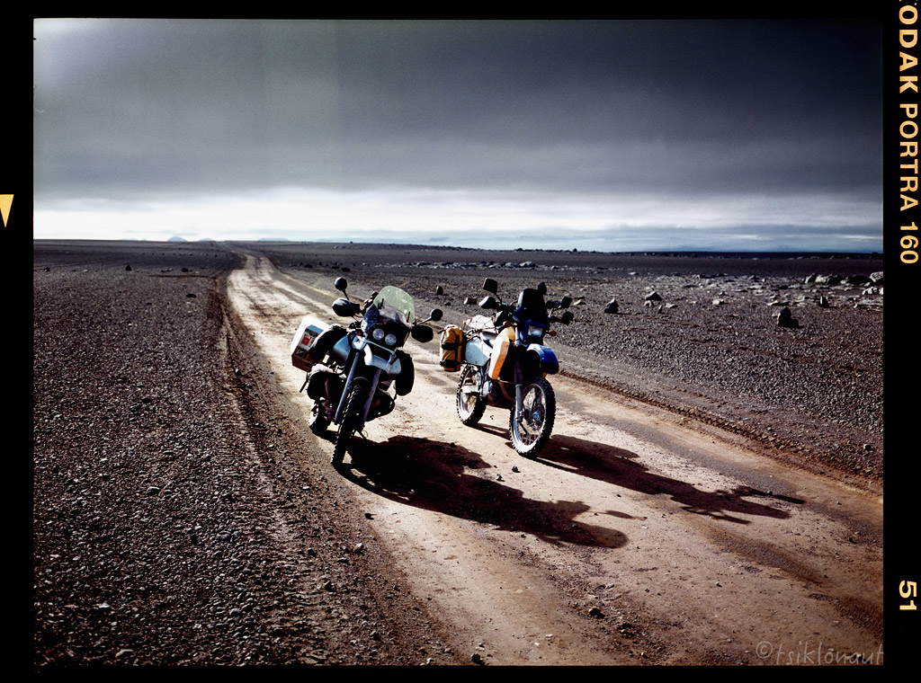
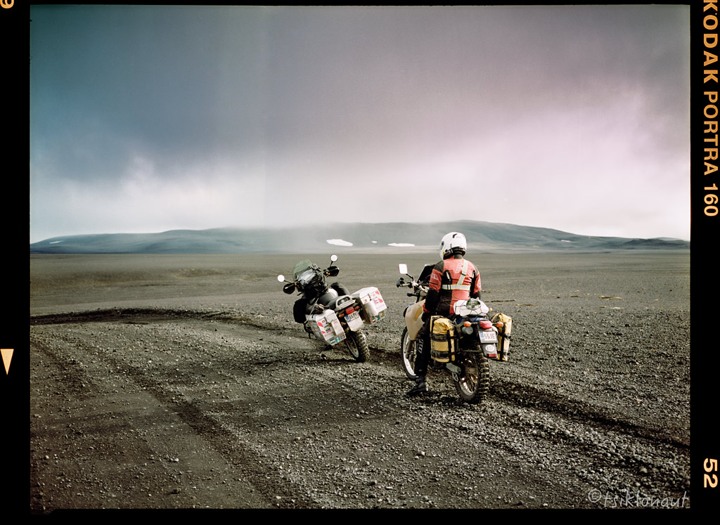
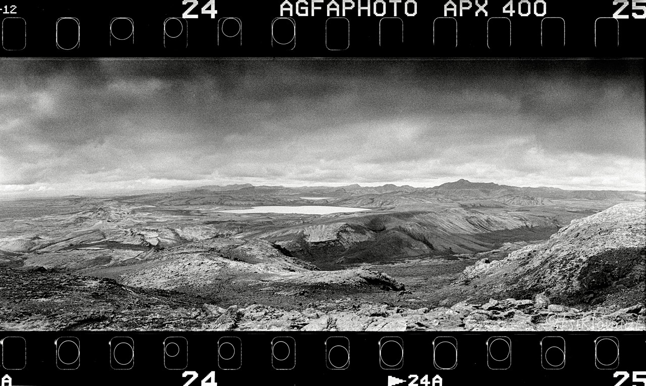
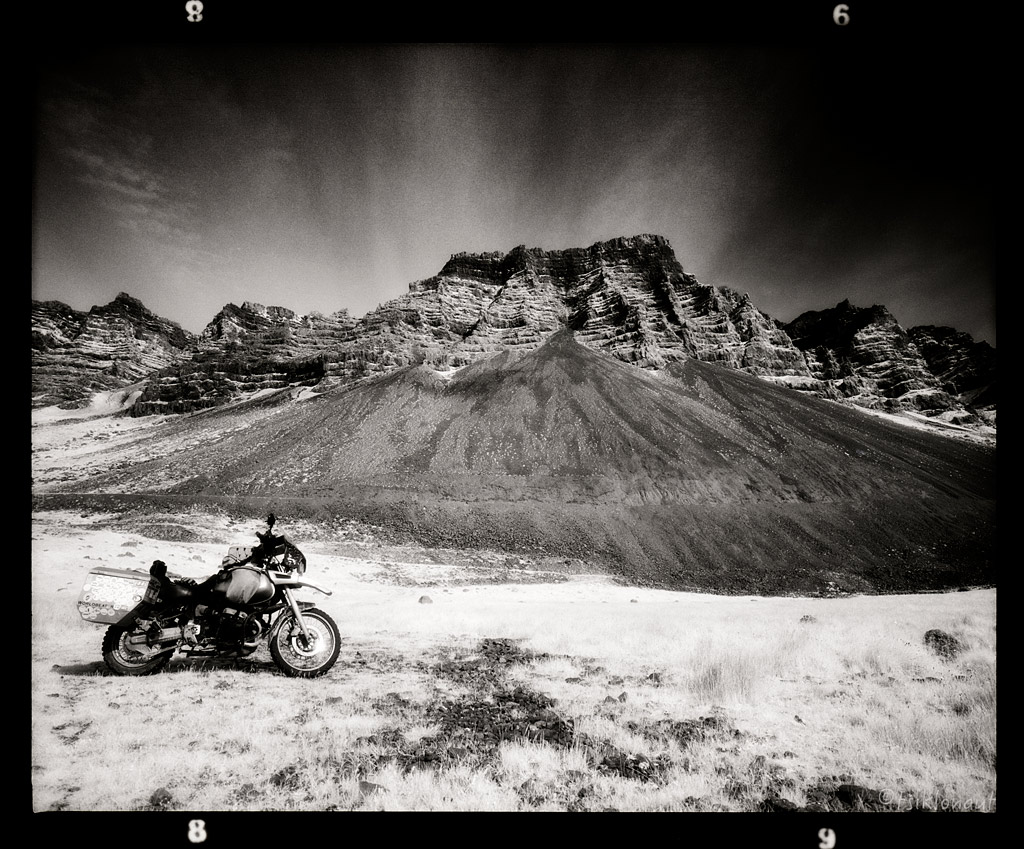
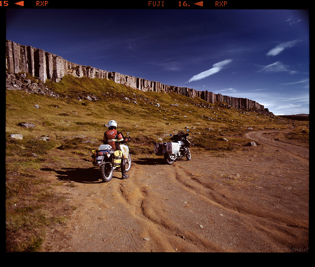
Then it was time for some last chance offroad dash via F910 to Askja. We rode all the way to Modhrudalur only to find out the sign: "Road CLOSED". Ups.
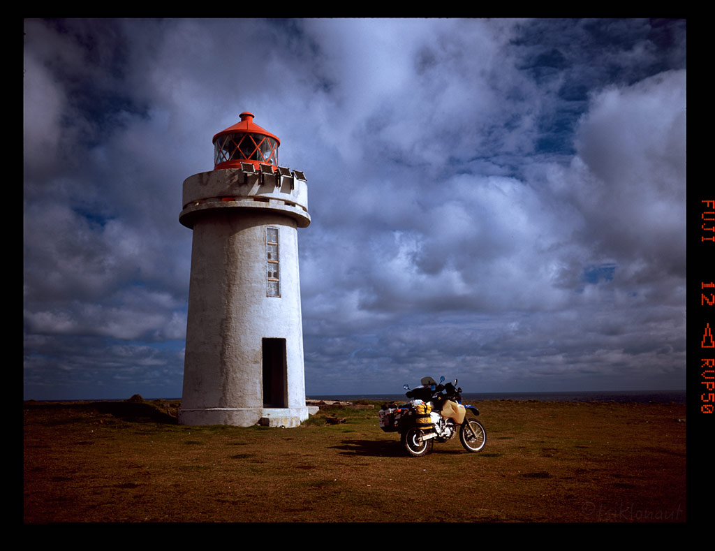
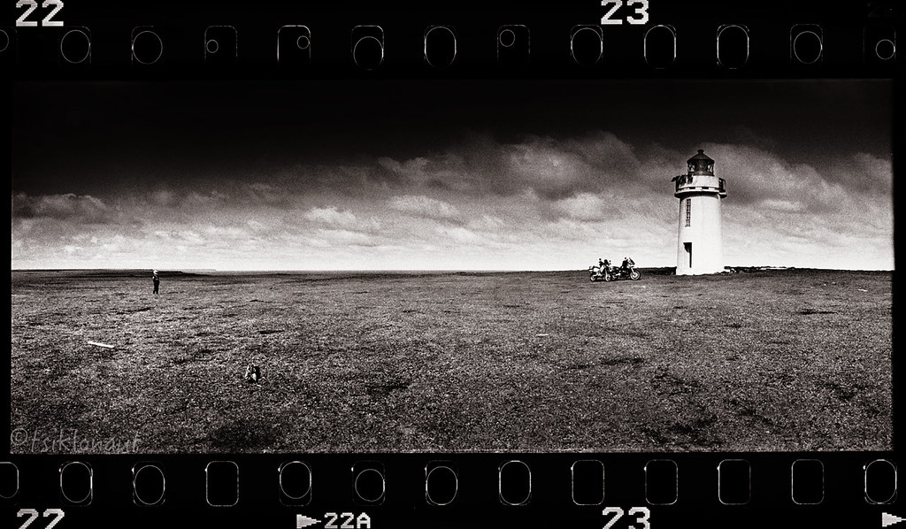
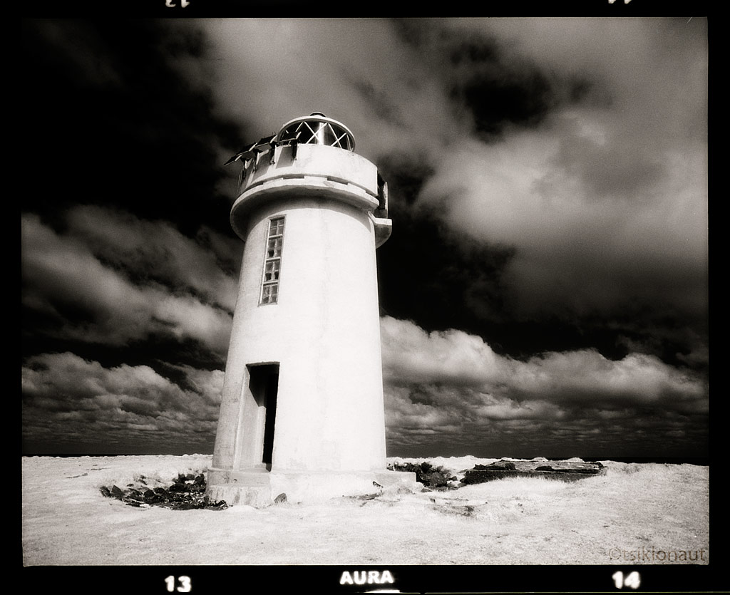
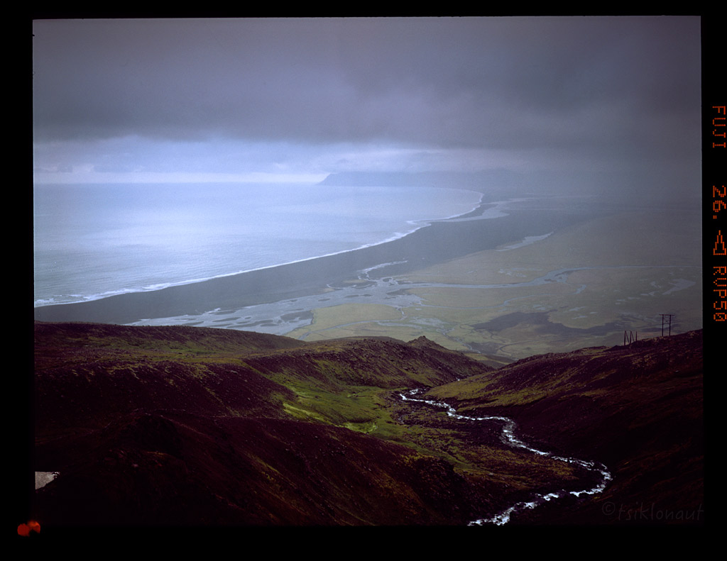
Disappointed, we had to turn back and head to Öxarfjörður, to visit the northernmost point on Iceland, the Hraunhafnartangi light house.
Northernmost point in our sights.
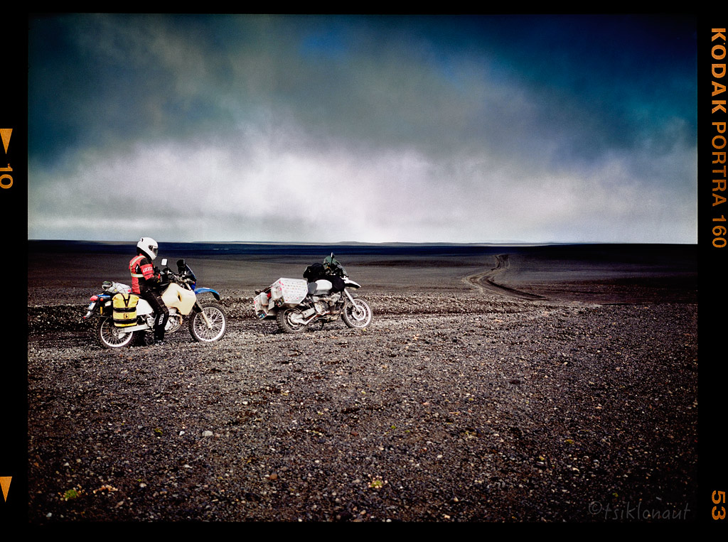
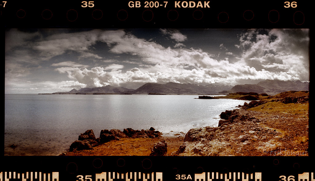
The road was also a decent one with views to the shore.
On the map there was an irresistible nice pointy peninsula with a trail access - Langanes is a peninsula in northeast Iceland. The name literally means "long peak".
It is 40 kilometres (25 mi) long from southwest to northeast, ending in a thin strip of land called Fontur.
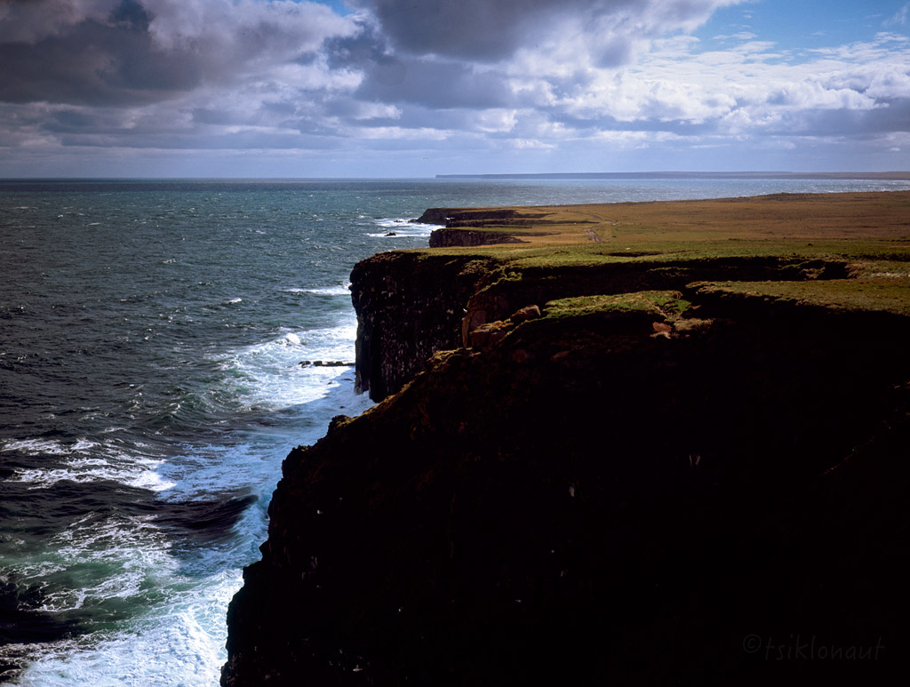
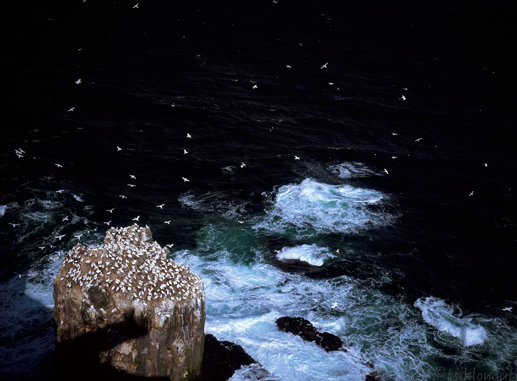
There's a huge Northern Gannet colony there. Living in a very unique spot.
At the End of the World by tsiklonaut
Marker by tsiklonaut
On Langanes peninsula there's also the charismatic abandoned village of Skálar. In 1910, it used to be a big fishing center even with its own cinema.
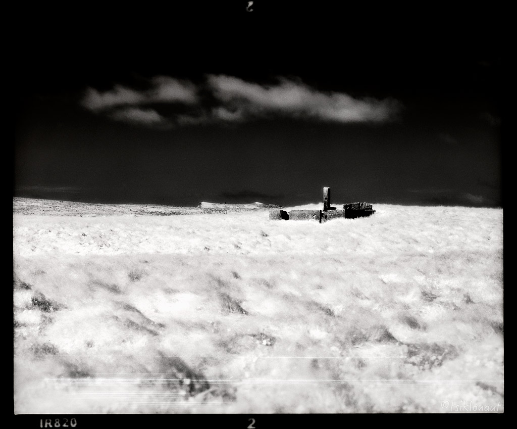
Skálar
The decline began in 1930 when engine powered boats started replacing the row boats and Skálar having a very bad port and isolated location was destined to an end. During WW2 there was some revival, but loose and drifting sea mines destroyed three houses in 1942, the last 25 residents leaving in 1946. Everything is abandoned since then. Surreal place.
Skálar by tsiklonaut

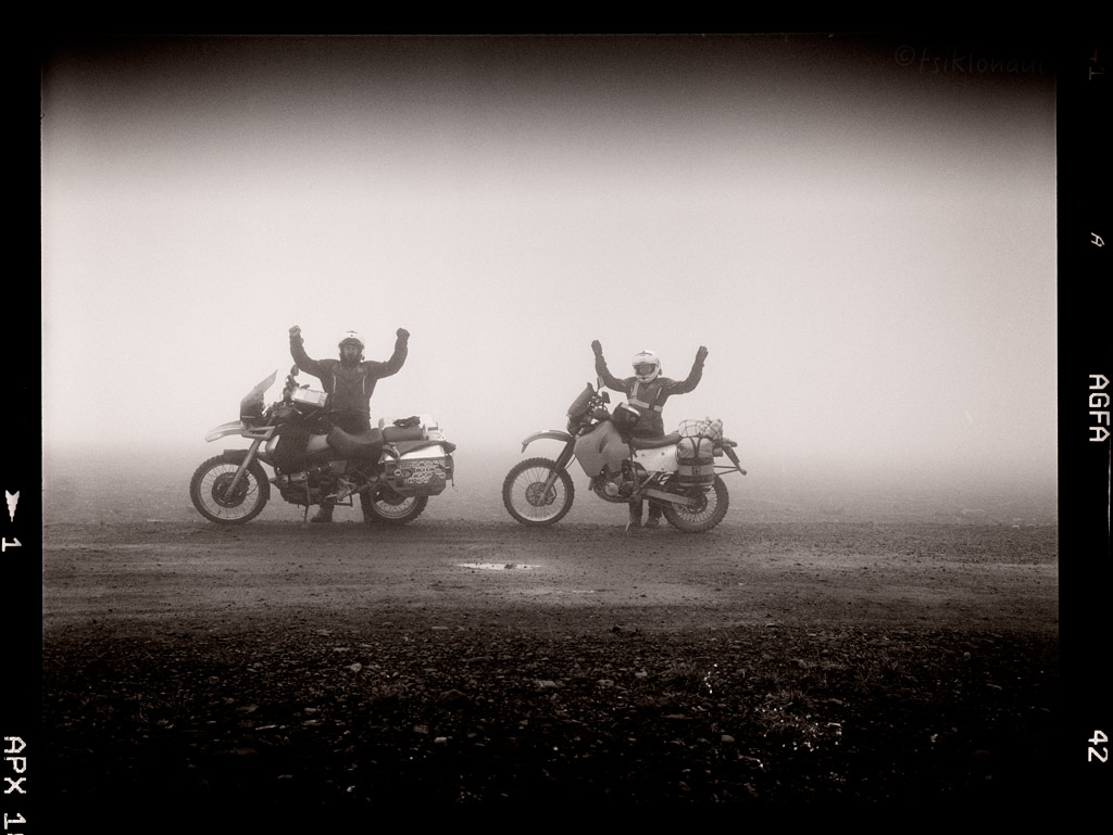
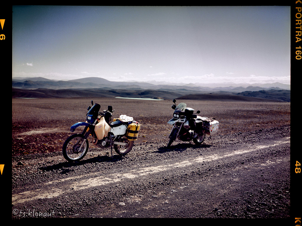
There was nowhere to go but south...
Two Blondes by tsiklonaut
Low Point by tsiklonaut
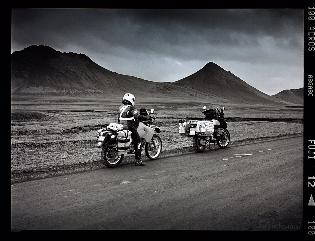
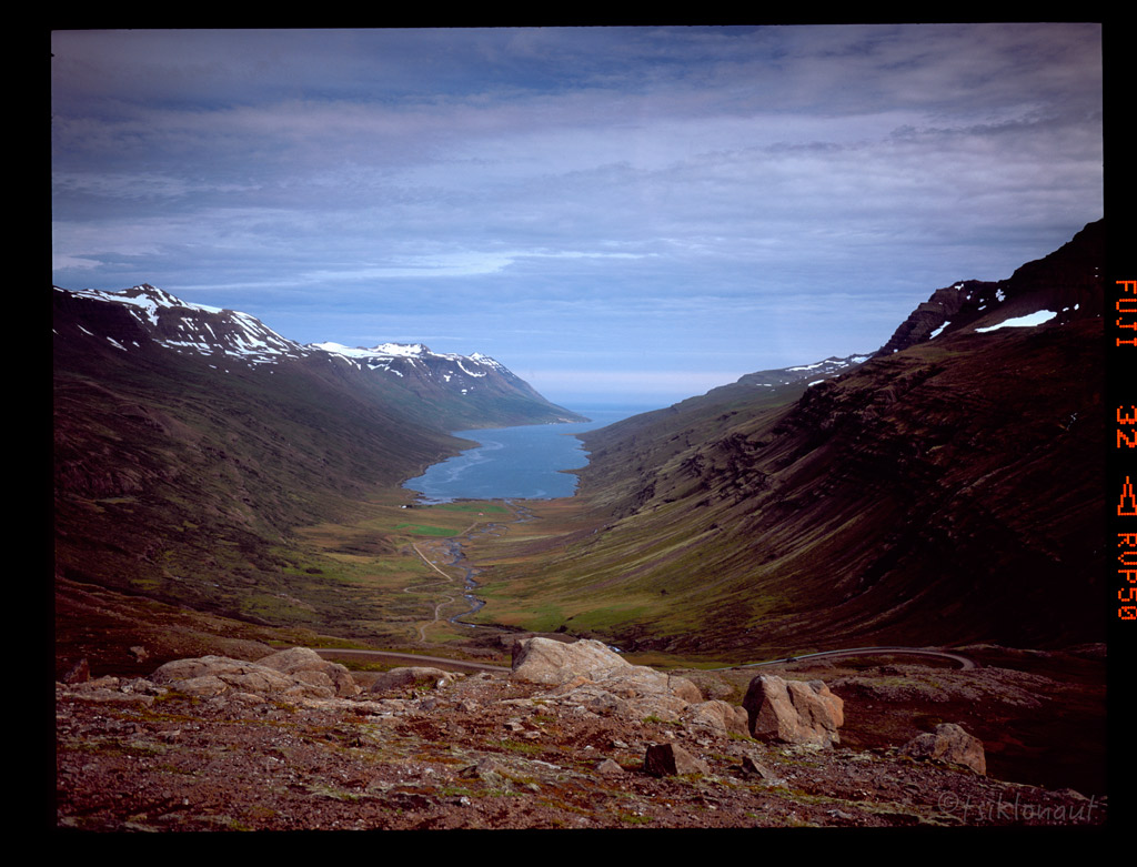
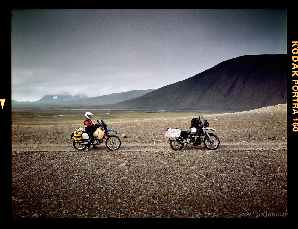
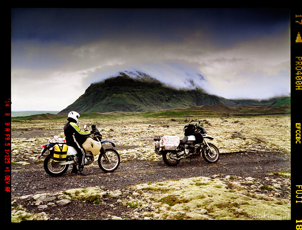
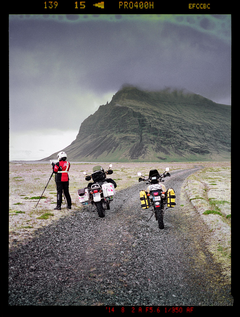
It took us to one of the highest passes in Iceland:
With impressive views just below cloudline:
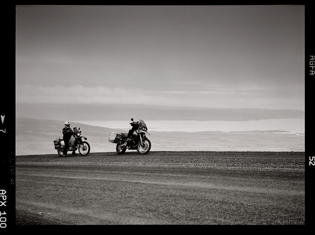
High altitude pass over the fjord.
Sky is the Limit by tsiklonaut
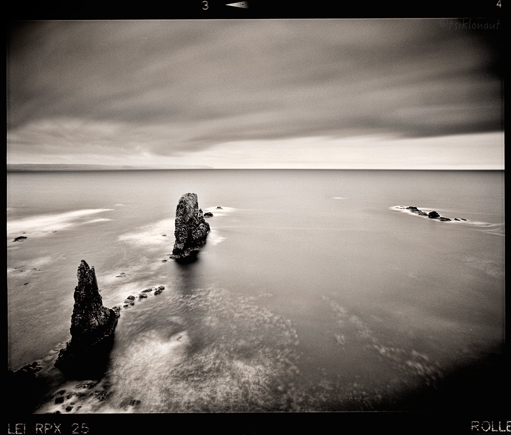
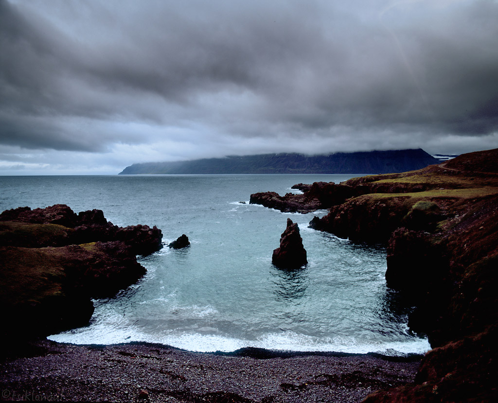
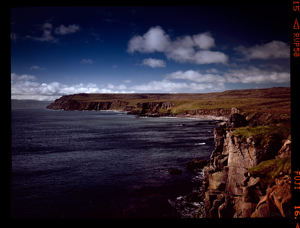
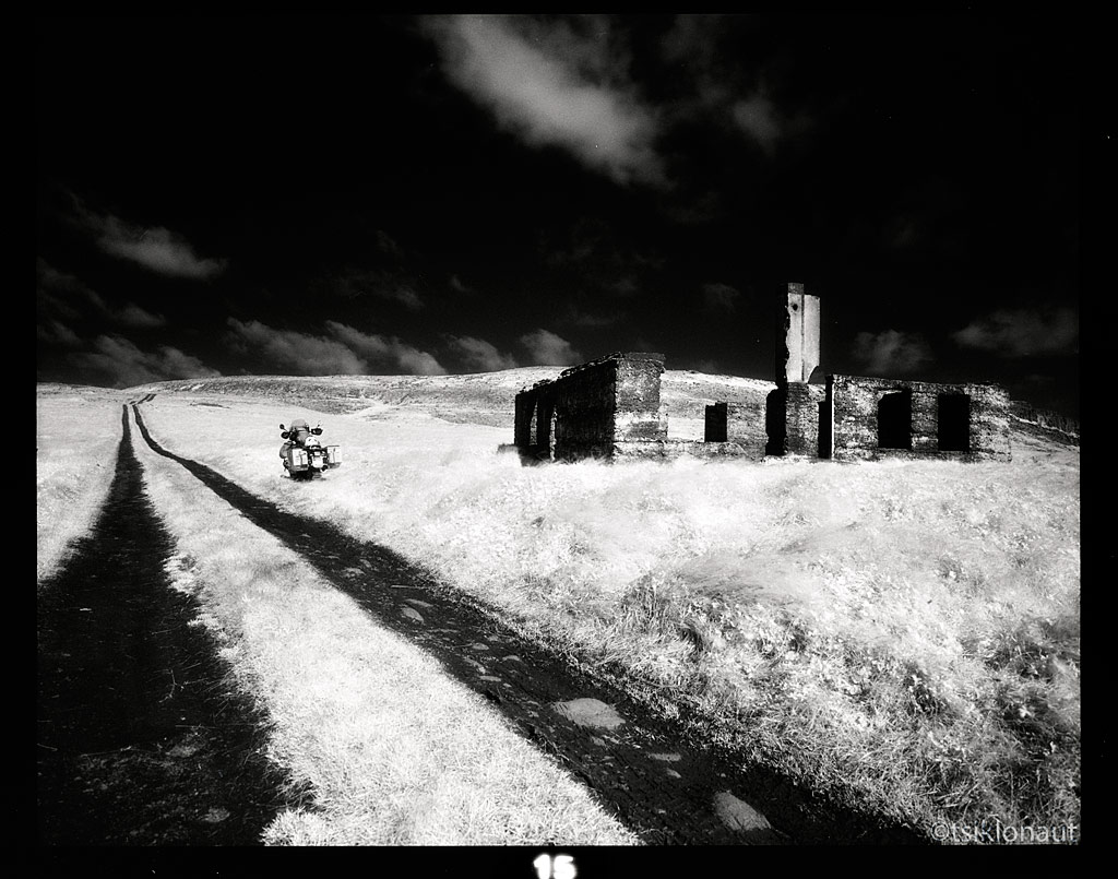
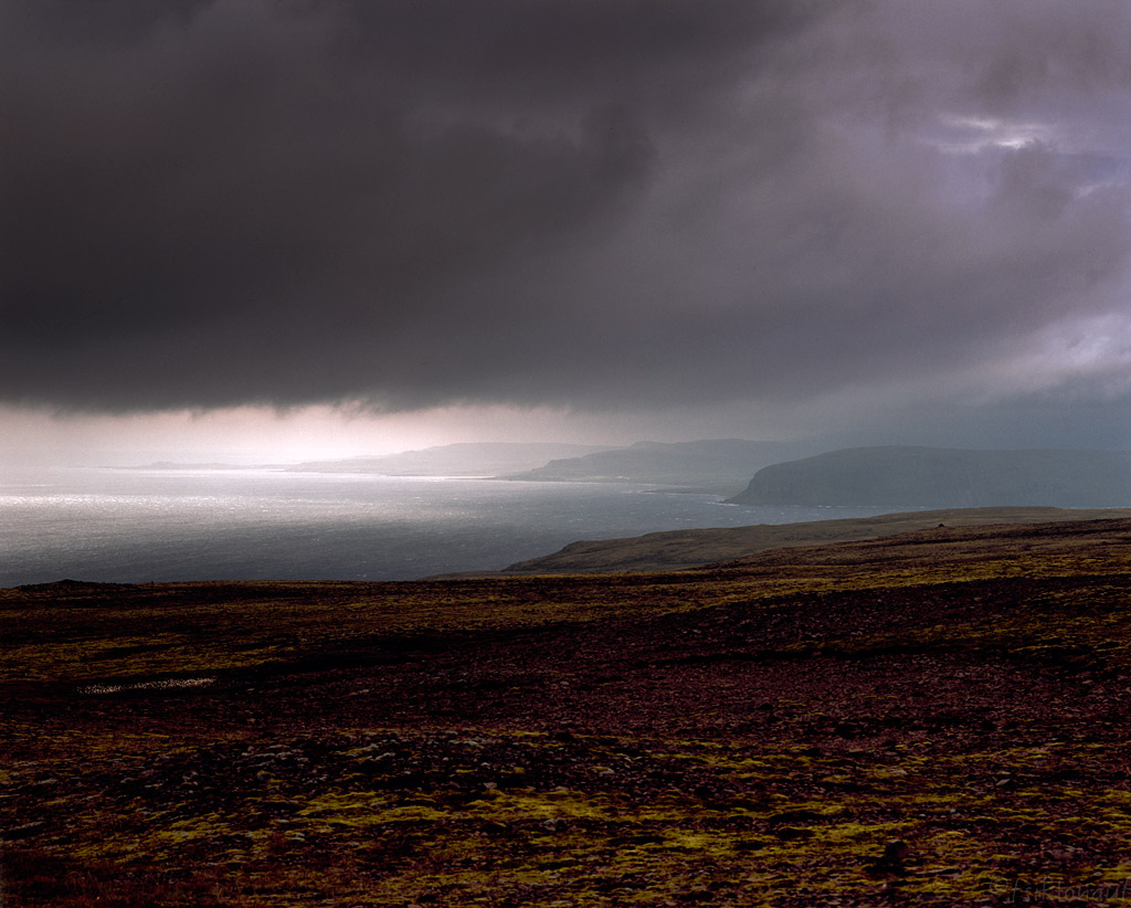
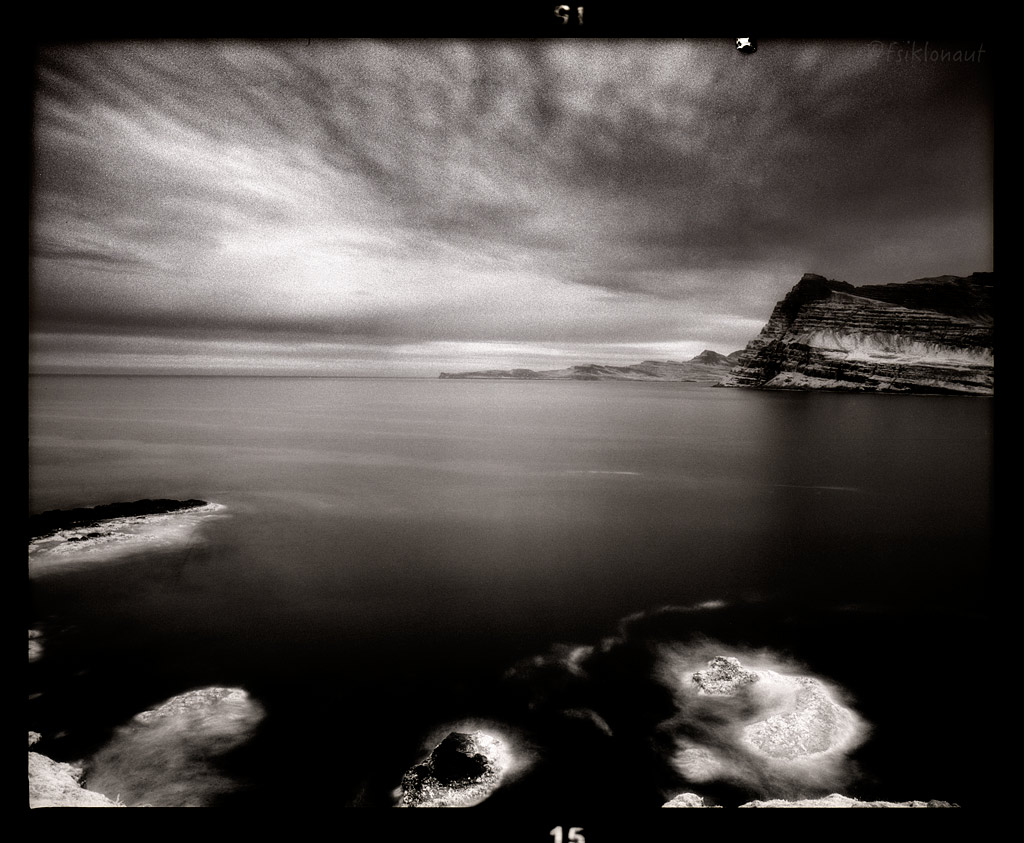
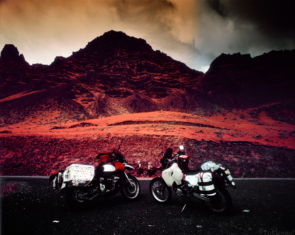
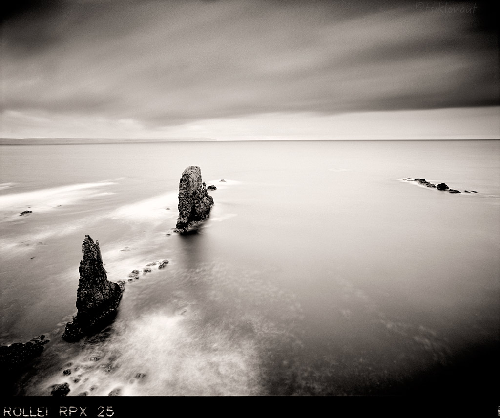
And before heading to our destination port (i.e. the ferry back to mainland Europe) we decided to touch the final extreme point in the eastern side. The way to Dalatangi takes one along a rough and narrow trail along the northern coast of Mjóifjörður.
A spectacular symphony awaits the traveller at the edge of the high and rugged shore: waterfalls, steep cliffs an vales with the roaring ocean below are not cut out for those suffering from vertigo! At the end of the road - as far eastward as possible - awaits the farm and the lighthouses.
Bay by tsiklonaut
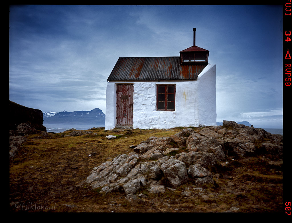
Old Lighthouse by tsiklonaut
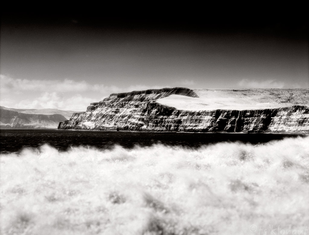
Skálanesbjarg.
Road down to fjord.
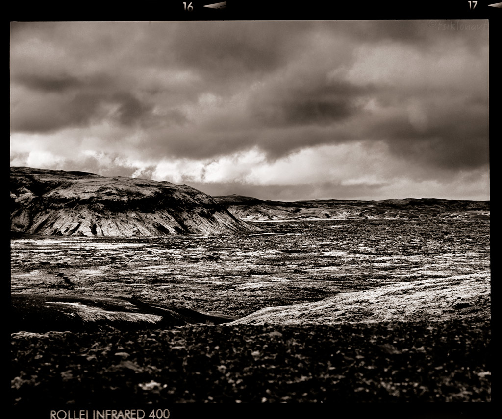
Icelandic infrascape.
Only outside the FaceBook world and social hype one can find it's true self and freedom within. As always, we prefer to be off the beaten track - explore the rarely seen sights on those decent Icelandic trails.
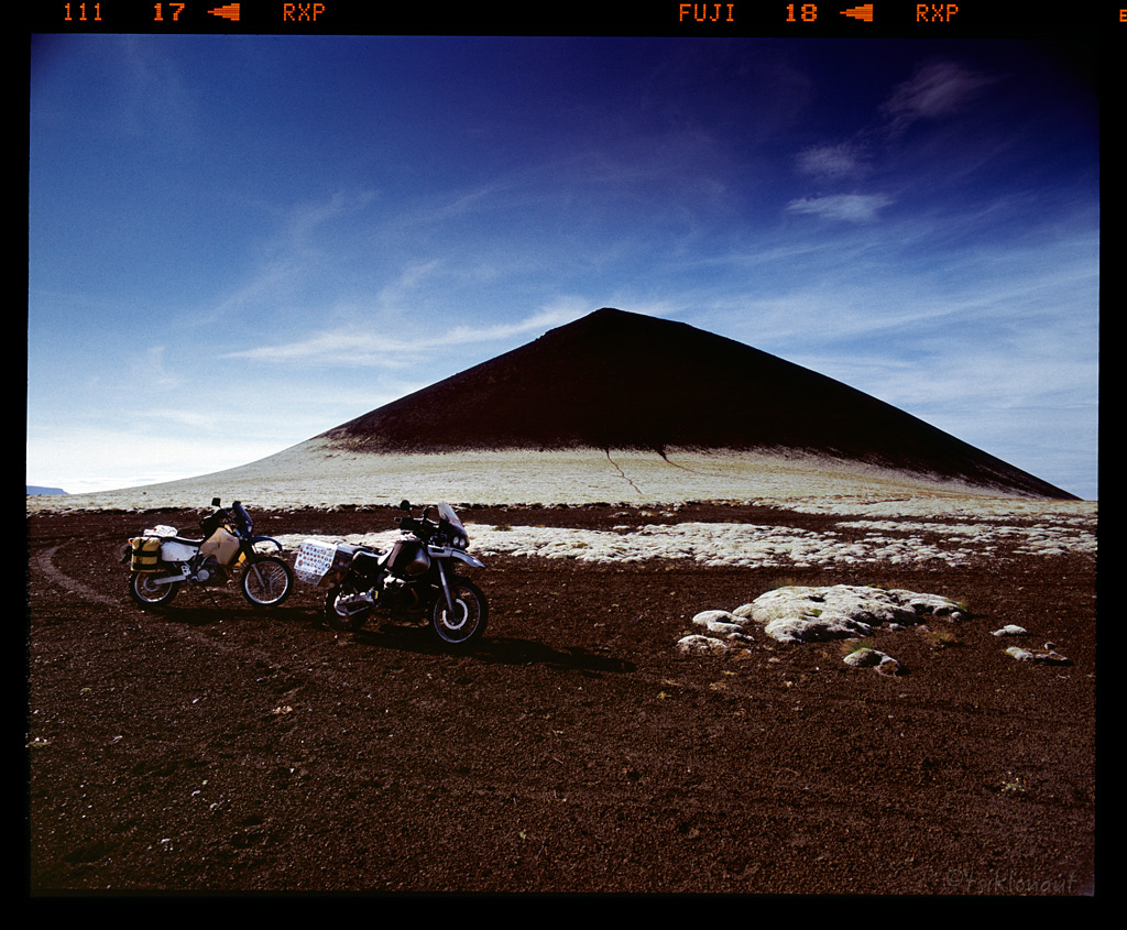
Dark Pyramid by tsiklonaut
It was then the right time to call it quits and head back to the ferry from Seydisfjörður, feeling satisfied and saying our goodbyes to Iceland!
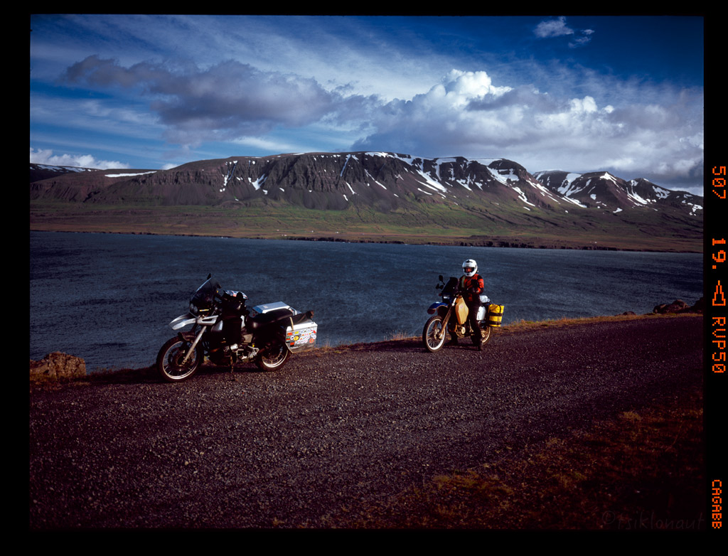
It was a fantastic 7800 kilometers, 33 days. Interestingly during all that time, we didn't spend a single night in a hotel or under a roof. Every night was spent in our cozy and trusty tent. We touched all the extreme land points reachable by a road or trail in Iceland: eastern, western, southern & northern. Touched the heart of Iceland via central highlands and had a decent dash on both the Faroe Islands & Iceland.
Hopfully you enjoyed the report.
Till next time...
M&K
Who said there are no mosquitos on Iceland? There's loads of 'em around lake Myvatn. We had to GTFO as fast as we could there and head to Námaskarð for the rotten egg smelling sulphur smoke shelter and succumb into those outwordly volcanic landscapes:
Shades of Námaskarð by tsiklonaut
All the landscape and atmosphere does make it seem like a scene from post-apocalyptic event...
Transition Ground by tsiklonaut
Boiling grounds.
Sulphuric Atmosphere by tsiklonaut
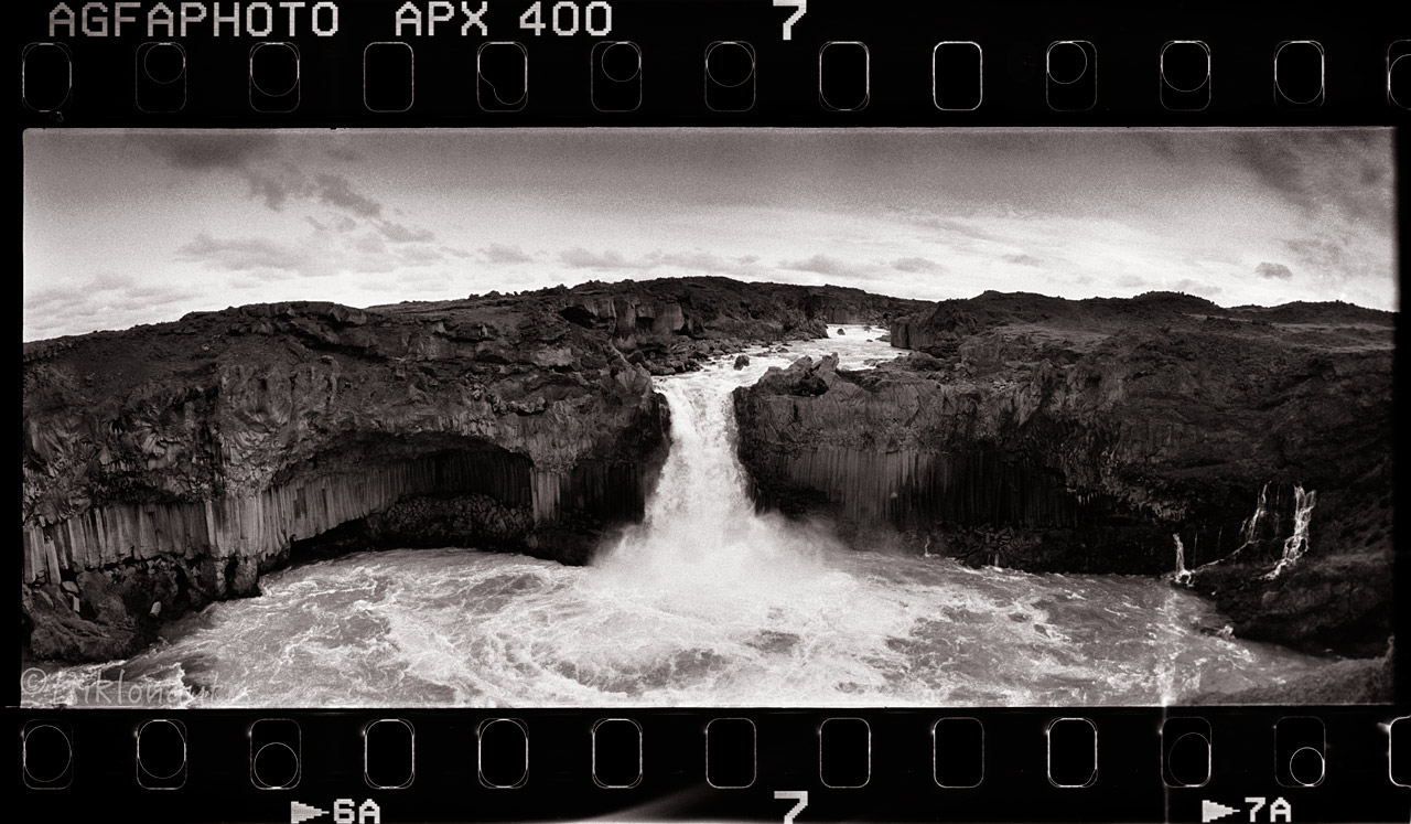
It was then too close to the most powerful waterfall in Europe, the Dettifoss. The falls are 100 metres (330 ft) wide and have a drop of 45 metres (150 ft) down to the Jökulsárgljúfur canyon.
Fall to Rise by tsiklonaut
Gravity-assisted art.
It is the largest waterfall in Iceland in terms of volume discharge, having an average water flow of 193 m3/s. It was an unreal experience, just staggering power you feel through your body standing aside it.
Turn by tsiklonaut
Sheer power...
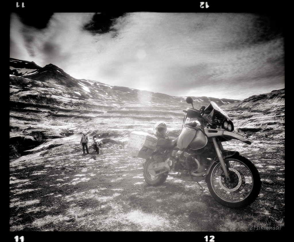
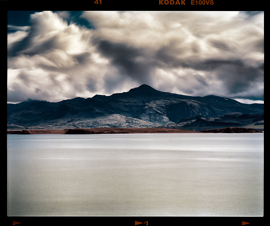
A little flashback to Westfjords, we tried to reach the highest fjord on the way to Skalavik, our luck ran out with the weather.
Below a massive glacier.
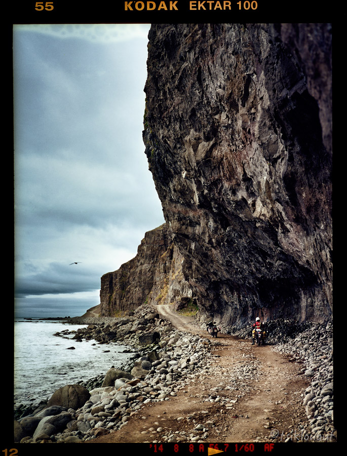
Trail up to Bolafjall was nothing but inside a cloud, visibility less than 10 meters, giving a bizarre feeling like you're floating on the 600 meter drop of the edge:
Then it was time for some last chance offroad dash via F910 to Askja. We rode all the way to Modhrudalur only to find out the sign: "Road CLOSED". Ups.
Disappointed, we had to turn back and head to Öxarfjörður, to visit the northernmost point on Iceland, the Hraunhafnartangi light house.
Northernmost point in our sights.
The road was also a decent one with views to the shore.
On the map there was an irresistible nice pointy peninsula with a trail access - Langanes is a peninsula in northeast Iceland. The name literally means "long peak".
It is 40 kilometres (25 mi) long from southwest to northeast, ending in a thin strip of land called Fontur.
There's a huge Northern Gannet colony there. Living in a very unique spot.
At the End of the World by tsiklonaut
Marker by tsiklonaut
On Langanes peninsula there's also the charismatic abandoned village of Skálar. In 1910, it used to be a big fishing center even with its own cinema.
Skálar
The decline began in 1930 when engine powered boats started replacing the row boats and Skálar having a very bad port and isolated location was destined to an end. During WW2 there was some revival, but loose and drifting sea mines destroyed three houses in 1942, the last 25 residents leaving in 1946. Everything is abandoned since then. Surreal place.
Skálar by tsiklonaut
There was nowhere to go but south...
Two Blondes by tsiklonaut
Low Point by tsiklonaut
It took us to one of the highest passes in Iceland:
With impressive views just below cloudline:
High altitude pass over the fjord.
Sky is the Limit by tsiklonaut
And before heading to our destination port (i.e. the ferry back to mainland Europe) we decided to touch the final extreme point in the eastern side. The way to Dalatangi takes one along a rough and narrow trail along the northern coast of Mjóifjörður.
A spectacular symphony awaits the traveller at the edge of the high and rugged shore: waterfalls, steep cliffs an vales with the roaring ocean below are not cut out for those suffering from vertigo! At the end of the road - as far eastward as possible - awaits the farm and the lighthouses.
Bay by tsiklonaut
Old Lighthouse by tsiklonaut
Skálanesbjarg.
Road down to fjord.
Icelandic infrascape.
Only outside the FaceBook world and social hype one can find it's true self and freedom within. As always, we prefer to be off the beaten track - explore the rarely seen sights on those decent Icelandic trails.
Dark Pyramid by tsiklonaut
It was then the right time to call it quits and head back to the ferry from Seydisfjörður, feeling satisfied and saying our goodbyes to Iceland!
It was a fantastic 7800 kilometers, 33 days. Interestingly during all that time, we didn't spend a single night in a hotel or under a roof. Every night was spent in our cozy and trusty tent. We touched all the extreme land points reachable by a road or trail in Iceland: eastern, western, southern & northern. Touched the heart of Iceland via central highlands and had a decent dash on both the Faroe Islands & Iceland.
Hopfully you enjoyed the report.
Till next time...
M&K


")


