

Deleted account 250319001
Registered user
- Joined
- Sep 19, 2004
- Messages
- 6,495
- Reaction score
- 565
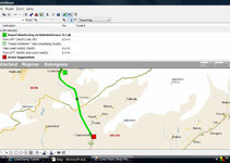
Fine tuning my route through the mountains, my GPS has suggested a route although it isn’t showing a road, just a broken line. This looks great, but, it’s a long way to turn round if we can’t get through. The broken line is from Kandestag to Goppenstein, just North West of Brig. This route really does look to be fun. Ive done the Recce on Goggle earth, it does show a track, but has anyone been through?
Any info would be great.
Nige
Any info would be great.
Nige

")


