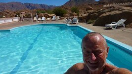
Thank you, kind sir. It was stopping eating all the donuts that helped.

Back to the story... In this case things don't always go to plan.

I decided to do a loop south from Tafraoute as far as the N12 main road (60km as the crow flies) then come back up via the prehistoric rock carvings of Ait Herbil. It was a bit of a last minute decision as the weather seem iffy and I didn't start until 1045 which gave me only 7.5 hours before sunset.
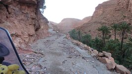
Shortly after leaving Tafraoute it started to rain again, but I kept going even though I was riding at times through low cloud. After 70km the tarmac stopped and the route continued as a piste which was of the worst possible surface--beaten earth--which is lethal when wet. But I kept going and once over the watershed the piste surface became mainly stones and then the rain stopped and I came down a beautiful gorge.
I did 28km on the piste including 13 river crossings (dry river bed but stoney, longest lateral crossing was 300m) then it was back to tarmac. So far, so good.
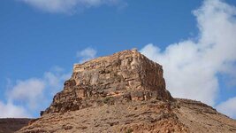
I was trying to find a route east up the valley from the ancient agadir (granary) of Amtoudi at N29 14.974 W9 11.389 and wasted some time here before giving up. So I was behind schedule when I did the section with the rock carvings and I then carried up north on the main R107 (Regional Route 107) road.
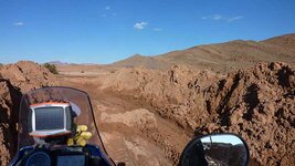
However this turned into piste, fast at first, then the route was riding up a river bed. The stones were more compressed than I remembered when I did this route before on the 1200GSA so rather than a 'red' (technical) piste I termed it a hard 'blue' (intermediate). Everything seemed to be working out OK.
By then it was just before 1700 (sunset at 1815) and a couple of guys tried to persuade me from going further saying it was 'interdit' (forbidden) and that I should stay the night with them. I immediately smelt a rat, but in any case most of my stuff was in the Hotel Les Amadiers in Tafraoute which by then was only 40km line-of-sight away.
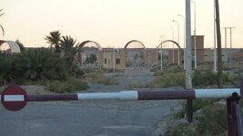
So I carried on, switched from one valley's river bed to another, congratulating myself on my ability to sense a scam. After 12km of river bed riding I exited into a date palmery and 500m later came to a sign just past Gite Igmir saying the R107 was closed due to road works. No problem thinks me, I can get through roadworks.
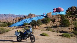
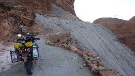
I remembered the steep climb out of the gorge on a concrete road but it was now really badly torn up and I had to repair one section in order to pass. Then I came to the landslide...
Oh shite.
The only way back to Tafraoute was back down the river bed about 16km to where another valley branched off and then head north towards the Ait Mansour gorge. My return down the river bed was much faster--I knew there were no serious obstructions and light was failing. It was fully dark by the time I came to the turn so I zoomed my GPS in close to follow the tracklog on the screen so I would not lose the track on the ground. Unfortunately this route north was also a river bed.

Then the wind started getting up, switching quickly in direction, sometimes blowing sand and dust directly at me created a kaleidoscope effect in the headlight, other times coming from behind so I was totally enveloped in my own dust trail. Sometimes I was blinded and had to stop until the wind calmed down, other times the wind was so strong I had stop the bike to avoid being blown over.
On most bikes the dip headlight beam stays on when you switch to main beam, but on the Tenere it's one of the other. Generally this isn't too bad as it forces you to concentrate on far ahead (on the basis you can't fekking well see what's any nearer as it's in the shadows) but sometimes I had to switch beams. Generally momentum is your friend and I made what I thought was remarkable progress in difficult condition. Measuring the tracklog afterwards the second river bed section was over 35km.
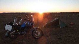
I eventually got back to the hotel at 2230 after a total of 300km of which 110km was piste riding. Fortunately the bar was still open!
Pics below of Amtoudi agadir, the concrete section and the landslide.


 Lovely to see you here. Hope the rest of your journey went well!
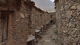


") . I think tourist take them home like cow bells in Swiss
. I think tourist take them home like cow bells in Swiss

