

BMBEN
Registered user
Wednesday 9th Nov 2011
Oberon Dam
There were eleven (I think) riders at Maccas that morning (plus Richard who had come to put in a cameo appearance). The temperature forecast was for 36 degrees so Noel, who was to be our ride leader, opted for the cooler climate of Oberon for our destination. He also decided to avoid the painful roadworks on the Great Western Highway by using the Bells Line of Road.
We set off up the highway and turned off at Springwood for Hawkesbury Road. Along this road we had the usual procedure of crawling through school zones to avoid running over the non-existent schoolkids until we reached Hawkesbury Heights. Then it was down the twisty hill to Agnes Banks and onto Castlereagh Road. From there we used Crowleys Lane to avoid Richmond and joined the Bells Line of Road at North Richmond. We cruised westward along this road and were soon powering up Bellbird Hill and on to Bilpin. We didn’t stop at the Fruit bowl with its crumbling picnic tables but carried on westward to the cooling bends of Mount Tomah and Mount Bell. When we reached Bell Dennis, one of the riders, decided to head back as he was having some kind of problem with nerves in his arms. The rest of us carried on past the Zigzag Railway and down Scenic Hill into Lithgow. Here we used some rather devious back-streets to emerge onto the Great Western Highway, then rode on to the Shell servo at South Bowenfels for smoko. It had been about two hours since we left Blaxland and I was certainly ready for a break.
After smoko John Mac left us. Said something about visiting Dawn (probably a relative of his). Noel decided that we wouldn’t go the usual way through Tarana but we would use the Jenolan Caves Road instead. So we set off along the highway again to use McKanes Falls Road as a shortcut. Noel must have been having a senior’s moment and he turned off too early onto the wrong road, dutifully followed by the rest of the group except me. I smugly cruised past and waited at the correct turnoff for them to catch up. This is a delightful little shortcut road although the intersection with Jenolan Caves road can be a bit hairy. It was then on to Hampton where we turned onto the Duckmaloi Road which took us to Oberon and then it was down to the picnic area at the dam.
There was quite a stiff breeze blowing here so we retired to the shelter shed. Unfortunately it didn’t provide much shelter as there was no wall on the windward side and I was forced to huddle in a corner to make a cup of coffee as the granules kept blowing out of my cup before I could add the water. We persevered however and after lunch walked up onto the wall of the dam. There was more water in the dam than on our last visit, but still a long way from full. One of the fellas (Ian I think) spotted some kangaroos on the opposite hillside. It’s quite often that we see a few kangaroos there, but today there would have been a hundred of them. I wonder if the cocky who owned the land knew about them.
After finishing lunch we rode back into the town and turned onto a road that headed out towards Edith. This is a very nice run and took us to a turnoff which brought us back onto the Duckmaloi Road. We crossed the Duckmaloi River where I remember catching copperheads in my miss-spent youth and back to Hampton. From here we followed the Jenolan Caves road across the Cox’s River and on to the Highway at the foot of River Lett Hill. The temperature was really starting to rise here and after riding through Little Hartley we came to Victoria Pass. This pass is currently being widened and while work is going on has been reduced to just one lane in each direction and a few of us tail-enders got stuck behind a bloody great fuel tanker! What seemed like a week later we finally reached the servo at the top and stopped for afternoon tea. Would you believe we actually paid for our coffee and cold drinks? Yes I know it’s out of character for us.
Before leaving, we went through the obligatory ritual of hand shaking and I stowed my jacket and gloves away. Buggered if I was going to dissolve in a puddle of sweat while sitting in roadworks in a leather jacket. Besides, I really enjoy just riding in a T-shirt. (Spare me the safety lectures). Anyway it was an uneventful run home, apart from when I pulled into a park near Faulconbridge to find the toilet closed for renovations. It’s very difficult to ride with your legs crossed but I made it home without mishaps.
My trip meter showed 302km for the day. Many thanks to Noel for leading the ride and to Jeff for the photos.
Peter M
Thanks to Franz and Geff for the photos
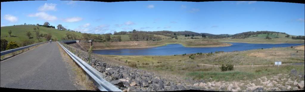
The dam on the March 2010 visit

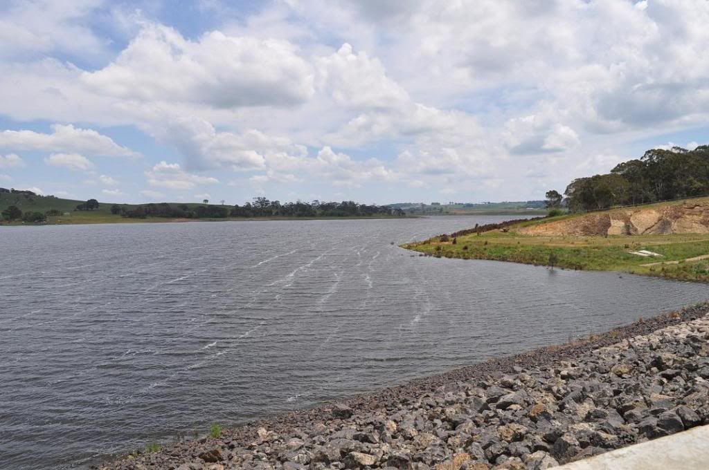
and on the November 2011 visit. Just goes to show how much rain was had through the 2010 summer.
Regards BMBEN
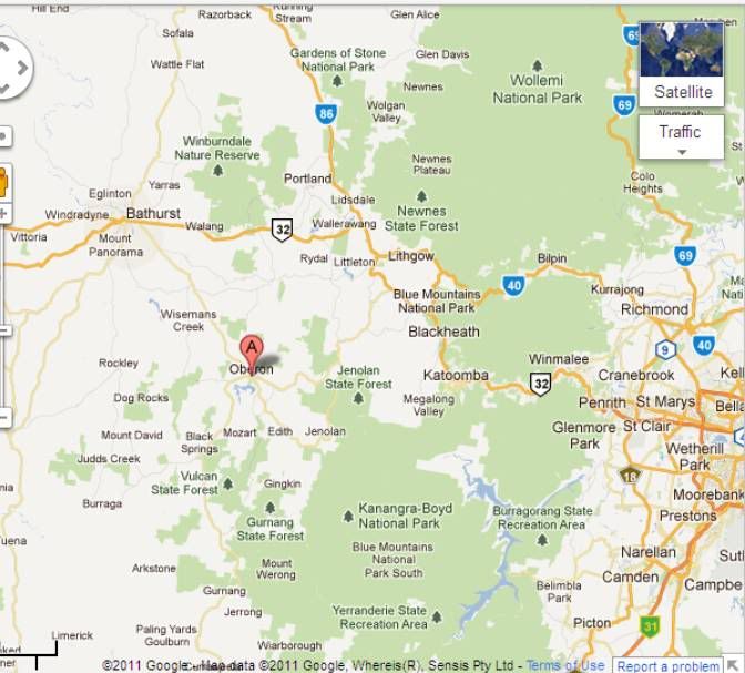
Thanks to Google maps
Oberon Dam
There were eleven (I think) riders at Maccas that morning (plus Richard who had come to put in a cameo appearance). The temperature forecast was for 36 degrees so Noel, who was to be our ride leader, opted for the cooler climate of Oberon for our destination. He also decided to avoid the painful roadworks on the Great Western Highway by using the Bells Line of Road.
We set off up the highway and turned off at Springwood for Hawkesbury Road. Along this road we had the usual procedure of crawling through school zones to avoid running over the non-existent schoolkids until we reached Hawkesbury Heights. Then it was down the twisty hill to Agnes Banks and onto Castlereagh Road. From there we used Crowleys Lane to avoid Richmond and joined the Bells Line of Road at North Richmond. We cruised westward along this road and were soon powering up Bellbird Hill and on to Bilpin. We didn’t stop at the Fruit bowl with its crumbling picnic tables but carried on westward to the cooling bends of Mount Tomah and Mount Bell. When we reached Bell Dennis, one of the riders, decided to head back as he was having some kind of problem with nerves in his arms. The rest of us carried on past the Zigzag Railway and down Scenic Hill into Lithgow. Here we used some rather devious back-streets to emerge onto the Great Western Highway, then rode on to the Shell servo at South Bowenfels for smoko. It had been about two hours since we left Blaxland and I was certainly ready for a break.
After smoko John Mac left us. Said something about visiting Dawn (probably a relative of his). Noel decided that we wouldn’t go the usual way through Tarana but we would use the Jenolan Caves Road instead. So we set off along the highway again to use McKanes Falls Road as a shortcut. Noel must have been having a senior’s moment and he turned off too early onto the wrong road, dutifully followed by the rest of the group except me. I smugly cruised past and waited at the correct turnoff for them to catch up. This is a delightful little shortcut road although the intersection with Jenolan Caves road can be a bit hairy. It was then on to Hampton where we turned onto the Duckmaloi Road which took us to Oberon and then it was down to the picnic area at the dam.
There was quite a stiff breeze blowing here so we retired to the shelter shed. Unfortunately it didn’t provide much shelter as there was no wall on the windward side and I was forced to huddle in a corner to make a cup of coffee as the granules kept blowing out of my cup before I could add the water. We persevered however and after lunch walked up onto the wall of the dam. There was more water in the dam than on our last visit, but still a long way from full. One of the fellas (Ian I think) spotted some kangaroos on the opposite hillside. It’s quite often that we see a few kangaroos there, but today there would have been a hundred of them. I wonder if the cocky who owned the land knew about them.
After finishing lunch we rode back into the town and turned onto a road that headed out towards Edith. This is a very nice run and took us to a turnoff which brought us back onto the Duckmaloi Road. We crossed the Duckmaloi River where I remember catching copperheads in my miss-spent youth and back to Hampton. From here we followed the Jenolan Caves road across the Cox’s River and on to the Highway at the foot of River Lett Hill. The temperature was really starting to rise here and after riding through Little Hartley we came to Victoria Pass. This pass is currently being widened and while work is going on has been reduced to just one lane in each direction and a few of us tail-enders got stuck behind a bloody great fuel tanker! What seemed like a week later we finally reached the servo at the top and stopped for afternoon tea. Would you believe we actually paid for our coffee and cold drinks? Yes I know it’s out of character for us.
Before leaving, we went through the obligatory ritual of hand shaking and I stowed my jacket and gloves away. Buggered if I was going to dissolve in a puddle of sweat while sitting in roadworks in a leather jacket. Besides, I really enjoy just riding in a T-shirt. (Spare me the safety lectures). Anyway it was an uneventful run home, apart from when I pulled into a park near Faulconbridge to find the toilet closed for renovations. It’s very difficult to ride with your legs crossed but I made it home without mishaps.
My trip meter showed 302km for the day. Many thanks to Noel for leading the ride and to Jeff for the photos.
Peter M
Thanks to Franz and Geff for the photos
The dam on the March 2010 visit
and on the November 2011 visit. Just goes to show how much rain was had through the 2010 summer.
Regards BMBEN
Thanks to Google maps
