Looking for a GPS that will track

sockpuppet

Registered user
Joined
Aug 12, 2008
Messages
1,685
Reaction score
0
Location
A Field
Hello,

As part of my efforts to circumnavigate Africa next year I want to be able to record where I go so I can produce a map of where I've been.

Ideally looking for something that records every x mins a gps co-ordinate that can be accessed by a small laptop or similar and will output the results in some easy to use format (text or csv). Also if there is an easy way to power it from the bike / bike mounts already made then all the better.

I've had a search and the only threads I can find were from 2006 :(

I'm not interested in it having street mapping so its a pure GPS rather than a sat nav.
 
Yeah that's what I might have to do. A nightly download of tghe tracks unless I can find one that takes SD/CF/Other memory card. Bear in mind that I don't plan to travel much over 100 miles a day on average after the Calums Road duties are done so it may not be too much of a problem.
 
Edited :rolleyes:

I've only had experience with Garmin & can tell you that you won't store much as tracks.
After a few hundred miles it will record over the earliest tracks.

Unless you d/load the tracks every few hundred miles you're not going to record it all.

I think!

If you're only planning on 100 miles or so a day it shouldn't be a problem.
 
Hello,

As part of my efforts to circumnavigate Africa next year I want to be able to record where I go so I can produce a map of where I've been.

Ideally looking for something that records every x mins a gps co-ordinate that can be accessed by a small laptop or similar and will output the results in some easy to use format (text or csv). Also if there is an easy way to power it from the bike / bike mounts already made then all the better.

I've had a search and the only threads I can find were from 2006 :(

I'm not interested in it having street mapping so its a pure GPS rather than a sat nav.

This was in the Maplin catalog I was send the other day. Looks like it might be just the thing for you?


Product Features


Uses GPS technology to track you back to a single user-defined location
Eight LEDs clearly indicate direction you need to go to get back to your location
Up to 14 hours usage on a fully charged battery
Can also be used as a location data-logger with storage for up to 100,000 records or positions including longitude, latitude, speed, tag data and UTC (Universal Time, Coordinated)
Supplied with DC 8~30V charger for charging from your vehicle''s cigarette lighter socket and software to enable photo-tagging and upload of location data to Yahoo Flickr™
 
Edited I've only had experience with Garmin & can tell you that you won't store much as tracks.
After a few hundred miles it will record over the earliest tracks.
This is simply not true any more. The Zumos & Nuvi 550 will archive tracklogs, giving an almost unlimited capacity. Check the Nuvi 550 section for a quote from Garmin's website where this is a FAQ.

Since the Nuvi 550 has settings for walking (off route) & a compass, I can't see why it wouldn't be suitable. Battery life is good, and you can carry as many spare batteries as you need.

You would have to find an original copy of Mapsource though.
 
My humble Geko 201 (pic below) will store 10,000 trackpoints - that can be enough for several hundred miles.

A trackpoint is recorded every time there is a significant change in vector - if you're holding a steady speed on a straight and level motorway, very few will be used. Trail riding is likely to use a few more.

cf-lg.jpg


I've just totted up the tracks and it has over 550 miles of trails/skiing stored with 66% of memory capacity used.

Greg
 
Max speed 20.2 mph:augie not bad for an oldy:rob

I use a Garmin Colorado, following previously recorded tracks is very clear, non of this breadcrumb nonsense.
 
... and 35 minute 'moving time' has nothing to do with my bowels either!

:rob

Greg
 
I've gone for the V-900 gps logger. Runs for 24 hours on a battery charge - but I'll wire it to the bike.

It'll record one gps point every second with speed, heading, alititude as well. Uses a SD card so can records 2million+ waypoints. That way I can always remove the points I'm not interested in at a later date but have them all there should I ever be that interested.

I've just finished writing the section of my website that this info will go onto so it'll diplay the track on google maps and also present graphs with speed/altitude through the day (yes I am a monster geek).

I've just got a few more pages to finish them I'll release it onto the world
 
Hey sockpuppet that 900 sounds very interesting but can you export your route into memory map or into a garmin gps if you need to track back?
 
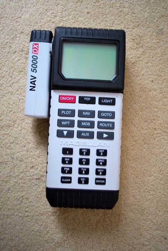
Marine units plot & work fine on land too in Lat/Long... This is an old one without mapping but you do have a man over board & drifting anchor capability..:D

DSC_0946.jpg
 
Hey sockpuppet that 900 sounds very interesting but can you export your route into memory map or into a garmin gps if you need to track back?

Yes. It'd need a laptop to do it but its possible. The CSV files are just plain text so not too hard to write a widget to do that.

I'm just going to be using this as a logger though. I already have a Garmin eTrex which I will use to find where I am / plot but this is more just something that I can attend to every few days also so we can see the route we took on the way etc.

Marine units plot & work fine on land too in Lat/Long... This is an old one without mapping but you do have a man over board & drifting anchor capability..:D

Man over board? I was assuming that they''' just photo me when I fall off not tell me where it was as well.
 
Got the V-900 today and sexy it is too - the testing shall begin.
 

Attachments

  • 06052009(001).jpg
    06052009(001).jpg
    73.9 KB · Views: 200
Although you already have one, I have a Qstarz recorder and a BGT-31. The Qstarz one is fine for 2 weeks at longer intervals i.e. 4 second intervals (if you have no pc to download the logs) but the BGT-31 is better as it has removable SD media (like your v-900), so the logging is as big as your pile of SD cards. I looked at the v-900 but the BGT-31 is waterproof (probably ony resistant) and floats and I like SD rather than MicroSD - too small! But I do like the voice tagging on the V-900 and it is small enough to fit on your camera strap :)
 
Sockpuppet....we use the Garmin Rino series in Morocco and they are excellent....10,000 tracklog points with user set breadcrumbs so pretty good for logging, plus waterproof, rugged, micro Sd card with 20 track slots (probably enough to go RTW depending on resolution chosen) and depending on model, electronic compass/ barometer etc.

They're also high powered radios, which can be extremely handy, but if you're going alone won't be of much use :(

I tend to have a battery on the unit and another on charge- at the moment there isn't a cradle that charges the unit whilst in use but we do get 24 hours + with radio on and fully lit, so no probs with battery life and as I said, you can charge another battery on the bike ready to go.

They're also bloody cheap in comparison with mainstream units....£250 a unit from 'Merica but I'd have to check models and current prices.

Worth a look :)


Back
Top Bottom