For some time I've been thinking about getting a custom sat nav solution for the GS.
The Problem
Plenty of Sat Nav Apps work fine, put the postcodes in, bang, fastest route is generated. But they never go the route I want to go, its a big issue on the bike, as I want to take fun twisty roads, which often make no sense to a satellite navigation planning software.
The Solution
Well I had been considering this:
http://www.amazon.co.uk/Garmin-Zumo-Satellite-Navigation-Motorbikes/dp/B001PKTBR2
Its well reviewed here, works well. But a tad expensive*
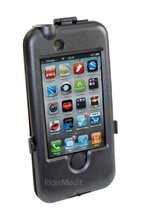
My iPhone does all the above, except custom route planning.
So finally got a solution:
Navigon for iPhone (this is the only one which allows custom route (be it with slight bodge) TomTom & CoPilot just don't support it)
That said CoPilot can do route 'planning' on the handset but its fair amount of work if your work inputting it manually. No good for a two week trip. This will be a last resort, but for now....
Use Tyre for TomTom:
http://www.janboersma.nl/gett/index.php
Its an application that uses Google Maps, that creates itinerary files for Garmin & TomTom. You basically plan your route in the excellent Google maps and export it. (sure most of you have heard of it)
This gives you a file called "yourmap.itn" (easily used in TomTom)
Convert it to a .targets file with this handy program:
http://www.benichou-software.com/index.php?option=com_content&view=article&id=4&Itemid=2&lang=en
Then just place it in your iPhone Navigon directory, either via SSH or WinSCP, I followed this blog:
http://certain.cc/2010/08/custom-routes-navigon-iphone/
Just tested it all it all works!
Just got to take it for a test run now
The Problem
Plenty of Sat Nav Apps work fine, put the postcodes in, bang, fastest route is generated. But they never go the route I want to go, its a big issue on the bike, as I want to take fun twisty roads, which often make no sense to a satellite navigation planning software.
The Solution
Well I had been considering this:
http://www.amazon.co.uk/Garmin-Zumo-Satellite-Navigation-Motorbikes/dp/B001PKTBR2
Its well reviewed here, works well. But a tad expensive*
My iPhone does all the above, except custom route planning.
So finally got a solution:
Navigon for iPhone (this is the only one which allows custom route (be it with slight bodge) TomTom & CoPilot just don't support it)
That said CoPilot can do route 'planning' on the handset but its fair amount of work if your work inputting it manually. No good for a two week trip. This will be a last resort, but for now....
Use Tyre for TomTom:
http://www.janboersma.nl/gett/index.php
Its an application that uses Google Maps, that creates itinerary files for Garmin & TomTom. You basically plan your route in the excellent Google maps and export it. (sure most of you have heard of it)
This gives you a file called "yourmap.itn" (easily used in TomTom)
Convert it to a .targets file with this handy program:
http://www.benichou-software.com/index.php?option=com_content&view=article&id=4&Itemid=2&lang=en
Then just place it in your iPhone Navigon directory, either via SSH or WinSCP, I followed this blog:
http://certain.cc/2010/08/custom-routes-navigon-iphone/
Just tested it all it all works!
Just got to take it for a test run now
")