And here are a few more suggestions ....
Canberra - boring road to Cooma, then down to Bombala.
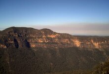
From here, take the road through Delegate and Bonang down to Orbost ; this road has over 100 kms of continuous corners, and you'll need to switch off the concentration for a while in Orbost before heading up to Buchan, and then up the very scenic, mostly unsealed Barry Way (good camping along here) to Jindabyne.
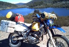
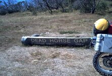
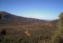
From here I'd head west up past Thredbo and dead horse gap towards Khancoban and Corryong. Along the way there's excellent camping at Leatherbarrel Creek (there's a nice little spot below the road), a large open area (with toilets) at Tom Groggin rest area, or, even better IMO at Geehi Hut rest area (toilets), where you can camp right next to the river. In the morning, face away from the river and you'll see any number of kangaroos out on the plain.
From here I'd continue to Khancoban (the glass-fronted large shop in the "town centre" serves good food), and on towards Corryong for "about 5kms", and turn right to Cabramurra (Australia's highest town), where the shop in the centre of town not only sells excellent egg & bacon sangers, but they have a display of some very good B&W photos taken during the construction of the Snowy Mountains Hydroelectric scheme.
Heading out of Cabramurra, turn left at the town's edge and travel "about 5kms" to a T junction, turning left towards Tumbarumba. It's worth stopping at the Tumut 2 tunnel to hear the echo ! After perhaps 60kms you'll reach another T intersection, with the right heading to Tumbarumba, but I'd turn left towards Corryong. Along the way there's a new lookout for the Silver Cloud, a plane which crashed in the mountains opposite. Carry on through Tooma and across to Tintaldra, west through Walwa, and across the bridge to Jingellic, where there's a good free campsite next to the pub.
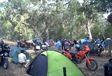
Back across the bridge to the river road and turn right towards Wodonga for about 60kms, turn left to Granya and across the gap to the Murray Valley Hwy, right to Tallangatta where there's a "motorcycle friendly" pub in the main street. The local police are fairly enthusiastic about their jobs .... About 500 metres west of town is a road up to the lookout ; watch out for gravel on the first left-hander which turns behind the house! From here it's a short ride to Mitta and the HU meeting.
From Mitta I'd head south towards Omeo, turning right after Glen Wills and across the partly sealed road to Falls Creek, down the great bit of road to Mt. Beauty, turning left at the town's northern end and across the Tawonga gap road to a T intersection, Bright to the right, but if you wanted to camp, left to Harrietville and a campground at the town's southern end with a lovely little creek. IMO the northern pub (on a corner) has the better meals.
If you're heading towards Melbourne, ride up through Bright, up to Myrtleford and turn left in the centre of town towards Cheshunt and Whitfield. This'll take you past Lake Buffalo, and after a 40 zone in the middle of nowhere, the road turns right, becomes unsealed and leads to Whitfield. You can camp in the uninspiring campground here (the food service at the pub is deplorable), but better to ride north towards Wang and stay in an excellent little campground in Moyhu, right next to a pub which serves excellent meals. Between Whitfield and Moyhu is La Cantina winery, where Gino makes excellent well priced preservative-free wines.
Back to Whitfield, take the turnoff to Mansfield, stopping at Power's Lookout on the way. The short, slightly strenuous return walk from the lower lookout is well worth it for the view.
This is obviously a very circuitous route, but it takes in not only great scenery, but some of the best motorcycling roads in south-east Australia. After all, it's the journey, not the destination !
If it's wet in Melbourne, look out for the tram lines !
I'll be down in Tassie from the 13th to the 22nd, but if you need a "guide" for a ride down the Great Ocean Road (or anywhere else), give me a call on 9817 2009
Safe riding,
Phil

 Thanks for sharing it with us


 )
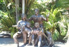
) I like the one with Steve Irwin and family, thats a good tribute to the guy