An excellent tip from Bumpkin 


I have just been mucking around in viaMichelin's website. There is a new (or at least I think it's new) routing option, available from a list of choices, in a drop down menu.
The routing option is called 'DISCOVERY'.


I've recently downloaded the ViaMichelin iPhone app and very useful it is too.
There is also a Michelin map of France app. Before I bung £7.50 at it does anybody have any experience of it? Does it do anything that ViaMichelin doesn't? More detail? Do they integrate with each other in some way? Or is it solely the fact that you can view off line?
Cheers
Andres
Dear Wapping
Thanks for your very useful advice on the UKUsers website about touring in France. I havent toured in France yet but I am planning a one week trip at the end of August. I want to do a round trip travelling to Northern Spain via Aix Le Bains and returning via Bordeaux and I reckon I need to cover about 300 to 400 miles a day. In your experience is this a realistic target? Bearing in mind that I am trying to get the balance right between motorway and scenic roads - yes, the purpose of the trip is to get to Spain but I do actually want to see something of France on the way! I will be camping and so, due to the luggage I dont want to be blatting along too fast either! Grateful for your advice. Cheers, Rodger
I've used the Découverte option on the viamichelin site.....If, however you do the 'discovery' option....
It's true.
I would think about updating mine about as often as I might update by big paper Atlas of France, say once every five to six years.

Unashamedly lifted (and adapted) from Franco's excellent original post:
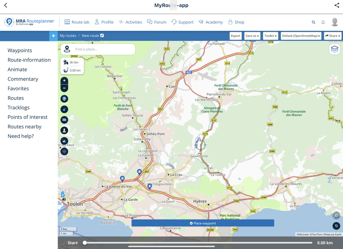
Michelin's French maps are excellent, with a host of useful detail for plotting touring routes.
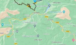
If you're travelling across France, motorways can save a lot of time and some of them (especially round these parts) are very scenic. They are marked on the maps as two red lines with a yellow band in the centre for toll roads, and two red lines with a white central band for non-toll. However, there are sections of the toll roads (marked 'peage' on French signposts) which are free. See the pic below.

The A57 autoroute from Toulon towards us, is free initially, then just after Cuers (directly above the aeroplane icon), you'll see the motorway turn to yellow from white and there is a black line across it. That's the toll barrier. Some of them can be expensive too, but you can figure out the charges and other costs, including fuel, on the ViaMichelin site:
http://www.viamichelin.com/viamichelin/int/tpl/hme/MaHomePage.htm
Also, on the same map you can see:
The classic D 'Country' roads, in yellow. These are, near enough, like the UK's B roads.
To the right hand side, the shaded green 'scenic' route across the Col de Babaou, with its suggested view point, probably with a suitable lay-by or pull off area.
To the left, you can see the unclassified (white) road, going west from Sollies Pont, again becoming scenic. As the white line is unbroken, it will be metalled but maybe bumpy or a broken surface, possibly narrow, but certainly OK for a motorbike or family saloon car.
In the lower portion of the map, you can see the D98. This has the distance calculators, between the 'pins'. From the D98's junction with the D12, west to its junction with the D559, is 11 km (nearly 7 miles).
The D98 road here is red, not yellow. This indicates it is more of a main road than the classic yellow D roads, so expect more traffic, particularly as it appears to be the only road along the coast. The French have, just recently, been reclassifying some of their main N roads (the equivalent of the the UK's A roads) as D roads. The colour and location of the road may well give you the best clues.
Bon route...
I was Googling Michelin maps and this post came up !!
Worth bringing back to the top.
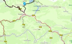
Interesting that the MRA Michelin map overlay isn’t quite as detailed as in Wapping’s original post
And it seems to be showing all toll rds,
Perhaps they are all tolls now compared to 2008 ?