Garmin/Magellan images of the Isle of Man

samwise

Registered user
Joined
Jan 1, 2003
Messages
886
Reaction score
0
Location
Yeovil, England
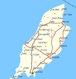
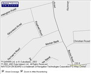
How much detail is in shown on the maps from Garmin (or Magellan) of the Isle of Man?

Never seen one and don't think there's a retailer of GPS on the island, so can't put my hands on one. Would just like to see a screenshot or something in order to tell whether it's worth buying or not.

I know I could use it when I start taking the bike across on the ferry next spring for long weekends oop north (as a transplanted Southern softie :D ), but would like to play on the island first - if the island maps are good enough :)

Cheers
 
Samwise

if you goto http://www.garmin.com/cartography/ and pick City Nav V6 from the "View Mapsource Map Viewers", and keep zooming in, it will show you the level of detail that you'll get with the product. I kept zooming in on Douglas (lucky Douglas I hear you cry) and it seems very comprehensive.

Cheers

Mark
 
Garmin (City Nav V5), this is all you get....
 

Attachments

  • screenshot025.jpg
    screenshot025.jpg
    33.2 KB · Views: 149
Whatton

Humm not what I got with V6 when I looked on their web site. You certainlky can look at the IOM at that level, but street level detail is also available.

Regards

Mark
 
markie_wales said:
Whatton

Humm not what I got with V6 when I looked on their web site. You certainlky can look at the IOM at that level, but street level detail is also available.

Regards

Mark

I think it's because I'm using City Nav V5. This is the mapping that came with my SP III.

:(
 
Thanks Mark - this is what I get down to at 200ft (the closest it gets). Shows my street so not too bad at all.

Can Garmin search by road number (i.e., a greenway over here starts at the junction of U70 (Slieau Whallian Back Road) and D47 (Garey Road)?
 

Attachments

  • 200ftgarmin.jpg
    200ftgarmin.jpg
    23.3 KB · Views: 132
Hi Samwise,

I've got a Garmin Colourmap with the latest v6 mapping software & can go down to 80ft scale at street level anywhere on the Island. I used it at this year's TT & found it quite useful as I could read the road ahead of me as a moving map (ie: does it go left or right after this next bend?). I've got the whole Island on a 16mB card & you'll be able to track log all the greenways. The useful thing about the C/map or SP111 are the ability to have several cards with different maps on. I've got the 16mB one, a 64mB one with areas of France I needed this summer & a 128mB one with almost the entire UK mainland on it.

In summary, you need the v6 maps.
 
Cheers Paul :thumb

Looks like I may be looking around for a play on one in a shop when I'm down at the parents in Somerset in November.

May need it if the ADVRider Europe meet goes ahead next year :D
 
How much detail do you want?

:confused:

Greg

untitled1.jpg
 
How much would it cost for me to upgrade from V5 to V6?

Has V6 got more detail of Ireland on it as well?
 
Whatton said:
How much would it cost for me to upgrade from V5 to V6?

Has V6 got more detail of Ireland on it as well?

You'll have to look at the Garmin site to find out how much the upgrade is - however, unless you're travelling soon, I'd wait for v7 which can't be more than a couple of months away.

Dublin's got reasonable detail:

dublin.jpg


but the picture below illustrates the relative lack of detail in Eire as opposed to Northern Ireland:

untitled2.jpg


Greg
 
Greg Masters said:
How much detail do you want?

:confused:

Greg

untitled1.jpg

At least enough to show the "White House" which keeps about the best selection of ale in Peel :D :D :D
 
grumpy-lee said:
At least enough to show the "White House" which keeps about the best selection of ale in Peel :D :D :D

Lee

You'd better check that map again!!!

;)

Greg

PS This one?

zwhse.jpg
 
Greg Masters said:
Lee

You'd better check that map again!!!

;)

Greg

PS This one?

zwhse.jpg

Checked map, must have been moved to where the Post Office was since I was last there :D :D :D


Back
Top Bottom