Garmin Map confusion and America

jimbo

Well-known member
UKGSer Subscriber
Joined
Jul 26, 2003
Messages
2,798
Reaction score
12
Location
Looking for a way out
I'm off to the US on holiday this year, so I was looking at the garmin maps.
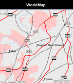
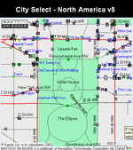
I can get a world map for £55 which looks to have a fair bit of detail for the US or I can get a 'MapSource City Select North America (one region) ' for £113.

What is the significance of the 'one region' bit:confused:
It also says works with 'GPS V Deluxe (EU basemap) v6 ', I'm only on version 5.

Does anybody have any experience of the world map? No autorouting (I've a GarminV). Is the detail worth having?

This all seems surprisingly complex or am I just not very bright
 
This is as good as WorldMap gets:
 

Attachments

  • untitled1.gif
    untitled1.gif
    79.8 KB · Views: 175
but City Select NA gets down to this detail:
 

Attachments

  • untitled2.gif
    untitled2.gif
    89.6 KB · Views: 171
City Select does not appear to be split into NA regions (City Navigator is).

The City Select will autoroute with a GPS V - WorldMap will not.

The market value of WorldMap may be somewhat less that you quote. ;)

Greg
 
Greg said "City Select does not appear to be split into NA regions (City Navigator is)."

Greg, I believe they have the same coverage. City Nav does not have split regions. City Select is the map software choice with routing options for a GPS V and can be bought online for $120 USD. List is $140.
 
CitySelect North America (see this link) would be the most appropriate choice for you.

There is a similar, slightly less expensive product called "MetroGuide USA" (see this link), but it does not support autoroute creation on the GPSR.

WorldMap would be inappropriate, it only provides very coarse information (major roads), does not support autorouting, and is now about 5 years old.

The various internet vendors tend to be pretty competitive on the prices for the map products. If you tell the vendor to discard the box that the product comes in, and just send you the CD (in the jewel case) and the unlock code, you could probably reduce your shipping costs considerably.

PanEuropean
 
K2R said:
City Nav does not have split regions.

K2R - you had me confused for a moment!

Different markets, different products. In Europe we can but City Navigator North America with a single region unlock code. This UK retailer is still offering v4 on their website.

Conversely, I don't think that you can buy a European Garmin product with less than the full version of City Navigator Europe - you might.

Greg
 
Guys, I am pretty sure that Garmin has abandoned the "regional unlock code" option for both North America and Europe. I think there were quite a few complaints about pricing it that way, so Garmin just went to a single "whole continent" unlock.

I don't think it would be a very good idea to buy version 4 of a CN product - seems to me that the current version of CitySelect North America, with the entire continent unlocked, is much less than a single region unlock code for the obsolete product. My guess is that the retailer has just neglected to delete that page from their website.

PanEuropean
 
Everyone here seems to have forgotten that there is a "Roads & Recreation" CD-ROM for the USA. It will load into ANY GPS. It has the same sort of detail as the new auto-routing types but without the auto routing data.
I have a copy if anyone would like to "borrow" it. Send me a PM.
 
Howard:

I think visitors to the USA would be better off with a paper map than with the 'Roads and Recreation' USA CD. Not that I am trying to show any disrespect for your courtesy in offering to loan your CD, but the product is about 6 years old, and the road networks change in the USA much faster than they change in Europe - meaning, interchanges are revised, new neighbourhoods built, new arterial roads created, etc.

At least with a paper map, a person could be assured that they would have up to date information.

If anyone does go to America and plans to use really old electronic cartographic data (e.g. Roads & Rec, or MetroGuide prior to the current version), I would suggest you keep the zoom set to a pretty wide view - in other words, just use it to keep yourself spatially oriented between major arterial roadways. Otherwise, the out of date cartography is more likely to get you into trouble, rather than keep you out of it.

PanEuropean


Back
Top Bottom