

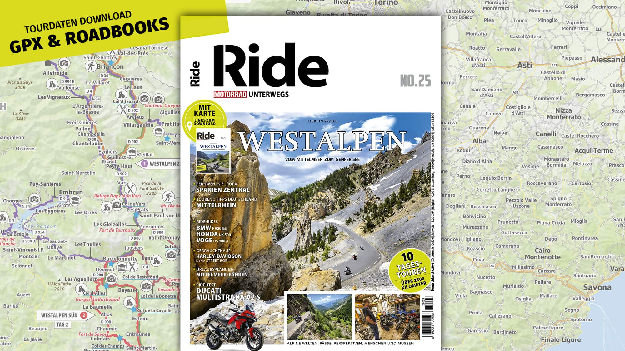
The latest German RiDE periodical (get it via Readly) has a special on what Germans call ‘Westalpen’, which to us is near enough south east France, into Switzerland and Italy.

The route suggestions are generally pretty good, with decent maps, along with free GPX downloads. I don’t speak German but a picture is a picture, a hotel suggestion is a hotel suggestion, and a distance is a distance. In other words, it’s easy enough to get a pretty good idea what route suggestion is like, before turning to a translation app.
Here’s a sample of one of the suggested routes. I’ve chosen this one, simply as Monaco comes up from time to time on these pages.


Tag is ‘day’ in German, so the article is a two day suggestion.
Stunden, is hours.
Streke, is distance.
The GPX downloads can be found here:
 www.motorradonline.de
Here’s day two, uploaded to Kurviger, simply for display purposes:

Here it is in MyRoute. I always try to download routes from a third party as a track:
The route suggestions are generally pretty good, with decent maps, along with free GPX downloads. I don’t speak German but a picture is a picture, a hotel suggestion is a hotel suggestion, and a distance is a distance. In other words, it’s easy enough to get a pretty good idea what route suggestion is like, before turning to a translation app.
Here’s a sample of one of the suggested routes. I’ve chosen this one, simply as Monaco comes up from time to time on these pages.
Tag is ‘day’ in German, so the article is a two day suggestion.
Stunden, is hours.
Streke, is distance.
The GPX downloads can be found here:
Ride No.25 — Westalpen — GPX & Roadbook Download
Auf dieser Seite finden Sie alle Touren als GPX und Roadbook-PDF aus dem Heft No.25 – Westalpen, exklusiv für unsere Leser der Ausgabe. Zum Herunterladen der Dateien klicken Sie einfach auf den entsprechenden Link.
www.motorradonline.de
Here’s day two, uploaded to Kurviger, simply for display purposes:
Here it is in MyRoute. I always try to download routes from a third party as a track:
Last edited:

