

As promised, the following to the Faroe Islands leg is a decent dash to discover the Iceland.
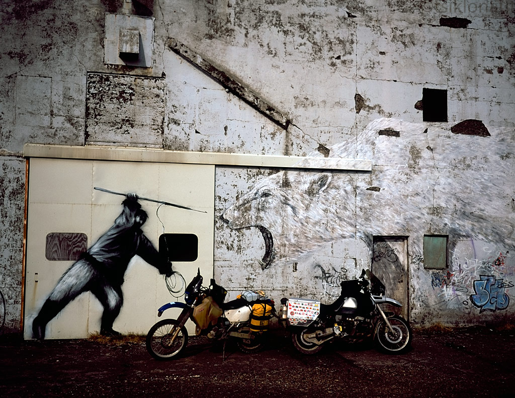
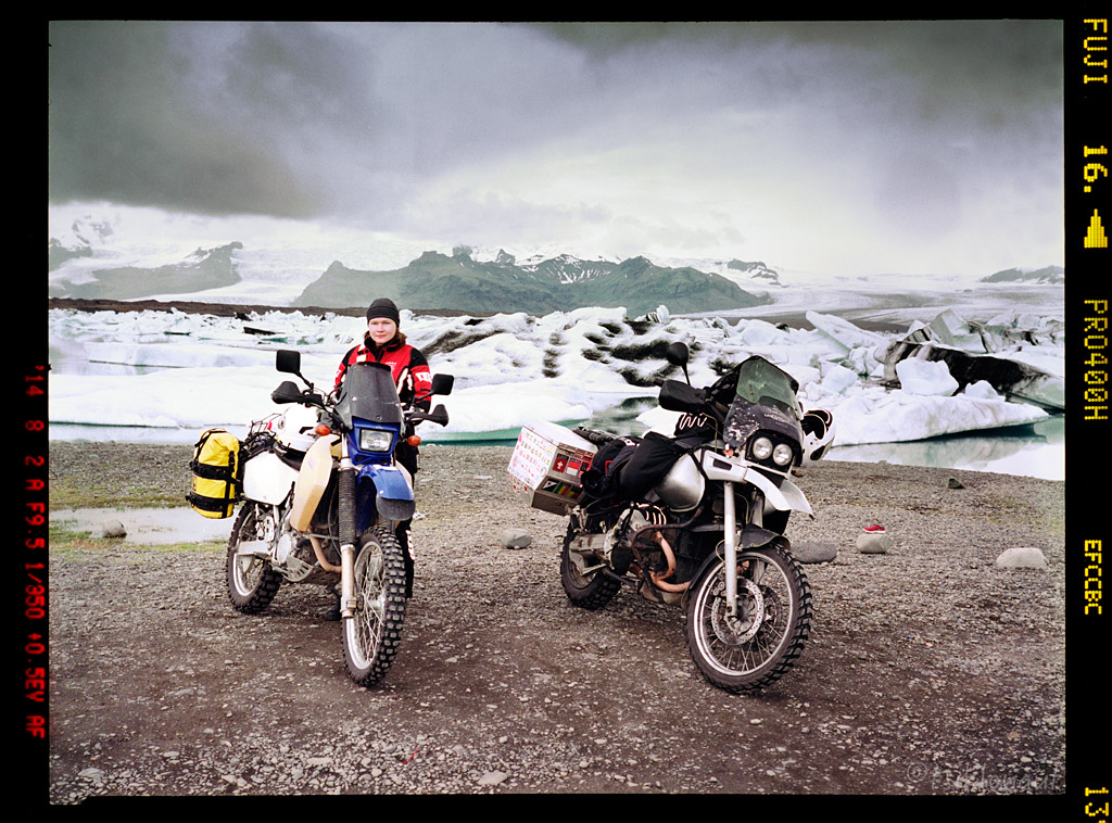
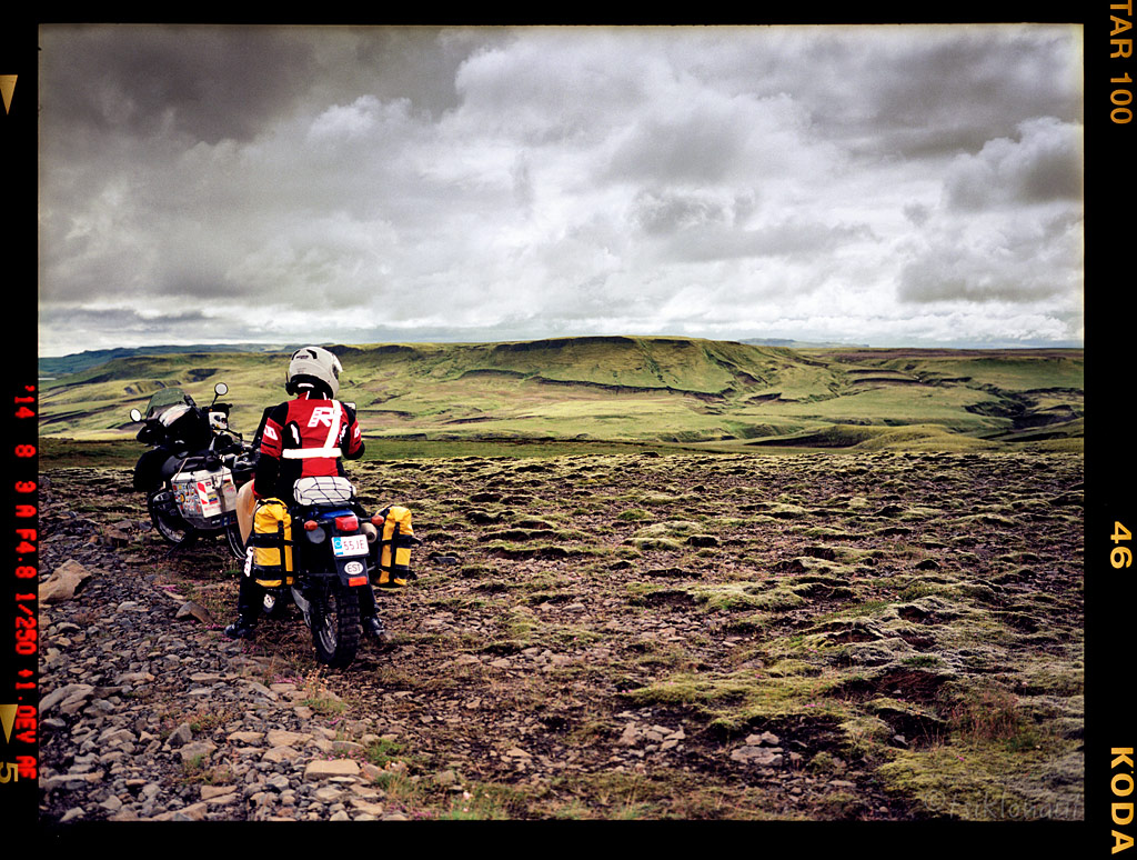
Kariina had just received her bike license and it seemed like a good chance to put it to the test. Iceland is remote enough for gaining that decent off-road experience, yet it has sufficient infrastructure in case something goes wrong.
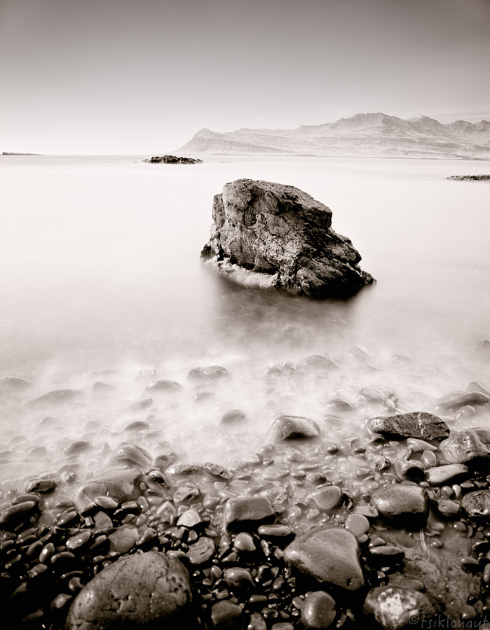
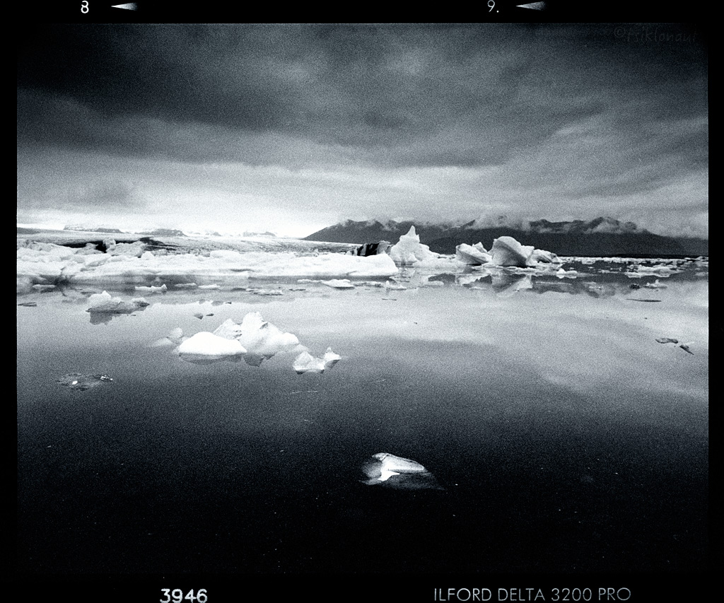
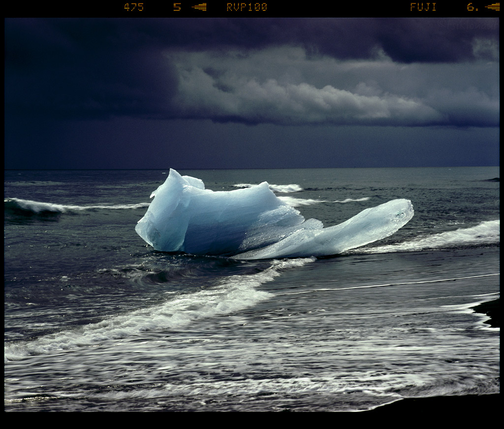
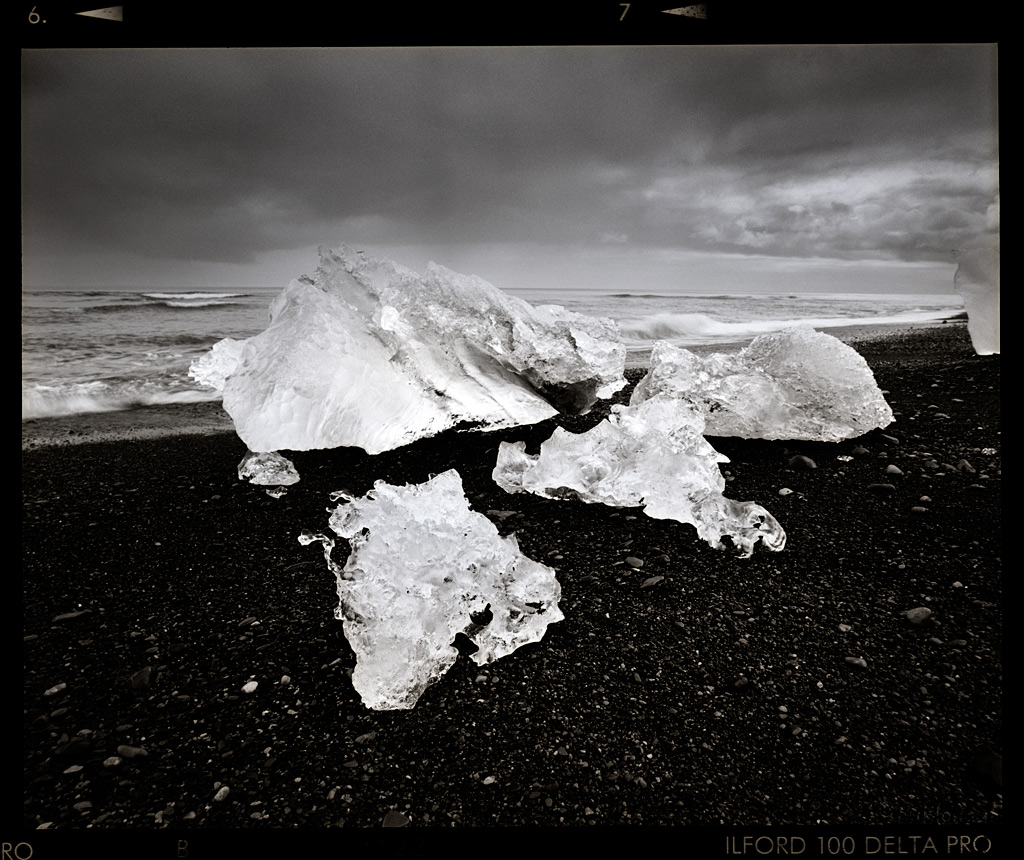
Cold Touch by tsiklonaut
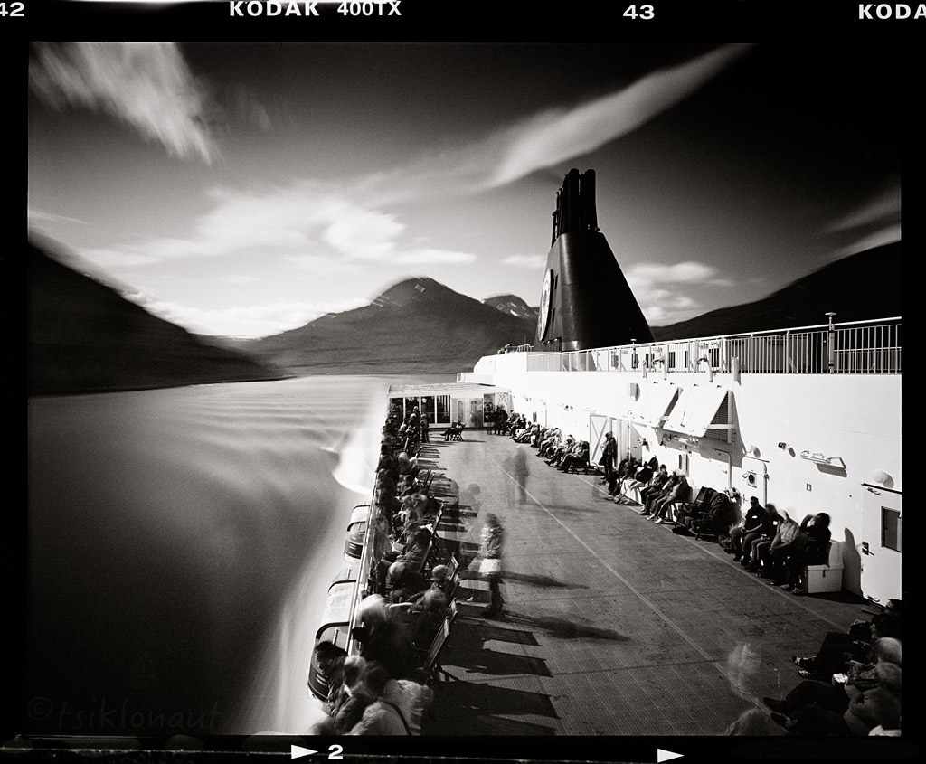
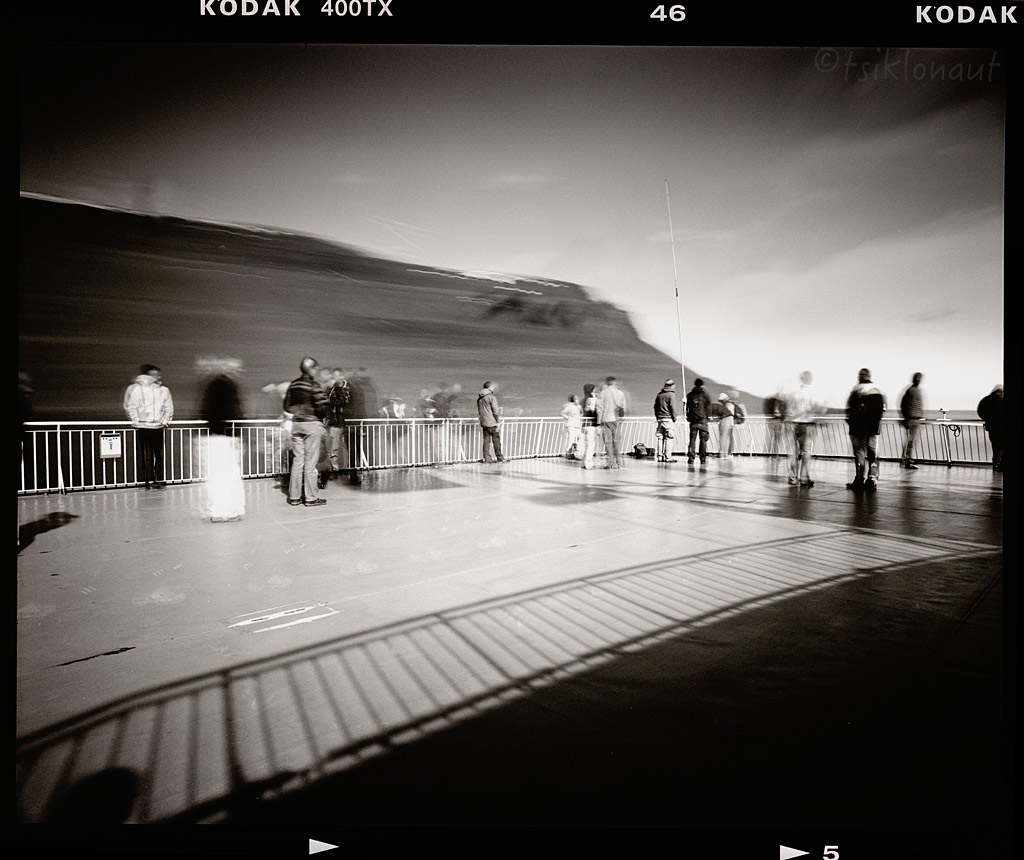
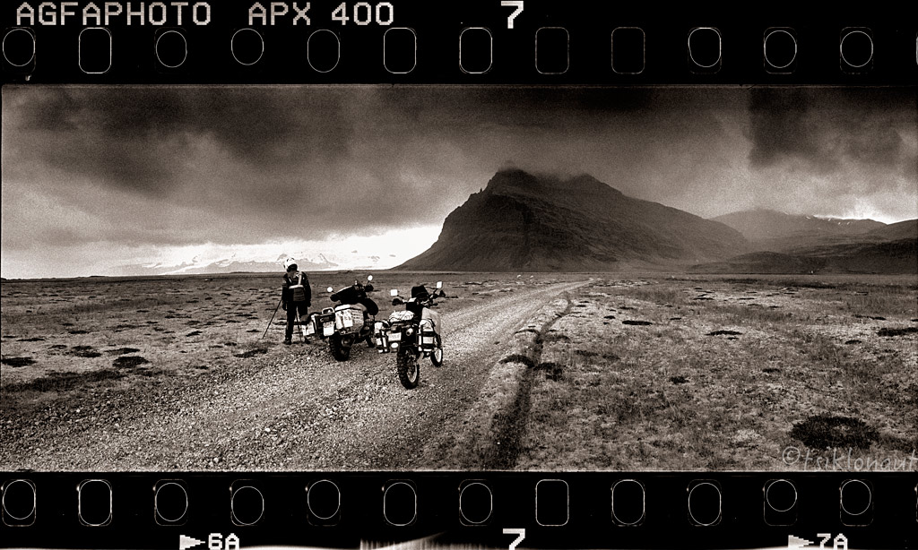
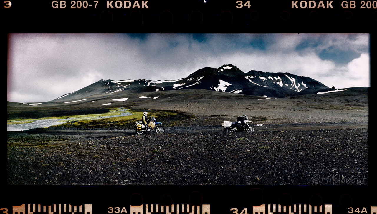
As you can see from the pictures, this time I decided to take a different approach on documenting it. I had "forgotten" my nice and very practical digital camera home, fully intentionally. I always wanted to do one trip purely with my set of film cameras as an experiment, with just a stash of film rolls with me. Mainly to be able to root the perfectionist out of me and take things as they are - think before taking a picture and don't count on technology, only count on yourself and your skill. Thus not exacly your "the latest and the greatest" gadget infested nerd ride report but a proper old fashioned way of documenting things. I had my trusty Pentax 67, my main workhorse that is around as old as I am and still going strong, plus cameras that were new to me: a Fuji GA645i rangefinder and a Soviet Horizon 202 panoramic camera for those proper unmanipulated panoramic shots. I had color and black & white films with me. NO Photoshop, most pictures aren't even cropped, I scanned them full frames as you'd see inspecting the film in your hands against the light.
And after a night on very stormy seas, accompanied by headache and vomit stench in the corridors of the ship, Iceland welcomed us.
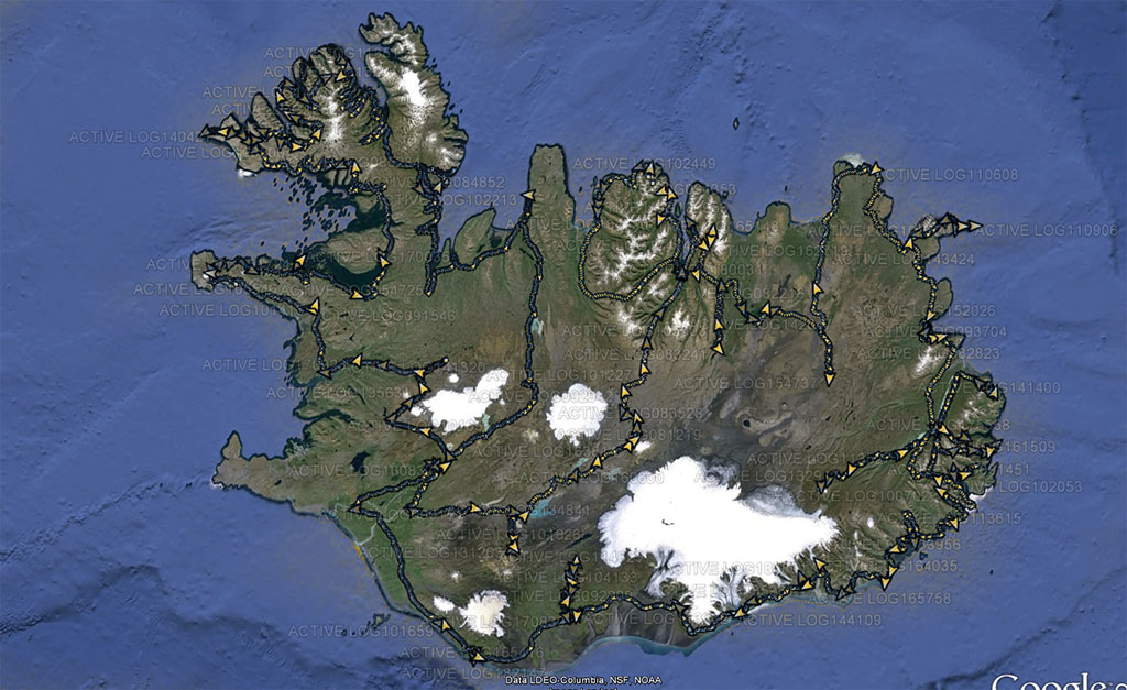
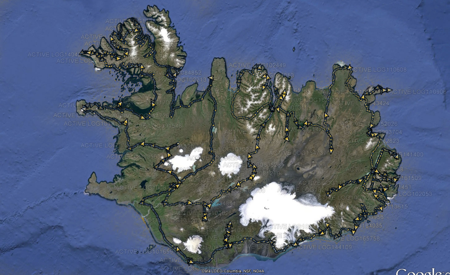
We disembarked in Seyðisfjörður (to make your reading easier, let us respect the local Icelandic writing - i.e. read this as "Seydisfyoerduur") and loaded up on our supplies of food and precious liquids for our thirsty horses. The plan was a decent clockwise circle softly touching the outer parts as a foreplay, then a deep penetration of the inner parts to top off the Icelandic enjoyment experience. Our Icelandic route:
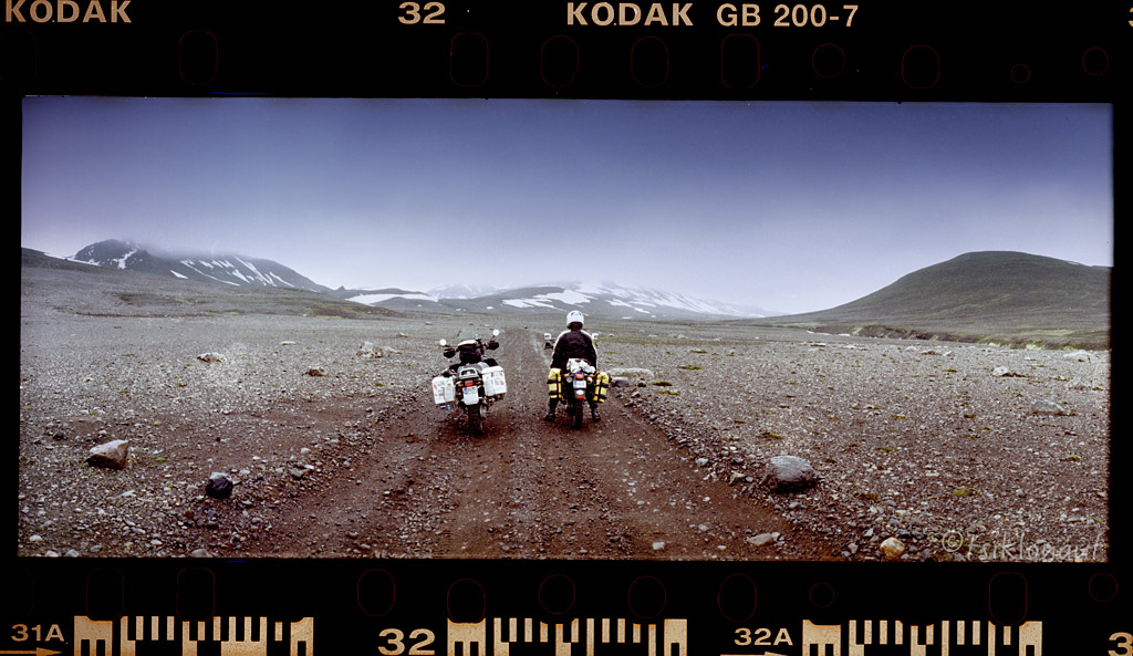
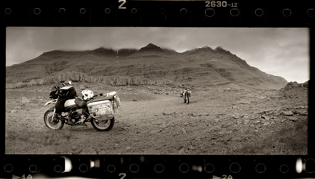
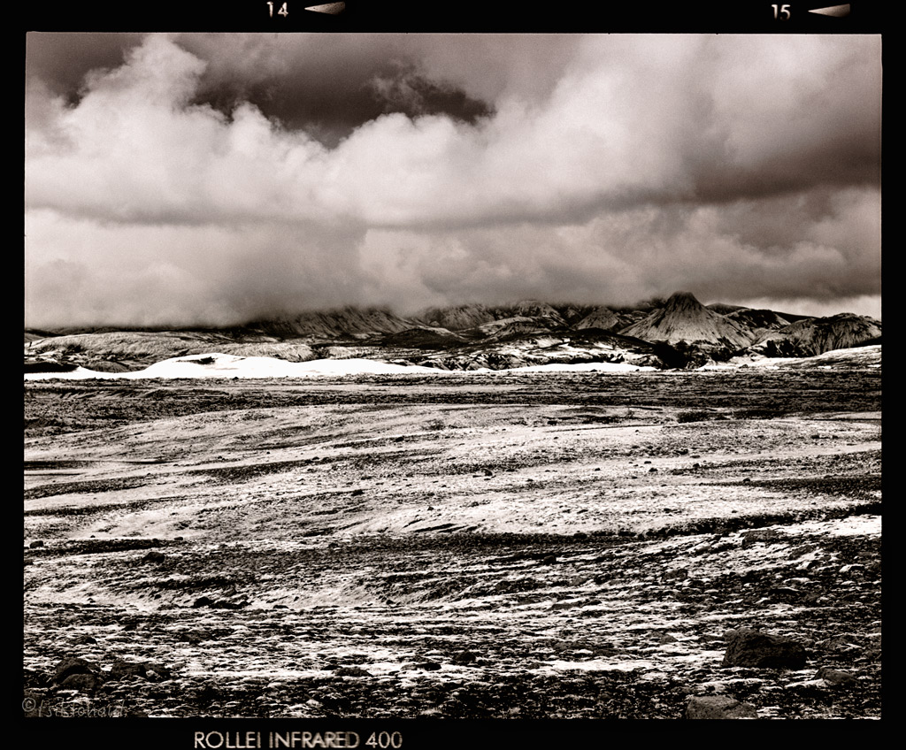
From Seyðisfjörður towards the inland.
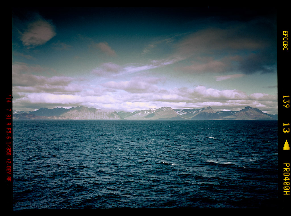
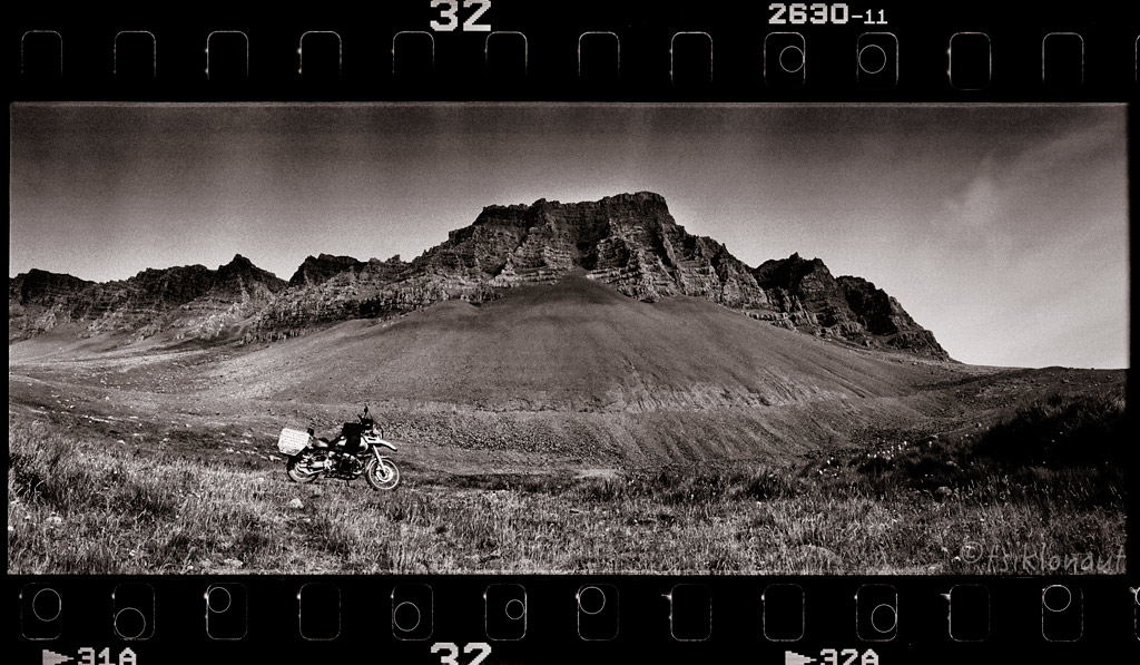
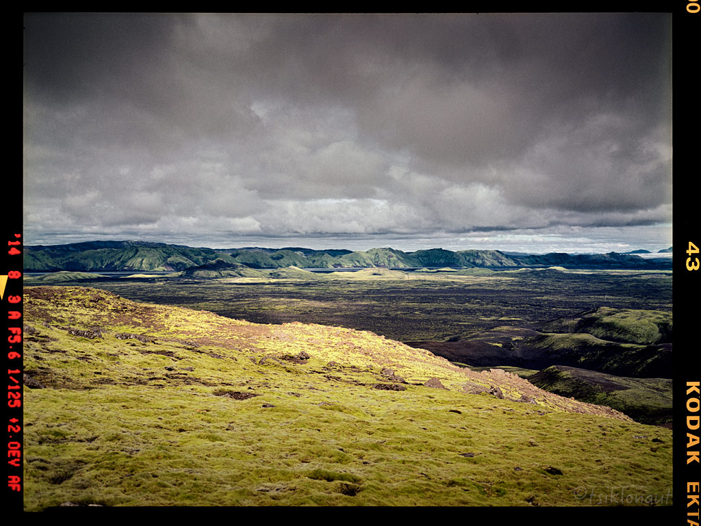
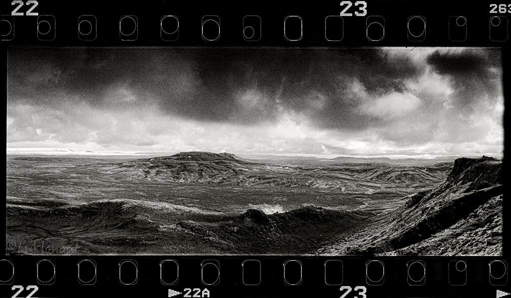
Our first course was a set to Snaefell (not the peninsula in the West). Riding down the road we could see that the landscapes were much broader than those of the Faroes. In the distance, we could spot snow on mountain tops. First it was nice and smooth tarmac, which we could not enjoy to the full though, as the wind was ferocious and now and then it rained a little. Then came a turnoff to a rocky track to Snaefell. Kariina, to whom I had promised that we would not be venturing onto extreme terrain on the first day, pointed out that there was a sign by the track indicating some river crossings. We decided to check it out regardless. The track was truly rocky, and so were the surroundings – it didn’t really resemble any place we’d been so far, as it seemed totally devoid of life. As we bumped on, the first river crossing came. Nothing serious really, but Kariina needed some convincing before she would, carefully but steadily ride through the water. Then the second river crossing came, and the third one too, until we arrived to Snaefell’s base camp. By the time we got there, the weather had turned really nasty, and we had two choices – either to stay and wait for better weather, or to ride back. Because we didn’t plan on doing any hiking in the area, we decided to turn around.
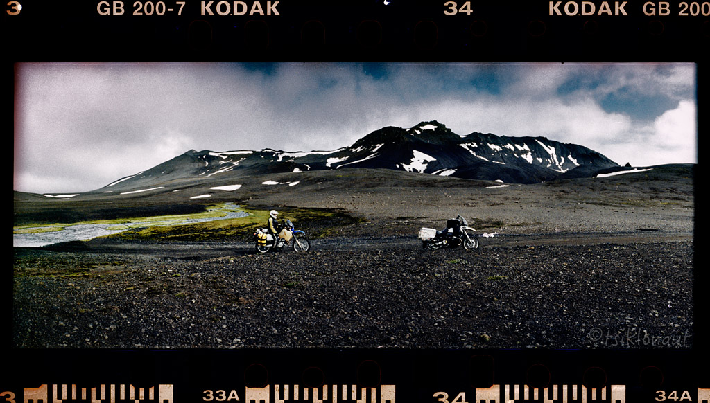
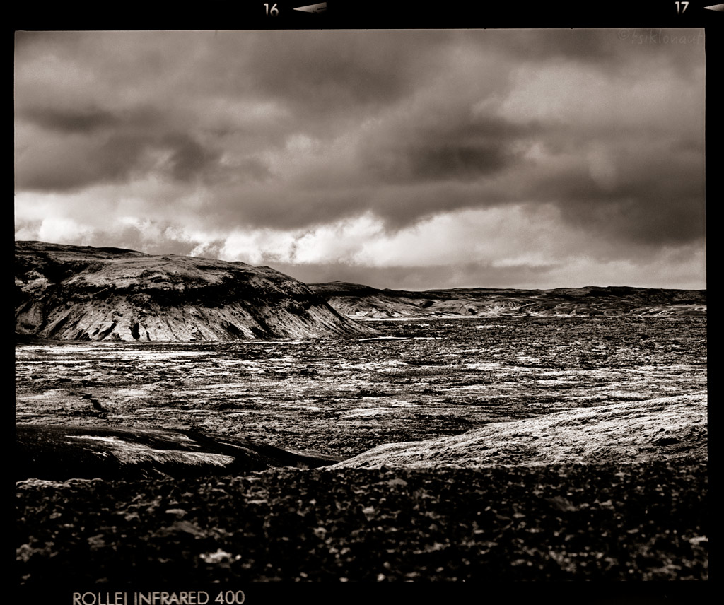
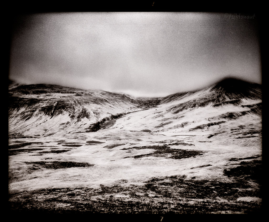
The eastern Snaefell high altitude track.
Headed back to coast discovering Icelands coastal green lands:
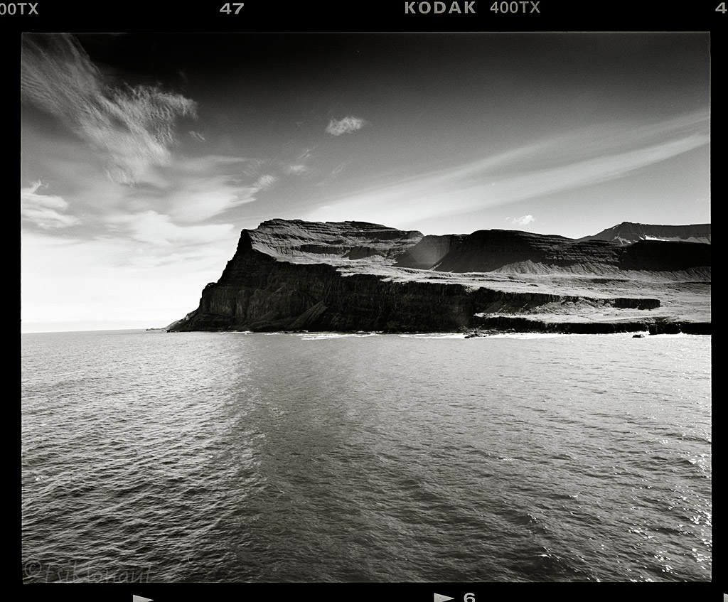
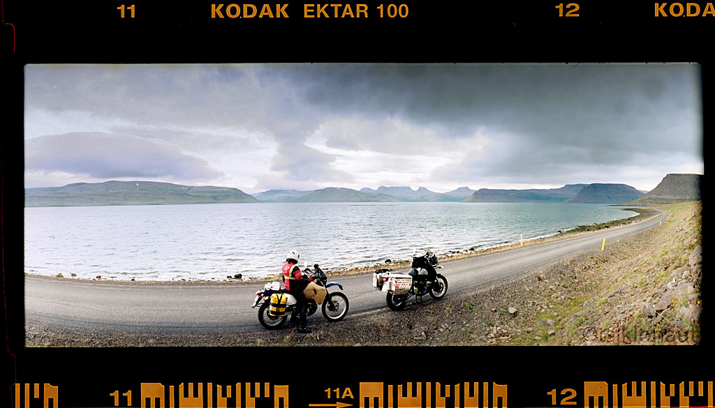
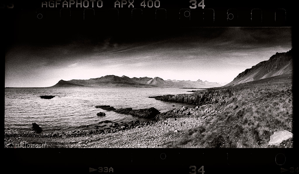
On the way East, with so many decent fjords (fjörður standing for fjord) there we simply couldn't resist the temptation to experience them close up. Fáskrúðsfjörður was very nice, like on another planet.
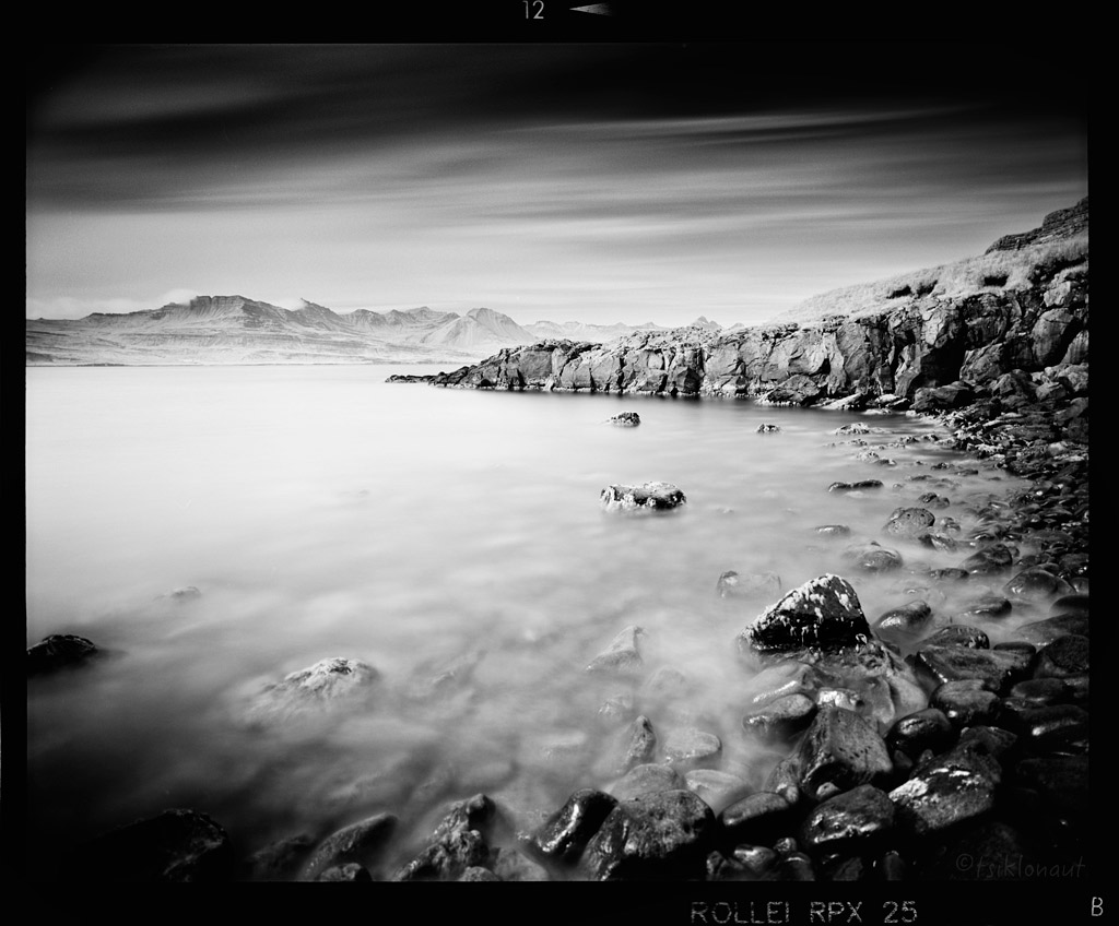
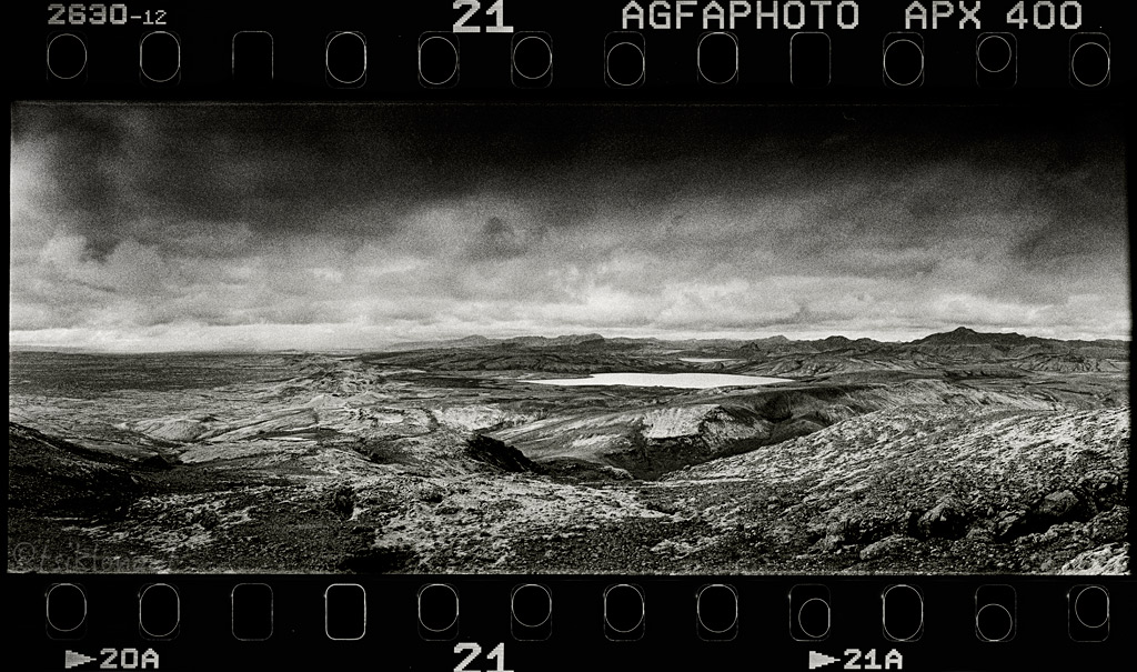
And so was the Stöðvarfjörður, I took a small steep cattle track down, Kariina decided to stay up somewhere on the road. I took a b&w film shot with my beloved fully mechanical Horizon 202 camera at the end of the track:
Down the track the views the fjords offered, the clash between the mountain and the ocean were very decent indeed.
Doc stop before the storm kicked in, Icelands biggest glacier Vatnajökull visible on the left.
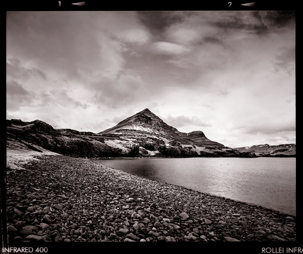
Djúpivogur is considered the nicest mountain in Iceland, looking like a pyramid.
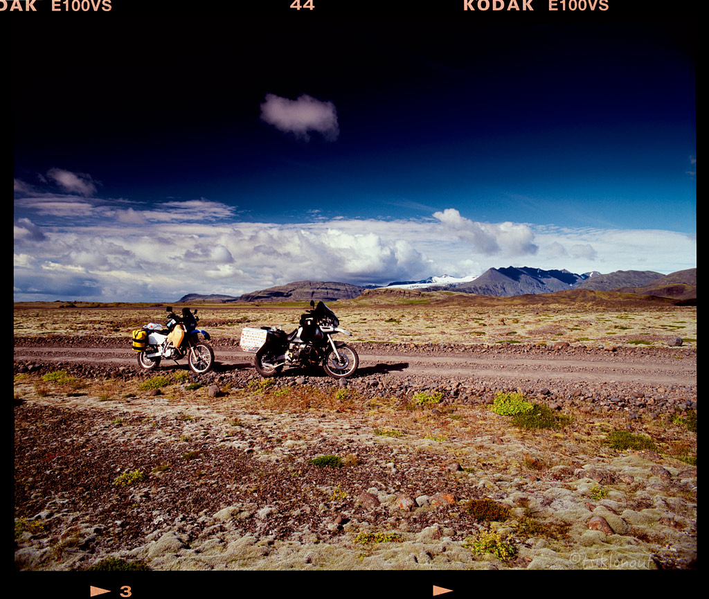
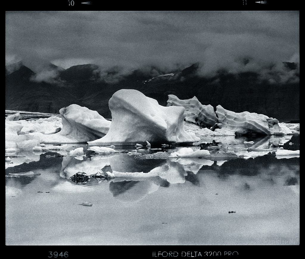
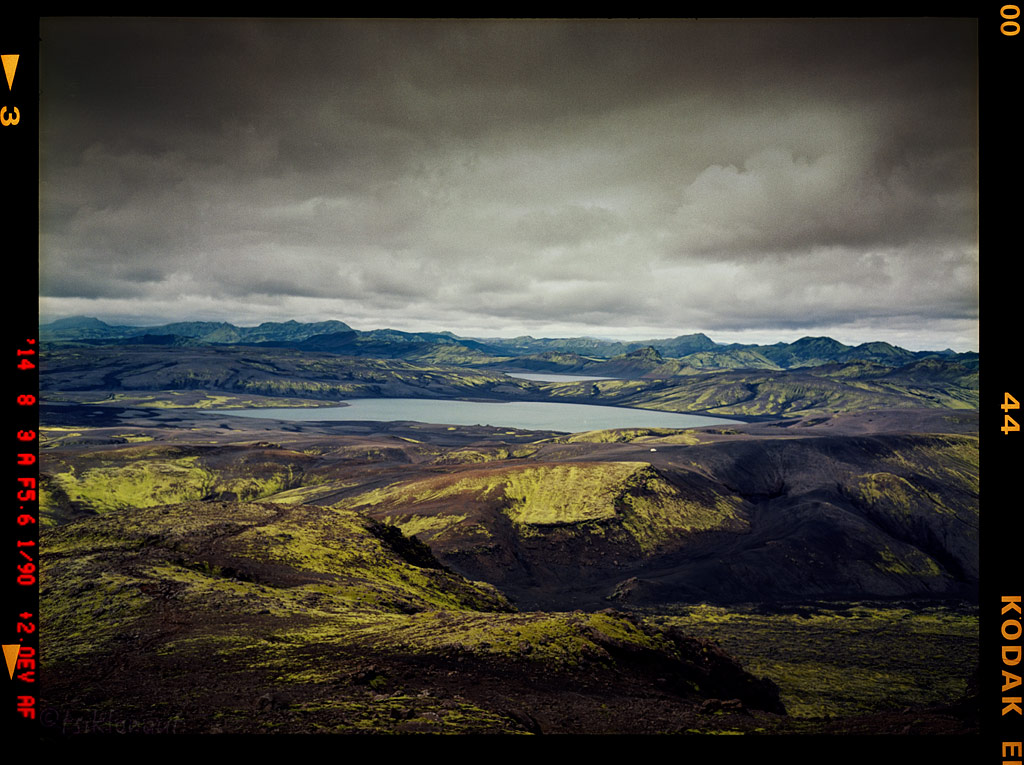
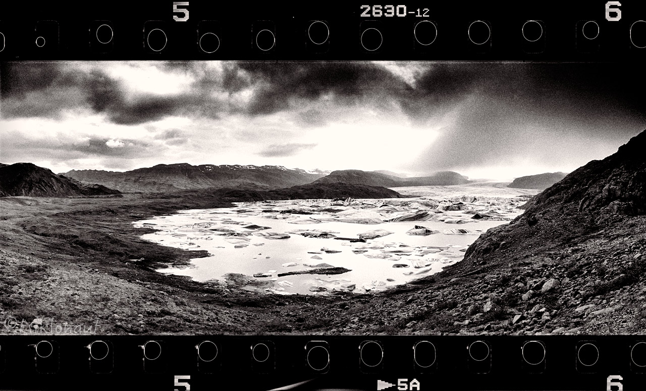
Afterwards we made a detour to take a look at Hoffellsjökull (jökull standing for glacier) lake full of ice chunks the size of a house.
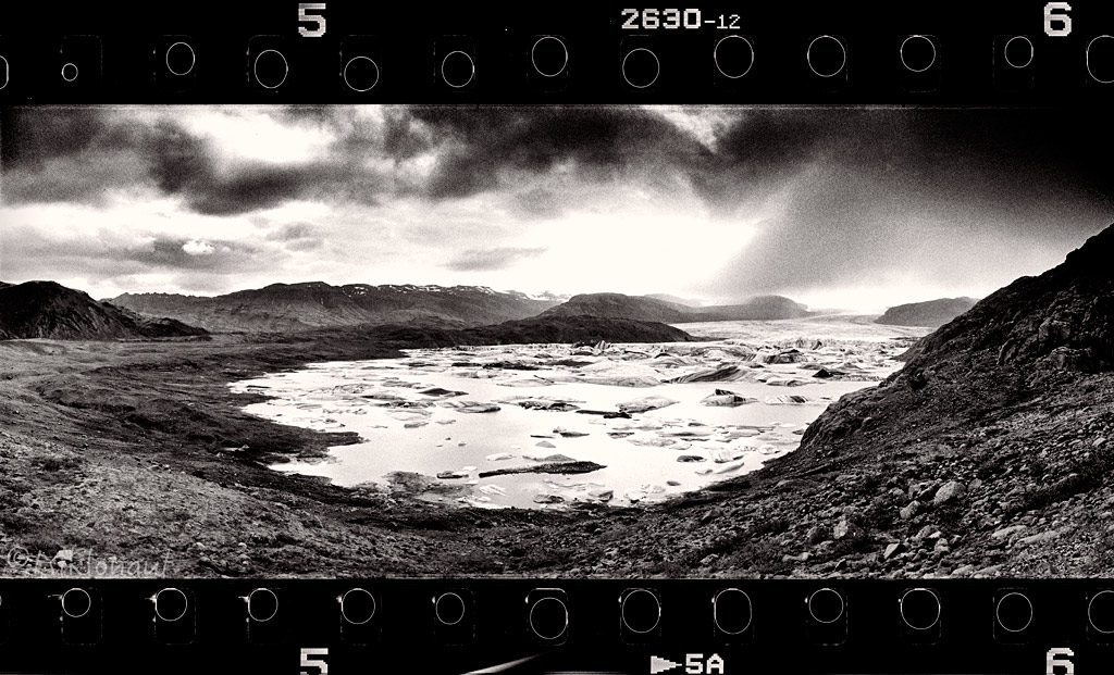
Hoffellsjökull.
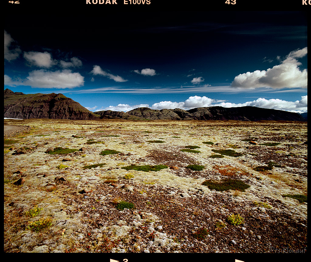
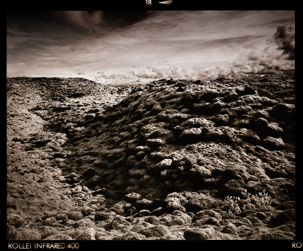
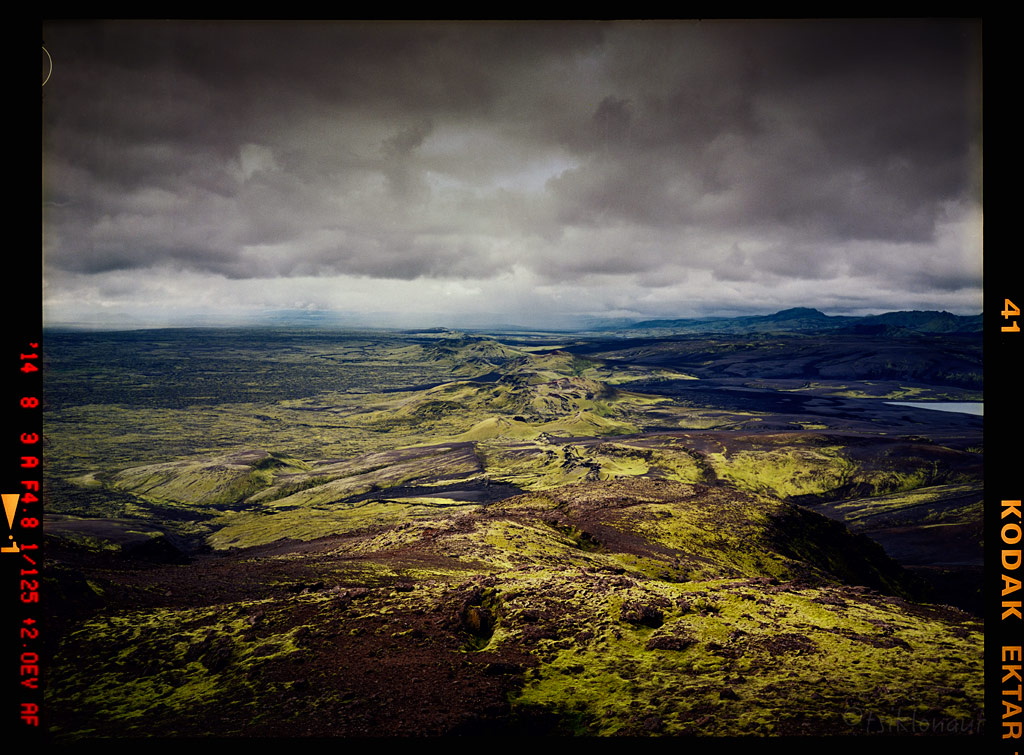
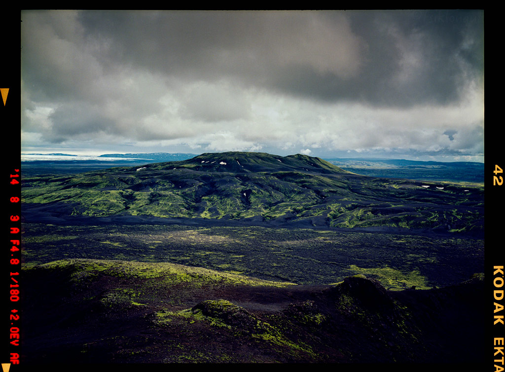
The surrounding mossy volcanic landscapes were otherworldly as well.
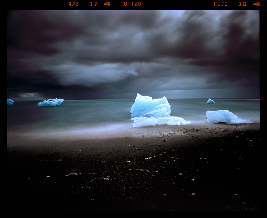
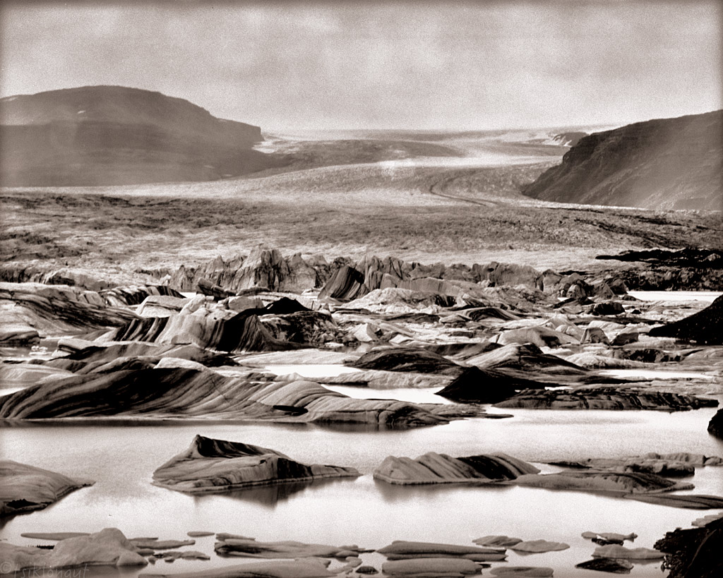
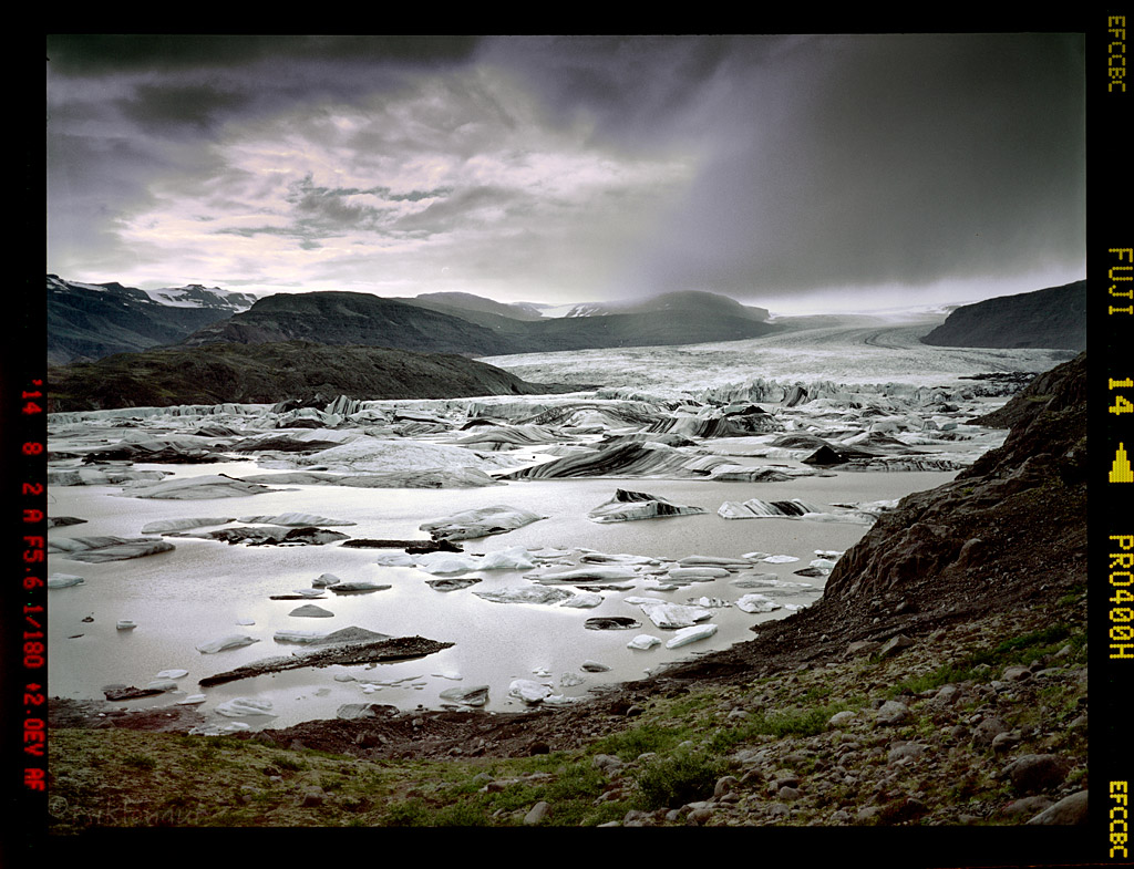
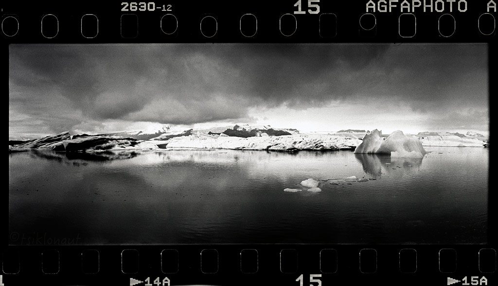
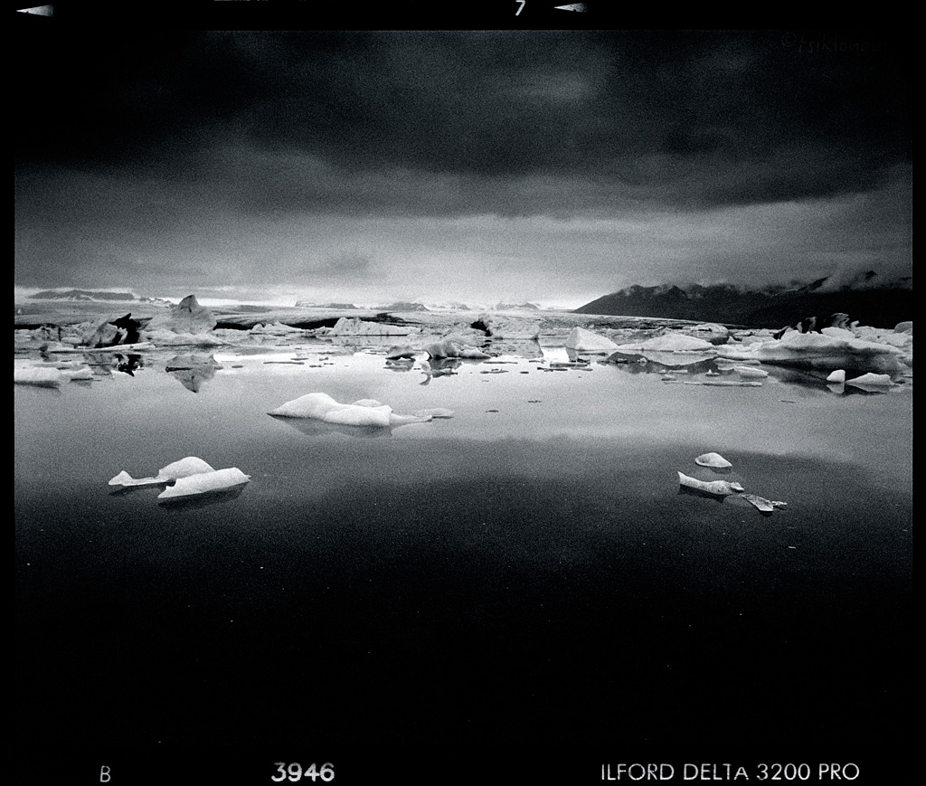
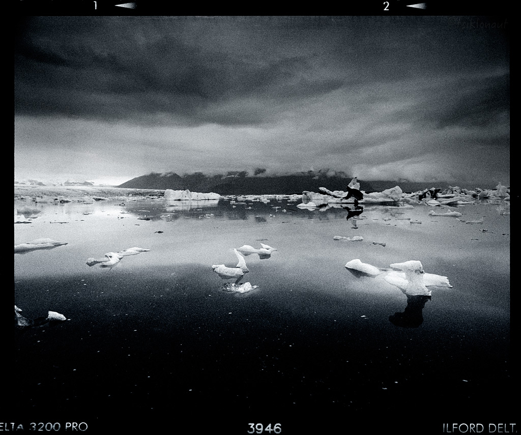
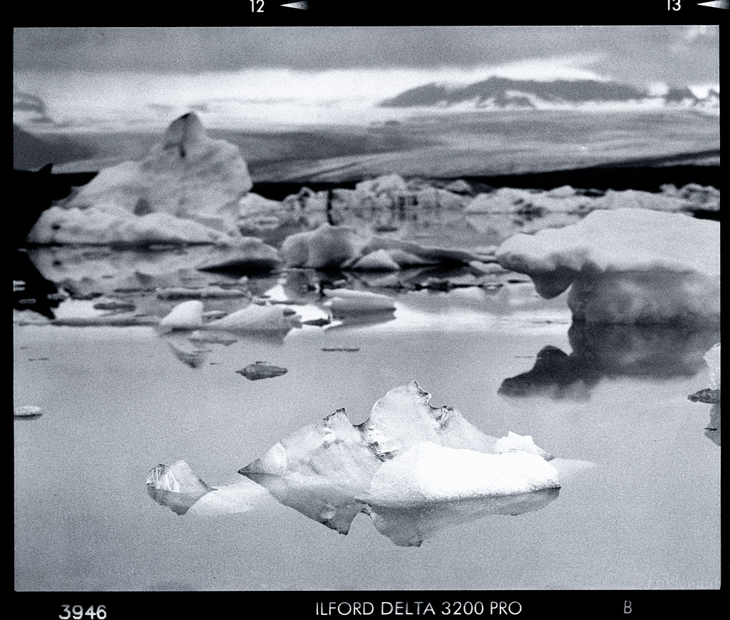
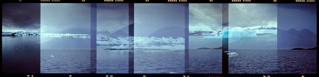
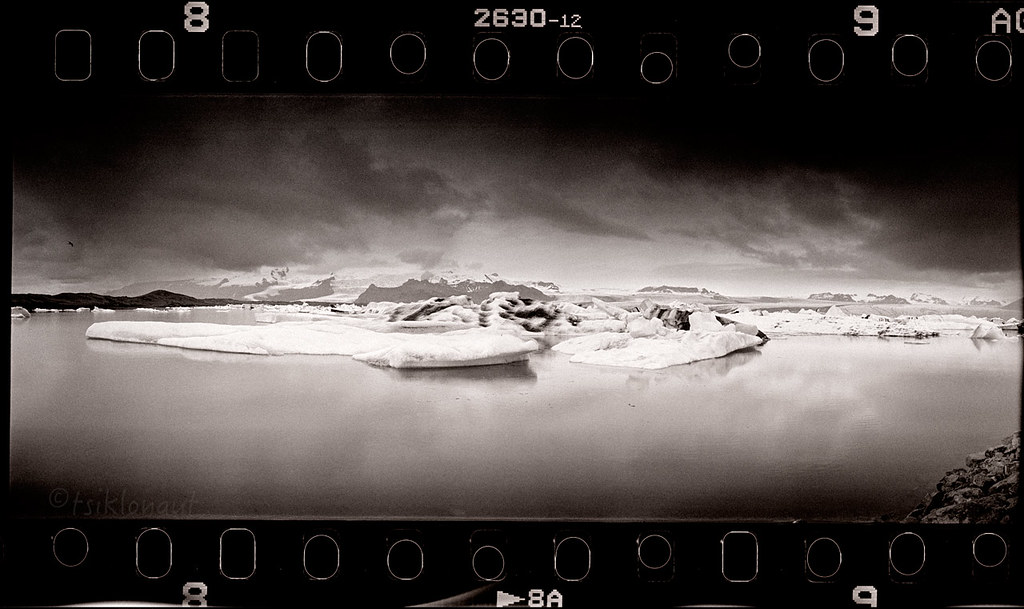
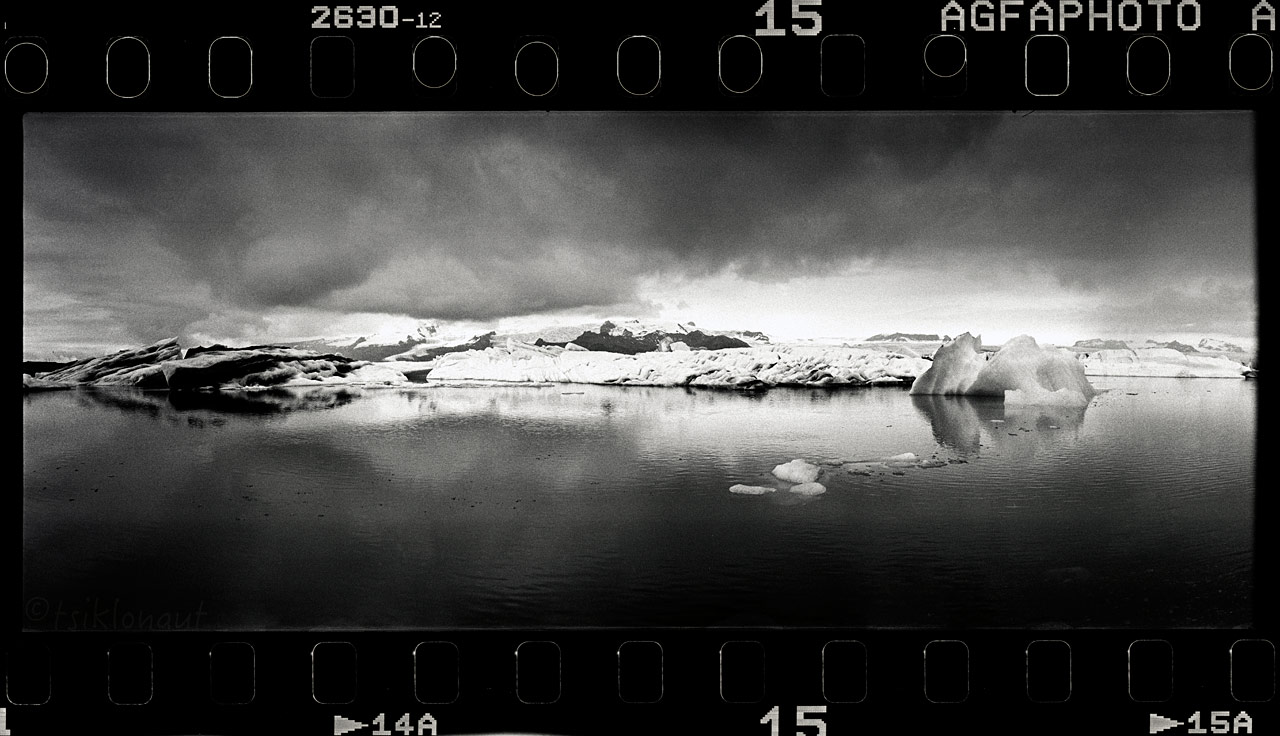
From there it's a short distance to even more impressive Jökulsárlón lagoon or a glacial lake, with the main visual attraction being the floating icebergs.
Situated at the head of the Breiðamerkurjökull glacier, it developed into a lake after the glacier started receding from the edge of the Atlantic Ocean. The lake has grown since at varying rates because of melting of the glaciers. It is now 1.5 kilometres (0.93 mi) away from the ocean's edge and covers an area of about 18 km2 (6.9 sq mi). It recently became the deepest lake in Iceland, at over 248 metres (814 ft), as glacial retreat extended its boundaries. The size of the lake has increased fourfold since the 1970s. It is considered as one of the natural wonders of Iceland.
Obviously loads of tourists fiddling around there, it was hard to find a parking spot for the motorcycles.
North.
 [/URL]
Glacial Patterns (over-lapping "accident" on a poorly loaded film roll).
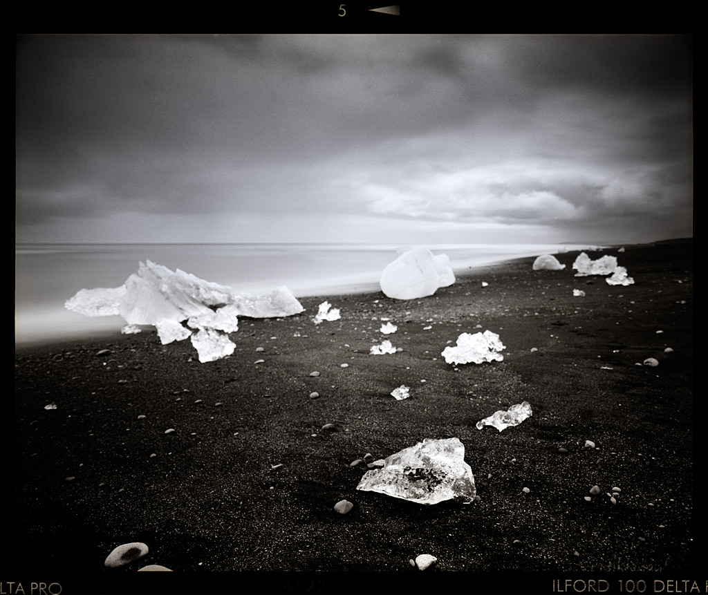
Ice Bay.
And on the nearby beach you can see the volcano that has melted loose those huge chunks of ice floating into the sea.
Cold Touch
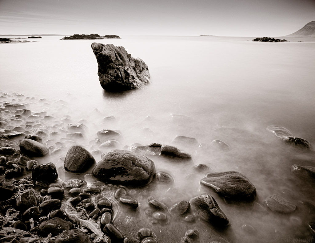
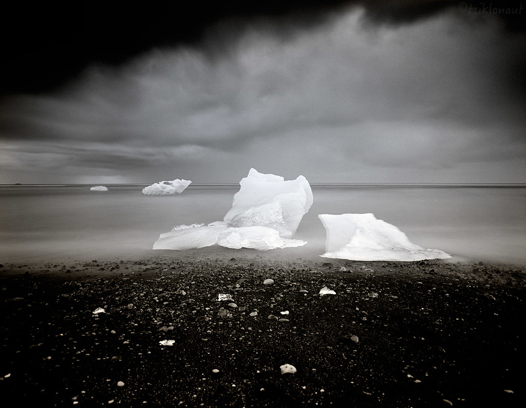
Long Tongued Beast
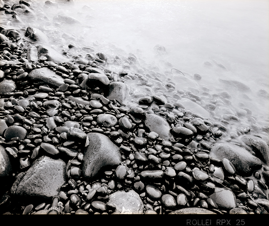
Pearls of the Moonlight.
Fat legged monster in arctic storm.
Shifting Diagonals
Despite it being a lovely sight it also marked our first annoyance and boredom with tourist traps and we thought it was time to search for some proper isolation via a decent off-road dash to some place away from civilization.
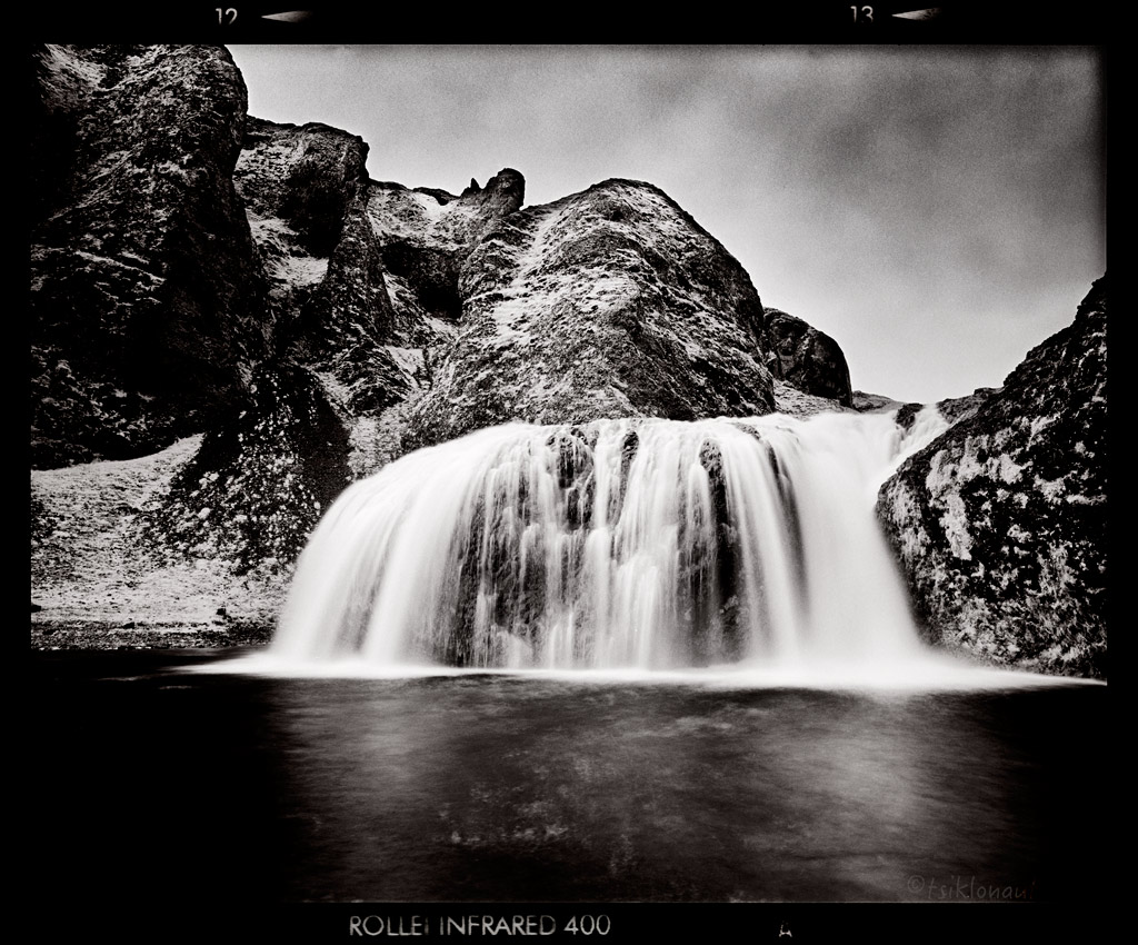
There was Stjórnarfoss:
Our destination was Laki or Lakagígar via the offroad F206 (the roads marked with “F” are considered “mountain roads”, and generally they have a warning plaque at the beginning which suggests that only 4x4 vehicles should use those roads). The craters of Laki is in fact a volcanic fissure in the south of Iceland, not far from the canyon of Eldgjá and the small village of Kirkjubæjarklaustur. Lakagígar is the correct name, as Laki mountain itself did not erupt as fissures opened up on each side of it. Lakagígar is part of a volcanic system centered on the Grímsvötn volcano and including the Þórðarhyrna volcano. It lies between the glaciers of Mýrdalsjökull and Vatnajökull, in an area of fissures that run from southwest to northeast.
The system erupted over an eight-month period between 1783 and 1784 from the Laki fissure and the adjoining Grímsvötn volcano, pouring out an estimated 14 km3 (3.4 cu mi) of basalt lava and clouds of poisonous hydrofluoric acid and sulfur dioxide compounds that killed over 50% of Iceland's livestock population, leading to a famine which then killed approximately 25% of the island's human population.
The Laki eruption and its aftermath caused a drop in global temperatures, as sulfur dioxide was spewed into the Northern Hemisphere. This caused crop failures in Europe and may have caused droughts in India. The eruption has been estimated to have killed over six million people globally, making it the deadliest in history.
-> go to Iceland (part II)
Cheers,
Margus
Kariina had just received her bike license and it seemed like a good chance to put it to the test. Iceland is remote enough for gaining that decent off-road experience, yet it has sufficient infrastructure in case something goes wrong.
Cold Touch by tsiklonaut
As you can see from the pictures, this time I decided to take a different approach on documenting it. I had "forgotten" my nice and very practical digital camera home, fully intentionally. I always wanted to do one trip purely with my set of film cameras as an experiment, with just a stash of film rolls with me. Mainly to be able to root the perfectionist out of me and take things as they are - think before taking a picture and don't count on technology, only count on yourself and your skill. Thus not exacly your "the latest and the greatest" gadget infested nerd ride report but a proper old fashioned way of documenting things. I had my trusty Pentax 67, my main workhorse that is around as old as I am and still going strong, plus cameras that were new to me: a Fuji GA645i rangefinder and a Soviet Horizon 202 panoramic camera for those proper unmanipulated panoramic shots. I had color and black & white films with me. NO Photoshop, most pictures aren't even cropped, I scanned them full frames as you'd see inspecting the film in your hands against the light.
And after a night on very stormy seas, accompanied by headache and vomit stench in the corridors of the ship, Iceland welcomed us.
We disembarked in Seyðisfjörður (to make your reading easier, let us respect the local Icelandic writing - i.e. read this as "Seydisfyoerduur") and loaded up on our supplies of food and precious liquids for our thirsty horses. The plan was a decent clockwise circle softly touching the outer parts as a foreplay, then a deep penetration of the inner parts to top off the Icelandic enjoyment experience. Our Icelandic route:
From Seyðisfjörður towards the inland.
Our first course was a set to Snaefell (not the peninsula in the West). Riding down the road we could see that the landscapes were much broader than those of the Faroes. In the distance, we could spot snow on mountain tops. First it was nice and smooth tarmac, which we could not enjoy to the full though, as the wind was ferocious and now and then it rained a little. Then came a turnoff to a rocky track to Snaefell. Kariina, to whom I had promised that we would not be venturing onto extreme terrain on the first day, pointed out that there was a sign by the track indicating some river crossings. We decided to check it out regardless. The track was truly rocky, and so were the surroundings – it didn’t really resemble any place we’d been so far, as it seemed totally devoid of life. As we bumped on, the first river crossing came. Nothing serious really, but Kariina needed some convincing before she would, carefully but steadily ride through the water. Then the second river crossing came, and the third one too, until we arrived to Snaefell’s base camp. By the time we got there, the weather had turned really nasty, and we had two choices – either to stay and wait for better weather, or to ride back. Because we didn’t plan on doing any hiking in the area, we decided to turn around.

The eastern Snaefell high altitude track.
Headed back to coast discovering Icelands coastal green lands:
On the way East, with so many decent fjords (fjörður standing for fjord) there we simply couldn't resist the temptation to experience them close up. Fáskrúðsfjörður was very nice, like on another planet.
And so was the Stöðvarfjörður, I took a small steep cattle track down, Kariina decided to stay up somewhere on the road. I took a b&w film shot with my beloved fully mechanical Horizon 202 camera at the end of the track:
Down the track the views the fjords offered, the clash between the mountain and the ocean were very decent indeed.
Doc stop before the storm kicked in, Icelands biggest glacier Vatnajökull visible on the left.
Djúpivogur is considered the nicest mountain in Iceland, looking like a pyramid.
Afterwards we made a detour to take a look at Hoffellsjökull (jökull standing for glacier) lake full of ice chunks the size of a house.
Hoffellsjökull.
The surrounding mossy volcanic landscapes were otherworldly as well.
From there it's a short distance to even more impressive Jökulsárlón lagoon or a glacial lake, with the main visual attraction being the floating icebergs.
Situated at the head of the Breiðamerkurjökull glacier, it developed into a lake after the glacier started receding from the edge of the Atlantic Ocean. The lake has grown since at varying rates because of melting of the glaciers. It is now 1.5 kilometres (0.93 mi) away from the ocean's edge and covers an area of about 18 km2 (6.9 sq mi). It recently became the deepest lake in Iceland, at over 248 metres (814 ft), as glacial retreat extended its boundaries. The size of the lake has increased fourfold since the 1970s. It is considered as one of the natural wonders of Iceland.
Obviously loads of tourists fiddling around there, it was hard to find a parking spot for the motorcycles.
North.
Glacial Patterns (over-lapping "accident" on a poorly loaded film roll).
Ice Bay.
And on the nearby beach you can see the volcano that has melted loose those huge chunks of ice floating into the sea.
Cold Touch
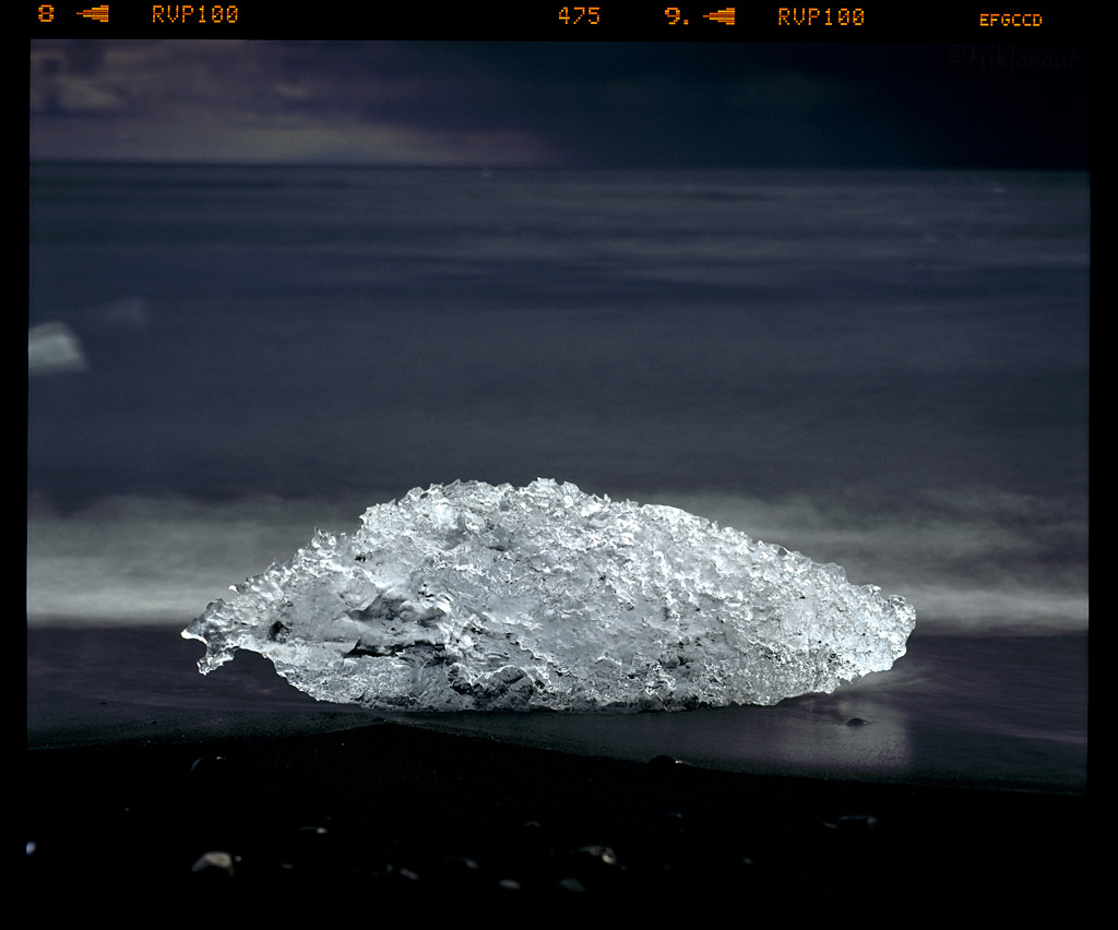
Long Tongued Beast
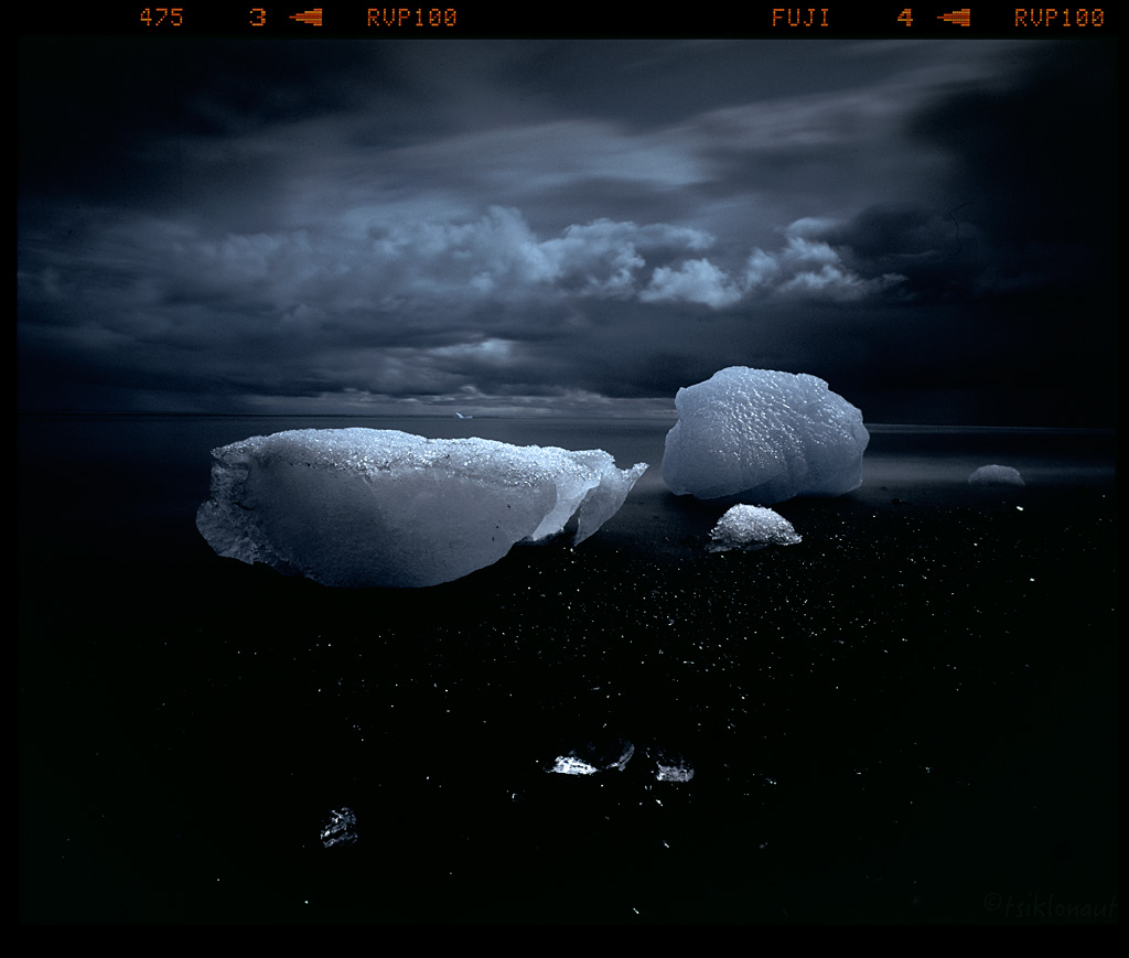
Pearls of the Moonlight.
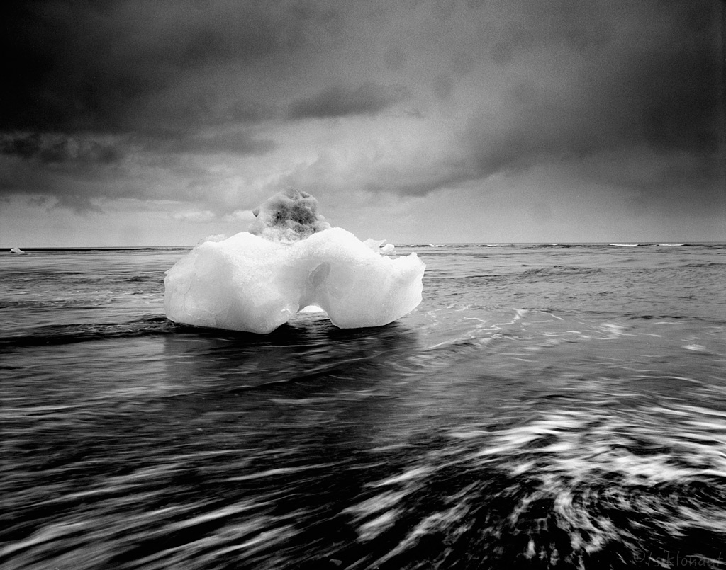
Fat legged monster in arctic storm.
Shifting Diagonals
Despite it being a lovely sight it also marked our first annoyance and boredom with tourist traps and we thought it was time to search for some proper isolation via a decent off-road dash to some place away from civilization.
There was Stjórnarfoss:
Our destination was Laki or Lakagígar via the offroad F206 (the roads marked with “F” are considered “mountain roads”, and generally they have a warning plaque at the beginning which suggests that only 4x4 vehicles should use those roads). The craters of Laki is in fact a volcanic fissure in the south of Iceland, not far from the canyon of Eldgjá and the small village of Kirkjubæjarklaustur. Lakagígar is the correct name, as Laki mountain itself did not erupt as fissures opened up on each side of it. Lakagígar is part of a volcanic system centered on the Grímsvötn volcano and including the Þórðarhyrna volcano. It lies between the glaciers of Mýrdalsjökull and Vatnajökull, in an area of fissures that run from southwest to northeast.
The system erupted over an eight-month period between 1783 and 1784 from the Laki fissure and the adjoining Grímsvötn volcano, pouring out an estimated 14 km3 (3.4 cu mi) of basalt lava and clouds of poisonous hydrofluoric acid and sulfur dioxide compounds that killed over 50% of Iceland's livestock population, leading to a famine which then killed approximately 25% of the island's human population.
The Laki eruption and its aftermath caused a drop in global temperatures, as sulfur dioxide was spewed into the Northern Hemisphere. This caused crop failures in Europe and may have caused droughts in India. The eruption has been estimated to have killed over six million people globally, making it the deadliest in history.


-> go to Iceland (part II)
Cheers,
Margus


")


