London’s Water… an occasional Wander

Wapping

Well-known member
Moderator
Joined
Oct 21, 2005
Messages
91,965
Reaction score
17,593
Location
Wapping, London
Whilst water companies seem to be in the news every day for some crime or other, I don’t see why I shouldn’t investigate at least some of London’s history with the stuff that comes out of our taps and, not to put to fine a point on it, keeps us alive.

To make a start, I pedalled my way to Holborn, to see at least a reminder that London’s water supply was, before the 16th century, precarious at best and not much better after.

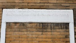
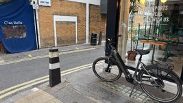
This is the plaque on the corner of a wall, just off Lamb’s Conduit Street;
IMG_0556.jpegIMG_0557.jpegIMG_0558.jpeg

The inscription reads:

Lambs Conduit the property of the City of London this Pump is Erected for the Benefit of the Publick

Here’s all about it:

 
Last edited:
GWWP, my next visit will be to north London, to see the source of the river Fleet, one of London’s ‘Lost rivers’, which fed (often foul) drinking water into London. I can hopefully combine this with a visit to Highgate cemetery, probably the best known of London’s ‘Magnificent Seven’ Victorian cemeteries. I’m hoping to visit all seven, having so far only visited one.

In the meantime, I’ve found a decent website and map of the ‘New River’ walk between north east London, out to Hertford. The ‘New River’ was a triumph of engineering, created in 1613, over 400 years ago. It’s still in use today, supplying a little under 10% of London’s massive daily demand for water.


Now to try to place some other sites onto a map, too.
 
Last edited:
GWWP, my next visit will be to north London, to see the source of the river Fleet, one of London’s ‘Lost rivers’, which fed (often foul) drinking water into London. I can hopefully combine this with a visit to Highgate cemetery, probably the best known of London’s ‘Magnificent Seven’ Victorian cemeteries. I’m hoping to visit all seven, having so far only visited one.

In the meantime, I’ve found a decent website and map of the ‘New River’ walk between north east London, out to Hertford. The ‘New River’ was a triumph of engineering, created in 1613, over 400 years ago. It’s still in use today, supplying a little under 10% of London’s massive daily demand for water.


Now to try to place some other sites onto a map, too.
The other link where the author of The Mercenary River, on your other thread, talks about the New River. It is very interesting explaining that the average drop is 5" a mile, that's pretty incredible now let alone in the early 17th century! That would need a very long hose pipe water level, if that's what they used for survey levels?

It is also interesting in that Wikipedia article about how the spelling of the name of the River Lee changes to Lea and alternates quite freely in place names relating to the river.
 
I have seen some of the Roman aqueducts in France, with their approach and exit channels crossing miles, all very gently sloped. The build up of chalk sediment was a regular problem for them.

The chapters in the book about the creation of the New River, explaining how it created the practice of owning shares, not in the physical parts of the enterprise, but in the concept of owning something ’non-physical’ ie. in a sense, the holding company, set the stage for business as we know it today. Similarly, the invention of subordinate shares, within an enterprise. All this was new.

It also explains, how ‘engineers’ and ‘surveyors’ were then, not what we think they are today.

All of this is very nicely explained in simple language and is (I am very pleased to say) easy to digest.

It is interesting that the new way of generating - and sometimes swindling - the vast sums to build public works and what to do with any profits, troubled people as much in the 1600’s as it does today. But it is to the 1600’s that we must look for the origins of ‘business’ (as we understand it today) and the birth of London as a global financial centre, which drives a significant portion of UK plc’s wealth still.
 
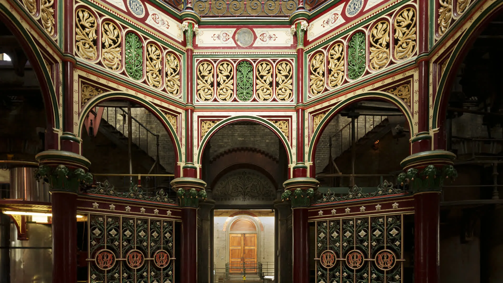
Another interesting thread. Perhaps further afield but in keeping with the water theme, apparently the Crossness Pumping Station that sits just south of the Thames does interesting tours and shows Victorian engineering at its best with a working beam engine.
 
'Ware the Enfield section on your travels; as Duty Officer there in 2000 I dealt with a lady reporting a Big Cat on the banks of the New River. She was perfectly lucid and believable, reporting it as being larger than her Labrador 🐈‍⬛
 
Whilst water companies seem to be in the news every day for some crime or other, I don’t see why I shouldn’t investigate at least some of London’s history with the stuff that comes out of our taps and, not to put to fine a point on it, keeps us alive.

To make a start, I pedalled my way to Holborn, to see at least a reminder that London’s water supply was, before the 16th century, precarious at best and not much better after.

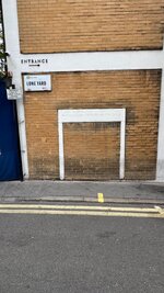
This is the plaque on the corner of a wall, just off Lamb’s Conduit Street;
View attachment 523164View attachment 523165View attachment 523166

The inscription reads:

Lambs Conduit the property of the City of London this Pump is Erected for the Benefit of the Publick

Here’s all about it:

Right then…..fact, water is being “moved” from Lincolnshire down south. They have spent millions laying 1m wide pipes to transport the water. Can you explain why Lincolnshire went on a hosepipe ban on July 11th yet down south only went on yesterday? Am I missing something here🤔
 
Another interesting thread. Perhaps further afield but in keeping with the water theme, apparently the Crossness Pumping Station that sits just south of the Thames does interesting tours and shows Victorian engineering at its best with a working beam engine.
Another part of Bazalgette's sewage system. It's worth hanging on for a steaming day for a visit. It's easy to get to on public transport being very near the end of the Elizabeth Line, they usually put on a free routemaster from the station when there's something on.
 
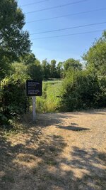
My first visit was not to see the source of the River Fleet in north London, instead I cycled out into east London, to see the former Middlesex filter beds on the River Lea.

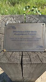
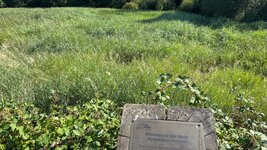
Middlesex Filter Beds, a historic Victorian water treatment facility built in 1852 by the East London Waterworks Company. Located in East London's Lea Valley (bordering Hackney Marshes), these former industrial ponds have been decommissioned and successfully transformed into a protected, thriving urban wetland nature reserve managed by the Lee Valley Regional Park Authority.

it’s quite a nice cycle ride there.

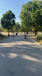
Victoria Park:

IMG_0691.jpegIMG_0692.jpeg

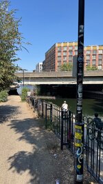
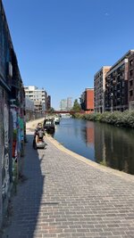
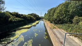
Before following the Hertford Union Canal:

IMG_0693.jpg

IMG_0694.jpegIMG_0695.jpeg

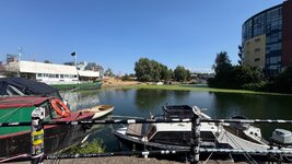
To where the canal joins the river Lea (here known as the River Lea Navigation:

IMG_0696.jpeg

To be continued….
 
Last edited:
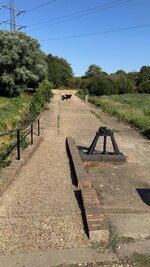
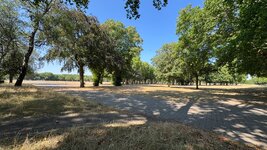
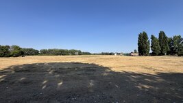
Follow the River Lea along, until you come to the huge expanse of Hackney Marshes, home to umpteen amateur football clubs and an equally umpteen football pitches:

IMG_0697.jpeg

There are no longer any marshes here, the vast area having been filled in with the rubble of London after the last war.
 
Follow the River Lea along, until you come to the huge expanse of Hackney Marshes, home to umpteen amateur football clubs and an equally umpteen football pitches:

View attachment 525007

There are no longer any marshes here, the vast area having been filled in with the rubble of London after the last war.
I wonder how much hidden gems are still under there, from all the historic rubble that was placed there.
 
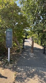
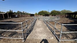
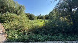
When the filter beds were closed, the area went into a wasteland, until a ‘wild’ nature reserve was created out of several of the large ponds, along with some pretty good walking and cycling paths:

IMG_0698.jpegIMG_0699.jpeg
IMG_0701.jpeg
 
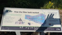
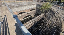
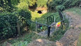
Whilst nothing (or very little) remains of the Victorian filter beds, there was enough to give you an idea as to how it all worked:


IMG_0707.jpeg

Clean water for Londoners

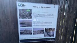
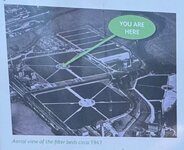
The area around you was once the No. 2 Essex and Leyton Filter Beds and, as you can see from the photograph, they formed part of a much larger site.There have been water, works in this area since the early 1700s, but the works that you are currently standing in were built in the 1860s to supply clean drinking water to homes in London following several outbreaks of cholera. This disease had arrived in the UK in the 1830s and spread rapidly through the crowded and unsanitary streets of the capital. By 1855 a series of epidemics had claimed the lives of more than 30,000 Londoners. By 1860 a growing understanding of how the disease was spread, coupled with a desire to improve sanitary conditions in the city, led to these vast facilities being commissioned by Parliament in order to provide a vital supply of clean water.
How the filter beds worked

They worked by pumping water into the filter beds where it was strained through layers of sand and gravel, eventually ending up in a perforated concrete base. Filtering water in this way is called siow sand filtration with any foreign matter being trapped in the top layer of sand and remains trapped there. The resulting filtered water was bacteria free and could then be pumped to homes all across North East London.
Two large steam-powered pumps known as the Duke and Duchess were constructed to move the water and a narrow gauge railway was built to move materials such as sand and gravel. Some of these features can still be seen around the site, but sadly the engine houses that held the pumps were demollsned.

IMG_0729.jpeg

Here’s some snaps of the parts that remain, including evidence of the narrow gauge railway:

IMG_0712.jpegIMG_0713.jpegIMG_0705.jpeg

IMG_0731.jpeg
 
Last edited:
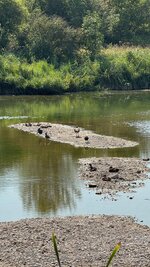
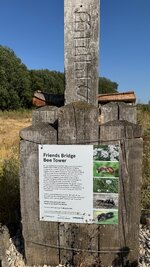
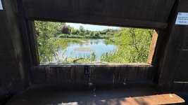
Around the circular concrete structure in the picture above, they have built simple ‘hides’ you can look through to see the birds out on a reclaimed wet area:

IMG_0531.jpeg

IMG_0714.jpegIMG_0717.jpegIMG_0719.jpegIMG_0720.jpeg
 
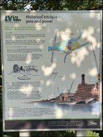
Another board at another part of the site, carried some information on the other works, including the water mills that used to be on the river:

IMG_0532.jpg

The words say:

Water is an important source of power. As early as 1760 there were water powered mills on this site.

The mills

To power the watermills, a special water channel or millrace took water from the river to the waterwheels. You're now standing over the millrace, almost all of which has been filled in. There have been three different mills on this site. When the waterwheels powered a water pump, they supplied over 1,000 families with water in twelve hours. The power of the waterwheels was also used for:

• Grinding corn to make flour or bread.

• Boring tree trunks to make pipes that could carry water to the reservoirs and from there to local people. The pipes were made thinner at one end so they could slot together.

• Grinding the points to pins and needles. One worker said he could by moderate labour point 120,000 pins and needles in one day. They were polished in another part of the mill but between operations, the pins and needles were sent all the way to Worcestershire, for the eyes to be made.

Following a huge fire, the mills were rebuilt and in 1829 were taken over by East London Waterworks Company. Four years later, they were demolished. A new pump house was built to take the place of ne mills, which could raise 13 million barrels of water a year, This pump house pumped water to a new reservoir in Stamford Hill where it settled before being distributed to local people.
 
Last edited:
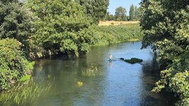
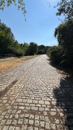
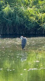
It was quite nice just to bicycle around the site, seeing what was there. Having in mind that you are deep in East London, there is little to tell you that you are in a city of about 8,000,000 people:

IMG_0724.jpgIMG_0725.jpegIMG_0728.jpegIMG_0727.jpegIMG_0734.jpeg

IMG_0721.jpeg
IMG_0723.jpeg
 
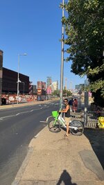
That was it for the filter beds. Leaving just the bicycle ride back home, along the canals and back through Victoria Park.

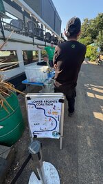
The Lower Regents Coalition, meet to gather up litter and debris:

IMG_0735.jpegIMG_0736.jpeg

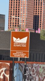
A view towards the 2012 Olympic Park:

IMG_0737.jpegIMG_0738.jpeg

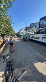
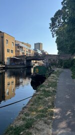
Then back onto the canal:

IMG_0739.jpeg

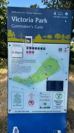
And into Victoria Park:

IMG_0741.jpeg

IMG_0740.jpegIMG_0742.jpeg


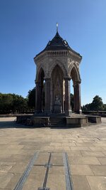
This is the ‘High Victorian’ Burdett Coutts’ drinking fountain, built in 1862 for the philanthropist, Angela Burdett Coutts:

IMG_0743.jpeg


And from a very wealthy Victorian lady (and her interesting life) to home.

Where to next?
 
Last edited:
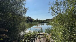
It was quite nice just to bicycle around the site, seeing what was there. Having in mind that you are deep in East London, there is little to tell you that you are in a city of about 8,000,000 people:
When I lived in Enfield I'd often cycle down thw Lea to Canary Wharf and beyond, and also north to Ware, off-road pretty much the whole way.

Now living on the Theobalds Estate and cycle along a stretch of the Lea most days.

Apologies for the derailment, but it is from the Wiki link you posted.

https://en.wikipedia.org/wiki/Theobalds_House - Following your earlier link to 'gates' to the city, Temple Bar was located at the entrance from 1880 to 2003. The Meux (brewery family) family had owned it - facinating history.
 
Last edited:

Back
Top Bottom