Pikipiki Safari does South America

rsstler

Registered user
Joined
Feb 18, 2010
Messages
137
Reaction score
0
Location
London, Cape Town, Buenos Aires and back
Some of you may remember the previous thread, "Africa in 5 months", where myself and Aidjay travelled, well… through Africa, from London to Cape Town

When we made it to South Africa in March, I decided to continue travelling. Adrian returned back to London, something about a pink ticket only extending so far.

So the big question, where to next? As with the last trip, the desirable continent would have plenty of corrupt officials, questionable hygiene standards and little understanding of the English Language. It was obvious to me, South America.

My GS, Ystervark, had taken a severe battering through Africa. So I settled down to perform some much needed maintenance, which consisted of changing the oil and replacing the tyres. Done, easy enough. Oh, and a deep deep clean to remove the ingrained Congolese mud. Next, the small matter of shipping the bike to Buenos Aires where the plan would be to ride solo from Argentina north to Colombia.

The next few posts cover what happened over the 3 months …
 
Muy buenos Buenos Aires

Ah yes, Buenos Aires. It is hard not to like the place; with its gorgeous architecture, good food and beautiful people. Very beautiful people. It is just how I imagined it to be, very European, the Spanish influence extremely noticeable. I arrived a few days before the bike, which gave me some time to do the tourist thing.

P1010325_edit0.jpg

Pleased to meet you, meat to please you.

Parrillas, the local BBQ/braai, are extremely popular here. The chefs are extremely talented at serving heaped plates of awesomeness. Many, like this one at Siga la Vaca, are all you can eat. The night we went, the little old couple next to us knocked back about 4 plates of meat. Truly impressive.

P1010308_edit0.jpg

Some graffiti at the Boca Juniors stadium. Not universally popular, judging by the comment in the bottom right.

P1010292_edit0.jpg


P1010297_edit0.jpg


Casa Rosado, the Pink Presidential Palace. In front is a Falklands demonstration. It was all in Spanish so I have no idea what their grievances were and I don't think they were keen to translate it into English for me. The Falklands are a bit of a sore point currently, a week before I arrived it was the 30 year anniversary of the Falklands war. Argentina saw many anti-British demonstrations, culminating with the British embassy being stormed. What is it with me choosing places as they kick off? Suddenly having a South African passport was not so bad.

P1010267_edit0.jpg

The antiques market at San Telmo

P1010314_edit0.jpg


Alas, I digress; this is a blog about biking and not a show and tell about my holiday snaps. The biggest problem was always going to be getting the bike released from customs. For 2 reasons. One, my Spanish is terrible; offensive in fact. And two, South American customs are notoriously pragmatic. There are stories of people paying thousands of dollars and it taking weeks to get their bikes released from the port. All advice was fly, don't ship and so that is what I did.

So on to the airport customs. The next bit was like an 90's computer quest game; to open the door you need a key, to get the key you need too...You get the picture.
First you get your landing documents from your shipper, wherever they are. Then go to Cargo arrivals; Officina 2, they check that the bike has arrived. Then on to Officina 1, they locate the bike. Then Officina 3, they verify the bike it what you say it is. This process repeats itself 12 times between the 3 officinas, seriously 12 times. There was one guy who bought a book from Amazon International and he had to do the whole 12 steps. Seriously it's not worth it for a book.

Anyway, there is a certain method to the madness, at one point I accidentally walked into the wrong officina and was instantly corrected. They did not look at my documents but told me straight away that I should be in Officina 1.

After about 3 hours I had made it to step 12, the final step. I get directed to the big boss back in Officina 3 (desk 2). This is the man who gives permission to release the bike.
Behind his desk, a picture of Maradona. Beneath that, a picture of the Falklands, stating "The Falklands belong to Argentina". I nudge my South African passport that little bit closer.
After a bit of Spanglish banter, some smiling and waving, I get the all clear. I can now re-assemble the bike. I'm nervous, I've never re-assembled the bike in Spanish before...

P1010343_edit0.jpg


For those repeating the airport customs process, the following <a title="Air customs guide" href="http://www.ukgser.com/forums/showpost.php?p=1080545&amp;postcount=18" target="_blank">step-by-step guide</a> is extremely helpful. A big thanks to the Dede from this parish.


I was wondering about your whereabouts only the other day when thinking about seeing a bit more of Africa and the route to the south. It's good to hear from you again Geezer. :thumb2

What's your current location?

Oficina...nice. Tu hablo Espanol. :D
 
Russ....living the dream mate....your last report was a gem, a very interesting & enjoyable read....not jealous in anyway!!!!!
 
Buenos Aires to the Atacama

Having freed the bike from the airport, I was all set to go. Driving out of Buenos Aires was a bit chaotic. They have wasted an awful lot of paint marking out road lanes, those lines count for nought here. More confusing are their intersections, which are treated somewhere between 4 way stops and traffic lights, a random number of cars taking turns to cross in no apparent logical order. I've seen worse driving but there is a sense of order out here, sort of. Remember, it's your responsibility to get out of their way.

I had decided to skip Patagonia and head northwest. I'd missed the season for Patagonia; snow had begun to fall in the mountains. That will have to wait for another time.

The next few days were spent heading northwest, taking in the towns of Rosario, Cordoba, Frias and Tucuman before reaching Salta at the base of the Andes. The distances in this country are huge with dead straight roads long into the horizon. I'd love to tell stories about spending my nights dancing tango with gorgeous Salsa girls, but life on the road is not always like that. My routine had developed into arriving in a large city, driving around aimlessly trying to find accommodation that has parking for the bike, whilst trying not to be written off at deadly intersections in the process. Then wander the streets looking for food until 9pm, which is when the restaurants start thinking about opening. Obviously only a tourist would want to eat before then.

Having spent 5 continuous days on the road and travelling 1,600km, I'd decided to stop in Salta for a few days to doing the usual mix of sightseeing, laundry and catching up on emails. Salta is a great little town, quaint cobbled street and Spanish style plazas.

P1010372_edit0.jpg


P1010435_edit0.jpg


P1010355_edit0.jpg

Random road sign; "The Falklands are Argentinean"

I caught up with some backpackers that I had met in Buenos Aires for a dinner of our now standard parrilla, consisting of excessive quantities of meat and even larger quantities of local red wine. Happy days. Here is a tip tho, when eating a at Salsa themed restaurant, if the MC asks your nationality and you say English, there is a strong chance you will be pulled up on stage. You may be forced to do your 'Guacho face' whilst dancing Salsa with someone who is clearly a better dancer. You have been warned, it was not me, but I've seen it happen.

P1010389_edit0.jpg


Cable car over looking Salta

Originally I had planned to go straight to Bolivia, but with their rainy season still winding down I decided to head across to the Atacama in Chile. This would involve Pasa de Jama, my first Andean crossing. At 4,200m above sea level, it is the northern most border crossing between Argentine and Chile. The road itself reaches much higher altitudes, but it has some of the most spectacular scenery and above all else, pristine tar with stunning sweeping bends. The altitude makes small tasks difficult, fortunately the bike held out well, better than I did...

P1010454_edit0.jpg


P1010450_edit0.jpg

The ascent into the Andes begin, it is still relatively green.

P1010483_edit0.jpg

But at the top it dries up totally

P1010471_edit0.jpg


P1010498_edit0.jpg


Argentinean customs was painless, my newly approach of pointing at various documents and mumbling in pidgin Spanish did the trick. Quite bizarrely, Argentinean customs are located on the border at 4,200m, whilst the Chilean customs are 150km down the road at San Pedro, residing at a far more respectable 2,400m altitude. Clearly someone has thought about this.

P1010509_edit0.jpg


P1010502_edit0.jpg


Chilean immigration was painless. When the Immigration office found out that I worked in IT he began showing me an iPhone app he had written to speed up the customs process for cargo vehicles. Again the conversation consists of both parties pointing at stuff, speaking in a pidgin version of the other party’s language and then nodding in agreement. I've had weirder experiences at borders, but not many. Then it was on to customs who are extremely thorough. I signed a declaration stating I have not imported any vegetables, meat or animal semen. Seriously. For the first time ever I had to unpack all my luggage as the Aduana agent looked to contraband food and God knows what else.

The town of San Pedro de Atacama is a couple of km's down the road, where I check into the rustic Puritama hostal which has plenty parking for oversized motorbikes. Happy days. I had planned to meet Ricky here, one of the back packers from Buenos Aires. He spent several months travelling Central America before heading south. We are on a similar route and we meet up occasionally.

San Pedro de Atacama is a small town on the northern border of the Salar de Atacama salt flats, which is in the northeastern part of the Atacama Desert, the driest area in the world. Some parts of the Atacama Desert have an average rainfall of 1mm a year; some weather stations have never recorded rain.

P1010527_edit0.jpg


P1010552_edit0.jpg


San Pedro itself is rustic, though often criticised for being too touristy. Granted every store is either a tour operator or a shop selling generic tourist bumpf, but you have to give it to this place, the landscape is absolutely stunning.

P1010619_edit0_edit0.jpg

Early morning mountain biking

P1010581_edit0.jpg

Salt caves in Lunar valley

P1010578_edit0.jpg
 
Last edited:
More superb narrative & pics Russ....

Are you going to be @ any of the Tossers weekends in 2013?
 
Bolivia, towards Uyuni

Bolivian border formalities were quick and straight forward, nothing like the horror stories that I had heard about. The differences between Argentina and Bolivia are immediately obvious, the shops explode out onto the streets and old ladies in bowler hats and traditional dress sell food from pavement stalls.

I had met up with 2 Canadian riders just south of the Bolivian border. Joca and Marianne were on a similar route to me and so we had decided to team up and do southern Bolivia together.

We left the main paved road at Tupiza to take the 200km dirt road to Uyuni. The first 100km were steep, ascending about 1000m to an altitude of around 3,800m. Steep switchbacks took us through valleys and along the ridges of the mountains.

P1010748_edit0.jpg


P1010752_edit0.jpg

Joca and Marianne on their Suzuki Vstrom

P1010763_edit0.jpg


P1010765_edit0.jpg


P1010774_edit0.jpg


The last 100kms were straight flat gravel with heavy washboard corrugation. On roads like these it is too jarring to take it slowly, you need to gun it skimming over the bumps and hope for the best. Ride slow and it will damage your bike fast, ride slow and it will damage your bike fast.

P1010807_edit0.jpg

This picture does not do the corrugations justice; on this particular stretch they were quite tame.

P1010800_edit0.jpg

A road-side cemetery, no reflection of the road condition which was actually pretty good.

P1010794_edit0.jpg

Sand, mortal enemy of the fully loaded bike. Passengers must walk.

Uyuni itself it not the prettiest town, but it is the closest place to Salar de Uyuni, the largest salt flats in the world. The Salar is somewhat of a pilgrimage for bikers, unbelievably fun to ride on.

Unfortunately we were low on fuel so we could not venture too far out onto the flats. All the fuel stations in town were out of petrol and with 2 days of holidays coming up nobody knew when fuel would arrive.

P1010908_edit0.jpg

The entrance to the flats were still under water, the rainy session having just finished a month ago.

P1010884_edit0.jpg

But it dries up soon, revealing the world's largest playground

P1010855_edit0.jpg

Obligatory silly perspective shot

P1010894_edit0.jpg

Coca leaf fuelled dance party, Uyuni style

P1010904_edit0.jpg

The Salt hotel, extremely touristy but deserves a mention

P1010906_edit0.jpg

This Larry is what happens when you play on the salt flats

P1010917_edit0.jpg

Statue in Uyuni, not quite sure what it's supposed to be, but it reminds me of the fembot in Austin Powers.

The next day rumours were spreading that a petrol station at the end of town had petrol, so we hot-footed it over there. A small queue indicated that there was in fact petrol. Within in minutes the queue was down the road and around the block. The attendant filled us up and charged us the local rate, earning himself a big tip.

Fuel is heavily subsidised in Bolivia for locals, foreign registered vehicles pay roughly 3 times the unsubsidised price. I don't have a problem with this; it's still a lot cheaper than fuel was in Argentina. They have however created a massively complicated billing process; you have to show your passport and enter your details into the computer. Firstly no one knows how they computer systems works, so you need to call the boss, then computer won't accept your passport number or list your country. However came up with this idea should be forced the use foreign plates, forever.

P1010743_edit0.jpg

I'm not quite sure what this advert was for, but it was at a pharmacy so it must be some form of local medicine.

P1010746_edit0.jpg

Big bikes always get lots of attention at borders
 
Bolivia, north to Lake Titicaca

From Uyuni we continued north on to Potosi. Apart from 20kms which was not yet finished, the road was brand spanking new. And as with many of the roads here, it is designed like a racetrack, awesome bends to get your footpegs down on.

I was not expecting much from Potosi, was heavily based on mining and has a terrible history dating back to the Spanish times, millions have died in the mines.
Unfortunately I only found out about the Miner's market after I had left, you can buy dynamite there. Life is full of missed opportunities...

P1010950_edit0.jpg


P1010973_edit0.jpg


P1010944_edit0.jpg

Yes, that is another protest, this time Potosi. It's difficult taking a picture in Bolivia without seeing one

At Potosi I said goodbye to Joca and Marianne, I was going to Sucre and them to Cochabamba. More racetrack roads led to Sucre, a great little city full of old Spanish style buildings and heaps of charm. I could wax lyrical about Sucre, low altitude and loads of character. I stayed 3 nights and could have stayed longer, but I was due to meet my backpacker mates in La Paz for a weekend out on the town.

P1020019_edit0.jpg

The main plaza in Sucre

P1020046_edit0.jpg

The Sucre food market

P1020048_edit0.jpg


En route to La Paz I get pulled over by the local fuzz, apparently doing 120kmh, in a country where national speed limit is 80kmh, is a chargeable offence. 80kmh national speed limit, seriously? No wonder nothing gets done in this country. OK, fair enough, I've been busted. I do my usual anti-police tactics; stay on the bike, helmet on, engine running, etc. The fine is 200 Bobs (30USD). Fine, I've done wrong, I'm happy to pay up, but I want a receipt. No, apparently I have to go with the police to the last town 100km back. Many "No etiendo's" later and they are still not budging. No receipt unless I go back to town, a 3 hour round trip at 80kmh. I finally give in and hand over the cash without a receipt, this really grates me because I'm confident this is a con and I hate dodgy cops.

Apart from this incident, Bolivia has been a lot tamer than I was expecting. I've heard so many horror stories about corrupt cops and even worse driving. Those people complaining about the driving and dodgy cops have clearly never been to Nigeria.

P1020012_edit0.jpg

More racetracks ascending the plateau

P1020051_edit0.jpg

Amazing scenery in the Andean plateau en route to La Paz

P1020054_edit0.jpg


The approach to La Paz is a long flat plateau which then descends into the valley where the city reveals itself in a sprawl that encompasses the entire valley. The city consumes every bit of available space. Whilst I did not particularly like the city, the views are outstanding. At 3,800m above sea level the air contains roughly 50% the Oxygen you would get at sea level, making everything a chore. Walking up a flight of stairs leaves you out of breathe. And in La Paz everything is either 45 degrees up or 45 degrees down. Nothing is easy.

P1020083_edit0.jpg

La Paz, consuming all available space in the valley

My stay in La Paz was extended by 2 days due to a national bus strike, drivers protesting about the forced introduction of seat belts and mandatory scheduled breaks. Seems fair to me. I leave the day after the bus strikes only to encounter another strike, this time medical workers protesting against the government increasing their working day from 6 to 8 hours. Seems fair to me. Not a day goes by without a strike in Bolivia, it's their national pastime. The strike causes havoc leaving the city. Every second street is blocked, detour after detour, inching forward in heavy traffic, every street 45 degrees up or 45 degrees down. Clutch taking strain, clutch being to smell. Finally after 2 hours, I'm free of La Paz...

P1020076_edit0.jpg

Bus strike in La Paz, who needs seatbelts? I do love their old America buses though

Next stop is Copacabana on the opposite shores of Lake Titicaca, not to be confused with the beach in Rio. I make my way to the waters where a row of ferries are lined up to take me across the lake. I say ferries but none of them are more than an outboard motor attached to a few loosely bound planks. At some point an argument brakes out between my would-be lake-fairing operators, you'd be surprised be know how often stuff like this happens to me. Anyway, I board the vessel, which I deem the most lake-worthy and we venture forth. 50m before we reach the opposite shore the motor cuts out and quickly gets dismantled. As we slowly drift to shore, the other ferry 'captain' from the earlier argument has caught up to us and starts ramming our boat. This actually helps push our boat the final few metres needed for me to disembark. I leave letting them to sort out their differences.

P1020108_edit0.jpg

Lake Titicaca ferry to Copacabana

P1020111_edit0.jpg

Loosely bound planks

P1020119_edit0.jpg

Scenery around Lake Titicaca approaching Copacabana

P1020208_edit0.jpg


Copacabana is great, exactly what I needed after La Paz, a quaint lakeside village full of hippies selling weird organic products, most of which seem to be of the alternative medicine variety. The guidebook mentioned an ancient Inca observatory on a hill a few km's out of town, being a history anorak I decided to venture forth. Lake Titicaca is situated at 3808m above sea level; it’s the largest high-altitude lake. Needless to say the 800m incline knacked me. I get to the top and wander around looking for the observatory, nothing. A local guide pops out of nowhere, this also happens often, and informs me that the Spanish destroyed the observatory. The Spanish were not keen on pagan gods. All that remains is a hole in rock where a pole was used to indicate the solstice. The rest on my time was spent eating cheap, tasty local trout and chilling out.

P1020176_edit0.jpg


P1020170_edit0.jpg

Inca observatory, note the hole in the rock

P1020141_edit0.jpg


P1020140_edit0.jpg

Some tourists accuse Copacabana of being overly touristy. Not me, I love pedalos

P1020215_edit0.jpg


From Copacabana it's not far to the border, just over 10kms. I've enjoyed Bolivia, it's spectacularly beautiful, but Peru beckons.
 
Southern Peru

Entering Peru could not have been easier, friendly and professional border control. OK, the guy entering my bike details took his job very seriously. Like 30 minutes worth of forms seriously.

First stop is Cusco. Leaving Lake Titicaca is a slow descent through winding valleys. Slowly it gets greener and more lush. Progress is slow due to the fact that I have to keep stopping to take photographs, the scenery is stunning. It is one of those rides that leaves you grinning ear to ear. There has been a lot of that lately.

P1020868_edit0.jpg


At Cusco, I checked into Hostal Estralita (Tullumayo 445) on recommendation from someone on HUBB. This place was great, very basic, but the old guy running it was fantastic. Every morning we had a little chat, him in Spanish, me in Spanglish, basically one of us pointing at stuff and the other nodded in agreement. They are very biker friendly, he has built a ramp so bikes can get into the courtyard. Why can't everyone do that?

P1020301_edit0.jpg


P1020308_edit0.jpg


I met up with Ricky the following day, we have been travelling on and off together since Buenos Aires. Ricky has been backpacking through the Americas and our South America route has been fairly similar.

My time in Cusco was spent doing touristy Inca stuff by day and drinking Abbot Ale playing darts and pool with Ricky at the Norton Rats Tavern by night.

P1020297_edit0.jpg


P1030102_edit0-1.jpg

What wine does one serve with Guinea Pig?

P1020331_edit0.jpg

A llama, I'm quite surprised it has taken so long for one to feature on this blog

No visit to Cusco is complete without visiting Machu Picchu. Now there are 2 ways to do Machu Picchu, the easy way or the cheap way. The easy way is with the ridiculously expensive 3 hour train trip. Or the painful 6 hour bus trip and then walking the rest. Lost cities are not meant to easy to get to, so we went for the cheap way. The first 5 hours to St Maria were easy enough. The final hour to St Teresa is a narrow and winding dirt road, bordered by deep precipices. After St Teresa, it's a 2 hour walk to Aquas Calientes at the foot of MP. As I said, lost cities are not meant to be easy to get to. Its during the walk that you appreciate how inaccessible MP is, mountains everywhere and they go straight up. Its easy to understand why it remained undiscovered until only 100 years ago.

P1020785_edit0.jpg

Drop offs on the road to St Teresa

P1020451_edit0.jpg


P1020443_edit0.jpg


P1020481_edit0.jpg


P1020464_edit0.jpg


P1020490_edit0.jpg


The following day we set of for MP at 4:00 am. Yes, 4am. It's a 2 hour hike up to MP, mostly in dark if you want to beat the crowds. Or an expensive 15 minute bus ride. The walk up feels near vertical. Everyone has seen pictures of MP, so you feel like you have been there already. What you don't realise is just how inaccessible the place feels. It's built on top of a near vertical mountain with sheer drop-offs which must be a good 800m. Seriously impenetrable. Growing crops in this environment would not have been easy, these steep angles require some serious terracing. They must have really wanted or needed to live here because it required some serious effort.

Machu Picchu is seriously impressive, definitely one for the bucket list. But make sure you get there early because thousands of people go there every day. And try walk some of it, it's a lost city, the mystery is in its inaccessibility.

P1020656_edit0.jpg


P1020561_edit0.jpg


P1020611_edit0.jpg


P1020676_edit0.jpg


P1020626_edit0.jpg

Serious terracing making for difficult farming

The descent to Nazca takes you through a spectacular valley, which runs parallel to the Colca Canyon, the one of the deepest canyon in the Americas at 3,191m. Which also means the end is almost at sea-level, a big big relief on the lungs.

P1020801_edit0.jpg

Great canyon riding

P1020809_edit0.jpg

Occasionally the road sort of disappears

P1020921_edit0_edit0.jpg

20km before Nazca the landscape changes from typical Andean highlands into spectacular rolling desert

Little is known about the <strong>Nasca lines</strong>, most is speculation. They were created by the Nasca people between 450 and 600 AD. There are 300 geometric figures and over 800 lines, covering an area of 500 sq km. The largest figures span 270m with some of the lines being several kms long.

There are various theories about the figures, they could represent an astrological calendar, the monkey for example maps to Orion. Or they could be representations of shamanic visions brought on by hallucinogenic trances. No one knows. Many of the lines seem to point to water sources from the river in the valley above the plain.

P1020962_edit0_edit0.jpg

The monkey, my favourite

P1020987_edit0_edit0.jpg

The Hummingbird

P1030039_edit0.jpg

Lines, lines everywhere.

P1030106_edit0.jpg

The lines were created by removing the surface sun darkened stones exposing the lighter sand below.

P1030090_edit0.jpg

Most of the lines forming the geometric figures are 20-30 cm wide only 10-15 cm deep

P1030064_edit0.jpg

My ride for the day

If you are into history, like I am; Peru is amazing. The hiking to is unparalleled. If I have to rate the countries I have been to on this trip by how many photographs I have taken, then Peru is winning by a long shot.
 
The PanAm through Northern Peru

My Peruvian trip has had 2 distinct halves to it. The first half from Bolivia to Cuzco took me through cool, lush highlands; whilst the second half was hot, flat desert coastal roads.

From Nazca, I continue north along the coast of Peru through the Sechura Desert. Dead straight roads and painfully slow speed limits make the 1,700km slow and dull.

P1030116_edit0.jpg

Desert wines. Gotta give this farmer 10 points for determination, these grapevines are growing bang in the middle of the desert. The wine is ridiculously sweet but very, very cheap.

P1030113_edit0.jpg

95 octane! At least the fuel improves along the coast. It's not just that 84 octane rubbish any more.

P1030128_edit0.jpg

Yes, 90kph speed limit, a cruel cruel joke on the long often dead straight PamAm. Some stretches allow a whopping 100kmp

Just north of Lima I deviated from the dull straights of the PanAm and head inland to see the Cordillera Blanca Mountains near Huaraz.

One of the things I love about motorcycle travel is how you notice the changes in the landscape. Nowhere have I noticed this more than when ascending or descending the Andes. No matter how many Andean crossing I've done, they fascinate me everytime. The road to Hauraz was a fairly typically example, from Paramonga on the coast you ascend to 4,100m in 120km. Its not the highest road out there, but it is a fairly average ascent.
<blockquote>Sea level - Road begins through a wide open valley, long fast straights with the odd bend. Its practically desert here with soft porous sand, but they manage to grow sugar cane with enough irrigation. The Peruvian coast is constantly covered with a thick fog during the dry season.

Andesascent-1_zpsce92beec.jpg


50km in; ascended 1,000m - The valley has narrowed to a few 100ms, the river supports crops on its banks. The road consists of long fast sweeping bends. The sea fog has disappeared but you can still smell the sea. Air is still thick and normal tasks are still manageable.

River_1_zps907eec31.jpg


85 kms in; ascended 2,100m - I have reached the mountains, they are literally everywhere. The ascent is increasing. The river is far below and there is no more farming. Sweeping bends have been replaced with hairpin bends and my speed drops. The air is noticeably thinner and it is getting harder to breathe.

Andes.jpg

105 kms in; ascended 3,100m - Ascended 1,000m in the last 20kms. It is now practically hairpin after hairpin. Progress becomes slower. The vegetation becomes greener and more plants appear on the mountain. The air becomes cooler and even thinner.

P1020830_edit0.jpg


GPS gone hairpin bend crazy. Yup, I've probably blown the warranty on my GPS...

120 kms in; ascended 4,100m - The ascent is now even steeper; 1,000m in 15km. Again, hairpin after hairpin. Now noticeably cooler and greener. Finally reach the highest point in the road and the landscape flattens to reveal a plateau with almost pumpas like vegetation. The rest of the road follows the plateau to Huaraz, gradually descending as it follows the river, but the landscape remains green. The air is now very thin and cold. Time to put extra clothing on, this simple task leaves you out of breathe.

P1030245_edit0.jpg

Sweeping bends along the crest of the Andes en-route to Huaraz

Even-wear-tyre.jpg

Constant hairpin bends are great for even tyre wear

P1030163_edit0_edit0.jpg


The Cordillera Blanca Mountains near Huaraz </blockquote>
Back from Huaraz and I rejoin the PanAm. Although it is a dull ride, there are loads of archaeological sites along the way, which I enjoy even though many are in a bad state of disrepair. These sites are a reminder that this part of the world has seen many different cultures rise and fall over the last 3,000 years.

The Sechin ruins, dating from 1600BC; with it's Homer Simpson-like reliefs of warriors often with gruesomely vivid depictions of their victims being disemboweled.

P1030330_edit0.jpg


P1030321_edit0.jpg


The Fortress of Paramonga with it's staggered pyramid structure
P1030301_edit0.jpg


P1030295_edit0.jpg

That is the PanAm in the background, literally meters from Paramonga

P1030293_edit0.jpg


The Moche Pyramids, the pyramids of the Sun and the Moon are about 1,500 years old. The Moon pyramids being the religious center where human sacrifices were carried out. Each new layer of the pyramid covered the previous, preserving the rooms and contents

P1030368_edit0.jpg


P1030382_edit0.jpg


P1030355_edit0.jpg


Chan Chan, 1300AD. This walled city-fort is massive, it's the largest pre-Colombian city in the Americas. Built by the Chim empire who were eventually conquered by the Incas in the 1460s.

P1030459_edit0.jpg

Chan Chan's 10m high exterior walls

P1030396_edit0.jpg


P1030419_edit0.jpg


P1030434_edit0.jpg

The sacred pool inside Chan Chan

I loved the next spot that I stayed at near Chiclayo. The owner was very keen to stress that he only had "rustico" accommodation available, a description that I would agree with. It consists of 3 "eco" pyramids and a collection of mad max buggies scattered throughout, the GS fitted in extremely well. Seen as no-one was staying there, or seemed to have stayed there recently, I had my own pyramid.

P1030483_edit1.jpg


P1030479_edit0.jpg


P1030505_edit0.jpg


The next day I continued north to Mancora marking the end of the Sechura Desert and my last stop before the Ecuadorian border. After all of the long desert riding, I settled down for a couple of days in this little surf town for some much needed R&R. Loki Hostel in Mancora, pictured below, is another party hostel that fits our "Chaos in a sea of calm" description.

P1030533_edit0.jpg

Sunset at Mancora. Like something out of a bad vampire film, Loki hostels can be quite scary places at nighttime

I have absolutely loved every second in Peru, it is a country that I am definitely going to return to. If the number of photographs that I took was anything to go by then Peru was the country that I found the most beautiful. Next time I will make a effort to spend more time hiking, the mountains here are stunning.
 
Ecuador and the Amazon Basin

The border crossing from Peru into Ecuador is one of those crossings where everything changes. The scenery changes dramatically, from the dry Peruvian desert into lush rolling hills covered in sugar cane and banana plantations in a few short kms. Ecuador produce the most bananas in the world, almost twice as much as their nearest rivals, Costa Rica - they are everywhere.

I need to find a fuel station fast, my bike’s running on fumes. At $2 a gallon, it’s the cheapest fuel I’ve had since Nigeria and I’ve arrived empty. A few wrong turns later and I locate a fuel station, fill up and then on to find some local road insurance.

Most of my trip prep has focused on the bit up to Peru. I know surprisingly little about Ecuador, apart from the bit about bananas. The FCO’s Travel Advice page does not make for good reading, armed robberies, express kidnappings, drug cartels, volcanoes, earthquakes, landslides…

I had planned to blast through Ecuador, avoiding armed robbery, and then meet up with some friends in Colombia. But after reading about the Amazon I decided to spend some time in the Amazon basin before continuing north. Ecuador has the highest biodiversity per sq km in the world and has lots of impressive national parks. Unfortunately lots of the land is under threat from oil exploration and the Amazon has a marked increase in pollution from oil production. My cheap fuel comes with guilt.

ecuador-3_zps00a7db67.jpg


ecuador-4_zps5b50c5d5.jpg


ecuador-19_zps288d9edb.jpg


ecuador-20_zps3964e9ae.jpg


I aim for the Amazon basin, which is on the other side of the Andes. My route takes me past Mount Chimborazo, Ecuador’s highest mountain and generally considered to be the farthest point from the Earth's centre. The earth is slightly wider at the equator, like a squashed ball. So although Everest is higher above sea-level, Mt Chimborazo, at 6,268 m (20,565 ft), is further from the centre of the earth meaning it could be said to be the world's highest point.

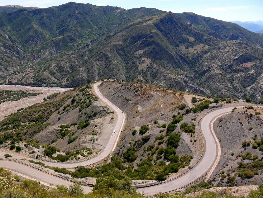
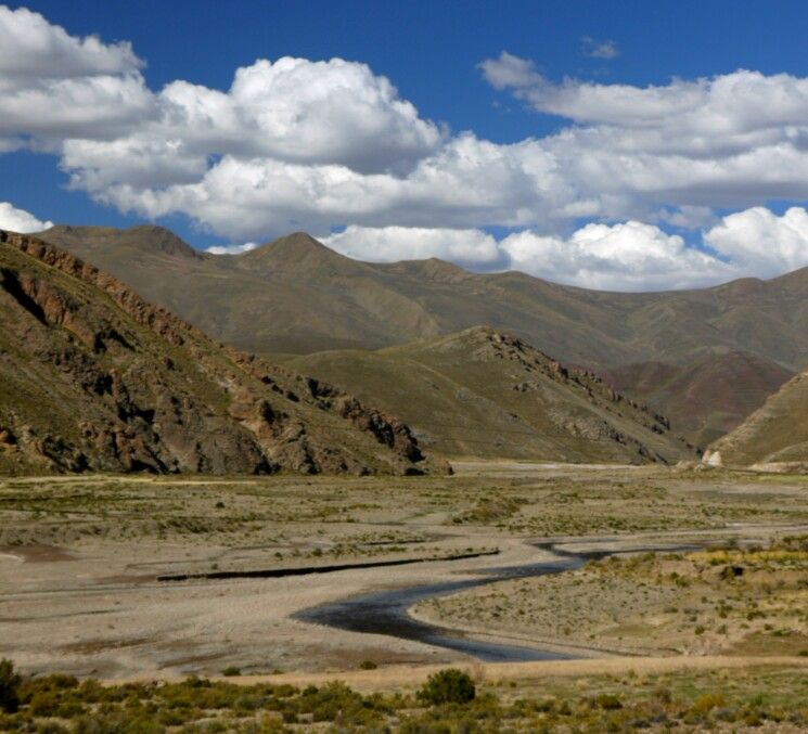
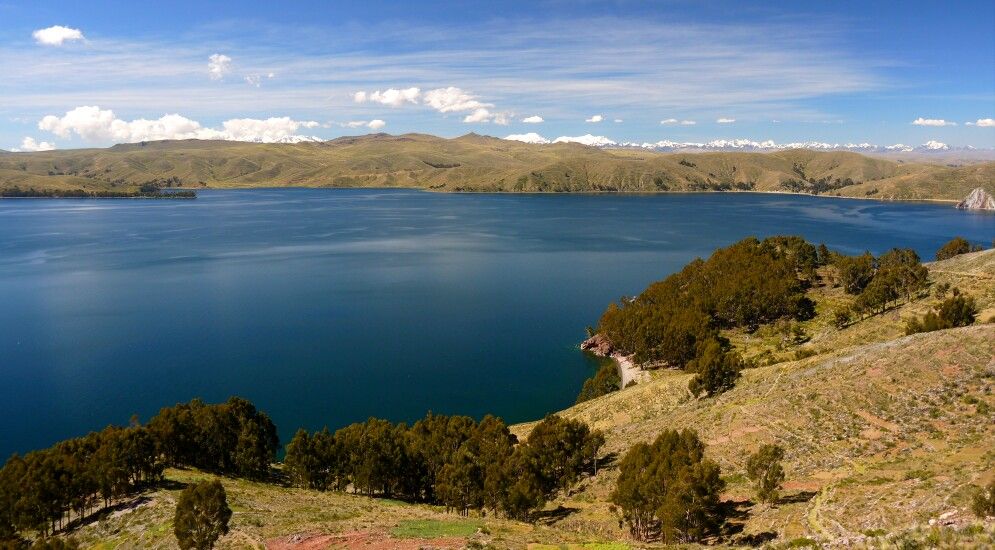
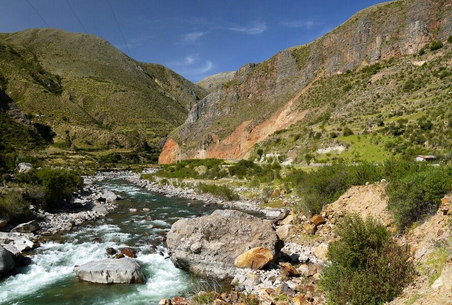
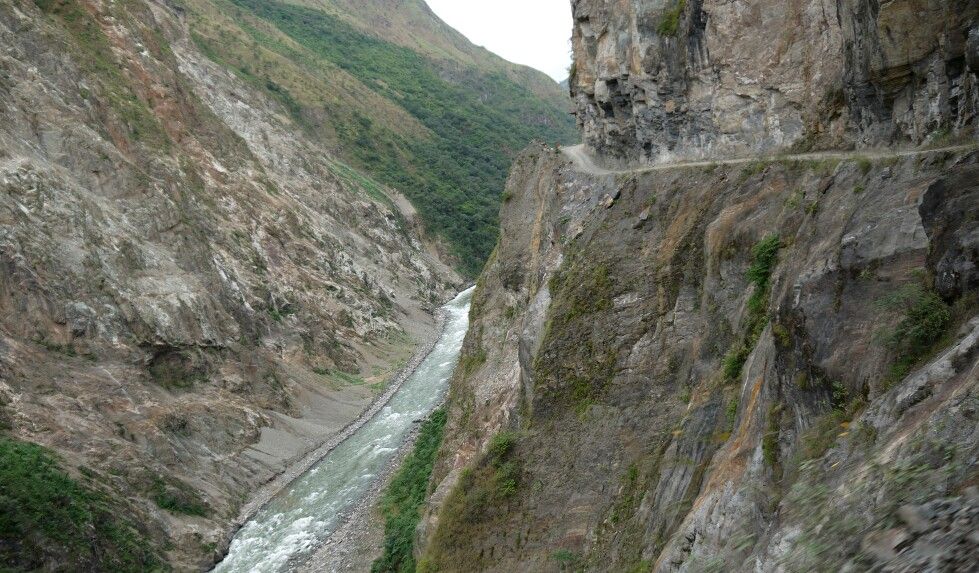
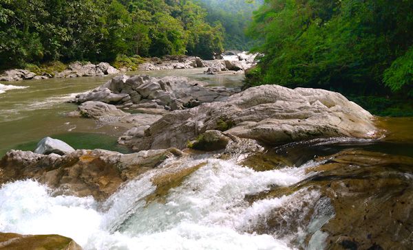
One thing is for sure, crossing the Andes here is a lot colder. And wetter. Descending into the Amazon basin, I hit some of the heaviest fog I’ve ever ridden in. Visibility is down to a few meters; I hit the horn on every bend hoping to warn oncoming trucks, which tend to overshoot the corners. When the fog lifts; some massive scenery hits me, lush green rain forest as far as the eye can see.

ecuador-2_zpsc4861fd5.jpg

Heavy fog crossing the Andes

ecuador-1_zpse8d46986.jpg


The road to Tena is good. I’d been worried because landslides are a problem here. Looking at the route on Google Earth, the road looked like it had been carpet-bombed. But it was brand new tar, great twisties to get your pegs down on grinning from ear to ear.

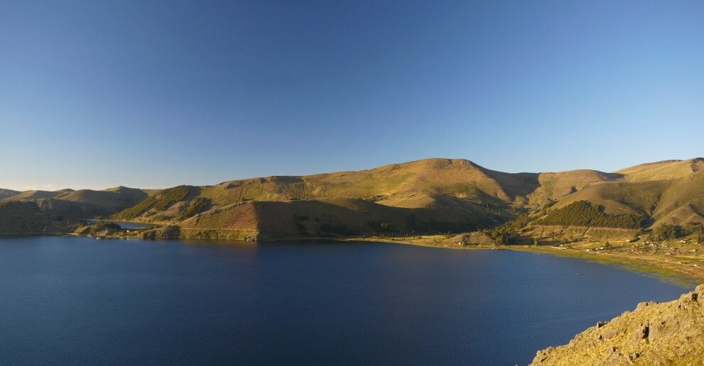
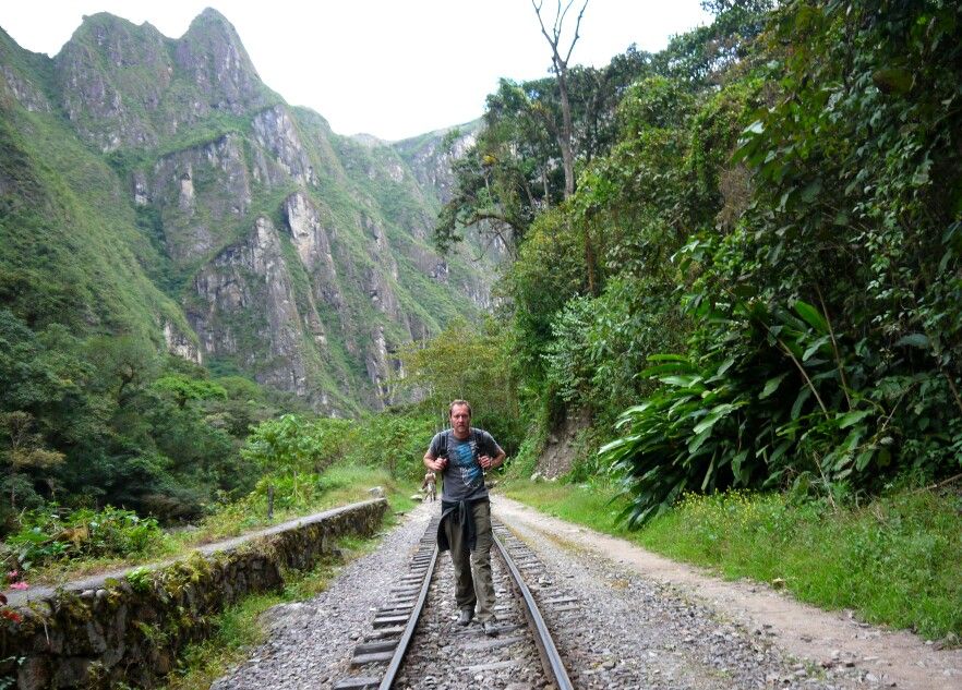
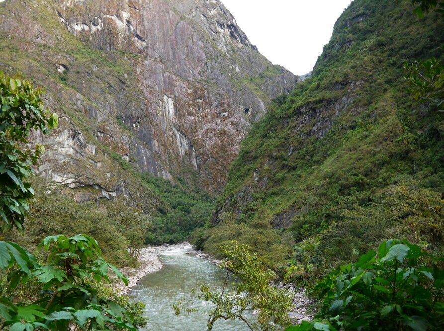
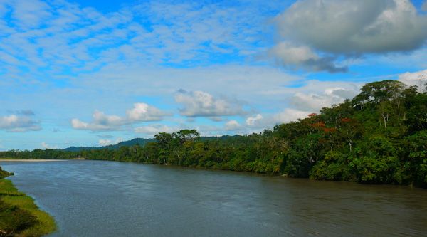
I head further down the Rio Napo, one of the most distant tributaries of the Amazon. Even this far from the Amazon mouth the Napo is massive, a good 100m wide. Average rainfall in parts of the basin can exceed 5,000mm per year.

ecuador-5_zps205f6b53.jpg

The Rio Napo, one of the most distant tributaries of the Amazon

ecuador-8_zps8eeb7482.jpg


I’d been given directions to a small community where I could stay, off the main road and what my Spanish understood to be “up a path of pebbles”. The pebble path turned out to be a twisty 35’ incline over tennis ball sized rocks. Wet rocks. With sticky mud thrown in for good measure. Sometimes I loathe the 300kgs of a fully loaded GS.

At the community, I stayed with the family of the local Shaman. Traditional medicine is still alive and well here; this family have been medicine men for many generations. Many of the locals can’t afford to pay the Shaman in money so they donate a chicken, almost always a cock. The result is a village of 10 cocks to a hen with constant violent chicken gang fights and a lack of sleep due to cockcrow-offs starting at midnight.

The family was great though and they looked after me extremely well. The next week was spent taking trips through the forest, down the river and to various local reserves.

ecuador-16_zps025b47d5.jpg

Children from the community

ecuador-17_zps598bdc70.jpg


ecuador-22_zpsff5cef04.jpg


ecuador-21_zps24e53be5.jpg

Helping out with daily chores

ecuador-24_zps77c51ccc.jpg

The Shaman's holiday home, in virgin rain forest a short hike away from the village. It was impressive to watch them building this hut, only a chainsaw and hammers where used

ecuador-7_zps1433bc00.jpg

Boats are often the main form of transport around here - not GS friendly!

After my week in the forest, I head back over the Andes again to Quito the capital. Quito took me by complete surprise, very American, clean and organised. I thought it was great place. Sorry no pictures, terrible scare stories about armed robberies and all.

Leaving Quito, I head for the Colombian border. I was planning to stop at the Equatorial Monument, which unlike Gabon where the equator is celebrated by a rusty road sign, this one is actually a, well, monument. Unfortunately I never made it to the monument, partly due to me missing the turn-off and partly because it is not actually on the Equator.

Continuing to the border I end up riding behind 2 other GS’s. This is odd because I have not seen another GS since Chile. Without speaking, we form a convoy, filtering through traffic, they even start to signal to me when it’s clear to overtake. Secretly I hope they are going to Colombia too, I’ve been a bit worried about the next bit of the trip, it’s one of the sections when you do actually have to take the FCO’s advice seriously. Unfortunately they turn of just before the border, we wave each other off, them in Spanish, me in English.


Back
Top Bottom