Dragon Master
Registered user
Hi collective...
When I posted my first message in the 'welcome' thread, ash19600 said I'm a 'lucky git' to live where I do. He (or she?) is right of course, some superb roads around here, but unfortunately, as is often the case, with living here I tend to take them for granted. And what's more, I tend assume that everybody will know them. But I realise that this is not the case, especially for tossers from other areas. So...
If the collective are agreeable, I could put together a few posts describing 'runs' in Cumbria and the surrounding areas, for the benefit of visitors to 'God's Country'. These would start and end in Kendal, but can be accessed at any point.
I've taken the liberty of describing the first one below; hope you don't find it too long winded. And let me know if you'd like some more.
Cheers,
Dave.
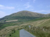
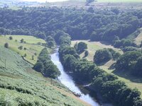
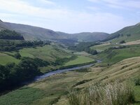
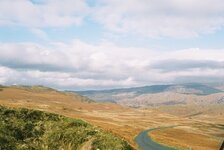
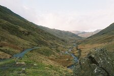
Not so much a road, rather a combination of roads that make a great (IMHO) 'Sunday Run'. I've started it from Kendal, but it could be joined at any point. Sorry there are no pictures, unfortunately I'm usually too busy enjoying the ride to bother with such mundane things. Maybe I'll have to discipline myself one day...
Leave Kendal on the A684 to Sedburgh. Nice twisty road, though touroids can be a problem. At Sedburgh take the A683 for Kirkby Stephen; more twisties, and a bit of open moorland thrown in. Just before Kirkby Stephen you turn right on to the A685 (an alternative is to follow this from Kendal, via Tebay, but not as much fun) and follow this through the town and on to Brough.
Pass under the A66 and turn right in the village, heading for Middleton-in-Teesdale, B6276. A real GS road this; if you're on a Jap Whizz-bang, watch the road surface, it isn't the best. GS's of course won't notice this problem.... A brilliant road across some fairly bleak looking moorland. At the bit where you drop in to a shallow valley and cross a couple of humpty-back bridges, just beware of the chevrons on the S-bends as you climb back out; they aint telling any lies! More of the same roads to Middleton. I usually stop here for a quick brew; if you haven't got a flask, the small cafe on the left just before the T-junction does a nice pot of Earl Grey...
Turn right, heading for Barnard Castle on the B6282. A couple of miles, and turn left on to the B6278 for Stanhope. This is the kind of road I could ride all day. Just watch for touroids when you drop in to the valley half way; it's a bit of a sun trap, and attracts pic-nicers by the thousand in hot weather. A steep descent in to Stanhope, with a ford at the bottom. I've never tried this; it's usually too high, or too full of kids splashing about. Turn left for alternative route.
At the A689 turn right, and after about a quarter of a mile take a left back on to the B6278.. Climb steeply out of Stanhope for more open moorland to Edmundbyers. Continue on past the Derwent reservoir (any Harry Potter fans might notice the sign post hereabouts directing you to 'Muggleswick' ) to join the A68, where you turn left. After a few miles you join the A69 for a short dual carriageway stretch, then back to the A68 (signed to Jedburgh) at Corbridge.
Perhaps watch it on this road; it is good, especially after the Corbridge roundabout, where the blind summits give plenty of scope to clock up air miles. But they are blind... Also the Police use unmarked bikes around here (sign informing you of this as you leave the Corbridge roundabout), and I believe they use R1's...
Follow the A68 for twelve miles, then take a left turn on to an unclassified road, heading to Bellingham, via Reedesmouth. Watch your mileage for this, the junction appears just after you wind her back for a blat down a long inviting hill...
At Bellingham, turn left at the T-junction. I usually stop again for a short break here, parking just on the left outside the shops. Then continue through the village, and take a right towards Kielder Water. Windy one-and-a-half track road eventually becomes fast two-lane with long sweepers as you pass Kielder Water.
An interesting alternative at Kielder village is to take the 'Forest road'. This is a private un-made road, about twelve miles, that brings you back to the A68. An 'Honesty Box' is provided for the £1.00 fee. Up to you, and off the route, but worth a quid in my opinion. But our route carries on through Kielder village, shortly after which it quite suddenly becomes one-and-a-half track again, to join the B6357 at Saughtree. Here you have the opportunity to abort the run, and turn left to head home via Newcastleton and Carlisle. But better to turn right and head for Bonchester Bridge. Here, after a short run on the A6088, again turn right back to the B6357, and follow this until it re-joins the A68. Turn left for the short run to Jedburgh. Anyone who needs it will find a 'Jet' filling station at the far end of town.
After a fill-up (if needed) watch your mileage again, as our route doubles back on the A68, over the Carter Bar pass. Great road, but again well watched by the boys in blue. The layby at the summit of the pass is worth a quick stop on a clear day, for the view back across the plain towards Edinburgh.
Continue south on the A68 past Catcleugh reservoir, watching for the T-junction at Elishaw, where the A68 takes a right turn. Take this, and if you've been watching the miles, after 26, take the right turn near Old Town, and head back to Bellingham. Again through the village, and where you turned right for Kielder, this time take the left on to the B6320, heading south to Chollerford. Here I take a right (roundabout) on to the B6318, and after a mile take a left on the B6319 for Haydon Bridge.
Here you turn left, and take the A69 for about half a mile, before taking a right on to the A686. There now follows around twenty miles of superb (GS) roads to Alston. If you fancy another brew, the South Tynedale Railway, signed to the right just as you enter Alston, has a cafe on the station, open in the touriod season; and the little chuffa-trains are quite cute. Then continue through town on the A686, and back on to open moorland, heading for Penrith via Hartside Pass. If you've done Hartside I need say no more. If you haven't done it; why not?
Just outside Penrith you join the A66; a right turn brings you to a roundabout. Straight on brings you to junction 40 of the M6, where you can take the motorway back to Kendal. But better to take the first exit, on to the A6, for the run back to Kendal. Since the opening of the motorway, this has become an almost deserted road, and a superb final leg of the run, with some excellent bends on the final descent to Kendal.
I first did this run, about 260 miles in all, twelve years back on a CX500. I left Kendal at 12:30, and was back home by 19:30. Not a bad way to spend a Sunday (or any other day!) afternoon. If you wish you could do as I did, and start by heading south out of Kendal on the A65, for a short stop at 'Devil's Bridge' at Kirkby Lonsdale, then take the A683 to Sedburgh.
When I posted my first message in the 'welcome' thread, ash19600 said I'm a 'lucky git' to live where I do. He (or she?) is right of course, some superb roads around here, but unfortunately, as is often the case, with living here I tend to take them for granted. And what's more, I tend assume that everybody will know them. But I realise that this is not the case, especially for tossers from other areas. So...
If the collective are agreeable, I could put together a few posts describing 'runs' in Cumbria and the surrounding areas, for the benefit of visitors to 'God's Country'. These would start and end in Kendal, but can be accessed at any point.
I've taken the liberty of describing the first one below; hope you don't find it too long winded. And let me know if you'd like some more.
Cheers,
Dave.
Not so much a road, rather a combination of roads that make a great (IMHO) 'Sunday Run'. I've started it from Kendal, but it could be joined at any point. Sorry there are no pictures, unfortunately I'm usually too busy enjoying the ride to bother with such mundane things. Maybe I'll have to discipline myself one day...
Leave Kendal on the A684 to Sedburgh. Nice twisty road, though touroids can be a problem. At Sedburgh take the A683 for Kirkby Stephen; more twisties, and a bit of open moorland thrown in. Just before Kirkby Stephen you turn right on to the A685 (an alternative is to follow this from Kendal, via Tebay, but not as much fun) and follow this through the town and on to Brough.
Pass under the A66 and turn right in the village, heading for Middleton-in-Teesdale, B6276. A real GS road this; if you're on a Jap Whizz-bang, watch the road surface, it isn't the best. GS's of course won't notice this problem.... A brilliant road across some fairly bleak looking moorland. At the bit where you drop in to a shallow valley and cross a couple of humpty-back bridges, just beware of the chevrons on the S-bends as you climb back out; they aint telling any lies! More of the same roads to Middleton. I usually stop here for a quick brew; if you haven't got a flask, the small cafe on the left just before the T-junction does a nice pot of Earl Grey...
Turn right, heading for Barnard Castle on the B6282. A couple of miles, and turn left on to the B6278 for Stanhope. This is the kind of road I could ride all day. Just watch for touroids when you drop in to the valley half way; it's a bit of a sun trap, and attracts pic-nicers by the thousand in hot weather. A steep descent in to Stanhope, with a ford at the bottom. I've never tried this; it's usually too high, or too full of kids splashing about. Turn left for alternative route.
At the A689 turn right, and after about a quarter of a mile take a left back on to the B6278.. Climb steeply out of Stanhope for more open moorland to Edmundbyers. Continue on past the Derwent reservoir (any Harry Potter fans might notice the sign post hereabouts directing you to 'Muggleswick'
) to join the A68, where you turn left. After a few miles you join the A69 for a short dual carriageway stretch, then back to the A68 (signed to Jedburgh) at Corbridge.Perhaps watch it on this road; it is good, especially after the Corbridge roundabout, where the blind summits give plenty of scope to clock up air miles. But they are blind... Also the Police use unmarked bikes around here (sign informing you of this as you leave the Corbridge roundabout), and I believe they use R1's...
Follow the A68 for twelve miles, then take a left turn on to an unclassified road, heading to Bellingham, via Reedesmouth. Watch your mileage for this, the junction appears just after you wind her back for a blat down a long inviting hill...
At Bellingham, turn left at the T-junction. I usually stop again for a short break here, parking just on the left outside the shops. Then continue through the village, and take a right towards Kielder Water. Windy one-and-a-half track road eventually becomes fast two-lane with long sweepers as you pass Kielder Water.
An interesting alternative at Kielder village is to take the 'Forest road'. This is a private un-made road, about twelve miles, that brings you back to the A68. An 'Honesty Box' is provided for the £1.00 fee. Up to you, and off the route, but worth a quid in my opinion. But our route carries on through Kielder village, shortly after which it quite suddenly becomes one-and-a-half track again, to join the B6357 at Saughtree. Here you have the opportunity to abort the run, and turn left to head home via Newcastleton and Carlisle. But better to turn right and head for Bonchester Bridge. Here, after a short run on the A6088, again turn right back to the B6357, and follow this until it re-joins the A68. Turn left for the short run to Jedburgh. Anyone who needs it will find a 'Jet' filling station at the far end of town.
After a fill-up (if needed) watch your mileage again, as our route doubles back on the A68, over the Carter Bar pass. Great road, but again well watched by the boys in blue. The layby at the summit of the pass is worth a quick stop on a clear day, for the view back across the plain towards Edinburgh.
Continue south on the A68 past Catcleugh reservoir, watching for the T-junction at Elishaw, where the A68 takes a right turn. Take this, and if you've been watching the miles, after 26, take the right turn near Old Town, and head back to Bellingham. Again through the village, and where you turned right for Kielder, this time take the left on to the B6320, heading south to Chollerford. Here I take a right (roundabout) on to the B6318, and after a mile take a left on the B6319 for Haydon Bridge.
Here you turn left, and take the A69 for about half a mile, before taking a right on to the A686. There now follows around twenty miles of superb (GS) roads to Alston. If you fancy another brew, the South Tynedale Railway, signed to the right just as you enter Alston, has a cafe on the station, open in the touriod season; and the little chuffa-trains are quite cute. Then continue through town on the A686, and back on to open moorland, heading for Penrith via Hartside Pass. If you've done Hartside I need say no more. If you haven't done it; why not?
Just outside Penrith you join the A66; a right turn brings you to a roundabout. Straight on brings you to junction 40 of the M6, where you can take the motorway back to Kendal. But better to take the first exit, on to the A6, for the run back to Kendal. Since the opening of the motorway, this has become an almost deserted road, and a superb final leg of the run, with some excellent bends on the final descent to Kendal.
I first did this run, about 260 miles in all, twelve years back on a CX500. I left Kendal at 12:30, and was back home by 19:30. Not a bad way to spend a Sunday (or any other day!) afternoon. If you wish you could do as I did, and start by heading south out of Kendal on the A65, for a short stop at 'Devil's Bridge' at Kirkby Lonsdale, then take the A683 to Sedburgh.
 , I`ve done that route & know excactly where you mean
 ") you lot on motorbikes really wouldn`t enjoy it
you lot on motorbikes really wouldn`t enjoy it  The M6 and places like that would be better
  Nothing to see here, move along :eyesdown All the locals you see on that road and any others round here are just on their way to work & MUST travel that way
  No good for tourists


") When you get to the A684, turn left, after half a mile take the right, just before the road slopes down towards the motorway bridge.
When you get to the A684, turn left, after half a mile take the right, just before the road slopes down towards the motorway bridge.