

You are using an out of date browser. It may not display this or other websites correctly.
You should upgrade or use an alternative browser.
You should upgrade or use an alternative browser.
The Ridgeway and Feeders (between Streatley and the A34)
- Thread starter Clive
- Start date

Mouse
Registered user
Lovely 
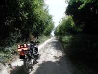
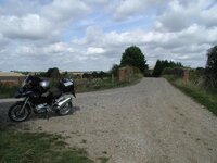
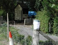
SU 534 824 to SU 534 820
Location: SU534824/SU534820
Map: Explorer 170
Date: 14/09/2005
Weather: Dry, Rain a few days ago
Difficulty: 2 - Moderate difficulty - perhaps deep ruts or large stones. Off road tyres and a bit of experience recommended.
Status: RUPP
Source: OS Map
Restrictions: None
Notes: Mud/Grass narrow deep ruts - partially overgrown.
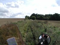
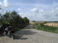
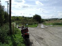
SU 525 823 to SU 509 832
Location: SU525823/SU509832
Map: Explorer 170
Date: 14/09/2005
Weather: Dry, Rain a few days ago
Difficulty: 2 - Moderate difficulty - perhaps deep ruts or large stones. Off road tyres and a bit of experience recommended.
Status: RUPP
Source: OS Map, Signpost indicates "Public Right Of Way"
Restrictions: None
Notes: Mud/Grass narrow deep ruts for part of the way. Concrete road has "replaced" the rest of the track, although it is still visible, an oil drum in the middle of the grass seems to indicate the concrete road should be used.
Great shots
Clive,
Great shots
I recognise most of them, as I used to take my Enduro and Trail bikes down there regularly.
Hopefully once my crash bars arrive and I get some knobblies, i'll be down there
Cheers, Piggers
Clive,
Great shots
I recognise most of them, as I used to take my Enduro and Trail bikes down there regularly.
Hopefully once my crash bars arrive
and I get some knobblies, i'll be down there Cheers, Piggers
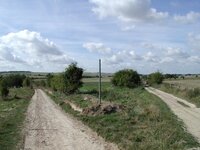
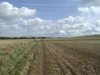
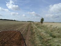
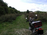
SU 509 832 to SU 497 840
Location: SU509832/SU497840
Map: Explorer 170
Date: 14/09/2005
Weather: Dry, Rain a few days ago
Difficulty: 2 - Moderate difficulty - perhaps deep ruts or large stones. Off road tyres and a bit of experience recommended.
Status: RUPP
Source: OS Map
Restrictions: None
Notes: Mud/Grass ruts for part of the way. Shortly after leaving the railway bridge I found myself following the wrong track across a field - keep to the left hand edge of the field for a few hundred yards then in the next field keep to the right hand edge.
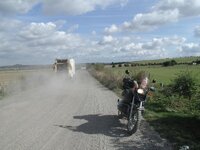
SU 497 840 to SU 486 844
Location: SU497840/SU486844
Map: Explorer 170
Date: 14/09/2005
Weather: Dry, Rain a few days ago
Difficulty: 1 - Easy unsurfaced road, suitable for a novice on road tyres.
Status: Byway
Source: OS Map
Restrictions: None
Notes: A wide stone unsurfaced road leading to a waste tip - numerous waste lorries - some potholes. Not very interesting.
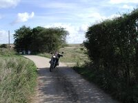
SU 550 843 to SU 537 825
Location: SU550843/SU537825
Map: Explorer 170
Date: 14/09/2005
Weather: Dry, Rain a few days ago
Difficulty: 2 - Moderate difficulty - perhaps deep ruts or large stones. Off road tyres and a bit of experience recommended.
Status: Byway
Source: Signposts (shown on OS Map as RUPP)
Restrictions: None
Notes: A bit of everything - potholes, mud/grass, ruts, sheep, steep chalk hill with deep ruts and washaway. Excellent - a recommended track.

Similar threads