

You are using an out of date browser. It may not display this or other websites correctly.
You should upgrade or use an alternative browser.
You should upgrade or use an alternative browser.
The Ridgeway and Feeders (between Streatley and the A34)
- Thread starter Clive
- Start date
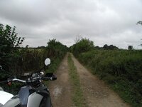
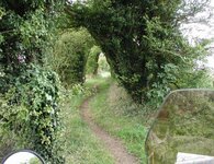
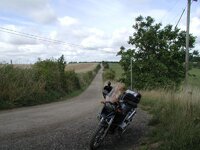
SU 563 798 to SU 555 805
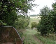
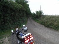
I, of course, missed the fact that the Byway went through the gate - there may be a signpost but I didn't spot it, so I followed this (private) track down the hill and up the other side. After ending up in a field of crops, I realised I'd gone wrong - a quick about turn and retraced the track to the start. I didn't go through the gate (which I spotted on the way back ) and the farmyard, just in case the farmer wanted "a few words"
I, of course, missed the fact that the Byway went through the gate - there may be a signpost but I didn't spot it, so I followed this (private) track down the hill and up the other side. After ending up in a field of crops, I realised I'd gone wrong - a quick about turn and retraced the track to the start. I didn't go through the gate (which I spotted on the way back
) and the farmyard, just in case the farmer wanted "a few words" Attachments
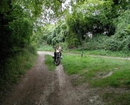
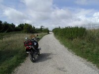
SU 544 810 to SU 534 805
Location: SU544810/SU534805
Map: Explorer 170
Date: 14/09/2005
Weather: Dry, Rain a few days ago
Difficulty: 1 - Easy unsurfaced road, suitable for a novice on road tyres.
Status: RUPP
Source: OS Map
Restrictions: None
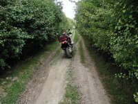
Notes: Good drainage. Single small rut on mud/grass between trees.
Location: SU544810/SU534805
Map: Explorer 170
Date: 14/09/2005
Weather: Dry, Rain a few days ago
Difficulty: 1 - Easy unsurfaced road, suitable for a novice on road tyres.
Status: RUPP
Source: OS Map
Restrictions: None
Notes: Good drainage. Single small rut on mud/grass between trees.
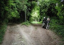
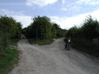
SU 531 800 to SU 534 805
Location: SU531800/SU534805
Map: Explorer 170
Date: 14/09/2005
Weather: Dry, Rain a few days ago
Difficulty: 2 - Moderate difficulty - perhaps deep ruts or large stones. Off road tyres and a bit of experience recommended.
Status: Byway
Source: OS Map
Restrictions: None
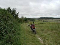
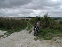
Notes: Chalk/mud track, probably nasty in the wet. A 9" step approx 1/2 way down the track. Fair amount of washaway, loose stones.
Location: SU531800/SU534805
Map: Explorer 170
Date: 14/09/2005
Weather: Dry, Rain a few days ago
Difficulty: 2 - Moderate difficulty - perhaps deep ruts or large stones. Off road tyres and a bit of experience recommended.
Status: Byway
Source: OS Map
Restrictions: None
Notes: Chalk/mud track, probably nasty in the wet. A 9" step approx 1/2 way down the track. Fair amount of washaway, loose stones.
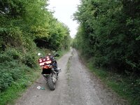
SU 534 805 to SU 539 815
Location: SU534805/SU539815
Map: Explorer 170
Date: 14/09/2005
Weather: Dry, Rain a few days ago
Difficulty: 2 - Moderate difficulty - perhaps deep ruts or large stones. Off road tyres and a bit of experience recommended.
Status: Byway
Source: OS Map
Restrictions: None
Notes: Chalk/mud track, some ruts. Long term "travellers" in residence.
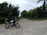
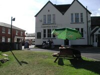
Loop from SU 546 809 to SU 550 803
Location: SU546809/SU544810/SU539815/SU549812/SU552804/SU550803
Map: Explorer 170
Date: 14/09/2005
Weather: Dry, Rain a few days ago
Difficulty: 1 - Easy unsurfaced road, suitable for a novice on road tyres.
Status: Byway
Source: OS Map
Restrictions: None
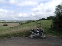
Notes: SU539815/SU549812 is part of the "official" Ridgeway. Basically all the same chalk/loose stone/potholes.
Location: SU546809/SU544810/SU539815/SU549812/SU552804/SU550803
Map: Explorer 170
Date: 14/09/2005
Weather: Dry, Rain a few days ago
Difficulty: 1 - Easy unsurfaced road, suitable for a novice on road tyres.
Status: Byway
Source: OS Map
Restrictions: None
Notes: SU539815/SU549812 is part of the "official" Ridgeway. Basically all the same chalk/loose stone/potholes.

Similar threads