what to see / where to camp in south?

Camping places here - http://www.camping-ireland.ie/ and here - http://www.discoverireland.ie/DI/re...=All+towns&Radius=1000&thisPage=1&PageSize=10

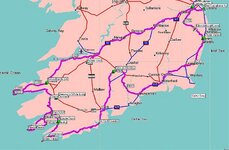
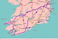
Then have a look at the PDF that Bin Ridin has posted. On the way down you can make a short detout & pick up the Slieve Blooms (Road No. 5) Another detour would bring you to No. 3 & the Burren. While down in the South West you can pick up No.'s 10/13/15 & the Shehy Mountains, Parts 1 & 2. Then on the way home there's The Vee & No.'s 12 & 4.

That & the other suggestions posted should fill your week :thumb2
 
Thanks everyone for taking the time and effort to post suggestions,

I'm just sourcing the campsites now and will post the final map once I've checked with the sites etc.

It's looking like a very good trip :bounce1
 
I believe I've added as many of the roads as I can whilst giving enough time to enjoy the views. Much helped by Bin Ridins attachment and Jocksers references to it:thumb

I've booked the ferry using the motorsport people -£65 return and idea sailing times. Going Sat 15th Sept to Fri 21st

Doing the route anti-clockwise
 

Attachments

  • Ire5.jpg
    Ire5.jpg
    69.1 KB · Views: 116
I believe I've added as many of the roads as I can whilst giving enough time to enjoy the views. Much helped by Bin Ridins attachment and Jocksers references to it:thumb

I've booked the ferry using the motorsport people -£65 return and idea sailing times. Going Sat 15th Sept to Fri 21st

Doing the route anti-clockwise

Call in for a cup of tea, I am right in the middle of the best bit your doing:D
 
Call in for a cup of tea, I am right in the middle of the best bit your doing:D

Assuming your on the Beara Pen I think that will poss be Tues in the day.

Happy to stop for a brew if you happen to be about:thumb
 
1. I had run the route through the Boggeragh Mts - this new route misses this area - is the Cork coast rd better? Cutting up from Mizen Head thru the Boggeragh Mts to the Galty Mts would be shorter but should I pass through Cork?

Given that you like the mountains Squid I would be inclined to go with this plan.

Keep an eye out in west Cork on Saturday & Sunday for a bunch of GS's wandering about the place on the PRC run. It would be good to see you somewhere along the way. :thumb2
 
I believe I've added as many of the roads as I can whilst giving enough time to enjoy the views. Much helped by Bin Ridins attachment and Jocksers references to it:thumb

I've booked the ferry using the motorsport people -£65 return and idea sailing times. Going Sat 15th Sept to Fri 21st

Doing the route anti-clockwise

Hi Squid

I'm not sure if you trying to 'make time' on the Thursday (?) after leaving the Glen of Aherlow, but the Dungarvan to Arklow bit can be improved to some extent by avoiding the main road. I'd recommend turning off the N25 at Lemybrien (sorry, dont have Mapsource, but the co-ords are N 52.16442,W7.52512) heading along the R676 to Carrick-on-Suir. Shortly after joing this road, if you have half and hour to spare, follow the signs to Mahon Falls N52.2222478, W7.54143) where you can ride a loop before rejoining the R676. From Carrick head for Kilmaganny on R697 (you'll pass the triangluar Faugheen road race course off this road just outside Carrick if you want to have a look-see:eek:) and then via Newmarket onto the R701 to Knocktopher. Pick up the N9 the short distance to Thomastown and then leave it on the R700 (you'll have to work around a new one-way system in the town thats not on Ver9 GPS mapping) along the Nore Valley to Inistoige and onwards to near to New Ross, turning left onto the N30 towards Enniscorthy, and continue to Arklow.

I may even be able to meet up for some of this depending on a number of factors - I'll PM a number if you want to give me a call on the Wednesday perhaps.

Above all else, enjoy!
V

I was trying to keep the travel time down - I don't like rushing to get off in the morning, breakfast, shower, pack up etc. Also as the nights are drawing in now I am aiming to be setting the tent up at around 6pm so I can settle in and get the stove on well before dark.

The section was showing around 5.15hrs before any stops so figure real time could be much longer.

I've adapted your route a bit to keep it under 6hrs as below. I assume this is still a better way to go than my previous one:thumb
 

Attachments

  • Ire6.jpg
    Ire6.jpg
    70.6 KB · Views: 99
I will be here, last/first house in the village. Its has a sign Cluin Dive School, only visible on way "up".... Call in and have a chat.

I take it thats the village of Allihies, I'll be coming from the North - as long as I am not running late i'll stick my head around the door:thumb
 
I take it thats the village of Allihies, I'll be coming from the North - as long as I am not running late i'll stick my head around the door:thumb
Squid, from Eyries to here is a fantastic piece of road. Stop a mile photography... I am therefore the last house in the village. Right hand side. Looks like a cow shed. Is / Was a cow shed.....

Tea and biscuits. Not a bother, remind me which day. Phone number is

zero eight seven seven four two zero double four three....
 
I was trying to keep the travel time down -
The section was showing around 5.15hrs before any stops so figure real time could be much longer.

I've adapted your route a bit to keep it under 6hrs as below. I assume this is still a better way to go than my previous one:thumb

Squid

Fair point, the route as you have amended it will be 5.5 hours or so without stops, so it will be half an hour or so longer 'saddle time' than the original section. There are a number of nice photo stops en-route so you'll be a full day at it, I guess. Its worth stopping off at the Vee, between Clogheen and Cappoquin; on the Mahon Falls loop if you take it, and along the Nore at Inistoige, so plan for those, and play it by ear.

If the need arises and you run short of time, you can always take your originally planned route after Dungarvan and miss out on the bit I suggested. You should make good time to New Ross by this main road, just dont be surprised if traffic holds you up in Waterford (it can be grim) and this could mean that the 'main' road ends up being nearly as long as the alternative.

V


Pm'd ye:thumb
 
Squid, from Eyries to here is a fantastic piece of road. Stop a mile photography... I am therefore the last house in the village. Right hand side. Looks like a cow shed. Is / Was a cow shed.....

Tea and biscuits. Not a bother, remind me which day. Phone number is

zero eight seven seven four two zero double four three....

Think it was a Tues - Milk, no Sugar:thumb2
 
Hi Squid, no show???? I or someone was in all day. Shame, but no problemo, hope your trip worked out OK


Sorry Richie, when I said Tue I should have re-stated the date.

I leave of Ireland this Sat so It should be Tues next week:thumb

All packed and ready:bounce1:bounce1
 
Great thread - great resources :thumb

I'm new to the area and starting to consider a 5-6 exploration in July. Hopefully all camping.

This will be a great help in planning.

Thinking about whether to buy a GPS or just go the usual adventurous route and get lost...

Main advantage of the GPS might be finding campgrounds.


Back
Top Bottom