A new Michelin map

Kinda related but loosely. I now have my French map and wonderful it is (Thanks, Richard). However, I am having issues scanning the QR code thingies with Google lens to get the GPX routes. They are very small and fuzzy up close but too far away when in focus. Dr Google doesn't seem to have any solutions I understand.
Any ideas?
Now sorted.
 
France a la Moto map arrived today, what a lovely thing it is too.

It should come in very useful when planning future jaunts to visit Johnny Foreigners tea rooms. :thumb2
 
FWIW
If you want to clear clutter, get more speed out of your satnav, have better routing for YOUR maps, streamline the files and create new routes, this is what I once did.
  1. Downloaded the GPX files and imported each into BC
  2. Deleted any routes, used the tracks to recalculate new routes for my mapping, then deleted the tracks to shrink the files.
  3. Renamed the files to the closest town and the direction from that town to the places as I found that easier to find when scrolling my lists.
Here is an example of result

.michelin.jpg

Hope this helps someone and if not- apologies for the clutter!

======

Tidied-up

Richard
 
A word to the wise about the Michelin GPX downloads and downloads from websites in general.

1. Michelin will, at some point, maybe not maintain their download portal.

2. If, as they did with their ‘100 routes around France’ site, it is not maintained, there is a pretty good chance that the downloads will not be available, should you then wish to use them.

3. To avoid this possibility upsetting your future plans, download them now. Or, should the downloads not be available in the future, create the routes yourself by using the map. I know which is easier to do.

4. Always check the downloads, to make sure nothing odd has happened in the process. Then check it again when you have transferred it to your GPS device. It is easier to resolve problems today, than it might be when you are standing on the side of the road.

5. This advice pertains just as much to any download, not just to GPX files from Michelin.

6. If possible, create tidy folders and / or rename the routes to something that you’ll recognise later. Yarkto in post #45 has kindly given us an example of how he does it, in a way that makes sense to him. That said, the P of PC is ‘Personal’ so do it in anyway that makes sense to you.
 
I have been looking at the routes offered up for north east France. On the whole they are not bad, designed to give a user a taste of the area, some towns to pass through and, not least, probably somewhere where you’d find a ‘biker friendly’ hotel to stay in, without too much effort.

Definitely, lots of the circular routes would go a long way to answering the “Me and six mates are free at the weekend and want somewhere to go, things to see and do” appeals. Here is an example:

IMG_5548.jpeg

It would be very easy to skip down the A16 motorway from Calais to Abbeville (you can see it’s a pretty large town) in say an hour an a half.

IMG_5549.jpeg

Or, if you are so inclined, ask Google or some other app or website to give you a non-motorway route. Here’s Kurviger’s effort, which the app predicts will take two and half hours non-stop.

IMG_5550.jpeg

Here’s ViaMichelin’s non-motorway effort, which they estimate at two hours:

IMG_5551.jpeg

As you can easily see, the Kurviger suggestion differs from ViaMichelin’s but they (along with the straightforward motorway route from Google) all go from A (Calais) to B (Abbeville). Use the one that you prefer and / or might be dictated to you by the time you have available to get from A to B.

So far, this has taken me under two minutes, using nothing but an iPad and what is readily available (all for free) from the internet. The only thing I have paid even a penny for is the Michelin paper map.

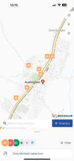
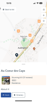
Michelin’s map suggestion is centred on the town of Abbeville as its start and finish. Are you obliged to stay there? Of course not, you are free to chose anywhere you like; it’s just a suggestion. Either way, now go into something like Booking.com, or ViaMichelin or Tripadvisor or any of the multiple search engines to find yourself a hotel which you think will suit you and your six mates for maybe one or two nights. Here is an example, using Booking.com, who list no less than 22 hotels in Abbeville or its environs. There must be at least one which suits the seven of you surely?

IMG_5552.jpeg

Book or reserve one and fine tune your plans later, perhaps. At least that way you have got a place to stay, which you can amend later, at leisure. So far, this has taken me less than five minutes, still all free and still just using an iPad.

It is that easy, as the internet will do it all for you. In short, an instant ‘short break’ holiday, in under five minutes, with all but zero effort between the seven of you.

Give it a go. You can’t break anything; it’ll cost you no more than the paper map, which Amazon will put through your letter box. Then go out and enjoy your holiday.

:beerjug:

PS It’s not until you look at the estimated times to travel between A and B (which doesn’t look that far on a basic map) that you start to appreciate how large France is.

Calais to Abbeville direct is about 75 miles, which is near enough the same as London to Oxford. The suggested Michelin map loop, is around 150 miles, just on its own. To put that into some kind of perspective, that is about the same as London to Sheffield, direct up a motorway. The Michelin map loop is the same distance but using mostly D roads. It’s something to think about….. how long would it take you to ride from Sheffield to London, avoiding motorways but riding reasonable D roads? Whatever that answer is, it’ll probably be no quicker in France.
 
Last edited:
Richard is spot on when he says 'get it now'- things disappear fast on the web- one reason I use SSD backups and minimise any reliance on the web/cloud.
(remember the OSM maps depository in the Netherlands so many relied on?- overnight and ...gone for ever.)
and build your own library of data which you may or may not use- either way- it is in your hands.

The smallest Michelin route is approx 106kms, median is approx 265 kms and largest 435kms and most are circular- add wee stops for photos, where's my mate?, photos, snack & lunch breaks, time on booking.com ( doesn't anyone use tents anymore :nenau ...:duck:) and many routes would be most enjoyed over 2 even maybe 3 days to take the time to soak it all in.

And do remember to recalculate the routes as your maps will make a difference. IMHO, it is best to avoid the old Mapsource program as the logarithms and parts of the software were found to be flawed hence Garmin produced Basecamp.
 
Last edited:
Good points.

I generally try to download GPX files as tracks, as they should at least be reasonably stable. I then convert the track into a route. This conversion is not necessarily always perfect for a number of possible reasons but, by-and-large, it’s usually not too bad. Even if it differs a bit it doesn’t really matter as bits can be tidied-up and / or it’s pretty rare that you’ll ever use an imported route exactly as the original creator rode or designed it.
 
Mine arrived today :)
Downloaded a couple of files. Simple to do.
Opened in Basecamp and converted the track to a route.
The result is:
CharenteTour.jpg

I will give it a go when I get the bike back...
 
Just got the map and it looks good.

How do I download the files - never done it before and I cannot see anything on the map itself
 
How do I download the files - never done it before and I cannot see anything on the map itself

Point your phone camera at one of the QR codes and open the website it links to. There yiu’ll find the GPX file to download. Download the file and then open it in whatever app you. For example, I open the GPX file in MyRoute or Pocket Earth.

Tap around, you can’t break it.
 
Excellent map. It does show a few routes in the areas of the Path of Peace so anyone who plans to follow the Path on a bike can have some good routes in the locality.
 
Richard....just as an aside, I imagine I'm not the only one to miss the proper online Michelin maps that were available in a separate window on via Michelin if you scrolled in far enough? Is there any other source for the proper Michelin maps on line that you know of? Thanks...

Sent from my Pixel 8 using Tapatalk
 
The are still there:


IMG_4821.png

IMG_4822.png

IMG_4823.png

IMG_4824.png


I use MyRoute’s ability to display Michelin maps, too.

The same maps are on the ViaMichelin app, with the added advantage that you can display other things, like hotels and the Green Guide’s points of interest:

IMG_4821.png

IMG_4822.png
IMG_4823.png

IMG_4824.png

IMG_4826.pngIMG_4827.png
IMG_4829.png

IMG_4830.png
 

Attachments

  • IMG_4827.png
    IMG_4827.png
    208.9 KB · Views: 11
  • IMG_4828.png
    IMG_4828.png
    209.2 KB · Views: 11
  • IMG_4829.png
    IMG_4829.png
    162 KB · Views: 9
  • IMG_4828.png
    IMG_4828.png
    209.2 KB · Views: 10
Last edited:
Well... it's not quite the same. You used to get a pop out window of the red all the way down to the yellow (1:150 000)... But I do agree that the via Michelin app has recently been improved and all the information is there.... I have only just started exploring My Route.. thanks, Chris

Sent from my Pixel 8 using Tapatalk


Back
Top Bottom