

The London Marathon finds me trapped in Wapping, cut off from the rest of the world due to closed roads. The consequence of this is that I have taken up going away to France or Belgium on the Friday and not returning until the Monday morning.
This year, I thought I’d do something a bit different, to see what might be possible, going away to north east France, but never more than 40 miles from Calais. I also thought I’d ring a change by turning left (eastwards) when leaving the Chunnel, instead of heading south or westwards. I wasn’t disappointed.
People say that the roads of north east France are boring. To me, that’s a bit unfair. I’d call them ‘different’ but you do have to work at it a little and use a little imagination. Heading east from Calais, towards Dunkirk, brings you into Flanders, a strange part of France that stretches into Belgium. The land, in a word or two, is flat open. But as much of it lies on or not much above sea level, it is often cut by manmade canals and little waterways, all irrigating the agricultural land which stretches as far as the eye can see. Boring? Maybe, if you want to hoon twisties all day and see mountains. Less so, if you want to see and experience something different to a motorway or even a fast N or D road.
Knowing that I wanted to be within 40 or so miles of Calais and east of the port, I looked at a map and landed on the town of Bergues, roughly six miles south of Dunkirk. A quick look in Google, suggested that it should be a nice enough place.

I then needed to find a hotel, good enough for a two night stay. Google again came up with suggestions, so I picked one, reasonably near the middle of the town and reasonably close to a fuel station. Why there? Two reasons:
1. I wanted to stroll into town, to see what the place was really like.
2. I always like to fill up, if possible, on arrival at a hotel, to save any faffing about on the next morning.
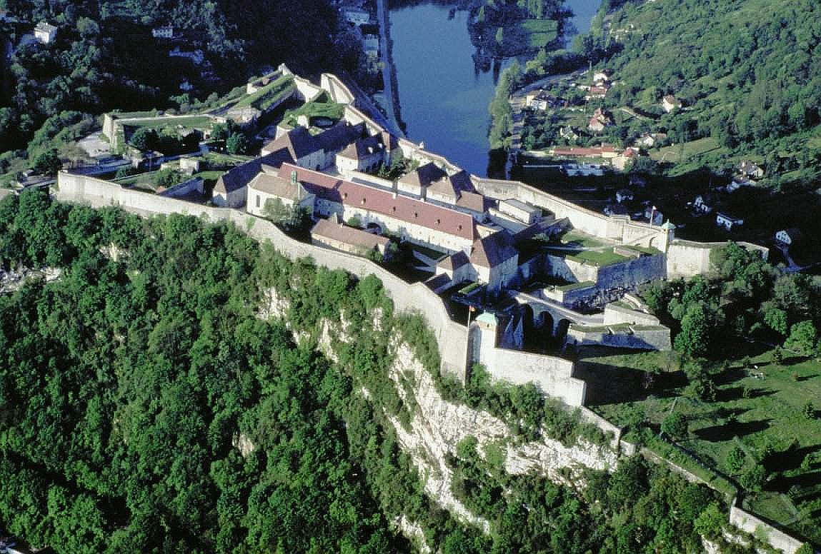
Google found the two fuel stations for me and showed me that the town had a pretty reasonable looking Logis hotel, slap bang in the middle:

This is the hotel, I chose:
 www.logishotels.com
 autonnelier.com
I wasn’t too fussed about garaging the bike, reasonably confident that it would be pretty safe on the street for the two nights of my stay. As a rule, I tend to avoid hotel parking garages, unless they are very large with easy access. Why? I once got blocked in by a gang of other motorbikes, whose owners idea of a good stay was to leave the hotel at around 11 AM, the next day. Fine and dandy if your timetable matches theirs. Far from fine, if you want to be on the road at nine AM, latest.
Despite dire warnings on these pages of Obergruppenfuhrers now fining anyone arriving at the Chunnel early and / or refusing to offer bikermates or cage drivers earlier trains, all was good and onto an earlier train I went. The same experience coming back, all at no additional cost.

Rolling off the Chunnel in Calais, I had created a simple route, taking D roads all the way to Bergues:
I wasn’t disappointed.
To be continued……
This year, I thought I’d do something a bit different, to see what might be possible, going away to north east France, but never more than 40 miles from Calais. I also thought I’d ring a change by turning left (eastwards) when leaving the Chunnel, instead of heading south or westwards. I wasn’t disappointed.
People say that the roads of north east France are boring. To me, that’s a bit unfair. I’d call them ‘different’ but you do have to work at it a little and use a little imagination. Heading east from Calais, towards Dunkirk, brings you into Flanders, a strange part of France that stretches into Belgium. The land, in a word or two, is flat open. But as much of it lies on or not much above sea level, it is often cut by manmade canals and little waterways, all irrigating the agricultural land which stretches as far as the eye can see. Boring? Maybe, if you want to hoon twisties all day and see mountains. Less so, if you want to see and experience something different to a motorway or even a fast N or D road.
Knowing that I wanted to be within 40 or so miles of Calais and east of the port, I looked at a map and landed on the town of Bergues, roughly six miles south of Dunkirk. A quick look in Google, suggested that it should be a nice enough place.
I then needed to find a hotel, good enough for a two night stay. Google again came up with suggestions, so I picked one, reasonably near the middle of the town and reasonably close to a fuel station. Why there? Two reasons:
1. I wanted to stroll into town, to see what the place was really like.
2. I always like to fill up, if possible, on arrival at a hotel, to save any faffing about on the next morning.
Google found the two fuel stations for me and showed me that the town had a pretty reasonable looking Logis hotel, slap bang in the middle:
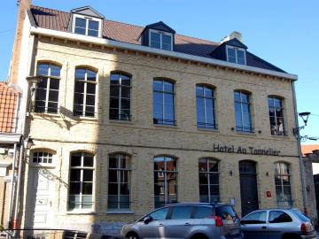
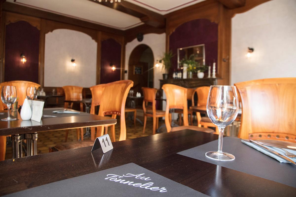
This is the hotel, I chose:
Logis Hôtel Au Tonnelier
A large 18th century residence, fully-renovated, at the heart of a fortified, listed village. Delightful all-year round with its tranquil paved, flowery courtyard. Local and regional culinary specialities along with a range of bourgeois-style dishes - a splendid time is guaranteed for all!
Au Tonnelier...
Établi dans une magnifique bâtisse du XVIIIème siècle, Au Tonnelier se situe au cœur de la ville fortifiée de Bergues. Pour un séjour détente ou... - Au Tonnelier
I wasn’t too fussed about garaging the bike, reasonably confident that it would be pretty safe on the street for the two nights of my stay. As a rule, I tend to avoid hotel parking garages, unless they are very large with easy access. Why? I once got blocked in by a gang of other motorbikes, whose owners idea of a good stay was to leave the hotel at around 11 AM, the next day. Fine and dandy if your timetable matches theirs. Far from fine, if you want to be on the road at nine AM, latest.
Despite dire warnings on these pages of Obergruppenfuhrers now fining anyone arriving at the Chunnel early and / or refusing to offer bikermates or cage drivers earlier trains, all was good and onto an earlier train I went. The same experience coming back, all at no additional cost.
Rolling off the Chunnel in Calais, I had created a simple route, taking D roads all the way to Bergues:

I wasn’t disappointed.
To be continued……
Last edited:


")


