Britain's Highest Roads

#98 Grinton Moor

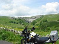
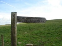
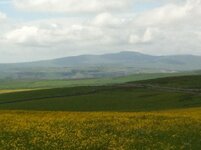
Okay, I will accept that this is a sneaky sneak in (mainly because we didn't actually take any pics when we were on it), but this one is of Grinton Moor in the background looking in the direction of Preston Moor (more trails :beerjug:) - you can see the road over it to the left side of the pic.

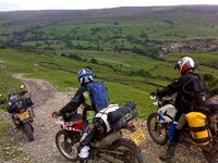
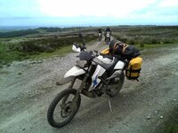
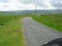
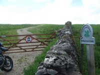
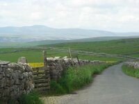
Pics taken whilst descending Fremington Edge from Marrick Moor (this route may be on the list but I've not found it yet)
 

Attachments

  • Grinton Moor from Fremington Edge s.jpg
    Grinton Moor from Fremington Edge s.jpg
    92.1 KB · Views: 185
"oft overlooked BMW G650X Country"

The much vaunted:augie
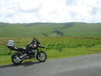
, but oft overlooked BMW G650X Country :JB

I think the oft overlooked aspect must refer to views from the xChallenge (which is both somewhat taller, a pain to get on and uncomfortable when not acclimatised :D)
 

Attachments

  • DSC00026 s.jpg
    DSC00026 s.jpg
    68.3 KB · Views: 193
Had a little helper today , off to me Dads the long way.:)


Not all top grub when out and about , but for appearances corporation wine in a recycled Evian bottle so people think Im a posh git:D


From Top Of Ringinglow road to Burbage view toward Stanedge Edge 424 Meters


Toward Stanedge Edge 442 Meters


Winnats Pass 415 meters


From Mam Tor 455meters (just off road below crest)

Looking towards Winnats Pass and Castleton.


Went to Dirtlow Rake and is not open to vehicles.:blast
 
Had a silent weep en route to Dads more favourite lanes have been closed. :rob I remember a time when from my house several of us would do 100 or more miles every Sunday with 90% off road and all the very best are now closed to traffic:eek:
I am going to pop up one I know is open today BEFORE ITS SHUT:thumby:
 
I know what you mean Andrew, I do the same as I ride past gaps in hedges & gateways, dips in open moorland, all defined as 'roads', but sadly closed now

However on the up side there are still plenty open still, just not as many as 20 years ago
 
JB, went over Sir William Hill Road, pretty easy trail, a few sections of loose rock to catch out the unwary at its Peak 421 Meters.


Julies first proper trail:D She was not amused at first:eek:


but warmed to it and punching the air at the end of trail.:thumby:
 
A few more ticked off last Thursday, in an area of the Dales, I don't visit much........too touristy - Malham

This isn't on the official list, why I dunno as its well over 400m (and the list goes for roads from 100m to 815m)

It's the road that goes from Arncliffe to the back of Malham Tarn and it's a real gem


At 419m, it's well up there in Britain's Highest Roads
 

Attachments

  • DSC02636.jpg
    DSC02636.jpg
    66.4 KB · Views: 292
  • DSC02637.jpg
    DSC02637.jpg
    70.1 KB · Views: 276
  • DSC02642.jpg
    DSC02642.jpg
    59.3 KB · Views: 240
  • DSC02643.jpg
    DSC02643.jpg
    58 KB · Views: 282
Next was No104 Gorbeck Road at 460m, near Malham Cove and this used to be a cracking offroad road trail, which is a BOAT - but is now subject to a permanent TRO

So with that it mind I could only use it as far as the gate, which showed 386m

Bearing in mind the National Trust own the land and popularity of Malham in general, I'm sure the TRO is more socio-political than any damage to the historic road
 

Attachments

  • DSC02648.jpg
    DSC02648.jpg
    71.1 KB · Views: 267
  • DSC02649.jpg
    DSC02649.jpg
    56.4 KB · Views: 316
  • DSC02651.jpg
    DSC02651.jpg
    52.5 KB · Views: 263
  • DSC02653.jpg
    DSC02653.jpg
    67.8 KB · Views: 252
Last but not least was No118 - The Street @ 448m, which is a bit further on from Gorbeck and stands in the shadow of the back of Pen Y Gent (one Yorkshire's 3 Peaks)
 

Attachments

  • DSC02655.jpg
    DSC02655.jpg
    65.7 KB · Views: 296
  • DSC02654.jpg
    DSC02654.jpg
    48.6 KB · Views: 270
  • Dales 12-6-2014 008.jpg
    Dales 12-6-2014 008.jpg
    50.5 KB · Views: 258


Back
Top Bottom