Hi there,
trying to sort out a few routes in Scotland and having a bit of an issue...
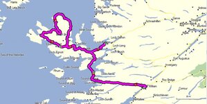
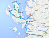
One route: Fortwilliam - Mallaig Ferry - Loop of Skye - over Skye bridge to Plockton.
Garmin Zumo 350 319km and 4hr10min
Google Maps route planner 316km and 5hr554min
Very confusing. Which one is more accurate or which one is more realistic on a motorcycle???
Cheers
Rory
trying to sort out a few routes in Scotland and having a bit of an issue...
One route: Fortwilliam - Mallaig Ferry - Loop of Skye - over Skye bridge to Plockton.
Garmin Zumo 350 319km and 4hr10min
Google Maps route planner 316km and 5hr554min
Very confusing. Which one is more accurate or which one is more realistic on a motorcycle???
Cheers
Rory