

You are using an out of date browser. It may not display this or other websites correctly.
You should upgrade or use an alternative browser.
You should upgrade or use an alternative browser.
First stage of DeGarminification
- Thread starter Berin
- Start date


DeGarmification...I like that. Sort of retiring from work and handing your laptop back. 

What is it? I expect there was a previous thread and I should know but I don’t!
I bought a cheap Chinese thin recently and it’s ok but I don’t expect it to replace a proper gos unit.
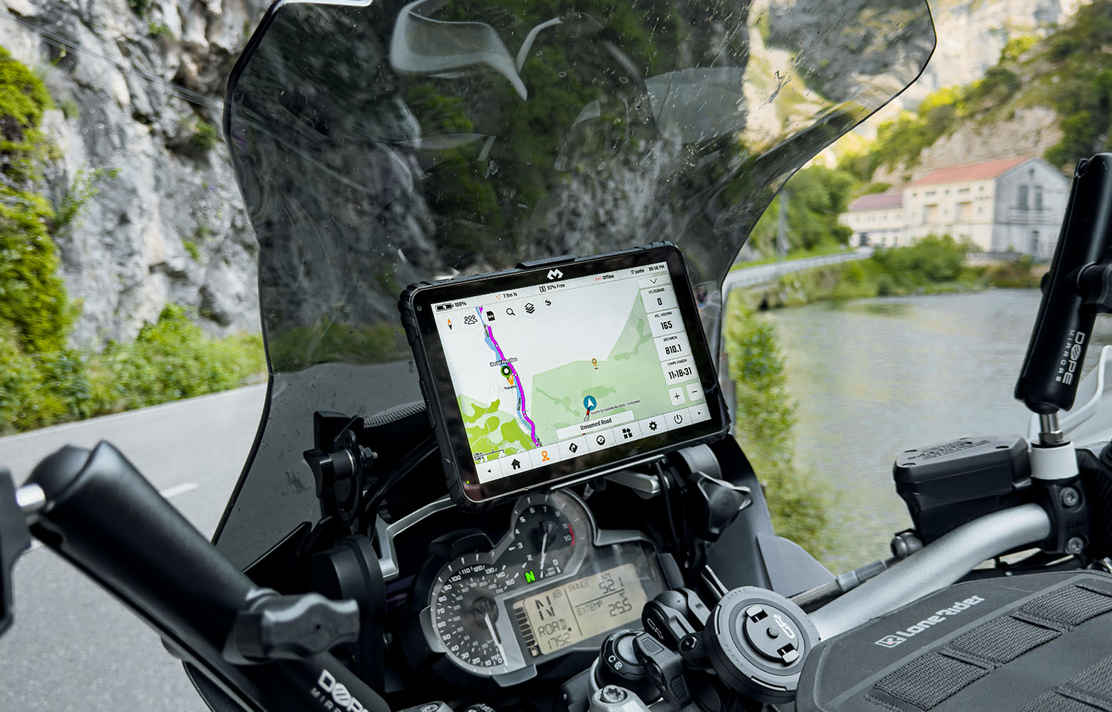
DMD Navigation | Rally & Adventure GPS Tablets | Torque Racing
Shop DMD Navigation (Thork Racing) hardware and software for off-road riding. Professional-grade rally tablets and controllers designed for the toughest environments.
 torqueracing.net
So far so good.
It’s updated itself and I’ve downloaded UK maps for test purposes, but worldwide map are included. I think there’s an option for UK OS maps (there is for French IGN maps) but I haven’t figured that out yet.
So it’s actually ready to go and navigate, but there’s a few more things I can customise if I want to, like the short cut buttons. Most of the faff was trying to stop the evil Google ecosystem extracting as much data as possible while selling me more stuff.
Theres an option to import GPX either from the DMD Hub, their route planner, or from the file system. Or do A-B navigation.
It has its own app launcher which can be used instead of the Android one. Today I’ll install MRA and TomTom go. Means I can follow a pre planned route then from the app launcher easily switch to Waze or Google Maps, which maybe better for local services.
I’ll also sign up for the route planner hub.
It has profiles, which is also good and was a key feature on the Montana which the Zumo’s lacked. I’ve set up one for UK Road, with imperial units, so far.
It’s updated itself and I’ve downloaded UK maps for test purposes, but worldwide map are included. I think there’s an option for UK OS maps (there is for French IGN maps) but I haven’t figured that out yet.
So it’s actually ready to go and navigate, but there’s a few more things I can customise if I want to, like the short cut buttons. Most of the faff was trying to stop the evil Google ecosystem extracting as much data as possible while selling me more stuff.
Theres an option to import GPX either from the DMD Hub, their route planner, or from the file system. Or do A-B navigation.
It has its own app launcher which can be used instead of the Android one. Today I’ll install MRA and TomTom go. Means I can follow a pre planned route then from the app launcher easily switch to Waze or Google Maps, which maybe better for local services.
I’ll also sign up for the route planner hub.
It has profiles, which is also good and was a key feature on the Montana which the Zumo’s lacked. I’ve set up one for UK Road, with imperial units, so far.
I expect there’s an option for that!Can you take it to Germany and ride down a road with a road closure.
See if it asks you to take a different exit off the roundabout?
This will save you riding 11 miles down a road, only to ride 11 miles back!
Asking for a friend
PS
My Garmin didn't, live traffic my arse!
That's one thing Garmin are missing a report option to warn other road users.... although that would have been too late for my mate who followed me

Not at all, all good info. I shall install and shortcut them on my new gizmo!

I would be very happy with a device that can run MRA Navigation on a decent screen that works well with gloves, especially if it is easy to have a few apps running and toggle them to the fornt / back, like have MRA on screen, but be able to work my music player for example, and also bring up a weather app etc without having to stop the bike, take off gloves, get phone out etc....
...Which is what the XT does very well - I can control the music player, bring up a weather forecast, look at a rain radar, make a phone call using my phones contacts etc....
...if only the thing could reliably follow a fucking route!
...Which is what the XT does very well - I can control the music player, bring up a weather forecast, look at a rain radar, make a phone call using my phones contacts etc....
...if only the thing could reliably follow a fucking route!


That is how DMD works, on any Android device.I would be very happy with a device that can run MRA Navigation on a decent screen that works well with gloves, especially if it is easy to have a few apps running and toggle them to the fornt / back, like have MRA on screen, but be able to work my music player for example, and also bring up a weather app etc without having to stop the bike, take off gloves, get phone out etc....
...Which is what the XT does very well - I can control the music player, bring up a weather forecast, look at a rain radar, make a phone call using my phones contacts etc....
...if only the thing could reliably follow a fucking route!

But thats how any app runs on an Android deviceThat is how DMD works, on any Android device.

My Tab nav runs any mapping software I've currently licenced & installed
Yes, but DMD has its own mini launcher and shortcuts, so it’s very easy to launch another app from the DMD nav app directly.But thats how any app runs on an Android device
My Tab nav runs any mapping software I've currently licenced & installed
So you could be navigating a track in DMD, then from DMD, drop a pin to navigate back to where you were, launch Google maps to find petrol, then navigate back.
You should have a look at DMD2.Yes, but DMD has its own mini launcher and shortcuts, so it’s very easy to launch another app from the DMD nav app directly.
So you could be navigating a track in DMD, then from DMD, drop a pin to navigate back to where you were, launch Google maps to find petrol, then navigate back.
Apparently it’s very different from the original version, which I guess would be the one you looked at.
Lots of settings and parameters to get started but they only need to be done once, and I’d say easy to use as a nav device rather than just a phone with nav apps on it.
You should have a look at DMD2.
Apparently it’s very different from the original version, which I guess would be the one you looked at.
Lots of settings and parameters to get started but they only need to be done once, and I’d say easy to use as a nav device rather than just a phone with nav apps on it.
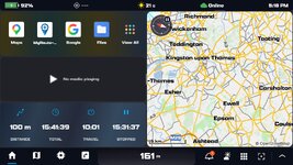
Well, so far so good - the device itself is now set up, ready to use, maps downloaded and the screen configured. Various other apps including MRA and TomTom also, all now easily reachable from the DMD2 nav screen.
Navigating is dead easy, search a place, POI (which are nicely categorised), a favourite, drop a pin, then go. Configure the routing - fast road, curvy road, shortest. Avoid cities, and pick road avoidances, and avoid urban roads, each change is viewable on screen. Waypoints or POI's can be added in, either from the map or a search - in the right order, as well - no adding it the end of a long list of waypoints like MRA. The route colour can be changed, weather forecast at destination and also warnings can be switched on - in fact it told me there a fire near my route and I checked on line and there is!
Switch on satellite view if you want to, or import a GPX from the planning hub, or a file, save the route as gpx and then share it with your mates.
So that's easy. The Hub planner/route library look good, routes can be easily built, converted to tracks, joined, split, and have sections - so maybe a fast road bit then a scenic bit or off road bit.
Routes/tracks can be saved in a folder structure and shared. Next on the list is to understand this better, and also how it handles your own waypoints/POI's.
So far, it's much easier than MRA or at least so it seems. A potential weakness is that the maps are OSM, unless I've missed something - but OSM is pretty good these days, and there's always MRA if Here maps are needed.
Navigating is dead easy, search a place, POI (which are nicely categorised), a favourite, drop a pin, then go. Configure the routing - fast road, curvy road, shortest. Avoid cities, and pick road avoidances, and avoid urban roads, each change is viewable on screen. Waypoints or POI's can be added in, either from the map or a search - in the right order, as well - no adding it the end of a long list of waypoints like MRA. The route colour can be changed, weather forecast at destination and also warnings can be switched on - in fact it told me there a fire near my route and I checked on line and there is!
Switch on satellite view if you want to, or import a GPX from the planning hub, or a file, save the route as gpx and then share it with your mates.
So that's easy. The Hub planner/route library look good, routes can be easily built, converted to tracks, joined, split, and have sections - so maybe a fast road bit then a scenic bit or off road bit.
Routes/tracks can be saved in a folder structure and shared. Next on the list is to understand this better, and also how it handles your own waypoints/POI's.
So far, it's much easier than MRA or at least so it seems. A potential weakness is that the maps are OSM, unless I've missed something - but OSM is pretty good these days, and there's always MRA if Here maps are needed.
So this will keep Treb happy. There's a very nice planning tool on the device. Using the tool, either a route or a track can be made, with sections so for example it cold include a road ride to a trail, then a track on a byway, then a road ride to the pub.
Locations can be searched, added from a POI, or from a favourite (your own POI's, in effect), or a GPX file can be imported and modified. Tracks and routes can be split and joined, on the device itself. If you've imported a gpu, from say Wikilocs, it will navigate you to the start or the closest entry point
Used together with the Hub app, I think this makes Basecamp redundant.
Locations can be searched, added from a POI, or from a favourite (your own POI's, in effect), or a GPX file can be imported and modified. Tracks and routes can be split and joined, on the device itself. If you've imported a gpu, from say Wikilocs, it will navigate you to the start or the closest entry point
Used together with the Hub app, I think this makes Basecamp redundant.

It's an impressive set up. I have it set up on an old phone for evaluation purposes/possible front screen for a device on an old phone. For me the biggest downsides of MRA are the lack of decent info on POI's and track handling. Custom POI's can be introduced to the map and displayed on the map as a gpx file which retains all of the information it had on basecamp plus you can make the waypoints proximity alert. The licence free version has a surprising amount of functionality. I presume that the main object is to sell the hardware that goes along with it. This is the free version on a phone.So this will keep Treb happy. There's a very nice planning tool on the device. Using the tool, either a route or a track can be made, with sections so for example it cold include a road ride to a trail, then a track on a byway, then a road ride to the pub.
Locations can be searched, added from a POI, or from a favourite (your own POI's, in effect), or a GPX file can be imported and modified. Tracks and routes can be split and joined, on the device itself. If you've imported a gpu, from say Wikilocs, it will navigate you to the start or the closest entry point
Used together with the Hub app, I think this makes Basecamp redundant.
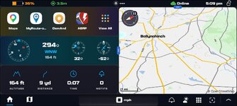
and some files loaded and synced with the hub. Very easily switched on and off. I haven't done any field testing yet.
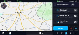
It doesn't really route byways properly, but then nothing does. For that you can draw the track, like we used to have to do in Basecamp or memory map

It's an impressive set up. I have it set up on an old phone for evaluation purposes/possible front screen for a device on an old phone
I am probably being very thick, but is it the DMB Hub app have you loaded onto a phone? If so, is it only Android at the moment?
Thanks.
Last edited:
I am probably being very thick, but is it the DMB Hub app have you loaded onto a phone? If so, is it only Android at the moment?
Thanks.
No, the DMD hub is essentially a web portal where you can manage groups, GPX files and plan routes or tracks - its also integrated into the Android DMD2 app that is used on Android phones or tablets (so you can edit / plan / manage your routes on any web browser at home and then automatically have them synced to your DMD2 App ready to use.)
Additionally, they have just released an iOS DMD hub app - which I haven't used personally yet but I believe at this point its an interface into the hub portal and doesn't contain all the Android DMD2 app functionality yet.

Similar threads

- Replies
- 158
- Views
- 5,856


- Replies
- 29
- Views
- 2,660


- Replies
- 2
- Views
- 531

