

You are using an out of date browser. It may not display this or other websites correctly.
You should upgrade or use an alternative browser.
You should upgrade or use an alternative browser.
If uou're in NW Scotland this week ...
- Thread starter Posh Pete
- Start date
do you really need gps in nw scotland? a simple map will show all the roads, not criticising just saying.
"The latest war games come just weeks after a fisherman claimed a submarine may have snagged itself on his trawler as it fished off the Western Isles, an area were [sic] elements of Joint Warrior's training are held."
Whatever happened to the days when you could trust could old Aunt Beeb to get it right...?
That remind me - I used to get e-mails with notifications of GPS restrictions. They seem to have stopped. Do you suppose Special Branch are behind that....?
http://stakeholders.ofcom.org.uk/spectrum/gps-jamming-exercises/scotland-april-15
If you go to Durness and go down the little road past Balnakeil and towards Farsaid head. You can ride across the beach onto the head but the army trucks chew it up a bit so it gets very soft. On Faraid Head is the overall command post for the military exercise and you can get very near (or inside if you know someone). From there it is a good view of warships lobbing huge big shells at ISO container targets on Cape Wrath and the RAF dropping bombs on a rocky island a couple of miles away.
I went last September with a friend "associated " with the MOD and we had a grandstand view of proceedings. Well worth the trip although the place was buzzing with military types from several NATO countries. Best thing was watching a 2000lb laser guided Paveway bomb squirelling down the laser cone from 'plane to target before a big lump of island disappeared in a huge cloud of dust.")
I went last September with a friend "associated " with the MOD and we had a grandstand view of proceedings. Well worth the trip although the place was buzzing with military types from several NATO countries. Best thing was watching a 2000lb laser guided Paveway bomb squirelling down the laser cone from 'plane to target before a big lump of island disappeared in a huge cloud of dust.
T'was indeed a good day out wasn't it! Even if we didn't manage to ride up to the point, the walk did us the world of good.I went last September with a friend "associated " with the MOD and we had a grandstand view of proceedings. Well worth the trip although the place was buzzing with military types from several NATO countries. Best thing was watching a 2000lb laser guided Paveway bomb squirelling down the laser cone from 'plane to target before a big lump of island disappeared in a huge cloud of dust.
Could always give it another go this year?
SteveT

Going a spine up that way later the day...
I will take the Garmin and see if she packs in, they are always pissing around with this sort of malarky up our neck of the woods..
Used to be involved on civvy side many moons ago on the west coast.
I will take the Garmin and see if she packs in, they are always pissing around with this sort of malarky up our neck of the woods..
Used to be involved on civvy side many moons ago on the west coast.
Humbug
Registered user
Peter, I think they were carrying out tests in Northern Spain the day we arrived in Santander. How long did it take us to get out of there? 
Going back this July Andy. Hopefully we'll make a quicker exit!
Cape Wrath - Joint Warrior 2015-1
Well, seeing as they were bombing the beejezus out of the range up at Garvie / Cape Wrath this week, I thought I pay the place another visit, what with the sun being out an all!
Except that the sun didn’t really make it’s presence felt till I’d arrived up at the top, which led to my “enjoying” the freezing mist that you see in the first few photo’s. I spent 30 plus miles wiping drizzle off of my visor whilst struggling to make 30mph. Still once “up north”, the sun shone, the wind didn’t blow and I got a lift up to the range compound, which saved a nice 3+ mile walk (the beach was a bit too soft for this Welshmans liking, hence no bike across the beach ride).
Due to the days activities including mortar fire from beside the control tower, Civvies were not allowed into the compound, so I stayed the other side of the wire and enjoyed the pleasant sensation of 10’s & 10’s of High Explosive 51mm mortars flying over my head on their way to the targets on the other side of the bay. As well as the mortars there were several ships lobbing shells onto various targets on shore as well as a poor defenceless bouy bobbing about in the oggin a couple of kilometres offshore from the range building.
Overhead a Typhoon pilot was busy spelling his name in the sky via the con trail from his jet. Due to my being “the other side of the wire” I didn’t get the shout about the “Show of Force”, and was happily bird spotting – Puffins are SO cute as they bob about on the sea – that I was only aware of the jets fly past as the roar of it’s engines “appeared” from behind the range building, with the Typhoon on it’s right wing tip belting past the towers windows as an accompaniment. I swear to you I could see the pilots face, he was THAT close as he blasted past the fence I was now cowering behind. Needless to say I didn’t get a photo of this fly-by.
After many happy hours of sitting in the sun, sipping coffee (brew kit is never far away") ) and watching various chemical combinations being turned into smoke, heat and noise, I wandered back across the beach to the bike, kitted up and took a different route home, covering a total of over 300 miles on the day.
) and watching various chemical combinations being turned into smoke, heat and noise, I wandered back across the beach to the bike, kitted up and took a different route home, covering a total of over 300 miles on the day.
Misty Bonar Bridge

Misty Loch Shin


Kylesku Bridge and HI-Viz Man

Quinag
View to Unapool

Dornoch Firth


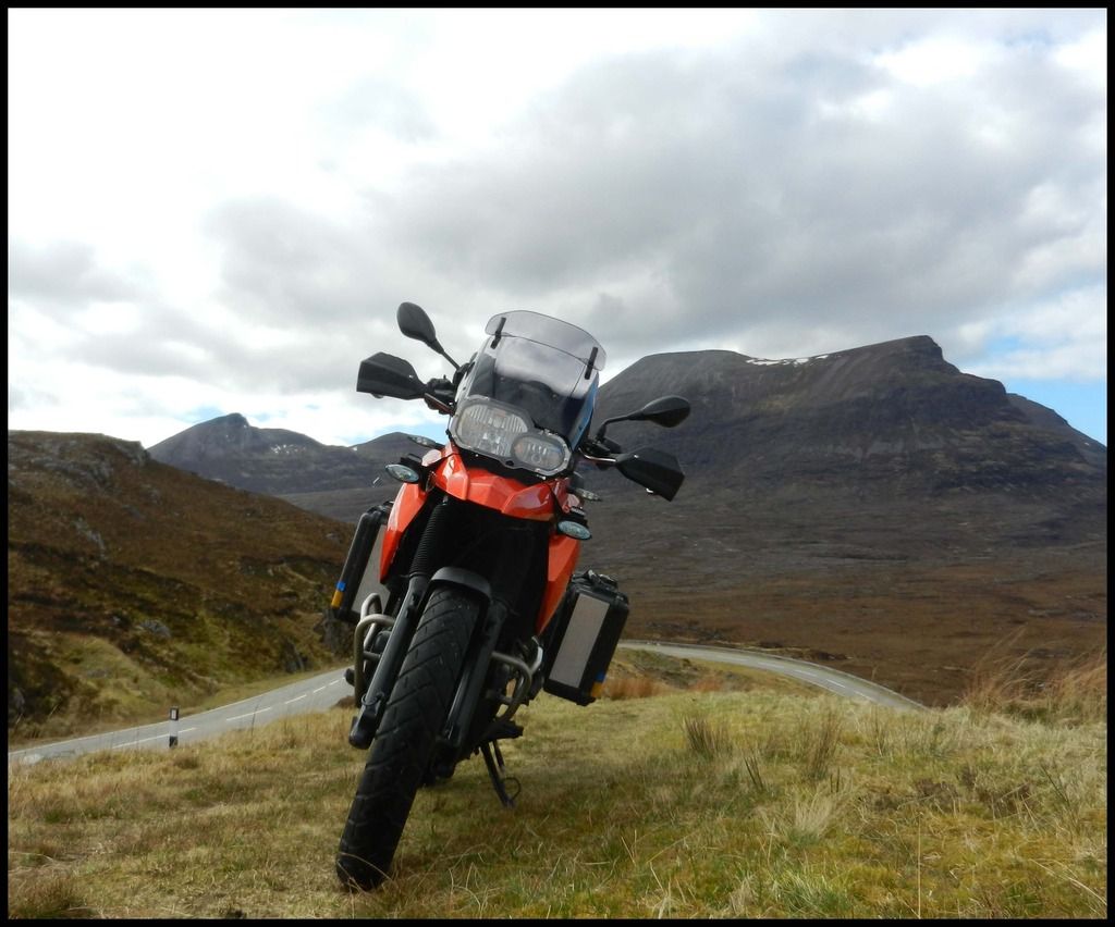
I had planned to over-night up at Durness, but I thought I’d better not due to my back being a right pain . . . . . in the back! Hence all the boxes on the bike – even though I wasn’t overnighting I thought I’d try the machine fully loaded as I’d never done so before. It did OK, handling the carriage of all my usual camping kit. Did get a bit “jiggy” when trying to stretch the throttle cable, but now I know where the wobble point is, I’ll steer clear of it
  .
.
SteveT
Well, seeing as they were bombing the beejezus out of the range up at Garvie / Cape Wrath this week, I thought I pay the place another visit, what with the sun being out an all!
Except that the sun didn’t really make it’s presence felt till I’d arrived up at the top, which led to my “enjoying” the freezing mist that you see in the first few photo’s. I spent 30 plus miles wiping drizzle off of my visor whilst struggling to make 30mph. Still once “up north”, the sun shone, the wind didn’t blow and I got a lift up to the range compound, which saved a nice 3+ mile walk (the beach was a bit too soft for this Welshmans liking, hence no bike across the beach ride).
Due to the days activities including mortar fire from beside the control tower, Civvies were not allowed into the compound, so I stayed the other side of the wire and enjoyed the pleasant sensation of 10’s & 10’s of High Explosive 51mm mortars flying over my head on their way to the targets on the other side of the bay. As well as the mortars there were several ships lobbing shells onto various targets on shore as well as a poor defenceless bouy bobbing about in the oggin a couple of kilometres offshore from the range building.
Overhead a Typhoon pilot was busy spelling his name in the sky via the con trail from his jet. Due to my being “the other side of the wire” I didn’t get the shout about the “Show of Force”, and was happily bird spotting – Puffins are SO cute as they bob about on the sea – that I was only aware of the jets fly past as the roar of it’s engines “appeared” from behind the range building, with the Typhoon on it’s right wing tip belting past the towers windows as an accompaniment. I swear to you I could see the pilots face, he was THAT close as he blasted past the fence I was now cowering behind. Needless to say I didn’t get a photo of this fly-by.
After many happy hours of sitting in the sun, sipping coffee (brew kit is never far away
) and watching various chemical combinations being turned into smoke, heat and noise, I wandered back across the beach to the bike, kitted up and took a different route home, covering a total of over 300 miles on the day.Misty Bonar Bridge

Misty Loch Shin


Kylesku Bridge and HI-Viz Man

Quinag

View to Unapool

Dornoch Firth


I had planned to over-night up at Durness, but I thought I’d better not due to my back being a right pain . . . . . in the back! Hence all the boxes on the bike – even though I wasn’t overnighting I thought I’d try the machine fully loaded as I’d never done so before. It did OK, handling the carriage of all my usual camping kit. Did get a bit “jiggy”
when trying to stretch the throttle cable, but now I know where the wobble point is, I’ll steer clear of it .SteveT

Similar threads