

Thought ye might be interested in OSI's 3D Maps with aerial photography and height models.
Click HERE
Blurb:
Overview:
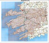
The Consumer version of OSi Trail Master is a DVD, PC compatible, interactive mapping tool for the outdoor enthusiast.
It enables users to plan and create walking, cycling and hiking routes using OSi mapping, aerial photography and height models.


Targeting selected regions of Ireland users will be able to:
Create, print, store and share routes using OSi 1:450,000 and 1:50,000 maps, aerial photography and 10m Digital Terrain Models.
View 3D landscapes and fly-throughs using OSi mapping and aerial photographs.
Import and export route co-ordinates, waypoints and interest marks to a GPS device.
Export routes, maps and aerial photography to a Pocket PC device.
Create Route Profiles; add notes, pictures to routes and much more!
OSi Trail Master features:
A search and locate tool which uses over 1,800 place and summit names.
Support for multiple co-ordinates systems, including Irish Grid, ITM and Latitude/Longitude.
Dynamic legends and scale bars.
Measurement tools.
Multiple windows which allow users to simultaneously view an area of interest with different mapping or aerial photography backgrounds.
4 Maps on DVDs at €48 each here.
or
http://www.osismartmaps.ie/SmartMaps/offers2.html
Click HERE
Blurb:
Overview:
The Consumer version of OSi Trail Master is a DVD, PC compatible, interactive mapping tool for the outdoor enthusiast.
It enables users to plan and create walking, cycling and hiking routes using OSi mapping, aerial photography and height models.
Targeting selected regions of Ireland users will be able to:
Create, print, store and share routes using OSi 1:450,000 and 1:50,000 maps, aerial photography and 10m Digital Terrain Models.
View 3D landscapes and fly-throughs using OSi mapping and aerial photographs.
Import and export route co-ordinates, waypoints and interest marks to a GPS device.
Export routes, maps and aerial photography to a Pocket PC device.
Create Route Profiles; add notes, pictures to routes and much more!
OSi Trail Master features:
A search and locate tool which uses over 1,800 place and summit names.
Support for multiple co-ordinates systems, including Irish Grid, ITM and Latitude/Longitude.
Dynamic legends and scale bars.
Measurement tools.
Multiple windows which allow users to simultaneously view an area of interest with different mapping or aerial photography backgrounds.
4 Maps on DVDs at €48 each here.
or
http://www.osismartmaps.ie/SmartMaps/offers2.html


")


