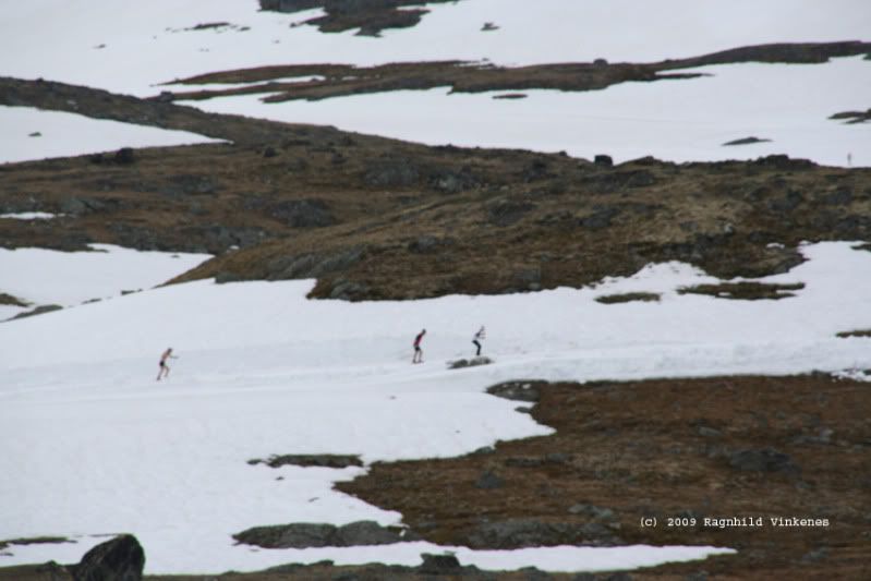
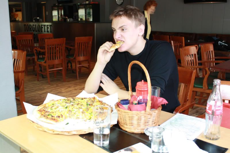
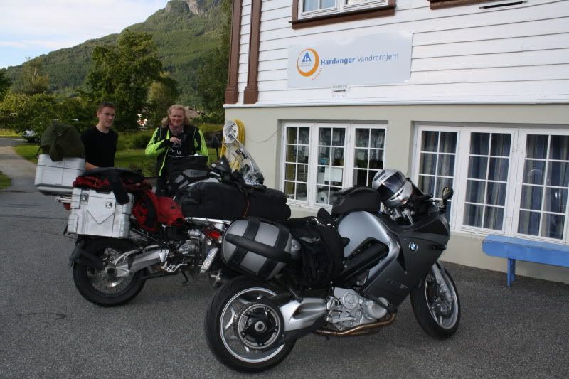
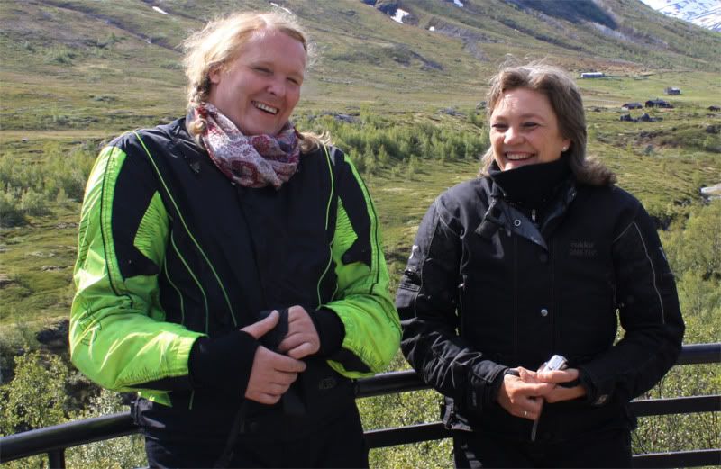
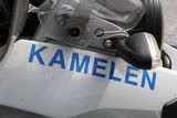
Ragnhild
Guest
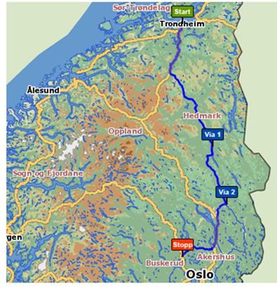
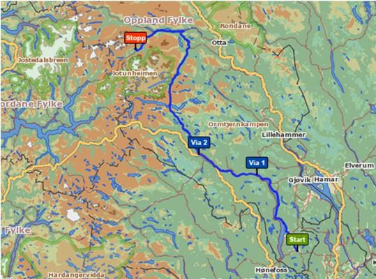
Last September I made a trip north through Sweden, and then back south, making a small detour to the central parts of south-eastern Norway
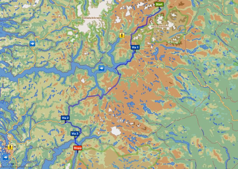
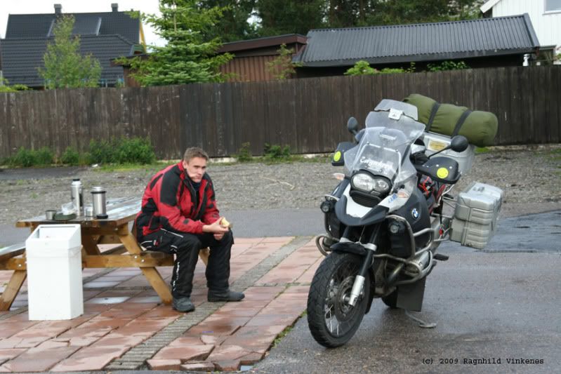
Sunday august 31. I left Trondheim and thought to drive to Lierne that day. I was thinking I would try to keep to the Norwegian/Swedish border most of the time. If not on the border, I would go as parallel and as close to the border as possible. And since I know the Norwegian roads and scenery pretty well, I wanted to drive on the Swedish side of the border. The route for the first day was the only one that was somewhat planned before I started. The rest was more like dots of interest on the map, and I wanted to find roads that connected those dots.
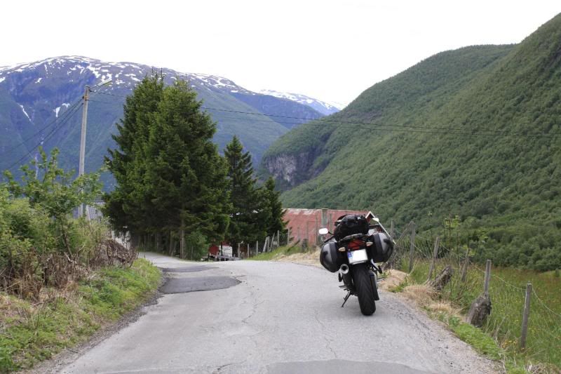
From Trondheim I followed the E6 to Stjørdal. From there I followed the E134 a couple of kms before I took a toll road over the hills from Hegra to Markabygda. This is a private dirt road over hills and down dales, and it’s a challenge compared with the asphalt on the E6/E134
The church in Markabygda.
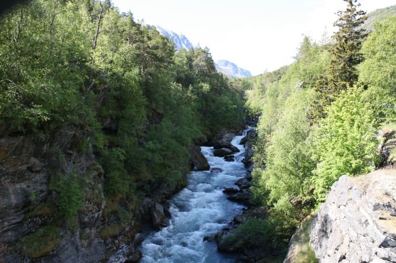
The weather was excellent. A beautifull day in early fall, and it was as beautiful to drive through as it looks")
Higher up in Markabygda there is a new toll road over the hills to Okkenhaug in Levanger were AndyT tells he has been. From Okkenhaug there are several choices of small roads, mostly gravel down to R72 which goes from Verdal and up to the Swedish border. Sight from the R72 over the Verdal valley. In Verdal, at Stiklestad, there was a battle in 1030 AD, which made Norway a christian country. Our only saint, St. Olav was killed in this battle. And his fight for Christianity made him a saint in the Catholic church.
As I said I wanted to keep mostly to the border on my way northwards, so I had to drive on the map and hope that my inner compass would keep me on track. The GPS had a map for all of Scandinavia, but he had no names for this part of the Swedish countryside, only the main roads.
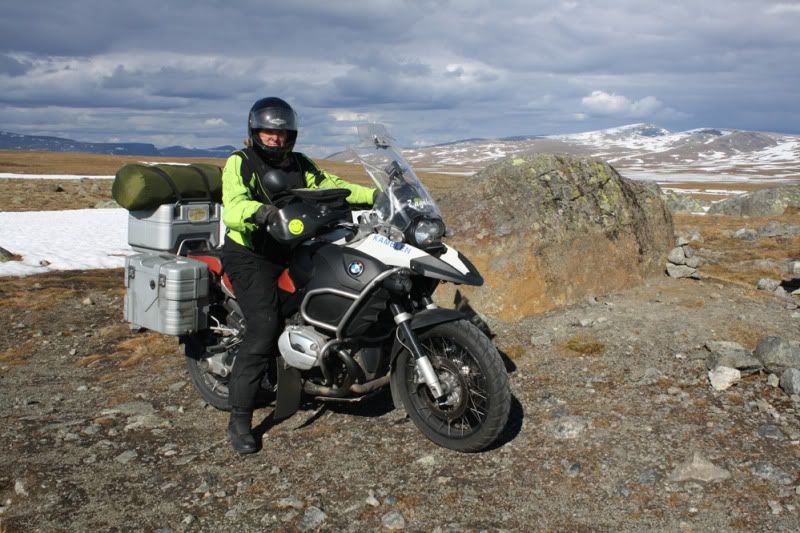
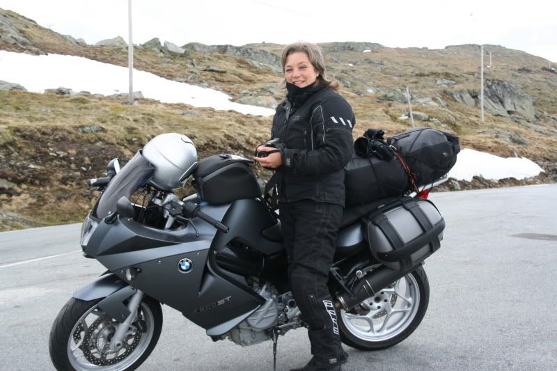
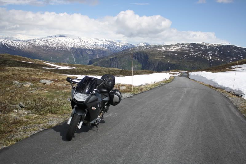
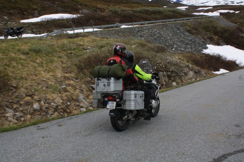
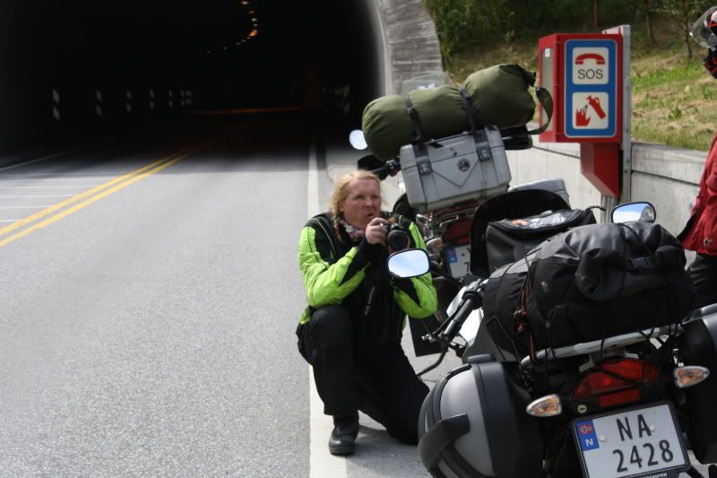
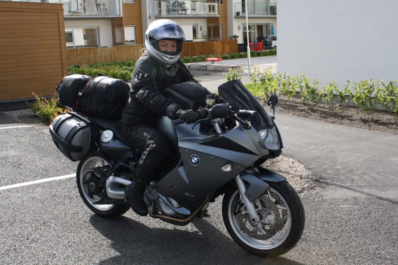
The pictures tell the tale of the visual impressions, and there were plenty of them. And they make up a big part of the driving experience. But also that I can handle the bike on different surfaces, in different speeds and different traffic is a part of my life on the bike. There is something of it’s own to handle a 330 kg bike (fully packed), and know there is only me, my skills and willpower that can bring me from A to B in one piece.
Someone may be offended by me being proud about my ability handle the bike this well, and are bragging about driving 43.000 km in less than two years. But it’s me and my life, and I am proud and brags about it as I please.
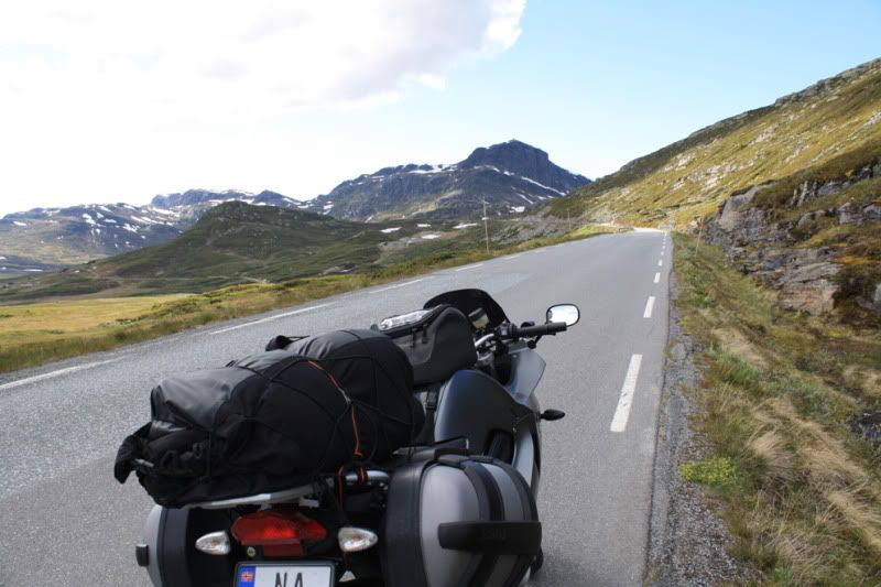
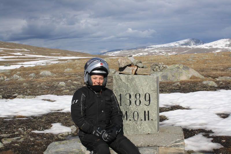
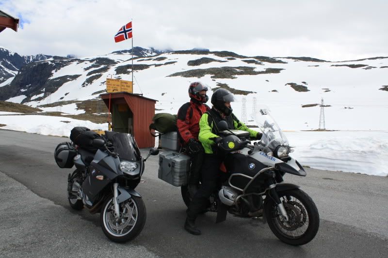
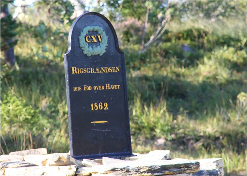
The border, 1615 feet above sea level
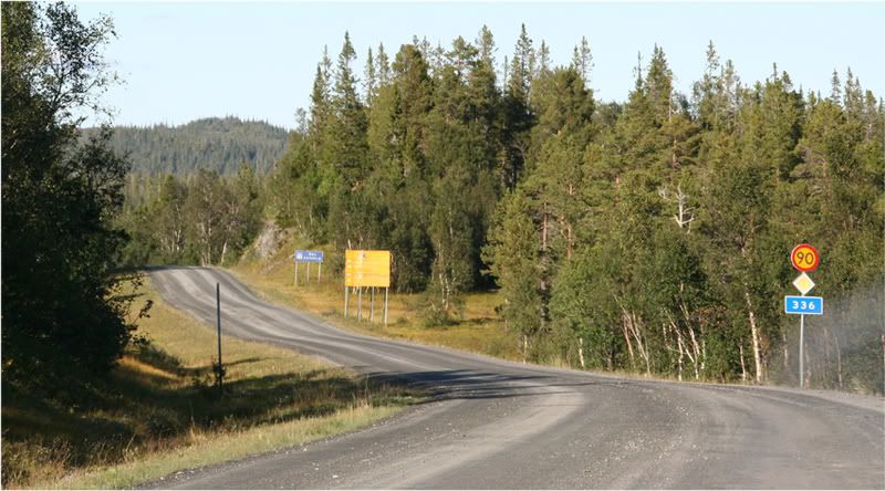
Swedish roads, Swedish speed limits
In Norway the speed limit is 80 km/h, in Sweden it’s 90 on roads like this, and 110 on the bigger ones. This makes Norwegians having a tiny bit more weight on the throttle on the Swedish side.
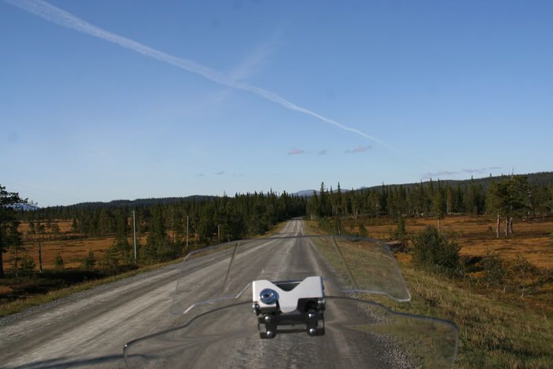
From the border the 336 goes down to the lake Anjan
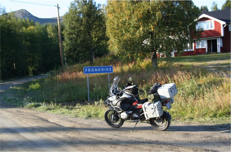
At Kalsedet I left the 336 drove more gravel roads on the northern side of the lake Juvuln searching for the road to the place Frankrike (France).
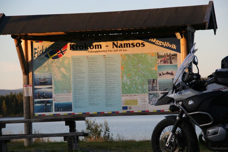
Here I turned more east and came down to the 340 at Landön. I followed the 340 until it went back over the border and in to Lierne. Rested short south of Häggsjövik at a rest place made up for fishing with shelters and barbecues. It was really a nice place to rest and feed the face.
I started out a bit late, and by now it was growing dark and the temperature was dropping, so the lady was a tad warmer clad when she continued northwards.
On the Norwegian side, in Lierne I started looking for a place to sleep. The camping site in Jule was full, which gave only one opportunity: Camp in the wild, at the roadside. In the morning I woke with two centigrades below zero, and fog down to my knees, with the sun lurking somewhere above. A nice, fresh fall morning, promising a nice ride later in the day. The road was dry, and there was no ice after the cold night. But it was pretty cold down the R765. At Nordli I continued on the R74 to the border and Gäddede in Sweden. Where I bought some food and filled the tank.
Morning in Sørli
Nice and cosy over the fog
But Sweden didn’t look that inviting…
At the borderline the dessert animal rounded 37.000 km.
From Gäddede I drove the ”Wilderness Road”. The Swedes likes to call their roads names like the ”Blue road” (it goes from Sweden to the north Norwegian coast). The “Fish road” (the 340) goes trough a countryside famous for its fishing possibilities.
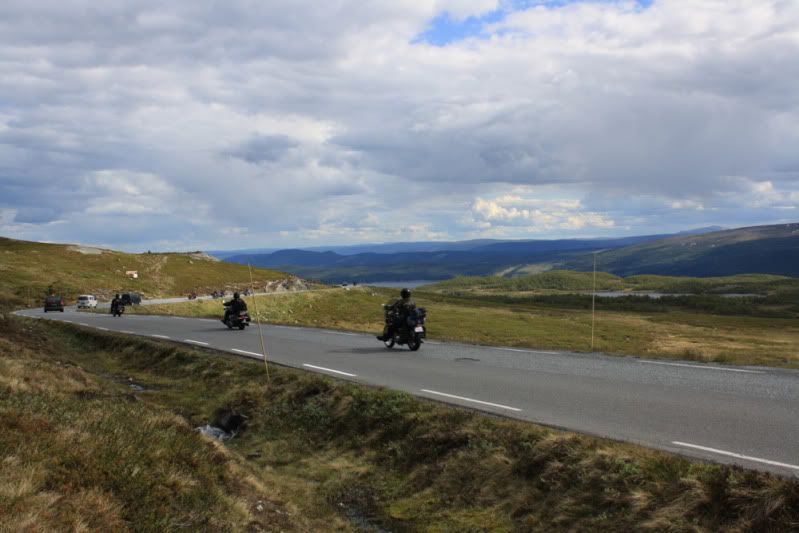
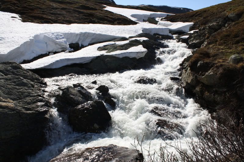
The Wilderness Road goes through a remote and wild countryside. It goes up to over 870 M, and the highest parts are over the forest.
From Stekenjokk the Wilderness Road goes down to the lake Kultsjön.
On the north side of this lake there is a nationalpark, and the mountains are called the Mars-mountains. The Swedish author Bernard Nordh has written about the life of the settlers in these areas in books like “In the shadow of the Mars Mountains” (my translation).
Made a stop at Kultsjön for some facefeeding and photos. At Saxnäs I turned in to a smaller road with gravel going to Blaikliden and Dikenäs. It went to Slussfors at the E12 which goes over Umbukta and down to Mo i Rana in Norway. Dikenäs said they had a MC-museum, but it was closed for the winter when I came by, so I couldn’t see it.
At Slussfors there was a place calling it self the “Restaurang Solvändan”. The Sunturn restaurant it could be translated with. My stomach had started speaking about some warm food, so I drove up the place. And got immediately attacked by the Innkeeper, a loveable old guy, who was really friendly to this late customer. Summer season was over, and the trade was down. On his porch he had two BMW Montauks. I got the impression the old man rode them occasionally. Inside the inn there were a lot of MC-paraphernalia and his riding gear was spread all over the tables. I had a cheese schnitzel which he proudly told all the German bikers ate, when they stopped at his place.
From Slussfors the tour went northwards on different small roads to Sorsele where my mount got some gas. From there it was 8 – 10 kms on 363, before I turned north against Arjeplog. From there I had planned to go back to Norway and catch a boat the next afternoon to the place were my father lives. But I found that I could spare another day on the road so I turned East in Arjeplog and went down more gravel clad roads to the 45 a bit north of Arvidsjaur. On these roads I met more than one reindeer, making the life on the road more interesting, not sure which side of the road they thought the safest. You have to consider the possibility of both reindeer and elk on the roads in most of the mountains of Norway and Sweden. More reindeer to the north and up in to mountains, and more elk down in the forests and to the south. And they are pretty uncomfortable to meet in the road, but very nice and good-looking everywhere else.
At the 45 they were working on the road. The Swedes take their road working seriously and usually they take some 2 – 3 kms a time. And this was no exception. And they have way to build the roads with stones at the size of a golf ball, and no sand between to keep the shit together, which is very funny to ride on, NOT. But they are really good at making the asphalt nice to ride on.
Even if it was a bit late, I thought Gällivarre could be a goal for the night. I came there around half past nine in the evening, but I had to drive around for a while before I found a place to sleep. Most of the hotels were £110 and upwards, which was not my cup of tea, and the camping site was packed. At last I found a bed&breakfast which was close enough to my budget. The dessert animal had to stand outside together with a red Jeep Cherokee. I think he thought it was a relief that I could watch him from my bed.
The day after it was the E10 north to Kiruna and from there to the border at Bjørnefjell. In this part of Sweden there is only one road going where I was going. Well, that is, if you don’t want to search out all the tiny roads, which I wasn’t this time. Between the 45 and the norwegian border there are vast mountain areas mostly populated by reindeer and nationalparks. There are a few water-powered powerstations, that’s all. Kiruna is a mining city. They mine iron ore for export over Narvik, a port in Norway. The mine is under the city of Kiruna, and they now have to move the whole city, because the ground is caving in under it. The yearly amount of iron ore mined in Kiruna is enough to produce knives and forks for all the Chinese. If they want to start eating their food with knife and fork as we do.
From here the iron ore is shipped by train to Narvik. The leftovers from the mining are dumped down the hillside.
On the road between Kiruna and the lake Torneträsk, looking northwest against Norway
On my way to Bjørnefjell (the Bearmountain) I had a couple of photoshoots along the lake Torneträsk. The last ten kms down to Torneträsk was bad, the Swedes did their job on the road with gravel like golfballs and the heavy trucks drove like Australian roadtrains on the only lane that was driveable.
The railroad station at Torneträsk is somewhere in the middle of nowhere, but the architecture fascinated me. The railroad was finished in 1902, and the station was a bit more grandiose than a Norwegian railway station in the middle of nowhere.
Abisko is a small winter resort, where I had dinner before I went home over Bjørnefjell.
The Norwegian and the Swedish kings have been here. And from the border the E10 is called King Olav’s road on the Norwegian side.
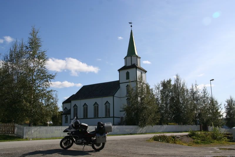
The chapell at Bjørnefjell
On the swedish side there is some winter resorts between Abisko and the border. On the Norwegian side there is a lot of cabins owned by people from Narvik.
The norwegian army had driven the german troops back to the swedish border in may 1940. Germany occupied Norway on april 9. seizing the biggest cities along the coast from the sea. Narvik was a logical goal because of the iron ore shipped from here. No iron ore, on tanks. But Churchill was more concerned about his men in France, which were loosing against the German tropps. He had three or four navy wessels at Narvik, and English, French an Polish troops. But the Norwegians were the ones to fight the germans. The foreign troops did not engage in the shooting. When Churchill decided to withdraw, leaving the Norwegians to fend for them selves, the Germans had power enough to take Narvik and then the rest of northern Norway. If Churchill had had enough ice in his stomach, he could have changed WWII these days in May 1940.
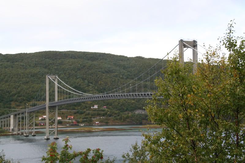
Further down the E10 there had to be a photostop to get the Rombakksfjord with the bridge.
This is the sight southwest the Ofotfjord against the Lofoten islands
In Narvik there was a short stop for e-mailcheck at the public library and some pictures. In 2000 I was at the college here to start my education as an engineer. I didn’t end up as an engineer, but as an Occupatinal therapist, but that’s another story. The college has a very nice place in the hillside, looking out over the city and the fjord. And the students can walk right out into the down hill skiing tracks with their skis.
One of the ships transporting the iron ore from Kiruna
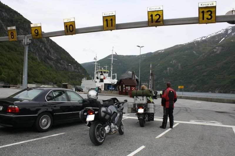
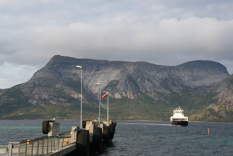
From Narvik the E6 brought me to Skarberget and the ferry over the Tysfjord. The picture from the ferry is to honour a friend of mine who like long-distance driving, but hate ferries. A very useful kind of hatred, when you are driving in a country like Norway, like he did earlier summer.
The last leg on this part of the tour went from E6 to Steigen, a tiny community on the coast living from fisheries and farming.
This is the Steigen-road at one o’clock in the morning midsummernight -07. My back is against an eight km long tunnel which ends at the E6 in Hamarøy. The Lofoten islands are behind the Island in center of the picture.
We had a farm here before we moved to Trondheim, and my father still lives there.
Daddys house
Our farm seen from the fjord looking south. We still have the farm, but there are no one living there anymore.
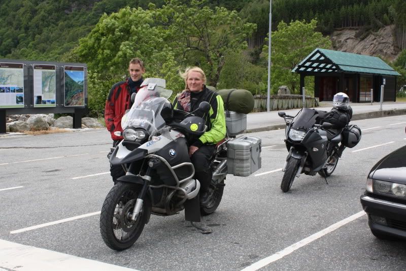
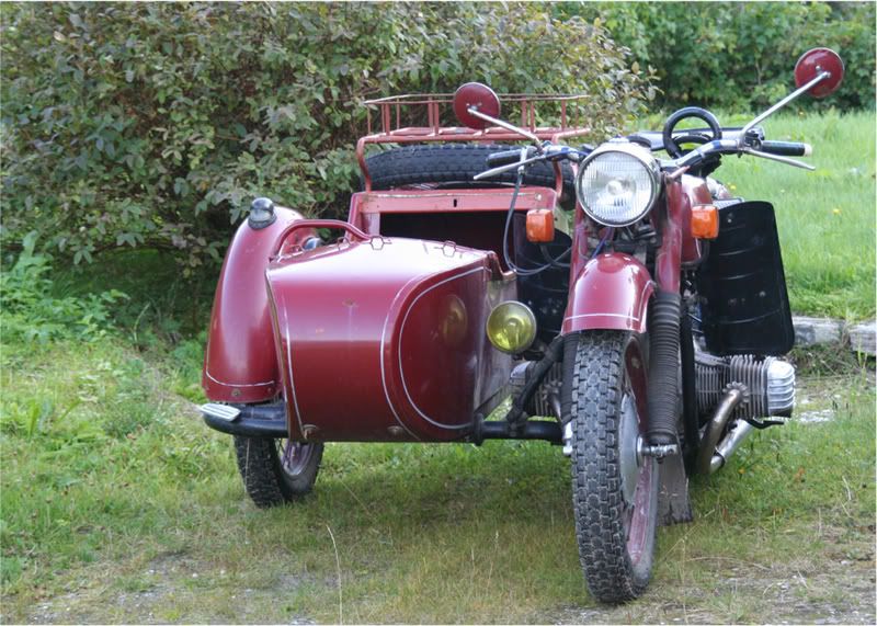
But before I came there I had to see a friend. But as usual he wasn’t there. Only his newly aquired Dnepr, which he had bought in Russia was standing in the courtyard.
After visiting my daddy’s a few days, I drove back north, this time to Harstad and the island Grøttøya visiting some friends there. Saturday I was back on the E10 heading towards Sweden again. The goal this time was my mother, who lives in a town outside Oslo, the capital of Norway.
But because of all the fjords there are some ferries. On this one the crew offered to tie the animal even though there were no waves.
The E10 from Lødingen to Harstad is a nice road for bikes. But there are a lot of speed limitations. 60 km/h is more common than not.
The E10 fro, Harstad to Narvik is going over the Tjeldsund Bridge, built in 1967
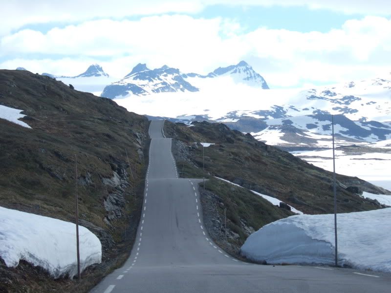
Luckily the new snow in the border mountains kept away from the road.
On this leg I had less time for enyoing the countryside. The E10 and the 45 down Sweden was merely transport, and Saturday night I rented a cabin at the camping site at Blatniksele, south of Sorsele. Nice site, situated at a small lake. Nice cabin, but the repair was… and since it was out of season, I paid £10 for the night. And to that price, I didn’t mind that the cabin wasn’t built last year.
South of Östersund the GPS was asked to find the shortest route to my mother’s. And it did. I didn’t mind the dirt roads it found at first. But when it guided me down a steep slope, more like a dry creek than a road, I took control. Luckily there was no mad Swedish landlord in that creek. I had been in the same area the year before, and had some bearings on where and when. And the map gave some clues to where to go.
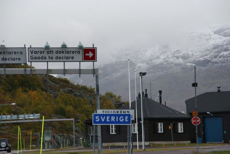
I ended up in Idre, a winter resort not far from the border. Here I did some shopping, food mostly. Swedish prices are nice prices for a Norwegian housewife Here I spoke with a guy on a Harley Davidson who was waiting for new tyres. He were heading for Poland and then north.
From Idre I thought I should go straight ahead on the 70 to the border and down to Drevsjø in Norway. Nice road for bikes, and I was looking forward to that leg. But I asked the GPS to guide me once again, and it pointed to a small road more along the border. Well, over the hills and down the dales I went, and voila, there I found myself crossing the border farther south, and probably closer to my destination. And back in Norway, the driver’s license was back living dangerous, due to Norwegian speed limits that doesn’t fit the dessert animal")
From the border I came down to the township of Østby. From there it was R26 an then R25 to Elverum. From Elverum it’s R3 down to the E6, and I have driven this one a few times. When I came to Gardermoen, I got rain, and late in the evening it’s dark, so the last leg Sunday went a bit slower than the previous ones
Monday I had a errand on my way home, and there it was fog down to the knees, but I reached my appointment, and could turn my front wheel homeward.
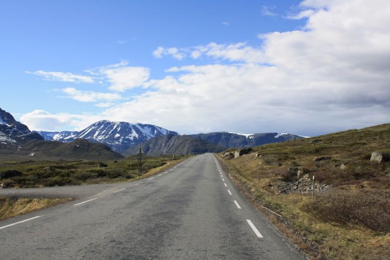
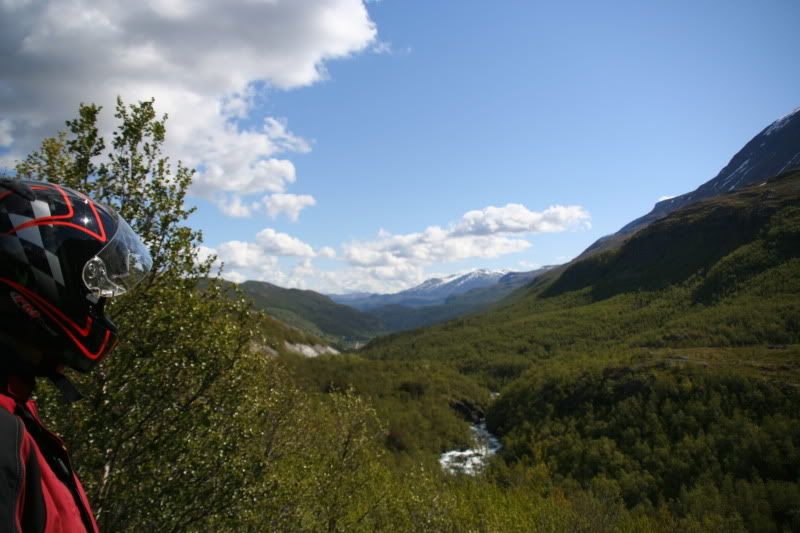
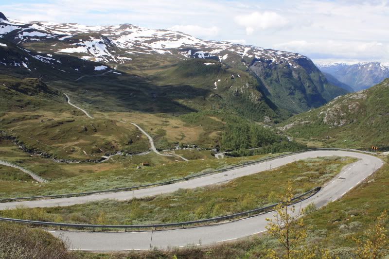
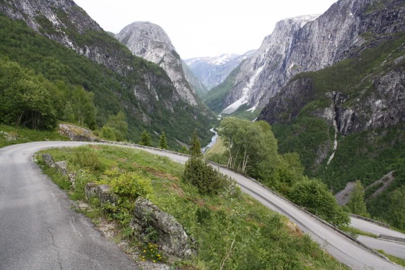
The R35 is a good bike road, the R4 and the E6 is OK for transport. When the R27 over the mountains from E6 at Ringebu is open, I prefer to drive there and not the E6. The R27/R29 from Ringebu to Hjerkinn is a few kms shorter than the E6, but its more hills and dales, and a smaller road. Put I prefer it when possible. With a car I drive the E6, it’s more a car road so to speak. Had to have a few photo sessions at the Ringebu church and in the hills above Ringebu
The Gudbrandsdal valley, looking northeast
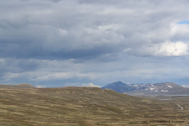
Up on the mountain the fog was still down to the road. But I had only 3 hours left in the sadle before I was home, so I didn’t mind taking it easy over there.
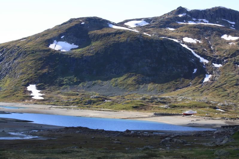
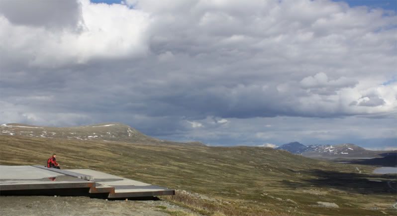
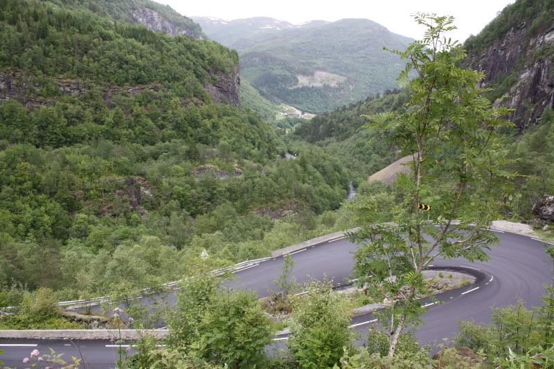
At Enden I took the R29 to Folldal and up the Folldal valley to Hjerkinn and E6
This the sight from R29 toward the highest point at the E6 which I met up on the hill here. Hjerkinn is about 1030 M above sea level, and is the highest point on the E6.
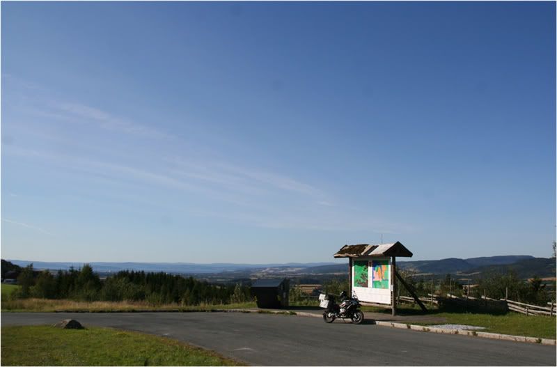
Thought about filling gas in Folldal, but decided I wanted to get home before I tanked. A short stop for leg stretching at the quarries south of Oppdal was necessary though. From there it is about 120 kms to Trondheim, and they went by like a breeze.
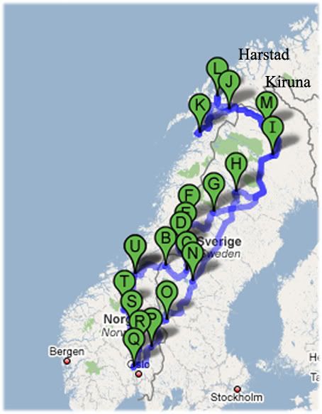
For those with a hang for statistics, the tour was 4.200 kms, I crossed the Norwegian/Swedish border five times and I was seven days on the road.
Sunday august 31. I left Trondheim and thought to drive to Lierne that day. I was thinking I would try to keep to the Norwegian/Swedish border most of the time. If not on the border, I would go as parallel and as close to the border as possible. And since I know the Norwegian roads and scenery pretty well, I wanted to drive on the Swedish side of the border. The route for the first day was the only one that was somewhat planned before I started. The rest was more like dots of interest on the map, and I wanted to find roads that connected those dots.
From Trondheim I followed the E6 to Stjørdal. From there I followed the E134 a couple of kms before I took a toll road over the hills from Hegra to Markabygda. This is a private dirt road over hills and down dales, and it’s a challenge compared with the asphalt on the E6/E134
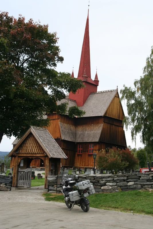
The church in Markabygda.
The weather was excellent. A beautifull day in early fall, and it was as beautiful to drive through as it looks
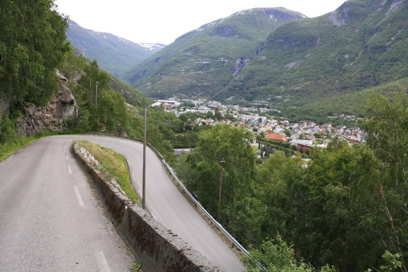
Higher up in Markabygda there is a new toll road over the hills to Okkenhaug in Levanger were AndyT tells he has been. From Okkenhaug there are several choices of small roads, mostly gravel down to R72 which goes from Verdal and up to the Swedish border. Sight from the R72 over the Verdal valley. In Verdal, at Stiklestad, there was a battle in 1030 AD, which made Norway a christian country. Our only saint, St. Olav was killed in this battle. And his fight for Christianity made him a saint in the Catholic church.
As I said I wanted to keep mostly to the border on my way northwards, so I had to drive on the map and hope that my inner compass would keep me on track. The GPS had a map for all of Scandinavia, but he had no names for this part of the Swedish countryside, only the main roads.
The pictures tell the tale of the visual impressions, and there were plenty of them. And they make up a big part of the driving experience. But also that I can handle the bike on different surfaces, in different speeds and different traffic is a part of my life on the bike. There is something of it’s own to handle a 330 kg bike (fully packed), and know there is only me, my skills and willpower that can bring me from A to B in one piece.
Someone may be offended by me being proud about my ability handle the bike this well, and are bragging about driving 43.000 km in less than two years. But it’s me and my life, and I am proud and brags about it as I please.
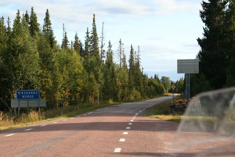
The border, 1615 feet above sea level
Swedish roads, Swedish speed limits
In Norway the speed limit is 80 km/h, in Sweden it’s 90 on roads like this, and 110 on the bigger ones. This makes Norwegians having a tiny bit more weight on the throttle on the Swedish side.
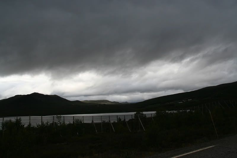
From the border the 336 goes down to the lake Anjan
At Kalsedet I left the 336 drove more gravel roads on the northern side of the lake Juvuln searching for the road to the place Frankrike (France).
Here I turned more east and came down to the 340 at Landön. I followed the 340 until it went back over the border and in to Lierne. Rested short south of Häggsjövik at a rest place made up for fishing with shelters and barbecues. It was really a nice place to rest and feed the face.
I started out a bit late, and by now it was growing dark and the temperature was dropping, so the lady was a tad warmer clad when she continued northwards.
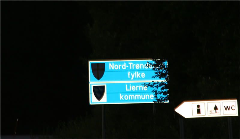
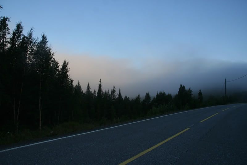
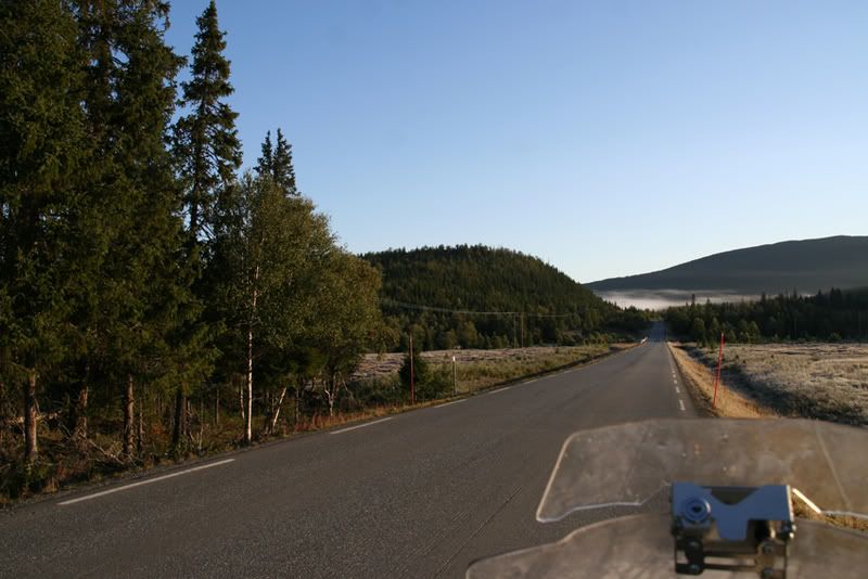
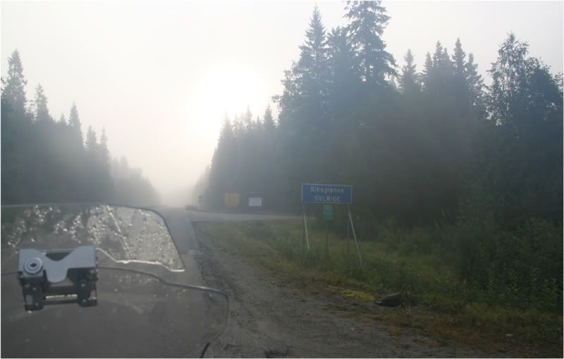
On the Norwegian side, in Lierne I started looking for a place to sleep. The camping site in Jule was full, which gave only one opportunity: Camp in the wild, at the roadside. In the morning I woke with two centigrades below zero, and fog down to my knees, with the sun lurking somewhere above. A nice, fresh fall morning, promising a nice ride later in the day. The road was dry, and there was no ice after the cold night. But it was pretty cold down the R765. At Nordli I continued on the R74 to the border and Gäddede in Sweden. Where I bought some food and filled the tank.
Morning in Sørli
Nice and cosy over the fog
But Sweden didn’t look that inviting…
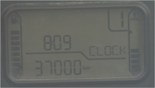
At the borderline the dessert animal rounded 37.000 km.
From Gäddede I drove the ”Wilderness Road”. The Swedes likes to call their roads names like the ”Blue road” (it goes from Sweden to the north Norwegian coast). The “Fish road” (the 340) goes trough a countryside famous for its fishing possibilities.
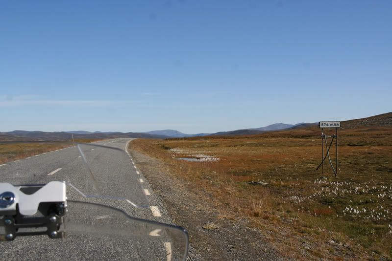
The Wilderness Road goes through a remote and wild countryside. It goes up to over 870 M, and the highest parts are over the forest.
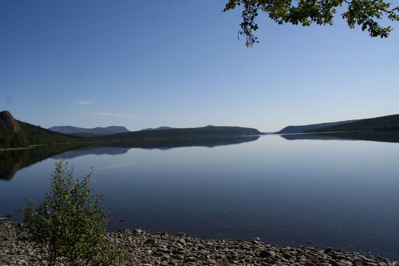
From Stekenjokk the Wilderness Road goes down to the lake Kultsjön.
On the north side of this lake there is a nationalpark, and the mountains are called the Mars-mountains. The Swedish author Bernard Nordh has written about the life of the settlers in these areas in books like “In the shadow of the Mars Mountains” (my translation).
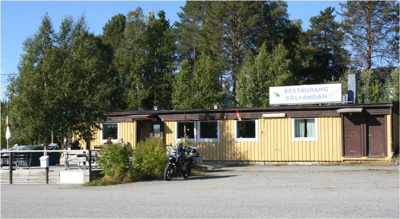
Made a stop at Kultsjön for some facefeeding and photos. At Saxnäs I turned in to a smaller road with gravel going to Blaikliden and Dikenäs. It went to Slussfors at the E12 which goes over Umbukta and down to Mo i Rana in Norway. Dikenäs said they had a MC-museum, but it was closed for the winter when I came by, so I couldn’t see it.
At Slussfors there was a place calling it self the “Restaurang Solvändan”. The Sunturn restaurant it could be translated with. My stomach had started speaking about some warm food, so I drove up the place. And got immediately attacked by the Innkeeper, a loveable old guy, who was really friendly to this late customer. Summer season was over, and the trade was down. On his porch he had two BMW Montauks. I got the impression the old man rode them occasionally. Inside the inn there were a lot of MC-paraphernalia and his riding gear was spread all over the tables. I had a cheese schnitzel which he proudly told all the German bikers ate, when they stopped at his place.
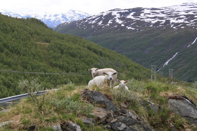
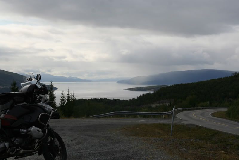
From Slussfors the tour went northwards on different small roads to Sorsele where my mount got some gas. From there it was 8 – 10 kms on 363, before I turned north against Arjeplog. From there I had planned to go back to Norway and catch a boat the next afternoon to the place were my father lives. But I found that I could spare another day on the road so I turned East in Arjeplog and went down more gravel clad roads to the 45 a bit north of Arvidsjaur. On these roads I met more than one reindeer, making the life on the road more interesting, not sure which side of the road they thought the safest. You have to consider the possibility of both reindeer and elk on the roads in most of the mountains of Norway and Sweden. More reindeer to the north and up in to mountains, and more elk down in the forests and to the south. And they are pretty uncomfortable to meet in the road, but very nice and good-looking everywhere else.
At the 45 they were working on the road. The Swedes take their road working seriously and usually they take some 2 – 3 kms a time. And this was no exception. And they have way to build the roads with stones at the size of a golf ball, and no sand between to keep the shit together, which is very funny to ride on, NOT. But they are really good at making the asphalt nice to ride on.
Even if it was a bit late, I thought Gällivarre could be a goal for the night. I came there around half past nine in the evening, but I had to drive around for a while before I found a place to sleep. Most of the hotels were £110 and upwards, which was not my cup of tea, and the camping site was packed. At last I found a bed&breakfast which was close enough to my budget. The dessert animal had to stand outside together with a red Jeep Cherokee. I think he thought it was a relief that I could watch him from my bed.
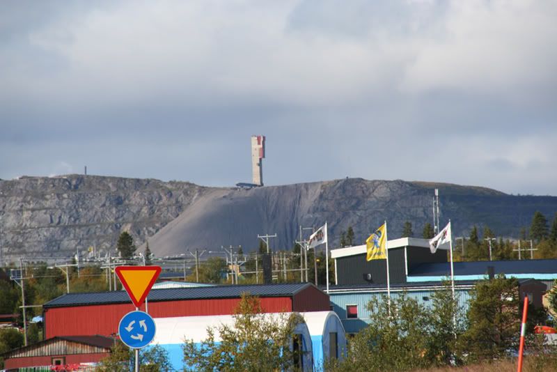
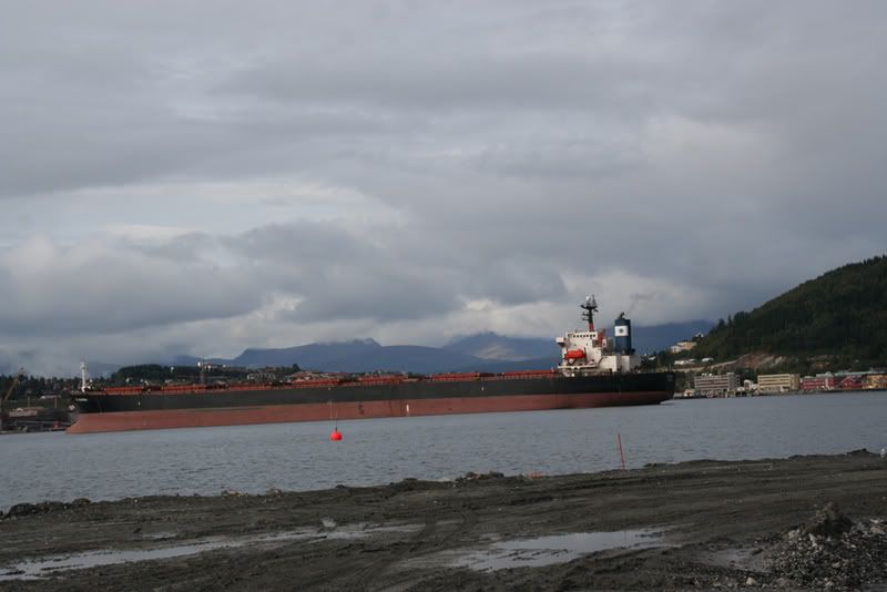
The day after it was the E10 north to Kiruna and from there to the border at Bjørnefjell. In this part of Sweden there is only one road going where I was going. Well, that is, if you don’t want to search out all the tiny roads, which I wasn’t this time. Between the 45 and the norwegian border there are vast mountain areas mostly populated by reindeer and nationalparks. There are a few water-powered powerstations, that’s all. Kiruna is a mining city. They mine iron ore for export over Narvik, a port in Norway. The mine is under the city of Kiruna, and they now have to move the whole city, because the ground is caving in under it. The yearly amount of iron ore mined in Kiruna is enough to produce knives and forks for all the Chinese. If they want to start eating their food with knife and fork as we do.
From here the iron ore is shipped by train to Narvik. The leftovers from the mining are dumped down the hillside.
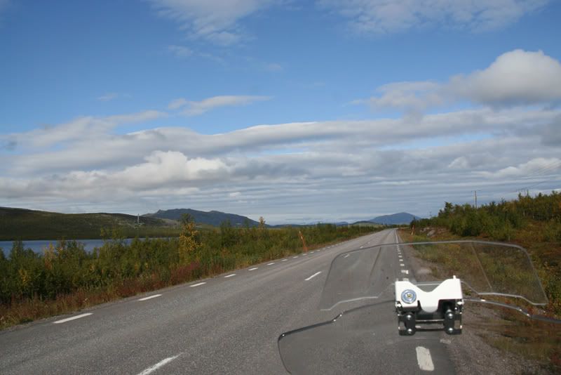
On the road between Kiruna and the lake Torneträsk, looking northwest against Norway
On my way to Bjørnefjell (the Bearmountain) I had a couple of photoshoots along the lake Torneträsk. The last ten kms down to Torneträsk was bad, the Swedes did their job on the road with gravel like golfballs and the heavy trucks drove like Australian roadtrains on the only lane that was driveable.
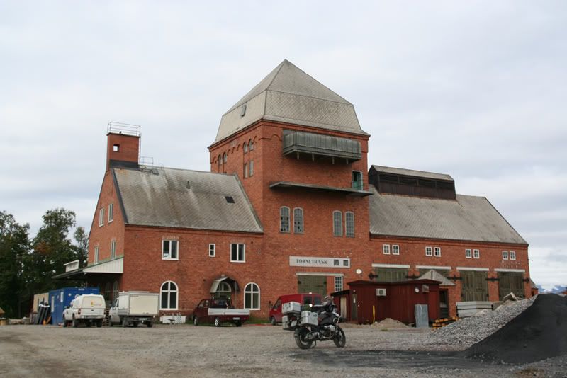
The railroad station at Torneträsk is somewhere in the middle of nowhere, but the architecture fascinated me. The railroad was finished in 1902, and the station was a bit more grandiose than a Norwegian railway station in the middle of nowhere.
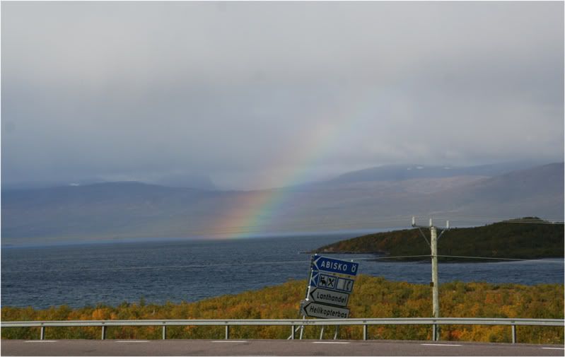
Abisko is a small winter resort, where I had dinner before I went home over Bjørnefjell.
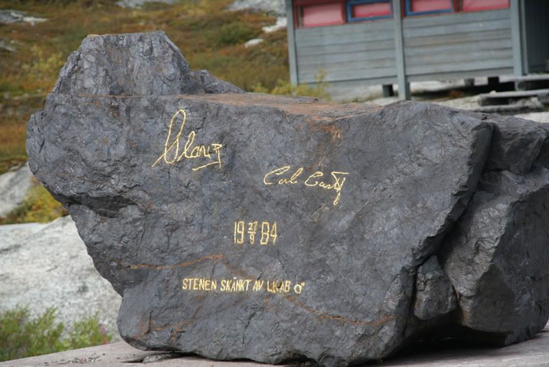
The Norwegian and the Swedish kings have been here. And from the border the E10 is called King Olav’s road on the Norwegian side.
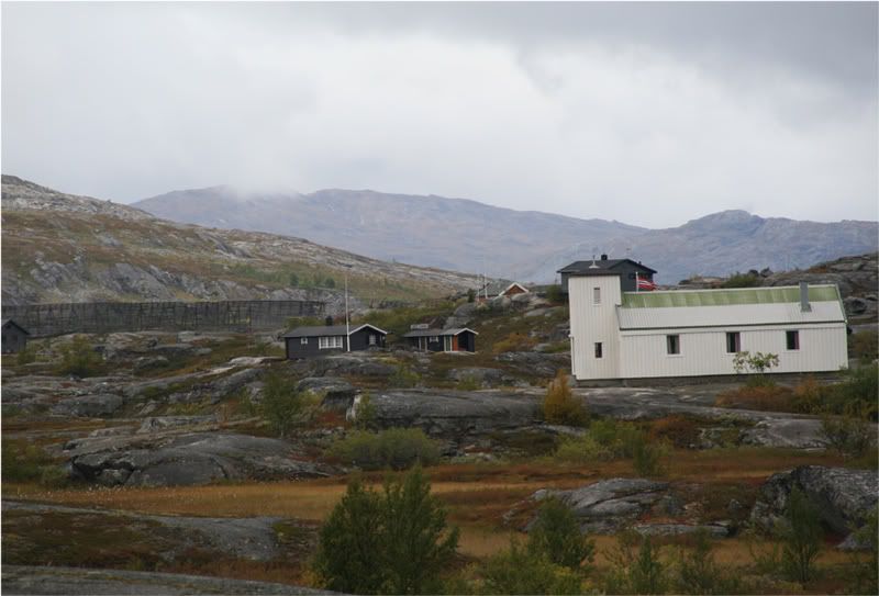
The chapell at Bjørnefjell
On the swedish side there is some winter resorts between Abisko and the border. On the Norwegian side there is a lot of cabins owned by people from Narvik.
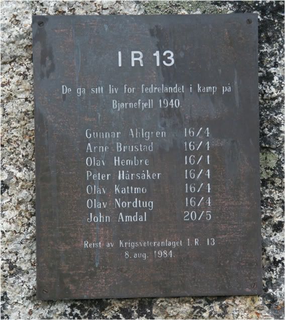
The norwegian army had driven the german troops back to the swedish border in may 1940. Germany occupied Norway on april 9. seizing the biggest cities along the coast from the sea. Narvik was a logical goal because of the iron ore shipped from here. No iron ore, on tanks. But Churchill was more concerned about his men in France, which were loosing against the German tropps. He had three or four navy wessels at Narvik, and English, French an Polish troops. But the Norwegians were the ones to fight the germans. The foreign troops did not engage in the shooting. When Churchill decided to withdraw, leaving the Norwegians to fend for them selves, the Germans had power enough to take Narvik and then the rest of northern Norway. If Churchill had had enough ice in his stomach, he could have changed WWII these days in May 1940.
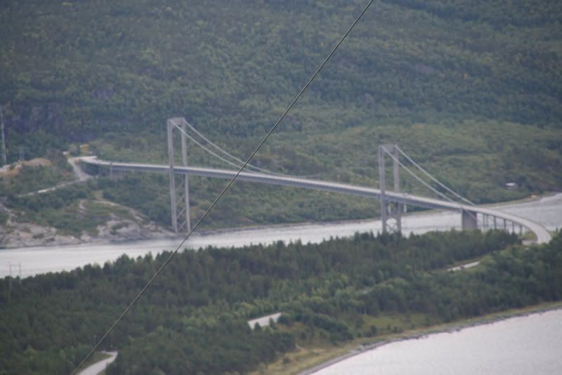
Further down the E10 there had to be a photostop to get the Rombakksfjord with the bridge.
This is the sight southwest the Ofotfjord against the Lofoten islands
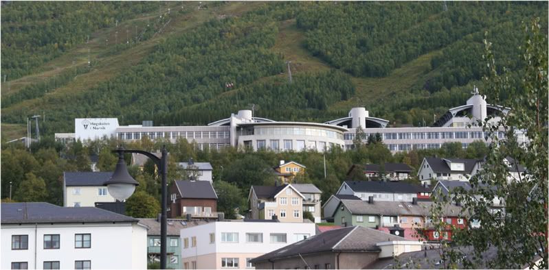
In Narvik there was a short stop for e-mailcheck at the public library and some pictures. In 2000 I was at the college here to start my education as an engineer. I didn’t end up as an engineer, but as an Occupatinal therapist, but that’s another story. The college has a very nice place in the hillside, looking out over the city and the fjord. And the students can walk right out into the down hill skiing tracks with their skis.
One of the ships transporting the iron ore from Kiruna
From Narvik the E6 brought me to Skarberget and the ferry over the Tysfjord. The picture from the ferry is to honour a friend of mine who like long-distance driving, but hate ferries. A very useful kind of hatred, when you are driving in a country like Norway, like he did earlier summer.
The last leg on this part of the tour went from E6 to Steigen, a tiny community on the coast living from fisheries and farming.
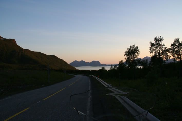
This is the Steigen-road at one o’clock in the morning midsummernight -07. My back is against an eight km long tunnel which ends at the E6 in Hamarøy. The Lofoten islands are behind the Island in center of the picture.
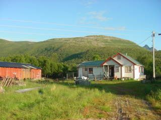
We had a farm here before we moved to Trondheim, and my father still lives there.
Daddys house
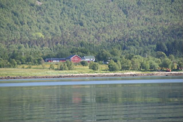
Our farm seen from the fjord looking south. We still have the farm, but there are no one living there anymore.
But before I came there I had to see a friend. But as usual he wasn’t there. Only his newly aquired Dnepr, which he had bought in Russia was standing in the courtyard.
After visiting my daddy’s a few days, I drove back north, this time to Harstad and the island Grøttøya visiting some friends there. Saturday I was back on the E10 heading towards Sweden again. The goal this time was my mother, who lives in a town outside Oslo, the capital of Norway.
But because of all the fjords there are some ferries. On this one the crew offered to tie the animal even though there were no waves.
The E10 from Lødingen to Harstad is a nice road for bikes. But there are a lot of speed limitations. 60 km/h is more common than not.
The E10 fro, Harstad to Narvik is going over the Tjeldsund Bridge, built in 1967
Luckily the new snow in the border mountains kept away from the road.
On this leg I had less time for enyoing the countryside. The E10 and the 45 down Sweden was merely transport, and Saturday night I rented a cabin at the camping site at Blatniksele, south of Sorsele. Nice site, situated at a small lake. Nice cabin, but the repair was… and since it was out of season, I paid £10 for the night. And to that price, I didn’t mind that the cabin wasn’t built last year.
South of Östersund the GPS was asked to find the shortest route to my mother’s. And it did. I didn’t mind the dirt roads it found at first. But when it guided me down a steep slope, more like a dry creek than a road, I took control. Luckily there was no mad Swedish landlord in that creek. I had been in the same area the year before, and had some bearings on where and when. And the map gave some clues to where to go.
I ended up in Idre, a winter resort not far from the border. Here I did some shopping, food mostly. Swedish prices are nice prices for a Norwegian housewife
Here I spoke with a guy on a Harley Davidson who was waiting for new tyres. He were heading for Poland and then north.From Idre I thought I should go straight ahead on the 70 to the border and down to Drevsjø in Norway. Nice road for bikes, and I was looking forward to that leg. But I asked the GPS to guide me once again, and it pointed to a small road more along the border. Well, over the hills and down the dales I went, and voila, there I found myself crossing the border farther south, and probably closer to my destination. And back in Norway, the driver’s license was back living dangerous, due to Norwegian speed limits that doesn’t fit the dessert animal
From the border I came down to the township of Østby. From there it was R26 an then R25 to Elverum. From Elverum it’s R3 down to the E6, and I have driven this one a few times. When I came to Gardermoen, I got rain, and late in the evening it’s dark, so the last leg Sunday went a bit slower than the previous ones
Monday I had a errand on my way home, and there it was fog down to the knees, but I reached my appointment, and could turn my front wheel homeward.
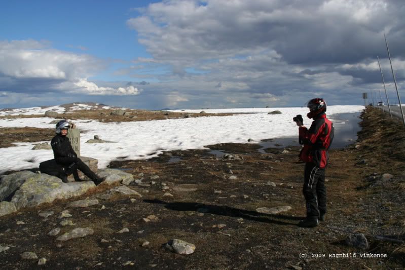
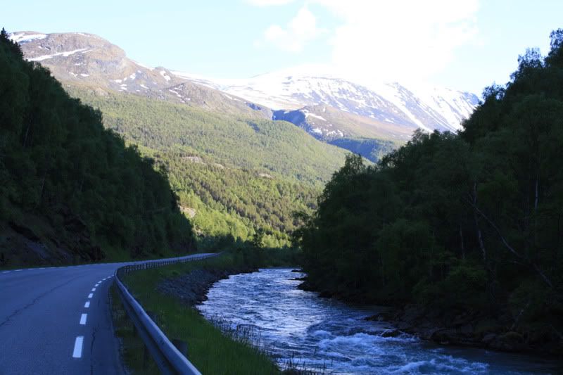
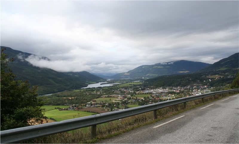
The R35 is a good bike road, the R4 and the E6 is OK for transport. When the R27 over the mountains from E6 at Ringebu is open, I prefer to drive there and not the E6. The R27/R29 from Ringebu to Hjerkinn is a few kms shorter than the E6, but its more hills and dales, and a smaller road. Put I prefer it when possible. With a car I drive the E6, it’s more a car road so to speak. Had to have a few photo sessions at the Ringebu church and in the hills above Ringebu
The Gudbrandsdal valley, looking northeast
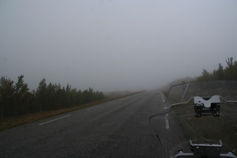
Up on the mountain the fog was still down to the road. But I had only 3 hours left in the sadle before I was home, so I didn’t mind taking it easy over there.
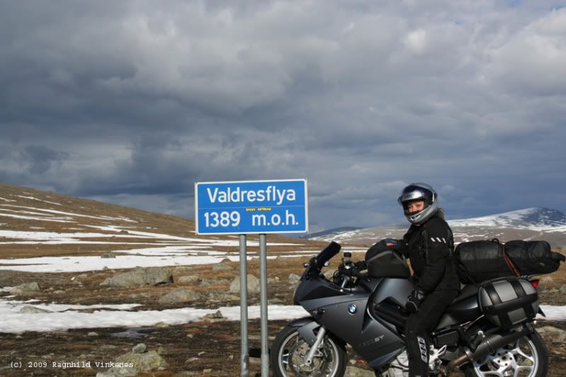
At Enden I took the R29 to Folldal and up the Folldal valley to Hjerkinn and E6
This the sight from R29 toward the highest point at the E6 which I met up on the hill here. Hjerkinn is about 1030 M above sea level, and is the highest point on the E6.
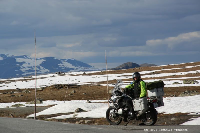
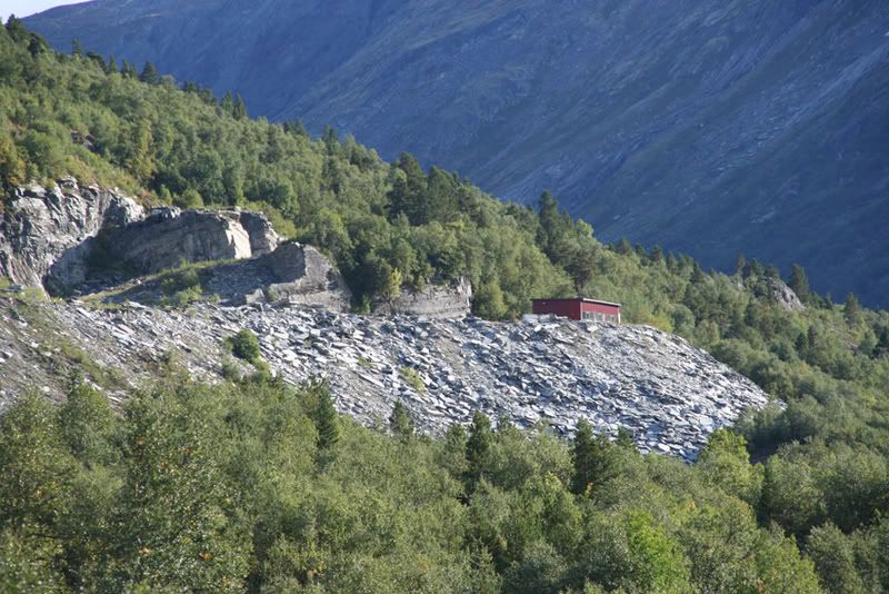
Thought about filling gas in Folldal, but decided I wanted to get home before I tanked. A short stop for leg stretching at the quarries south of Oppdal was necessary though. From there it is about 120 kms to Trondheim, and they went by like a breeze.
For those with a hang for statistics, the tour was 4.200 kms, I crossed the Norwegian/Swedish border five times and I was seven days on the road.
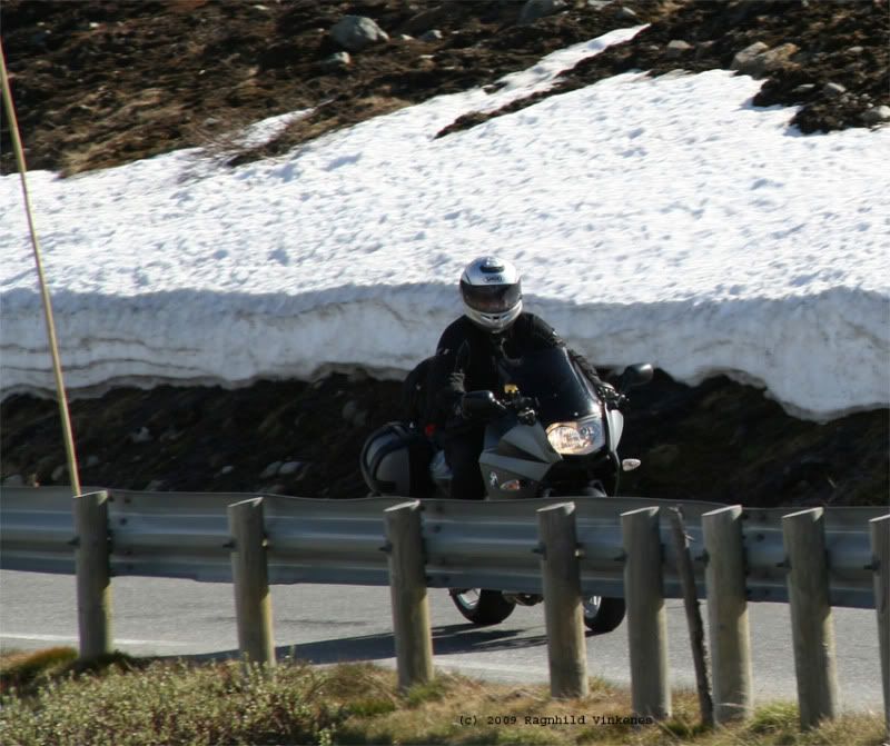
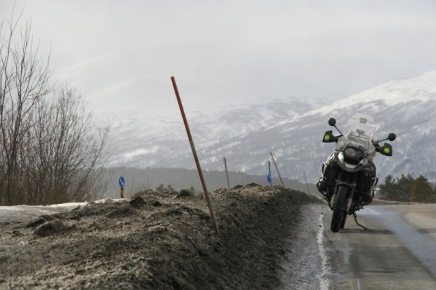
 The spikes on dry asphalt gave the drive an ekstra edge, like driving on skates. An that was a bit uncomfy, at times. But I have to admit that my driver’s license was living dangerous this Sunday. Good weather, dry road, little traffic, what more can a biker ask for


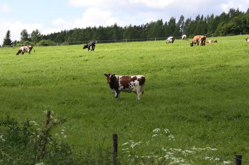
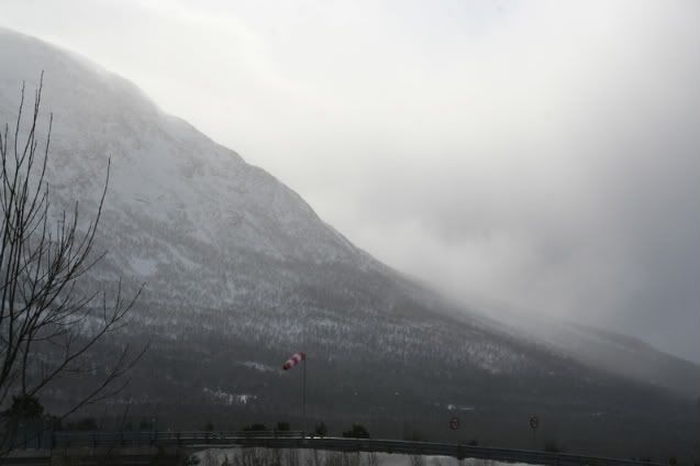
 On my way down the valley I found that the wind had increased even more. This one had no problems with hanging horizontally, anyway.
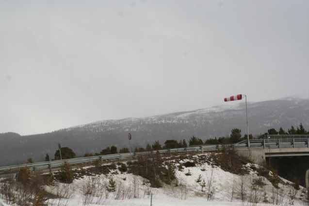

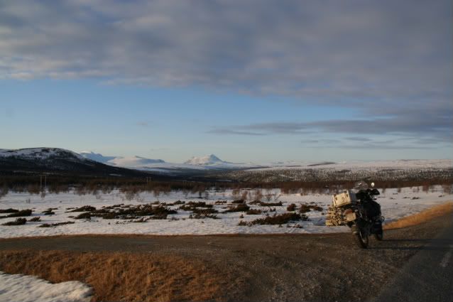


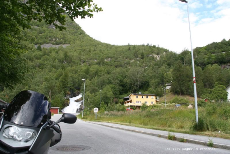
 that it is the perfect stead for touring the Norwegian coutryside..