There are some disadvantages to using a North American model SP 26xx in Europe. I'm not shilling for Garmin here, but in the interests of making sure everyone makes a fully informed decision, here is some info that I posted in another moto GPS forum (Horizons Unlimited) about this topic:
To understand how the GPS works, and why buying a North American version for use in Europe would not be a good idea, here is some information.
1) Basemap Issues
All Garmin GPS receivers (GPSR's) ship with a built in basemap. The basemap is "burned into" an EPROM (programmable read only memory) within the unit at the time of manufacture, and cannot be updated or changed by the user.
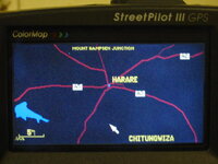
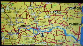
Garmin has (at least) two versions of basemaps, "Americas", which covers North America down to about Costa Rica, and "Atlantic", which covers Europe east to about Turkey and south to about the bottom of Algeria.
The basemaps serve two important purposes: first, they enable your GPS to display some limited information (major highways) when you do not have any other cartography loaded into your GPSR's memory, and second, they are used to create the screen display when the zoom setting is set to 8km zoom or greater.
If you are using an Americas GPSR in Europe, you won't benefit from the basic highway information when you don't have other cartography products loaded, or for countries that Garmin does not have cartography products for (e.g. Turkey, Algeria, Poland etc.). Also, if you zoom out to a view greater than 8 km, you will see a blank screen.
2) Included Cartography Issues
Garmin includes a set of CD's with every automotive GPSR that they sell. By "automotive", I mean the GPS V, StreetPilot III, and SP 2610/2650 series. The area covered by the CD's corresponds to the basemap of the unit - by this I mean North American purchasers of a GPS V get City Select North America, and European Purchasers get City Select Europe.
Any Garmin GPSR that is capable of auto-routing - and this includes the GPS V - uses a serial number unlock code for the cartographic data that is stored on the CD's. By this I mean that in order to use the CD's in the GPSR, and benefit from the information that they provide, you must have an unlock code that corresponds to the serial number of your specific GPSR. No doubt the person planning to sell you the North American GPS V has a set of City Select North America CD's, with a valid unlock code for that particular serial number GPSR.
But, the North American CD's are of no value to you whatsoever if you plan to use the GPSR in Europe. You can't copy (duplicate, borrow, pirate, whatever) the data from someone else's City Select Europe CD's, because you won't have a valid unlock code that matches the serial number of your GPSR.
Your only choice will be to buy a set of City Select Europe CD's as a stand-alone product. This is expensive - list price for the current version of City Select Europe is USD 350. See this link for details: Garmin Website - City Select Europe.
Even if you fork out the USD 350 for the set of Europe CD's and the unlock code, you still will be stuck with a GPSR that will not display map detail at wide zoom levels (beyond 8 km). You could correct this problem by purchasing or pirating a copy of WorldMap and loading the appropriate segments onto your data chip, but you will then have a very old (ca. 1998) underlying map, not a contemporary one, so when you zoom out, roads will not match up properly.
I have been a Garmin user for several years - had a SP III (actually had 2, one for North America and one for Europe), now have a SP 2650, and I beta-test these units for Garmin - my specialty is testing their suitability for motorcycle applications. Trust me, I know what I am talking about, and I am not shilling for Garmin. There is just no economical way to buy a GPSR in America and use it in Europe.
Some people get so caught up with the desire to beat the system that they buy a North American unit, then load it with older European cartography (e.g. the old 'Roads and Rec' CD's, or the old 'MetroGuide' CD's). These older cartographic products don't use a serial number unlock system, so they can be copied and shared easily - but the problem is, the data is now over 4 years out of date, and none of them support autorouting - so it's kind of pointless to spend the money on the hardware (a GPS V) and then ride around with way out of date maps, and no routing ability.
Your best bet is to search eBay in Europe for used GPS V's or used SP III's. Now that the SP 2610 and SP 2650 are shipping, there are quite a few of the V's and III's on eBay. Make sure you are buying a European unit, and make sure it comes both with the Europe CD's AND the appropriate unlock code for the Europe CD's.
----------------------
The original URL for this post is:
Horizons Unlimited
PanEuropean


 I see, thanks Greg!
 ). You can then use one in your camera when you don't need it for your 2610.