

You are using an out of date browser. It may not display this or other websites correctly.
You should upgrade or use an alternative browser.
You should upgrade or use an alternative browser.
To use a North American 2610 over here...
- Thread starter mrTickle
- Start date
mrTickle
Registered user
PanEuropean
Registered user
Geez, Mr. Tickle, I don't know how to make it clear to you that I am not trying to attack your credibility or undermine your seniority here on the BB, I'm just trying to provide more information about a topic that is not well understood by GPS users.
You wrote: "In the real world, a GPS is going to be used 99.9% of the time in an area where either CN or MetroGuide offers full coverage." This statement is undoubtedly true for most motorists (car drivers), who drive their cars in large urban agglomerations, or on motorways between cities. It is of questionable accuracy for touring motorcyclists, especially for those who ride dual-sport motorcycles. It is patently false for anyone in Europe who rides outside of the EC countries.
I can't post pictures here on this BB, because (I'm guessing) I am a new user and the admin's have not granted me permission to post pictures yet. But, if you can perhaps arrange to have picture posting enabled for me, I'll post a few of the literally hundreds of screen pictures I took last summer in North America, using an Americas basemap unit, showing where roads existed on the basemap but not on the current CN product, or showing where roads were visible on CN but one needed to use the basemap to route through the area. I've got all these pictures because every time I ran up against this problem, I took the pictures and emailed them back to the software engineers, to ensure that the specific problem I documented would be corrected in the next cartographic release.
Please don't confuse what you see on the display with what the GPSR is using at the moment for navigation. When you zoom out past a certain level, the display will switch from using the highest ranking cartographic product loaded to using the basemap (if it exists for the area) or WorldMap (if no basemap exists for the area and WorldMap is loaded). However, navigation does not switch over, navigation continues to be predicated on and calculated with use of the highest ranking cartographic product loaded on the chip, without regard to what the screen is displaying.
This is the point I was trying to make in my post above - if you have, for example, three different cartographic products available to you in your GPS (for example, CN by NavTech, MG by someone else, and a basemap by Garmin), then you have three different possibilities for success through an area - but you have to "gear down" manually to shift through the maps, by either disabling them through the options menu, or pulling out the data card. If you don't have the appropriate basemap for your area burned into your GPSR, then you have one less option available to you. I know, from personal experience, that the basemap is often a very useful option for both navigation and routing, regardless of how much money you have spent on other "more detailed" cartographic products.
PanEuropean
roadrider
Registered user
very usefulgps info
Pan European,
Thanks for the recent posts, and the detailed info, it's all become very clear now, why my GPS 3 sometimes seems to have a mind of it's own with regard to routes and hidden roads etc. And a better understanding of how the different types of maps work.
John
")
More please
Pan European,
Thanks for the recent posts, and the detailed info, it's all become very clear now, why my GPS 3 sometimes seems to have a mind of it's own with regard to routes and hidden roads etc. And a better understanding of how the different types of maps work.
John
More please
PanEuropean
Registered user
John:
Thanks for your kind words.
Here is a post I made to a different forum a fortnight ago, when a newbie was confused by the different cartography products. Perhaps it will be of some interest to users here. Once again, I want to stress that I do not work for, nor speak for, Garmin.
Here’s a very quick overview of automotive cartography products from Garmin, for those who are new to this:
I suggest you open the link to Garmin’s website catalog of these products in a second browser window, then you can compare back and forth: Garmin Cartography – Automotive Cartography Products
1) CityNavigator (Europe, North America, Australia)
Very, very detailed street level data for cities. Sometimes incomplete rural community street level data (it is called CITY Navigator). Coverage will vary by country, from perfection (every road and path in the country) in the German speaking countries, to pretty good (just about everything) for the USA, to rather spotty for places like Spain, Scandinavia, etc.
Contains many attributes (things you do not see on the map) about each street, such as width, presence of a median, truck restrictions, precise lane positions, exact text of overhead signs. Ships included with the StreetPilot III and GPS 2610/2650. Supports autorouting on both the PC and GPS, and is the ONLY product that supports voice prompts (e.g. "In 200 feet turn left") on the SP III and SP 2610/2650. Serial number locked to the individual GPS serial number. Current version contains 2003 data from NavTech. FYI, NavTech gets most of this info from various governments (they buy it), therefore the quality of the data depends on how well the country has progressed in developing vector-based electronic maps. Germany, Switzerland, and the Benelux countries are 100% done with amazing accuracy and detail. South of the Alps and Pyrenees, both coverage and accuracy gets spotty.
2) CitySelect (Europe, North America, South Africa)
Exactly the same visual data (what you see on the screen) as CityNavigator, not one street less or more, but fewer invisible road attributes such as turn restrictions, time of day restrictions, and weight restrictions. Fully suitable for cars and motorcycles. Not appropriate for delivery vehicles or intense urban work. Ships with the GPS V. Supports autorouting on both the PC and GPS. Serial number locked to the individual GPS serial number. Current version contains 2003 data from NavTech.
3) “MetroGuide” Products (Europe, USA, Canada, Australia)
Be very careful here, these products have different characteristics according to their version number:
Version 5, MetroGuideUSA (Current shipping product)
Almost exactly the same product as CitySelect, Supports autorouting on the PC and GPS. Serial number locked to the individual GPS serial number. A 2003 release. NavTech data, therefore identical visually to CN and CS for the same areas.
Version 4, MetroGuideUSA
Not as complete a cartographic database as the above 3 products (CN, CS, MG USA version 5), but better rural coverage than earlier CityNavigator and CitySelect products that were available at the same time as version 4 of MetroGuide USA came out. Not as good urban coverage as any version of CN or CS. Supports autorouting on the PC and GPS. NOT serial number locked to the individual GPS serial number. A 2001 release. Contains data compiled by TeleAtlas (formerly known as Etak).
MetroGuide Australia
Good coverage of urban areas, no street level detail elsewhere. Serial number locked to the individual GPS serial number. A 2002 release. Not sure who provides the data, but I think it is UBD in Australia.
MetroGuide Canada Version 4
Just released in very late 2003, excellent coverage of virtually all of Canada, the best product to choose for touring the country, but if you drive a taxi or delivery vehicle in a big city, CN has more detail for the big cities. Cartographic data provided by DMTI Spatial (a Canadian Company) from public domain data. Not serial number locked to the GPSR, and will autoroute on both the PC and the GPSR.
Earlier Versions - Any product with "MetroGuide" plus a country name (USA, Switzerland, Spain, Benelux, etc.).
Do not support autorouting, pretty spotty data, obsolete nowadays because they are all more than 5 years old, should be discarded.
4) Roads & Recreation
Any product with the name 'Roads & Recreation' is really, really old (late 90's data, the very first effort at electronic mapping) and should be tossed. No autorouting support.
5) WorldMap
WorldMap is a specialty product that gets a lot of disrespect that it does not deserve. It was created by Garmin from public domain data in the late 1990's to provide 'major road' information for the whole world, but no detailed street information. It is not of value in any area that currently (2003) has other data available - for example CN, CS, MG, or even the built-in basemap - but it is invaluable - and the only thing available for Garmin GPSR's - if you are in Africa south of the extent of the built-in 'Atlantic' basemap, or Central or South America (south of the 'Americas' built-in basemap, which ends at about Belize). In such cases, WorldMap will give you information similar in detail to what the basemap would provide, if it existed for that area. 6 year old data, but that's not much of a problem, major roads don't change very quickly in lesser developed countries. No unlock codes needed, and no autorouting support.
Another great advantage of WorldMap is that the map chunks are very small in size (kb's) relative to the area that they cover. This makes WorldMap really valuable for people who have [usually older] GPSR's with limited memory capacity. By example, the entire continent of Africa from WorldMap only occupies 15 mb of space, and this will give you just about every intercity road that a passenger car could travel on. At the other end of the scale, the city of London, England takes up 20 mb if you use the latest CN data, which is the most detailed.
WorldMap deserves serious consideration from folks that participate here on HUBB. I use it all the time when I go to Angola, Sierra Leone, Algeria, etc.
6) The Built-in Basemap in every GPSR
Because of the "pecking order" of the maps, and the fact that the GPSR can only use one map at a time, you don't often get to use your built in basemap. You must turn off any same-area map segments from the above listed cartographic products that are loaded in memory if you want to be able to navigate using the built in basemap, or to be able to see roads contained in the built-in basemap at views of 5 miles or less. If you don't know how to turn map segments off, just remove the data chip and put it in your pocket, the GPSR will then use the built in basemap only. Obviously, it's safer to turn them off via the software in your GPS, you don't risk losing the tiny and expensive data chip.
The "pecking order" of cartography products is the same as the order I have listed them here, 1 through 6. This means that it is pointless to have more than one map product loaded for any area - the product highest in the pecking order will overlay and hide any and all products that are lower in the pecking order. You can, however, have segments from multiple products loaded for the same area, and then choose which one to use by turning off the higher-ranked ones that you don't want to use. For example, I often travel with both CN North America and MetroGuide Canada Version 4 loaded. When I get outside of the big Canadian cities, I turn off CN and switch over to MG Canada v4. When I get really, really far out into the boonies, I occasionally turn off both CN and MG Canada 4, just to check and see if the built-in basemap has coverage that the other two don’t. Occasionally the basemap surprises me.
If you are not sure what product has best coverage, just stop, change the map scale to 5 miles (8 km) or smaller, and turn the various map products on and off to compare what you get. Note that all GPSR's use the built in basemap only to draw the screen display when the scale is bigger than 5 mile range (this gives faster screen redraws), so everything will look the same above 5 mile scale. But, for route calculation purposes, the unit uses the highest ranked map that is enabled, regardless of the scale you choose for your view.
PanEuropean
Pan Euro
I'm really enjoying your contribution!
In the UK we also have, in theory at least, 100% coverage. I can't imagine that NavTech buy the data from anyone but Ordnance Survey - they are listed as business partners.
But as someone has posted, a major new toll-motorway has recently opened near Birmingham, but it does not feature on v.6 of city Navigator.
Do you have any idea of the lead time between a road being constructed and it featuring on a Garmin map? In other words, when v.6 was released in January (although nobody yet has it), to what date were the UK maps updated?
cheers

Greg
I'm really enjoying your contribution!
In the UK we also have, in theory at least, 100% coverage. I can't imagine that NavTech buy the data from anyone but Ordnance Survey - they are listed as business partners.
But as someone has posted, a major new toll-motorway has recently opened near Birmingham, but it does not feature on v.6 of city Navigator.
Do you have any idea of the lead time between a road being constructed and it featuring on a Garmin map? In other words, when v.6 was released in January (although nobody yet has it), to what date were the UK maps updated?
cheers
Greg
PanEuropean
Registered user
Greg:
I have no special knowledge of the cartography compilation process. But I am pretty sure that the quality of the digital cartography for any given area is primarily dependent on the quality of the records that the government keeps, and also very dependent on how important a priority digital cartography is to the government of the affected area.
Here in Switzerland, I have seen new roundabouts depicted on CN releases before the construction workers even finish paving the things. In Canada, I have seen extensions of toll roads depicted on new CN releases a few months before the toll road is fully open.
On the other hand, in Spain, big 4 lane motorways that have been there for 5 years are still missing sections. In Scandinavia, whole sections of the countries are missing simply because the governments have not digitized the data yet.
The cartographic companies (NavTech, Etak, etc.) buy their data from the governments, then add features to it. If the government wants to sell them high quality, up to date data, then that's what we see. If the government is indifferent, then it takes a lot longer for the cartographic company to update and correct the data - either by their own efforts, or as a result of user feedback.
PanEuropean
BurnieM
Guest
Metroguide Australia and City Navigator Australia are from Sensis.
Sensis sourced the orginal mapping from UBD then enhanced it and owns all the electronic rights to the mapping.
Sensis is the source of all auto-routing data in Australia.
Sensis is owned by Telstra (ex Telecom Australia - national telecoms carrier)
They use software from TeleAtlas.
MGA metropolitain coverage is identical to CNA. Rural coverage on MGA is much better and, overall, I would describe it as very good. All rural sealed roads are included. All main dirt roads are included. Most tracks (70-80%) are included. I do motorcycling and 4WDing and have personally verified this (in NSW - state of New South Wales, Sydney is capital)
MGA has street level detail and POI for most rural towns (not included in CNA)
MGA does not auto-route on either the GPSR or PC
MGA uses an unlock code and therefore will not work on older GPSRs without an internal ID number (like the original Streetpilot)
PanEuropean
Registered user
Burnie, thanks a lot for those corrections and additions concerning the Australia products.
PanEuropean
PanEuropean
BurnieM
Guest
No probs
We are expecting an update to CNA (Feb?) supposedly to allow for the more efficent way the 2610 and iQue search for addresses and POI.
As Navman have autorouting data (same supplier) that includes many rural towns we are also expecting the CNA rural coverage to be enhanced.
We are expecting an update to CNA (Feb?) supposedly to allow for the more efficent way the 2610 and iQue search for addresses and POI.
As Navman have autorouting data (same supplier) that includes many rural towns we are also expecting the CNA rural coverage to be enhanced.
mrTickle
Registered user
PanEuropean said:Geez, Mr. Tickle, I don't know how to make it clear to you that I am not trying to attack your credibility or undermine your seniority here on the BB, I'm just trying to provide more information about a topic that is not well understood by GPS users.
PanEuropean
No worries PanEuropean, I know that
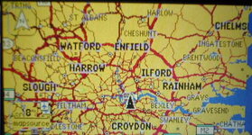
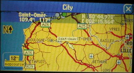
I took a chance buying an American 2610 and I'm pleased to say that it works great for me over here. I knew that the Worldmap may have some roads missing but I haven't found any where I've been using my GPS yet. I thought a few pictures to show the difference between Worldmap & the basemap would have been useful.
To understand the 2610 better, the 2610 was designed primarily for motorists who will use it in areas covered by Garmins own Garmin/NavTech mapping products. For anyone considering venturing out to remote countries or who travel off-road much, a 2610 with either version of basemap is a bad choice for your GPS. The 2610 was designed primarily for street navigation and for any off-road driving, the unit provides no guidance directions and it only operates as an electronic map showing your position on the map. A GPS V is a far better all-round choice.
The 2610 needs City Navigator software loaded into it because without it, it cannot provide street level autorouting. Once City Navigator is loaded into the unit, regardless of whether it's an American 2610 or a European 2610, they will both have exactly the same route calculated within them. The only difference is that on an American 2610 without Worldmap loaded, when zoomed out past 3 miles, there will be no roads displayed on its screen. However once Worldmap is loaded, no such problem exists. Even if Worldmap did miss out a small part of a road, it doesn't really matter as the route overlay follows the City Navigator route details, overlaying a pink route guide on top of all the roads that you follow.
I've used my American 2610 over here for a month now and I've not discovered any routing or map problems. As for it being slower to load - that's untrue. Worldmap is only a few Mb, whereas City Navigator is what takes the time to load. 1Gb on the same compact flash card will take the same amount of time to load in either an Atlantic or American unit. I suspect the make & manufacturer of the Flash card is also very important. Lots of people are considering doing what I'm doing & all I can say to them is that it's worked out great for me. It is quite possible for Garmin to update the 2610's Firmware to stop the GPS being used in this manner, so I'll keep copies of the old versions just incase they do. If people want investigate a little more, try these links:-
http://gpsinformation.net/sp26xx/sp2610rev.html
http://groups.google.co.uk/groups?hl=en&lr=&ie=UTF-8&oe=UTF-8&group=sci.geo.satellite-nav
PanEuropean
Registered user
Mr. Tickle:
You wrote, in your third paragraph: "The only difference is..."
That is where your error lies. There is an additional difference, which I explained in my post on page three. Here it is again:
"This is the point I was trying to make in my post above - if you have, for example, three different cartographic products available to you in your GPS (for example, CN by NavTech, MG by someone else, and a basemap by Garmin), then you have three different possibilities for success through an area - but you have to "gear down" manually to shift through the maps, by either disabling them through the options menu, or pulling out the data card. If you don't have the appropriate basemap for your area burned into your GPSR, then you have one less option available to you."
This is the last time I am going to say this. It is not an academic difference. It is a very meaningful difference, for autorouting purposes, most especially when riding outside of the urban agglomerations where CN provides full coverage.
You do make a very good point when you state that the SP 26xx is not a good choice of GPSR for off road riding. In fact, the software in the Garmin automotive products - the GPS V, SP III, and 26xx family - incorporates a "road lock" feature that will snap the vehicle position symbol to the nearest roadway when the vehicle position (by satellite fix) shows the vehicle slightly off the roadway. This is a great feature for those who normally stay on the roads (cars, trucks, Honda ST1100's), but it could be a big PITA for those who choose to ride off road and want to see exactly where they are. Although the lat/long displayed on the GPS status page will always be correct, the display won't, if you are laterally displaced from a roadway and the position symbol "snaps" to the roadway.
For serious off-road use, a non-automotive GPSR would be a much better - and much less expensive - choice. You can defeat the "snap to road" feature in a SP 26xx by removing the data chip, or deselecting the appropriate map segment, but that's kind of a waste of the power of the high-end power of the 26xx - sort of like using a Range Rover as a delivery truck.
PanEuropean
mrTickle
Registered user
Hey Pan, you're a great Garmin Beta tester - I’ve just done another 1 500 miles and still not found any roads that aren’t covered by my imported jobbie ( yes I know, they're missing somewhere -just where? )
Cheers
)Cheers
Missing roads
As covered in a earlier post Garmin don't seem to know what the changes are, which is nice. I'm going to pay out $150 and only know that the latest motorway in the UK isn't on it.
Mr Pan European and mr Tickle:
Am I right in guessing that you can use the world map as a non-autorouting base map, and load the same geographical map segment using the appropiate City navigator. And that this combination will allow you to zoom to +/- 8km without loss of a map? Granted that the Worldmap may, or may not, be as good as the appropiate base map, but then I'm unlikely to tour the east of Europe or anywhere other than Morocco. Also that the 26XX is the best unit due to its memory capabilities.
roadrider
Registered user
mrTickle said:Hey Pan, you're a great Garmin Beta tester - I’ve just done another 1 500 miles and still not found any roads that aren’t covered by my imported jobbie ( yes I know, they're missing somewhere -just where?
Cheers
!!!!!!!Eh!!!!!

 My 2610 has arrived too.
 Got the euro maps installed tonight on the 1 Gig CF card, looking great so far! (same SPIII double unlock trick)
No road testing done so far, but I trust it will work just fine!
 Thanks a lot for the tip of the year mrTickle!!
 PanEuropean
Registered user
I've said enough on this topic (Americas units in Europe).
John, in response to your last question, "[Is] the 26XX is the best unit due to its memory capabilities[?]" - it really depends on how far from home you plan to go.
I couldn't, in good faith, recommend a SP 26xx to someone who doesn't plan to go more than a day's riding from their home base, unless they had some other reason to justify the faster processer in the SP 26xx, for example, if they were a courier driver or something like that. The SP 26xx is a fairly expensive piece of kit, and it's a wonderful unit if someone wants (and needs) fast route calculations, big memory capacity for long distance tours, and a few more major tricks that will be coming along soon.
But, as I mentioned in another thread earlier tonight, for a rider who stays pretty close to home and intends to use the GPSR primarily for recreational motorcycle use, the GPS V is much more economical and gets the job done just as well - you only need to wait a few seconds longer for a route recalculation. The SP III is also a very competent unit, with lots of memory capacity (up to 128 megs), and a colour screen, it calculates routes at about the same speed as the GPS V, and in addition, provides voice guidance.
Buying GPSR's is a lot like buying portable (laptop) computers - you need to assess your needs carefully first, to avoid buying features you don't need, or worse still, to avoid buying something that doesn't have features that you DO need.
For long distance touring - transcontinental touring - no doubt about it, the SP 26xx is the way to go. If you don't plan to leave the British Isles, think carefully about the SP III unless you really want a specific feature that the SP 26xx has. If you don't plan to spend very many nights away from your own home, consider the GPS V. If you don't need autorouting, have a close look at the eTrex products that have road detail in them.
There are also some excellent bargains to be had buying a second-hand unit on eBay or similar, but "caveat emptor" - see the remarks I made in this post (4th response) about what to check for if you are buying a used GPSR.
PanEuropean
BurnieM
Guest
It is a bit of a 'catch 22'; what you want and what you need are often not the same.
I tend to think that the first GPSR that you get will be a learning exercise.
Your second unit will be much closer to what you need.
I don't really see any way around this as advise you receive will be biased towards the givers usage which is probably different to yours.
I tend to think that the first GPSR that you get will be a learning exercise.
Your second unit will be much closer to what you need.
I don't really see any way around this as advise you receive will be biased towards the givers usage which is probably different to yours.
PanEuropean
Registered user
Very good point, Burnie.
Thanks
I've had a couple of aviation GPSR's before I bought an SP3 a year ago. I'm only really considering the 2610 as I'm off to the states this year and the benefit of paying less $ than £ for one.
Probably the SP3 would do me for a long time, but the 26xx series overcome some of the SP3 difficulties ie storage and time to recalculate routes. The cheapest route would probably to buy more storage cards for the SP3.
Whether I need all the rest of the improvements is unlikely, but hey when did you last buy anything electronic that you needed all the improvements?

Similar threads
- Replies
- 3
- Views
- 513
- Replies
- 0
- Views
- 1,323
- Replies
- 51
- Views
- 24,666