Using AI to plan your routes. Yes or No?

AI, used smartly, is only the 21st century’s version of a well thumbed travel guide book and dog eared map.

Use it, as you see fit.

PS Somewhat worryingly, AI spat out an answer this morning, where its primary source of data was….. UKGSer! I don’t think it will be taking over the world any time soon.
Won't take over the world sourcing UKGSer, but imagine the arguments it will have with itself. Initially factual, then opinionated, lastly personal and derogatory with no capability to exit the loop. The AI will self implode, leaving only a vacuous hollow of ignorance like so many threads on here.
 
Won't take over the world sourcing UKGSer, but imagine the arguments it will have with itself. Initially factual, then opinionated, lastly personal and derogatory with no capability to exit the loop. The AI will self implode, leaving only a vacuous hollow of ignorance like so many threads on here.

One day AI will tell a woman she’s wrong. That will be end of AI.

:beerjug:
 
I tried using it to plan a route up the RDGA avoiding the worst of the balcony roads as they put the Willie’s up me, it didn’t do badly but you have to check the results as it does make mistakes
Gave me a pretty good route taking in most of the well known and also less well known passes
 
… but you have to check the results as it does make mistakes

Indeed so. It will though acknowledge errors, if you point them out. It takes a bit of time ‘engaging’ with it, but it’s learning fast. That it’s free to use the basic versions is a bonus, of course.

In a way I equate it to assuming that a GPX file of a route, downloaded from the internet, will be perfect and not need checking. Similarly, assuming that a conversion from a GPX track to a route will always be perfect, too.
 
Indeed so. It will though acknowledge errors, if you point them out. It takes a bit of time ‘engaging’ with it, but it’s learning fast. That it’s free to use the basic versions is a bonus, of course.

In a way I equate it to assuming that a GPX file of a route, downloaded from the internet, will be perfect and not need checking. Similarly, assuming that a conversion from a GPX track to a route will always be perfect, too.

Yes, it apologizes when you tell it it’s wrong

I did try to get a GPX file for another trip but it failed miserably, don’t know if the problem was my prompt or it’s lack of actual intelligence
 
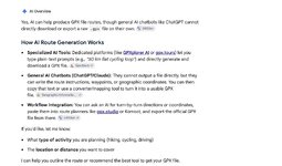
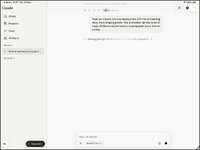
AI’s response to the question: Can AI create GPX files of its suggested routes?

Note, it references UKGSer…. Make what you will of that.

IMG_2238.jpeg
 
The only negative I can see is that it doesnt leave many surprises on the actual trip so torn about using it.

You might well get one hell of a surprise, if you follow AI suggestions blindly and to the letter.

Joking aside, AI is only a 21st century version of someone asking UKGSer for a route (sometimes many hundreds of miles long) along with ‘stuff’ to see and do all along the way, with cafes and hotels. That AI is certainly fast and, by and large, pretty accurate (though not perfect) and is free, is quite remarkable.
 
Just buy a map and make your own route, If wrong, you can always go back the way you came!
Or be like explorers, follow the stars!......No not Him! the twinkly kind! :D
 
Claude can certainly create gpx files

That’s useful to know, thank you.

In Claude, can you for example say to it: ‘Create me a scenic motorcycle route from Calais France to Apt in Provence, avoiding motorways, with a duration of three days’

I guess it will spit something reasonably good out fairly quickly? Yes?

Will it then respond to a request of: ‘Thank you for the suggested route, Claude. Please give me a GPX file of the route you have provided, suitable for use in BaseCamp and MyRoute’?

If it can do that accurately, it might well be very useful.

 
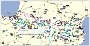
No Ai needed - just ride your bike... maybe rather than spending your life farkling and polishing it!! :duck:Pyrennees.jpg
 
No Ai needed - just ride your bike...

That of course is an excellent option, which stood the pre-internet world in pretty good stead for hundreds of years and more. But it does little to nothing to assist those who arrive at the door of UKGSer, to then shout through the letterbox:

“Me and me six mates we need windy roads from here to there and stuff to see and do no motorways leaving thrursday”

You can see a very basic form of AI (or at least an algorithm) when bods post: “I was in X and wanted to go to Y. I asked my Garmin to give me a windy route, avoiding motorways. It was excellent, giving me roads that I’d not otherwise have ridden”.

:beerjug:
 
Sorry to hear to of the death of Mr Tosser,

But can you tell me Mrs Tosser,

how did your husband come to be in the middle of a live fire excersise in a very sensitive military area?


Well , i do recall he was chatting to his chums on the line , about using that robot intelligence thing to plan a route for him to starbucks.

He said he wanted action, adventure , and to cross vast swathes of rugged landscape
 
Claude can certainly create gpx files

That’s useful to know, thank you.

In Claude, can you for example say to it: ‘Create me a scenic motorcycle route from Calais France to Apt in Provence, avoiding motorways, with a duration of three days’

I guess it will spit something reasonably good out fairly quickly? Yes?

Will it then respond to a request of: ‘Thank you for the suggested route, Claude. Please give me a GPX file of the route you have provided, suitable for use in BaseCamp and MyRoute’?

If it can do that accurately, it might well be very useful.

Don’t worry, I have done it myself by tapping around with Claude.

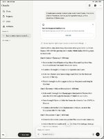
I asked Claude for the Calais to Apt route, as per my question. This it provided, broken up into the three days, along with some supplementary questions Claude asked of me, in order to offer some additional assistance.

I then asked Claude for the GPX file, which it provided. This arrives in the form of code, unsurprisingly I guess.

I then asked Claude how to get tge file of code into MyRoute. I knew how to do this but was interested to see what Claude said.

Claude provided very clear instructions, even to me, whose knowledge of IT type ‘stuff’ is less than zero.

Bingo! Three separate one day routes. Here they are in one file:

https://www.myrouteapp.com/en/social/folder/16116982?mode=share

PS I haven’t checked it for glitches or anything like that. Nor to see if it misses out the two mile stretch of the D12345, without which no journey is ever complete.

Many thanks for the heads-up, appreciated.

:beerjug:
 
Stop the presses!

I have found a fault with the GPX file that Claude created.

I specifically asked for it to avoid motorways:

IMG_2258.jpg

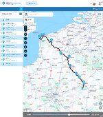
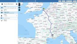
When I displayed the file in MyRoute, it took motorways with odd deviations off:

IMG_2259.jpeg

I am guessing that this is because I up loaded it to MyRoute as a ROUTE and not a TRACK.

I’ll have another go.
 
I am guessing that this is because I up loaded it to MyRoute as a ROUTE and not a TRACK.

I’ll have another go.

MyRoute now displays the outline of the TRACK, all three days joined together:

IMG_2260.jpeg

I’ll play around a bit more.
 
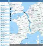
I asked MyRoute to convert the TRACK into a ROUTE,

Still no good, as it very largely follows motorways,

IMG_2261.jpeg

I am guessing but I suspect that the GPX file that Claude offered up, has insufficient shaping points. If I am correct, them MyRoute has simply done its best to join the known points up.

I’ll see if I can get Claude to improve it.


Back
Top Bottom