Bumpkin
Registered user
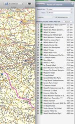
Have a look here 
Once you've picked up the basics you'll find it easier.
If you suspect that you're dealing with a dual-carriageway or motorway then you definately need to check as have a routing node on the wrong side of the Armco can have you being instructed to loop back to visit that point from the next junction to the previous one. What I tend to do is to rough out the route and then check each node in turn at a closer zoom level. The route properties dialogue (double click the route in the left window) shows each point, described my road names, and clicking each in turn zooms in close enough for you to see the exact placement of that node.
A few other tips (assuming that you're using a PC rather than a Mac, as the latter may differ):
Zooming and panning of the map can be done with one tool, the Hand tool, quickest way to get around the screen IMHO - Keyboard short-cut 'H'
There are other short-cuts for the tools, as you get used to using Basecamp using these will greatly enhance and speed up your route plotting. Click 'Tools' in the main menu to see a list.
Once you've picked up the basics you'll find it easier.
Do I have to zoom right in to do that? It seems very clunky.
If you suspect that you're dealing with a dual-carriageway or motorway then you definately need to check as have a routing node on the wrong side of the Armco can have you being instructed to loop back to visit that point from the next junction to the previous one. What I tend to do is to rough out the route and then check each node in turn at a closer zoom level. The route properties dialogue (double click the route in the left window) shows each point, described my road names, and clicking each in turn zooms in close enough for you to see the exact placement of that node.
A few other tips (assuming that you're using a PC rather than a Mac, as the latter may differ):
Zooming and panning of the map can be done with one tool, the Hand tool, quickest way to get around the screen IMHO - Keyboard short-cut 'H'
There are other short-cuts for the tools, as you get used to using Basecamp using these will greatly enhance and speed up your route plotting. Click 'Tools' in the main menu to see a list.