Deleted account 250722001
Registered user
- Joined
- Aug 2, 2019
- Messages
- 1,052
- Reaction score
- 416


Paul, as an after thought.
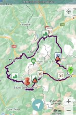
The waypoints screenshot shown I posted above are NOT part of the route calculation but are 'added value'.


 ...
... ......
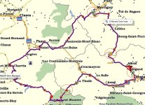
Is there still a road over the Mont Blanc to avoid the tunnel ?
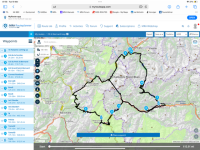
@yakto. What programme did you do this in pls
 it may be worth reminding folks that any data/gpx/kml etc offered does not necessarily mean it works under every known and unknown platform and is is or is not suitable for purpose- perhaps best thought of as a 'skeleton' upon which to build each persons' personal trip.
Happy to contribute/help Richard- without being a clever clogs,