


Lake District Trip - September 2026
Day 1 Saturday 19th
Wife took me to the railway station for the 07.21 train. Got there about 20 minutes early. Whilst it’s a good habit to be early, I sometimes annoy myself just how early I get there, just in case!
Arrived at the platform to be told my train had been cancelled. The very helpful lady told me that I could get the earlier train to Nottingham and get the Manchester train from there. Same train that I’d be getting in Sheffield. Good job I was so early!
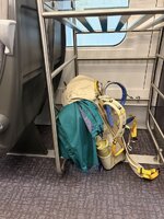
I found a seat next to somewhere I could keep an eye on my rucksack. A man sat down opposite and started chain drinking Guinness Zero. I can’t imagine why. Especially at 07.45.
No wonder the health service can’t cope. By 08.15 he’s on full strength Red Stripe. I think there are quite a few people going to football matches, so obviously you need to drink from breakfast time.
Arrived in Windermere and caught the bus to Ambleside. As I got off the driver gave me a tip about a footbridge which was really useful. Great bit of local knowledge.
Started walking about 13.15. Mainly on minor roads and a few paths. Weather looked like it might rain but never did.
Arrived in Little Langdale at around 15.00 and decided to find somewhere to stay for the night. I didn’t want to overdo it on the first day. I couldn’t see any B&Bs so enquired in the pub to see if they had any rooms. All full.
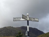
It appears that in a lot of villages in the Lake District, and I’m guessing elsewhere, the B&B’s have changed to holiday cottage lets instead.
With nothing else to do, I carried on walking up Wrynose Pass along the road. In my memory, I thought there were flat places at 3 Shire Stone, or an easy walk up to Red Tarn with somewhere to camp.
It was hard work going up the pass. When I got to the top there was nothing flat and dry. The recent rain had refilled the bogs and there was nowhere to put up a tent.
My memory had failed me over the last 30 years, and Red Tarn seemed to be in a different dimension, cut off by bogs and water. I didn’t want to risk wet feet so late on in the day, and possibly, 30 years ago, the hills wouldn’t have been so daunting.
I decided to continue along the road, thinking I’d find somewhere to camp. There were places, a couple had parked their car with a roof-tent. However, it was really windy coming down through the valley. So much so that I couldn’t find anywhere to camp. It was at that point I realised I’d brought the wrong tent.
It was a toss-up between the Solar and the Voyager. Both about the same weight, but the Solar is slightly smaller and easier to heat up from your body heat. But it’s a single pole construction, whereas the Voyager is semi-geodesic and self-supporting. I’ll not make that mistake again. I’d have risked a night in the valley if I’d had the Voyager.
I continued to the bottom of the pass and in front of me loomed the Hardknott Pass, which was on my original route.
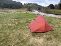
I knew that I’d have the same problem if I started walking up hill, so decided to turn left at Cockley Beck. After a mile or so, I was close to the River Duddon, and decided to get some water to drink. Took off my pack and got my bottles out and started to filter some water. It struck me, this place is completely dead. It’s 8.00pm I’ve not seen anyone for hours, why don’t I camp here? So between the road and the river I put up my tent and cooked something to eat.
The ground was hard and the pegging wasn’t that good and, in the wind, I had to re-peg the tent a couple of times in the night, which didn’t help with having leg cramp every time I moved.
Day 1. 13.5 miles.
Day 2. Sunday
Cramp all night including getting up. Managed to get packed away and on the road for 8.30.
Walked to Hardknott Forest car park and took the path around the left side of Harter Fell. Quite boggy and hard work. Hillier than expected. It was supposed to be a bridleway, although I’d like to watch someone trying to get a horse up there. It was also further than I thought it was going to be.
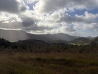
In my head it was just around the side of the fell, but there was still quite a bit of a climb and walking through bog and avoiding getting wet or bogged down, takes quite a lot of energy. Once around Harter Fell, there’s still quite a lot of walking to be done, before dropping down into Dale Garth in Eskdale.
I stopped and asked at a farm for recommendations for somewhere to stay. It was still a couple of miles to the village itself. I went straight to The Boot and they had a room for the night.
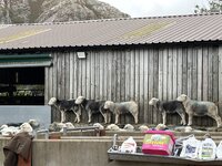
Got to my room, showered and washed my clothes and put them to dry. They put my boots in boiler room to help them dry overnight.
Had roast lamb for dinner which was great. Couldn’t finish it.
It was wonderful to be able to dry everything out and relax in a bed. I think I’ve got soft with age.
Day 2. 11 miles
Day 3. Monday
Woke up and hobbled down to breakfast. Looked at the weather forecast which showed the rain stopping at 10.00 so had a relaxing morning waiting for the rain to pass. It didn’t!
Set off anyway at 10.15 over the old coffin trail to Wasdale Head. Enjoyable day except for the wet. A really pleasant walk, especially in the summer, I would imagine.
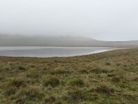
I arrived at Wasdale Head at about 14.00. I’ve been to Wasdale Head quite a few times, but never stayed at the Inn. It’s almost been an ambition, and I was lucky enough to get a room there. Whilst a short walking day, I had got thoroughly soaked and if I’d have camped I’d have been pretty uncomfortable all evening.
Within 15 minutes of arriving, I was in the bath. What luxury, an ensuite bathroom with a bath! I also washed all my clothes and, using their drying room, got my trousers dry enough to go for dinner in the bar.
Day 3. 6.5 miles
Day 4 Tuesday
Not a bad night’s sleep. Great breakfast. The breakfast room seems unchanged for about a century. A lovely, panelled room, with a marble-topped sideboard at one end. The hotel walls are covered with photographs of explorers and climbers from years gone by. Rock climbing with your hobnail boots, but also wearing a suit and tie. Madness.
This was going to be quite a big day. Not too much distance, but quite a bit of height, up and down.
Started walking at 09.00. Walked up Black Sail Pass and behind Kirk Fell. It was unusual to see bullocks so high up in the pass. The path behind Kirk Fell was tricky. I never enjoy contouring paths, but this was covered in ankle twisting rocks and the path wasn’t too defined. Although I’d taken a map and compass, and know how to use them, this is the first time I’d navigated ‘on the hill’ using the OS Maps app on my phone. I have to say, this was a game changer. Being able to pin-point where you are in seconds saved loads of possible errors, thus saving time and effort.
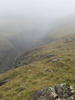
I continued up to Beckhead Tarn then across to Stone Cove, however, the paths weren’t on the ground which made navigation difficult. Walking backwards and forward looking up and down, the paths that were on the map, were no longer on the ground. I carried on a path in the right direction but couldn’t find a path up onto Green Gable. Probably a good thing, as the weather was very wet and windy and I was better walking in the shelter of the mountain, than over the top. I found a path called Moses Trod and that took me in my general direction, before I turned east and joined the Coast-to-Coast long distance path.
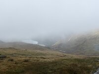
Just after I joined the coast-to-coast path I chatted to an Australian lady who was doing the supported walk. I think the exposure of the path and the navigation was a bit of a shock to her but she was carrying on doggedly. The sun came out and the clouds broke as I walked with her for a mile or so then left her as I needed to press on to find somewhere to stay.
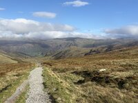
I walked down to the Honister Slate Mine and then down into the village, which is still quite a way.
I arrived at Seatoller but there was no room anywhere. Tried the Glaramara Hotel and the lovely lady at Ghillie Combe B&B, who told me to try the YHA. They were full too. Went a bit out of my way to the Langstrath Inn in Stonethwaite, which was great and also had a bath in the room.
The food here was brilliant. Ordered a starter of black pudding and haggis tower then slow cooked lamb.
Day 4. 12 miles (and 54 floors according to my watch)
Day 5. Wednesday
Up for a good breakfast at 08.00.
Today was my last walking day. Finishing in Keswick.
Started walking at 9.00. There was a good path all the way following the Cumbria Way. The terrain mostly good. A few ups and downs but pretty clearly defined. A really nice low-level path through Borrowdale and occasionally on the bank of Derwent Water.
Arrived in Keswick at 13.20.

Booked into a hotel in Grasmere for a relaxing evening.
Day 5. 8.2 miles
Conclusion
51.2 miles covered in 4 and a half day’s walking. After not doing any long-distance walking for about 10 years, I finished up quite pleased with myself.
I’ve not carried that much weight for a long time, and arguably, with better planning, wouldn’t have needed the tent, mat, sleeping bag, stove, fuel, food etc. which would have made the walking a lot easier, but less of a challenge.
Before setting out, I had no idea what distances I was going to cover, how my fitness would hold up, so taking a shelter was a requirement. There were also plenty of campsites I could have used, had it not been so wet.
Previously, I was walking higher routes and I never used to worry about drinking stream water, but the Grayl Utrapress filter meant that I never had to go thirsty or take any risks. This and the OS Maps app were the two big gear revelations for this trip.
After walking over the ridges and peaks during the 1990’s this trip has opened my eyes to the great lower-level paths that are available, which has given me renewed hope for my walking career.
Can’t wait to do more.
Day 1 Saturday 19th
Wife took me to the railway station for the 07.21 train. Got there about 20 minutes early. Whilst it’s a good habit to be early, I sometimes annoy myself just how early I get there, just in case!
Arrived at the platform to be told my train had been cancelled. The very helpful lady told me that I could get the earlier train to Nottingham and get the Manchester train from there. Same train that I’d be getting in Sheffield. Good job I was so early!
I found a seat next to somewhere I could keep an eye on my rucksack. A man sat down opposite and started chain drinking Guinness Zero. I can’t imagine why. Especially at 07.45.
No wonder the health service can’t cope. By 08.15 he’s on full strength Red Stripe. I think there are quite a few people going to football matches, so obviously you need to drink from breakfast time.
Arrived in Windermere and caught the bus to Ambleside. As I got off the driver gave me a tip about a footbridge which was really useful. Great bit of local knowledge.
Started walking about 13.15. Mainly on minor roads and a few paths. Weather looked like it might rain but never did.
Arrived in Little Langdale at around 15.00 and decided to find somewhere to stay for the night. I didn’t want to overdo it on the first day. I couldn’t see any B&Bs so enquired in the pub to see if they had any rooms. All full.
It appears that in a lot of villages in the Lake District, and I’m guessing elsewhere, the B&B’s have changed to holiday cottage lets instead.
With nothing else to do, I carried on walking up Wrynose Pass along the road. In my memory, I thought there were flat places at 3 Shire Stone, or an easy walk up to Red Tarn with somewhere to camp.
It was hard work going up the pass. When I got to the top there was nothing flat and dry. The recent rain had refilled the bogs and there was nowhere to put up a tent.
My memory had failed me over the last 30 years, and Red Tarn seemed to be in a different dimension, cut off by bogs and water. I didn’t want to risk wet feet so late on in the day, and possibly, 30 years ago, the hills wouldn’t have been so daunting.
I decided to continue along the road, thinking I’d find somewhere to camp. There were places, a couple had parked their car with a roof-tent. However, it was really windy coming down through the valley. So much so that I couldn’t find anywhere to camp. It was at that point I realised I’d brought the wrong tent.
It was a toss-up between the Solar and the Voyager. Both about the same weight, but the Solar is slightly smaller and easier to heat up from your body heat. But it’s a single pole construction, whereas the Voyager is semi-geodesic and self-supporting. I’ll not make that mistake again. I’d have risked a night in the valley if I’d had the Voyager.
I continued to the bottom of the pass and in front of me loomed the Hardknott Pass, which was on my original route.
I knew that I’d have the same problem if I started walking up hill, so decided to turn left at Cockley Beck. After a mile or so, I was close to the River Duddon, and decided to get some water to drink. Took off my pack and got my bottles out and started to filter some water. It struck me, this place is completely dead. It’s 8.00pm I’ve not seen anyone for hours, why don’t I camp here? So between the road and the river I put up my tent and cooked something to eat.
The ground was hard and the pegging wasn’t that good and, in the wind, I had to re-peg the tent a couple of times in the night, which didn’t help with having leg cramp every time I moved.
Day 1. 13.5 miles.
Day 2. Sunday
Cramp all night including getting up. Managed to get packed away and on the road for 8.30.
Walked to Hardknott Forest car park and took the path around the left side of Harter Fell. Quite boggy and hard work. Hillier than expected. It was supposed to be a bridleway, although I’d like to watch someone trying to get a horse up there. It was also further than I thought it was going to be.
In my head it was just around the side of the fell, but there was still quite a bit of a climb and walking through bog and avoiding getting wet or bogged down, takes quite a lot of energy. Once around Harter Fell, there’s still quite a lot of walking to be done, before dropping down into Dale Garth in Eskdale.
I stopped and asked at a farm for recommendations for somewhere to stay. It was still a couple of miles to the village itself. I went straight to The Boot and they had a room for the night.
Got to my room, showered and washed my clothes and put them to dry. They put my boots in boiler room to help them dry overnight.
Had roast lamb for dinner which was great. Couldn’t finish it.
It was wonderful to be able to dry everything out and relax in a bed. I think I’ve got soft with age.
Day 2. 11 miles
Day 3. Monday
Woke up and hobbled down to breakfast. Looked at the weather forecast which showed the rain stopping at 10.00 so had a relaxing morning waiting for the rain to pass. It didn’t!
Set off anyway at 10.15 over the old coffin trail to Wasdale Head. Enjoyable day except for the wet. A really pleasant walk, especially in the summer, I would imagine.
I arrived at Wasdale Head at about 14.00. I’ve been to Wasdale Head quite a few times, but never stayed at the Inn. It’s almost been an ambition, and I was lucky enough to get a room there. Whilst a short walking day, I had got thoroughly soaked and if I’d have camped I’d have been pretty uncomfortable all evening.
Within 15 minutes of arriving, I was in the bath. What luxury, an ensuite bathroom with a bath! I also washed all my clothes and, using their drying room, got my trousers dry enough to go for dinner in the bar.
Day 3. 6.5 miles
Day 4 Tuesday
Not a bad night’s sleep. Great breakfast. The breakfast room seems unchanged for about a century. A lovely, panelled room, with a marble-topped sideboard at one end. The hotel walls are covered with photographs of explorers and climbers from years gone by. Rock climbing with your hobnail boots, but also wearing a suit and tie. Madness.
This was going to be quite a big day. Not too much distance, but quite a bit of height, up and down.
Started walking at 09.00. Walked up Black Sail Pass and behind Kirk Fell. It was unusual to see bullocks so high up in the pass. The path behind Kirk Fell was tricky. I never enjoy contouring paths, but this was covered in ankle twisting rocks and the path wasn’t too defined. Although I’d taken a map and compass, and know how to use them, this is the first time I’d navigated ‘on the hill’ using the OS Maps app on my phone. I have to say, this was a game changer. Being able to pin-point where you are in seconds saved loads of possible errors, thus saving time and effort.
I continued up to Beckhead Tarn then across to Stone Cove, however, the paths weren’t on the ground which made navigation difficult. Walking backwards and forward looking up and down, the paths that were on the map, were no longer on the ground. I carried on a path in the right direction but couldn’t find a path up onto Green Gable. Probably a good thing, as the weather was very wet and windy and I was better walking in the shelter of the mountain, than over the top. I found a path called Moses Trod and that took me in my general direction, before I turned east and joined the Coast-to-Coast long distance path.
Just after I joined the coast-to-coast path I chatted to an Australian lady who was doing the supported walk. I think the exposure of the path and the navigation was a bit of a shock to her but she was carrying on doggedly. The sun came out and the clouds broke as I walked with her for a mile or so then left her as I needed to press on to find somewhere to stay.
I walked down to the Honister Slate Mine and then down into the village, which is still quite a way.
I arrived at Seatoller but there was no room anywhere. Tried the Glaramara Hotel and the lovely lady at Ghillie Combe B&B, who told me to try the YHA. They were full too. Went a bit out of my way to the Langstrath Inn in Stonethwaite, which was great and also had a bath in the room.
The food here was brilliant. Ordered a starter of black pudding and haggis tower then slow cooked lamb.
Day 4. 12 miles (and 54 floors according to my watch)
Day 5. Wednesday
Up for a good breakfast at 08.00.
Today was my last walking day. Finishing in Keswick.
Started walking at 9.00. There was a good path all the way following the Cumbria Way. The terrain mostly good. A few ups and downs but pretty clearly defined. A really nice low-level path through Borrowdale and occasionally on the bank of Derwent Water.
Arrived in Keswick at 13.20.
Booked into a hotel in Grasmere for a relaxing evening.
Day 5. 8.2 miles
Conclusion
51.2 miles covered in 4 and a half day’s walking. After not doing any long-distance walking for about 10 years, I finished up quite pleased with myself.
I’ve not carried that much weight for a long time, and arguably, with better planning, wouldn’t have needed the tent, mat, sleeping bag, stove, fuel, food etc. which would have made the walking a lot easier, but less of a challenge.
Before setting out, I had no idea what distances I was going to cover, how my fitness would hold up, so taking a shelter was a requirement. There were also plenty of campsites I could have used, had it not been so wet.
Previously, I was walking higher routes and I never used to worry about drinking stream water, but the Grayl Utrapress filter meant that I never had to go thirsty or take any risks. This and the OS Maps app were the two big gear revelations for this trip.
After walking over the ridges and peaks during the 1990’s this trip has opened my eyes to the great lower-level paths that are available, which has given me renewed hope for my walking career.
Can’t wait to do more.
Last edited:





