shrek 2
Guest
hi Clive put me down looks good .


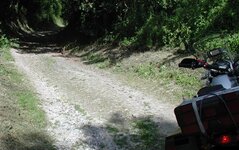
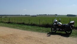
Blowzorn and I got there yesterday evening and although the water level had gone down quite a bit since last time I was there...Clive said:I can well believe it - I got caught out on an earlier bit of the Ridgeway with a "puddle" that was much deeper than it looked - I had a good poke around with a stick when I got to "Barbury Lake" - and then went around it like everyone else appeared to have done anyway - hardcore

")
Clive said:Blowzorn and I got there yesterday evening and although the water level had gone down quite a bit since last time I was there...
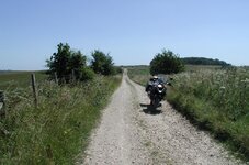
I said "This might be deep so I'm going around it on the left".
Blowzorn said "I'm going around it on the right - that way looks easier" and off he went.
Sod's law took effect
I had to ride through the lake anyway then to help him pick the bike up

CliveClive said:The basic route...
I've only entered the waypoints so far - when I finish the proper route I'll post it up on this thread - I'll try and remember to put it in GPX format which you should be able to read.Perryhill said:In case I can't, could you let me have a copy of your GPS file (I have a Quest but it must be possible to read other files) or is it posted somewhere else on this forum?

")
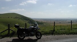
Just to clarify - the day will be a road ride of approx 150 miles.Clive said:There are a couple of (optional) green lane (Ridgeway) sections in the Avebury area that I can incorporate into the route as required.
My guess is that we'll be back in Hungerford around 4pmblues n twos said:I would like to come along on this one... what sort of time will you be finished as on a 7pm start night shift at work near Heathrow
Clive said:My guess is that we'll be back in Hungerford around 4pm