With Aldgate behind us, we can wander along, just looking at the buildings:
View attachment 522372
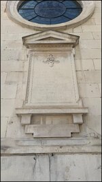
All over City there are blue plaques, recording what used to stand on the site. It’s got me wondering whether there is a list of them? If so, I’ll get it and try to see them all.
View attachment 522373
If nothing else, a little Google tells you about the livery company that occupied the site:
The guild was first chartered in 1568. For Tyler, read Tiler not Taylor, and the connection makes sense. The 1666 Great Fire of London initially appeared to be good for the Company due to a Royal Proclamation regarding rebuilding work and requiring the use of bricks and tiles instead of timber...

www.londonremembers.com
Of course buildings today are much less reliant on tylers and bricklayers. This is the redevelopment of the site of the former Commercial Union building. The building encased in white will, when finished, be enormous at 310 metres tall (the same height as The Shard) and - along with The Shard - be the joint tallest building in Western Europe:
View attachment 522374
They were busy testing the driverless cars:
View attachment 522375
On past the Gherhkin, which now looks small compared with its neighbours:
View attachment 522376
I have worked in the City for over half my life. I can remember the Nat West tower being topped off. It used to dominate the City but now, like the Gherkin, it is dwarfed by the new structures:
View attachment 522377
But, as it’s the City (and London) the old continues to meet the new. This is St Helen’s church, the site being a church from around the year 1210:
View attachment 522378
It also serves as a church for the new influx of Chinese residents:
View attachment 522379
Building, history, VR, 3D

www.st-helens.org.uk
Gate 2 - Bishopsgate
We are now getting close to the site of the Bishops Gate and can stand near enough where it stood:
View attachment 522381
Bishopsgate was the original gate of London on the road heading in the direction of Lincoln and the north-east of England.

www.thehistoryoflondon.co.uk
Then turn westwards to follow the line of the wall, along the modern road (London Wall):
View attachment 522383
View attachment 522382