Dave Ford
Registered user
Back in 2009 I put together a reasonably long RR based on a trip I’d done to Romania and Bulgaria – it was entitled “Long Way to Work”. This trip turned out to be a life-changing experience for me, as it resulted in me getting divorced and ending up living in Romania with my partner, Gabi. Given the importance of the trip, I was more than a little pissed off when the nearly 200 photographs disappeared due to those twats at Photobucket. So, given that it was 35 Celsius over the weekend and Gabi had abandoned me to go and see the Red Hot Chilli Peppers with her daughter, I decided I’d recreate the post (for my own benefit – a kind of therapy). And here it is. Apart from correcting a few typos, it’s as I originally drafted it, with (hopefully) exactly the same photo’s (which now reside on Flickr).
Hard to believe that it was almost eight years ago...
Disclaimer: this trip report is very picture intensive, and they’re not award-winning quality pictures. Nor does this report describe a particularly adventurous trip, or provide profound words of wisdom. However the trip that it describes trip was hugely important to me, and as such I wanted to write it up and share the photographs.
I first visited Romania and Bulgaria back in 1994 and have now lost count of the number of times I’ve travelled to the two countries; certainly more than a hundred, and always by air. Even before returning to biking two years ago I had begun to have ideas about a trip that would take in the two countries and visit the subsidiary companies for which I have responsibility.
Preliminary plans for a trip in September 2008 failed to materialise and the timing was postponed until spring of this year. An accident in January that resulted in a Category D write-off and my arm in plaster for two months caused further delays. Eventually I settled on early September and started to do some more detailed planning. The first thing that struck me was just how bloody far it was. I’d somehow got an idea in my head that I would spend a week on the round trip, which would include at least one full day in Bucharest and another in Sofia. Add in a day to travel between the two capital cities and it becomes clear that a seven or eight day trip would allow little or no opportunity to do anything other than long distance commuting. So the schedule extended to 13 nights, which would give me sufficient time to take in some of the more interesting parts of Romania, the Adriatic coast of Croatia and the Stelvio Pass.
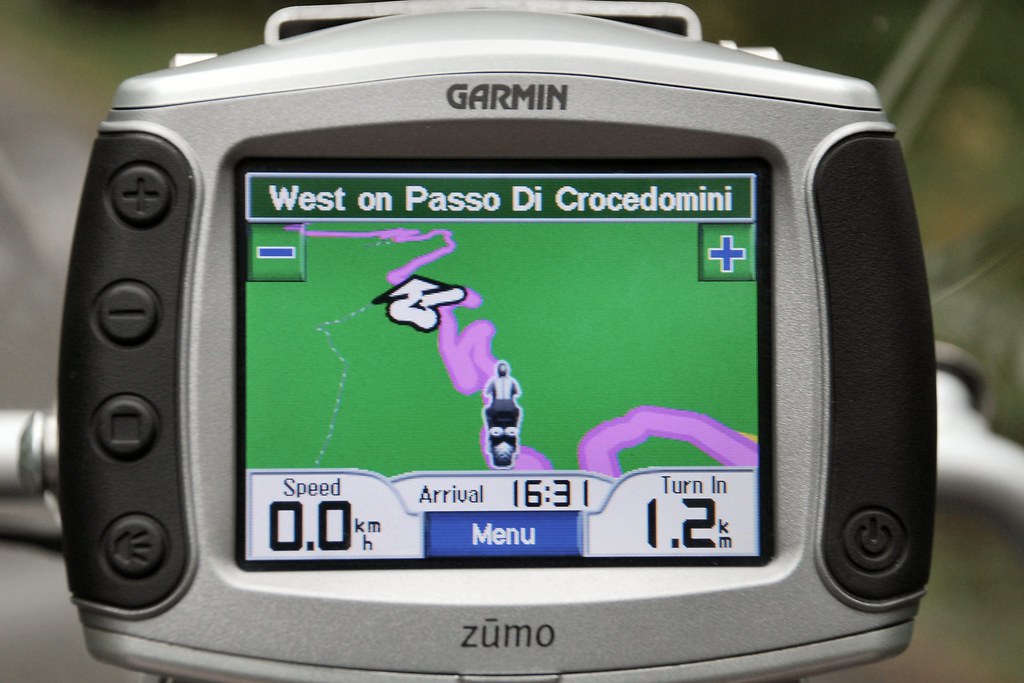
I undertook some fairly detailed route and schedule planning. According to the Zumo and Mapsource, the total distance would be around 4,200 miles. Taking into account the fact that four of the 14 days would be “lost” due to spending time in the two offices, I would need to average more than 400 miles per day. By no means impossible. But such a schedule, coupled with the fact that I wanted some time to enjoy the places through which I was travelling meant that I didn’t want to waste time planning routes each morning or looking for accommodation each evening, so routes were planned and hotels booked in advance.
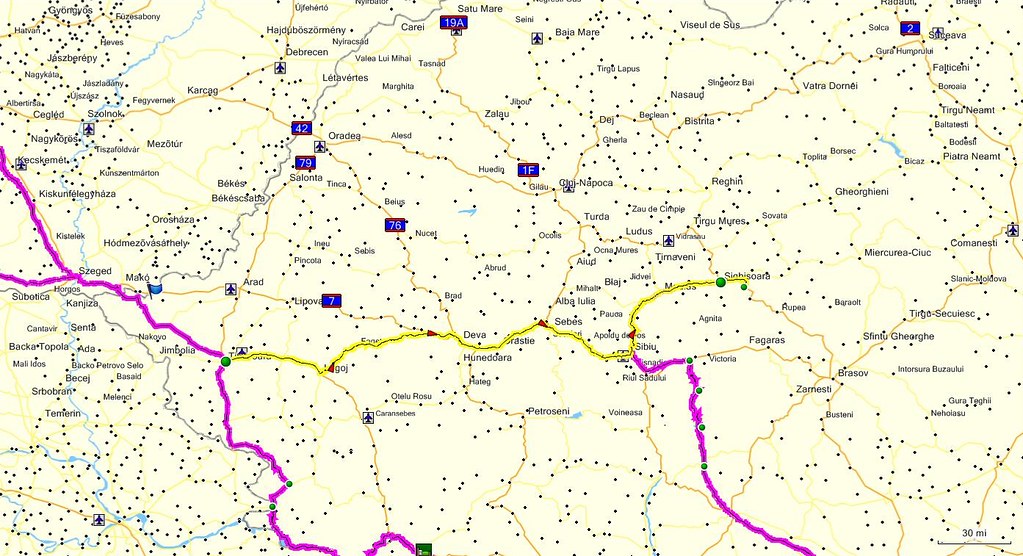
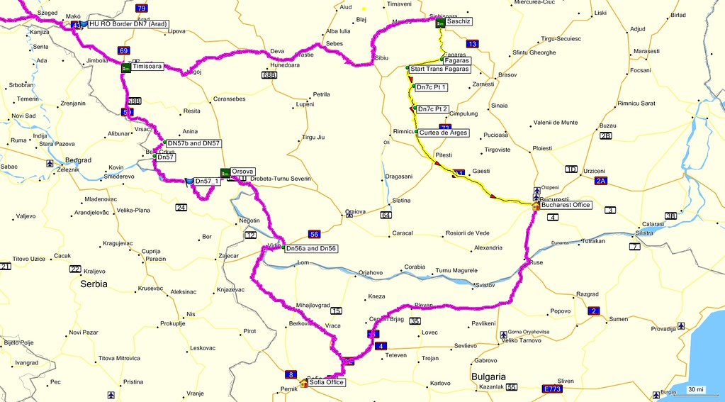
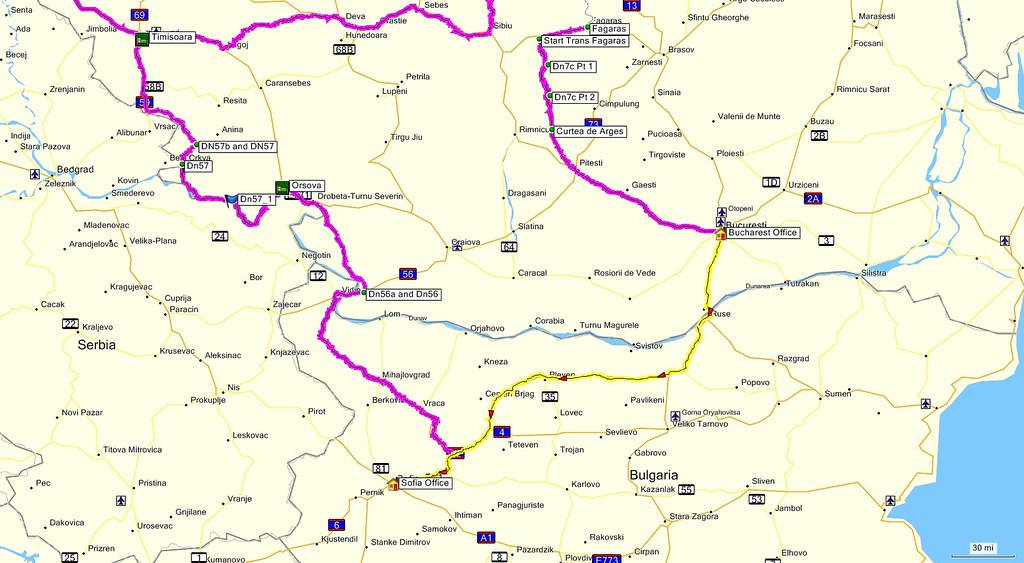
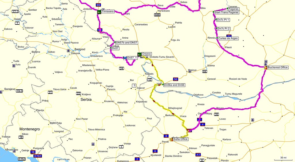
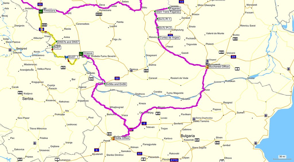
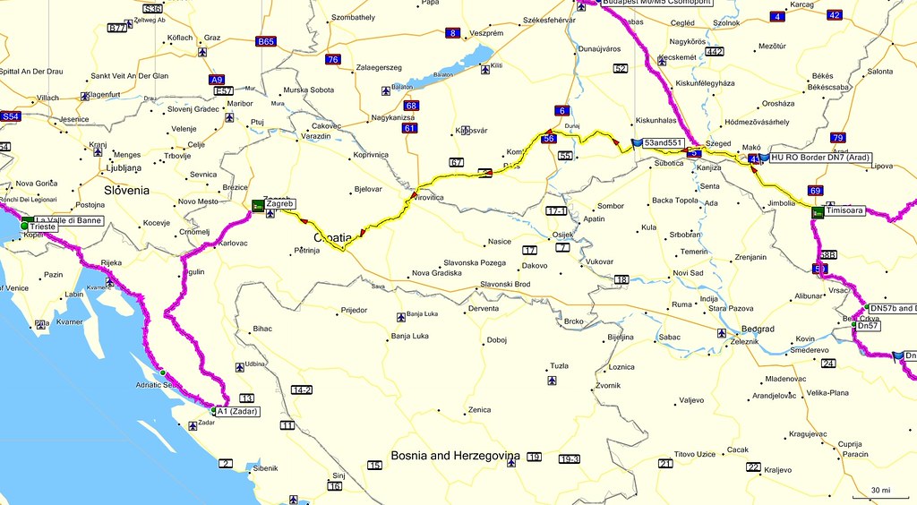
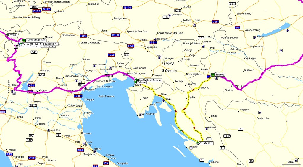
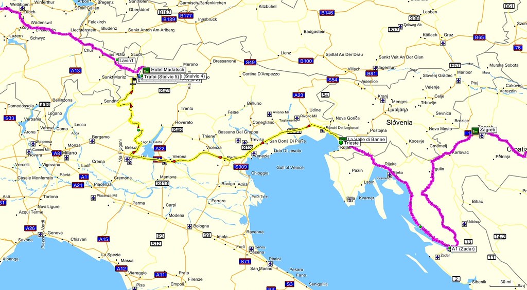
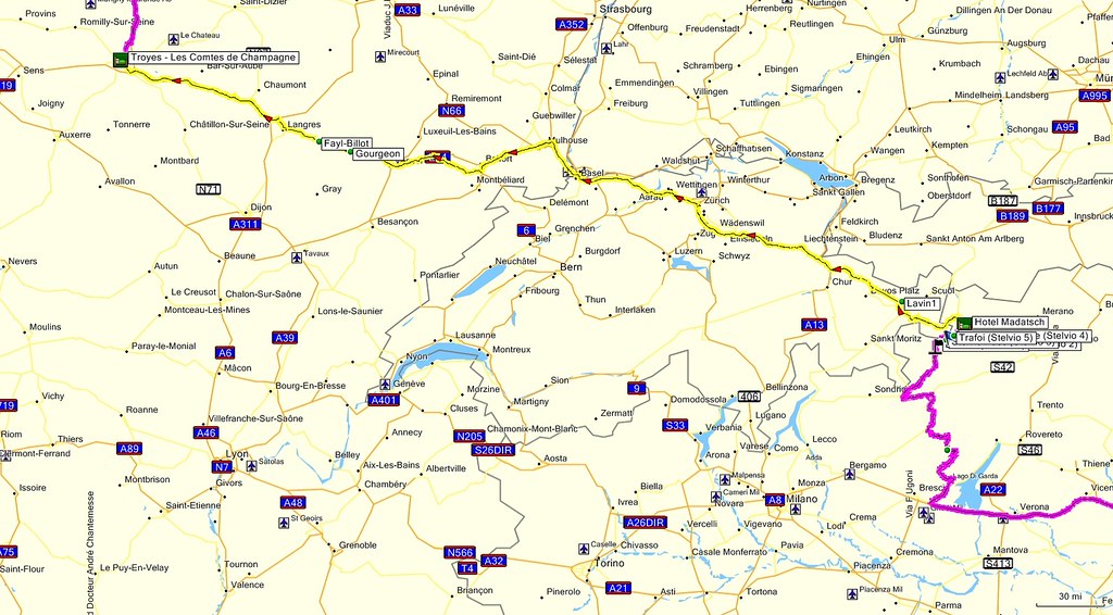
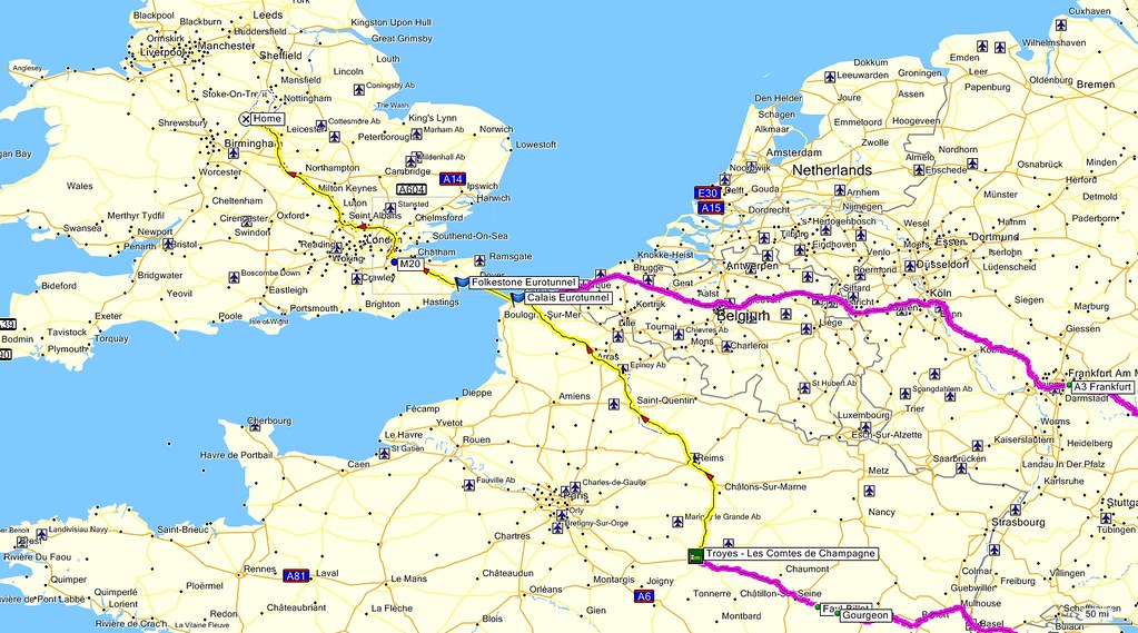
The route (done in a clockwise direction):
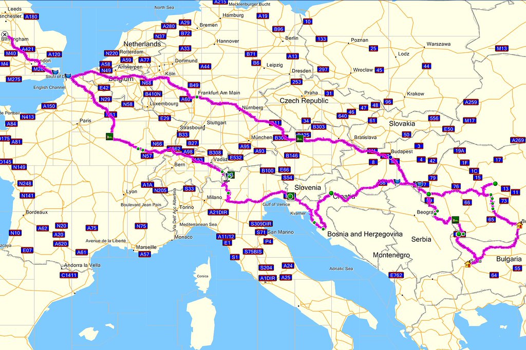
The original plan involved a more direct route from Sofia to Zadar (on the Croatian coast) through Serbia and Bosnia. However on checking my insurance cover I found that these two countries were specifically excluded and E-Bike do not issue green cards of any description. Although I was advised that it was usual to purchase insurance at the border to Serbia, I took the view that, given the relatively tight schedule, I couldn’t afford the risk of losing a day due to insurance problems at either the Serbian and/or Bosnian borders. Hence the rather roundabout route from Sofia, back into Romania and Hungary, into Croatia.
Day 1 – Friday 4th September, Burton upon Trent – Ansfelden, 898 miles
I wanted to make it to Romania as quickly as reasonably possible (two days). Day 1 was the most difficult of the whole trip – 900 miles plus crossing the channel. My most “ambitious” journey prior to this had been to Dublin. I really had no idea how I was going to find it.
A very early start in order to be at Folkestone for the 0620 train.

Emerged at Calais at 0800. Within 15 minutes it started to rain and hardly stopped during the subsequent 12 hour journey to Ansfelden in Austria. I’d been looking forward to easy high-speed cruising on the famous autobahns – the reality turned out to be miles of filtering through stationary or slow-moving traffic at what seemed like interminable road works – the fact that it was Friday afternoon didn’t help. Stayed in characterless “C and C” motel at the side of the motorway. C and C evidently stands for Cheap and Chic – not my idea of “chic”, but I was in no state to argue, nor did I care.
First use of gaffer tape, in an attempt to dry a thoroughly soaked boot, while I went out in search of drink and food.
Day 2 – Saturday 5th September, Ansfelden - Timișoara, 440 miles
A relatively easy day – several hours of effortless motorway cruising in very light weekend traffic. Eventually arrived at the Hungarian border – this was the first recognisable border crossing since arriving on the continent. Stopped to buy a vignette…
…having managed to forget that I’d bought one online a couple of weeks previously!
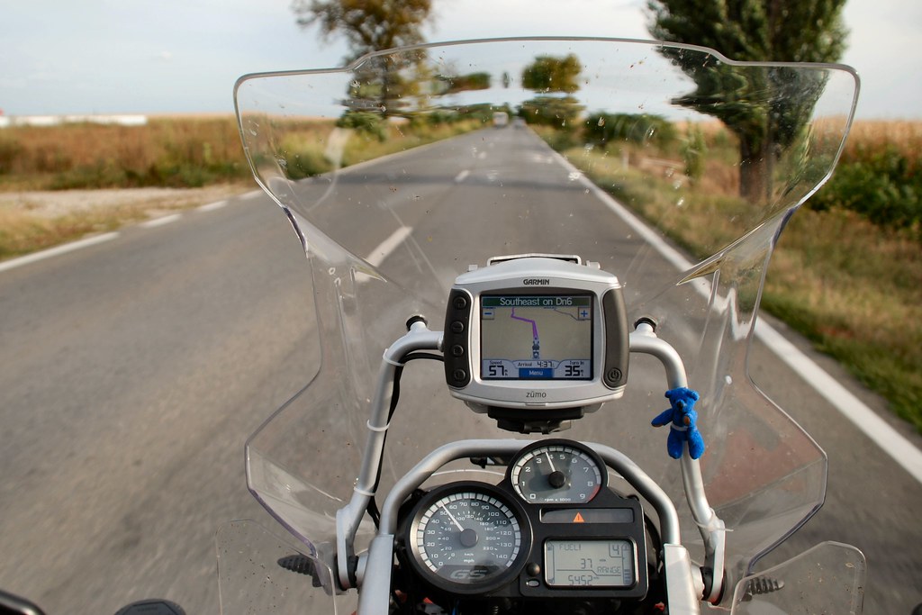
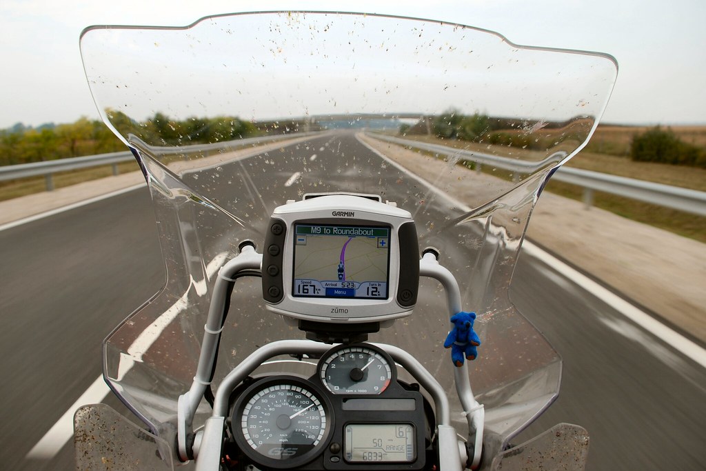
Soon I had crossed into Romania and was heading for Timișoara on the DN6. It’s difficult to describe how I felt at this point. After talking about returning to biking for more than ten years and then dreaming that one day I’d ride to Romania, I’d finally done it. I recognise that this may seem trivial to many on this site, but it was hugely significant to me, so much so that I had to capture the moment:
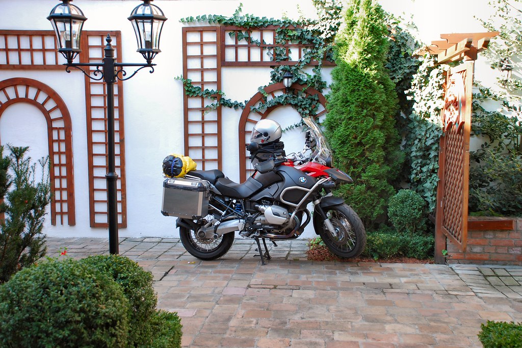
Spent the Saturday night at the delightful Casa del Sole (www.casadelsole.ro - highly recommended) in Timișoara, where I was able to park the bike in the garden:
I’d heard a lot about Timișoara and had planned to explore it on the Saturday evening, but have to confess that I never made it out of the hotel garden and its bar and restaurant.
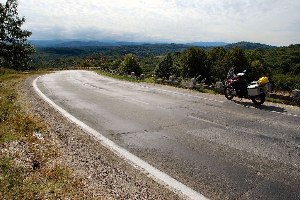
Day 3 – Sunday 6th September, Timisoara – Sibiu – Sighisoara – Saschiz, 241 miles
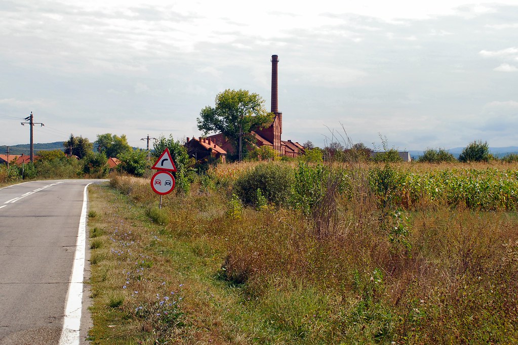
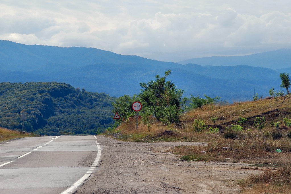
In undertaking the planning for this trip I’d made contact with Gavin Bell of this parish, now a resident of Transylvania, and he’d kindly suggested that I visit him in Saschiz, one of the “Saxon villages” of Transylvania. Set off from Timisoara on Sunday morning. As I was travelling between Sibiu and Sighișoara I found myself approaching this place:
Somehow, even from a distance, this place seemed special. It turned out to be Copșa Mică, about which I’d heard much over the years. It was well known as one of the most polluted sites in Central and East Europe and the Former Soviet Union, as a result of a plant for producing carbon black, and if that wasn’t enough, a lead smelter (Sometră). The carbon black factory produced highly visible pollution. Compare the aerial photograph on the left, from 1986 when the plant was in production, to the one on the right, taken in 2004 after the plant had closed.
If this pollution of the local landscape wasn’t bad enough, Sometră produced much less visible, but far more insidious, pollution that caused impotence and lung disease. Life expectancy in Copșa Mică was nine years below the average for Romania – not a good place to be born.
From a distance it looks just like another town in the countryside…
And with countryside like this, it’s soon forgotten:
Had to stop at a level crossing:
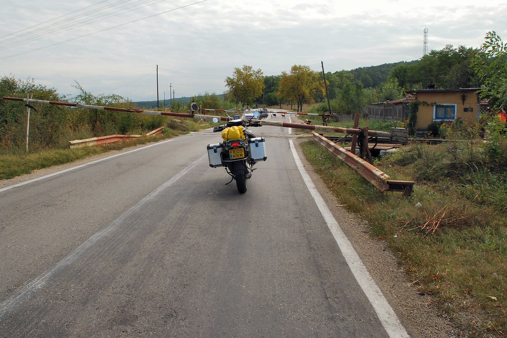
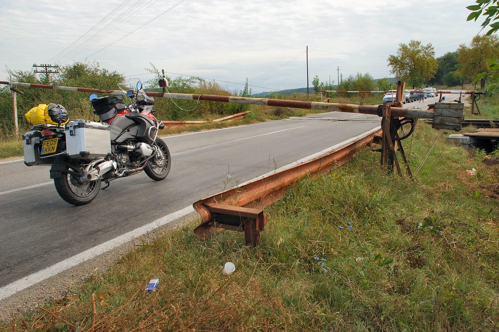
Complete with suitably attired official
Gave me the opportunity to inspect the state of the infrastructure. Yet again I marvelled at the attitude to workmanship and standards that one comes across so often in Romania. The (white) cable to the lamp on the barrier had obviously been recently replaced – but whoever did it must have worked hard to achieve such an appalling standard….
Sighișoara, and particularly its cetate (fortress), is well worth seeing:
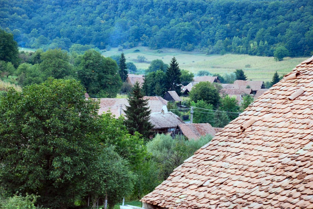
From Sighișoara it was a short ride to Saschiz, complete with its UNESCO World Heritage Site status fortified church:
 Bike Trip 060909 066 by David Ford, on Flickr
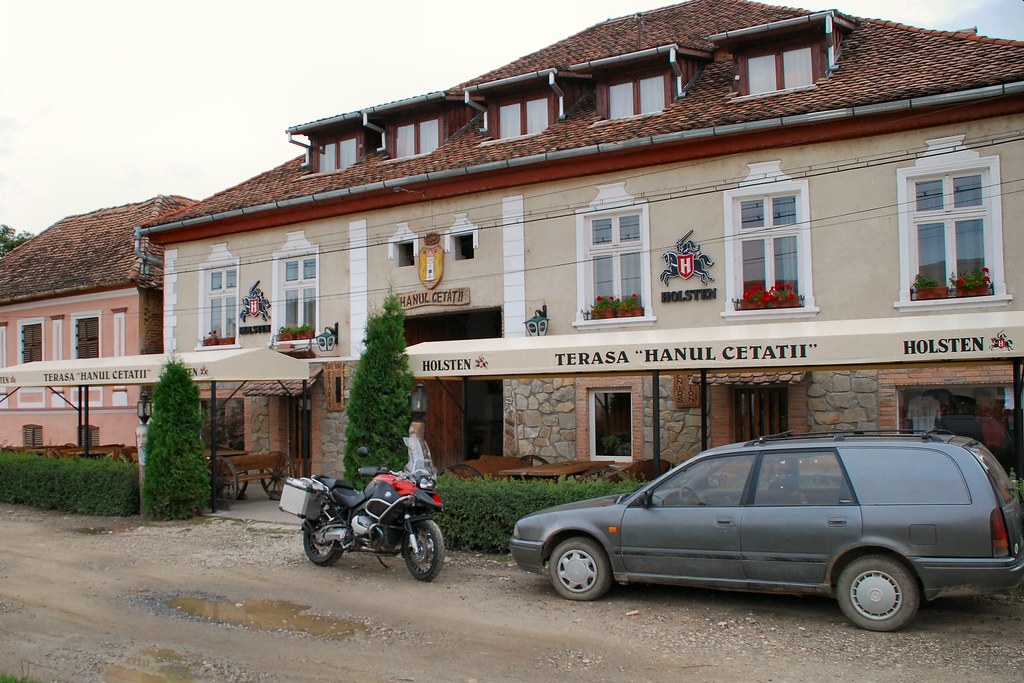
Checked into the local pensiune and unloaded the bike:
Pensiune had a nice courtyard at the rear:
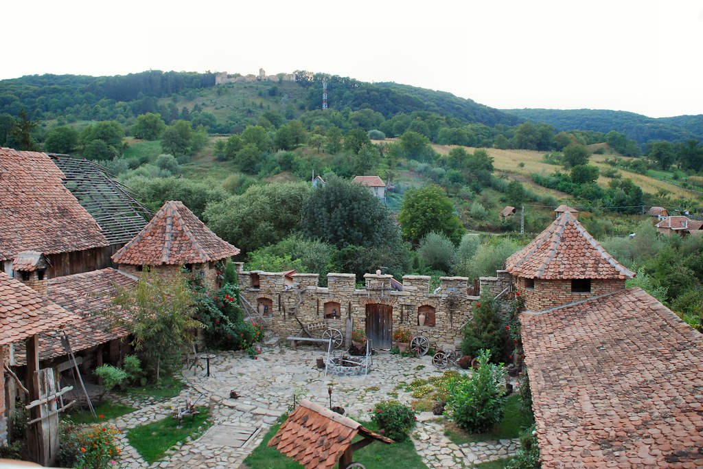
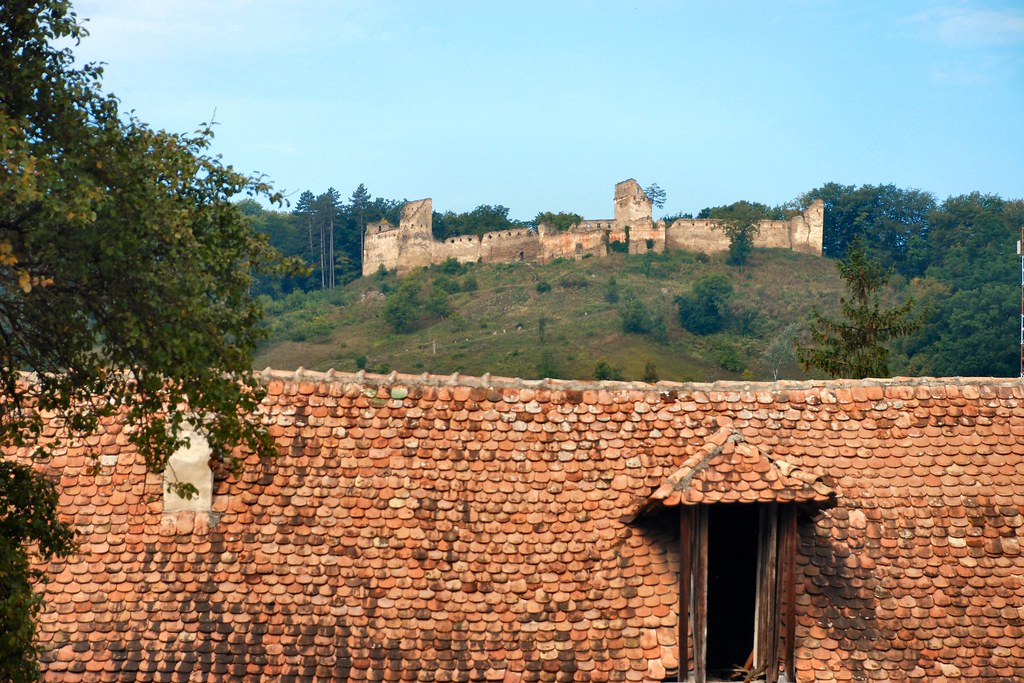
In the distance was the citadel where, in the past, the peasants would seek protection from marauding Turkish raiders:
Spent the evening with Gavin and his wife Andreea. Gavin runs an NGO (see www.fundatia-adept.org) devoted to sustainable development in this beautiful part of Transylvania. However on Sunday evenings he sometimes moonlights in the local wool industry, where he holds a key position (sorry Gavin!):
Though I was able to do it without relying on a wall for support:
At least a local mother and daughter seemed to appreciate my efforts:
Even the bike had company for the night:
Seriously, a great evening – thanks Gavin and Andreea.
Day 4 – Monday 7th September, Saschiz - Bucharest, approximately 220 miles
Next morning, from my bedroom window, a scene that probably hasn’t changed (OK – apart from the power lines) in more than a hundred years:
Today I had to get to Bucharest. The sensible route would have been on national roads via Brașov. However this day I was going to tick off another ambition, and travel the Transfăgărășan. The “Transfag” is Romania’s Stelvio, with Dolomites replaced by Carpathians. The commonly accepted story is that that Ceausescu had it constructed as a route for moving troops in the event of a Soviet invasion of Romania. According to Wikipedia:
The road was constructed between 1970 and 1974, during the rule of Nicolae Ceauşescu. It came as a response to the 1968 invasion of Czechoslovakia by the Soviet Union. Ceausescu wanted to ensure quick military access across the mountains in the event the Soviets attempted a similar move into Romania. Consequently, the road was built mainly with military forces, at a high cost both financially and from a human standpoint—roughly 6 million kilograms of dynamite were used on the northern face, and about 40 soldiers lost their lives in building accidents.
[Also on same Wikipedia entry: In September 2009 the cast and crew of the British television show Top Gear were seen filming along the road. The segment will appear in Series 14, Episode 1 on November 15, 2009.]
Whilst I’m certainly no historian, I do wonder about this - I’m tempted to think that the road was another of Ceausescu’s insane schemes designed to satisfy his ego.
Gavin was travelling to Brașov and agreed to lead me cross country as far as the town of Făgăraș. So off we set on roads that, although surfaced, do not appear on the standard Zumo 550 City Navigator map product. No other traffic of which to speak, and beautiful, unspoilt countryside:
Some “modest” houses, but note satellite dishes:
Approaching what appears to be an ordinary village…
With “modest” main street:
Except that this village contains a house that belongs to a member of the British royal family...
We stopped for a coffee:
Off again – have long wanted to take a photo like this:
Interesting road conditions:
Approaching Făgăraș - nice waste dump:
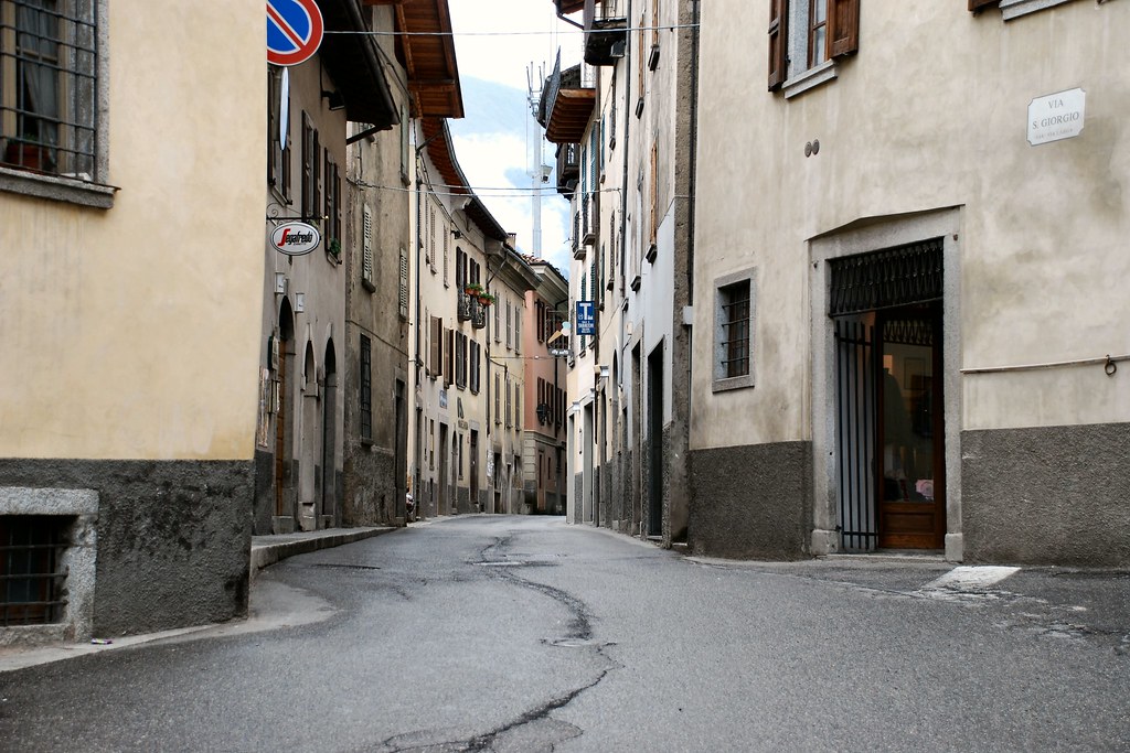
And into the town (the centre’s nicer!):
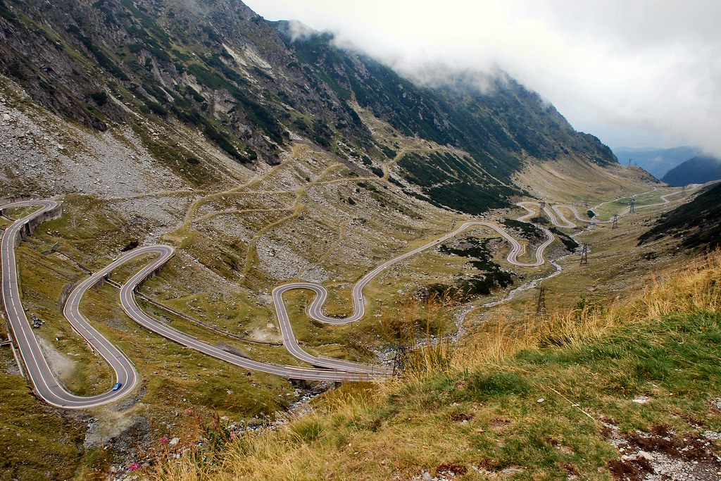
Said goodbye to Gavin and Andreea in Făgăraș, then headed west on DN1. To my left I could see the Carpathians, with the peaks in the clouds. The DN7C, the Transfăgărășan, was up there somewhere:
Soon found the turning and started heading south, and upwards:
I soon knew that I was in for something very special:
Fortunately the route was deschis (open):

As I continued to climb the road and the views became more and more spectacular:
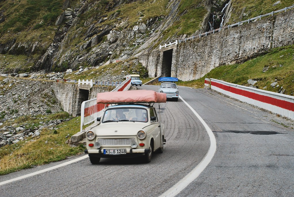
Came across these three Trabants on German plates – respect!
Looking back down the valley:
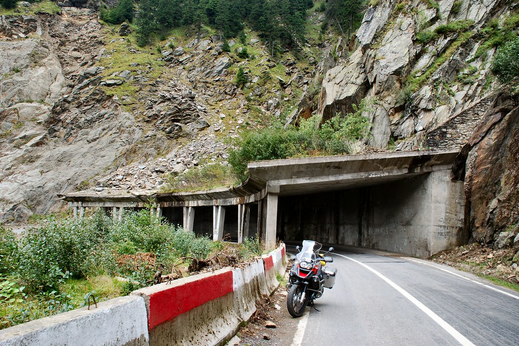
At the highest point the Transfăgărășan becomes a tunnel. If, like me you’re doing from north to south, you enter the tunnel in Brașov County…
…and emerge in Argeș County:
Starting the descent – probably not good for nervous pillions:

The Argeș side is less extreme…
…but still superb:
Show due consideration for other road users:

At the summit the temperature had been only 5°C, compared to around 20°C in Făgăraș. The temperature was climbing nicely as I continued the descent. And then, as I emerged from yet another bend, I came across a couple of Argeș residents who lived in the woods….
The guy in the BMW had already stopped and was out of the car. I stayed on the bike, with the engine running:
Might be time to get back in the car (not that the window glass would have offered much protection):
Time for me to back off a little:
“Well it was like this officer – I came round a bend and there was this f***ing bear in the middle of the road….”
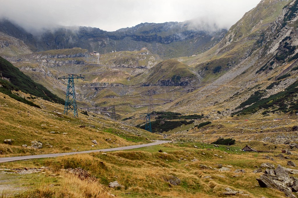
Time to press on – next stop Lacul Vidraru…
…and its dam:
The road runs along the dam wall…
…before entering a tunnel. More sheep:
Gave the sheep a few minutes to get clear, before continuing. Five minutes later…
From then on it was an uneventful ride to Pitești and then onto Romania’s only motorway from Pitești to Bucharest.
Day 5 – Tuesday 8th September, Bucharest
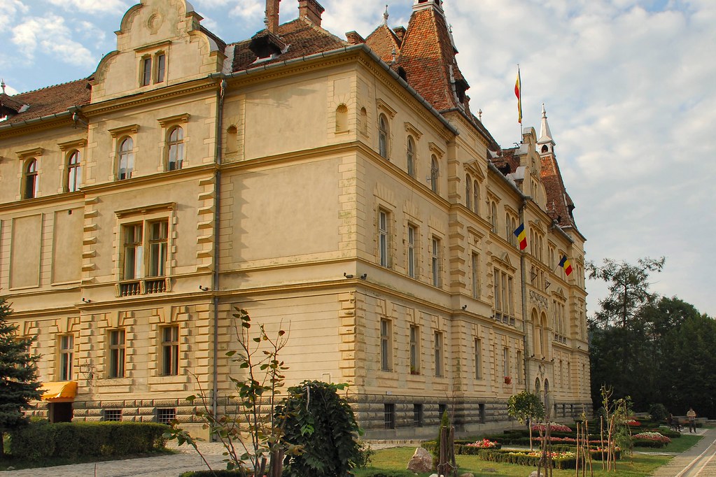
Rode the bike to the Bucharest office – another minor ambition achieved:
Tried to persuade one of the staff to join me for the rest of the trip, but to no avail:
Day 6 – Wednesday 9th September, Bucharest – Sofia, 237 miles
A pleasant but uneventful journey, south from Bucharest to Giurgiu, across the Danube into Ruse on the Bulgarian side, then south-west to Sofia. Arrived at Hotel Downtown (www.hotel-downtown.net - thoroughly recommended) and parked the bike on the pavement outside.
Another attempt to talk one of my colleagues into joining me for the remainder of the journey....
Day 8 – Friday 11th September, Sofia – Orșova, 222 miles
In order to avoid a long detour back to the Ruse-Giurgiu bridge, I planned to cross the Danube back into Romania by means of the Vidin-Calafat ferry. Enquiries revealed that there was no timetable – the ferry left when it was full, but I shouldn’t have wait “more than four hours”.
Had a delightful ride up from Sofia, north through Vratsa, Montana and Dimovo:
Then the mighty Danube was in front of me again:
Procedures at the Vidin ferry terminal are best described as “relaxed” and the facilities as “limited”:
My fears about a four-hour wait were unfounded - within an hour we were boarding:
I was directed to a place near the bows, where I was able to admire the minimalist approach to safety barriers and guard rails…
As we crossed, I reflected that Rotterdam need not feel too threatened by the “Port of Vidin North”:
Nor by the Port of Calafat on the Romanian side for that matter:
Back on Romanian soil (well, concrete):
Heading north from Calafat towards Drobeta-Turnu Severin, on recently rehabilitated roads – bends to die for. Note heavy traffic!
Finally alongside the Danube again, with Serbia on the far side and the Iron Gates hydro-electric power station in the distance:
Now, that’s what I call a hydro-electric plant:
And that’s what I call a river:
Spent the night here:
Day 9 – Saturday 12th September, Orșova - Timisoara, 179 miles
This was to be another highlight – riding the DN57 along the Danube Gorges:
Whilst the scenery was spectacular, the road conditions started to deteriorate...
...and went from bad (this is a national road)…
…to worse:
In fact it was mile after mile of roadworks and temporary traffic lights. I was lucky I was doing this on a Saturday with very little traffic and no HGVs, otherwise it would have been a nightmare.
Romania’s answer to Mount Rushmore – it’s Decebal, famous Dacian king who fought against the Romans in the first and second centuries AD (wouldn’t you look pissed-off if the Government allowed the road at which you had to stare to deteriorate to such a condition?)
Back to Casa del Sole in Timisoara. It was very hard to believe that it was only eight days since I’d stayed here:
Day 10 – Sunday 13th September, Timisoara - Zagreb, 344 miles
After a few days of taking it fairly easy. time to get back to business – 300+ miles with little or no motorway. Started the day with a quick look around Timisoara as it woke up on a Sunday morning:
As I drank an early morning coffee I reflected on the reasons why I love Romania and how the trip had exceeded all my hopes and expectations.
Then it was back to the border at Cenad and soon I was making the most of Hungary’s great roads:
Not much of particular interest, except this:
Made it safely to Zagreb. I had no preconceptions, but the old centre is beautiful. Unfortunately camera was left in hotel room.
Day 11 – Monday 14th September, Zagreb - Trieste, 322 miles
I’d mentally divided this day into two halves. Firstly a fairly tedious, but hopefully relatively high-speed, slog to the Adriatic coast at Zadar. Secondly a much more interesting ride up the coast, a few miles through Slovenia, then into Italy and the night’s accommodation just outside Trieste.
Things started well:
Though the weather in the distance was starting to look a little ominous:
And more ominous:
Tunnels gave rise to hope that I might nearing the peaks of the mountains, after which I should see the coast:
The green sign to the right of the entrance says “Sveti Rok 5681 m”:
And sure enough, I was soon at the coast:
But this not quite the view I’d hoped for:
Still, just get on with it:
As I pressed northwards, things started to get brighter:
…and brighter:
Here we go! This was probably the most enjoyable stretch of road on the whole 4,000+ miles journey. Obviously it doesn’t compare with the Transfăgărășan or the Stelvio for the scale of the achievement, the technical hairpins or the breathtaking views. However it was superbly surfaced and seemed to consist of an endless series of bends of varying radius and hence speed. Very little traffic heading north and the little that there was could be safely overtaken at will. When it was over I just wanted to turn round and do it again.
It just got better and better:
Although there was still the odd shower, these were very limited and the surface was soon dry again:
Lots of interesting side roads, which just begged to be explored. Alas, no time:
Some more views:

Finally made it to Trieste where heavy rain quickly wiped any desire to explore. Stayed at <i>La Valle di Banne</i> (<a href="http://www.lavalledibanne.it" target="_blank">www.lavalledibanne.it</a> - another great find). This albergo doesn’t serve dinner, but in view of the pouring rain the proprietor drove me in his own car to his favourite cucina in the next village, and returned to collect me later. Service like that leaves one (well, me at least) feeling good inside.
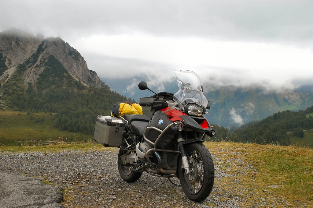
Day 12 – Tuesday 15th September, Trieste – Trafoi, 350 miles
By the end of this day, if all went according to plan, I would be able to look forward to a future in which I could bore people with “When I did the Stelvio Pass”. In planning the route I’d decided to leave the autostrada just after Lake Garda, in the hope of a more interesting, though less direct, route to the beginning of the Stelvio. The morning was taken up with a fairly unpleasant 190 mile slog westwards on the autostrada.
But after turning off, things soon became much more interesting:
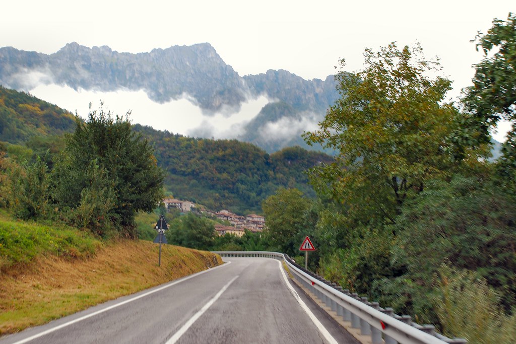
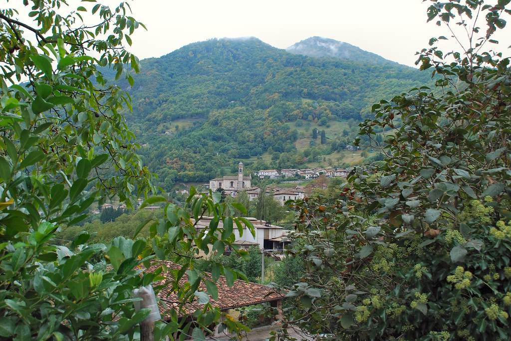
Though it wasn’t all idyllic – some towns seemed quite depressed:
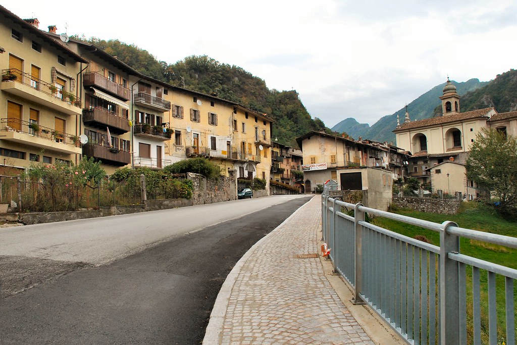
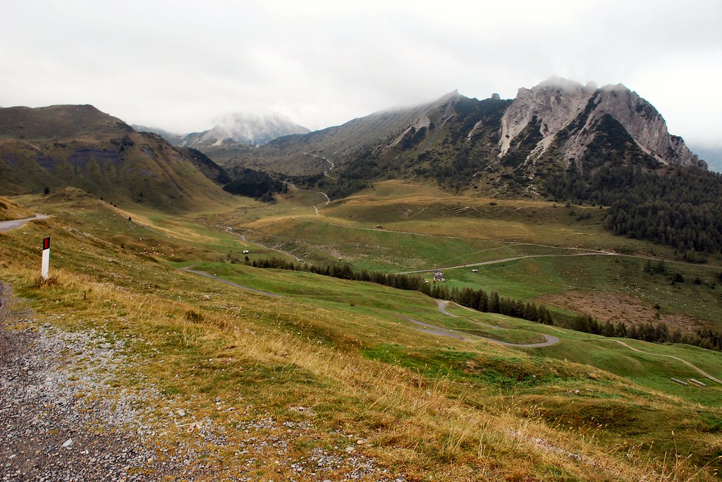
As I pressed on, it just got better and better:
Found myself alongside Lake Idro:
Turned off the main road and started to climb…
...and climb…
...and climb…
...and climb…
Some places would really benefit from a by-pass:
Though a by-pass might mean missing the amazing cemetery:
Idyllic mountain streams, crystal clear and ice cold:
And then it started getting really interesting. For those not familiar with these things, and it had me worried for a while, the strange white arrow on the route is a U-turn indicator, where the hairpin is so tight that the Zumo is confused:
At the top:
And suddenly there’s a beautiful meadow stretched out in front of me, complete with cows with bells:
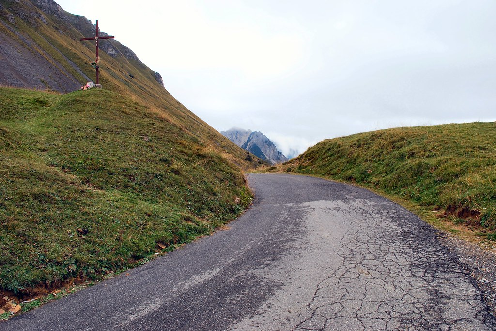
The summit of the pass, complete with cross:
Some more pics:
Just unbelievable, and no sign yet of Stelvio…
Some interesting descents:
Down to a more sensible altitude, and lots of tunnels, but still no Stelvio:
Could this be the start of something?
Oh yes!
Most definitely!
Hopefully you can make out the road switching left right up the hillside to the right of the stream:

Definitely in the right place:
Nearer the summit I pulled up in a lay-by, where a Brit on an ageing Goldwing was already stopped. I made some comment along the lines of it being “f**ing incredible” (or something similarly profound!). He suggested I look over the ledge, indicating the grass ledge at the bottom of the photo below:
So I did:
Attempts at “arty” shots with bike:
The weather was closing in, and I still had to reach the summit:
Shortly afterwards I was at the summit, in thick fog. Bumped into some of the guys doing the “Swiss Alps 2009” tour. It was at this point that the camera battery finally went dead, so no photos of the summit.
Started the descent, then remembered that, in addition to the D80, I had a compact Sony camera buried in a pannier somewhere, and stopped on a hairpin and eventually dug it out.
It was bloody cold:
And it could feel very isolated:
As I descended the visibility improved, until I was at the last hairpin. The sign reads “48° kehre tornante”, which I believe translates as “48 bends remaining” (and every one is a hairpin!)
Accommodation for the night was <i>Hotel Madatsch</i> (<a href="http://www.hotelmadatsch.it" target="_blank">www.hotelmadatsch.it</a> - recommended)
Day 13 – Wednesday 16th September, Trafoi - Troyes, 402 miles
I’d assumed that the low cloud would have cleared, and had intended to return to the summit of Stelvio and then take the road down into Switzerland. A quick glance up the valley convinced me that this was not a good idea. I had a 400 mile journey ahead and couldn’t really afford to waste time. And fog looks the same wherever you are…
However the view in the other direction was hardly encouraging:
Set off down the valley and soon dropped (just) below cloud level:
The 19 km Vereinatunnel is operated by Swiss Railways:
…and operates on the same principles as the Channel Tunnel:
The Gotschnatunnel I don’t really remember, except that it was where I finally managed to take a photo while riding in the dark:
Travelled through some fairy tale Swiss scenery…
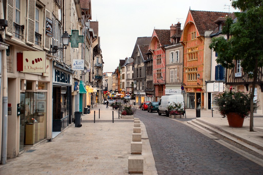
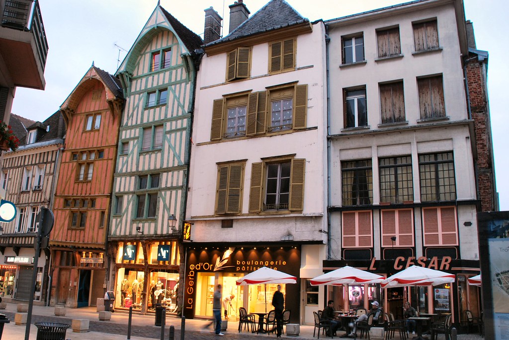
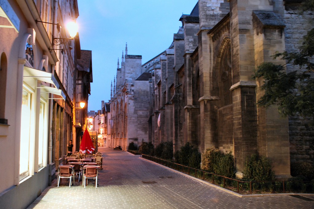
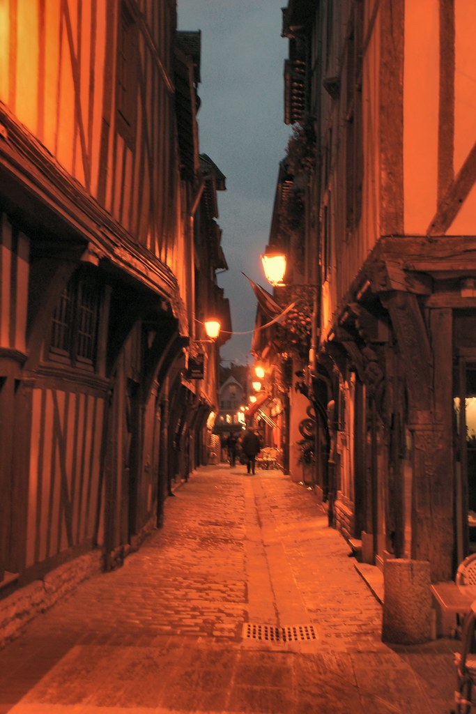
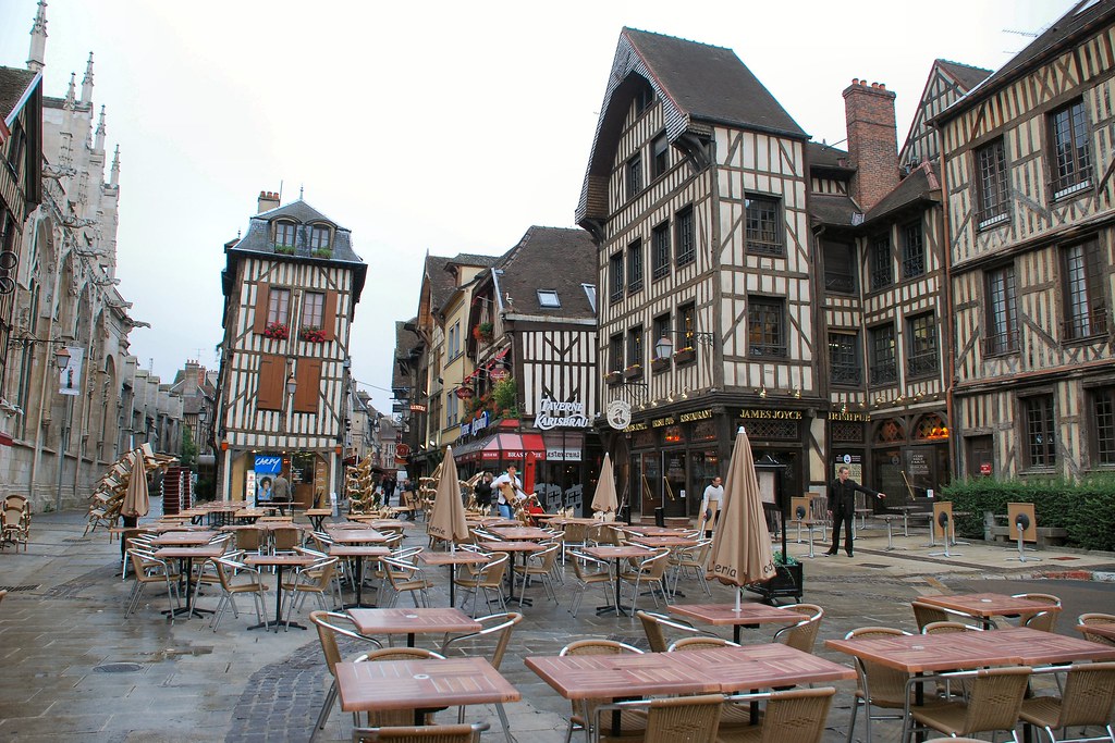
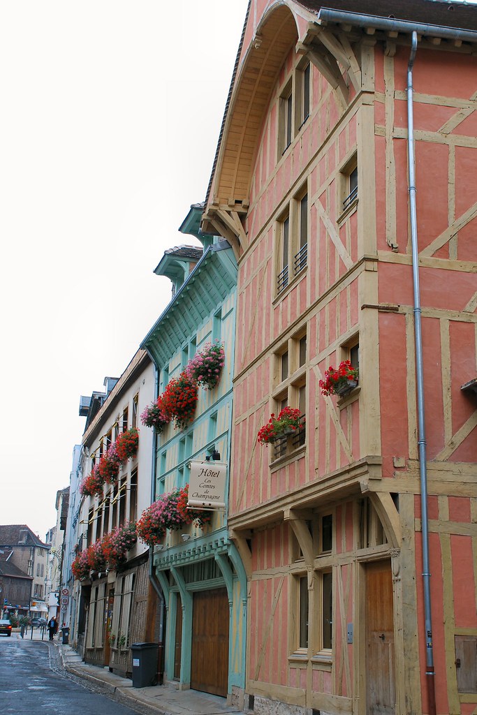
I soon left the A36 for the infinitely preferable N19. I had accommodation booked in Troyes. I’d enquired on this site about accommodation in the Reims area and came across a recommendation for the Hotel Comtes de Champagne (www.comtesdechampagne.com - again highly recommended) in nearby Troyes, which offered garage accommodation for bikes. I must admit to never having heard of Troyes, but it was a small town in roughly the right place, so it seemed that it would suit my purpose. After all, this would be my last night and I just needed somewhere to sleep. Given its evident size, I was a little surprised when I started seeing it signposted while I was still many, many miles away. When I arrived, it became clear why – this is no ordinary provincial French town:
I didn’t have a tripod, hence the poor quality of the ones taken after darkness fell:
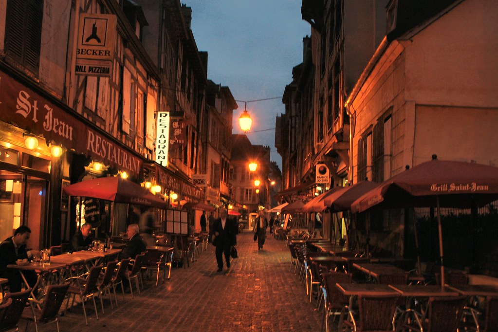
In many ways I had not been looking forward to this last night to the trip. But finding myself in such a beautiful town made all the difference. I thought about how I felt about the whole thing while eating outdoors at one of the restaurants on the photograph immediately above – the word that seemed to best describe it was “privileged”.
Day 14 – Thursday 17th September, Troyes – Burton upon Trent, 444 miles
Being tight, I’d booked the tunnel crossing for after 8pm, so a relaxed schedule. Started with a wander around Troyes:
This is the Town Hall. It was the window boxes that I noticed – how many UK town halls would do the same?
Hotel Comtes de Champagne €53.75 including 500 year old rooms, breakfast and garaging for bike:
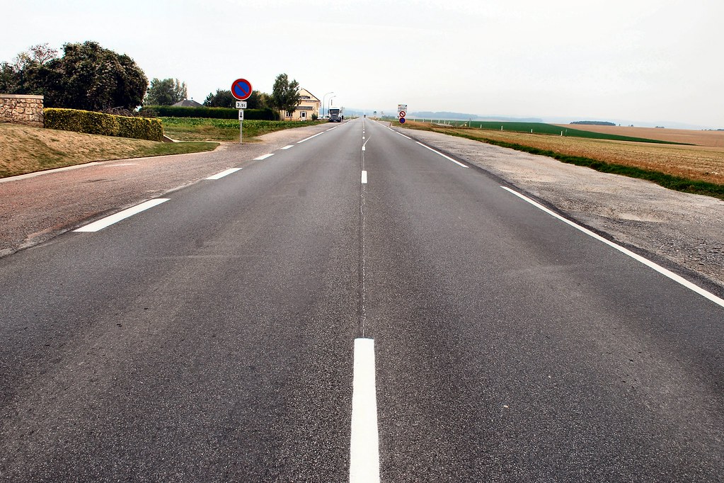
Late morning I set off towards Calais. My planned route basically comprised 250 miles of the A26. After 100 miles or so it became clear that I would be at Calais several hours too early, and that I should be off the motorway and on national roads.
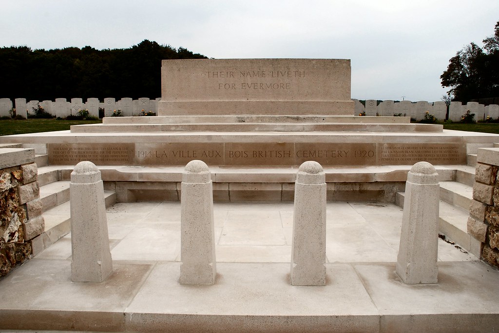
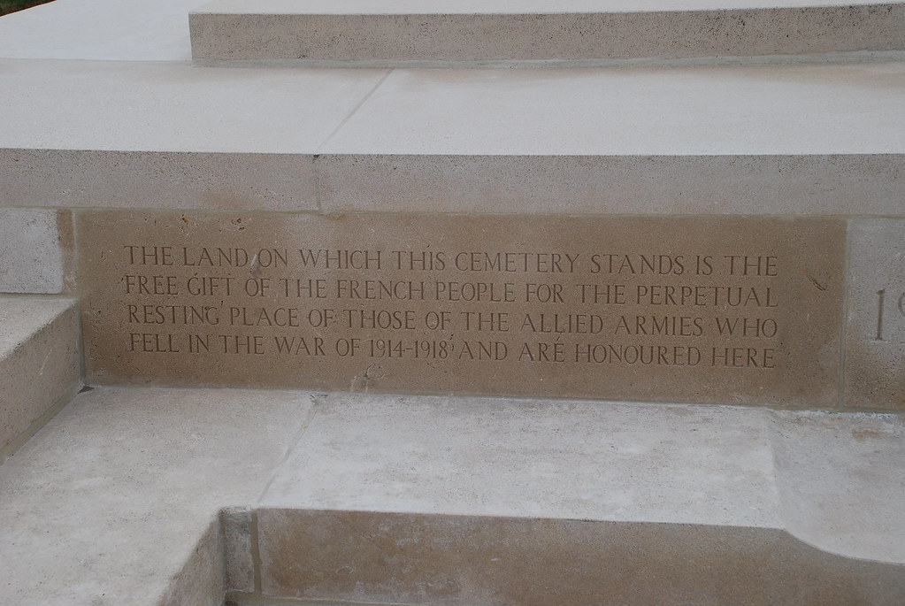
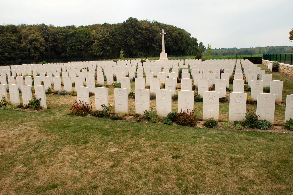
It soon became apparent that I was in First World War battlefield country. La Ville aux Bois British Cemetery – I was surprised how moving I found it.
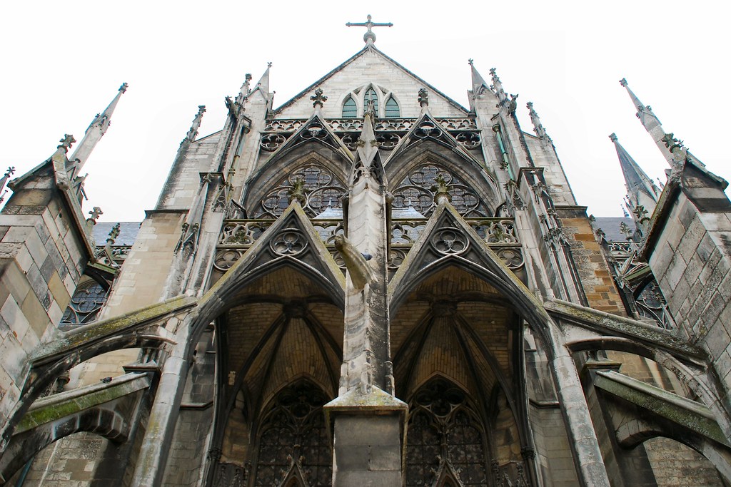
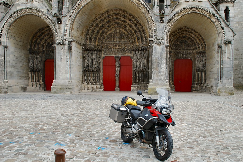
From miles away I could see an odd looking structure on the top of a hill. It turned out to be the town of Laon, and the structure was a magnificent church in the centre of a very old town on the hill. Another unplanned bonus:
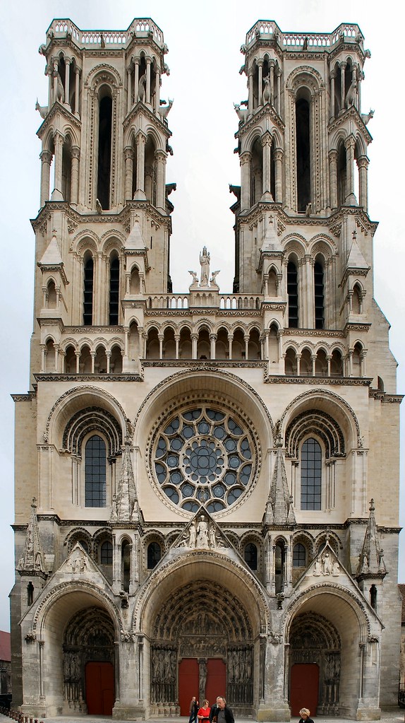
1200 GSA finds God…
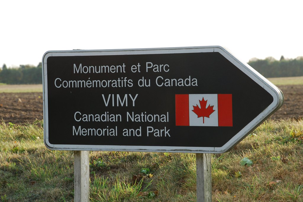
Back on the road I headed towards Cambrai and then Arras – names that will probably forever be associated with the First World War. Somewhere near Arras I saw a sign to Vimy. In the hope of finding the infamous Vimy Ridge, off I went. I was in luck.
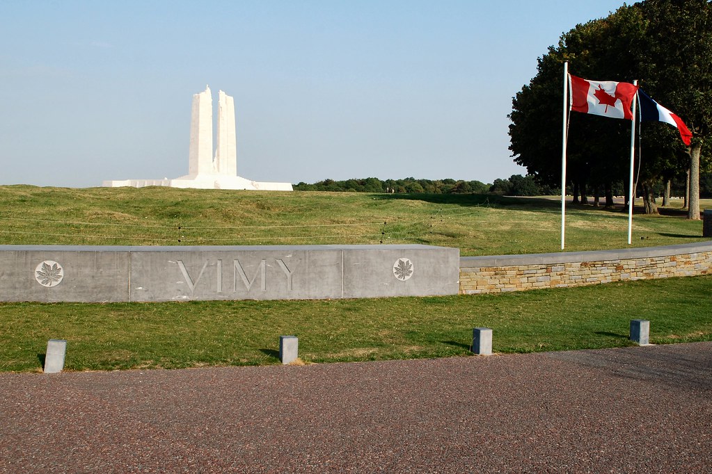
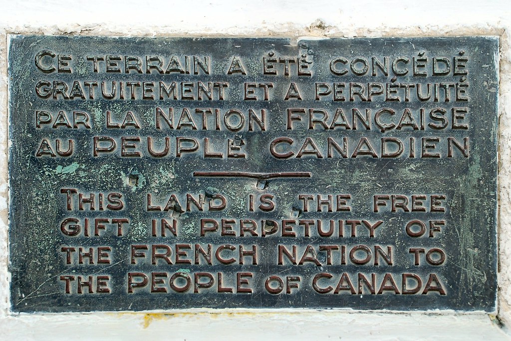
The memorial is truly impressive:
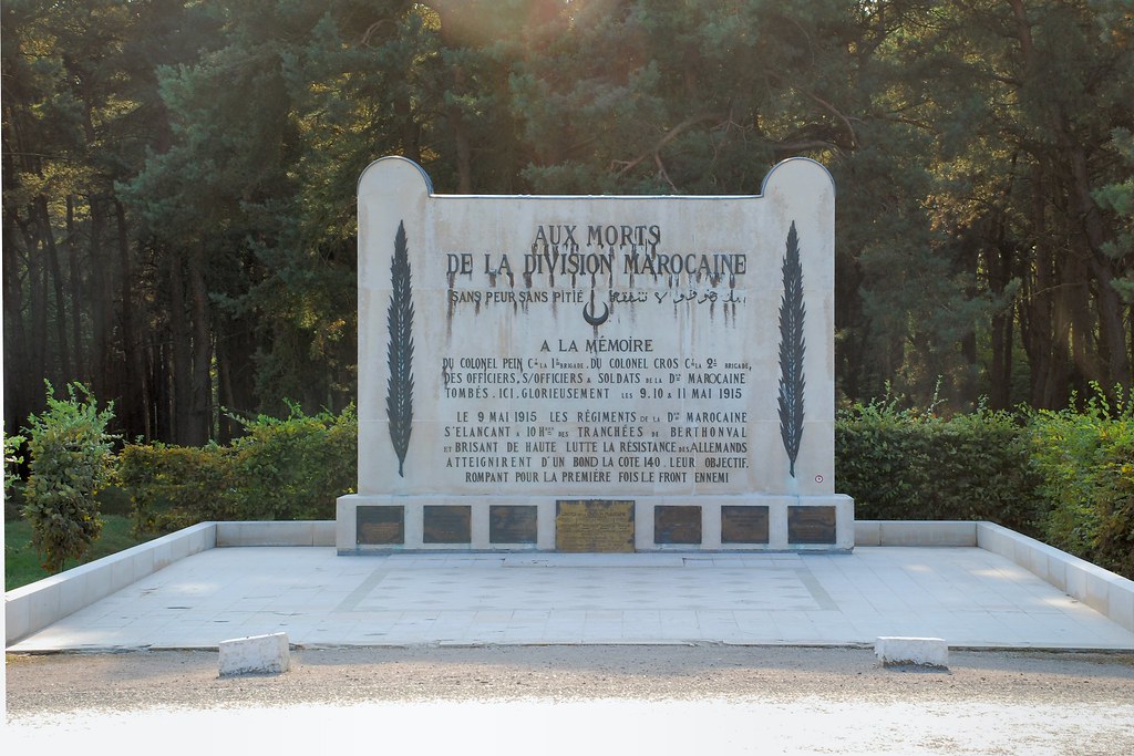
There is also a memorial to the Moroccan Division:
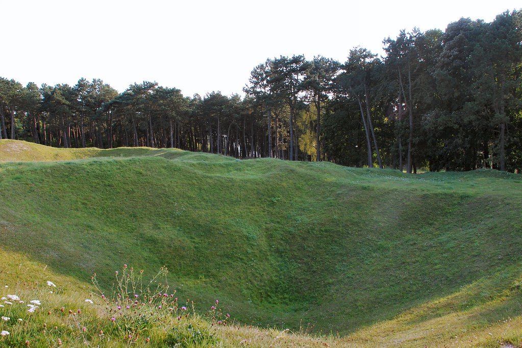
This was my first visit to the site of a concentrated WW1 battle. If it’s like this nearly 100 years later, what must it have been like at the time?
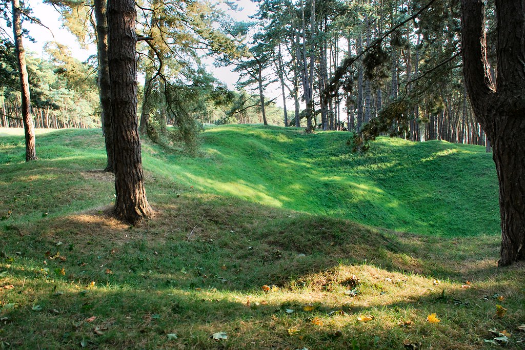
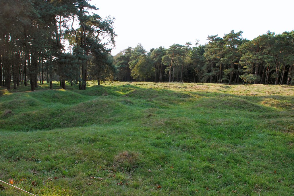
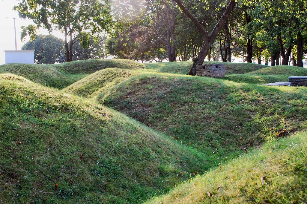
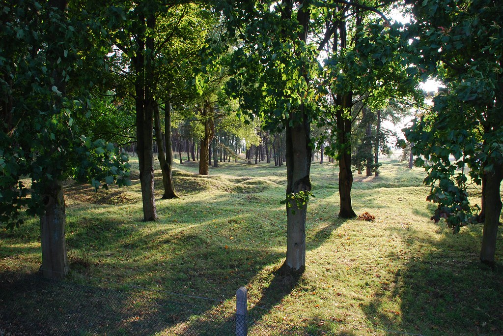
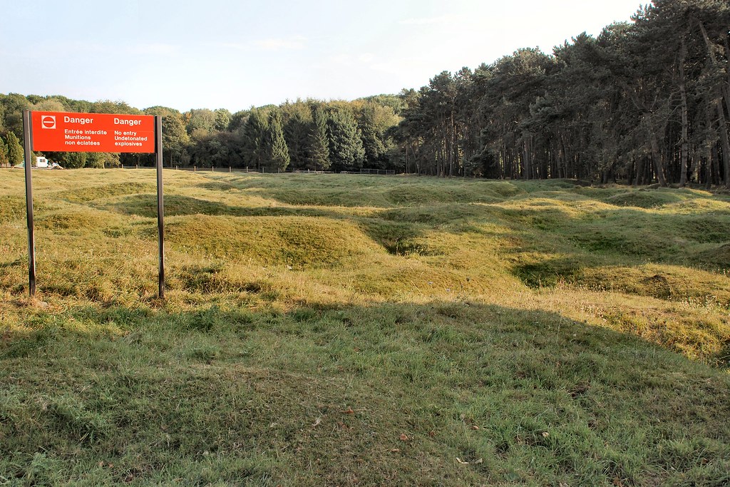
Most of the Vimy Ridge site is inaccessible. The sign reads “Danger No entry Undetonated explosives”:
The state of the ground in the preceding photos is the result of shelling. This is the result of an underground charge being detonated:
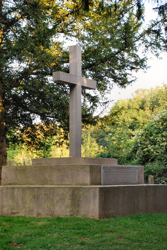
Memorial to the 3rd Canadian Division:
Somehow it seemed fitting and appropriate that the last day of the trip should incorporate somewhere like Vimy Ridge. I’d had the time of my life over the preceding 13 days, and sometimes it’s necessary to remember those that gave their lives in order that people like us are able to have the times of our lives today...
Self portrait on arriving home!
Hard to believe that it was almost eight years ago...
Disclaimer: this trip report is very picture intensive, and they’re not award-winning quality pictures. Nor does this report describe a particularly adventurous trip, or provide profound words of wisdom. However the trip that it describes trip was hugely important to me, and as such I wanted to write it up and share the photographs.
I first visited Romania and Bulgaria back in 1994 and have now lost count of the number of times I’ve travelled to the two countries; certainly more than a hundred, and always by air. Even before returning to biking two years ago I had begun to have ideas about a trip that would take in the two countries and visit the subsidiary companies for which I have responsibility.
Preliminary plans for a trip in September 2008 failed to materialise and the timing was postponed until spring of this year. An accident in January that resulted in a Category D write-off and my arm in plaster for two months caused further delays. Eventually I settled on early September and started to do some more detailed planning. The first thing that struck me was just how bloody far it was. I’d somehow got an idea in my head that I would spend a week on the round trip, which would include at least one full day in Bucharest and another in Sofia. Add in a day to travel between the two capital cities and it becomes clear that a seven or eight day trip would allow little or no opportunity to do anything other than long distance commuting. So the schedule extended to 13 nights, which would give me sufficient time to take in some of the more interesting parts of Romania, the Adriatic coast of Croatia and the Stelvio Pass.
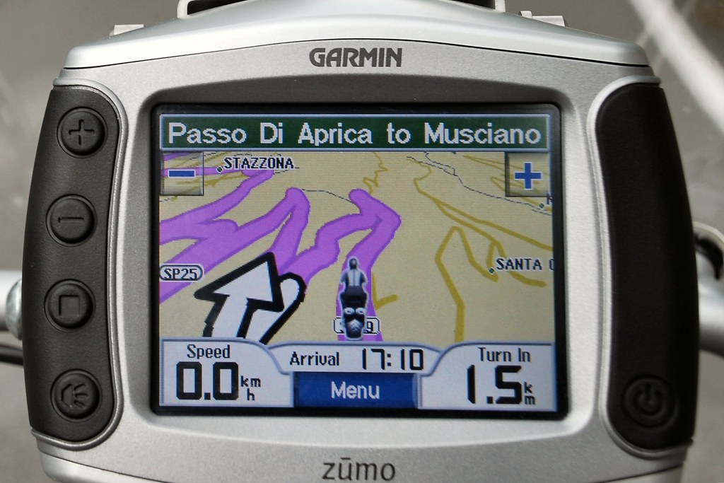
I undertook some fairly detailed route and schedule planning. According to the Zumo and Mapsource, the total distance would be around 4,200 miles. Taking into account the fact that four of the 14 days would be “lost” due to spending time in the two offices, I would need to average more than 400 miles per day. By no means impossible. But such a schedule, coupled with the fact that I wanted some time to enjoy the places through which I was travelling meant that I didn’t want to waste time planning routes each morning or looking for accommodation each evening, so routes were planned and hotels booked in advance.
The route (done in a clockwise direction):
The original plan involved a more direct route from Sofia to Zadar (on the Croatian coast) through Serbia and Bosnia. However on checking my insurance cover I found that these two countries were specifically excluded and E-Bike do not issue green cards of any description. Although I was advised that it was usual to purchase insurance at the border to Serbia, I took the view that, given the relatively tight schedule, I couldn’t afford the risk of losing a day due to insurance problems at either the Serbian and/or Bosnian borders. Hence the rather roundabout route from Sofia, back into Romania and Hungary, into Croatia.
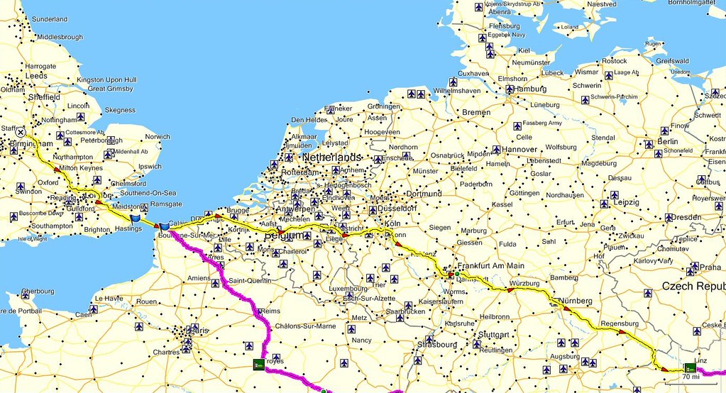
Day 1 – Friday 4th September, Burton upon Trent – Ansfelden, 898 miles
I wanted to make it to Romania as quickly as reasonably possible (two days). Day 1 was the most difficult of the whole trip – 900 miles plus crossing the channel. My most “ambitious” journey prior to this had been to Dublin. I really had no idea how I was going to find it.
A very early start in order to be at Folkestone for the 0620 train.
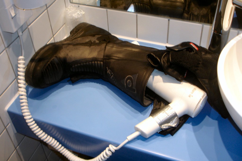
Emerged at Calais at 0800. Within 15 minutes it started to rain and hardly stopped during the subsequent 12 hour journey to Ansfelden in Austria. I’d been looking forward to easy high-speed cruising on the famous autobahns – the reality turned out to be miles of filtering through stationary or slow-moving traffic at what seemed like interminable road works – the fact that it was Friday afternoon didn’t help. Stayed in characterless “C and C” motel at the side of the motorway. C and C evidently stands for Cheap and Chic – not my idea of “chic”, but I was in no state to argue, nor did I care.
First use of gaffer tape, in an attempt to dry a thoroughly soaked boot, while I went out in search of drink and food.
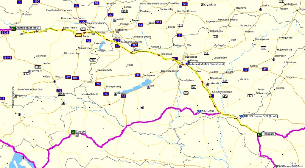
Day 2 – Saturday 5th September, Ansfelden - Timișoara, 440 miles
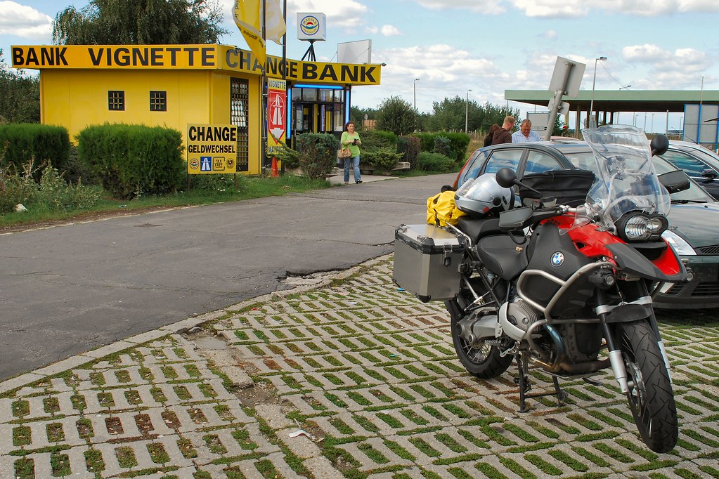
A relatively easy day – several hours of effortless motorway cruising in very light weekend traffic. Eventually arrived at the Hungarian border – this was the first recognisable border crossing since arriving on the continent. Stopped to buy a vignette…
…having managed to forget that I’d bought one online a couple of weeks previously!
Soon I had crossed into Romania and was heading for Timișoara on the DN6. It’s difficult to describe how I felt at this point. After talking about returning to biking for more than ten years and then dreaming that one day I’d ride to Romania, I’d finally done it. I recognise that this may seem trivial to many on this site, but it was hugely significant to me, so much so that I had to capture the moment:
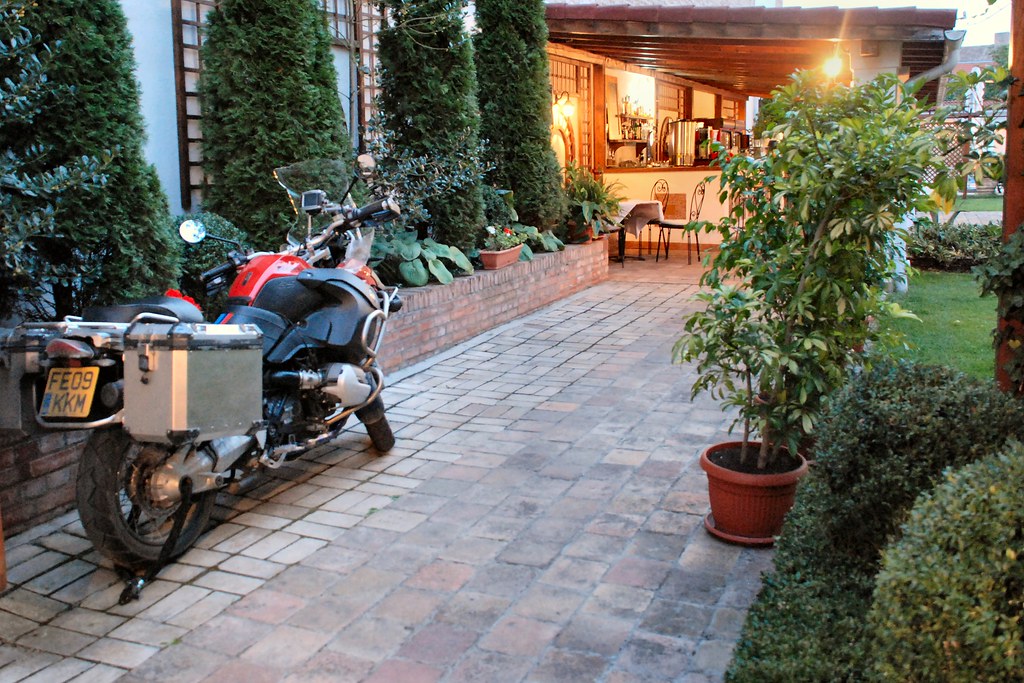
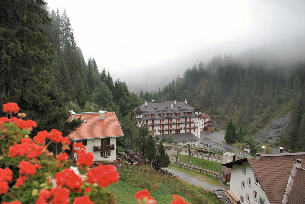
Spent the Saturday night at the delightful Casa del Sole (www.casadelsole.ro - highly recommended) in Timișoara, where I was able to park the bike in the garden:
I’d heard a lot about Timișoara and had planned to explore it on the Saturday evening, but have to confess that I never made it out of the hotel garden and its bar and restaurant.
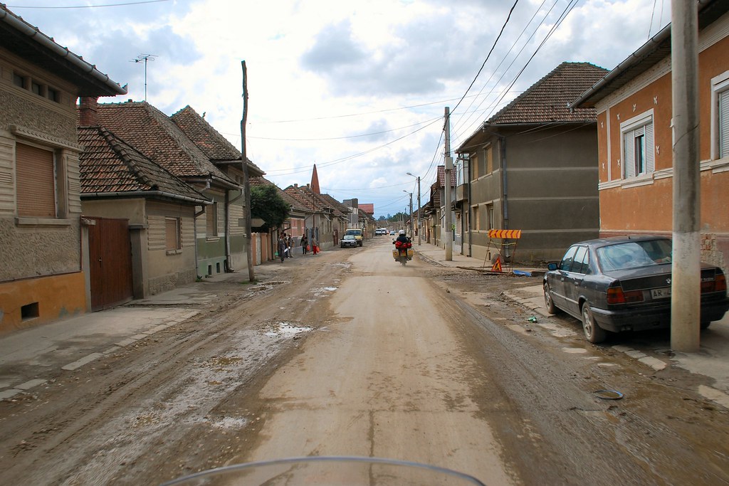
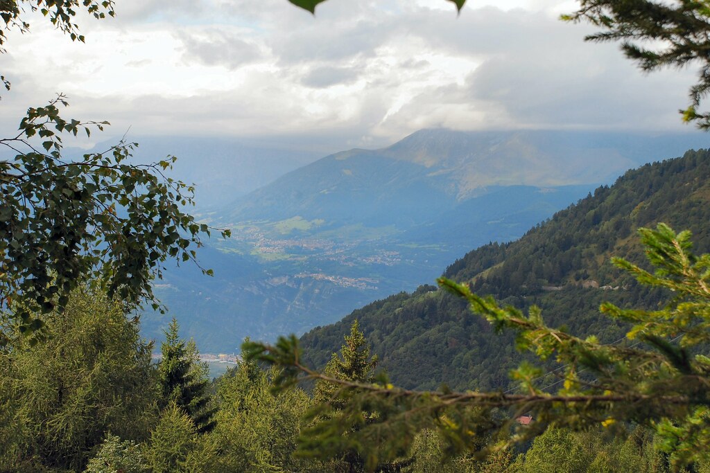
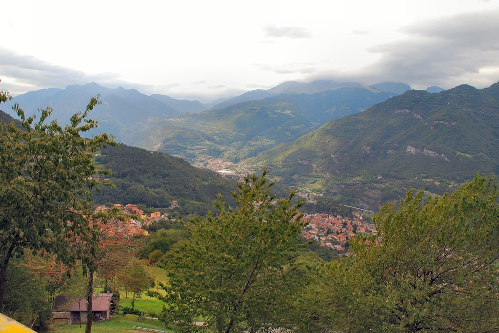
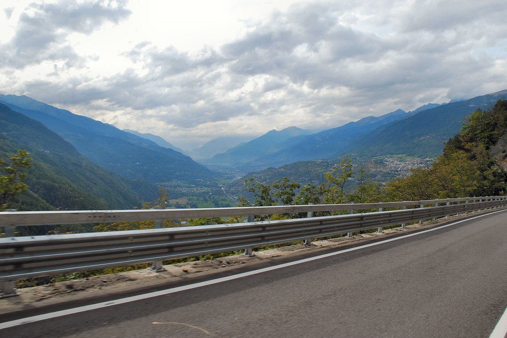
Day 3 – Sunday 6th September, Timisoara – Sibiu – Sighisoara – Saschiz, 241 miles
In undertaking the planning for this trip I’d made contact with Gavin Bell of this parish, now a resident of Transylvania, and he’d kindly suggested that I visit him in Saschiz, one of the “Saxon villages” of Transylvania. Set off from Timisoara on Sunday morning. As I was travelling between Sibiu and Sighișoara I found myself approaching this place:
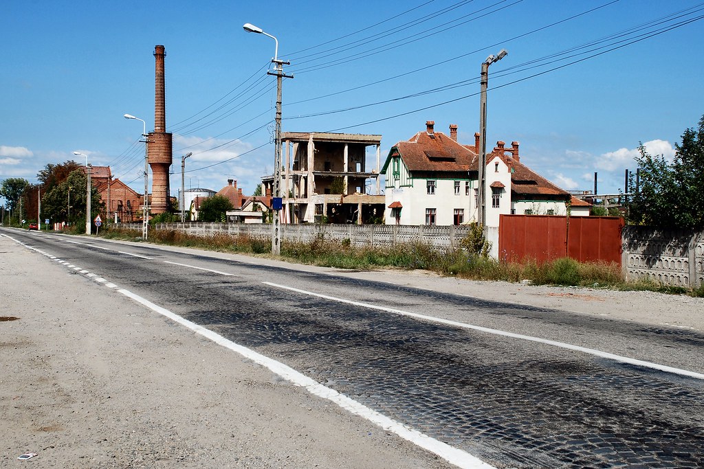
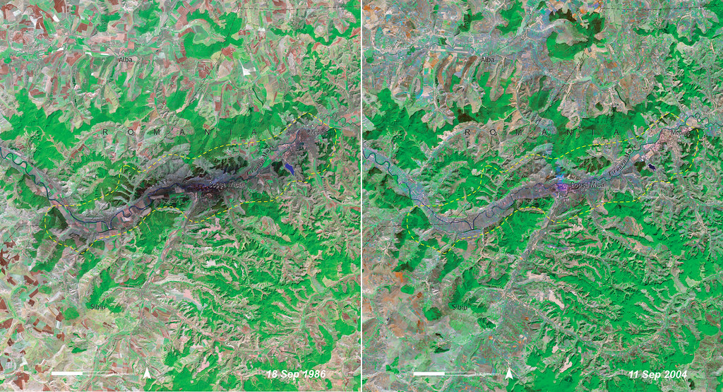
Somehow, even from a distance, this place seemed special. It turned out to be Copșa Mică, about which I’d heard much over the years. It was well known as one of the most polluted sites in Central and East Europe and the Former Soviet Union, as a result of a plant for producing carbon black, and if that wasn’t enough, a lead smelter (Sometră). The carbon black factory produced highly visible pollution. Compare the aerial photograph on the left, from 1986 when the plant was in production, to the one on the right, taken in 2004 after the plant had closed.
If this pollution of the local landscape wasn’t bad enough, Sometră produced much less visible, but far more insidious, pollution that caused impotence and lung disease. Life expectancy in Copșa Mică was nine years below the average for Romania – not a good place to be born.
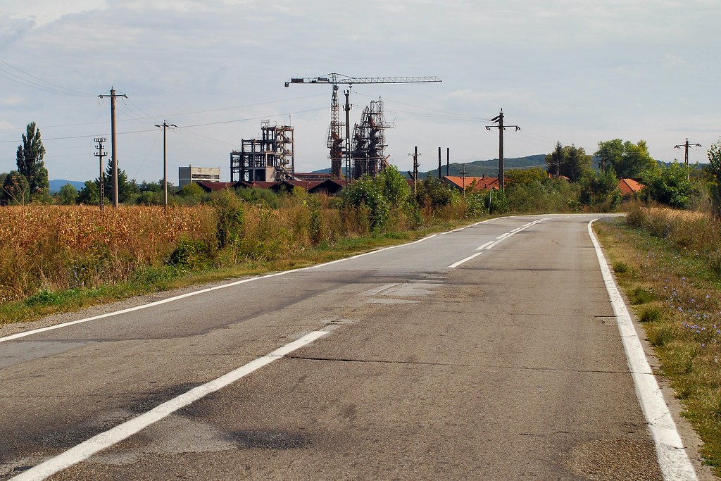
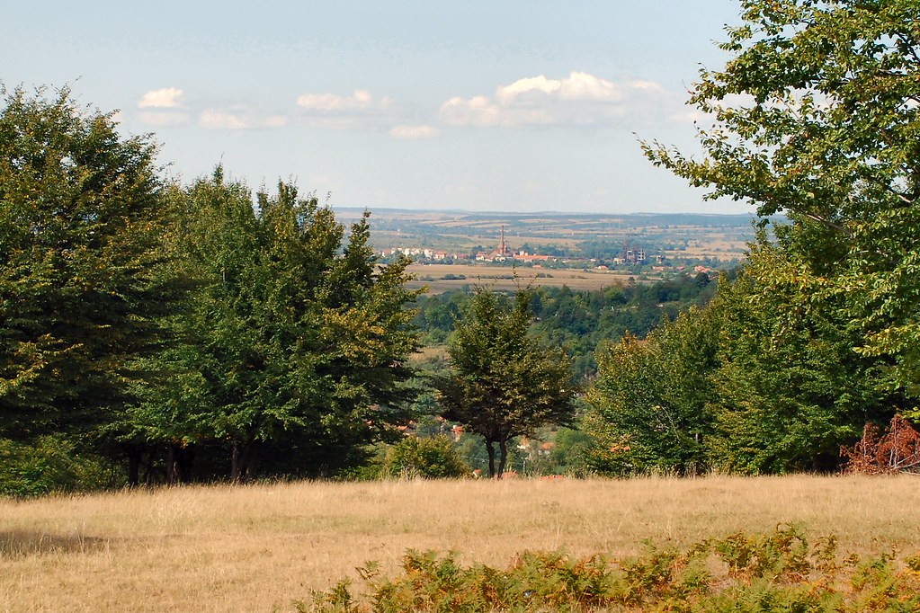
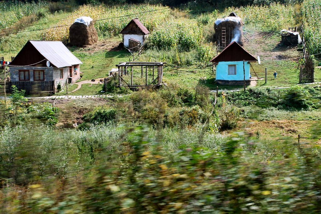
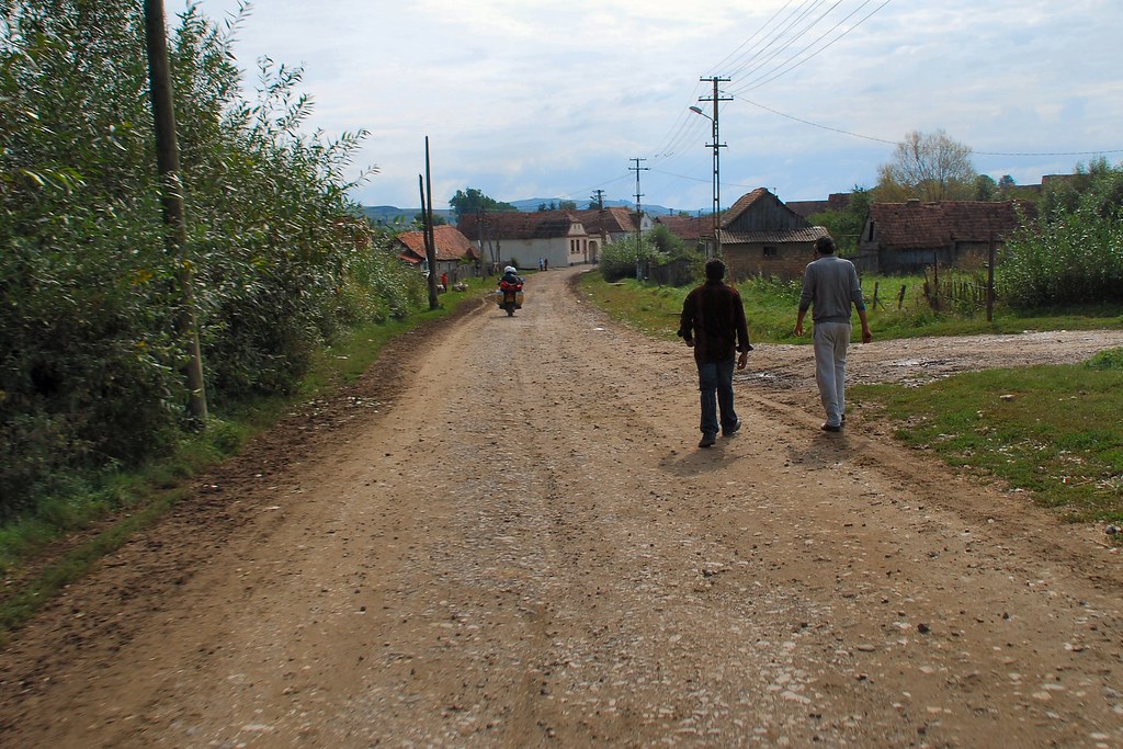
From a distance it looks just like another town in the countryside…
And with countryside like this, it’s soon forgotten:
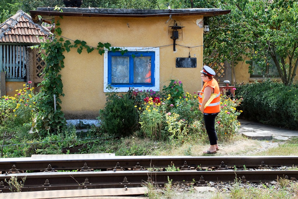
Had to stop at a level crossing:
Complete with suitably attired official
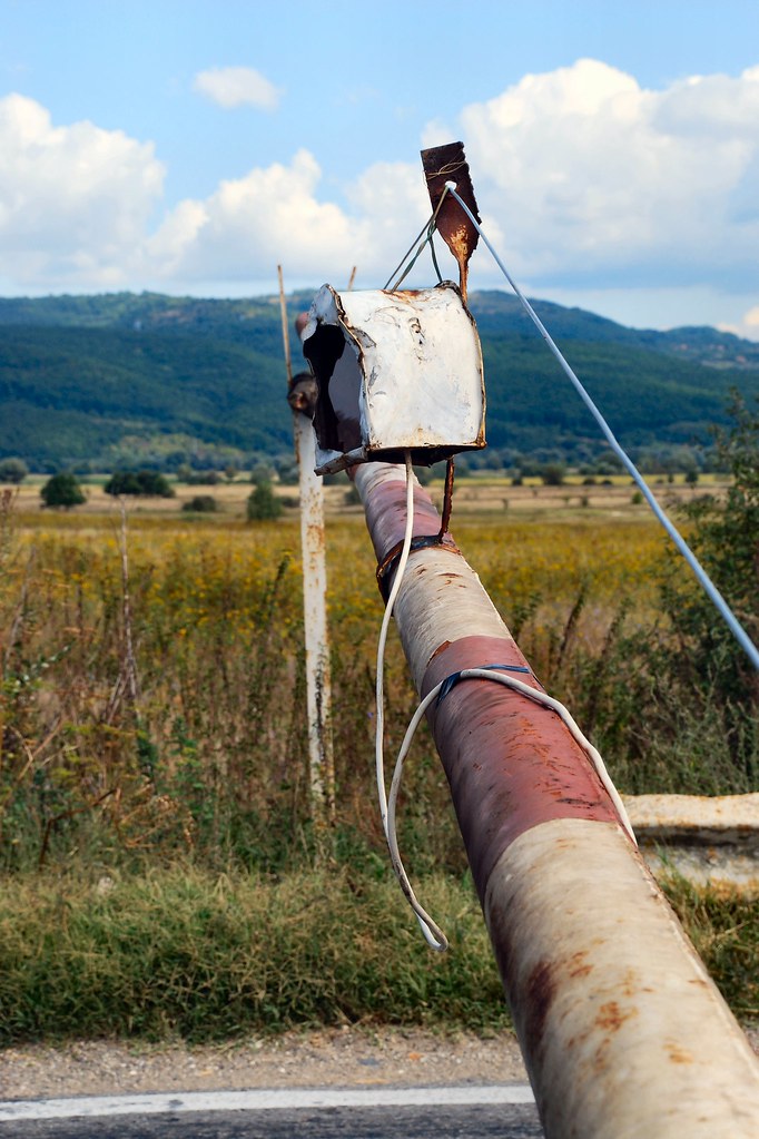
Gave me the opportunity to inspect the state of the infrastructure. Yet again I marvelled at the attitude to workmanship and standards that one comes across so often in Romania. The (white) cable to the lamp on the barrier had obviously been recently replaced – but whoever did it must have worked hard to achieve such an appalling standard….
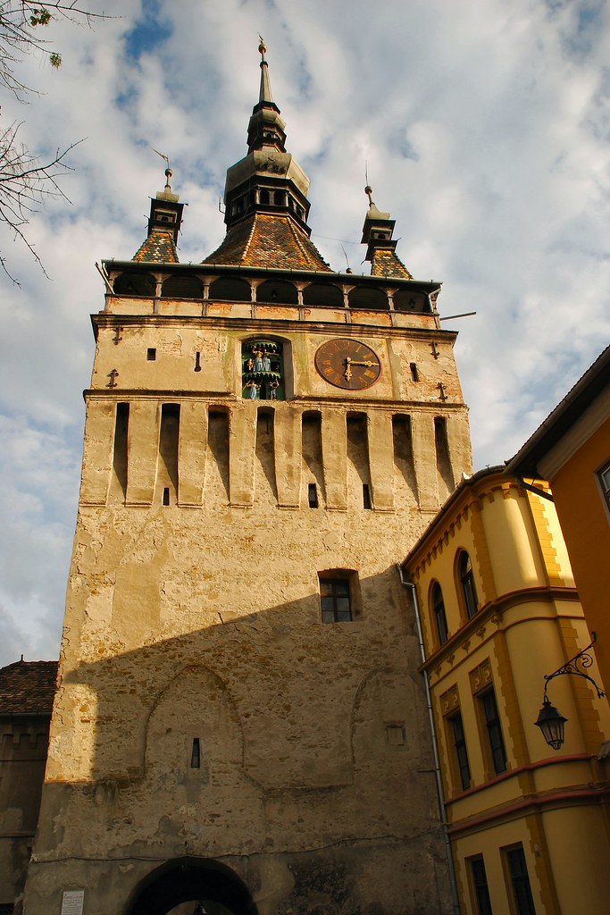
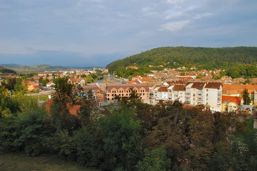
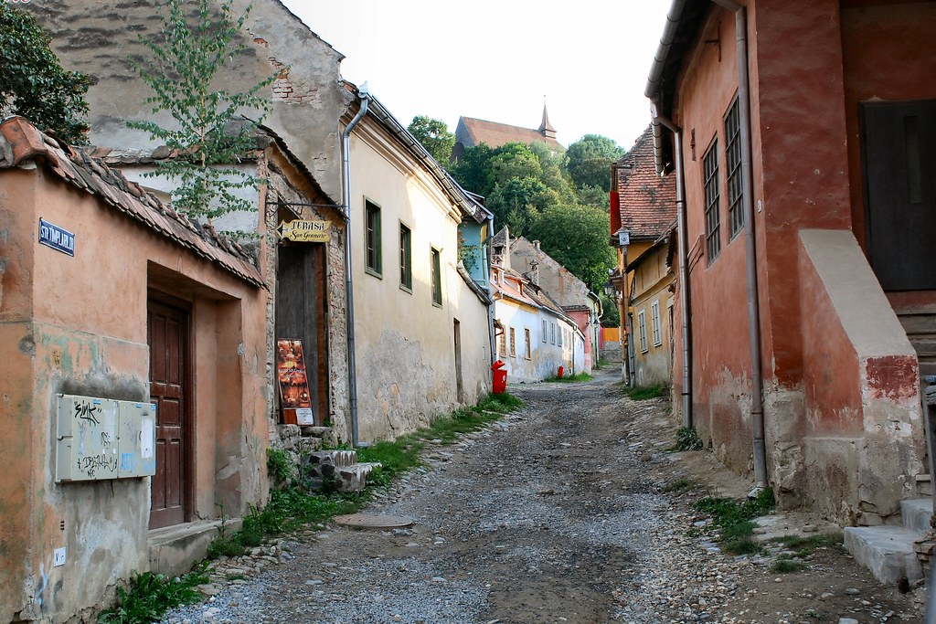
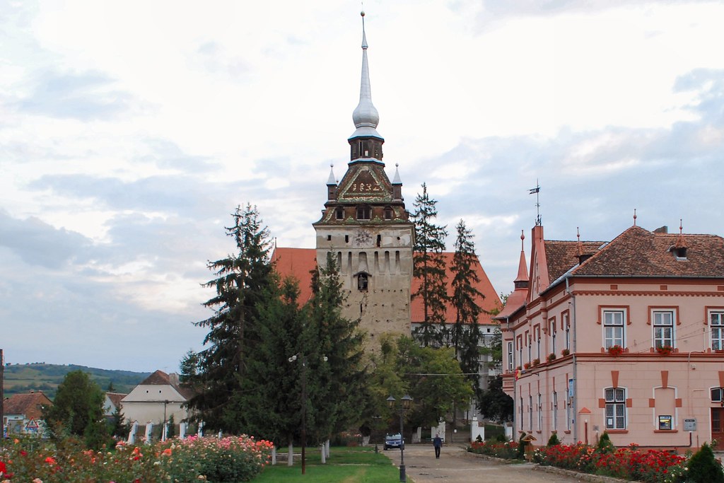
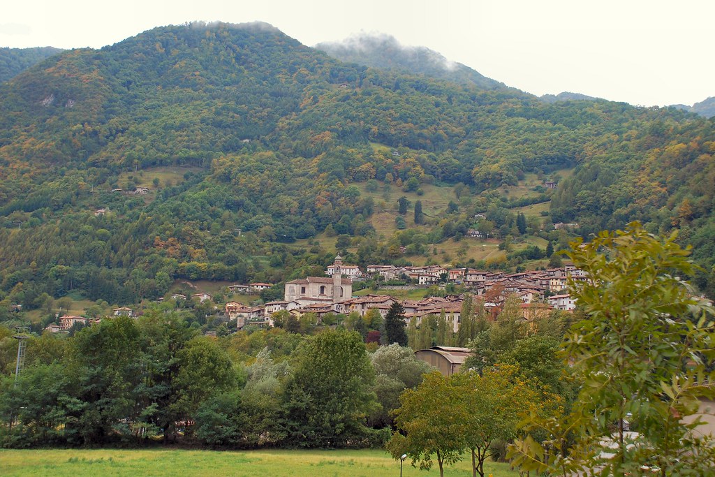
Sighișoara, and particularly its cetate (fortress), is well worth seeing:
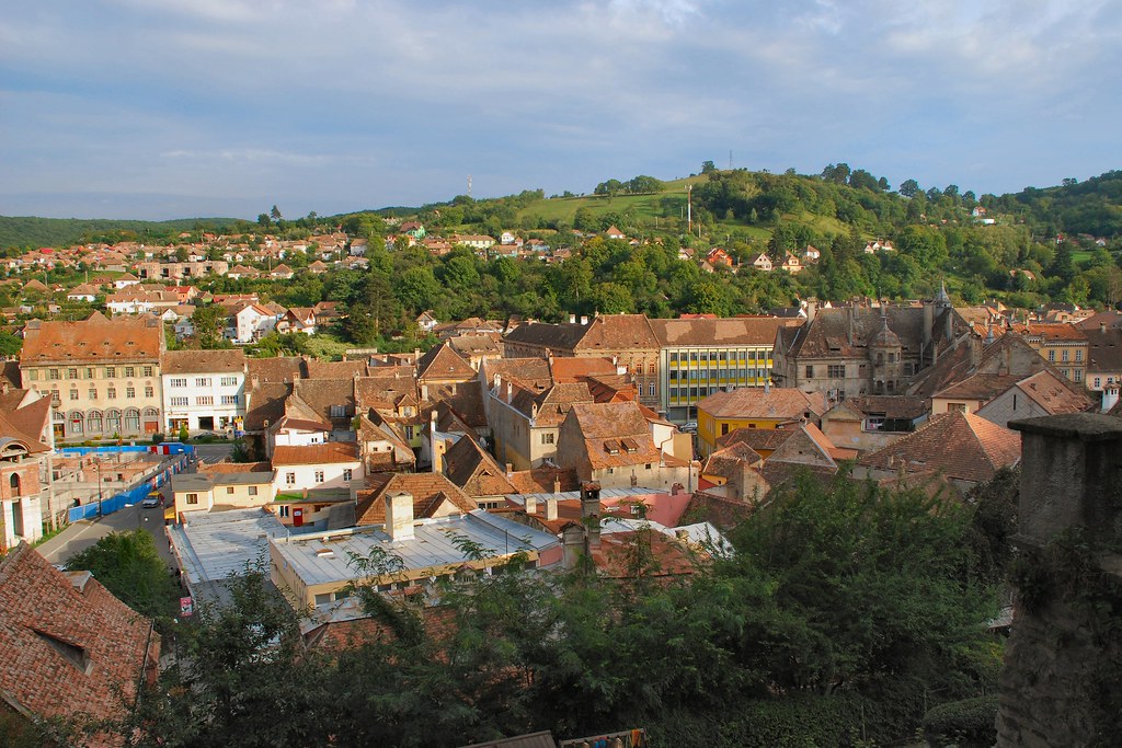
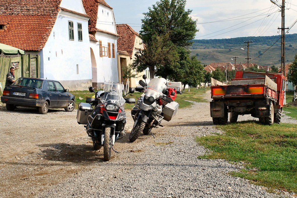
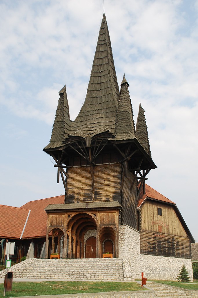
From Sighișoara it was a short ride to Saschiz, complete with its UNESCO World Heritage Site status fortified church:
Bike Trip 060909 066 by David Ford, on FlickrChecked into the local pensiune and unloaded the bike:
Pensiune had a nice courtyard at the rear:
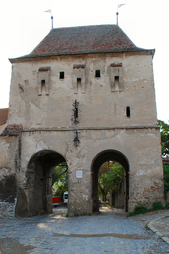
In the distance was the citadel where, in the past, the peasants would seek protection from marauding Turkish raiders:
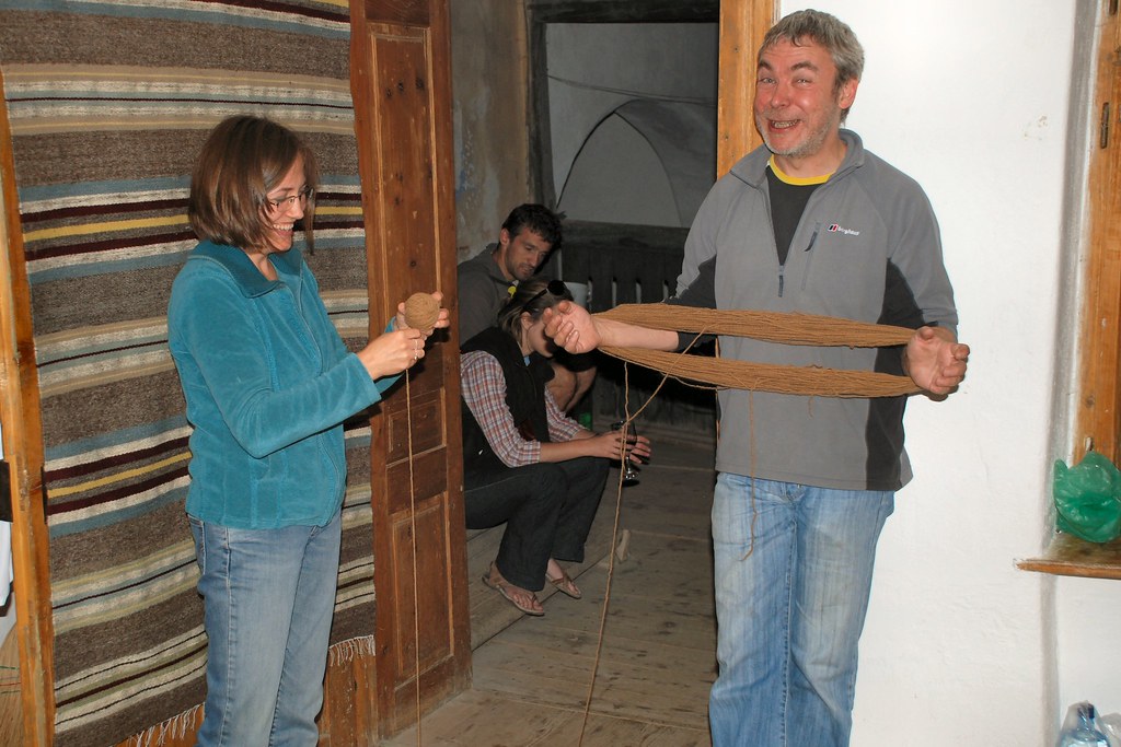
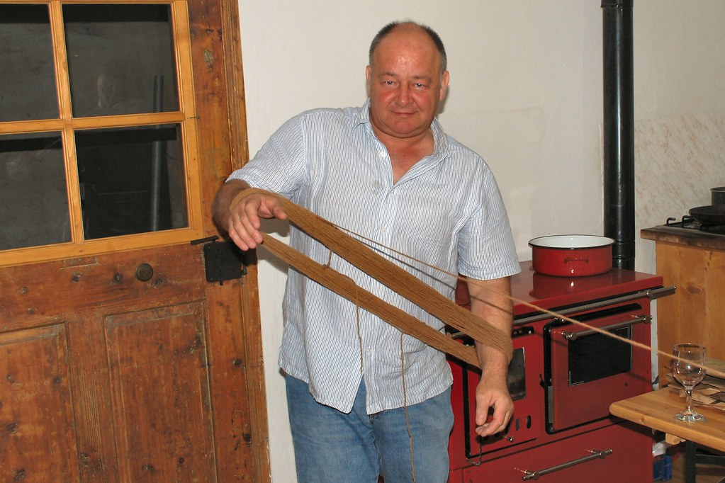
Spent the evening with Gavin and his wife Andreea. Gavin runs an NGO (see www.fundatia-adept.org) devoted to sustainable development in this beautiful part of Transylvania. However on Sunday evenings he sometimes moonlights in the local wool industry, where he holds a key position (sorry Gavin!):
Though I was able to do it without relying on a wall for support:
At least a local mother and daughter seemed to appreciate my efforts:
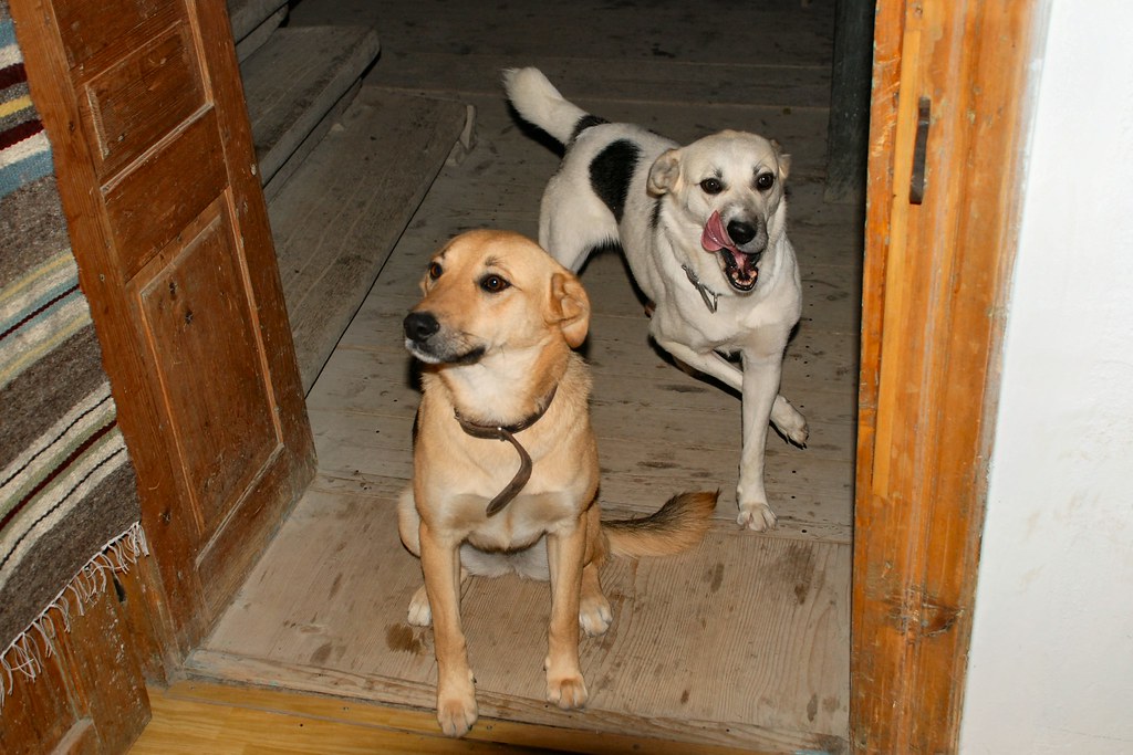
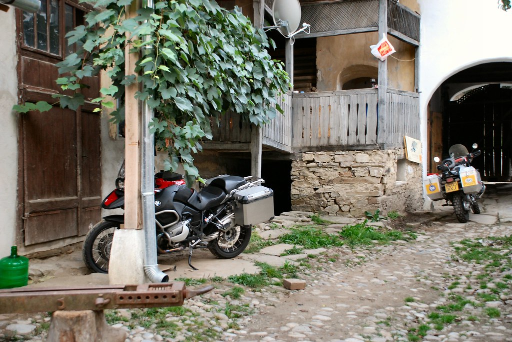
Even the bike had company for the night:
Seriously, a great evening – thanks Gavin and Andreea.
Day 4 – Monday 7th September, Saschiz - Bucharest, approximately 220 miles
Next morning, from my bedroom window, a scene that probably hasn’t changed (OK – apart from the power lines) in more than a hundred years:
Today I had to get to Bucharest. The sensible route would have been on national roads via Brașov. However this day I was going to tick off another ambition, and travel the Transfăgărășan. The “Transfag” is Romania’s Stelvio, with Dolomites replaced by Carpathians. The commonly accepted story is that that Ceausescu had it constructed as a route for moving troops in the event of a Soviet invasion of Romania. According to Wikipedia:
The road was constructed between 1970 and 1974, during the rule of Nicolae Ceauşescu. It came as a response to the 1968 invasion of Czechoslovakia by the Soviet Union. Ceausescu wanted to ensure quick military access across the mountains in the event the Soviets attempted a similar move into Romania. Consequently, the road was built mainly with military forces, at a high cost both financially and from a human standpoint—roughly 6 million kilograms of dynamite were used on the northern face, and about 40 soldiers lost their lives in building accidents.
[Also on same Wikipedia entry: In September 2009 the cast and crew of the British television show Top Gear were seen filming along the road. The segment will appear in Series 14, Episode 1 on November 15, 2009.]
Whilst I’m certainly no historian, I do wonder about this - I’m tempted to think that the road was another of Ceausescu’s insane schemes designed to satisfy his ego.
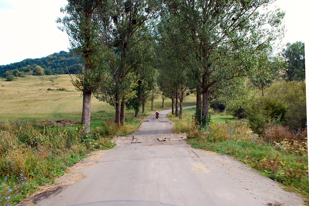
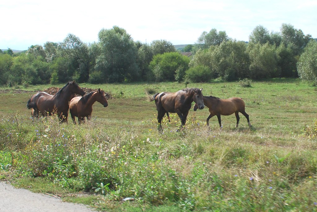
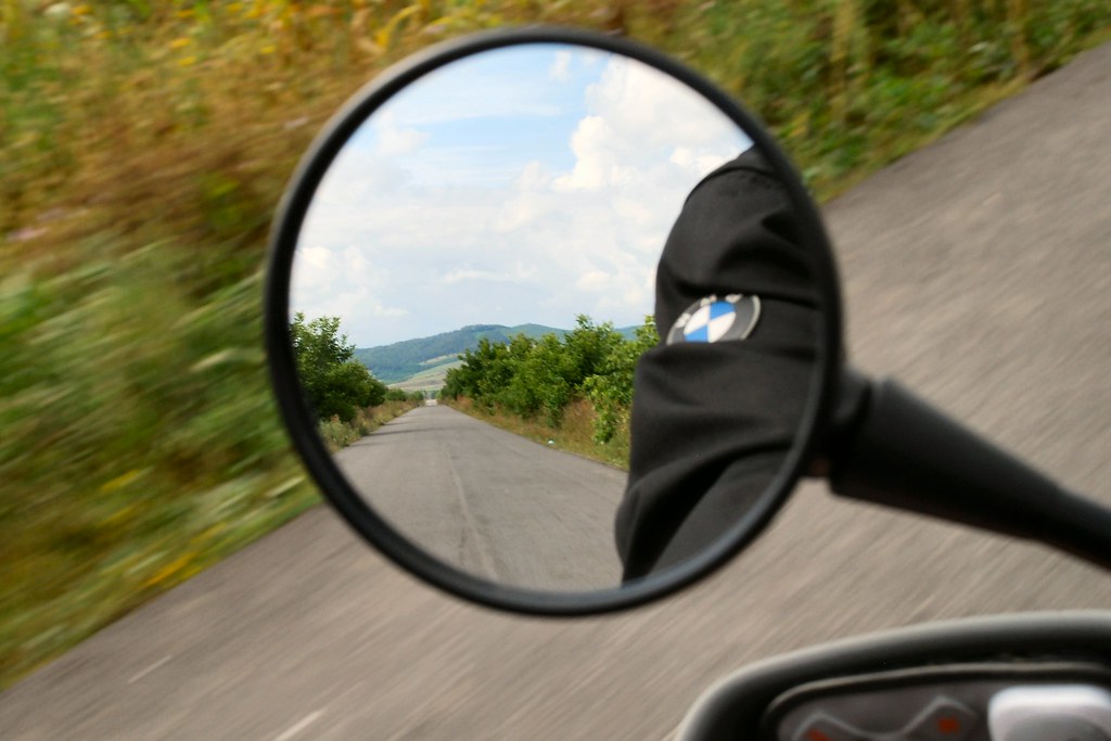
Gavin was travelling to Brașov and agreed to lead me cross country as far as the town of Făgăraș. So off we set on roads that, although surfaced, do not appear on the standard Zumo 550 City Navigator map product. No other traffic of which to speak, and beautiful, unspoilt countryside:
Some “modest” houses, but note satellite dishes:
Approaching what appears to be an ordinary village…
With “modest” main street:
Except that this village contains a house that belongs to a member of the British royal family...
We stopped for a coffee:
Off again – have long wanted to take a photo like this:
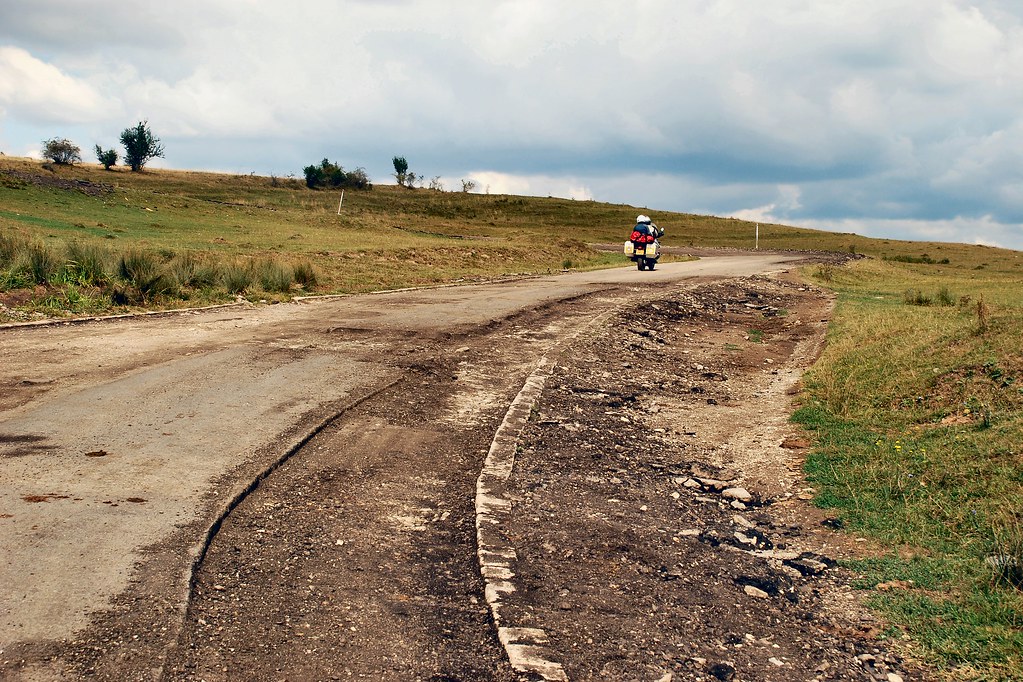
Interesting road conditions:
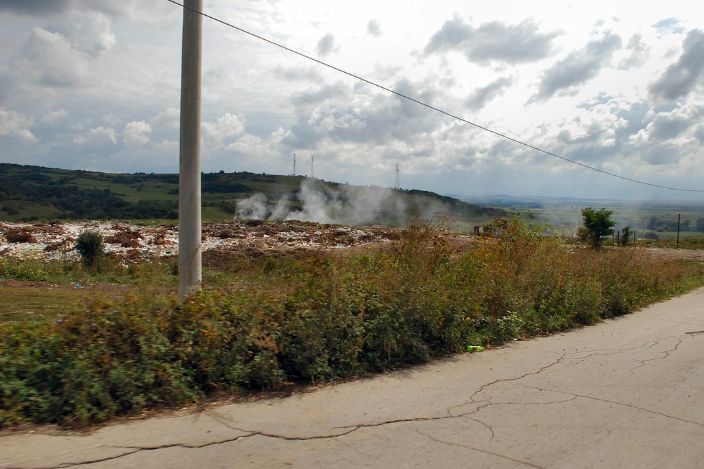
Approaching Făgăraș - nice waste dump:
And into the town (the centre’s nicer!):
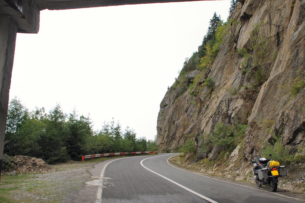
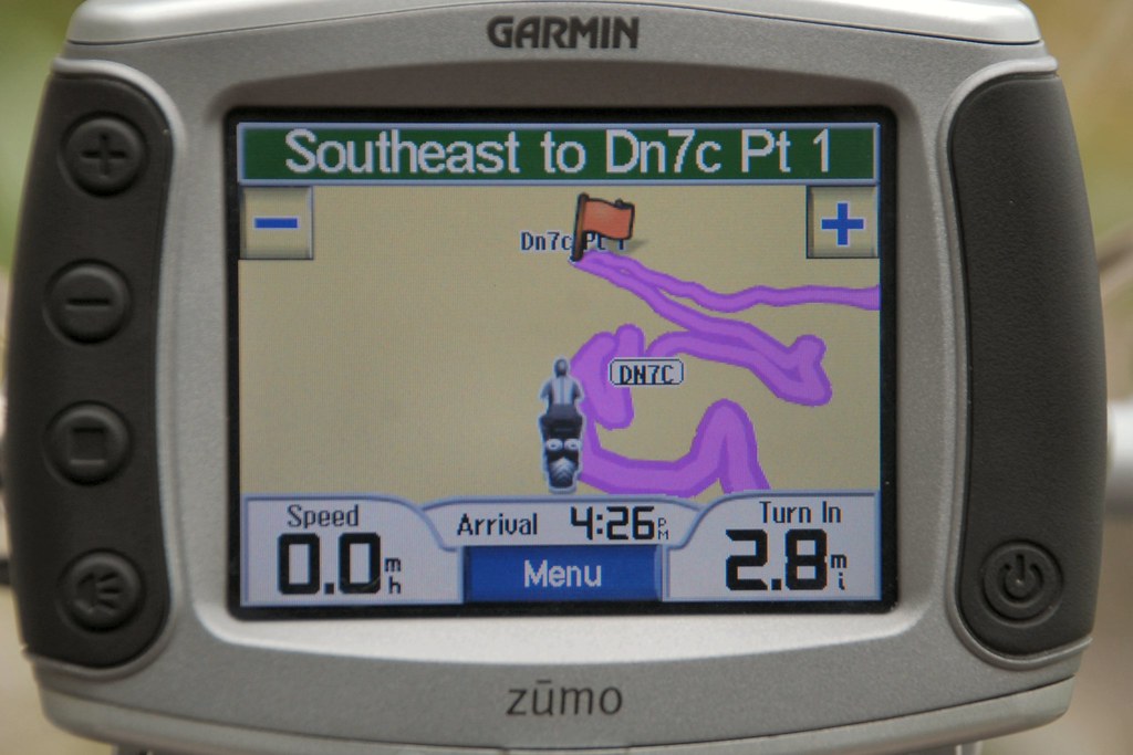
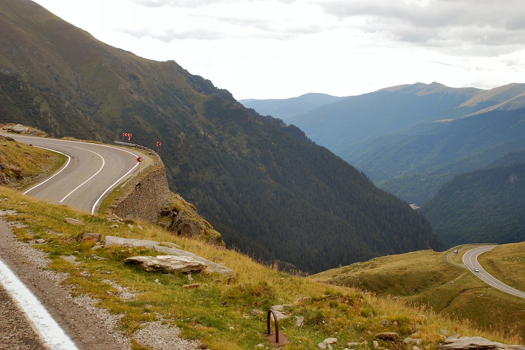
Said goodbye to Gavin and Andreea in Făgăraș, then headed west on DN1. To my left I could see the Carpathians, with the peaks in the clouds. The DN7C, the Transfăgărășan, was up there somewhere:
Soon found the turning and started heading south, and upwards:
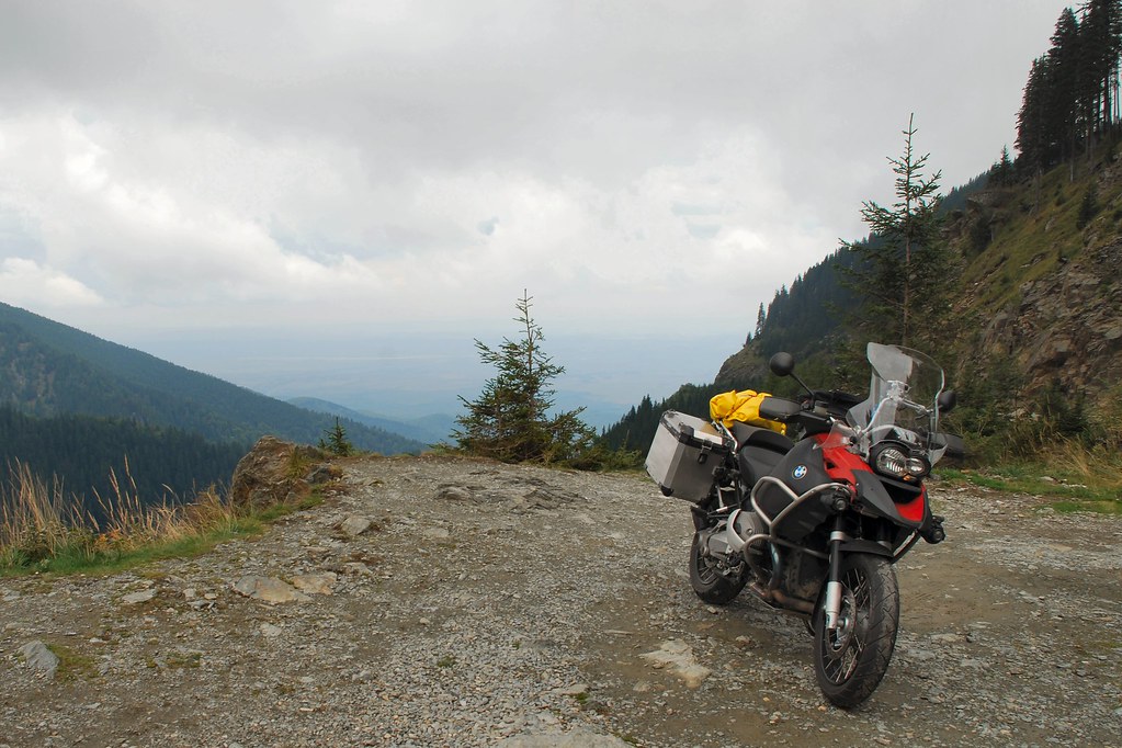
I soon knew that I was in for something very special:
Fortunately the route was deschis (open):
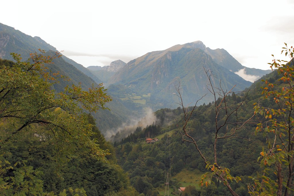
As I continued to climb the road and the views became more and more spectacular:
Came across these three Trabants on German plates – respect!
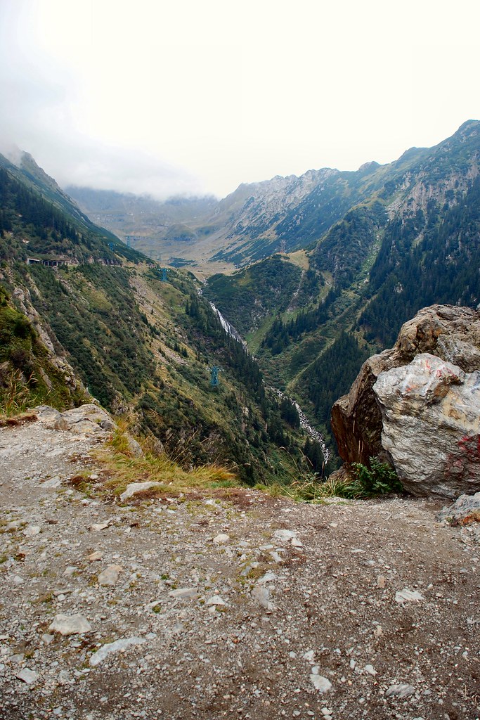
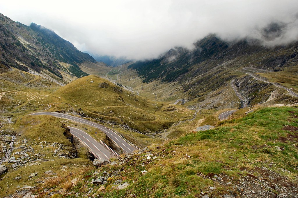
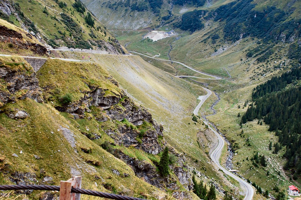
Looking back down the valley:
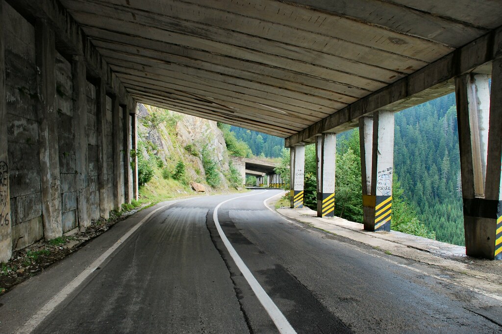
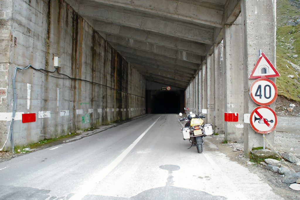
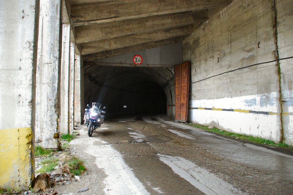
At the highest point the Transfăgărășan becomes a tunnel. If, like me you’re doing from north to south, you enter the tunnel in Brașov County…
…and emerge in Argeș County:
Starting the descent – probably not good for nervous pillions:
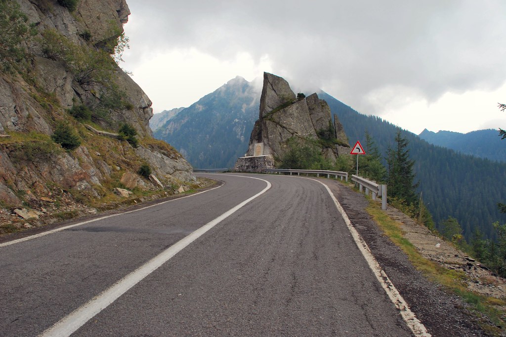
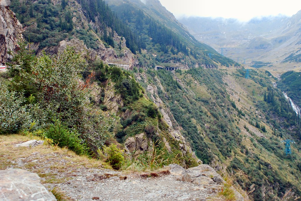
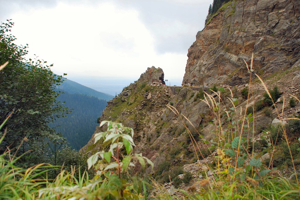
The Argeș side is less extreme…
…but still superb:
Show due consideration for other road users:
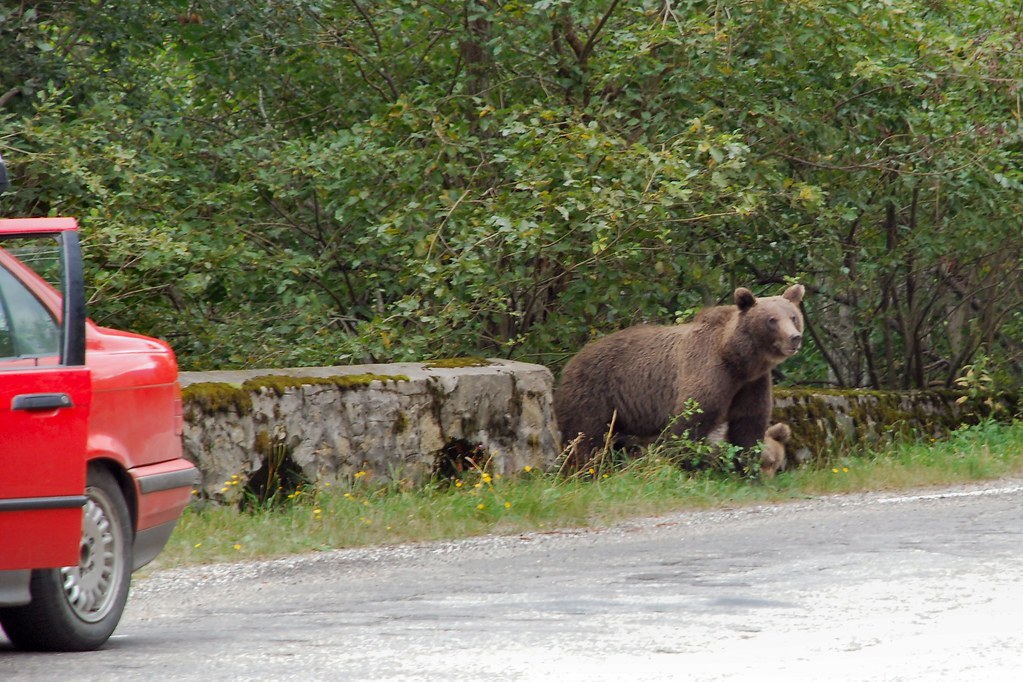
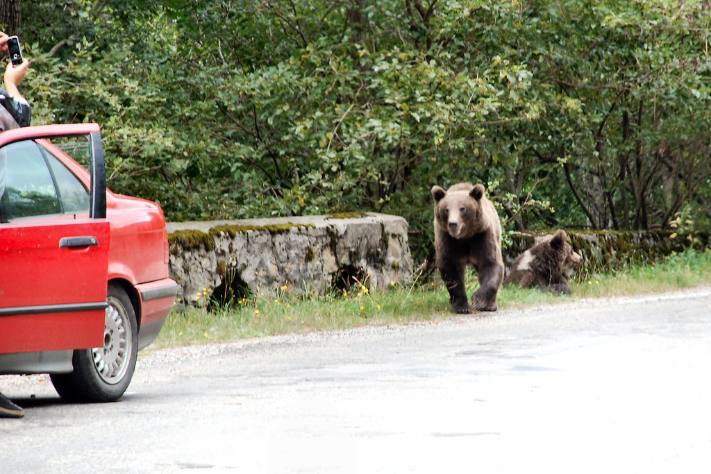
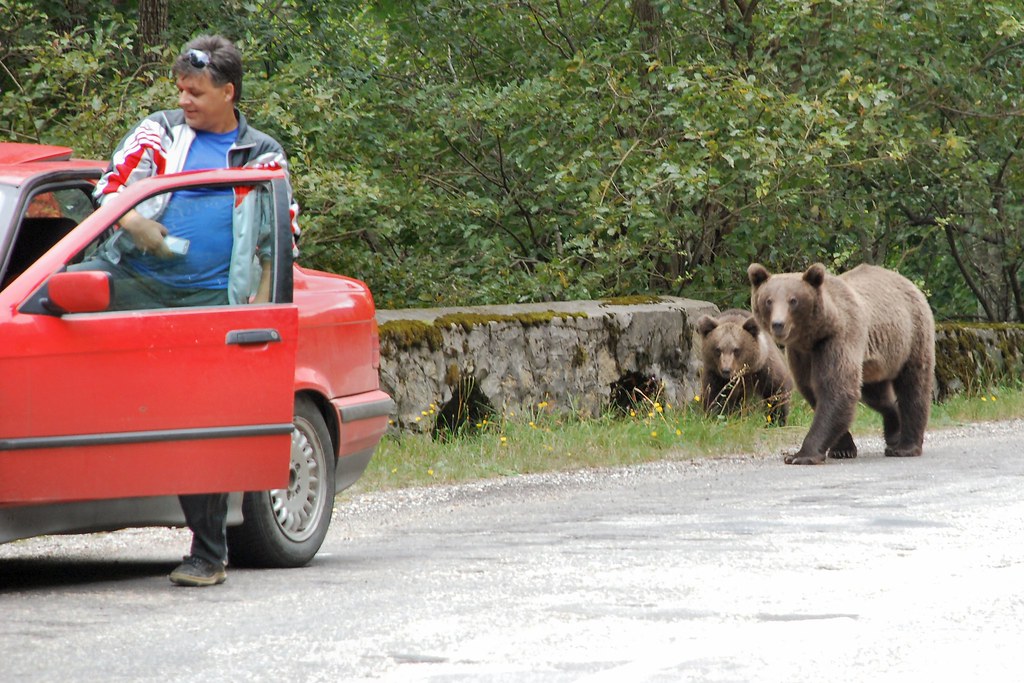
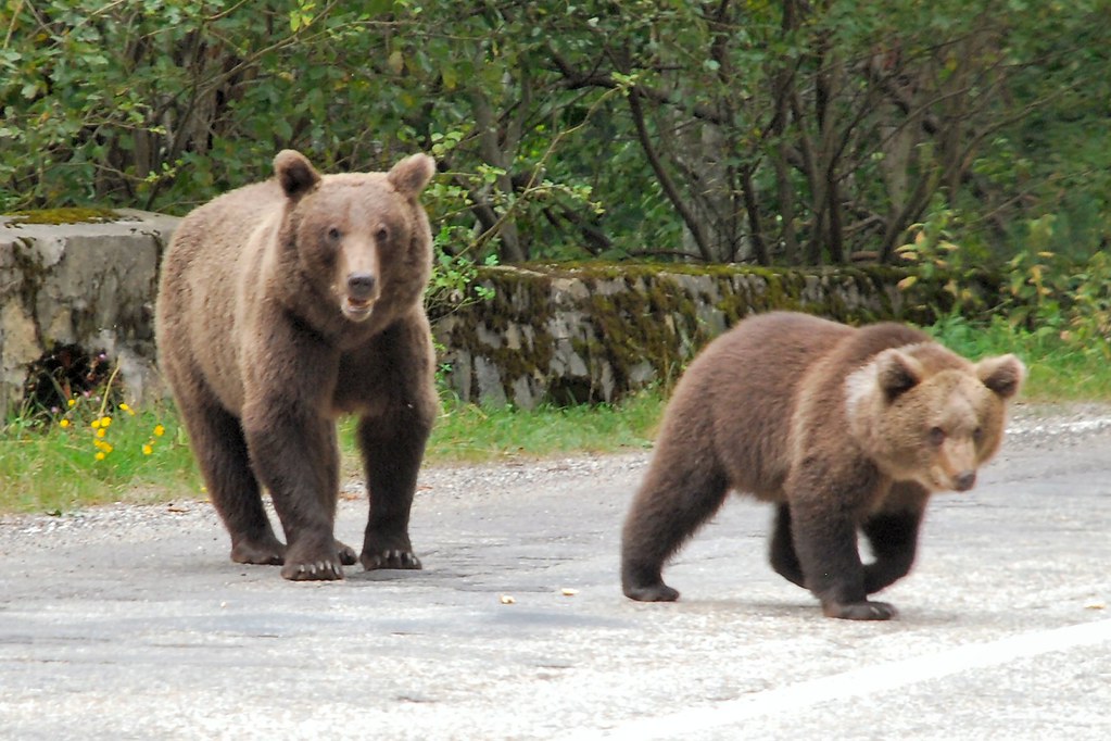
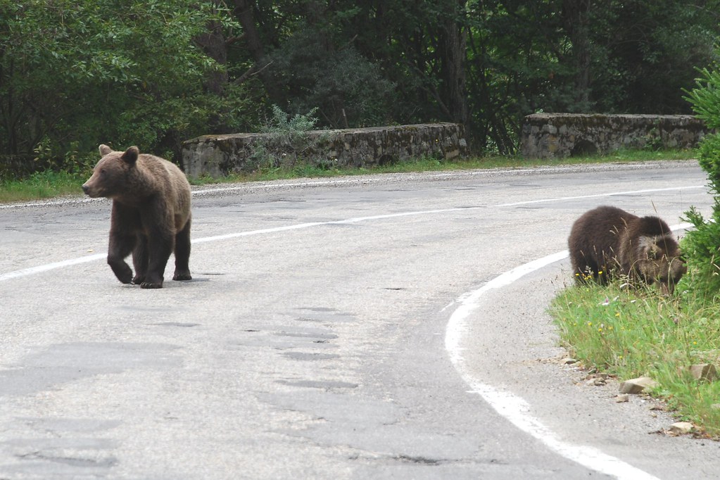
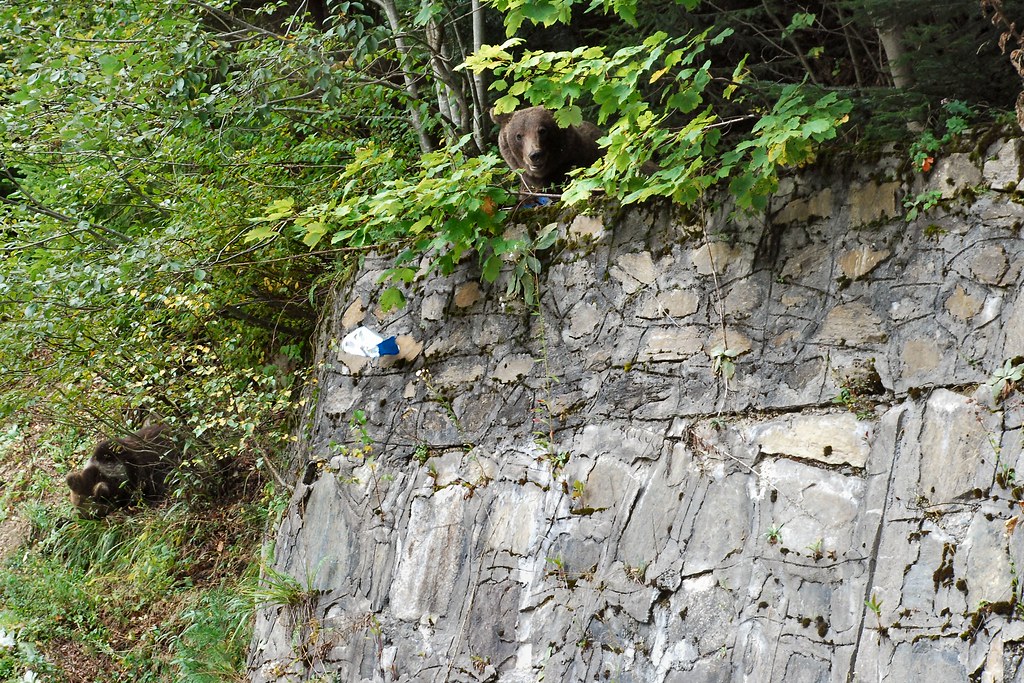
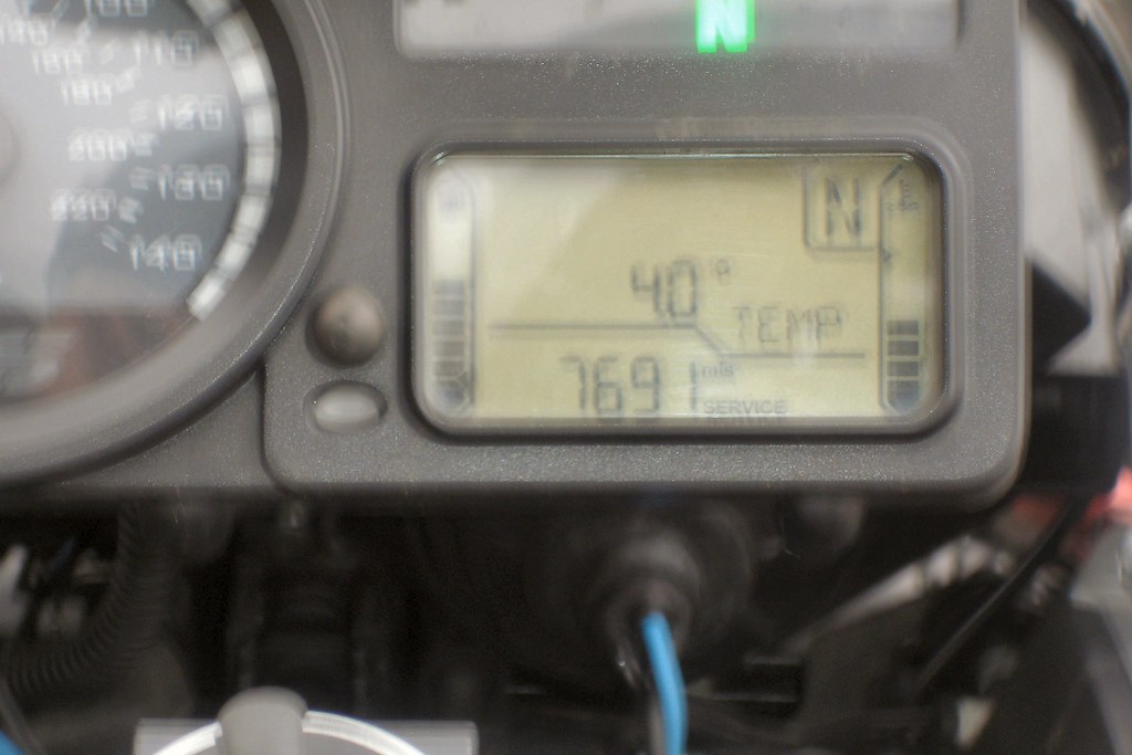
At the summit the temperature had been only 5°C, compared to around 20°C in Făgăraș. The temperature was climbing nicely as I continued the descent. And then, as I emerged from yet another bend, I came across a couple of Argeș residents who lived in the woods….
The guy in the BMW had already stopped and was out of the car. I stayed on the bike, with the engine running:
Might be time to get back in the car (not that the window glass would have offered much protection):
Time for me to back off a little:
“Well it was like this officer – I came round a bend and there was this f***ing bear in the middle of the road….”
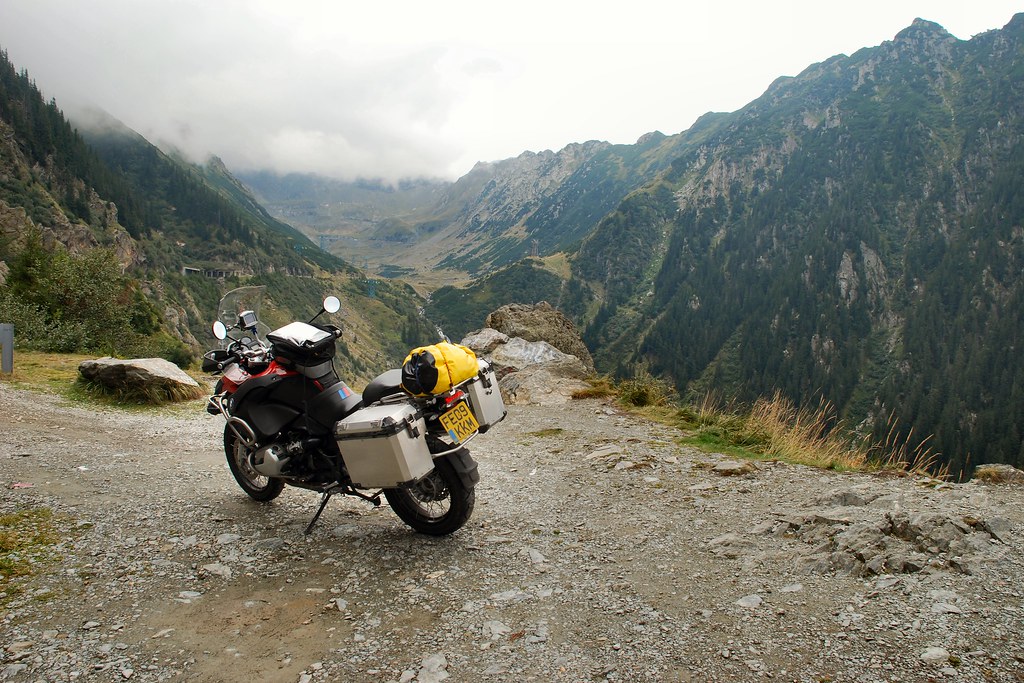
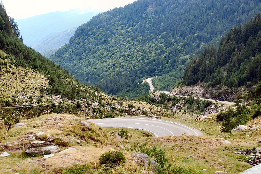
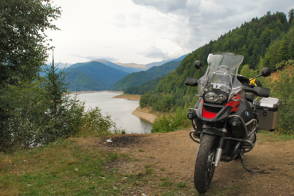
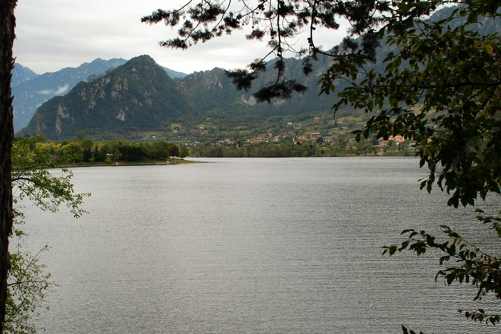
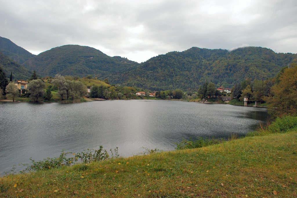
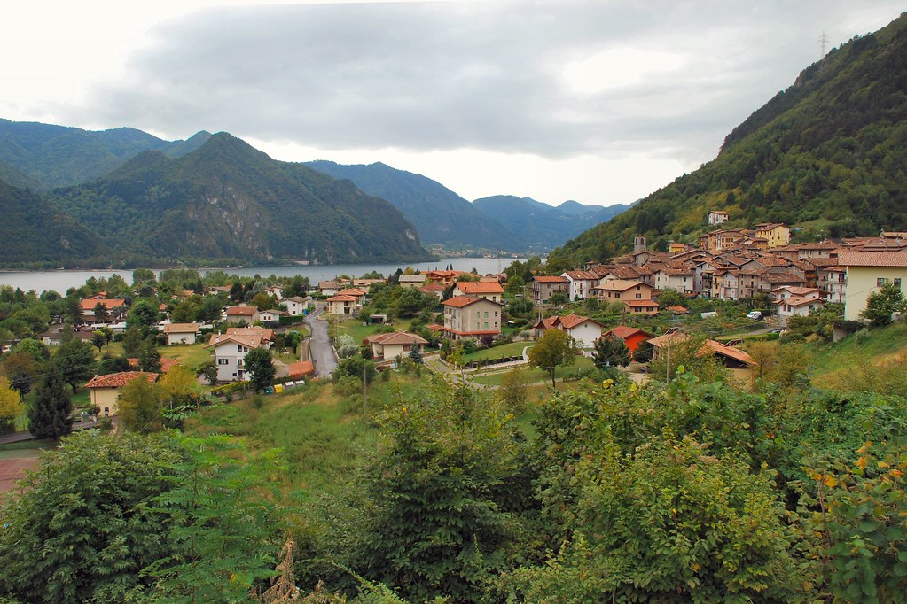
Time to press on – next stop Lacul Vidraru…
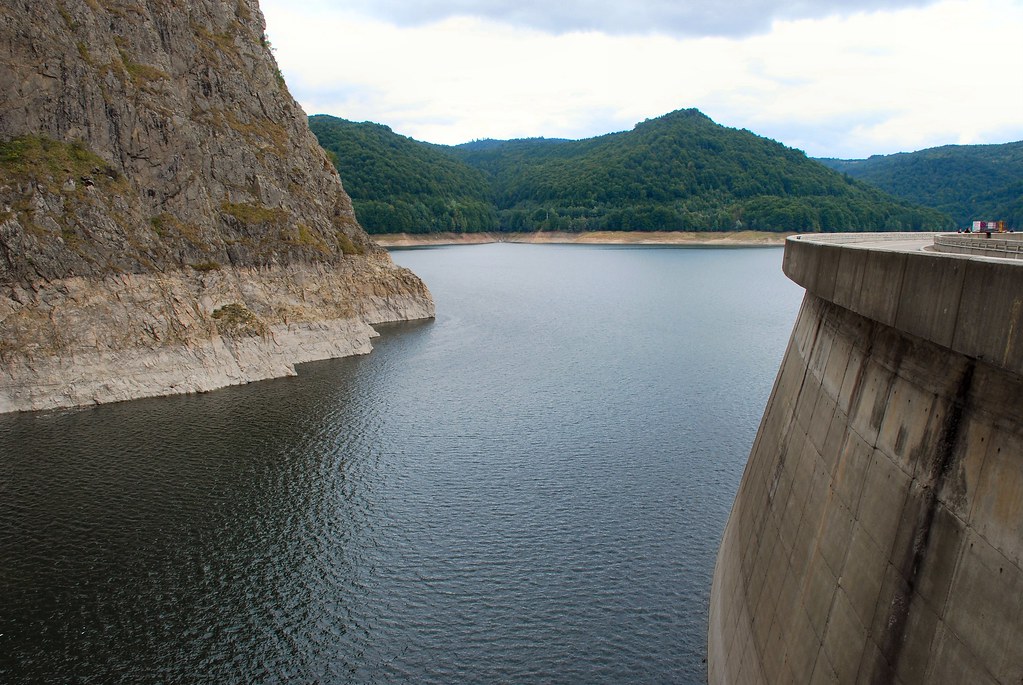
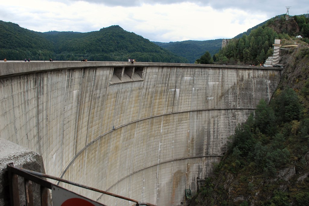
…and its dam:
The road runs along the dam wall…
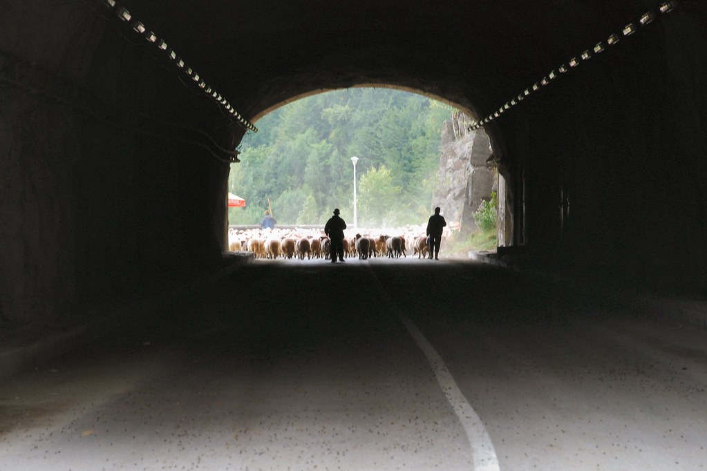
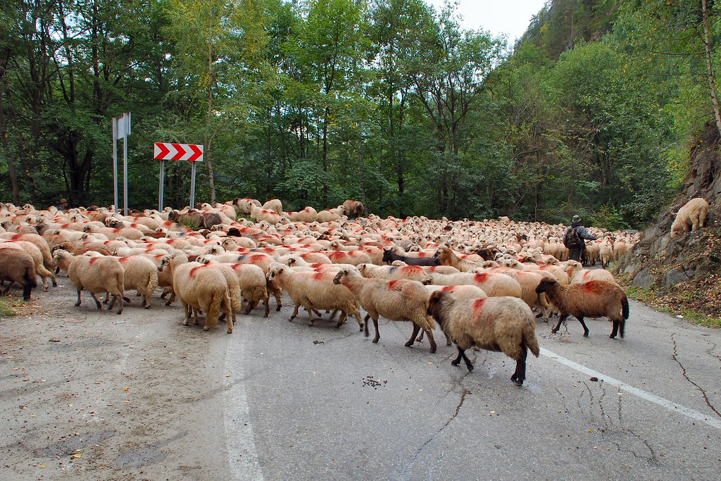
…before entering a tunnel. More sheep:
Gave the sheep a few minutes to get clear, before continuing. Five minutes later…
From then on it was an uneventful ride to Pitești and then onto Romania’s only motorway from Pitești to Bucharest.
Day 5 – Tuesday 8th September, Bucharest
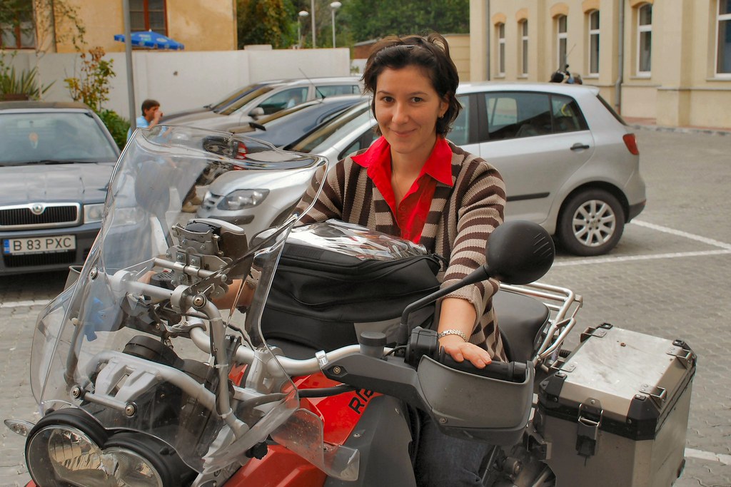
Rode the bike to the Bucharest office – another minor ambition achieved:
Tried to persuade one of the staff to join me for the rest of the trip, but to no avail:
Day 6 – Wednesday 9th September, Bucharest – Sofia, 237 miles
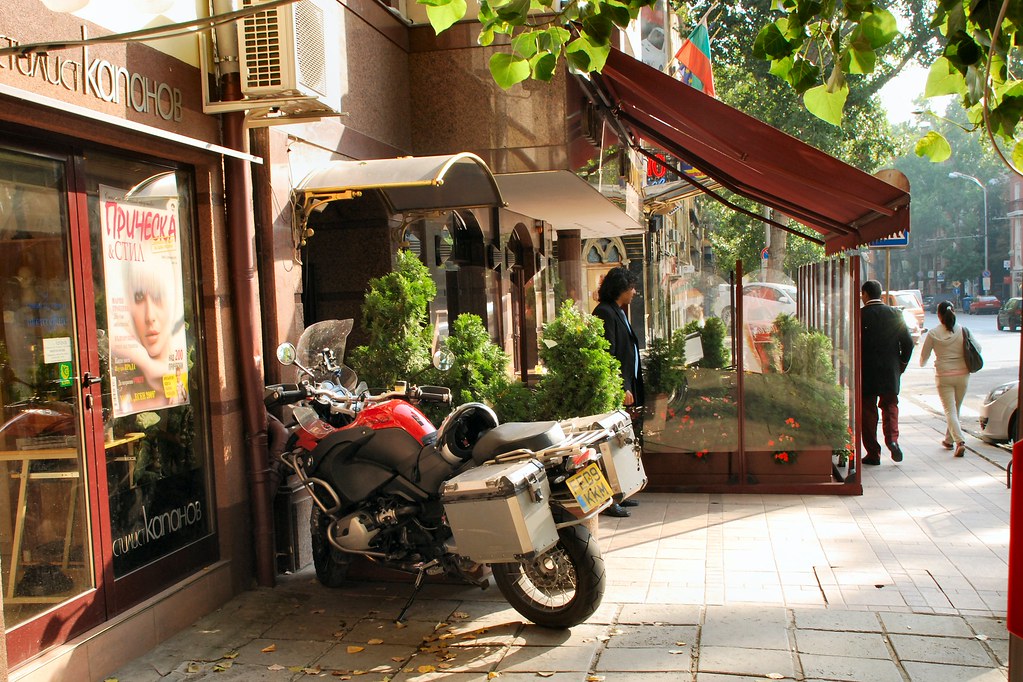
A pleasant but uneventful journey, south from Bucharest to Giurgiu, across the Danube into Ruse on the Bulgarian side, then south-west to Sofia. Arrived at Hotel Downtown (www.hotel-downtown.net - thoroughly recommended) and parked the bike on the pavement outside.
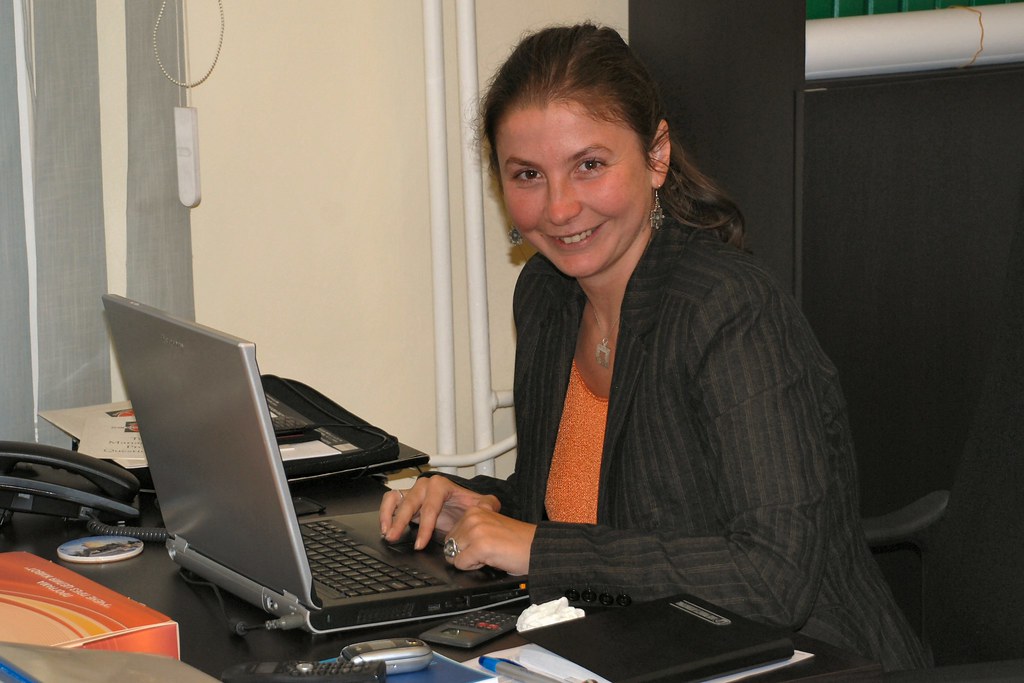
Another attempt to talk one of my colleagues into joining me for the remainder of the journey....
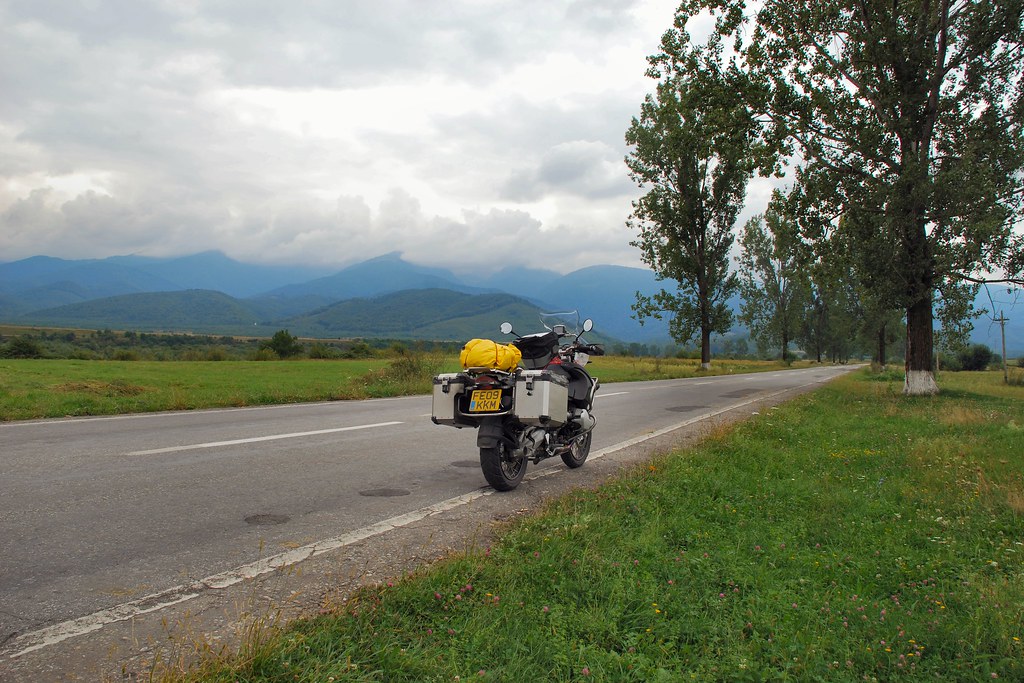
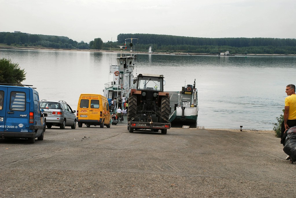
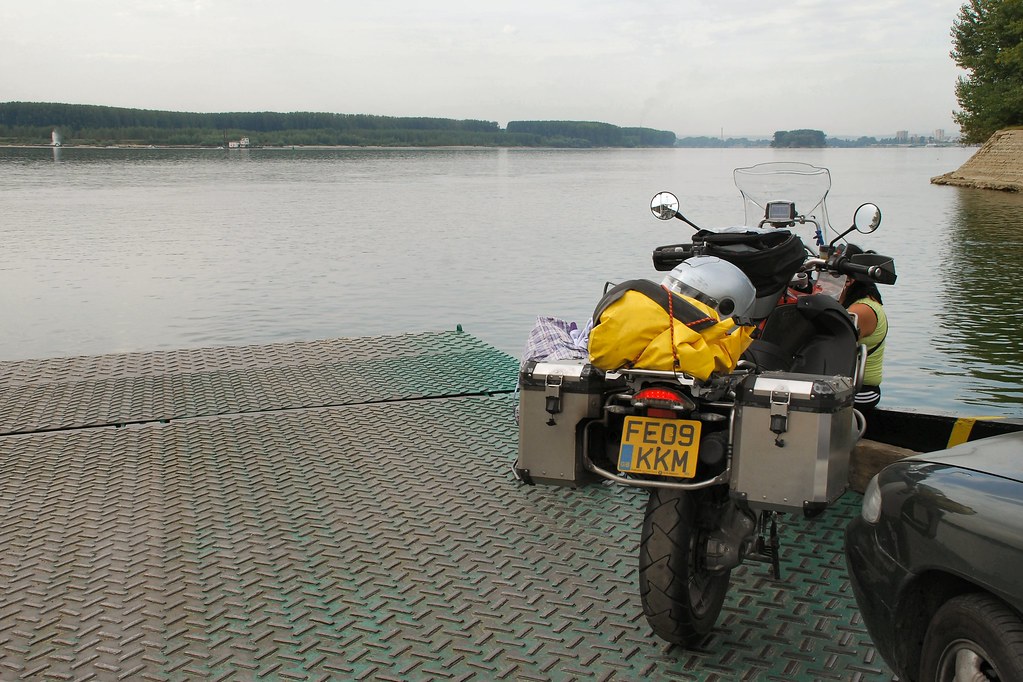
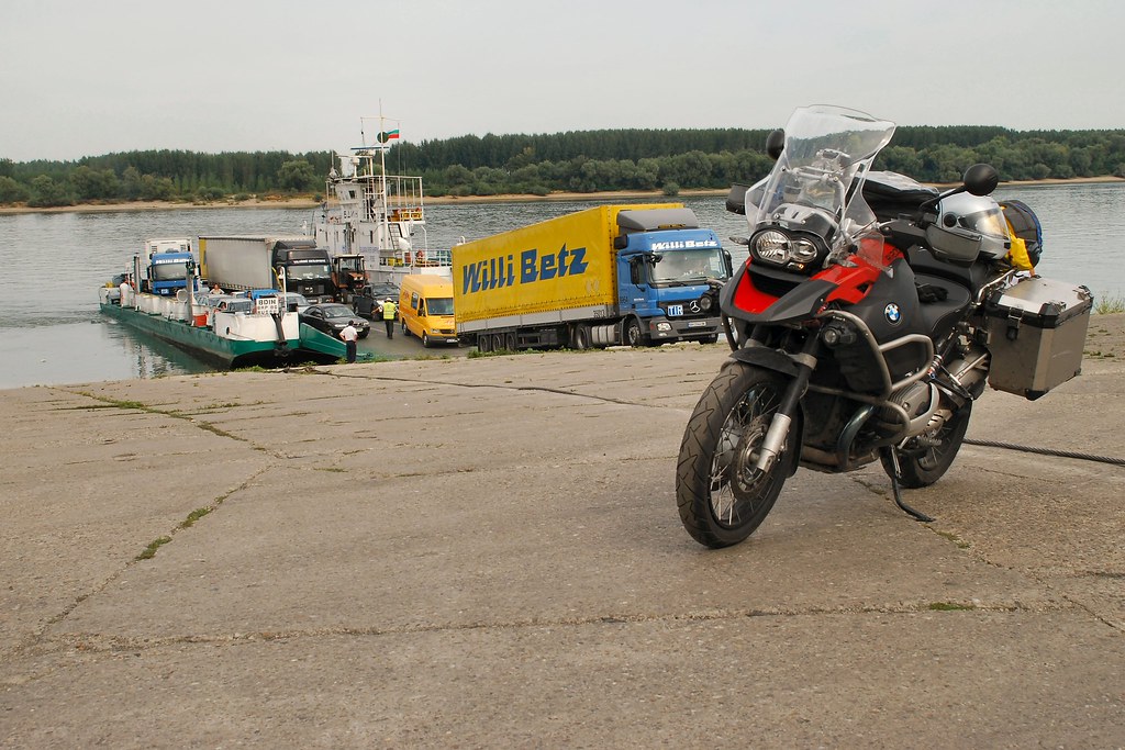
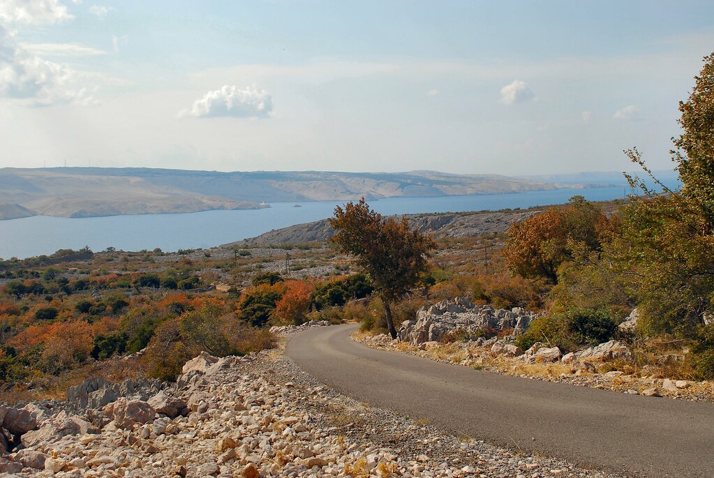
Day 8 – Friday 11th September, Sofia – Orșova, 222 miles
In order to avoid a long detour back to the Ruse-Giurgiu bridge, I planned to cross the Danube back into Romania by means of the Vidin-Calafat ferry. Enquiries revealed that there was no timetable – the ferry left when it was full, but I shouldn’t have wait “more than four hours”.
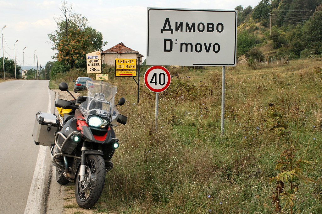
Had a delightful ride up from Sofia, north through Vratsa, Montana and Dimovo:
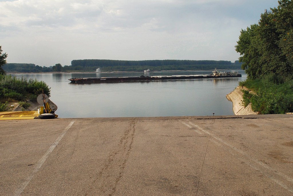
Then the mighty Danube was in front of me again:
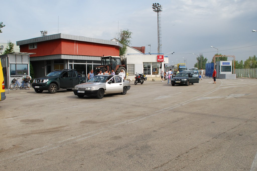
Procedures at the Vidin ferry terminal are best described as “relaxed” and the facilities as “limited”:
My fears about a four-hour wait were unfounded - within an hour we were boarding:
I was directed to a place near the bows, where I was able to admire the minimalist approach to safety barriers and guard rails…
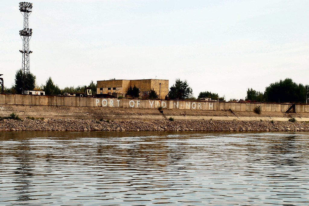
As we crossed, I reflected that Rotterdam need not feel too threatened by the “Port of Vidin North”:
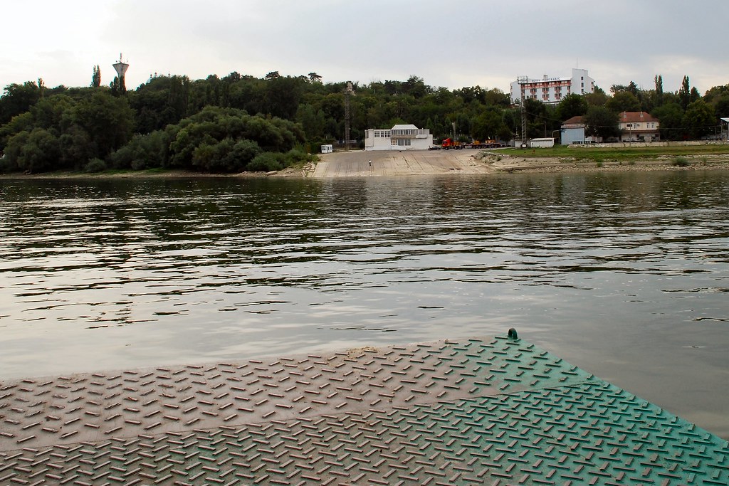
Nor by the Port of Calafat on the Romanian side for that matter:
Back on Romanian soil (well, concrete):
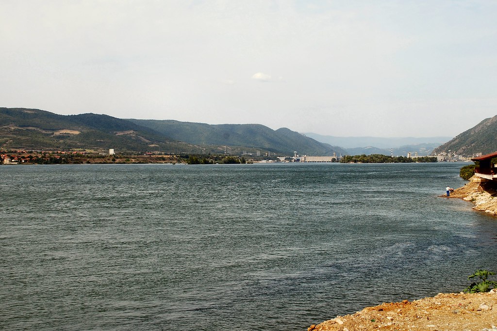
Heading north from Calafat towards Drobeta-Turnu Severin, on recently rehabilitated roads – bends to die for. Note heavy traffic!
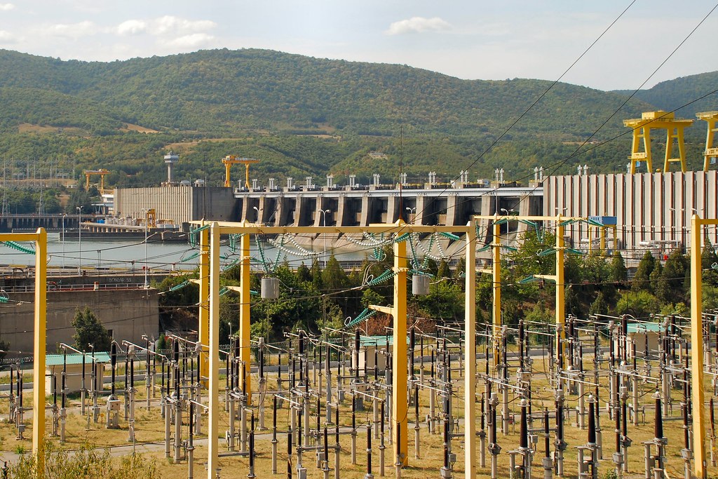
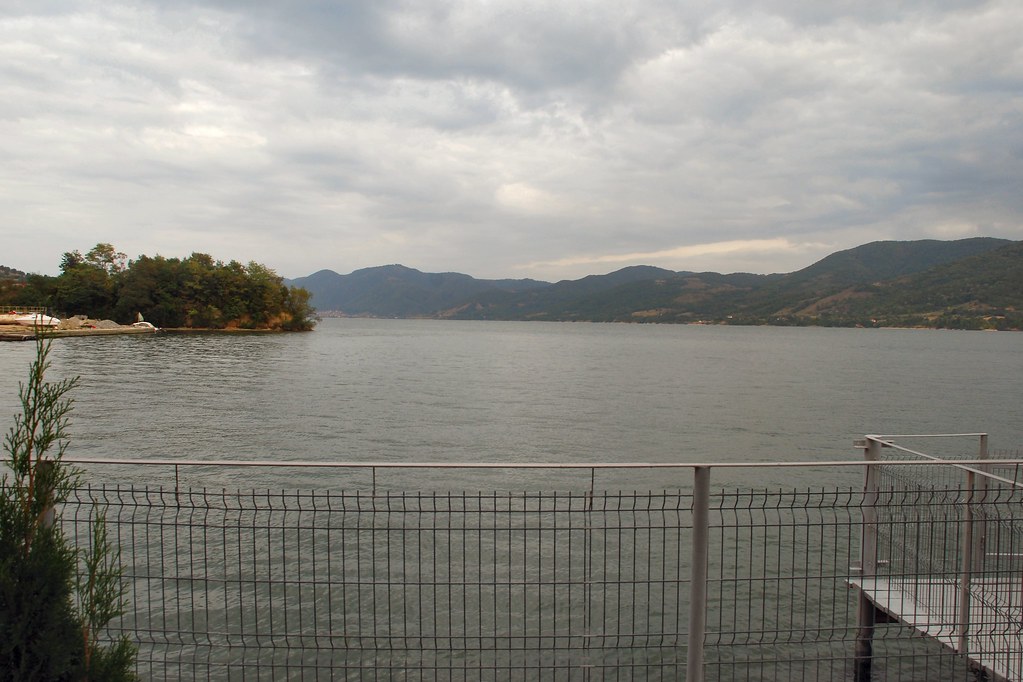
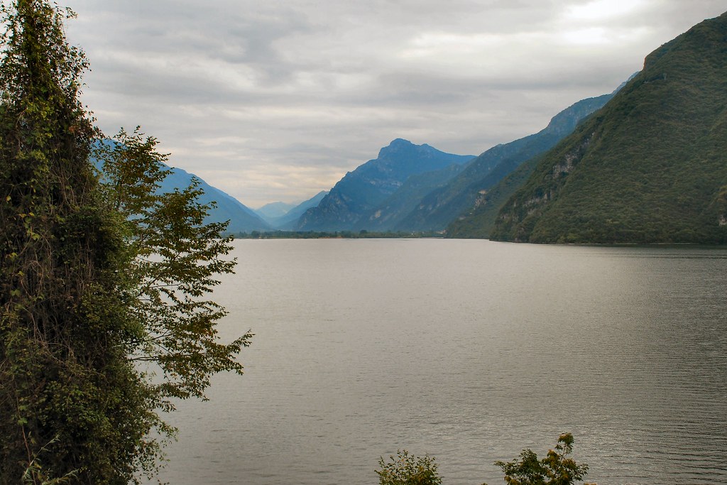
Finally alongside the Danube again, with Serbia on the far side and the Iron Gates hydro-electric power station in the distance:
Now, that’s what I call a hydro-electric plant:
And that’s what I call a river:
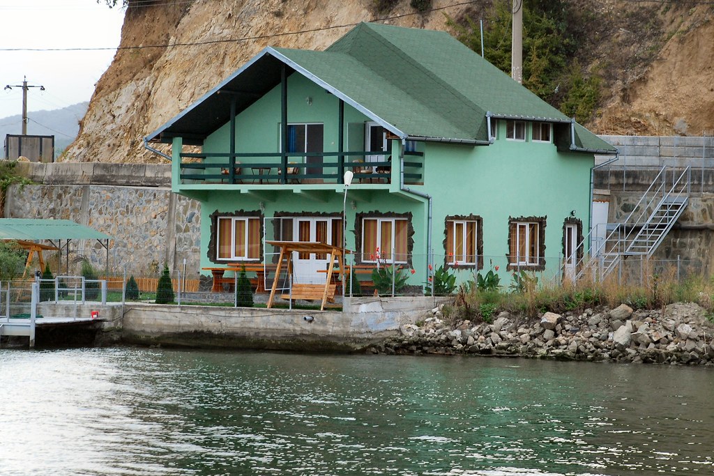
Spent the night here:
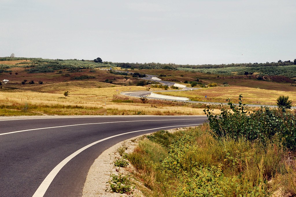
Day 9 – Saturday 12th September, Orșova - Timisoara, 179 miles
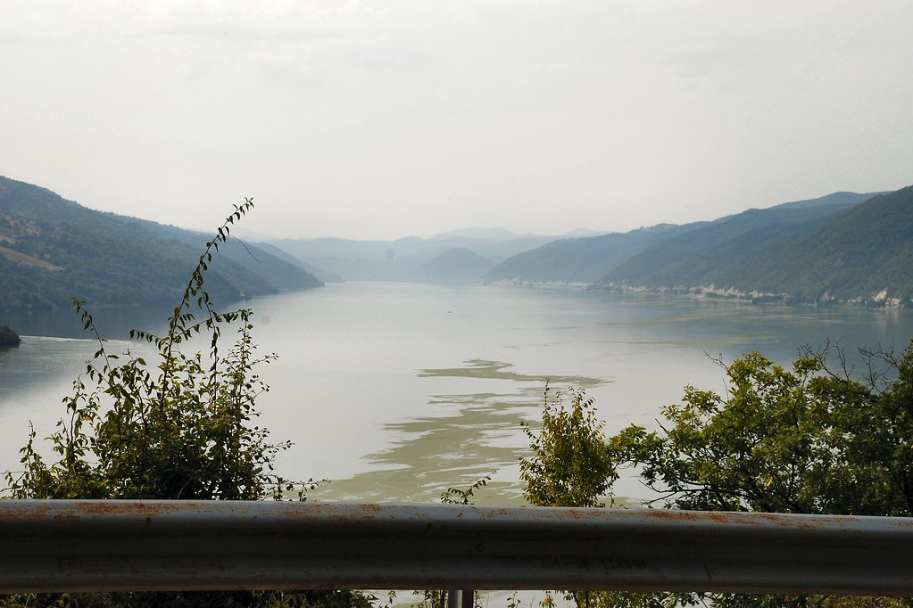
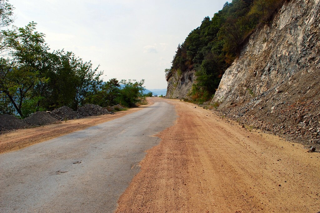
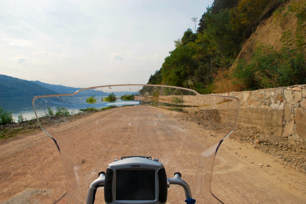
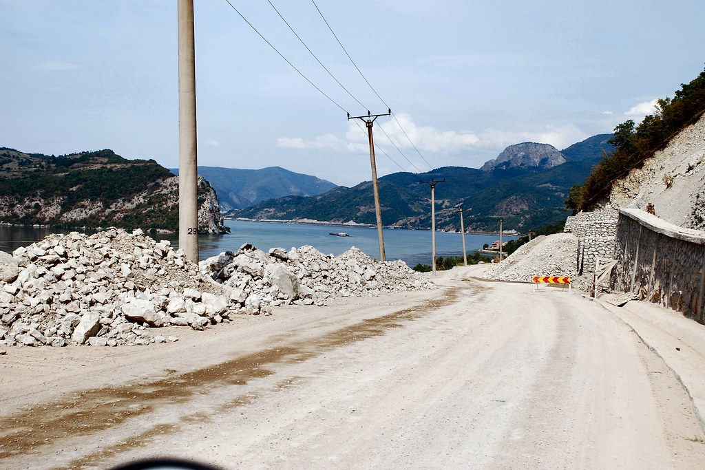
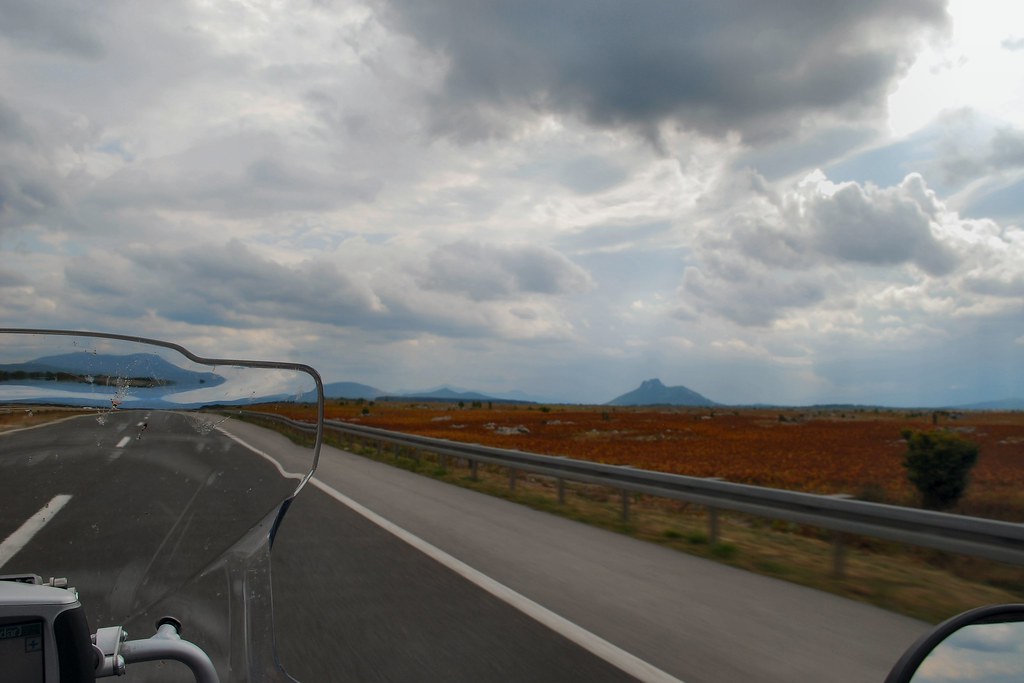
This was to be another highlight – riding the DN57 along the Danube Gorges:
Whilst the scenery was spectacular, the road conditions started to deteriorate...
...and went from bad (this is a national road)…
…to worse:
In fact it was mile after mile of roadworks and temporary traffic lights. I was lucky I was doing this on a Saturday with very little traffic and no HGVs, otherwise it would have been a nightmare.
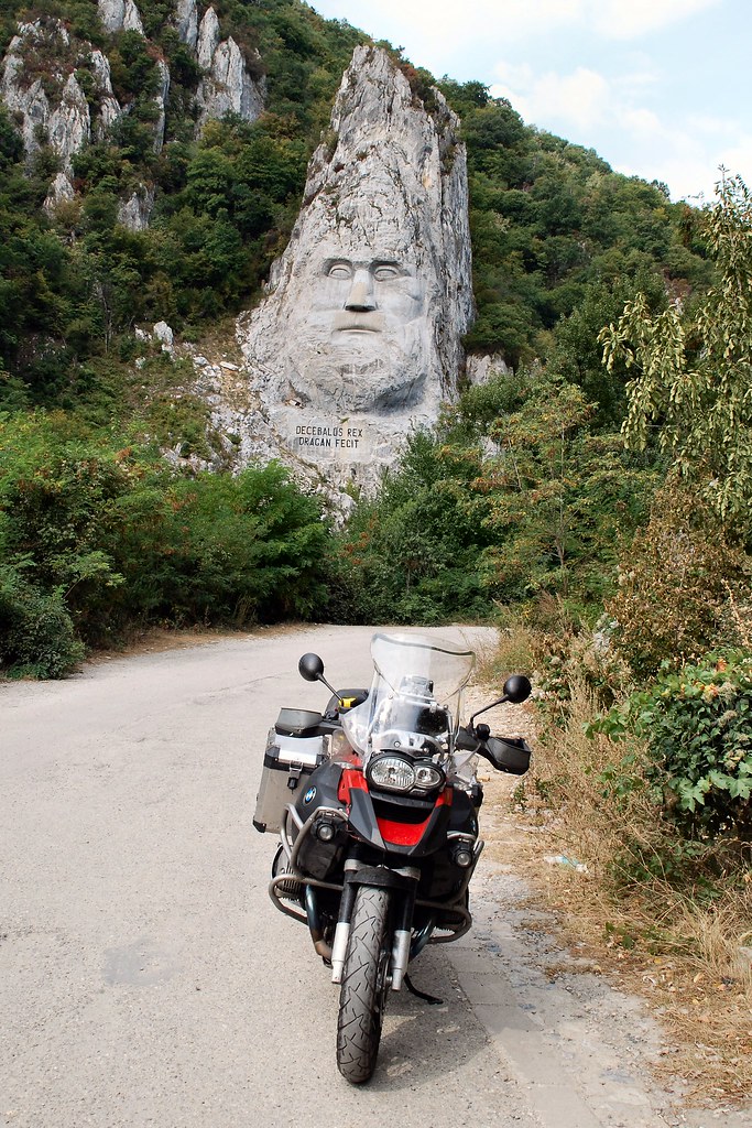
Romania’s answer to Mount Rushmore – it’s Decebal, famous Dacian king who fought against the Romans in the first and second centuries AD (wouldn’t you look pissed-off if the Government allowed the road at which you had to stare to deteriorate to such a condition?)
Back to Casa del Sole in Timisoara. It was very hard to believe that it was only eight days since I’d stayed here:
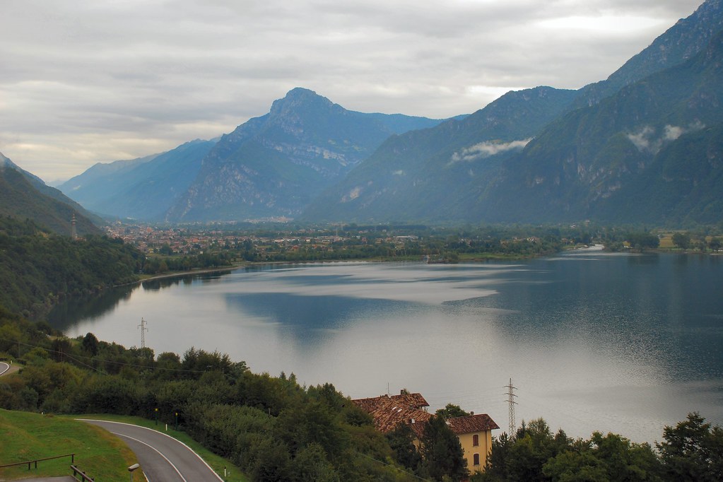
Day 10 – Sunday 13th September, Timisoara - Zagreb, 344 miles
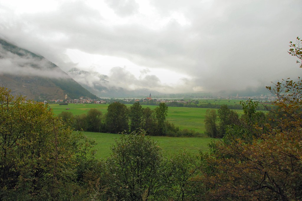
After a few days of taking it fairly easy. time to get back to business – 300+ miles with little or no motorway. Started the day with a quick look around Timisoara as it woke up on a Sunday morning:
As I drank an early morning coffee I reflected on the reasons why I love Romania and how the trip had exceeded all my hopes and expectations.
Then it was back to the border at Cenad and soon I was making the most of Hungary’s great roads:
Not much of particular interest, except this:
Made it safely to Zagreb. I had no preconceptions, but the old centre is beautiful. Unfortunately camera was left in hotel room.
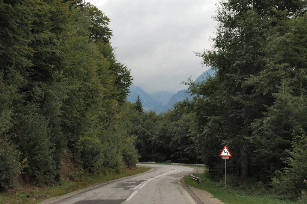
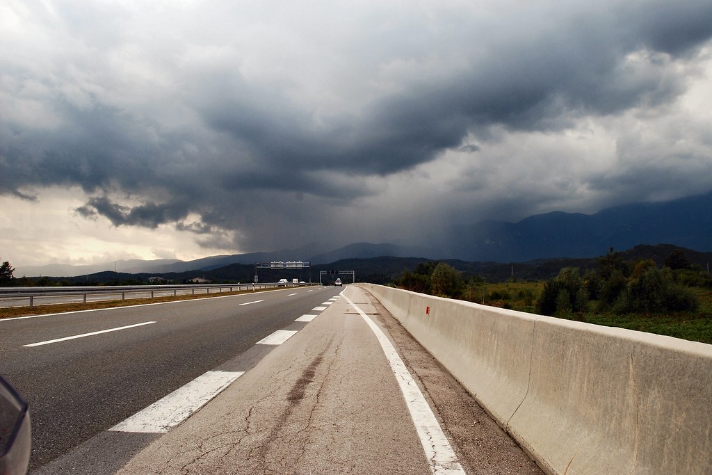
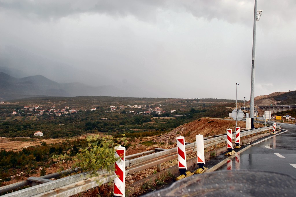
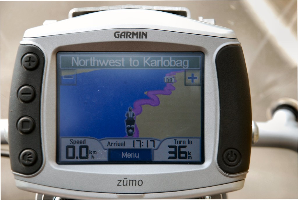
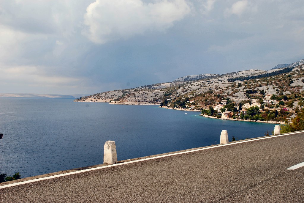
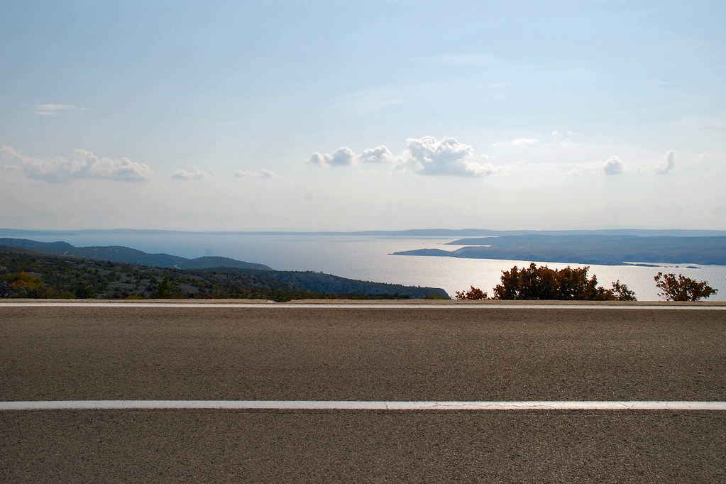
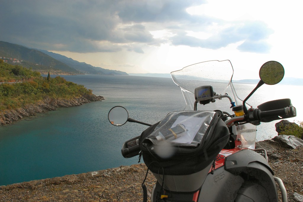
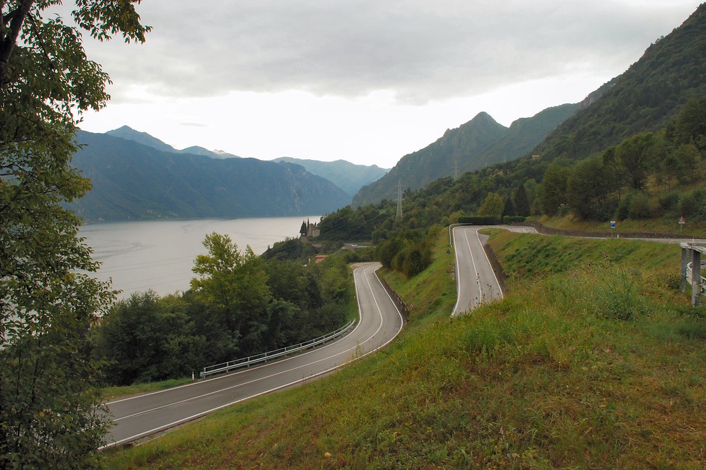
Day 11 – Monday 14th September, Zagreb - Trieste, 322 miles
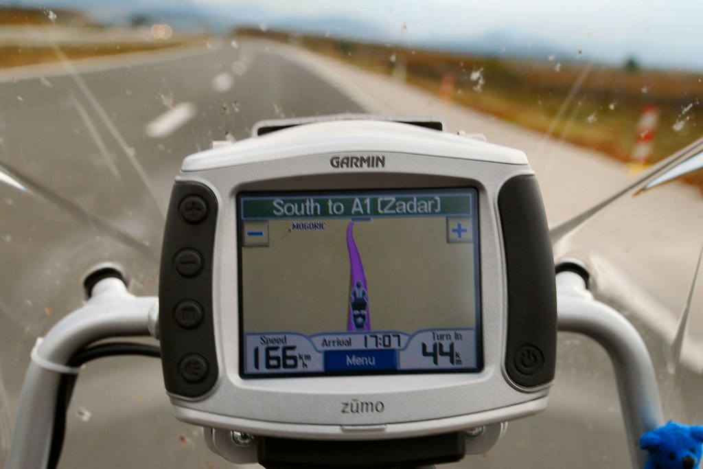
I’d mentally divided this day into two halves. Firstly a fairly tedious, but hopefully relatively high-speed, slog to the Adriatic coast at Zadar. Secondly a much more interesting ride up the coast, a few miles through Slovenia, then into Italy and the night’s accommodation just outside Trieste.
Things started well:
Though the weather in the distance was starting to look a little ominous:
And more ominous:
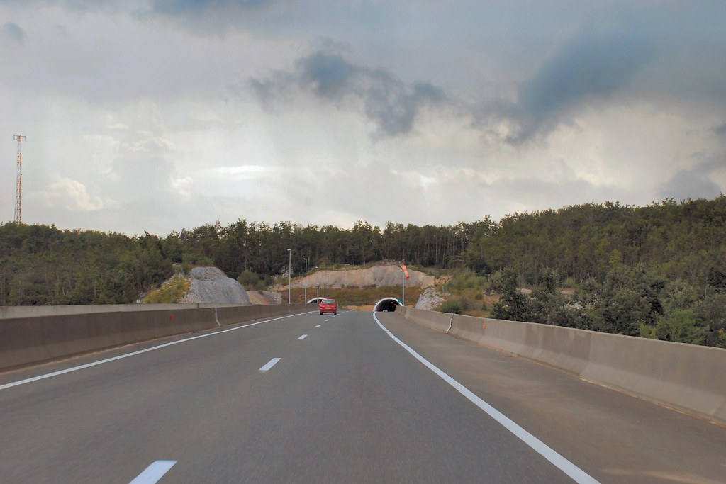
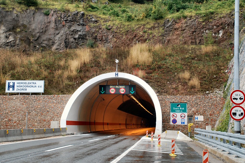
Tunnels gave rise to hope that I might nearing the peaks of the mountains, after which I should see the coast:
The green sign to the right of the entrance says “Sveti Rok 5681 m”:
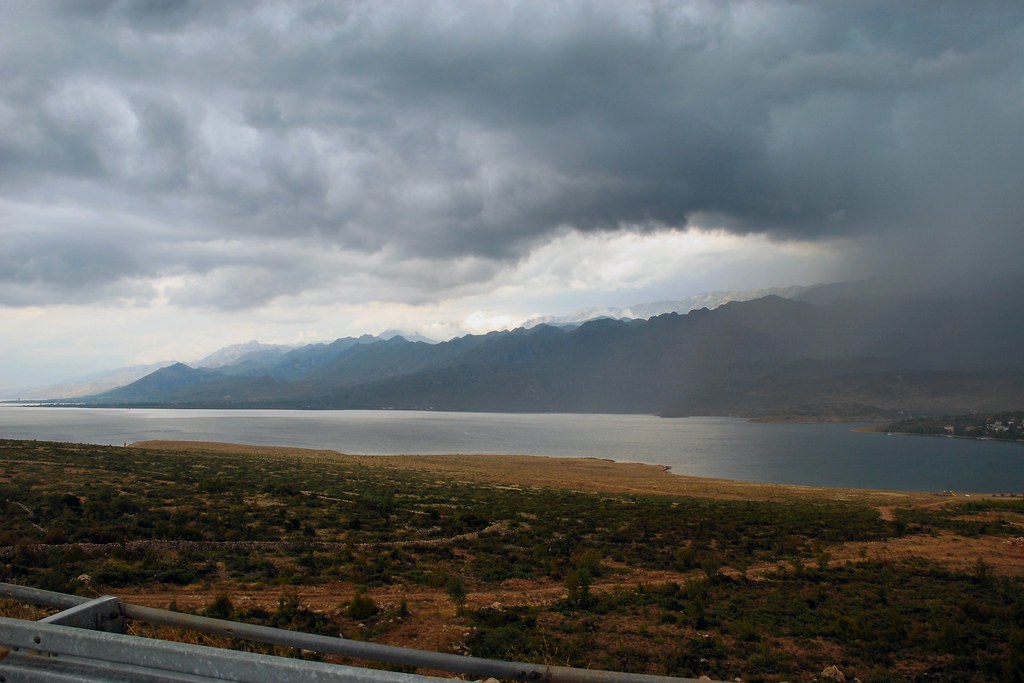
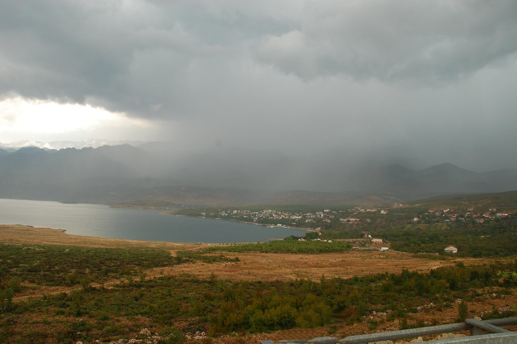
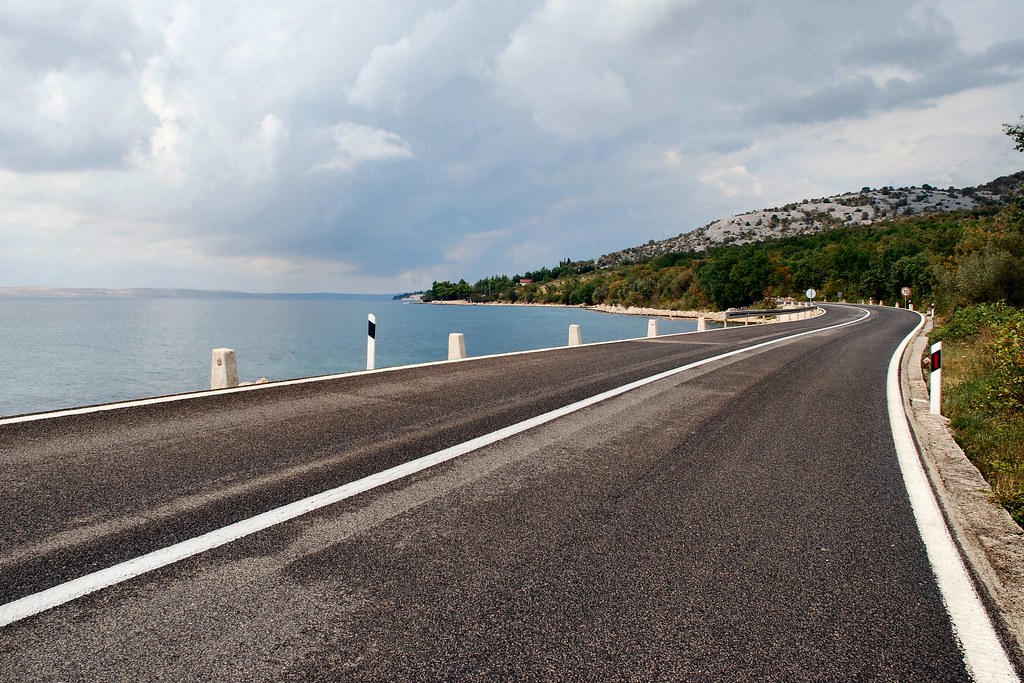
And sure enough, I was soon at the coast:
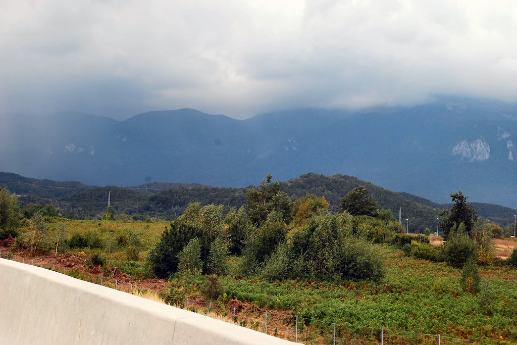
But this not quite the view I’d hoped for:
Still, just get on with it:
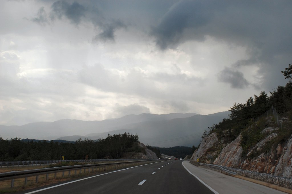
As I pressed northwards, things started to get brighter:
…and brighter:
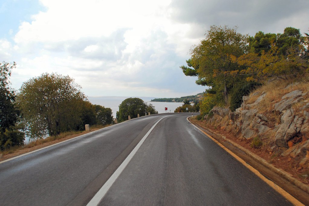
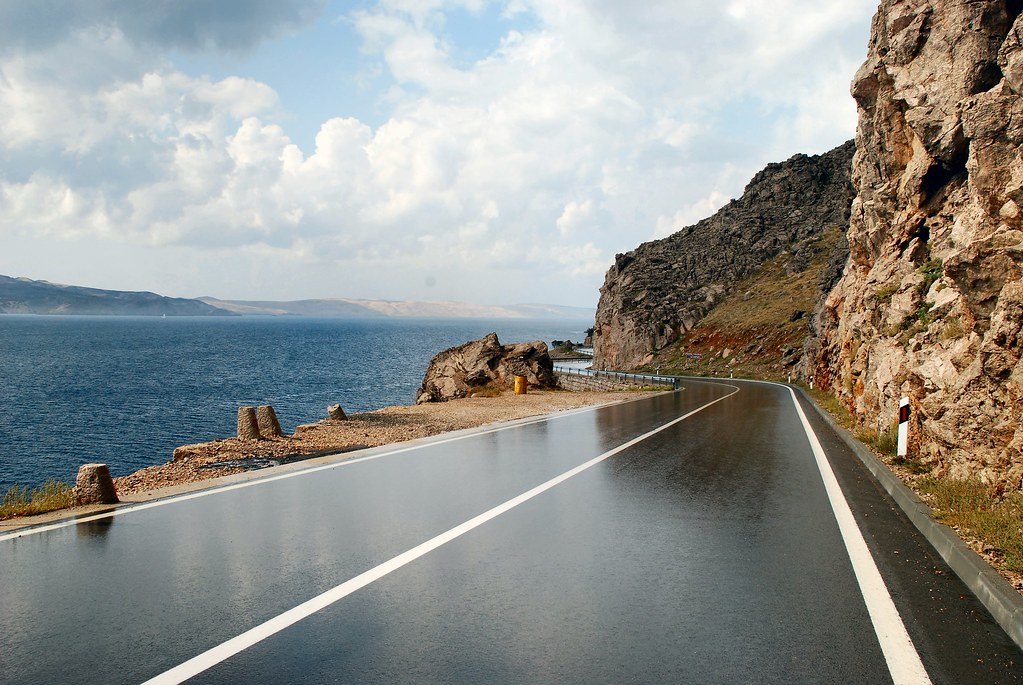
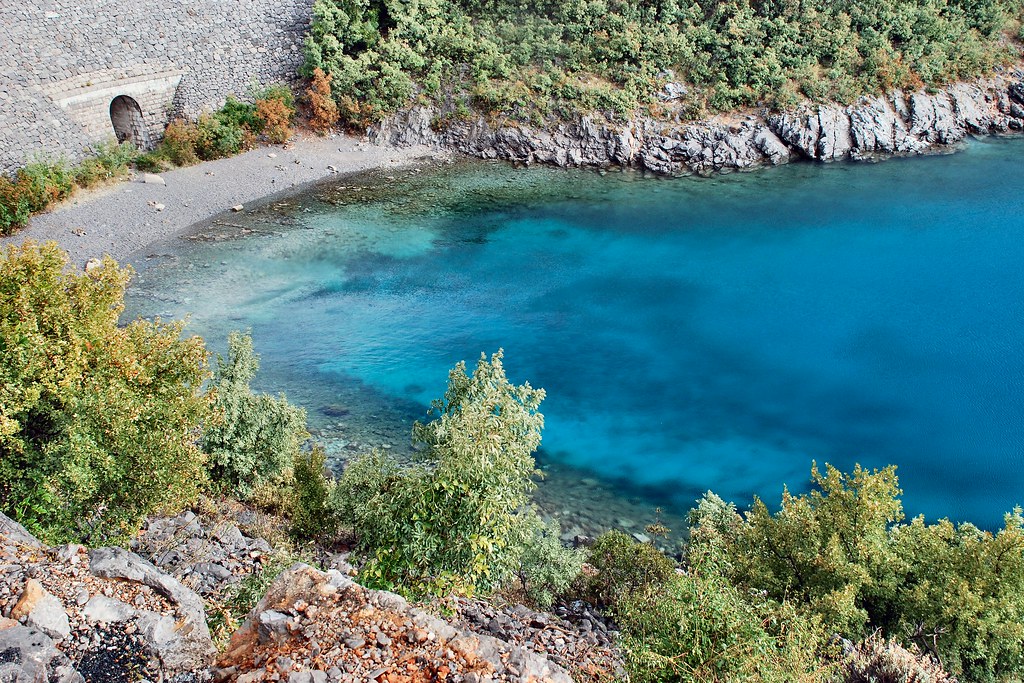
Here we go! This was probably the most enjoyable stretch of road on the whole 4,000+ miles journey. Obviously it doesn’t compare with the Transfăgărășan or the Stelvio for the scale of the achievement, the technical hairpins or the breathtaking views. However it was superbly surfaced and seemed to consist of an endless series of bends of varying radius and hence speed. Very little traffic heading north and the little that there was could be safely overtaken at will. When it was over I just wanted to turn round and do it again.
It just got better and better:
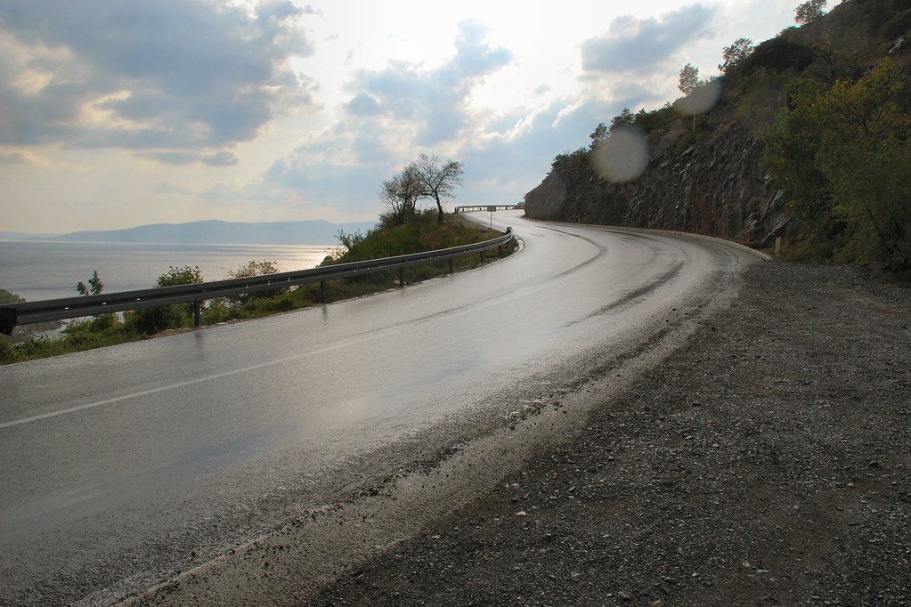
Although there was still the odd shower, these were very limited and the surface was soon dry again:
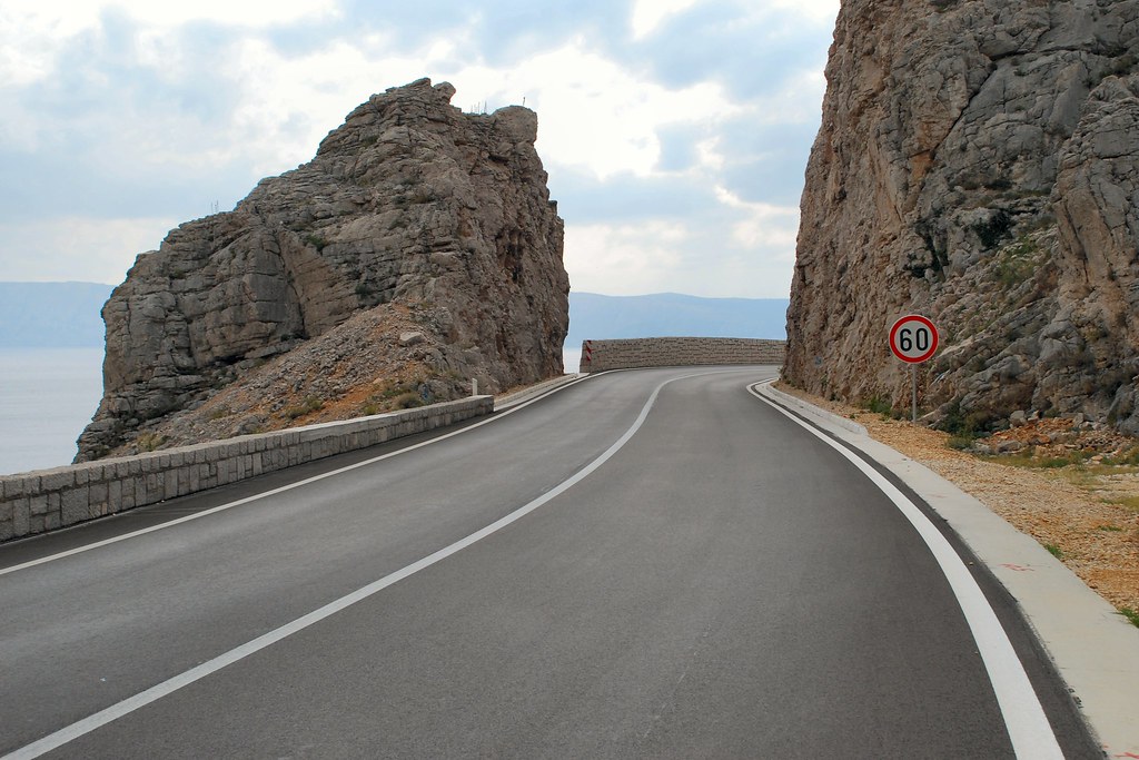
Lots of interesting side roads, which just begged to be explored. Alas, no time:
Some more views:
Finally made it to Trieste where heavy rain quickly wiped any desire to explore. Stayed at <i>La Valle di Banne</i> (<a href="http://www.lavalledibanne.it" target="_blank">www.lavalledibanne.it</a> - another great find). This albergo doesn’t serve dinner, but in view of the pouring rain the proprietor drove me in his own car to his favourite cucina in the next village, and returned to collect me later. Service like that leaves one (well, me at least) feeling good inside.
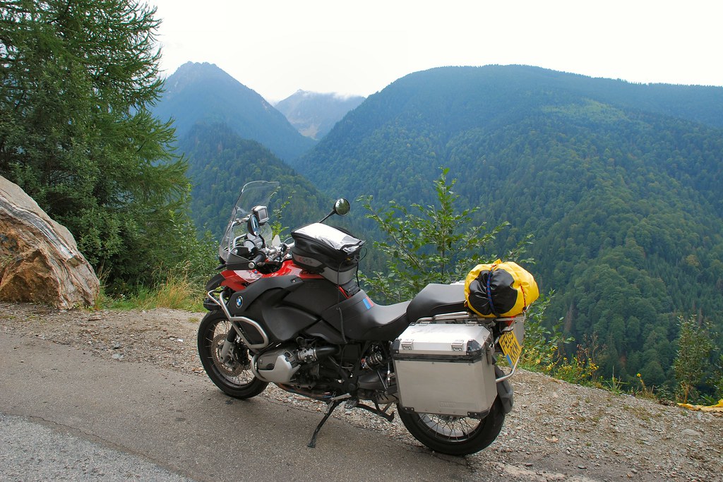
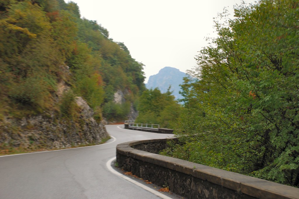
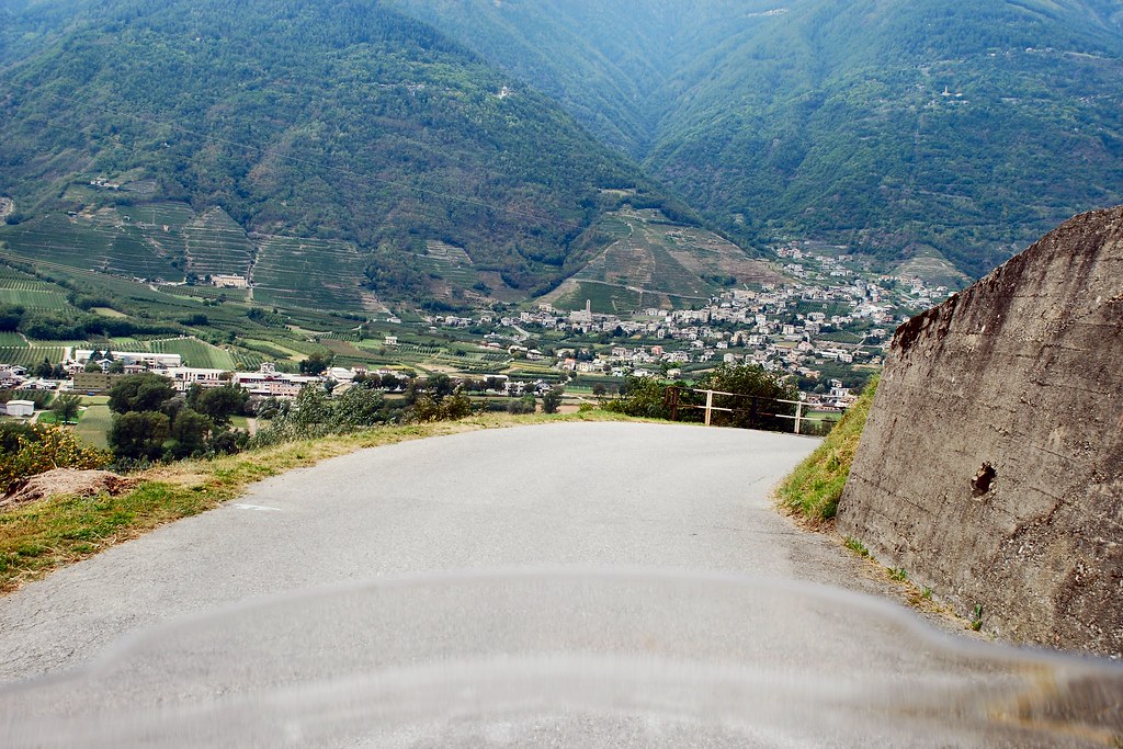
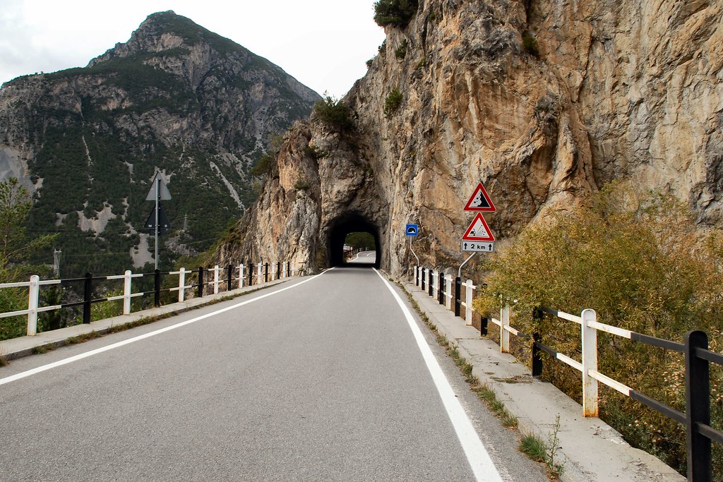
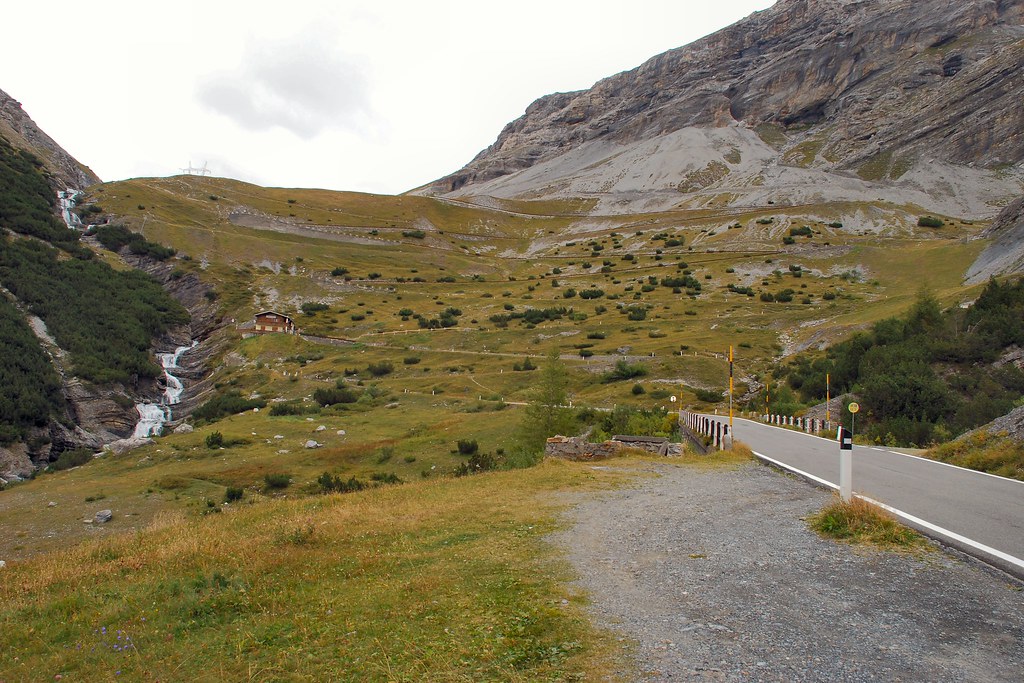
Day 12 – Tuesday 15th September, Trieste – Trafoi, 350 miles
By the end of this day, if all went according to plan, I would be able to look forward to a future in which I could bore people with “When I did the Stelvio Pass”. In planning the route I’d decided to leave the autostrada just after Lake Garda, in the hope of a more interesting, though less direct, route to the beginning of the Stelvio. The morning was taken up with a fairly unpleasant 190 mile slog westwards on the autostrada.
But after turning off, things soon became much more interesting:
Though it wasn’t all idyllic – some towns seemed quite depressed:
As I pressed on, it just got better and better:
Found myself alongside Lake Idro:
Turned off the main road and started to climb…
...and climb…
...and climb…
...and climb…
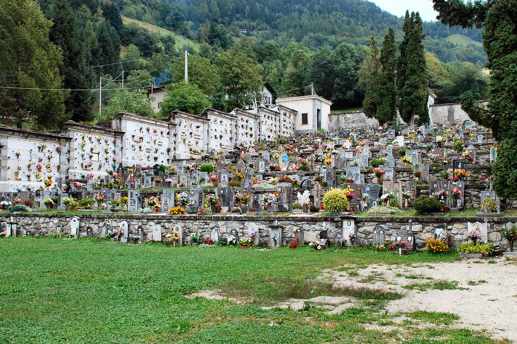
Some places would really benefit from a by-pass:
Though a by-pass might mean missing the amazing cemetery:
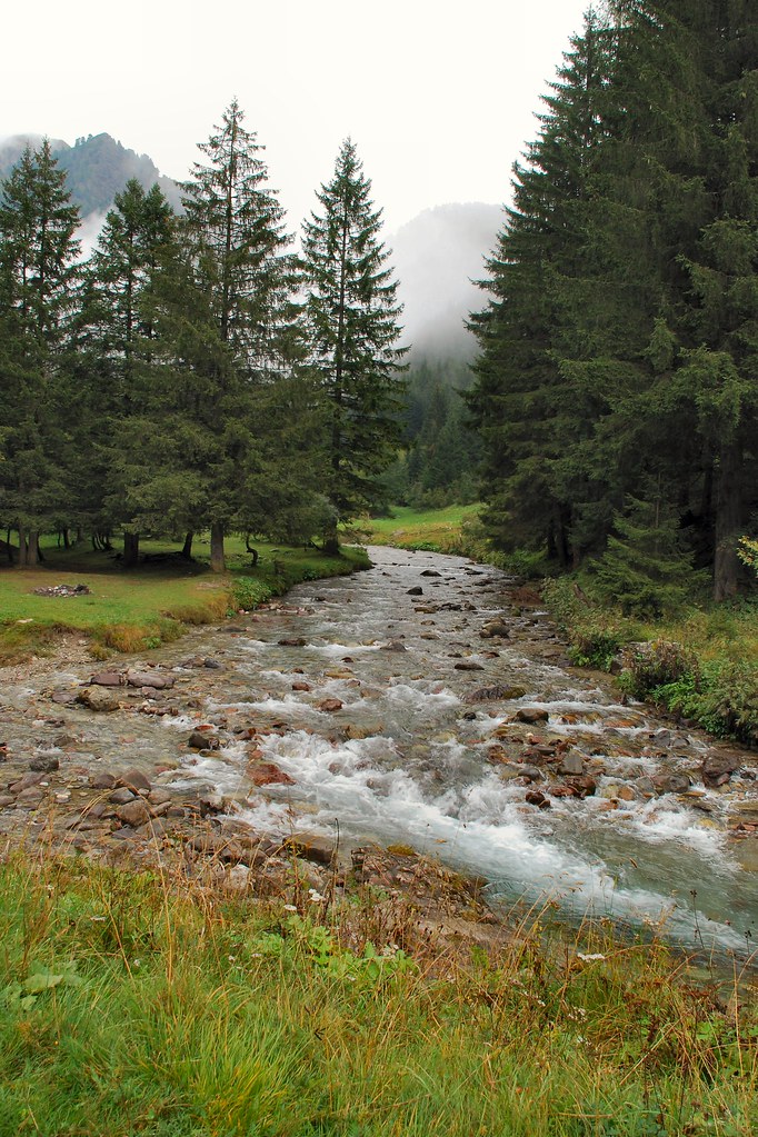
Idyllic mountain streams, crystal clear and ice cold:
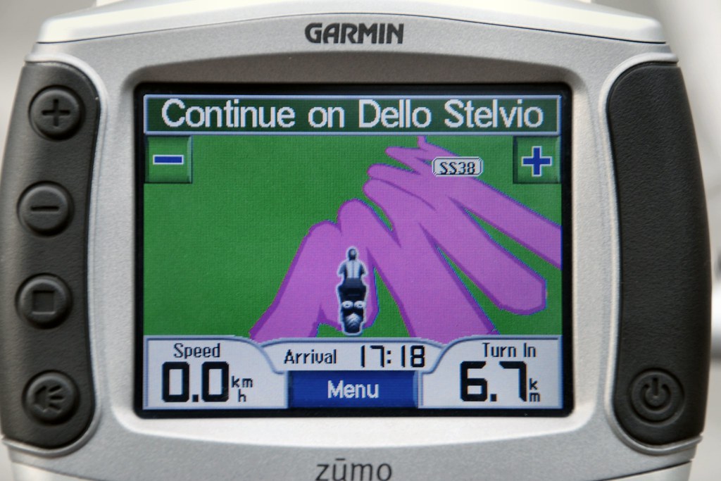
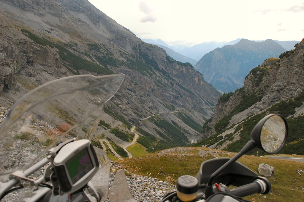
And then it started getting really interesting. For those not familiar with these things, and it had me worried for a while, the strange white arrow on the route is a U-turn indicator, where the hairpin is so tight that the Zumo is confused:
At the top:
And suddenly there’s a beautiful meadow stretched out in front of me, complete with cows with bells:
The summit of the pass, complete with cross:
Some more pics:
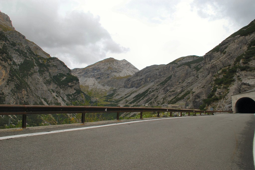
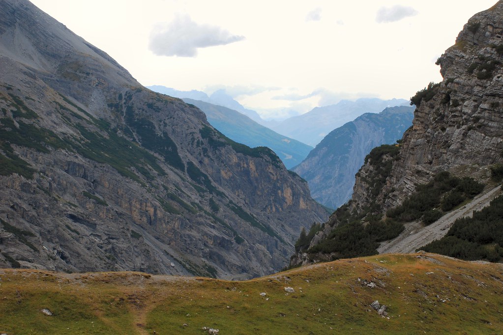
Just unbelievable, and no sign yet of Stelvio…
Some interesting descents:
Down to a more sensible altitude, and lots of tunnels, but still no Stelvio:
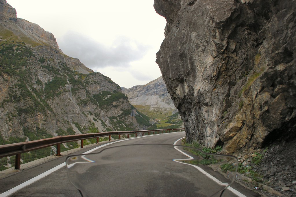
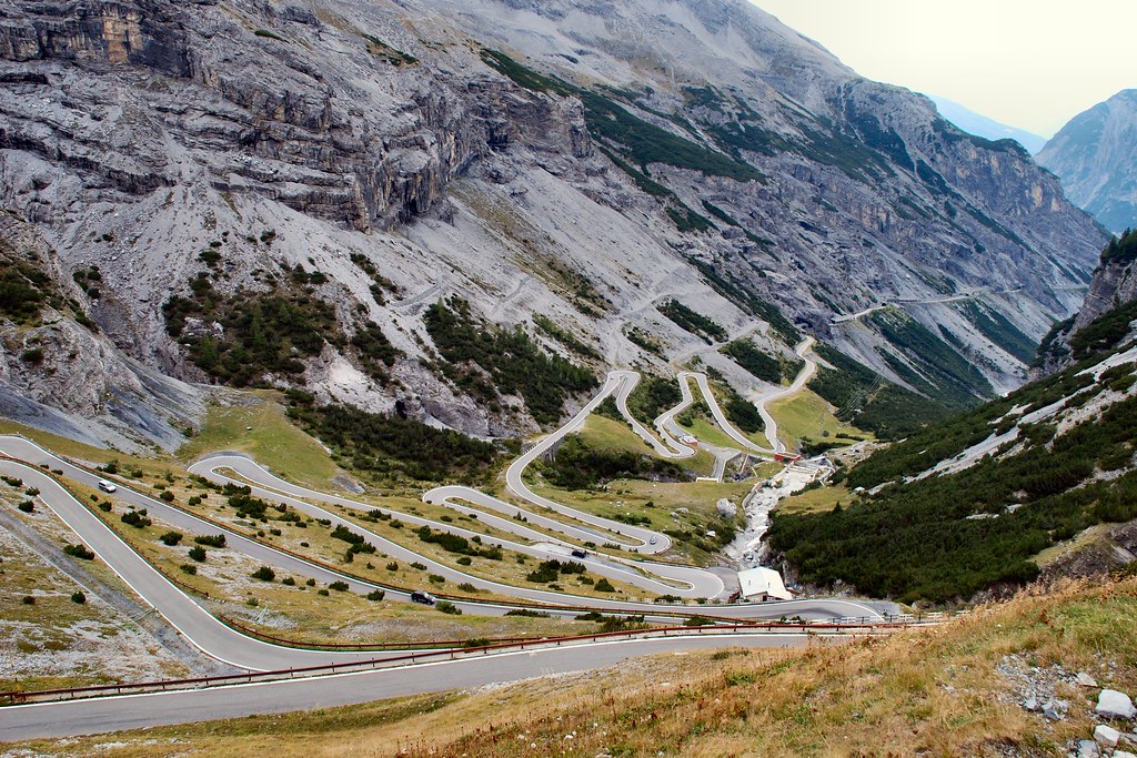
Could this be the start of something?
Oh yes!
Most definitely!
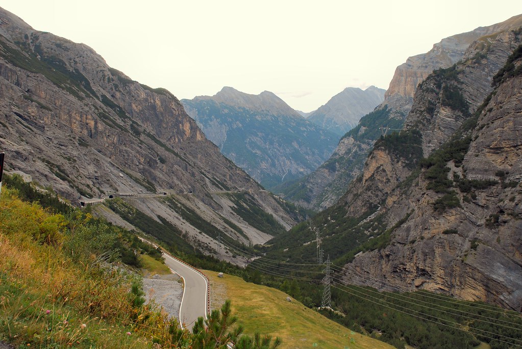
Hopefully you can make out the road switching left right up the hillside to the right of the stream:
Definitely in the right place:
Nearer the summit I pulled up in a lay-by, where a Brit on an ageing Goldwing was already stopped. I made some comment along the lines of it being “f**ing incredible” (or something similarly profound!). He suggested I look over the ledge, indicating the grass ledge at the bottom of the photo below:
So I did:
Attempts at “arty” shots with bike:
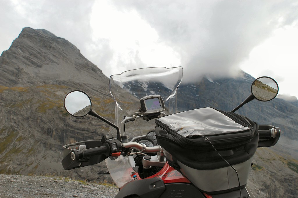
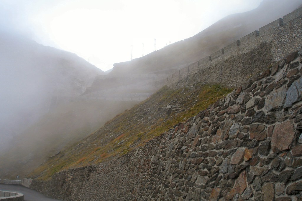
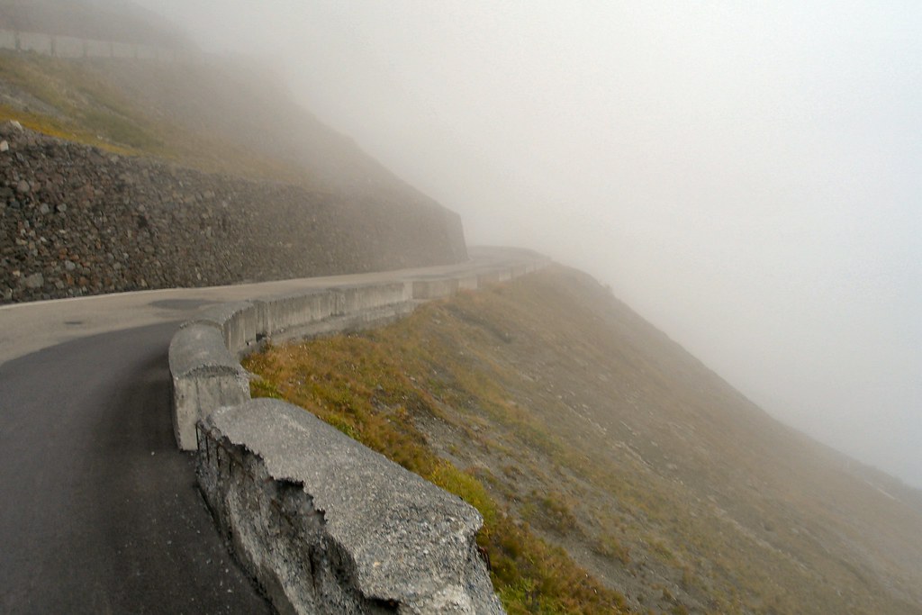
The weather was closing in, and I still had to reach the summit:
Shortly afterwards I was at the summit, in thick fog. Bumped into some of the guys doing the “Swiss Alps 2009” tour. It was at this point that the camera battery finally went dead, so no photos of the summit.
Started the descent, then remembered that, in addition to the D80, I had a compact Sony camera buried in a pannier somewhere, and stopped on a hairpin and eventually dug it out.
It was bloody cold:
And it could feel very isolated:
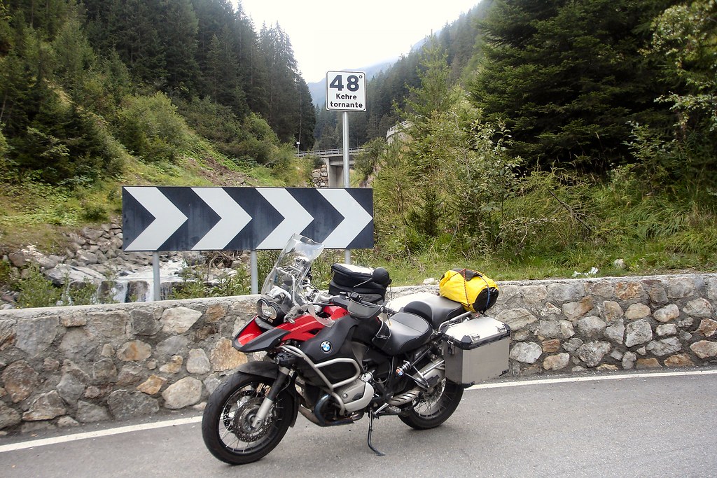
As I descended the visibility improved, until I was at the last hairpin. The sign reads “48° kehre tornante”, which I believe translates as “48 bends remaining” (and every one is a hairpin!)
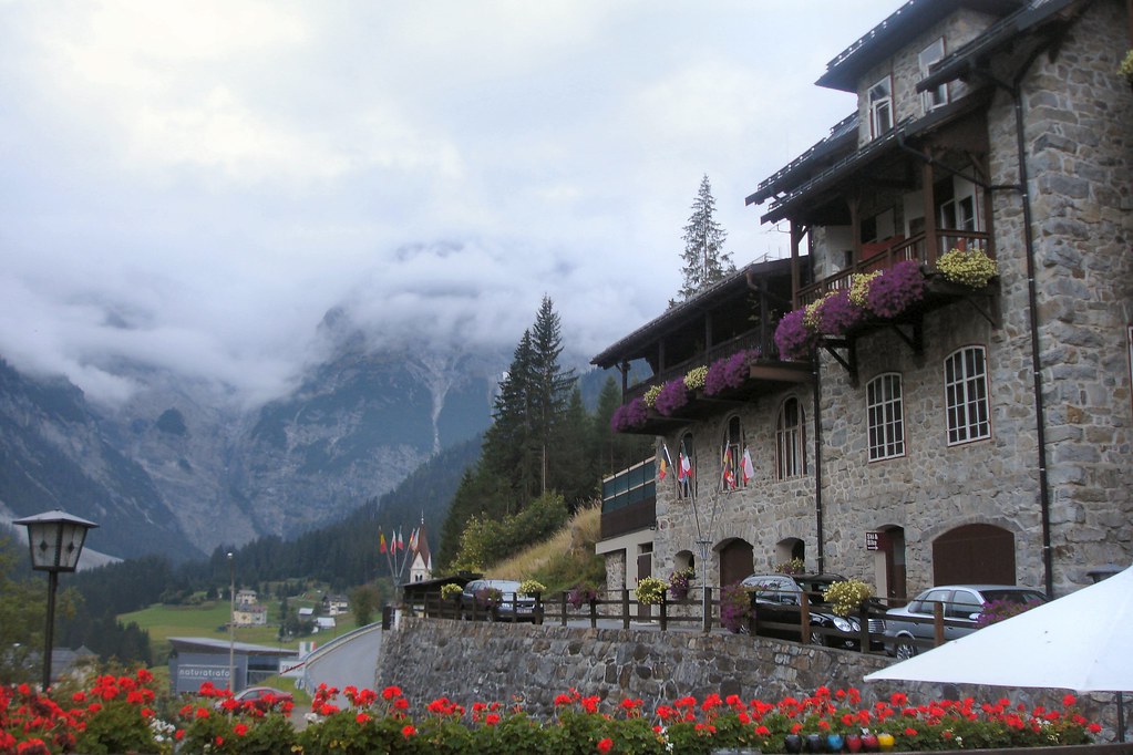
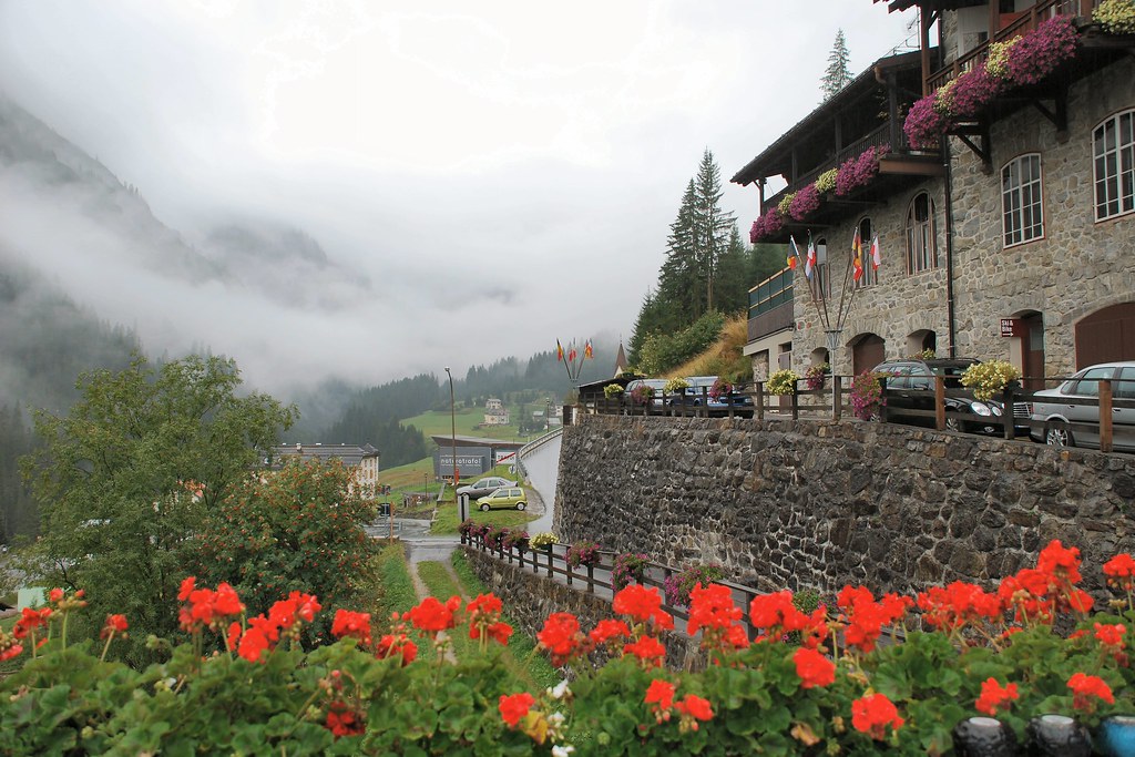
Accommodation for the night was <i>Hotel Madatsch</i> (<a href="http://www.hotelmadatsch.it" target="_blank">www.hotelmadatsch.it</a> - recommended)
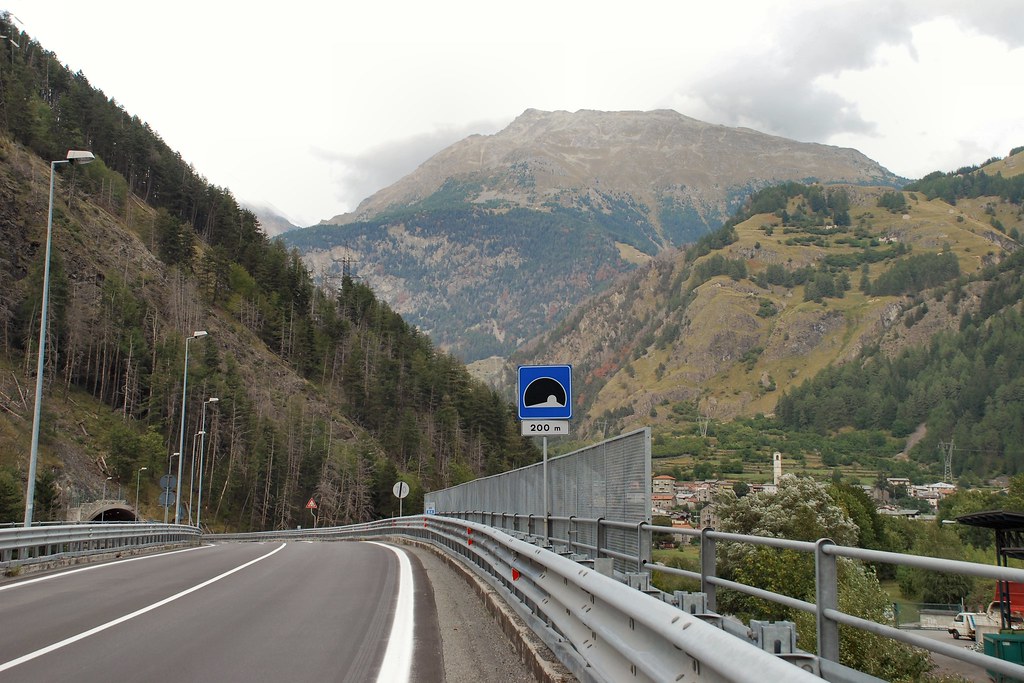
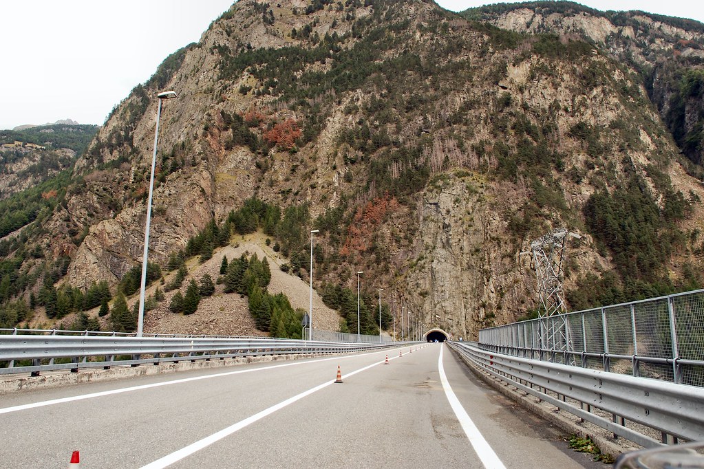
Day 13 – Wednesday 16th September, Trafoi - Troyes, 402 miles
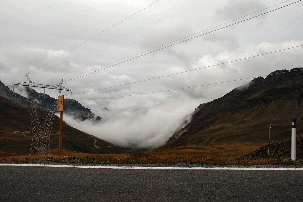
I’d assumed that the low cloud would have cleared, and had intended to return to the summit of Stelvio and then take the road down into Switzerland. A quick glance up the valley convinced me that this was not a good idea. I had a 400 mile journey ahead and couldn’t really afford to waste time. And fog looks the same wherever you are…
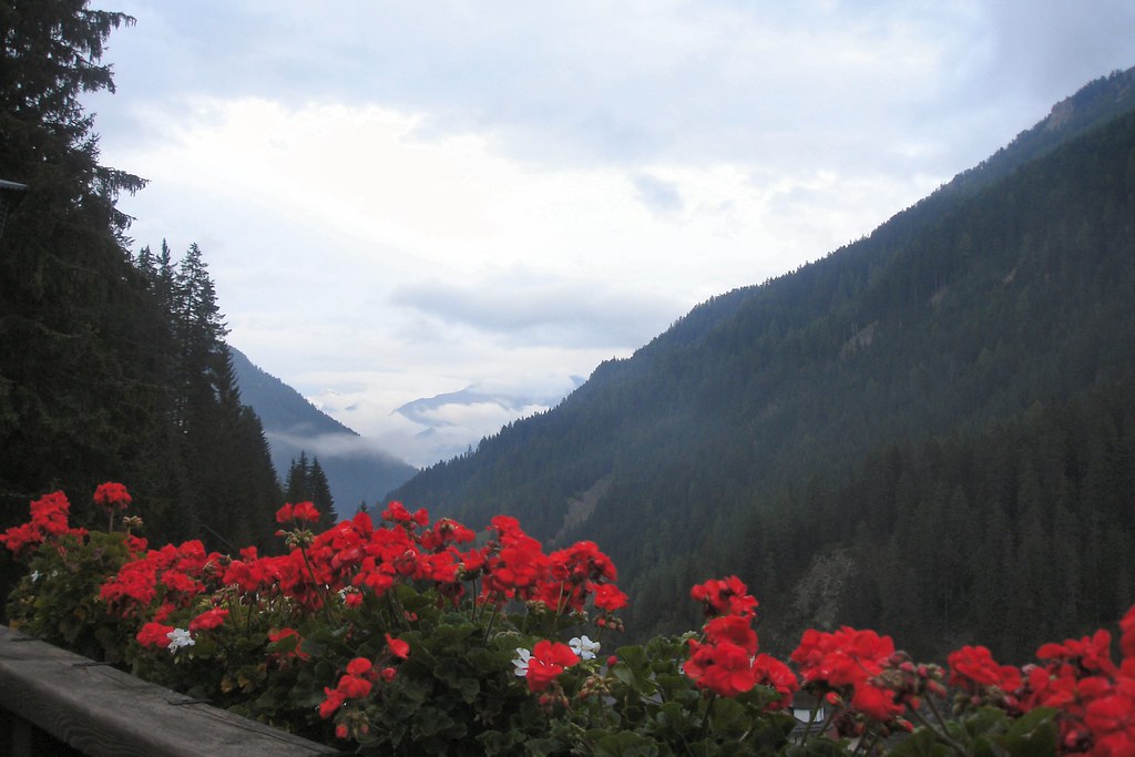
However the view in the other direction was hardly encouraging:
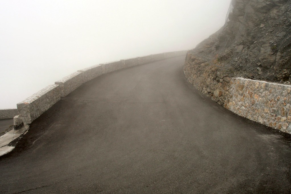
Set off down the valley and soon dropped (just) below cloud level:
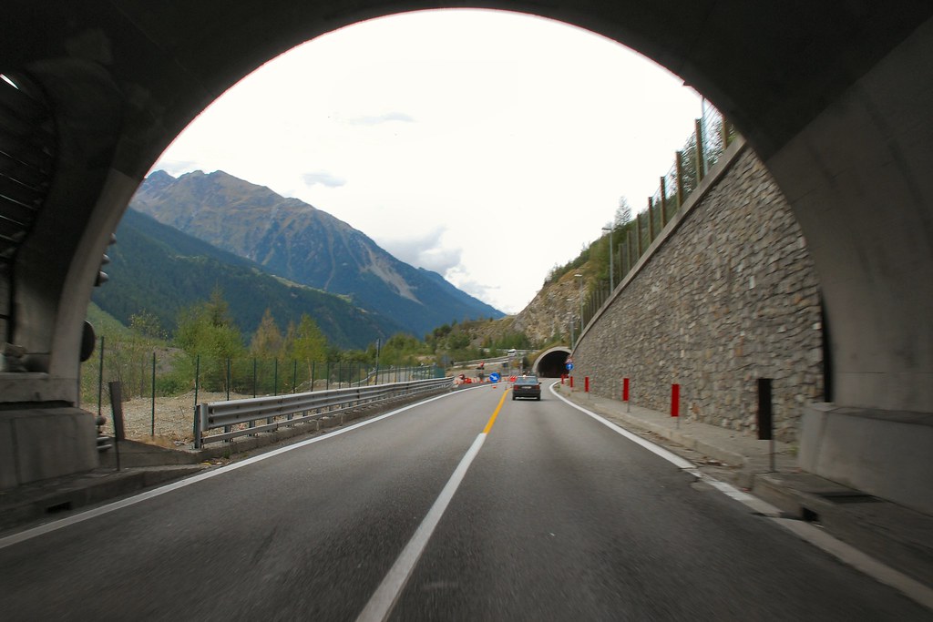
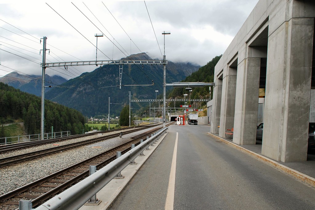
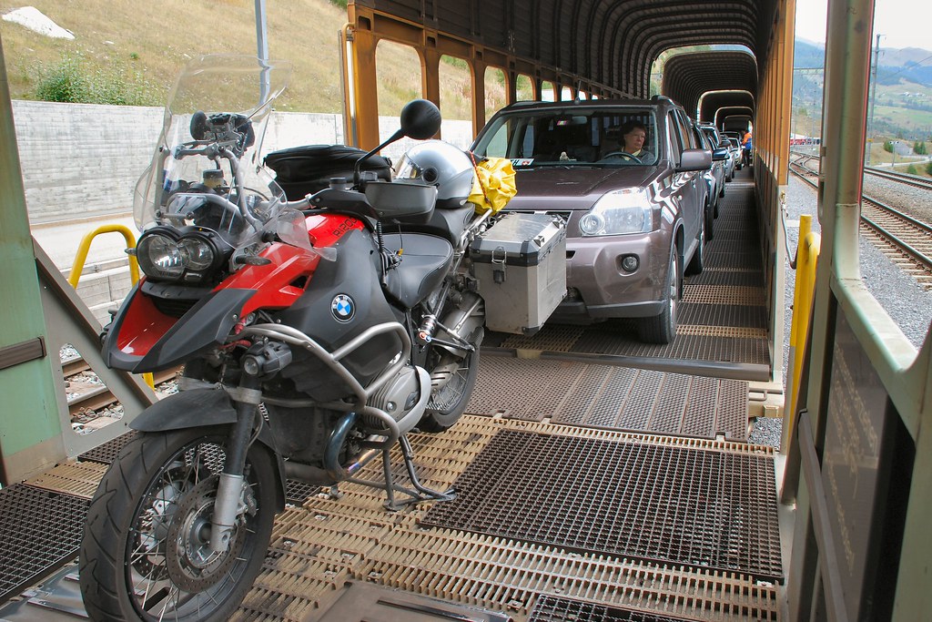
The 19 km Vereinatunnel is operated by Swiss Railways:
…and operates on the same principles as the Channel Tunnel:
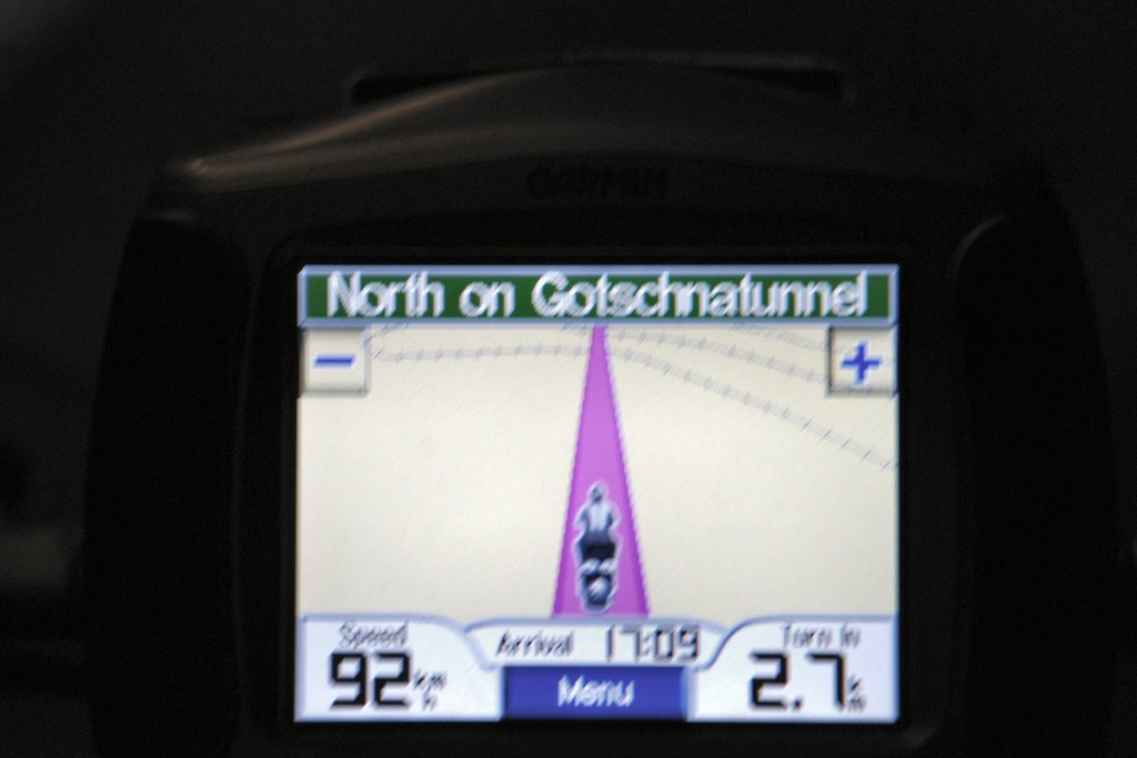
The Gotschnatunnel I don’t really remember, except that it was where I finally managed to take a photo while riding in the dark:
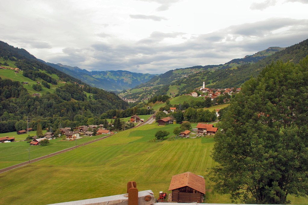
Travelled through some fairy tale Swiss scenery…
I soon left the A36 for the infinitely preferable N19. I had accommodation booked in Troyes. I’d enquired on this site about accommodation in the Reims area and came across a recommendation for the Hotel Comtes de Champagne (www.comtesdechampagne.com - again highly recommended) in nearby Troyes, which offered garage accommodation for bikes. I must admit to never having heard of Troyes, but it was a small town in roughly the right place, so it seemed that it would suit my purpose. After all, this would be my last night and I just needed somewhere to sleep. Given its evident size, I was a little surprised when I started seeing it signposted while I was still many, many miles away. When I arrived, it became clear why – this is no ordinary provincial French town:
I didn’t have a tripod, hence the poor quality of the ones taken after darkness fell:
In many ways I had not been looking forward to this last night to the trip. But finding myself in such a beautiful town made all the difference. I thought about how I felt about the whole thing while eating outdoors at one of the restaurants on the photograph immediately above – the word that seemed to best describe it was “privileged”.
Day 14 – Thursday 17th September, Troyes – Burton upon Trent, 444 miles
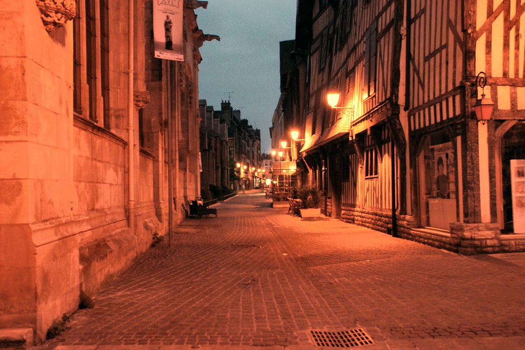
Being tight, I’d booked the tunnel crossing for after 8pm, so a relaxed schedule. Started with a wander around Troyes:
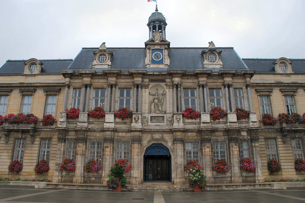
This is the Town Hall. It was the window boxes that I noticed – how many UK town halls would do the same?
Hotel Comtes de Champagne €53.75 including 500 year old rooms, breakfast and garaging for bike:
Late morning I set off towards Calais. My planned route basically comprised 250 miles of the A26. After 100 miles or so it became clear that I would be at Calais several hours too early, and that I should be off the motorway and on national roads.
It soon became apparent that I was in First World War battlefield country. La Ville aux Bois British Cemetery – I was surprised how moving I found it.
From miles away I could see an odd looking structure on the top of a hill. It turned out to be the town of Laon, and the structure was a magnificent church in the centre of a very old town on the hill. Another unplanned bonus:
1200 GSA finds God…
Back on the road I headed towards Cambrai and then Arras – names that will probably forever be associated with the First World War. Somewhere near Arras I saw a sign to Vimy. In the hope of finding the infamous Vimy Ridge, off I went. I was in luck.
The memorial is truly impressive:
There is also a memorial to the Moroccan Division:
This was my first visit to the site of a concentrated WW1 battle. If it’s like this nearly 100 years later, what must it have been like at the time?
Most of the Vimy Ridge site is inaccessible. The sign reads “Danger No entry Undetonated explosives”:
The state of the ground in the preceding photos is the result of shelling. This is the result of an underground charge being detonated:
Memorial to the 3rd Canadian Division:
Somehow it seemed fitting and appropriate that the last day of the trip should incorporate somewhere like Vimy Ridge. I’d had the time of my life over the preceding 13 days, and sometimes it’s necessary to remember those that gave their lives in order that people like us are able to have the times of our lives today...
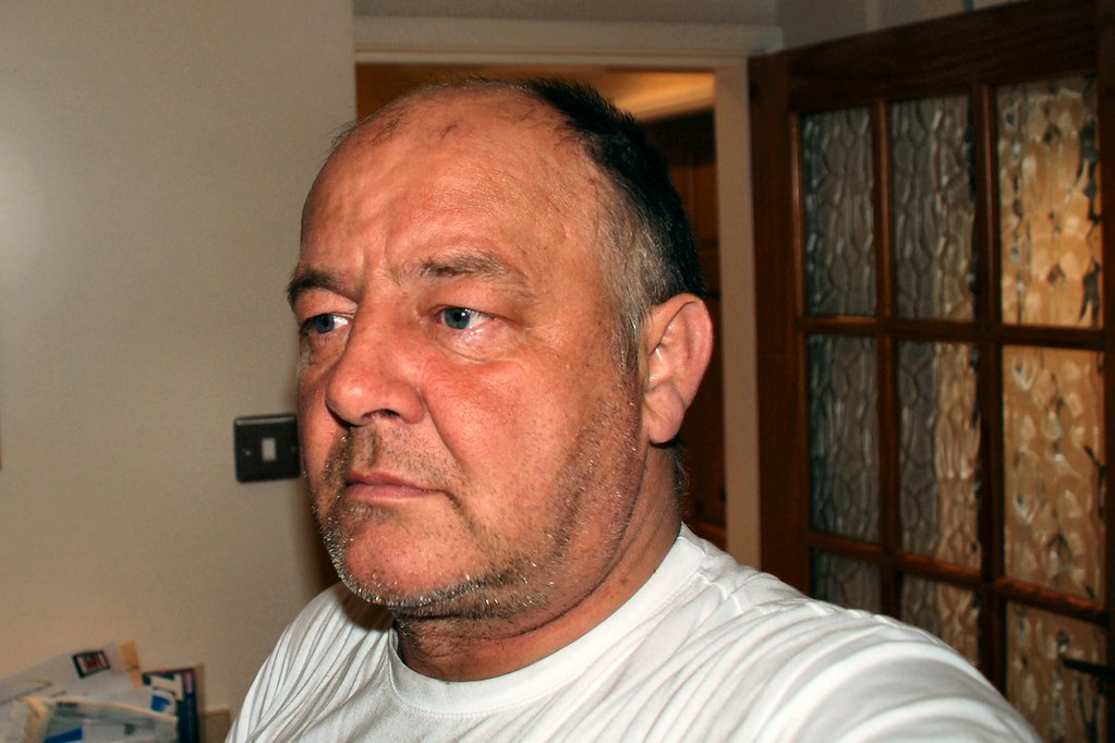
Self portrait on arriving home!

")
 (having never been on a bike before). This is what subsequently happened and the rest, as they say, is history...