As it’s easy to save MyRoutes’ GPX files as KML or indeed a host of other file types, I’ll do it that way as well.

As much as anything else, the original post and thread in the Travel section
Quite a nice route in and through this pretty much wild bit of France, courtesy of Motorrad magazine 07 March 2024 If bods are wondering why the route extends north of Die, to the oddly named ‘Ideal palace of Cheval the postman’ here’s the answer. It is an all but incredible story. Worth a...
www.ukgser.com
Was not so much about sharing the GPX file, but my hope that:
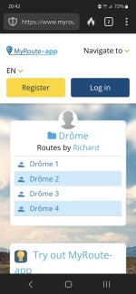
A. Bods might get an idea to maybe go to the Drôme region of France, instead of going to the Alps or Black Forest….. again. I can understand why they do, as these are ‘safe and well trodden’ places, whist the Drôme is maybe less so. In short, you have to work at it a bit. But hey, it’s an Adventure (with a capital A) forum.
B. Ideas of where to go come from various sources. The Drôme article I picked up from a German magazine, which comes ‘free’ via Readl. I don’t speak or read German but a map is a map and a picture is a picture. Having looked at now quite a few, I am getting the hang of the German words, enough to pick out the places they are suggesting to see, where to stay and the like.
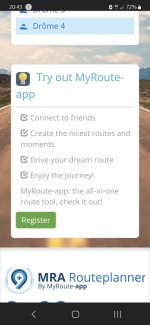
C. With just a little bit of effort (I used nothing more than an iPad and MyRoute) it is possible to create an article’s map of a route (assuming it is even half decent in the magazine) as a GPX file for possible use.
I did it by first of all doing nothing more than putting the place names into MyRoute and letting it spit out a route between them. Naturally enough, this had the basic shape of the magazine’s article’s map but was not correct. I then dragged the route around, pinning it in place, just as I would have done in BaseCamp, using the cols named in the map as reference points, This was made easier as MyRoute can display Michelin’s maps as an overlay. A couple of the cols had different names, so I used Google on my iPad to find them.
Why did I do it?
1. Because it’s good practice in using MyRoute on my iPad. I am still learning bits of it. I took a break halfway through, going back to fine tune it to (near enough) match the magazine’s map. I have noticed that it’s often easier to break the operation up, I guess because my brain gets tired otherwise?
2. My iPad can simultaneously Google things or places I cannot find and / or tell me about things. The postman’s work of art building, being a good example.
3. It hopefully makes for a half interesting thread on the forum. I hadn’t realised that sharing the MyRoute imbedded files, creates problems for people without MyRoute, all be it MyRoute is becoming more popular as a tool.
4. Once done, MyRoute will hold the route for me, so I can use it if I ever want to. There again, so will Google My Maps, Pocket Earth and / or a host of other sites and apps.


 but why complicate things with myroute app??


