
Some others complaining too
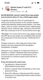



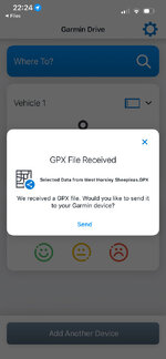

It can’t be enabled as a mass storage device like a Montana
This one then! I'm using an iPhone. I seem to have the same update and it is still working for me. Perhaps its because I binned explore and the link to my xt
Be very careful, I had major issues with 1.2, it was a very frustrating and lengthy journey, quick summary:If you use gpx 1.1, the XT will recalculate the route between shaping points as per your device setup, if you use loads of shaping points it should be ok.
I have been trying gpx 1.2 and although it doesn't show the shaping points, it does show the waypoints and it follows the track without any recalculation as long as you have auto recalculation switched off.
Now I will admit I am not as "expert" as some on here, so take the above with a pinch of salt, that is what I have found researching the differences and this is only true with the XT apparently

If you use gpx 1.1, the XT will recalculate the route between shaping points as per your device setup, if you use loads of shaping points it should be ok.

I noticed this, I was with a friend who had the route I did passed to his garmin in gpx 1.1, here maps and I used 1.2 on my XT, there were slight changes to the route on his device, because the route had been recalculated. My fault as I didn't use enough shaping pointsI use 1.1 for exactly that reason. I also follow MyRoute’s advice / best practice of having a shaping point every 5km / 3 miles. The transfer and any subsequent recalculation on import onto the device’s screen is then minimal. I also try, whenever possible, to create the route in Here maps. All that aside, I also check the route(s) before using them. Small discrepancies over estimated time / distance I ignore. Anything meaningful I investigate and fix. Five minutes spent, is better than half an hour on the roadside.
But we digress…..
I assume you know about the importing issue with MRA into the XT. You have to import, then start the route from the trip planner, then go to the active route and save it. The route then becomes a saved route instead of an imported route and works ok.This may be a difference with the I-Phone version, maybe they will fuck you over at a later date?
I also binned Explore as soon as I got my XT, so it has nothing to do with that, quite the opposite as it is actually insisting you use Explore now, probably trying to capture the market in route planning, and have all of the data on everywhere you plan to go, do go, how you get there, and how fast you go on the way etc.
Be very careful, I had major issues with 1.2, it was a very frustrating and lengthy journey, quick summary:
I started getting odd directions, detours, constantly asked to "turn around" for no reason, I tried all sorts of things with settings and placed support cals with Garmin and My Route App.....
...And this is where it got weird, as I use MRA for route planning as it is 1000 times quicker and easier than basecamp (and I can zap routes straight from phone to XT) this was how I made the routes, however I then discovered that using basecamp my test route worked OK.
Not sure on the technical specifications of GPX file, but MRA and Basecamp create them differently, and they behaved differently on my XT.
Be very interested in how you get on, if you are using basecamp then probably fine, if not you may get some weirdness, please do keep us all informed on your findings ;-)
One other point to note, because the "shaping points" using GPX 1.2 are not shown when you go into the route on the device it means you cannot edit them on the fly, sometimes I will want to shorten a route slightly when on tour due to weather / time / mood and I can open the route and remove a few points (as waypoints and shaping points show up and can be deleted) but with 1.2 you only see the Waypoints, making this impossible.

It was sent from Basecamp. I still use basecamp for a number of things because the waypoint handling on MRA is still very poor.It shouldn’t. Not dramatically at least.
Assuming the route was created and sent from MyRoute’s Routeplanner:
How many shaping points did the route have? MyRoute recommended one every 5km / 3 miles, for transfer to a Garmin device.
Which GPX version did you save and transfer the route in? I find 1.1 very reliable for transfer into my XT, as it transfers with it the blue shaping points and the orange flag way points, which are then displayed on the route on the XT.
Which map was it created in? Here? TomTom? OSM? Something else?
What preference settings are there on the XT which might have forced a recalculation?
Yes, but not on a mobile device like an iphone or iPad, whereas the Montana can be seen in the “files” app using usb.You can (on Mac) with Commander One.
But it's a faff and wouldn't bother.
Oh. Didn’t know that!whereas the Montana can be seen in the “files” app using usb.
My phone is an iPhone 12, so nothing new or fancy. Got loads of apps on it though.Back to topic, running the new app:
1. My main iPhone refused to connect with my XT.
2. My sacrificial iPhone (with very few app’s) connected perfectly with my XT. It also transferred routes perfectly, too.
My phone is an iPhone 12, so nothing new or fancy. Got loads of apps on it though.

I think these later XT’s use the Tread app, not Drive.I have a question about this (looking into how the share happens via Bluetooth).
Is the behaviour the same across Drive and XT1, XT2 and 3?
So probably IOS devices remain unaffected and it’s a programming cock up rather than deliberate policy.Just a further update on the issue with Version update 4.29.25 dated 3/09/2026. I made a call to Garmin and they are aware that there is an issue with the version and android devices. A "case" has already been raised and I've been added to the "List". Presumably if more folk add themselves to the "List" Garmin might be more inclined to address the issue pronto.

Not great. I was preparing a couple of routes as I was heading for an overnight trip to Westport heading on Sunday and back today and was trying to load up the routes on the XT as a backup using drive. It was an unpleasant surprise, but at least I could load them via the computer. I used MyRoute app for the trip and had no issues. Garmin aren't helping themselves this weatherSo probably IOS devices remain unaffected and it’s a programming cock up rather than deliberate policy.
No consolation if you’re on a trip though



